Iquique is a native word for “pleasant place.” It has no (NO!!) rainfall, though almost always cloudy with fogs. On the Pacific rim, sudden, unexpected inundation by water is a fact of life. At this point, the corner of Manuel Bulnes and Avenue of the Heroes of the Conception, the land is sloping up toward the escarpment, 125 feet above sea level, one mile from the ocean. Here we are “officially safe,” an oxymoron.
Twenty months prior Iquique was struck by an offshore earthquake, 8.2 magnitude, followed by a seven foot tsunami. Here, Matarani, Coquimbo, Valparaiso I was happy when we passed these signs (with English translations for us tourists). Traffic congestion would doom us if an earthquake/tsunami struck during the port/downtown transit.
Click any photograph for a larger view and use Ctrl-x to zoom in closer.
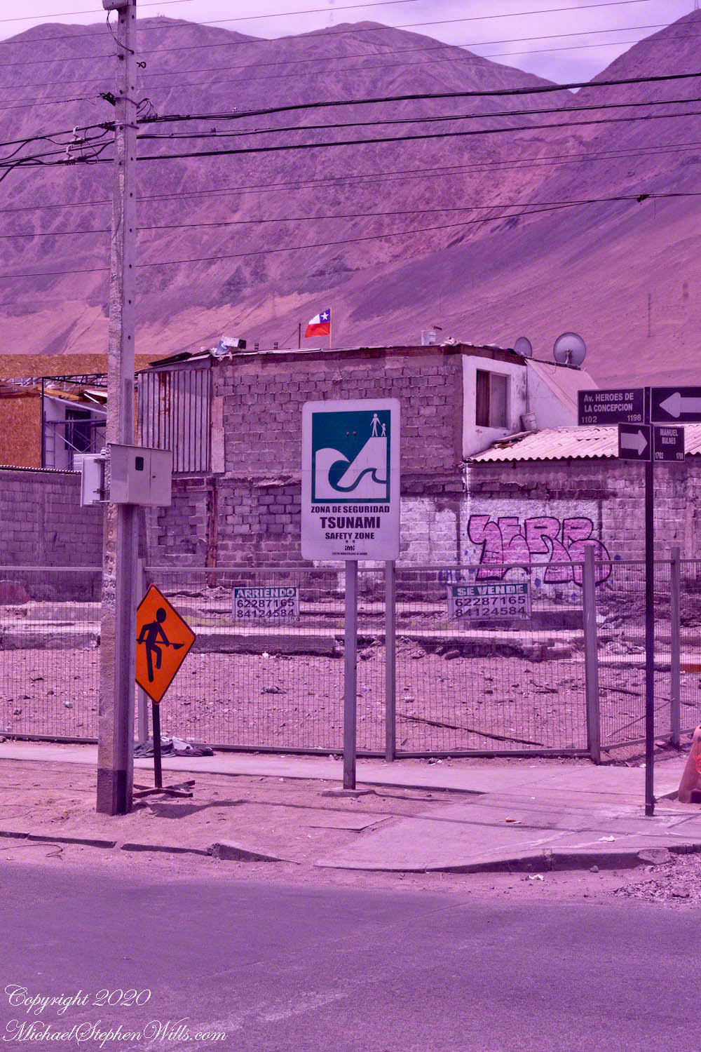
On this lot is a dwelling, haphazardly constructed of concrete blocks, evidence of desperate poverty. The fence signs (“Se Vende” — for sale) presage the leveling of this corner. Just this year, the street has seen riots…….
Click me for better experience viewing the following video. To do this from WordPress Reader, you need to first click the title of this post to open a new page. Note the replay icon (an arrow circling counter-clockwise.
Click me for the first post of this series.
References
Wikipedia – “Iquique“, “2014 Iquique earthquake.”
Copyright 2020 Michael Stephen Wills All Rights Reserved

Have you come across the articles about the safety zones in Japan, where stone markers serve the same function as your signs? Here’s one such article.
LikeLiked by 1 person
Thank you for that, shoreacres. The Japanese stones were local, even individual, productions before much was known of the ultimate causes for the tsunamis, and the certainty of recurrence. The article also describes place names as warnings. In the Chilean cities there are buildings along the shore and we visited one city I’ll write about later, where the tall buildings in the tsunami zone are only rented to vacationers.
LikeLike