A half mile footpath, marked in red on the following Google Earth view, leads from the Charles fort sallyport, along the shoreline cliffs, surmounted by working farmland and looks toward the Celtic Sea.
To “sally” is to suddenly charge out from a besieged place against the enemy. The word is also used as a noun. It can also be used to describe our walk, as a sally to an unusual place.

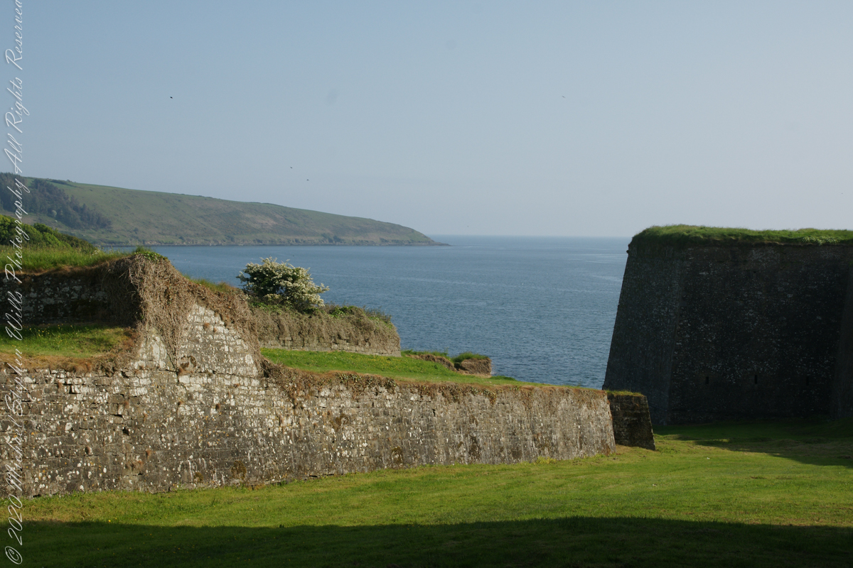
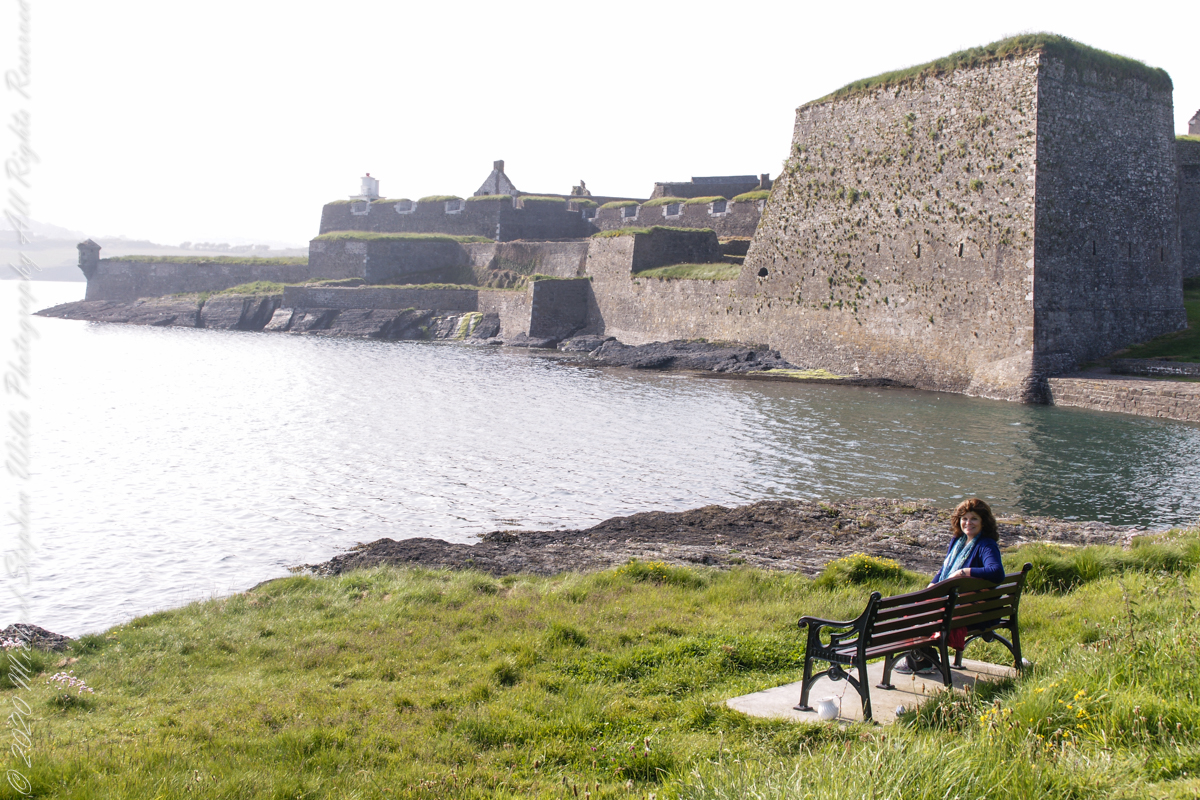
Here is a view of the Celtic Sea from the Sallyport
From Wikipedia: “The Celtic Sea receives its name from the Celtic heritage of the bounding lands to the north and east. The name was first proposed by E. W. L. Holt at a 1921 meeting in Dublin of fisheries experts from Great Britain, France, and Ireland. The northern portion of this sea was considered as part of Saint George’s Channel and the southern portion as an undifferentiated part of the “Southwest Approaches” to Great Britain. The desire for a common name came to be felt because of the common marine biology, geology and hydrology of the area. It was adopted in France before being common in the English-speaking countries; in 1957 Édouard Le Danois wrote, “the name Celtic Sea is hardly known even to oceanographers.”[3] It was adopted by marine biologists and oceanographers, and later by petroleum exploration firms. It is named in a 1963 British atlas.. A 1972 article states ‘what British maps call the Western Approaches, and what the oil industry calls the Celtic Sea […] certainly the residents on the western coast [of Great Britain] don’t refer to it as such.'”
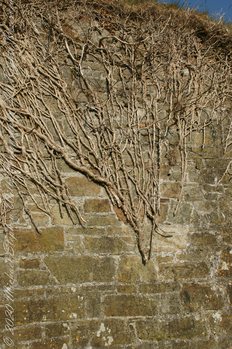
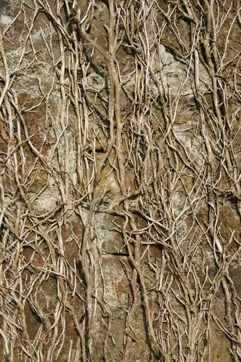
Views of the wall from previous photograph. The vines were separated from roots to preserve the walls, leaving interesting patterns.
The distant land to the right, beyond the walls, is the Old Head of Kinsale.

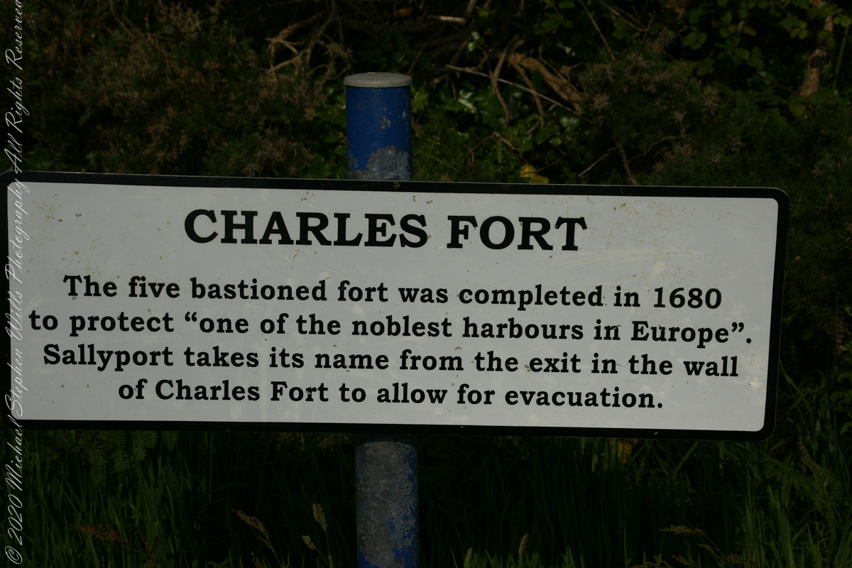
Informational placards along the walk give background to the views enjoyed by hikers.
Here is the above view.

Pam, at start of our walk. Poking above the walls is the Charles Fort Lighthouse. “This lighthouse is a directional light marking the way to safe anchorage close to Kinsale. In 1665 King Charles II granted letters patent to Sir Robert Reading to erect six lighthouses on the coast of Ireland, including one at Barry Oge’s castle, near Kinsale later to become Charles Fort. The original structure would have had a coal fire on its roof. In 1810 powers given to the Commissioners for Barracks and others between 1767 and 1806 were all vested in the Corporation for Preserving and Improving the Port of Dublin or the Ballast Board. This board took over the general lighting and marking of the coast when fourteen lighthouses were transferred to it including that at Charles Fort. This lighthouse, built in 1929, is one of the more recent to be found along the coast, with most dating to the nineteenth century. A new mains powered light at Charles Fort Lighthouse was put into operation on the 14 April 2004 marking the end of a long era of gas and oil powered lights in Ireland.” Quote is from the link provided in references.
References
“Celtic Sea” – wikipedia
“Charles Fort Lighthouse” — Charles Fort Lighthouse, FORTHILL, CORK – Buildings of Ireland

The views look lovely. It’s kind of neat how the vines have attached themselves to the wall and have left such interesting patterns.
LikeLiked by 1 person
The vines caught our eye on that hazy, sunny May day.
MERRY CHRISTMAS
LikeLiked by 1 person