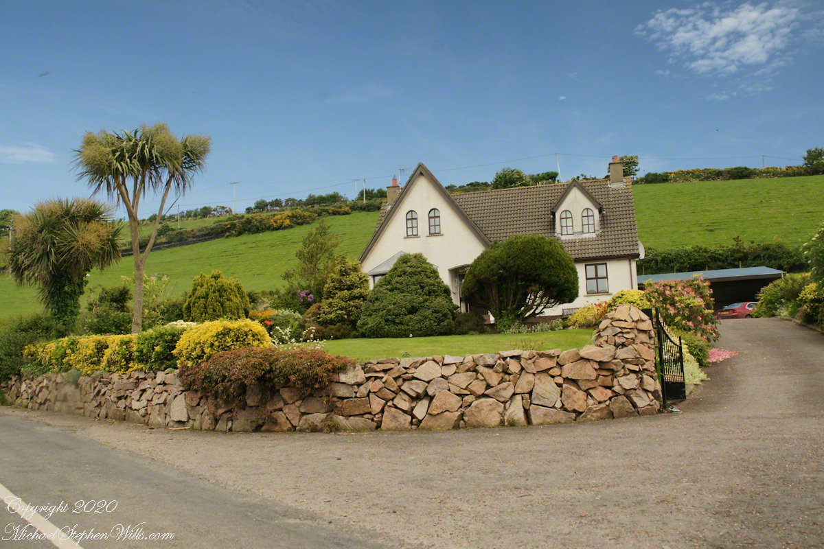
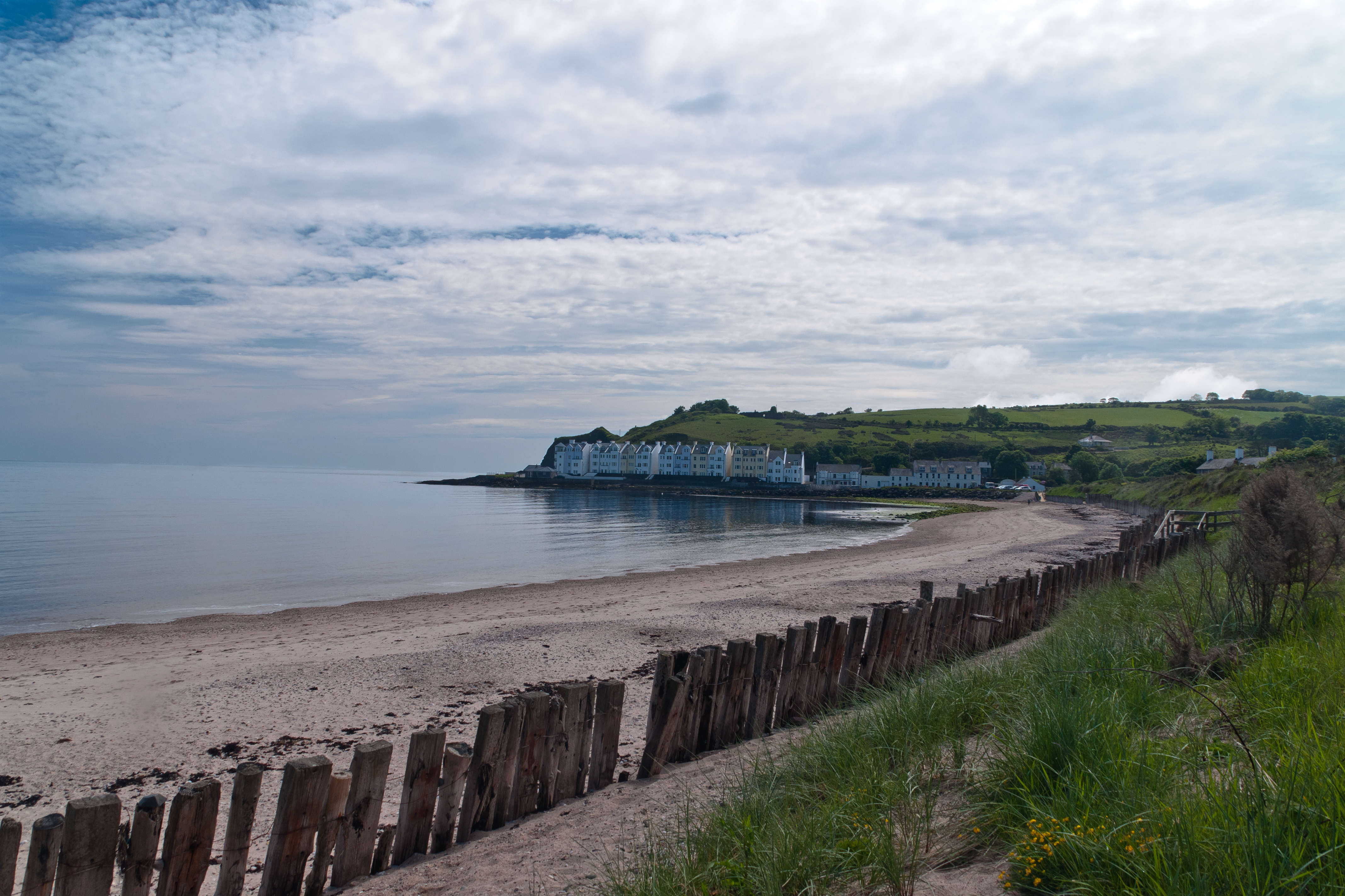
Cushendun (from Irish: Cois Abhann Doinne, meaning “foot of the River Dun”) is a small coastal village in County Antrim, Northern Ireland. It sits off the A2 coast road between Cushendall and Ballycastle.
It has a sheltered harbor and lies at the mouth of the River Dun and Glendun, one of the nine Glens of Antrim. The Mull of Kintyre in Scotland is only about 15 miles away across the North Channel and can be seen easily on clear days.
In the 2001 Census it had a population of 138 people. Cushendun is part of Causeway Coast and Glens district.
SONY DSC
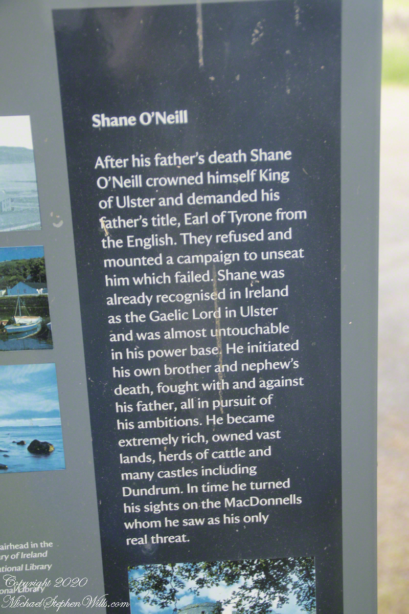
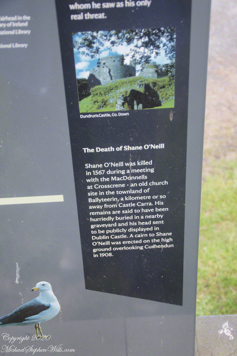
Here are several of the information placards near the harbor explaining some local history.
.
Ballyteerin townland, where Shane O’Neill was killed, is on the road to Torr Head.
Reference: Wikipedia, “Cushendun.”
Enter your email to receive notification of future postings. I will not sell or share your email address.
Copyright 2025 All Rights Reserved Michael Stephen Wills
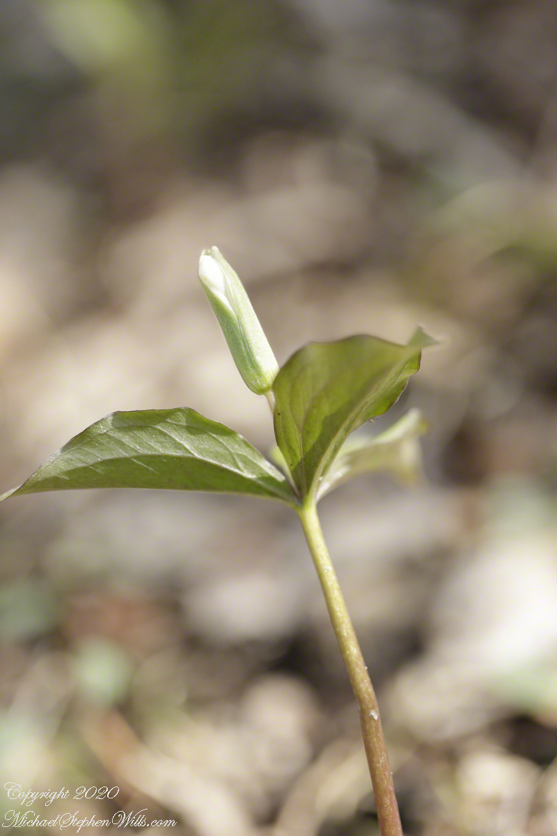
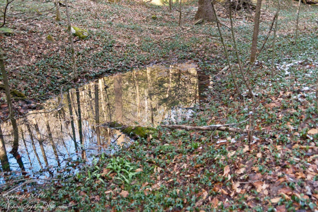
Wildflowers flourished where the slope turned to the north and late afternoon light spread across the small ravine created by a small stream. This early in the season White Trillium buds were forming between three green bracts.
Click photograph for a larger view. To do this from WordPress Reader, you need to first click the title of this post to open a new page.
Trillium Grandiflorium
The above photograph taken handheld with a variable zoom lens captures the plant and environment. On the forest floor is twig of hemlock, probably knocked off by squirrels feeding on the tiny cones. Oak leaves from last season frame the dark green bracts. We also see a few wintergreen leaves and the rich soil.
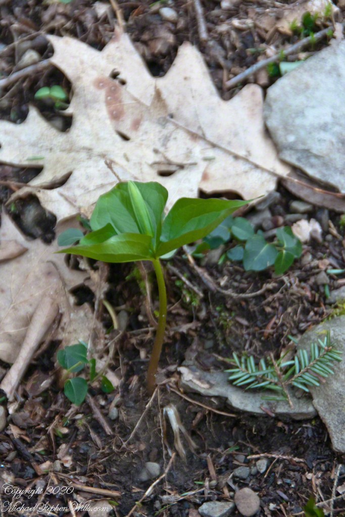
With the low light ISO is 2000, the f-stop of 5.6 allowed crisp details of the hemlock and wintergreen, the focus is soft on the oak leaves. Where is topography allowed sunlight, the White Trillium were a bit further along. Here is a bud opening.
Trillium Grandiflorium
Here I used a travel tripod and a macro lens with f-stop opened up to 3.2, not lens maximum, and all but the forward bract tip are in focus. A lower camera angle places surroundings in distance, allowing all to be blurred unrecognizable: the plant is the star of this shot. ISO 800 with the ample light. I was struggling with the spring breezes, having to wait for a break to take each exposure.
Copyright 2024 All Rights Reserved Michael Stephen Wills
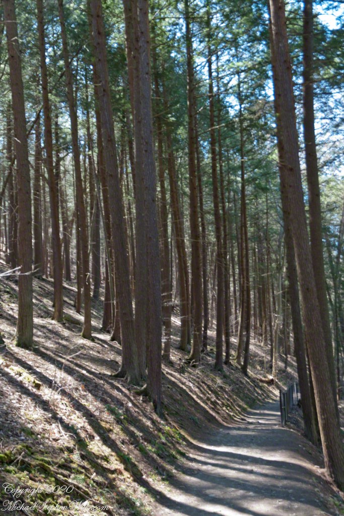
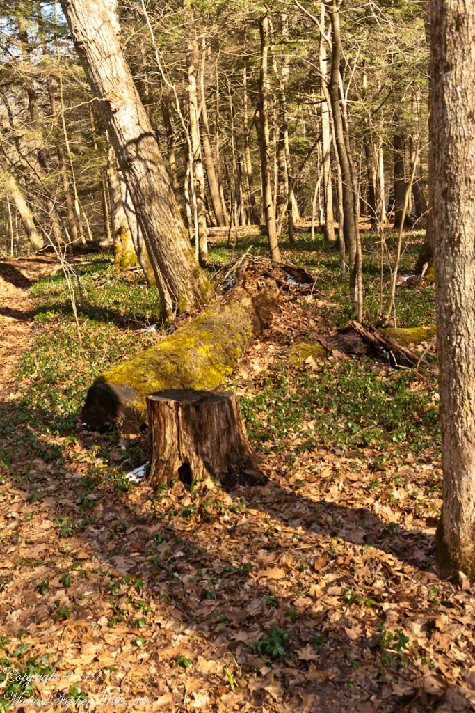
One hundred and fifty feet in a series of steep climbs is the effort expended to reach the relatively level portion of South Rim Trail where the tall Red Pines briefly reign. Here the trees thrive on the northeast facing slope. They grow in this way in one other location, in the upper park, on an eponymous trail.
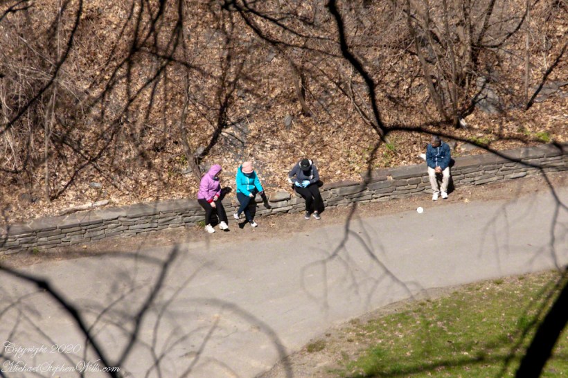
Encounters with groups of people descending always demanded I step off the trail to allow social distancing. Everyone work a flimsy face covering, although Governor Coumo’s order covers situations where social distancing is not possible. As of you, we do not have the loose masks; but only the N95 or a full respirator (both acquired very early on, our respirators were purchased for spreading lawn chemicals and spray painting).
Click photograph for a larger view. To do this from WordPress Reader, you need to first click the title of this post to open a new page.
Red Pine
Red Pine (Pinus resinosa), also know as Norway Pine, shed pollen prolifically. Some Aprils my boots are covered with it, a dusting of yellow. Not today.
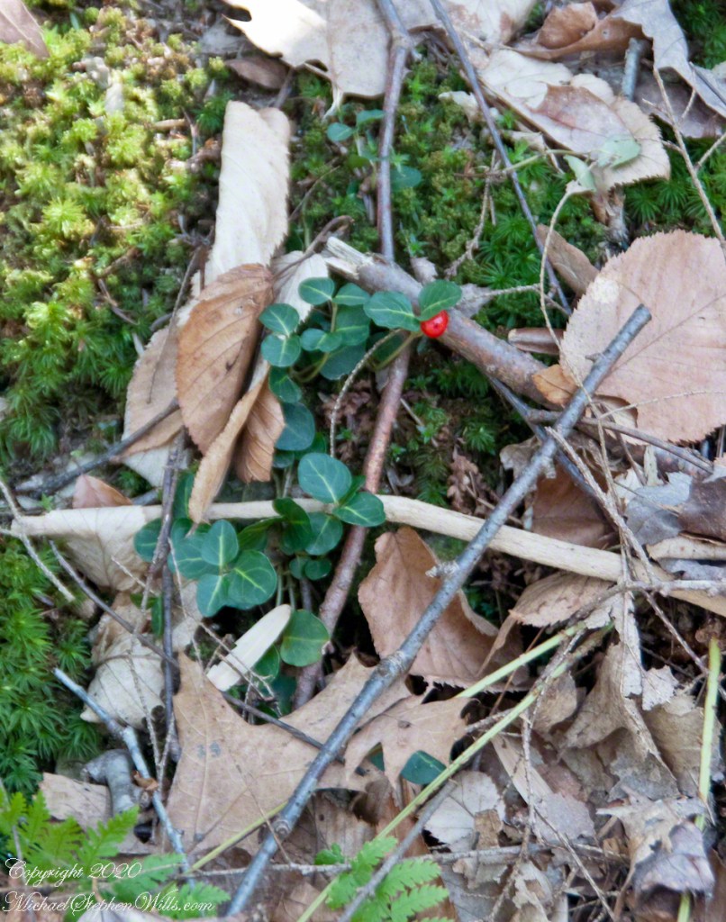
Wintergreen with Red Berry
A species easy to spot among the green, an example of a shrub of the genus Gaultheria, though a very small specimen. The common name is wintergreen and I have never found larger specimens in Treman park. It is growing among the mosses on the wall of Enfield Glen South Rim.
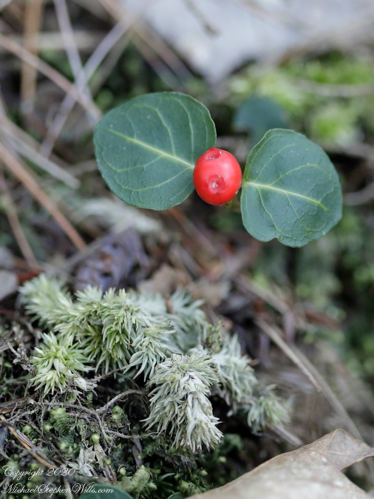
Macro, Red Berry and Leaves of Wintergreen with unidentified moss
The tough wintergreen leaves endue the cold seasons, the name is synonymous with evergreen.
Both shots are handheld, the macro is from a 100 mm “macro” fixed focus lens. ISO 2500, the f-stop to be wide open at 2.8 to gather the sparse light and present the subjects, blurring the immediate background. The overview shot is also a high ISO, 2000, the f-stop 5.8 on a variable focus lens set to 60 mm.
Copyright 2024 All Rights Reserved Michael Stephen Wills
This series of posts opens with the ascent to where the wildflowers grow.
Click photograph for a larger view. To do this from WordPress Reader, you need to first click the title of this post to open a new page.
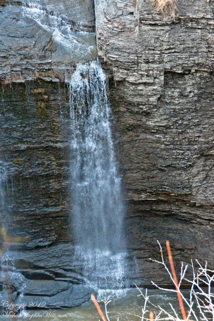
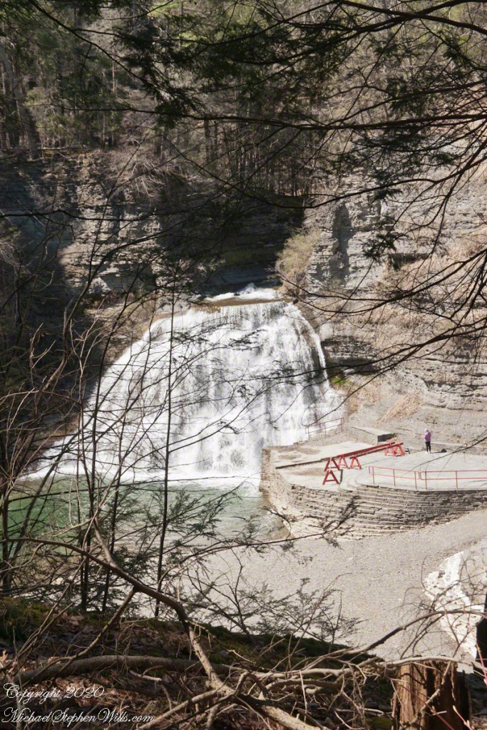
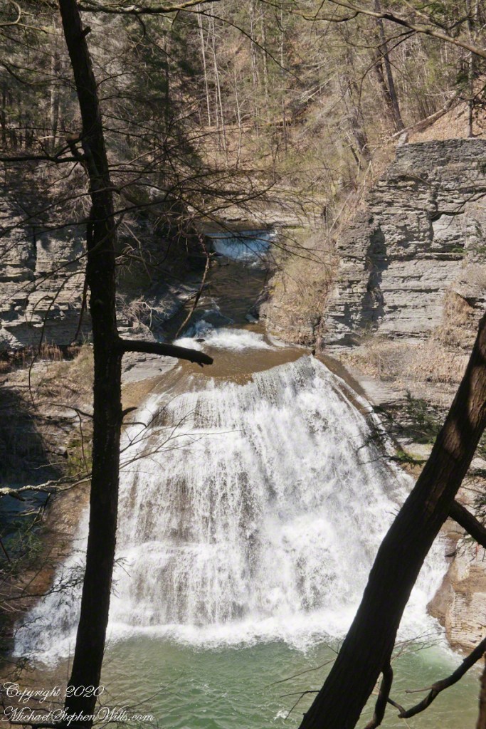
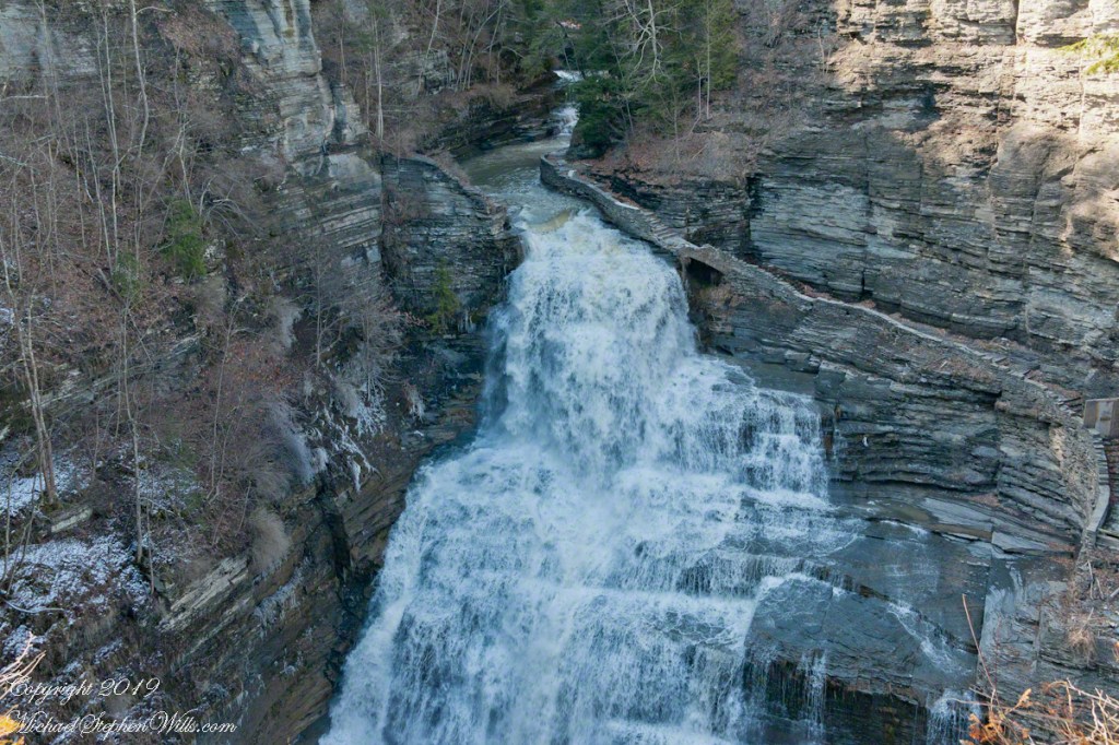
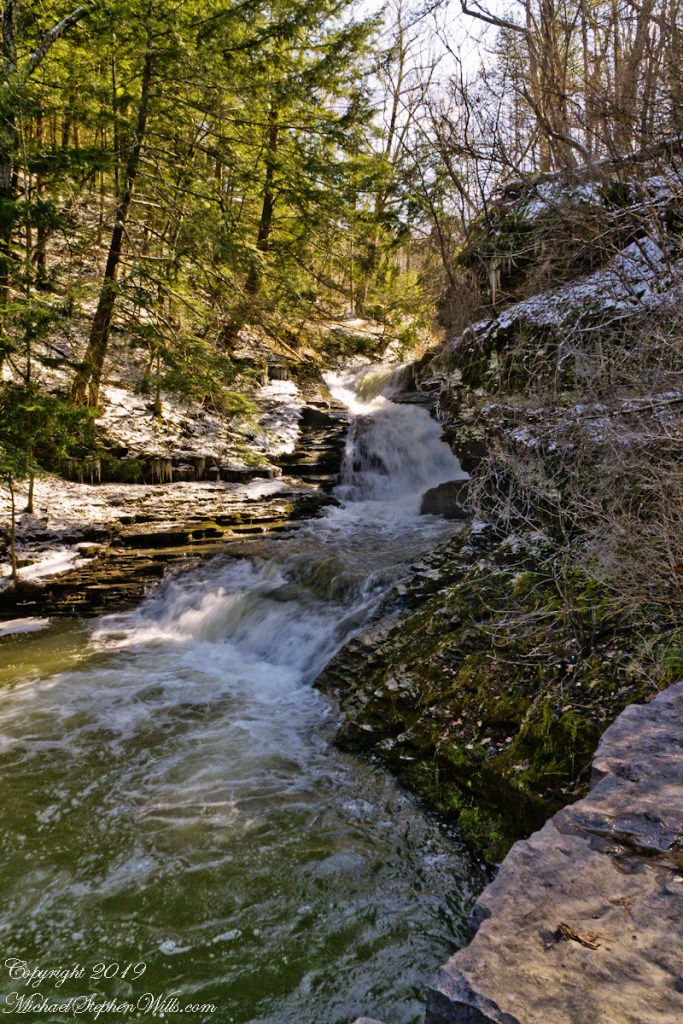
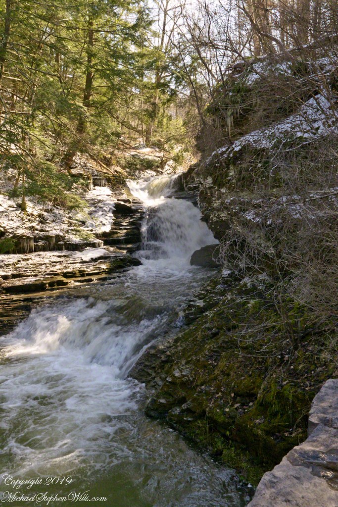
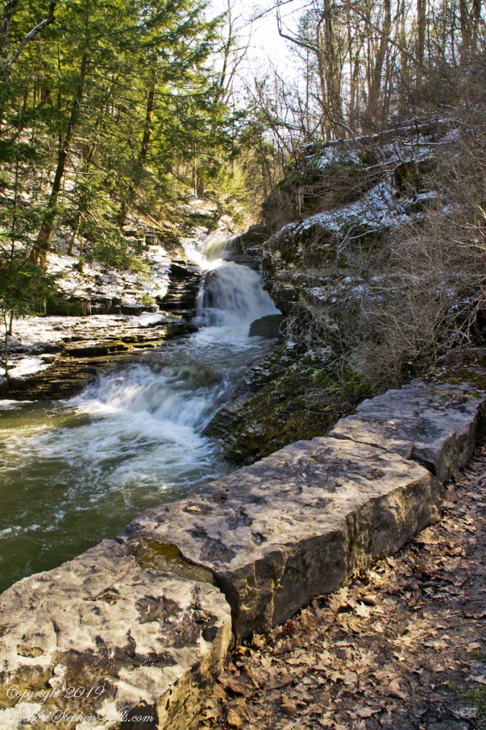
Lower Falls
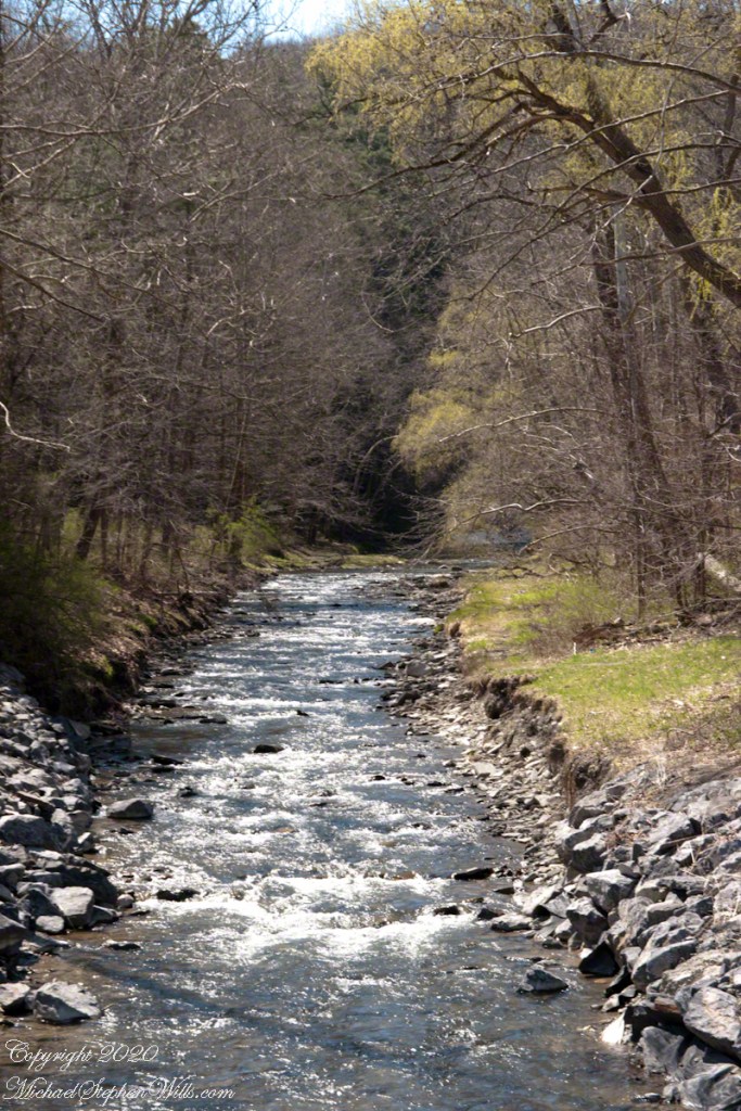
After just a taste of the climb to come, hikers are treated to an view of the Lower Falls of Enfield Creek. I call them the Wedding Cake. Summertime, a dam is erected, the water is deep enough to dive into the very cold creek water, lower than 70 degrees.
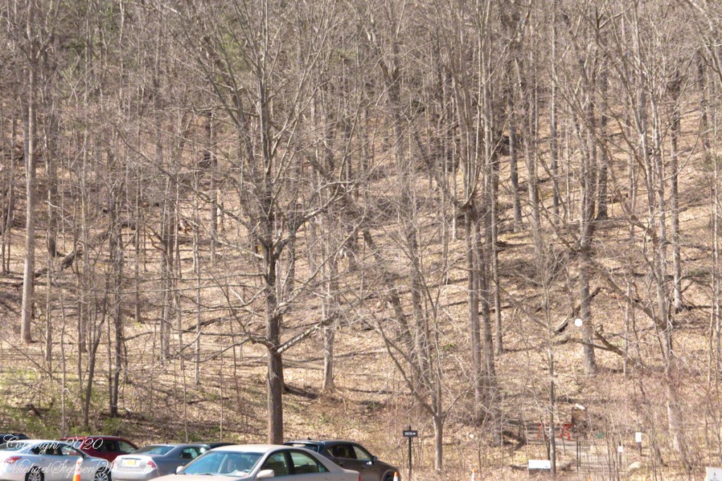
Parks were open during Govenor Cuomo’s “New York State on PAUSE.” Still, as a member of the at-risk group I was reluctant to visit, unsure of how crowded it will be. On a Monday afternoon, bright with sun, I drove over to Robert H. Treman lower park to check out the situation.
Click photograph for a larger view. To do this from WordPress Reader, you need to first click the title of this post to open a new page.
Social Separation ParkingGorge Trail is Closed for the winterParking Lot
I carried the Sony in hand and packed in a Canon with macro lens and a Manfrotto travel tripod.
Enfield Creek from park bridge
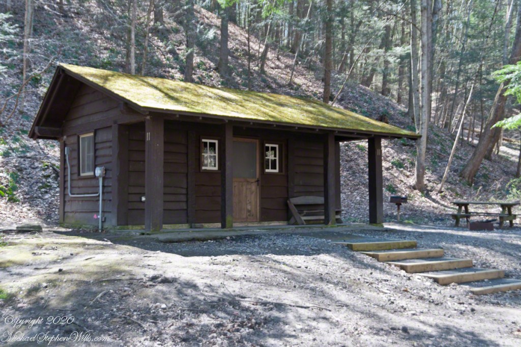
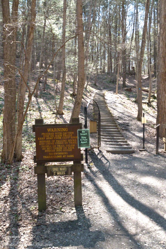
The path to a trail that climbs up the south side of Enfield Glen crosses Enfield Creek via a bridge, wends through cabins……
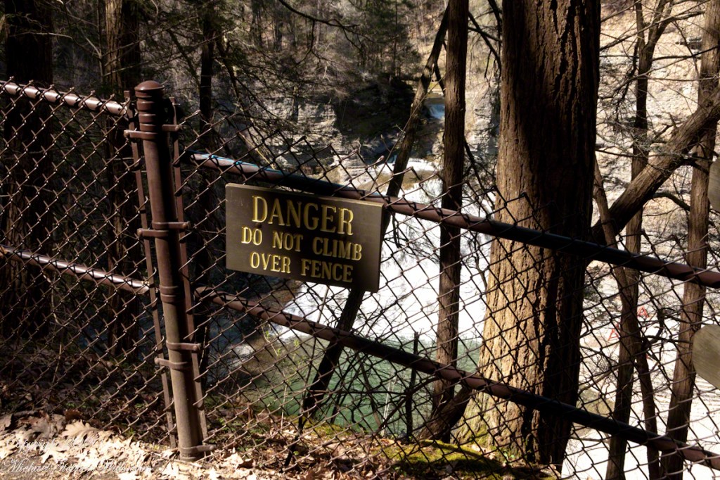
…..then heads up stairs that can seem to be forever. The green sign with white letters is new. This the South Rim Trail avoids the cliffs that make the Gorge trail so dangerous November through May.
Copyright 2024 All Rights Reserved Michael Stephen Wills
Here is a recapitulation of my latest posts in the form of a slideshow.
Click photograph to start show. To do this from WordPress Reader, you need to first click the title of this post to open a new page.
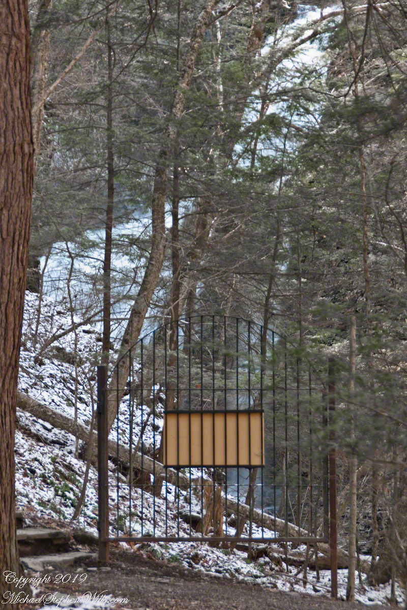
Robert H. Treman New York State Park.
Lower Lucifer Falls, early spring eveningLucifer Falls, early spring eveningPam on the Cliff StaircasePam examines the mossSo Like a Christmas TreeCliff StairLucifer Falls with Hemlock CurtainIcicle WonderlandSudden Frost April, Cliff StairsIcicles, Cliff StairSedimentary WallsIcicles hang over Fish KillRim Trail AscentRim Trail iciclesRim Trail icicles with lichen, moss and fern.Rim Trail icicles with lichen, moss and fern.Gully IGully IIVernal Pool with Vinca VineBeneath the Cliff Stairs IIBeneath the Cliff Stairs IRim Trail AscentFern, Moss, young trees, April SnowFresh Icicle with FernFern Frond with Early April SnowLate April Snow dusted with light
Copyright 2024 All Rights Reserved Michael Stephen Wills
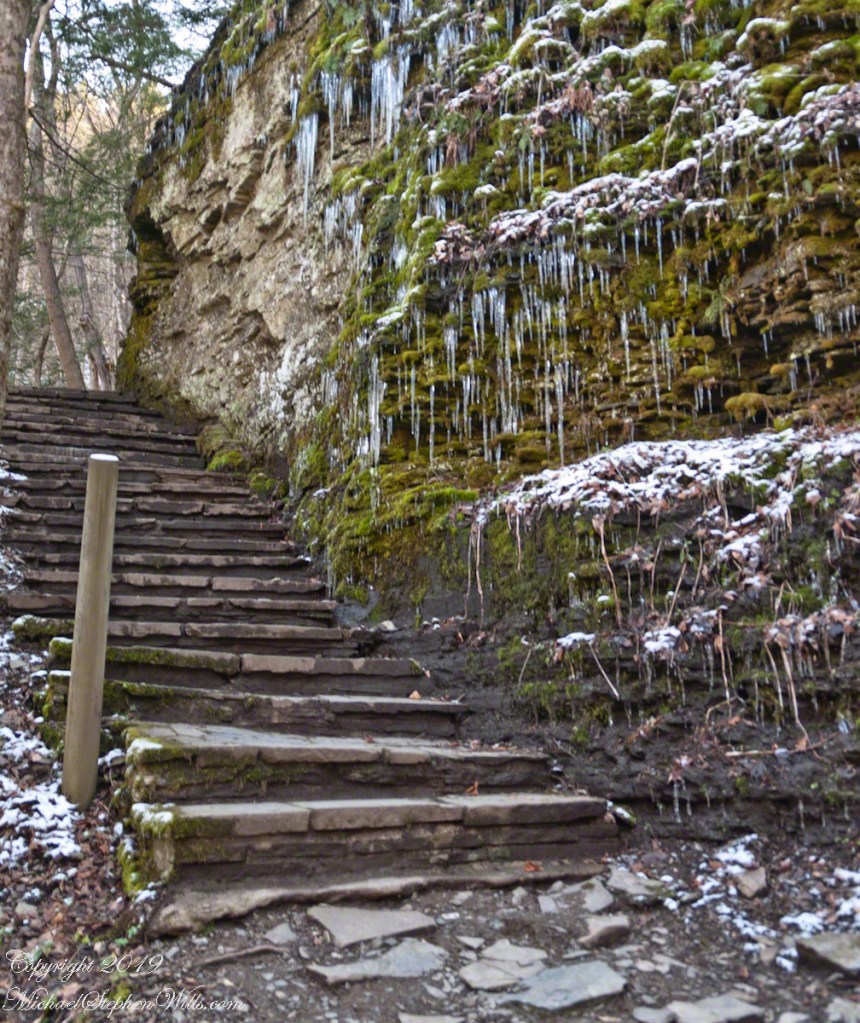
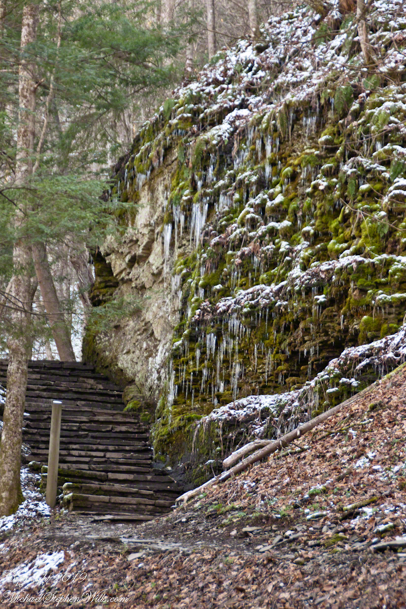
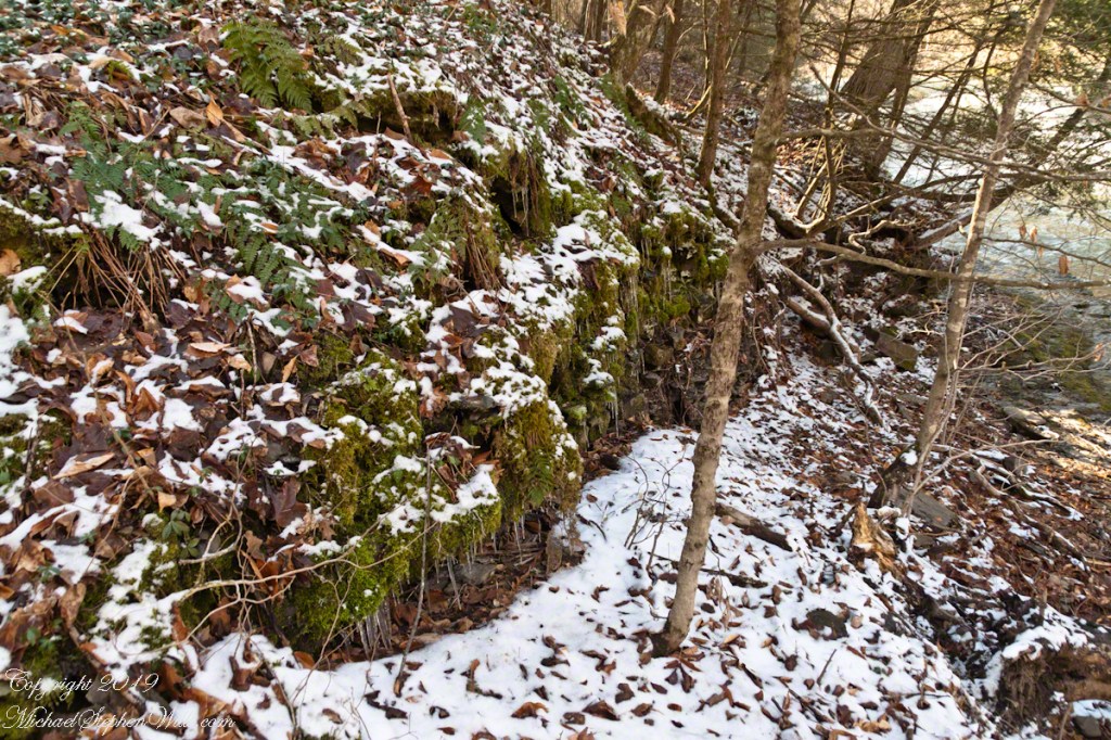
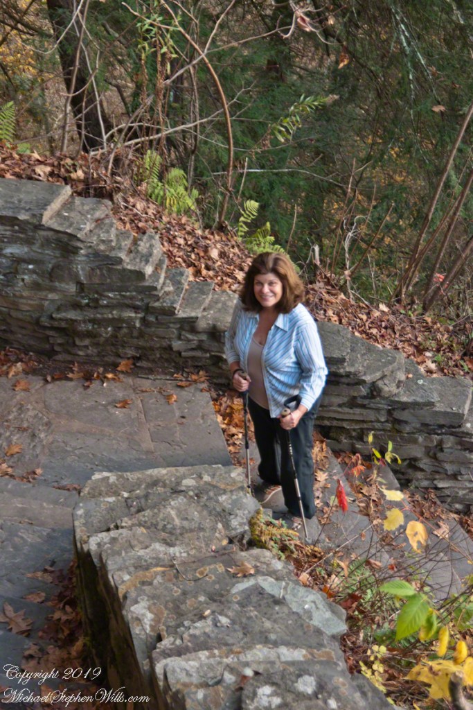
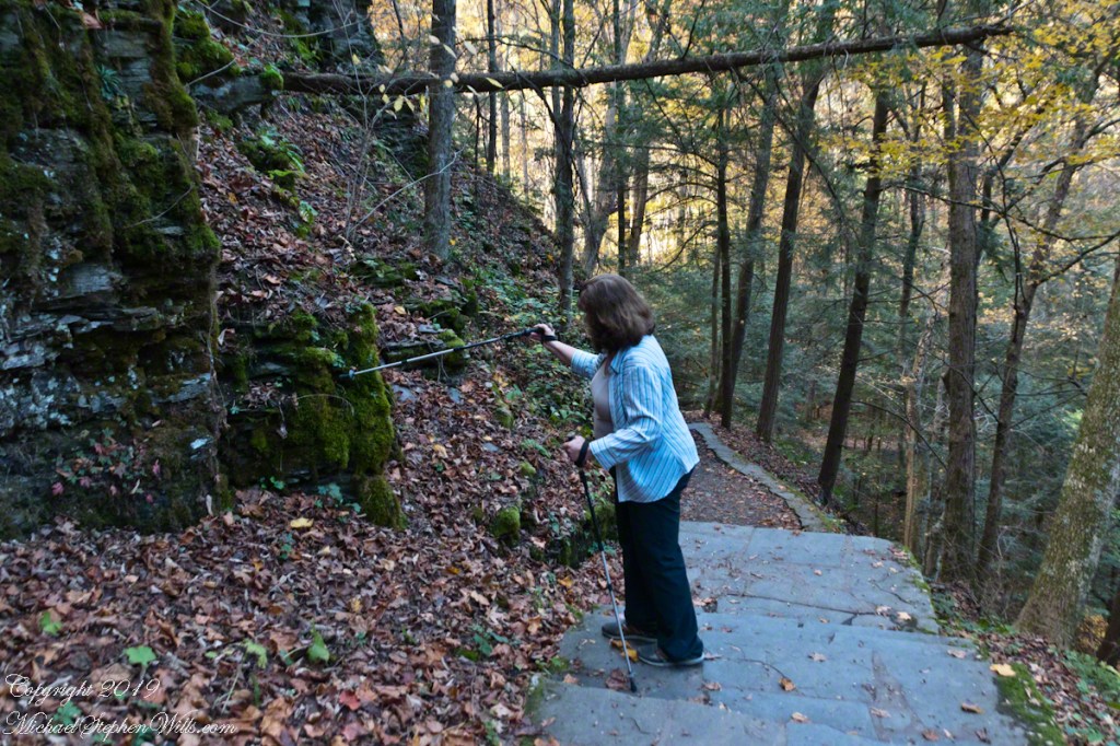
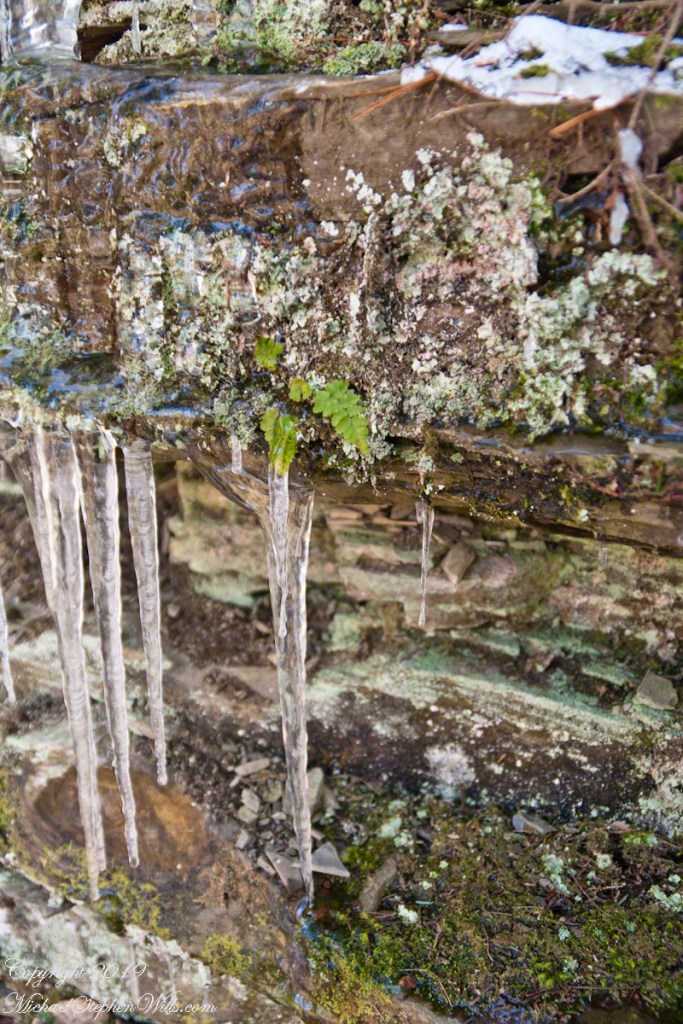
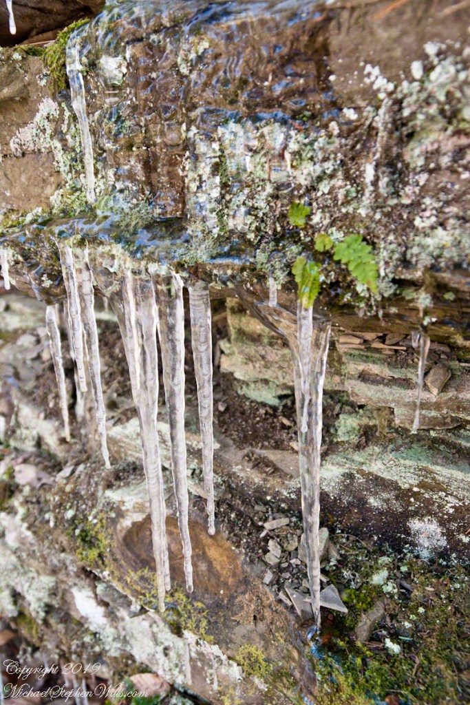
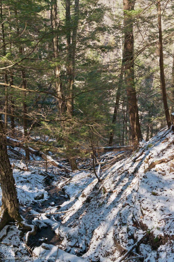
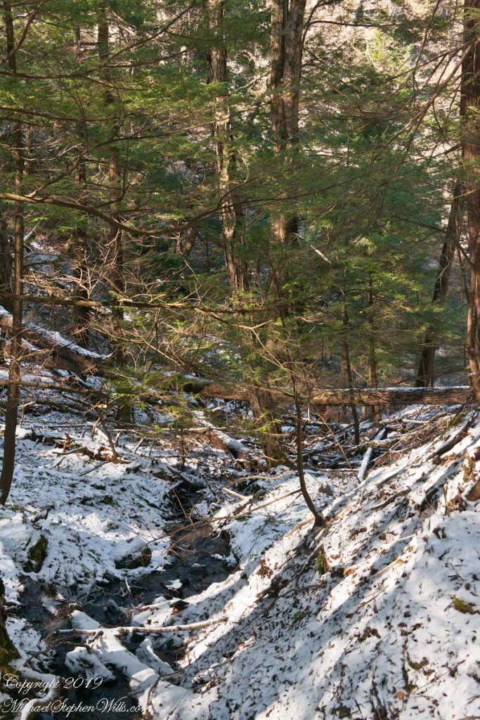
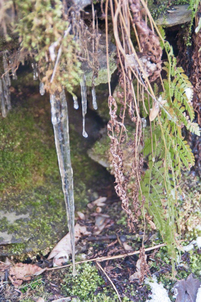
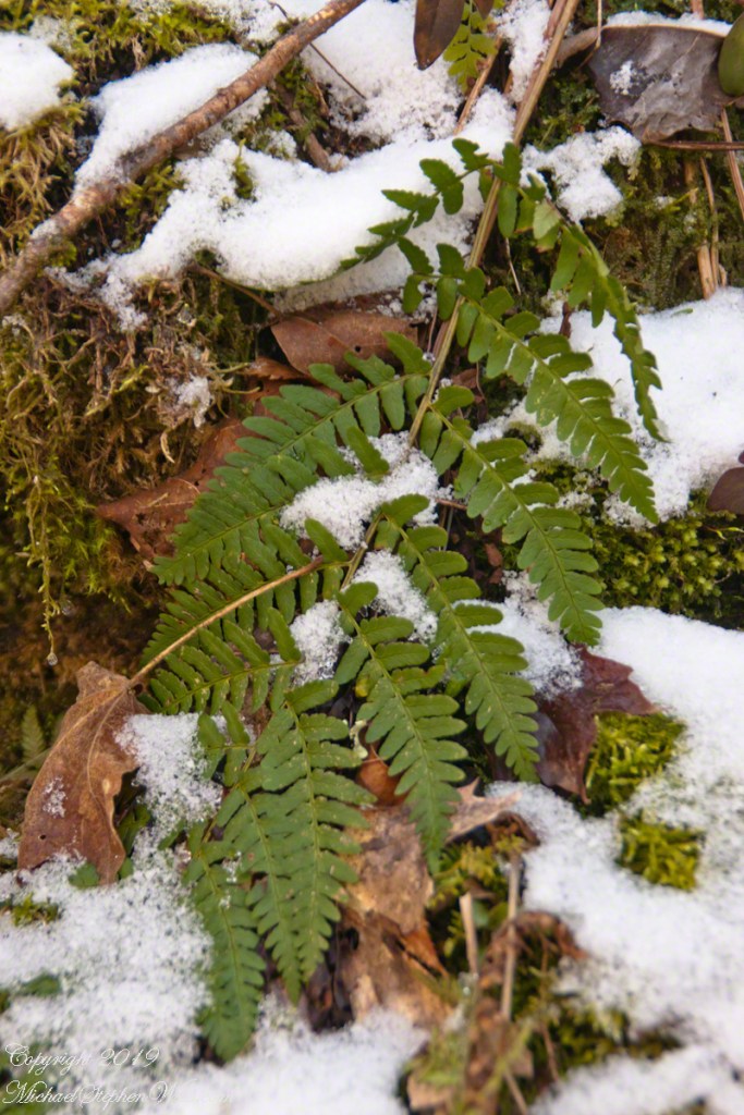
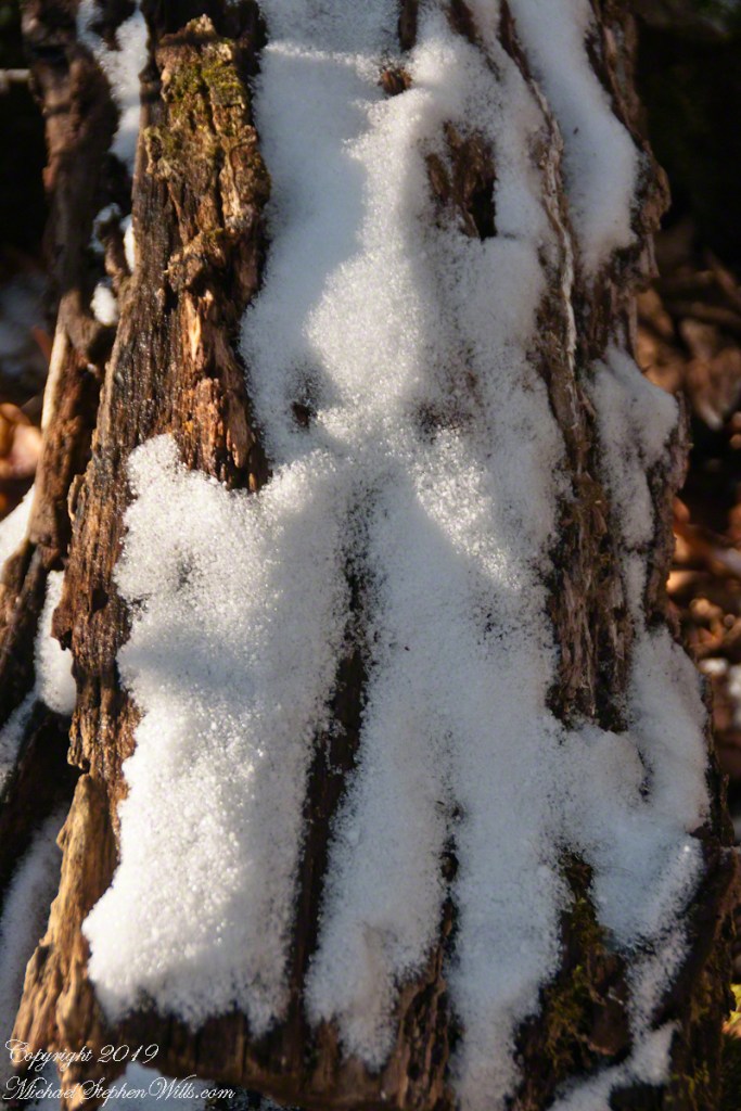
It is the Gorge Trail that’s closed for the cold months, November through April. The Rim Trail remains open for those who dare icy, steep paths Unlike Gorge Trail, Rim Trail climbs above the dangerous cliffs from which rocks are wedged free by ice to fall on the trail. On an early spring day, after a sudden frost, we walked the Rim Trail to capture the moment.
Here is the steep start, climbing up from the Upper Park where a footbridge crosses Fish Kill. Kill is the old Dutch word for creek. Fish Kill mergers with Enfield Creek a few hundred feet downstream.
Click photograph for a larger view. To do this from WordPress Reader, you need to first click the title of this post to open a new page.
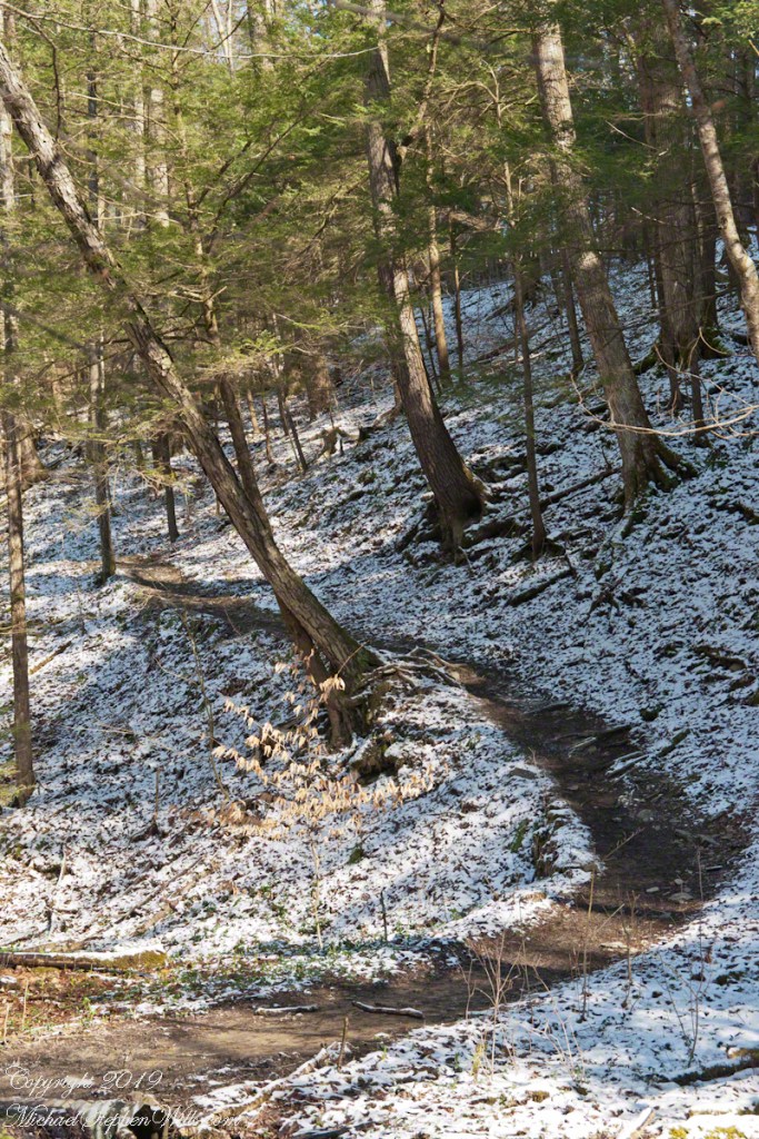
Rim Trail Ascent
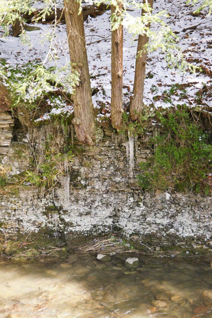
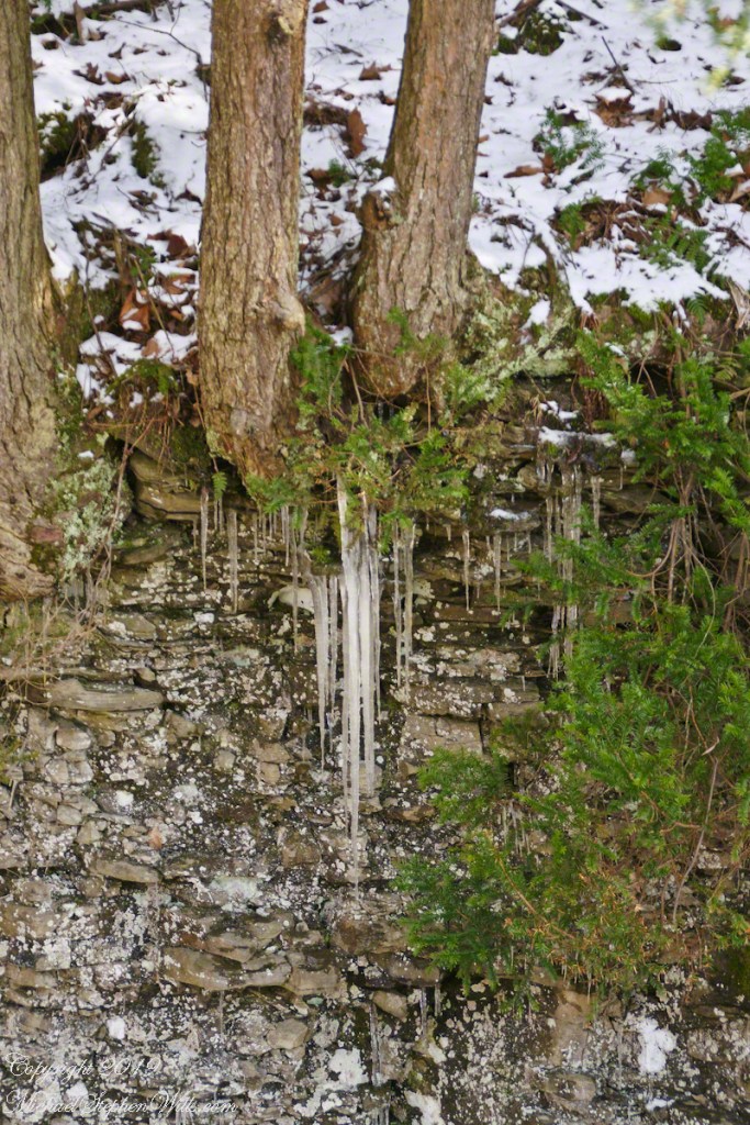
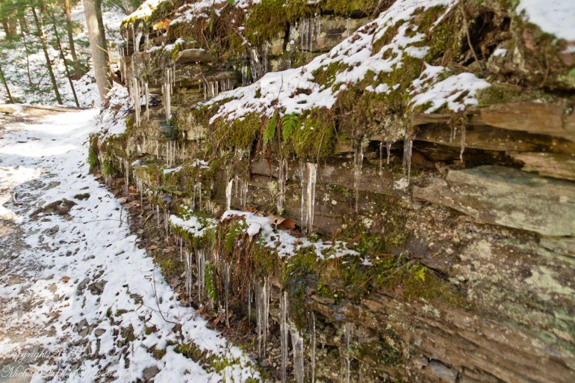
This north facing slope stays frozen into May. Here layers of the sedimentary rock shale, laid down in a shallow warm sea over 350 million years ago, are slowly pried apart. Hemlock tree roots wedge between rock layers, slowly growing. The action of ice, water expands in volume at the point of freezing, aids the process.
In places the rock face appears to be a hastily made dry stone wall, the rock layers are so disrupted by plant and frost.
Rim Trail icicles
These shots were hand held. I used a Sony Alpha 700 dslr with a variable “zoom” lens, great for framing compositions.
Robert H. Treman New York State Park.
Click for a slideshow of this Waterfall of the Old Mill sequence
Falls by the Old Mill, early springThe falls run free of ice. On an early spring day, after a sudden frost, we walked the Rim Trail to capture the moment.The falls run free of ice. On an early spring day, after a sudden frost, we walked the Rim Trail to capture the moment.New icicles formed overnight from seeps through the sedimentary walls around the Waterfall by the Old Mill. On an early spring day, after a sudden frost, we walked the Rim Trail to capture the moment.Rim Trail icicles
Copyright 2024 All Rights Reserved Michael Stephen Wills