From a modest bench above Taughannock Gorge, Cayuga Lake shifts from distant glimmer to presence—a quiet invitation to pause, breathe, and follow the water down.
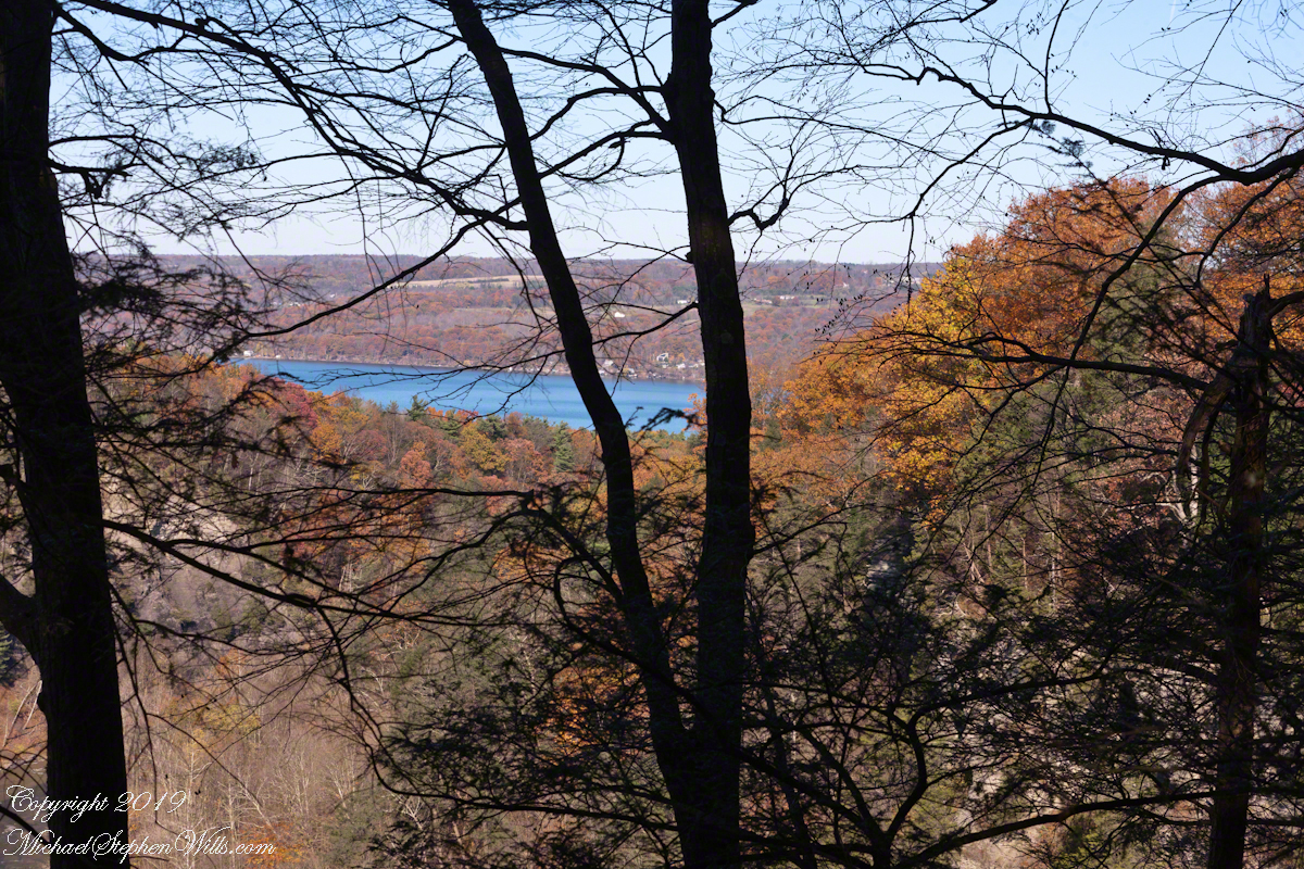
From the south rim of Taughannock Gorge, Cayuga Lake appears like a distant strip of sapphire, framed today by a soft veil of hemlock and oak. The overlook here is modest—a fence, a bit of open sky—but someone wisely added a comfortable bench, an invitation to pause between gorge and lake, rock and water.
I stood in front of that bench, resting the camera body on the fence, fingers braced against the wood to steady the shot. This is not the grand, sweeping vista of a postcard. Instead, it is a quieter, more human vantage point, the way a person actually encounters the lake after walking the rim: emerging from the trees, breath easing, eyes adjusting to the light on water.
From here, the trail descends toward Cayuga’s shore, each turn bringing you lower and closer, trading the lofty perspective for the intimate sounds of waves and stone. In Distant Sapphire I and II, the lake was a glimpse—caught between branches, distant beyond the gorge. Now, in this “Bench View,” the water feels nearer, almost within reach, as though the landscape itself is drawing you gently down.
Click photograph for a larger view. To do this from WordPress Reader, you need to first click the title of this post to open a new page.
Cayuga Lake Bench View
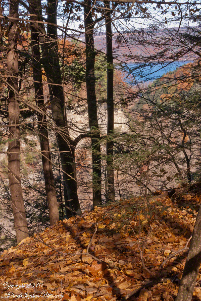
I’ve gathered the three photographs—Glimpse of Cayuga Lake, Gorge View with Oak Leaves, and this Cayuga Lake Bench View—into a small gallery, a progression of approach. Each frame is a step closer: from suggestion, to invitation, to the quiet promise of the bench, waiting for whoever needs to sit and look a little longer.
A gallery of the three Cayuga Lake photographs for comparison.
Glimpse of Cayuga LakeGorge View with Oak LeavesCayuga Lake Bench View
Enter your email to receive notification of future postings. I will not sell or share your email address.
Copyright 2025 All Rights Reserved Michael Stephen Wills
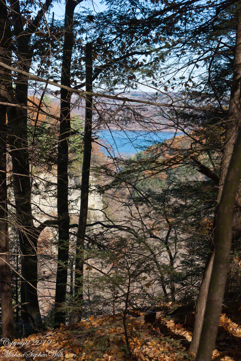
Cayuga Lake from the south rim of Taughannock Gorge, seen through a veil of hemlock with a carpet of fallen oak leaves, foreground. This is a companion to the previous post, both were handheld. For this the foreground was included to increase interest. For added stability, I rested the camera body on the fence bracketed with my fingers.
Click photograph for a larger view. To do this from WordPress Reader, you need to first click the title of this post to open a new page.
Gorge View with Oak Leaves
A gallery of the two photographs for comparison.
Glimpse of Cayuga LakeGorge View with Oak Leaves
Enter your email to receive notification of future postings. I will not sell or share your email address.
Copyright 2025 All Rights Reserved Michael Stephen Wills
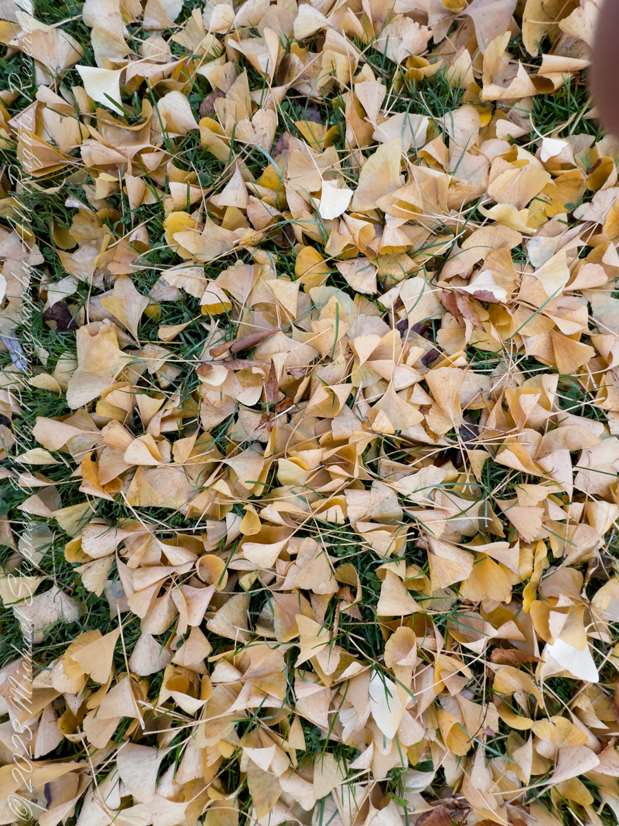
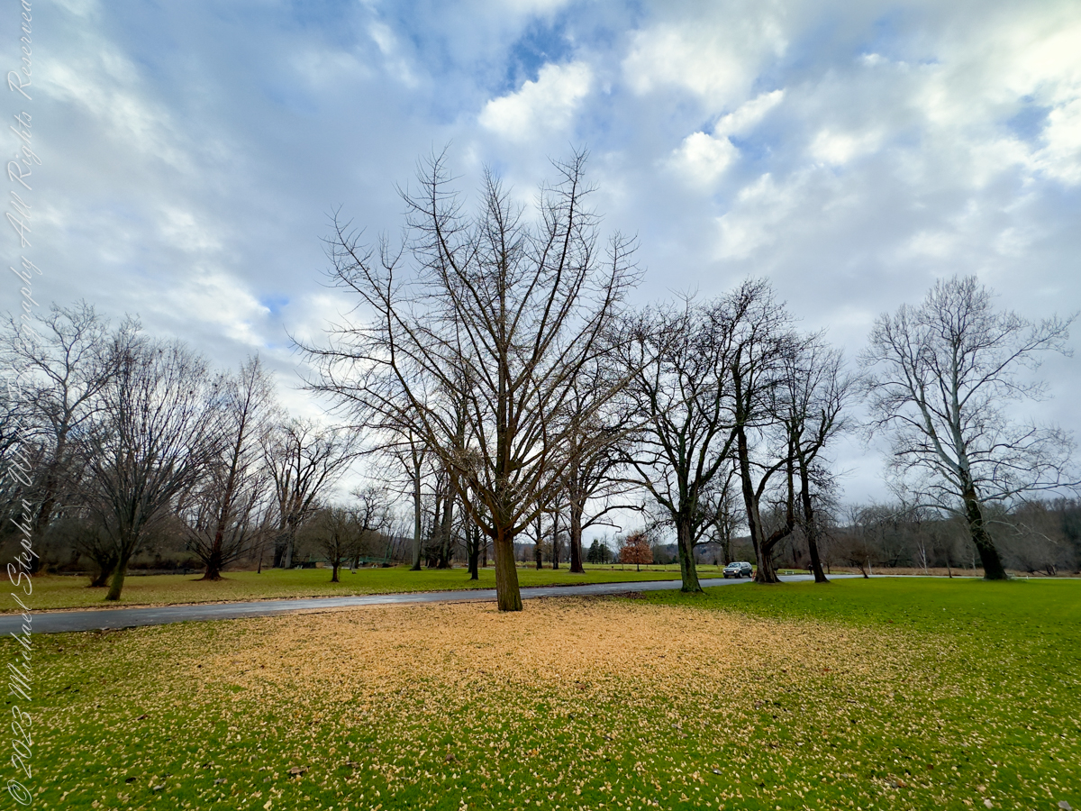
Standing before these two trees on a unseasonably warm autumn day, I am struck by the intricate patterns of their fallen leaves. Against the vibrant green of the grass, the golden leaves form halos around the trunks, as if nature herself were sketching mandalas. There’s something profoundly mathematical about these arrangements—a quiet order amidst what might initially seem like chaos.
The first tree, its barren branches reaching skyward, stands on a carpet of yellow that radiates outward in near-perfect symmetry. The leaves have fallen in such a way that their density decreases as the distance from the trunk increases. It reminds me of the inverse square law—a principle in physics that governs how light, gravity, and sound diminish with distance. Here, instead of energy dispersing, it’s the leaves thinning out, their graceful scatter dictated by the wind’s whims and gravity’s pull. There’s an undeniable harmony in this seemingly random process, a convergence of natural forces creating an elegant gradient.
Stewart Park, Ithaca, New York
The second tree presents a different story, yet one equally mesmerizing. Its leaves, still clinging in part to the branches, form a looser ring at the base. The distribution is uneven, hinting at prevailing winds or the sheltering influence of nearby buildings. But even in this asymmetry, I see fractals—the self-similar patterns that repeat at different scales throughout nature. Look closely, and you’ll notice clusters of leaves mimicking the broader structure of the canopy above. It’s as if the tree’s essence is echoed in the ground below, a reminder of how deeply interconnected every part of a system can be.
Robinia pseudoacacia, commonly known as the black locust
These patterns invite reflection on the mathematical principles governing our world. Fibonacci sequences, golden ratios, and fractals—abstract concepts are not confined to textbooks. They are etched into the fabric of existence, visible in the spiral of a sunflower’s seeds, the curve of a nautilus shell, and the fall of leaves beneath a tree. Even the chaos of autumn is underpinned by order, a dance choreographed by countless variables: the angle of the branches, the strength of the wind, the moisture in the air.
I find myself wondering about the unseen forces at play. How many leaves fell straight down, obeying only gravity? How many were carried aloft by a breeze before settling farther afield? Could we model these patterns with algorithms, tracing the arc of each leaf’s descent? Would the data reveal a perfect equation, or would it remind us that some mysteries resist full comprehension?
As I stand here, I feel a deep gratitude for these natural equations. They ground me in the present moment while also connecting me to the infinite. The pattern of leaf fall is a reminder of life’s balance: chaos and order, randomness and structure, fleeting moments and timeless principles. The trees, now shedding their golden crowns, invite me to pause, observe, and marvel at the beautiful mathematics of autumn.
Enter your email to receive notification of future postings. I will not sell or share your email address.
Copyright 2025 All Rights Reserved Michael Stephen Wills
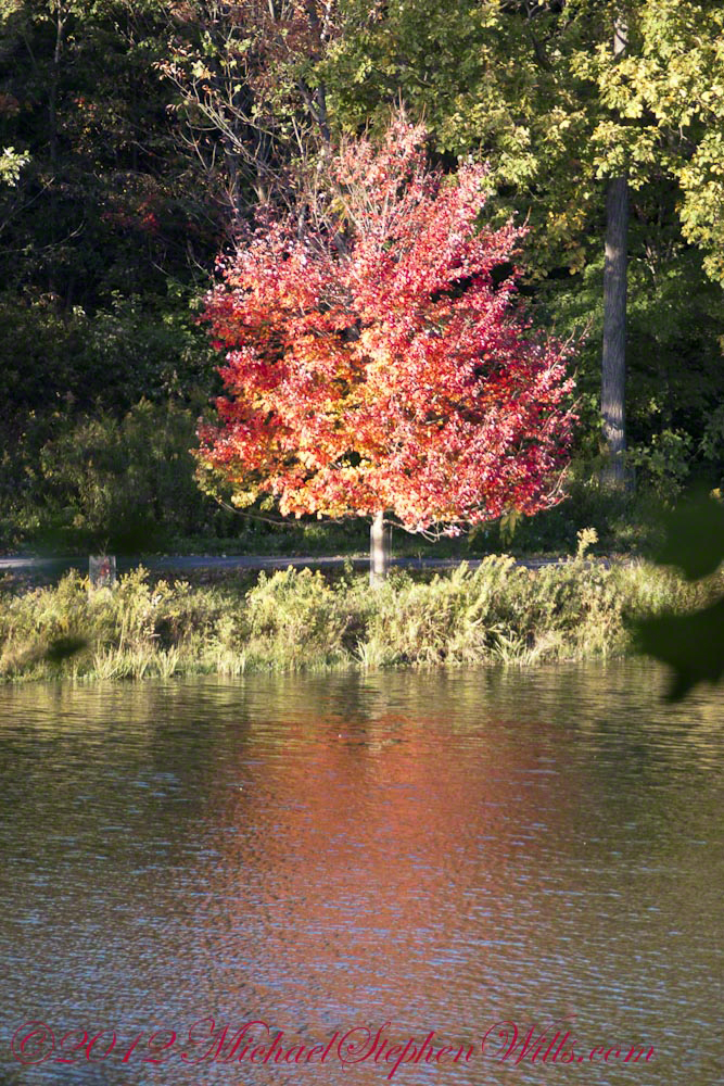
On a serene autumn afternoon by Beebe Lake, a solitary red maple stood out against the backdrop, showcasing its vibrant colors and resilience, symbolizing autumn’s fleeting beauty.
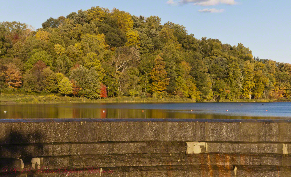
It was one of those serene autumn afternoons that linger in memory, the kind where the sky seems impossibly clear, the air crisp and gently scented with fallen leaves. I stood at the edge of Beebe Lake, my gaze first drawn to the textured concrete dam holding back the water, its weathered facade contrasting sharply with the soft reflections shimmering across the lake’s calm surface. Beyond, the wooded hillside rose gently, a tapestry woven with the warm hues of autumn—golds, greens, oranges, and reds mingling like brush strokes on a canvas.
An October Glory, turning before all others
Yet amidst this collective beauty, one tree captured my attention, singular in its brilliance—a solitary red maple standing proudly on the lakeshore. Its leaves had turned a vivid crimson, blazing brightly as though defying the muted earth tones surrounding it. Even from a distance, framed and partially obscured by larger trees, its vibrant reflection cast a fiery echo on the water, rippling softly in the afternoon breeze.
The maple, Acer Rubrum, seemed perfectly at home here, thriving robustly at the water’s edge. I remembered reading how adaptable red maples are, able to flourish in conditions ranging from dry uplands to swampy shores. This spot, near the edge of the tranquil Beebe Lake, seemed to showcase its resilient character perfectly.
Up close, the maple’s glow was even more striking. Its leaves cascaded in fiery clusters, hues deepening from bright scarlet at the tips to a darker maroon closer to the branches. This dramatic gradient seemed symbolic of autumn itself—beautiful, fleeting, and subtly tinged with the melancholy reminder of winter’s approach.
The Red Maple (Acer Rubrum) to tolerant of diverse conditions, making it a perfect choice for this spot on the short of Beebe Lake.
A memory surfaced of early spring in the Finger Lakes region, a time when maples, including this red maple, generously share their sap. Though not traditionally tapped like its sweeter cousin, the sugar maple, this species’ sap can indeed be boiled down into syrup, a surprising sweetness hidden within its sturdy trunk. Standing in its shadow, imagining those early spring days, it seemed astonishing that the same tree could offer both the delicate sweetness of syrup and the fierce beauty now on display.
Curiously, the transformation of the tree appeared methodical yet whimsical—it changed colors from the top down, its upper branches already bare, exposing slender twigs pointing skyward. Like an artist carefully removing layers to reveal something deeper beneath, the maple unveiled its upper bare bones first, as though reminding observers of the quiet strength supporting its autumn splendor.
This Red Maple (Acer Rubrum) turns from the top down and has already bare for most top branches.
As I lingered, taking in this turning tree, joggers passed by along the path, their rhythmic footsteps a gentle percussion beneath the rustling leaves. Briefly, they glanced toward the vivid maple, perhaps drawn, like me, by its striking contrast to the surrounding foliage. It felt like we shared a secret admiration for this singular tree, recognizing in it a quiet assertion of individuality amidst conformity.
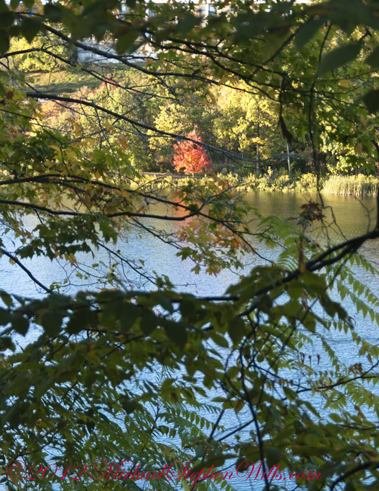
Eventually, I viewed the maple once more from afar, framed now by broader sweeps of branches and leaves, partially obscured but no less vivid. Through layers of leaves and dappled sunlight, it glowed like a distant flame, a beacon that seemed to encapsulate the entire mood of the season—warm yet cool, bright yet transient.
The Red Maple (Acer Rubrum) is the first to flower in spring and the first to turn in autumn.
Walking away, the image of that maple lingered, its reflection shimmering gently in the afternoon sun, a moment suspended between summer’s lush vitality and winter’s bare stillness. Beebe Lake had offered scenic beauty, a quiet meditation, a reflection mirrored not only on its tranquil surface but in the heart of an observer captivated by a single tree’s fleeting glory.
Enter your email to receive notification of future postings. I will not sell or share your email address.
Copyright 2025 All Rights Reserved Michael Stephen Wills
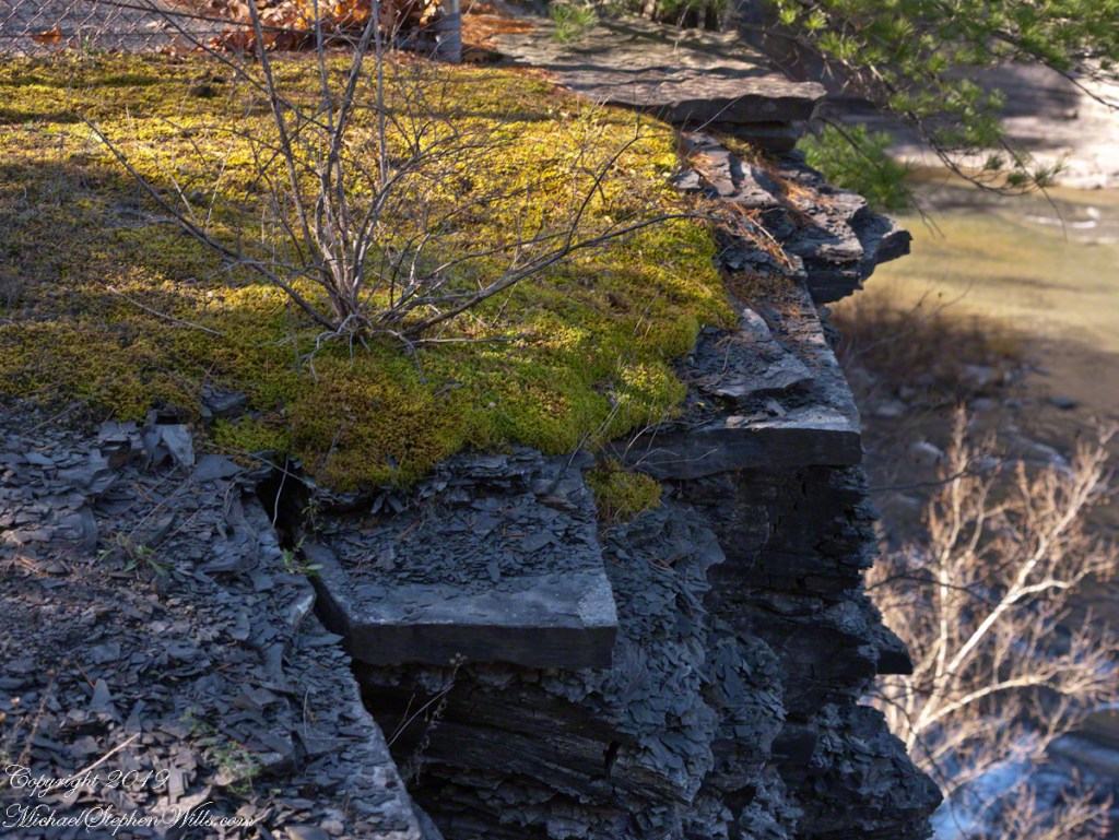
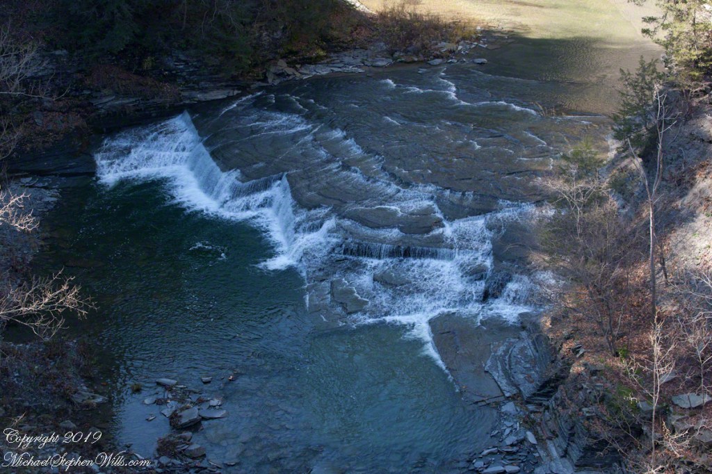
Perched above Taughannock Gorge, a moss-covered ledge and cascading falls reveal ancient stories—where Devonian seas once flowed and time’s layers whisper through stone and water.
The morning sun had only just breached the rim of the gorge, sending long slants of golden light across the forest floor. Walking the South Rim Trail of Taughannock Falls State Park, I came upon a quiet, unassuming spot—just a few paces off the path—where the forest seemed to pause in reverence. What greeted me was a small marvel of persistence and time.
There, rooted precariously atop a slab of brittle shale, was a tenacious shrub rising from a bed of moss, its spindly frame etched in sharp contrast to the soft, green sprawl beneath it. The moss had taken hold on a shelf of rock cantilevered over the gorge like a green tongue of earth defying gravity. Cracks traced the shale’s surface like veins, silent records of the forces that shaped this place—heat, ice, pressure, time. Together, the moss and the bush formed an improbable community, surviving against odds, bound together by the thin soil cradled in stone.
This ledge, suspended over the abyss, seemed less a part of the earth than a question it asked—how much life can cling to the edge before the edge itself gives way?
Beneath this living fragment, the gorge dropped away. Layers upon layers of shale revealed themselves, stacked like a collapsed library of time. Here, the Devonian Period lies exposed to wind and rain, and to those willing to pause and wonder. Each stratum holds the fossil whisper of ancient seas, where trilobites scuttled and coral reefs once stood. This gorge was not carved quickly. It was not born of a moment, but of many—countless raindrops, millennia of ice melt, the slow, sure work of water over stone.
From this natural balcony, I looked out and down to the gorge floor where the creek shaped the land with an artist’s patient hand. The falls, seen from above, no longer thundered—they danced. Spread like the folds of a fan, water curled over smooth stone in steps of white silk. From here, the cascade looked deliberate, choreographed—an elemental performance halfway between gravity and grace.
How many times had this water flowed, reshaped, receded? How often had it carved these grooves, smoothed those ridges, erased the footprints of what came before? Looking at the exposed rock, one could trace the signature of ancient glaciers, feel the memory of long-gone floods. It was humbling—this intersection of change and continuity.
Above it all, the trees stood still. Pine and oak, rooted well back from the edge, offered a kind of sentinel presence. Their shadows stretched long and angled, tracing the contours of both earth and memory. For a moment, I let go of all thought and simply listened—to the murmur of wind through leaves, the faint rush of water far below, and the silence that presses in when the land itself seems to be remembering.
This spot—so easily missed by a hurried hiker—offered a parable of resilience and impermanence. The moss did not grow with certainty, nor the shrub reach with confidence. They survived on the edge because they adapted. They made do with less. They took root where others could not. There was no security in that place, only presence. Only the now.
And isn’t that a lesson worth carrying?
We so often seek stability, firm ground, a clear path. Yet, some of the most beautiful things live just beyond comfort—on ledges, in cracks, in the margins of the known. To pause here was to acknowledge that life thrives not only in sheltered valleys but also at the edge of what seems possible.
As I stepped back onto the trail and continued along the South Rim, the image of that mossy outcrop stayed with me. I carried it in my thoughts like a talisman—proof that even on the brink, life finds a way. And that from above, the most chaotic falls can appear as ordered motion, as a flow toward something larger.
Later, when the sun climbed higher and the light lost its slant, I would look back on this moment not as a spectacular highlight but as something more intimate: a quiet encounter with nature’s subtle artistry, its layered truths, and its enduring invitation to look closely, feel deeply, and walk softly.
For here, above the gorge, at the edge of earth and time, even a whisper leaves a mark.
Enter your email to receive notification of future postings. I will not sell or share your email address.
Copyright 2025 All Rights Reserved Michael Stephen Wills
The Finger Lakes region, renowned for its natural beauty and changing seasons, put on a stunning performance on October 24, 2024. From the vibrant reds of a Japanese maple (Acer palmatum) to the golden hues of oak leaves (Quercus spp.), this photographic journey through our home captures the essence of autumn in upstate New York.
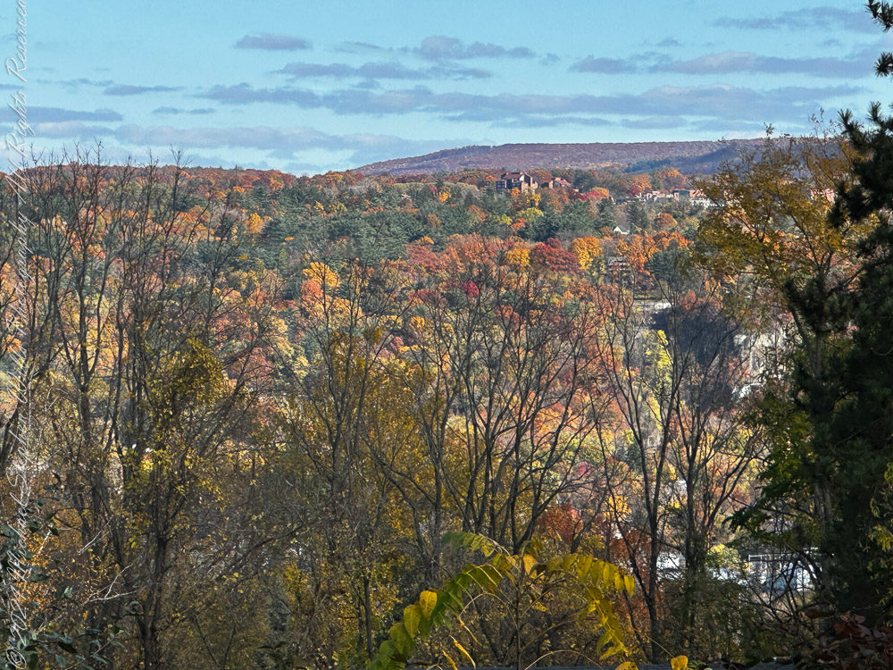
A Panoramic Tapestry
In the first photograph, the landscape unfolds like a watercolor painting. Hills dressed in fiery oranges and golds stretch across the horizon, with hints of evergreen pines (Pinus spp.) providing contrast. The sky, dotted with wispy clouds, serves as a serene backdrop, while the foreground frames the scene with bare tree limbs—a reminder that autumn is both a celebration of life and a prelude to winter’s dormancy. This image evokes a sense of timelessness, connecting us to the rolling hills that have witnessed countless seasons of change.
View from our porch across Ithaca to East Hill, Cornell University, Ithaca Falls on an October 2024 afternoon. Tompkins County, Finger Lakes Region, New York State
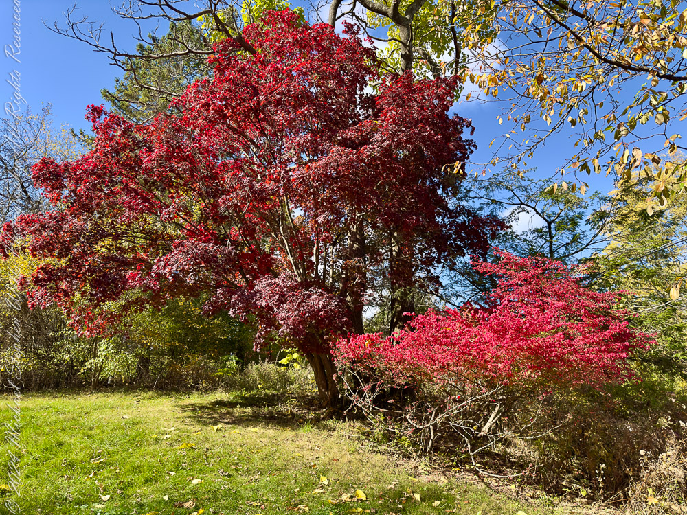
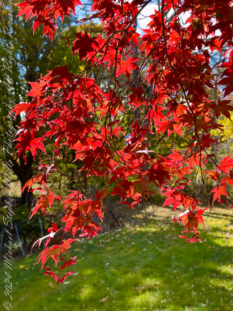
Japanese Maple: A Crimson Jewel
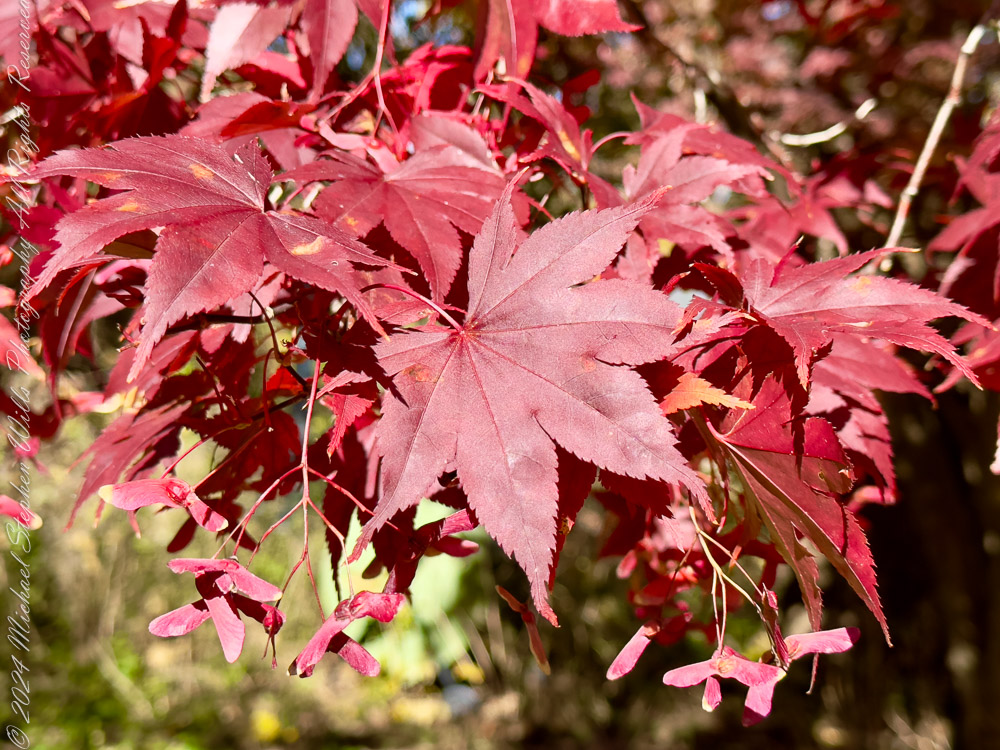
The next series of images focuses on the Japanese maple (Acer palmatum), a tree whose vibrant red foliage becomes a magnet for admiration in autumn. One close-up reveals delicate leaves, their intricate lobes illuminated by the afternoon sun. The interplay of light and shadow transforms each leaf into a tiny stained-glass window. Another photograph showcases the tree in its entirety, a commanding presence against the verdant lawn. It is a poignant reminder of nature’s artistry, where every branch and leaf contributes to the symphony of color.
Firebush and Japanese Maple in autumn colorsJapanese maple leaves and samara in autumn colors. From our yard October 2024Japanese maple leaves and samara in autumn colors. From our yard October 2024
Home Amid the Foliage
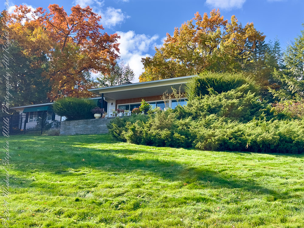
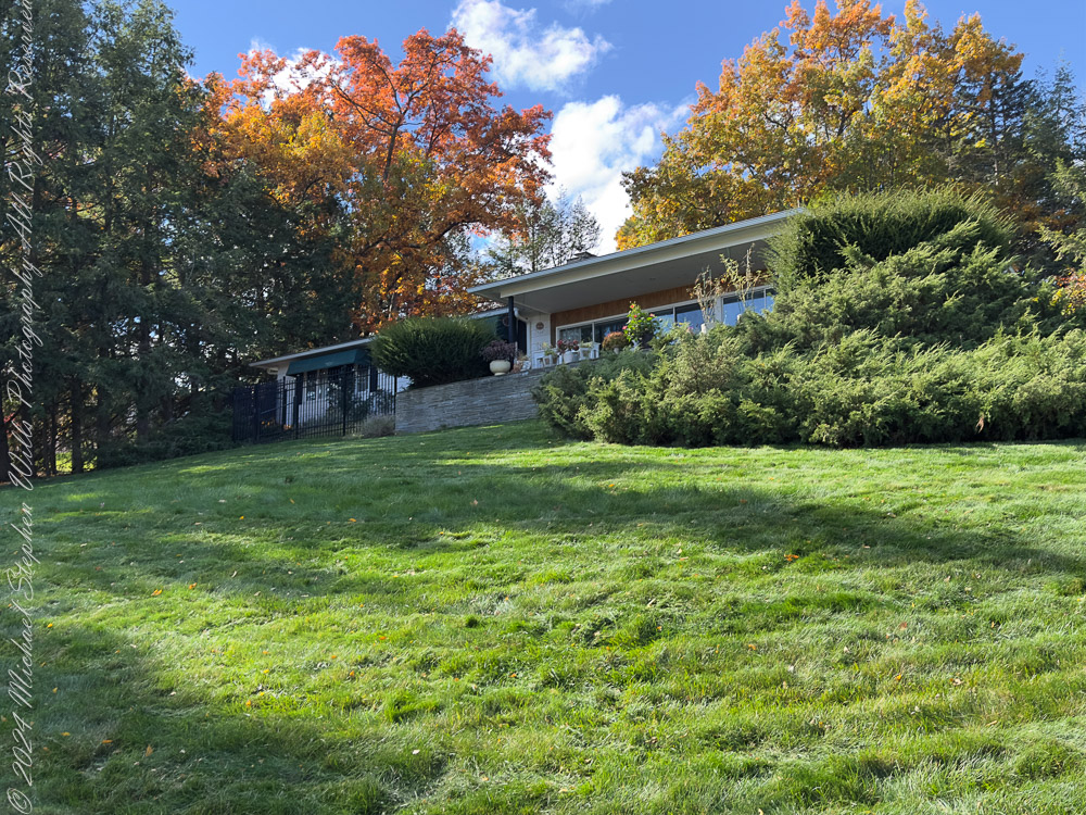
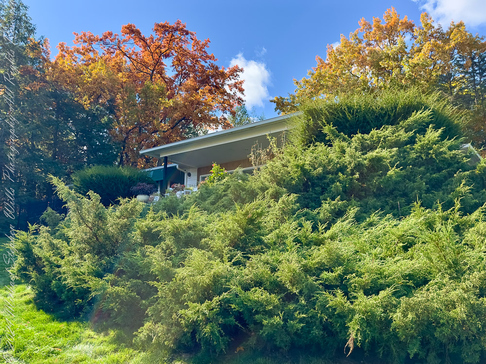
Nestled within this autumnal palette is our home, a mid-century structure that seems almost inseparable from its surroundings. The expansive lawn, a lush carpet of green, contrasts with the fiery colors of nearby oak (Quercus spp.) and maple trees (Acer spp.). In one angle, the house appears almost tucked away, sheltered by Eastern Hemlock (Tsuga canadensis) and junipers (Juniperus spp.) that add a sense of permanence to the scene. This juxtaposition of human habitation and natural splendor underscores how our lives are intertwined with the land we call home.
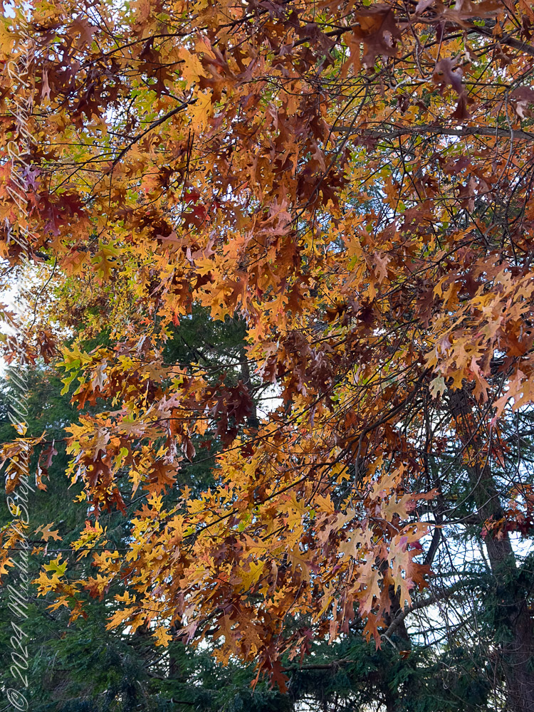
Our oak trees in autumn colors
Oak Leaves: A Study in Texture
A close-up of oak leaves (Quercus spp.) showcases their rugged beauty, with jagged edges and deep veins that seem etched by time itself. Their colors—ranging from deep amber to burnished copper—are a testament to the richness of autumn’s palette. These leaves, clinging tenaciously to their branches, remind us of resilience and the fleeting beauty of the season.
Our oak tree in autumn colors. Helmock backdrop
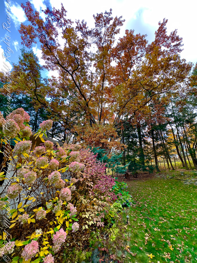
Hydrangeas in Transition
The hydrangea bushes (Hydrangea paniculata) by the house present a softer side of autumn. Their once-vivid blooms have faded to pastel pinks and creams, lending an air of nostalgia. These flowers, in their gentle decline, mirror the transition of the season, where vibrancy gives way to a quieter beauty. The hydrangea blooms seem to whisper the story of the summer past, offering a delicate contrast to the bolder hues of the surrounding trees.
Our oak tree in autumn colors. Pam’s hydrangia.
The Resilient Shrubs
Creeping Juniper (Juniperus horizontalis), here in the foreground, provides a grounding element in the composition, with a steadfast green the reminder of life persisting even as deciduous leaves fall. The dense shrubbery near the house creates a protective cocoon, framing the building with a sense of natural security. The dynamic interplay between these evergreens and the changing foliage of maples and oaks reflects the layered complexity of this landscape.
Reflections on an Afternoon
As I wandered through these scenes with camera in hand, I was struck by the interplay of light, color, and texture. Each photograph captures a fleeting moment, a slice of a season that, despite its predictability, never fails to surprise and inspire. Autumn in the Finger Lakes is a time of reflection, a reminder to pause and appreciate the world around us.
These images, taken on a single afternoon, tell a story of a landscape alive with color and character. From the steadfast junipers to the delicate hydrangea blooms, from the fiery maples to the enduring oaks, they invite us to celebrate not just the beauty of nature but also our place within it—a home nestled among trees that have stood for decades, witnessing the rhythms of the earth.
Enter your email to receive notification of future postings. I will not sell or share your email address.
Copyright 2024 All Rights Reserved Michael Stephen Wills
The air was soddenly warm that Thanksgiving morning in 2023, carrying a foreboding of climate change. Standing on the grounds of Ithaca High School, I couldn’t help but feel the incongruity of the unseasonable warmth. The annual “Turkey Trot” was unfolding around me, an event filled with cheerful camaraderie, yet beneath the surface of this tradition, the world itself seemed to whisper a warning. My attention drifted from the runners to the ground, where fallen leaves painted a story that echoed this uneasy tension.
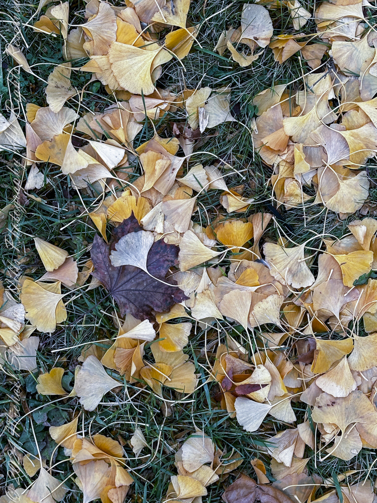
The ginkgo leaves, their vibrant golden hues glowing against the damp grass, seemed almost out of place in the humid air. Ginkgos are ancient survivors, trees that have witnessed millennia of change, yet even they now face a future shaped by the rapid pace of human disruption. Their fan-like shapes, so delicate and timeless, carried an irony—symbols of endurance scattered on a landscape where the seasons no longer held the predictability they once did. That morning, their luminous beauty felt like a quiet plea, a reminder of nature’s fragility in the face of human indifference.
As a spectator of the 2023 “Turkey Trot” on Thanksgiving Day I found these Ginko and Sycamore leaves at Ithaca High School, Ithaca, Tompkins County New York. Finger Lakes Region
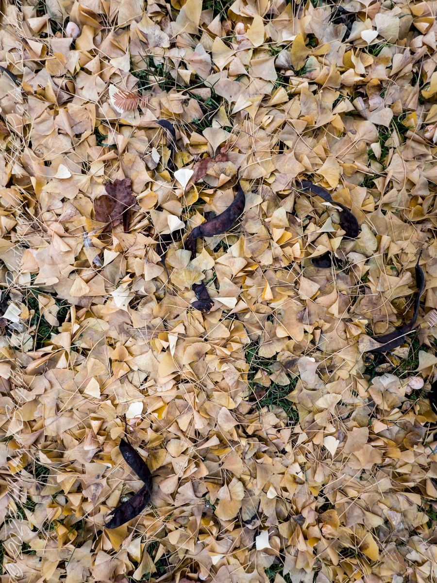
Among them, the sycamore leaves lay darker and more rugged, their broader forms curled and weathered by the elements. The sycamore is a resilient tree, often thriving in difficult conditions, yet its leaves bore a somber note against the warmth of the day. Together, the ginkgo and sycamore leaves formed a poignant tableau—a meeting of strength and delicacy, both subject to the same unrelenting forces of change. As I stood there, the leaves seemed to whisper their own story, a testament to survival amidst an increasingly uncertain world.
Ginko Leaves and Honey Locust Pods, Stewart Park on a December 2023 afternoon
The Turkey Trot unfolded with its usual energy—children dashed ahead with gleeful abandon, adults paced themselves in cheerful determination, and older participants moved with quiet dignity. The warmth seemed to amplify the human vibrancy of the event, yet it also cast a shadow of dissonance. This race, this celebration of resilience and community, was happening against the backdrop of a world in flux. The warmth of the morning was a reminder that even cherished traditions like this might one day feel the strain of climate shifts.
I crouched to capture the leaves in a photograph, drawn by their interplay of color and form. The ginkgo leaves glimmered like gold coins scattered across the ground, while the sycamore leaves added a depth and weight that anchored the scene. Together, they reminded me of the cyclical nature of life, the beauty and decay that coexist within the same space. Yet this year, the warmth in the air added an unsettling layer to the story. These leaves, so central to the rhythm of seasons, were now falling in a world where those rhythms seemed increasingly disrupted.
Bare Ginko tree with leaf pattern, Stewart Park on a December afternoon 2023
As the sunlight broke through the clouds, it illuminated the edges of the ginkgo leaves, making them shimmer with an almost otherworldly light. I lingered in that moment, feeling the weight of its quiet truth: life is fleeting, but its beauty endures in the connections we foster and the memories we hold. That Thanksgiving, the humid warmth of the air reminded me that we live in a time of profound change, yet even amid uncertainty, there is still wonder to be found beneath our feet. It is a wonder worth preserving.
Enter your email to receive notification of future postings. I will not sell or share your email address.
Copyright 2024 All Rights Reserved Michael Stephen Wills
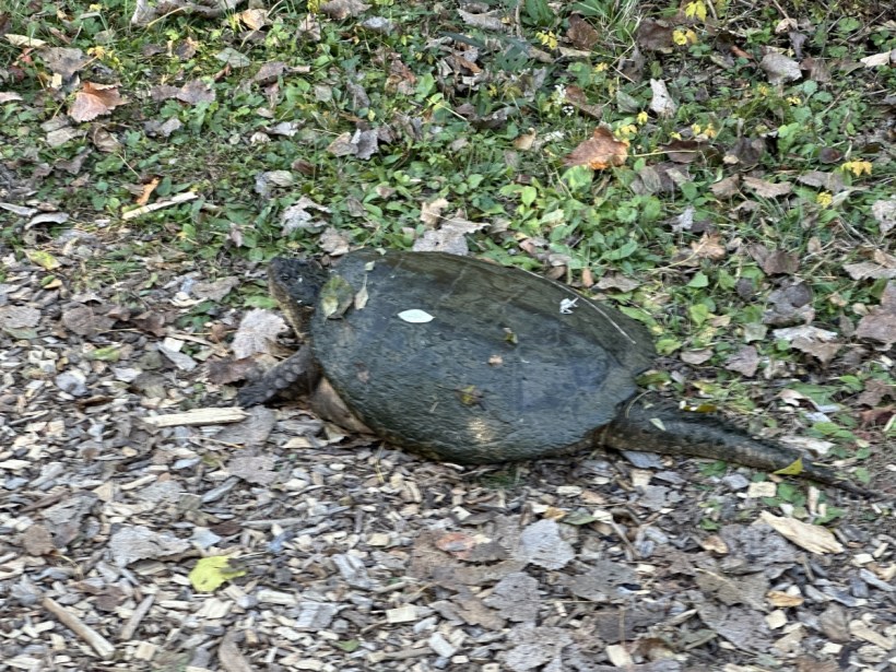
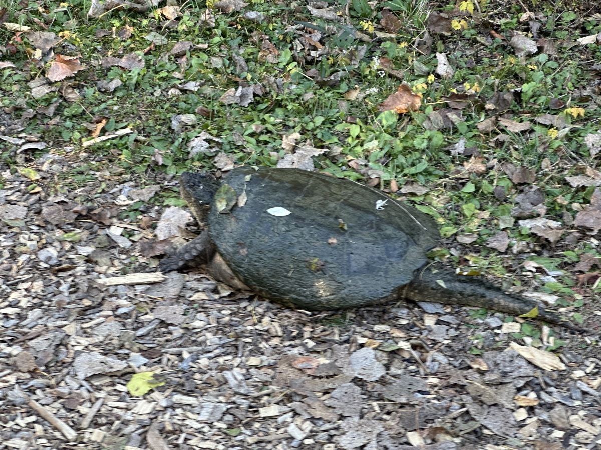
O ancient wanderer of Sapsucker Woods, armor-clad and quiet, you lumber forth, carved from the earth itself, sculpted from mud and pondweed dreams.
October’s afternoon light paints you with golden shadows, each leaf fallen, each branch broken a whispered testament to the slowness of your path, steady as a heartbeat unmoved by haste.
You bear the centuries in the lines of your shell, grooves and valleys where stories settle, tales of reeds and minnows, and the deep-rooted knowing that life is best met with patience, with pause.
O creature of edges and silence, you bridge water and wood, the line between stillness and stride. What weight you carry, not of burden, but of presence— a shell that holds the weight of stars, the bones of ancient rivers, and the soft clay of Sapsucker’s floor.
In your slow, silent passing, the trail bows to you. Leaves make way, and the earth beneath you settles a little deeper, reminded of the strength that moves without noise, the wisdom that crawls in the path of shadows.
Turtle, you who wear the world’s patience, I watch you disappear, an ambassador of ponds and pools, a silent architect of marsh and moss. May your journey be long, your pauses endless, and your shell a testament to the beauty of age, carved by time, blessed by the sun.
Enter your email to receive notification of future postings. I will not sell or share your email address.
Copyright 2025 All Rights Reserved Michael Stephen Wills
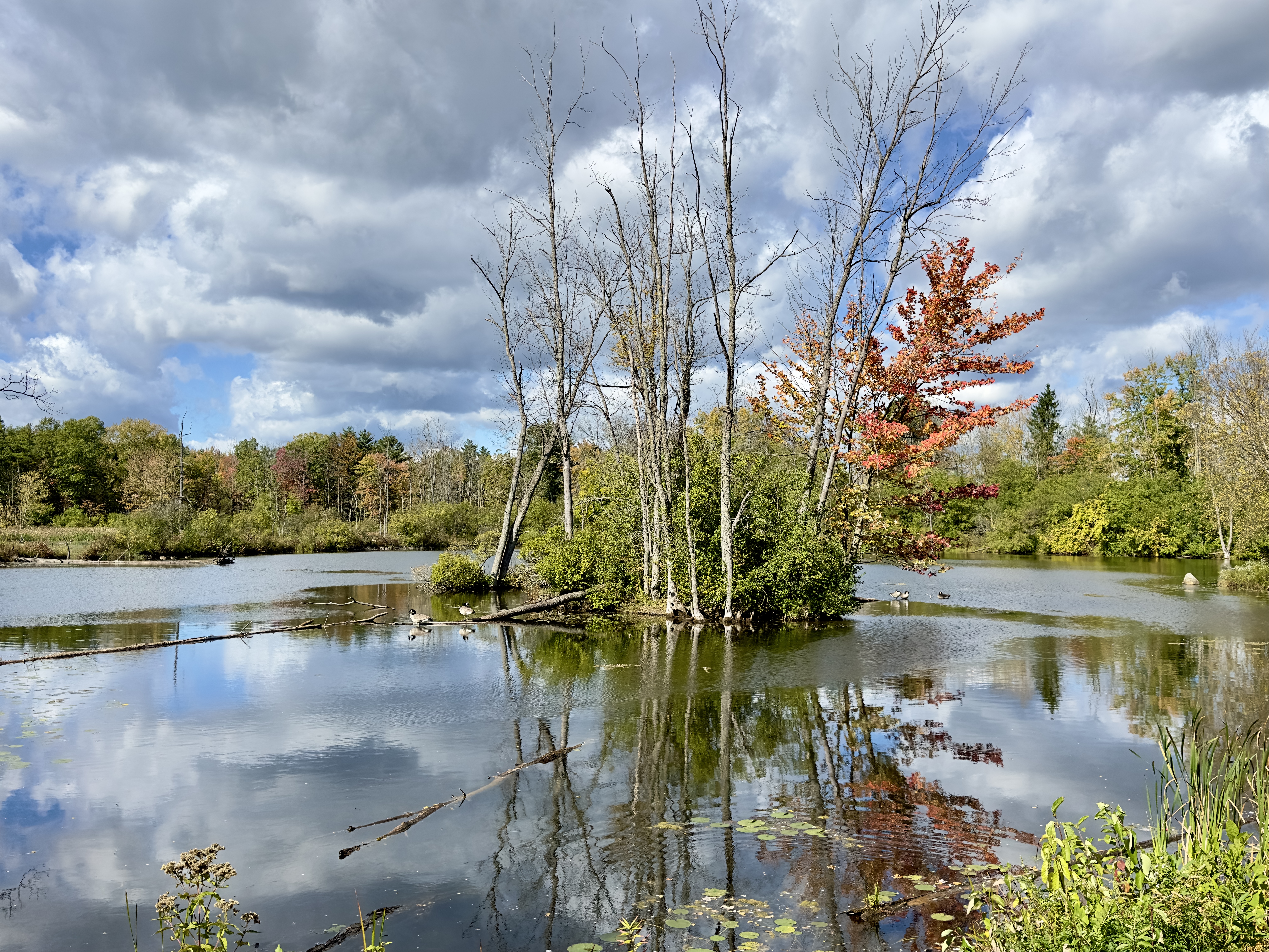
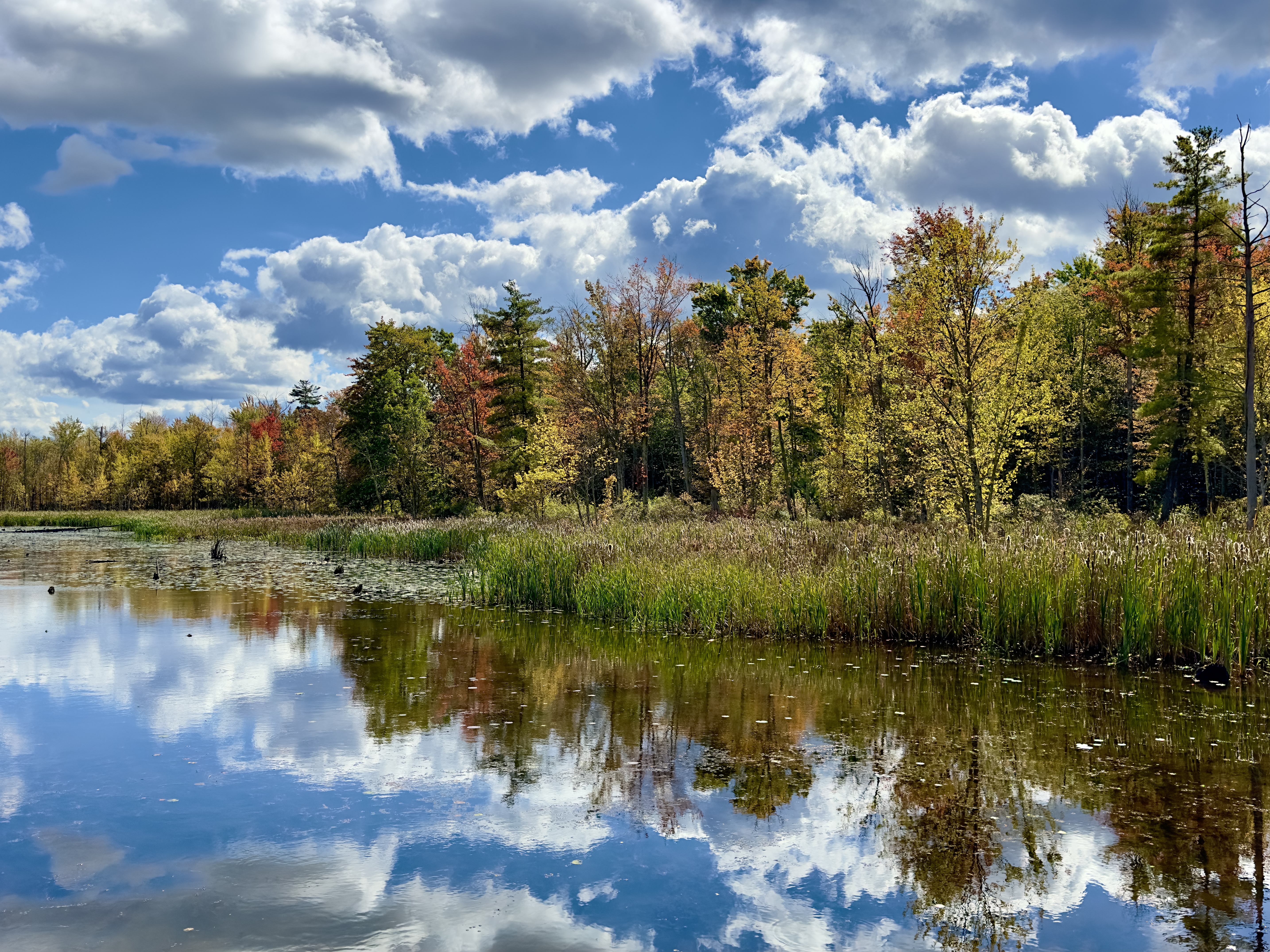
On this autumn Sapsucker Woods afternoon, the world seems crafted to soothe. Sunlight filters through the canopy, setting leaves ablaze in rich reds, golden yellows, and softened greens, the seasonal palette reflecting nature’s grand finale. Today, the woods are a sanctuary for healing, a space where steps are measured not by speed but by strength, each one a testament to resilience.
Pam stands before the wide, outstretched wings painted on the wall at the Cornell Lab of Ornithology, wings so vast that they dwarf her. She smiles, resting against her hiking poles, the Condor wings an emblem of a journey toward reclaiming freedom. Her recent hip replacement surgery has given her back this independence, a reminder that recovery is not just about physical mending, but about lifting the spirit to soar once again.
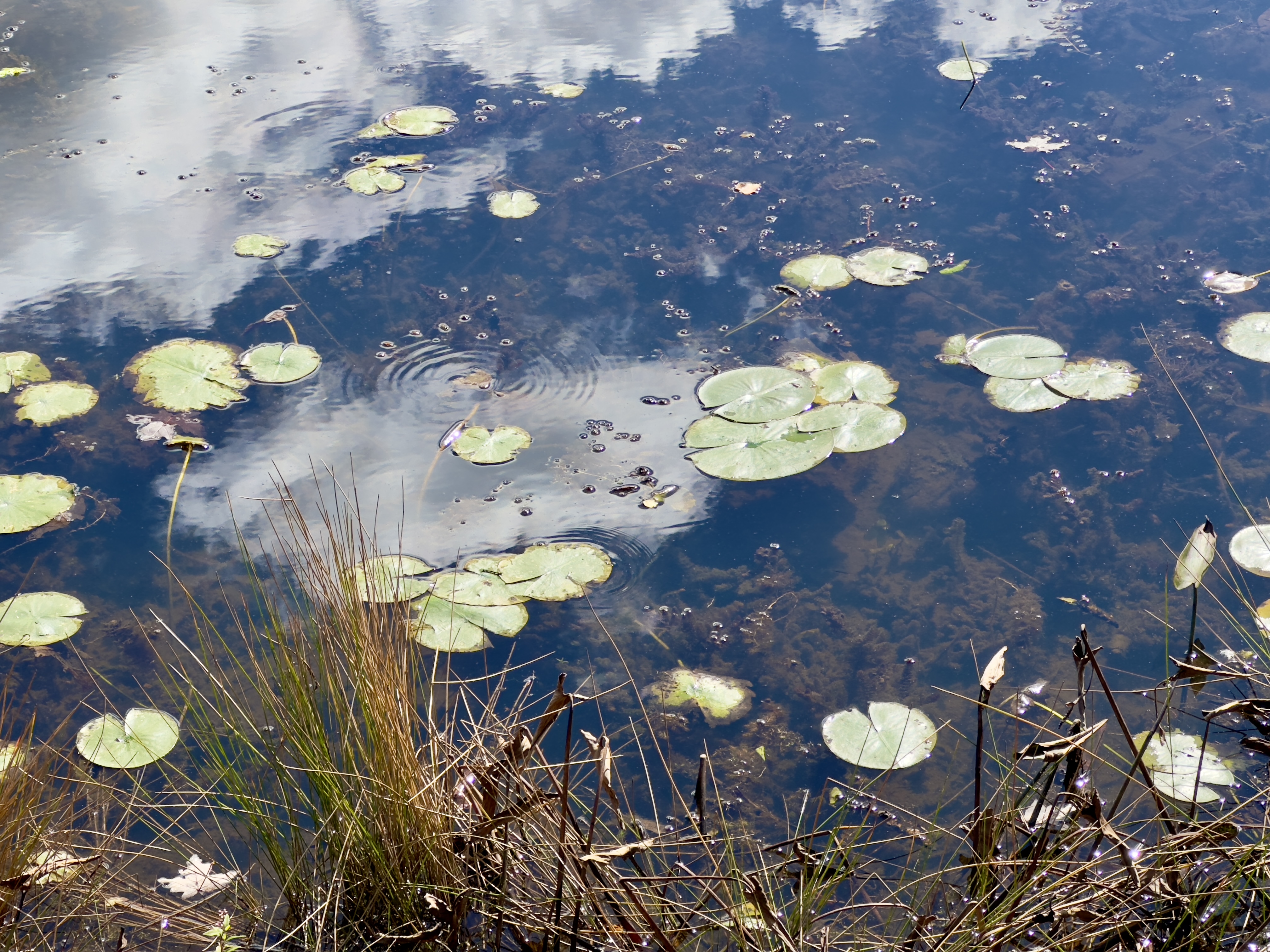
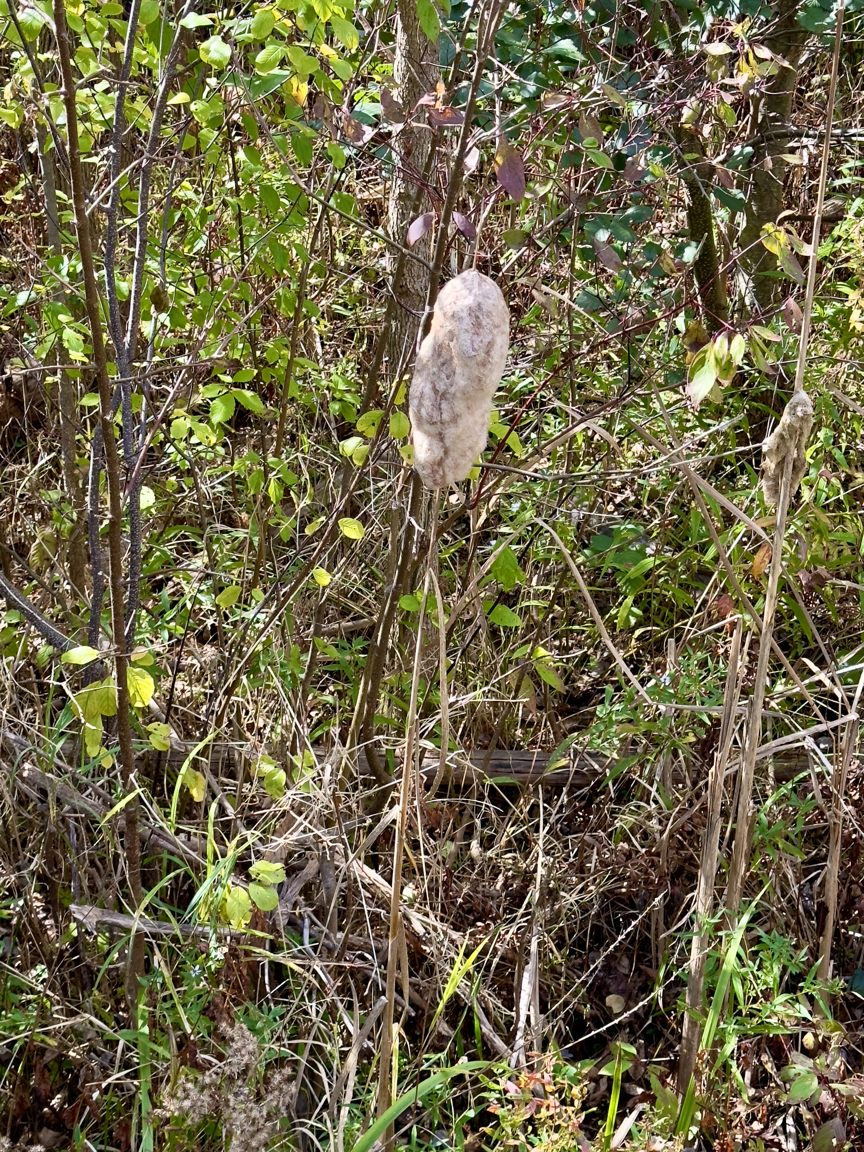
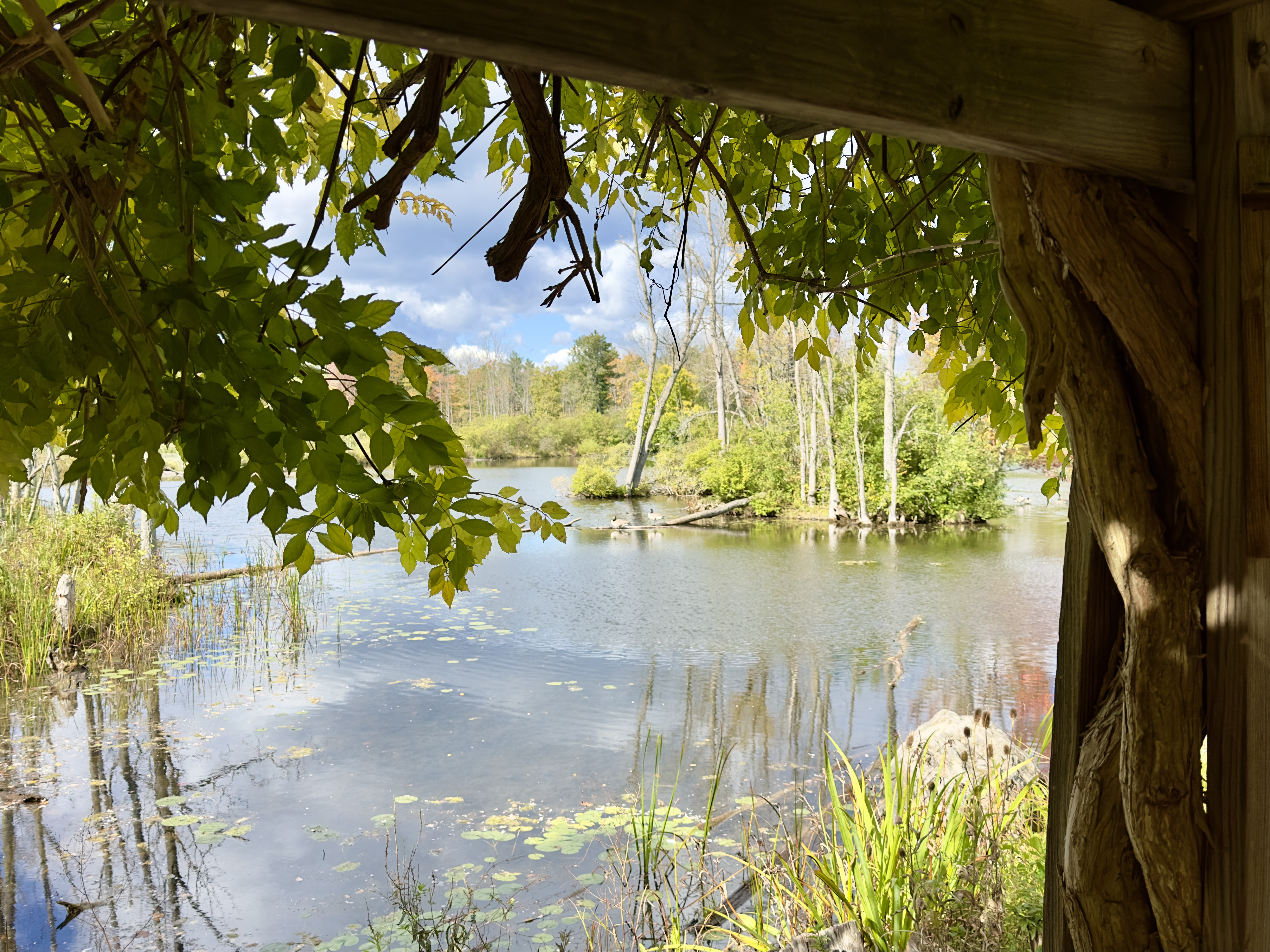
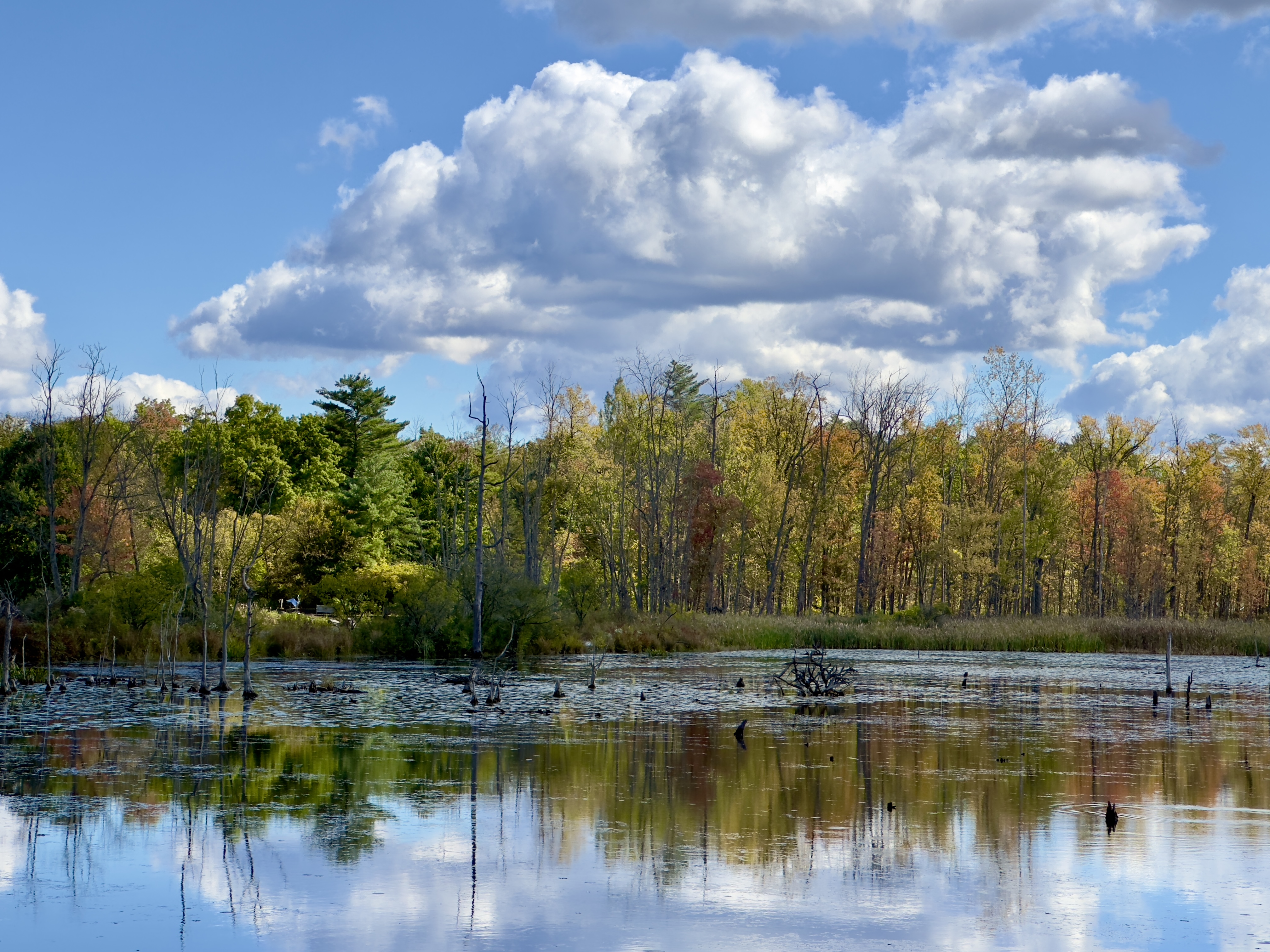
The trail unfolds gently, bordered by cattails and still waters that mirror the sky—a bright blue canvas mottled with soft clouds drifting in and out of the reflections. Fallen leaves float upon the pond’s surface, creating patches of color that seem suspended between water and sky. Nearby, lily pads, green stepping stones over shadowed depths, their edges lit by glittering sunlight. Geese glide by, unbothered, embodying a calm flowing outward, wrapping the whole scene in peace.
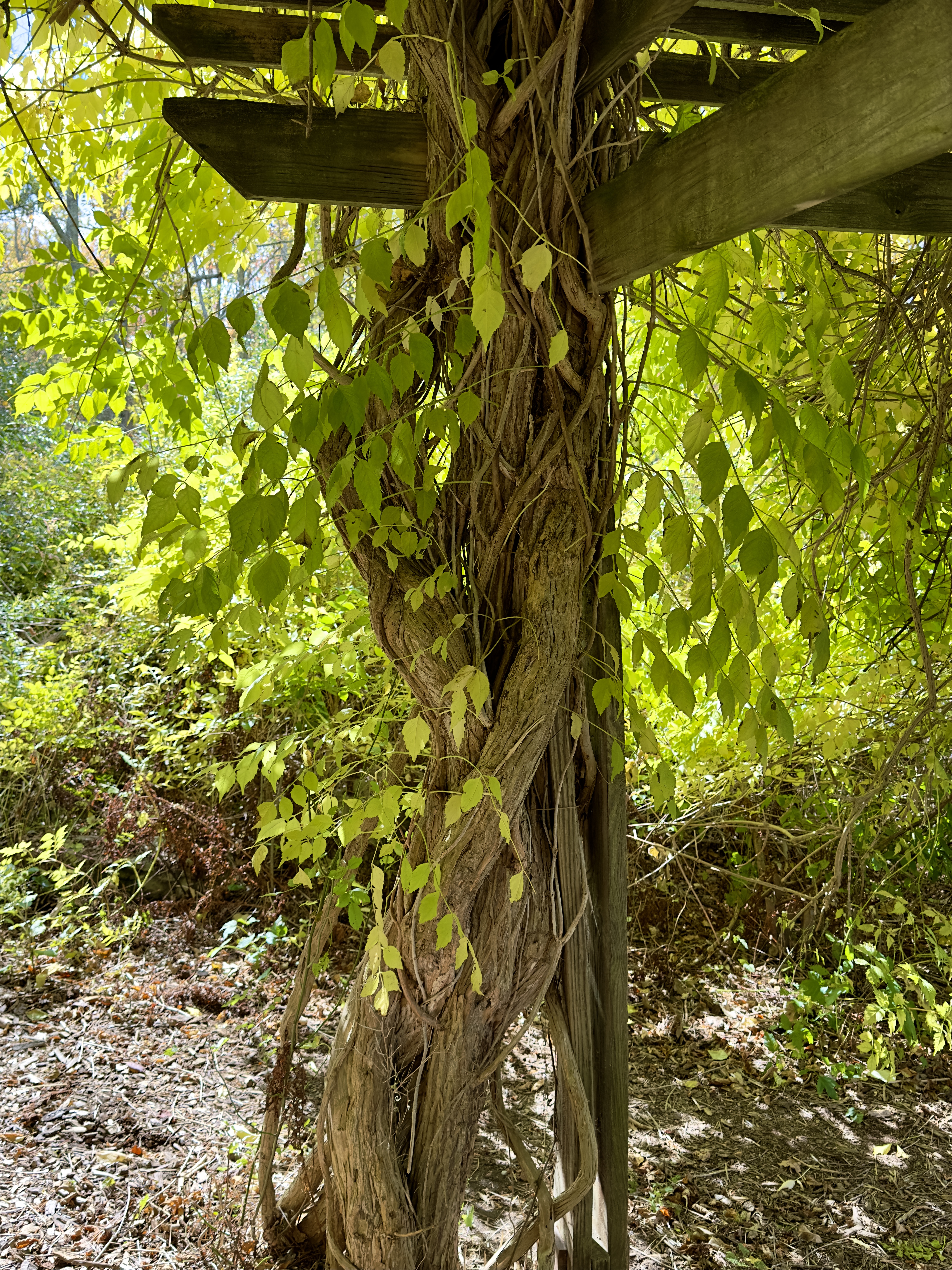
Each step Pam takes is deliberate, accompanied by the steady rhythm of her poles striking the ground. It is the kind of walk that invites contemplation, where time slows, and even the smallest detail—a single yellow leaf spiraling down, a ripple breaking the pond’s surface—feels like an invitation to pause and breathe. She moves from the open path toward a shaded arbor, draped with twisting vines. The vines climb upward, winding around the wooden beams, their leaves creating a soft veil that frames her view of the water beyond. Through this leafy curtain, she gazes upon the pond, where autumn’s reflection glows, offering a quiet moment of solitude, of healing drawn from nature’s persistence.
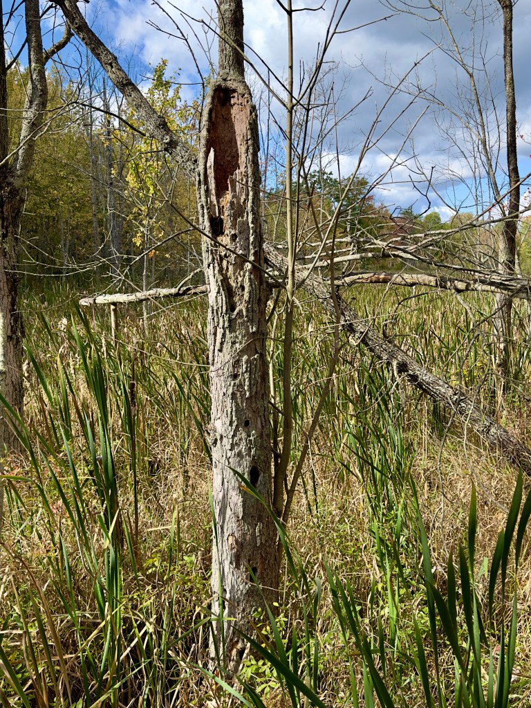
Just beyond, a bare tree stands, its trunk hollowed by years, its exposed wood testament to the life that has passed through it. In its decay, it offers a home to the creatures of the marsh, a structure among reeds and grasses that sway with the wind. The tree reminds Pam of her own journey, how resilience is often found in adapting, in letting time and life shape you.
At last, we reach a bench overlooking the pond, a perfect place to rest and reflect. She settles in, feeling the quiet thrill of accomplishment. The woods are still, save for the sound of a breeze rustling the reeds and the occasional bird song piercing the silence. In this moment, with the vast sky overhead and the world reflected below, she feels a profound sense of gratitude—not only for the beauty around her but for the strength within her. Sapsucker Woods are a personal cathedral, a space where nature and recovery intertwine, offering peace in every step, in every breath.
Enter your email to receive notification of future postings. I will not sell or share your email address.
Copyright 2024 All Rights Reserved Michael Stephen Wills