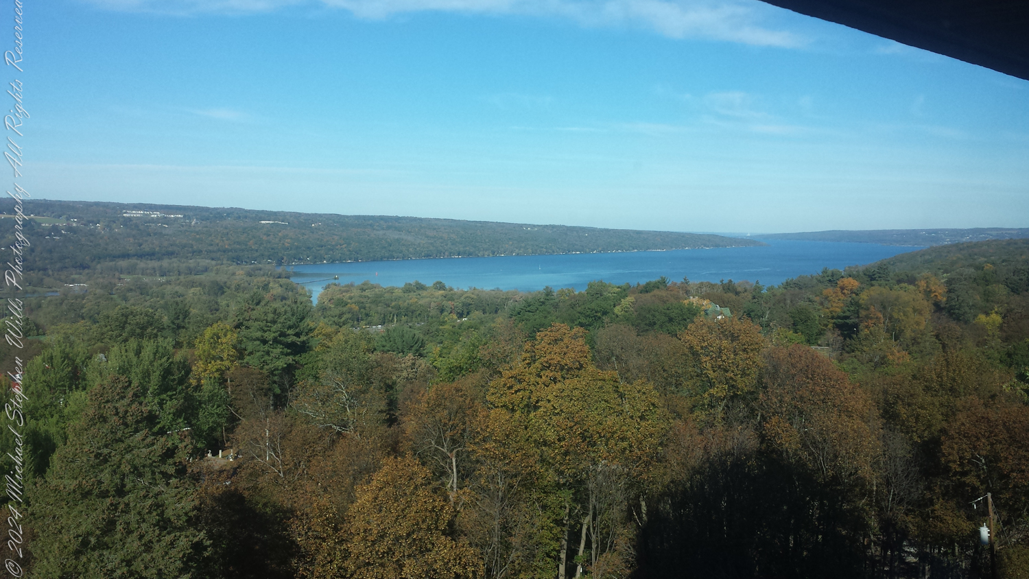
On April 11, 2026, I walked Fillmore Glen State Park beneath trees still bare, their branches opening the woods to the cool, unguarded light of early spring. The forest had not yet put on its full green speech. Last year’s leaves still covered the ground in shades of russet and tan, and among them, close to the earth, I found Hepatica acutiloba beginning to bloom.
These are flowers that ask for slowness. No one hurrying through the woods would fully see them. I had to kneel, lower myself into their world, and let my eyes adjust to their scale. Only then did they begin to reveal themselves: first as closed buds, pale and self-contained, then as opened white blossoms shining from the leaf litter like small votives in the dim cathedral of the spring woods.
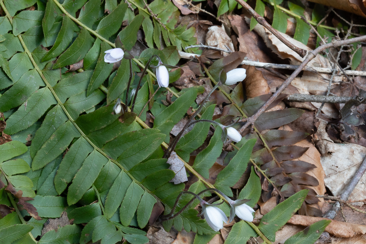
This flower was a light lavender blossoms, still closed, rising from the forest floor on a delicate stems. The sun had reached in, and I made the image handheld, steadying the camera on the ground. Even unopened, it seemed to hold light within itself, as though the day had touched it but not yet persuaded it to unfold. I have always loved that about hepatica. It does not fling itself into spring. It listens first. It waits with an old intelligence, answering warmth and brightness in its own time.
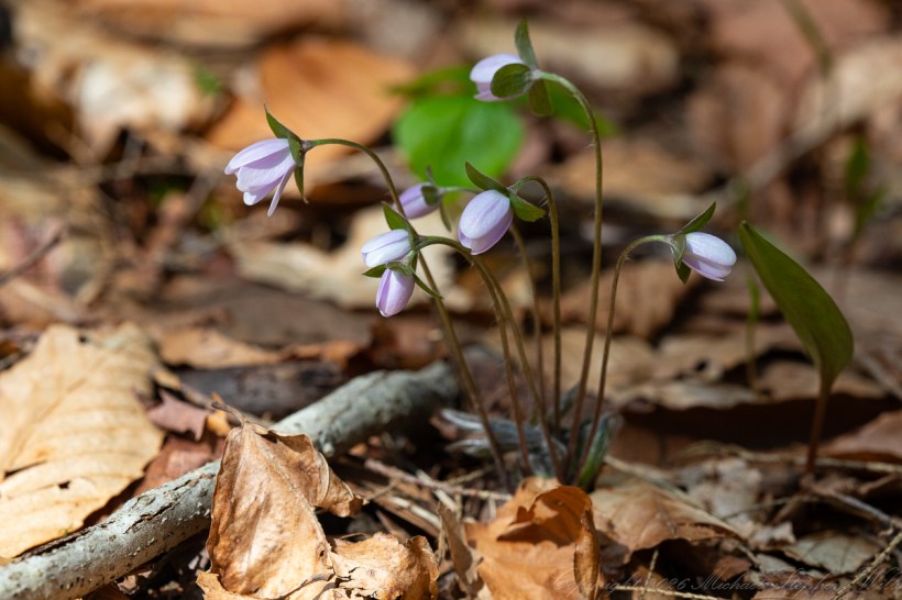
A second cluster of closed blossoms rested among evergreen fern fronds, which appear to be Christmas fern, Polystichum acrostichoides. Their leathery green pinnae, carried through the winter, formed a fitting companion to these early flowers. Together they seemed to embody one of the quiet truths of the April woods: that renewal does not come as a sudden trumpet blast, but by degrees. First the fern still holding its winter green. Then the bud. Then the opening. Then the day when the whole hillside begins to feel like a promise being kept.
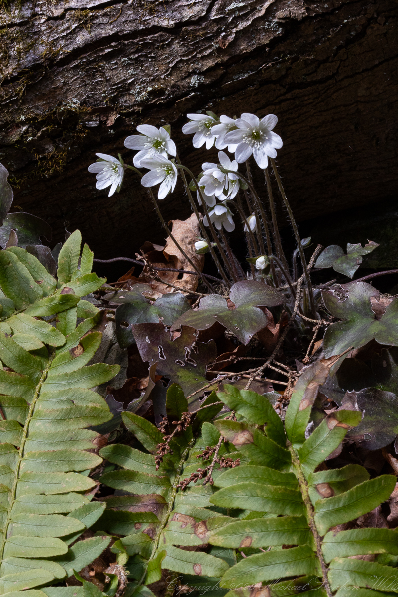
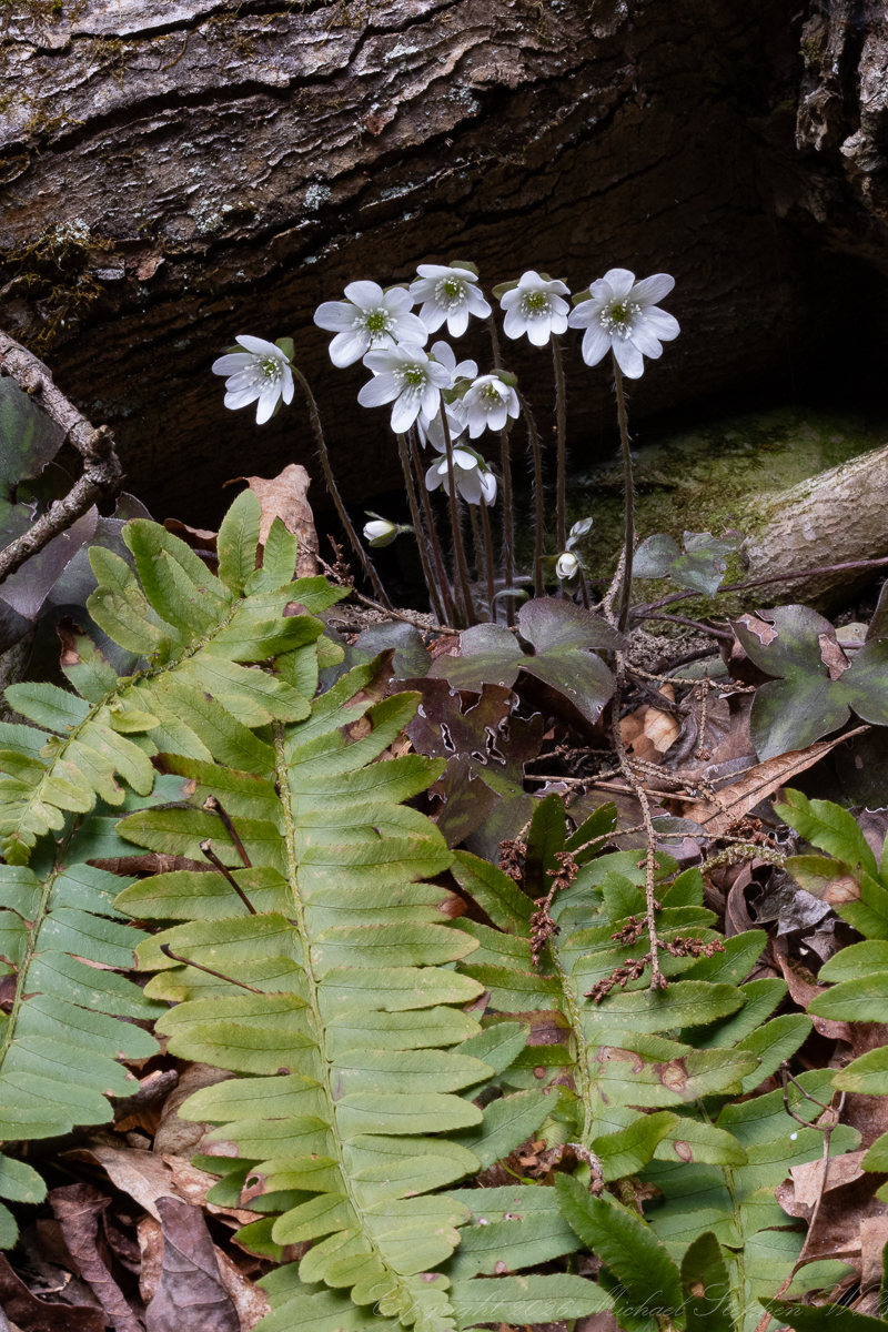
The last three photographs showed the same group of white hepatica blossoms growing on a south-facing slope beneath a tree root. By then I had placed the camera on my Manfrotto BeFree tripod, and I worked more deliberately, grateful for the patience that such flowers invite. One image was made in sunlight; the others when the sun had passed behind a cloud. That change mattered. In the sun, the white blossoms seemed almost to ring like little bells of light. Under cloud, they grew quieter, softer, more inward. The mood deepened. The exposed root above them became a rough shelter, a woodland lintel, and the blossoms beneath gathered into a hidden chapel of spring.
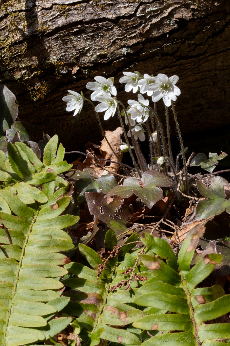
I stood there for a long while, looking not only at the flowers but at the place that had made their blooming possible. A south-facing slope gathers warmth earlier in the season. The root held the bank in place and offered a small measure of protection. The leaf litter insulated the soil. The ferns kept their green nearby. Nothing in such a scene is accidental. The woods are full of these small negotiations between light, temperature, shelter, and time. Hepatica, for all its delicacy, is a master of them.
We call these flowers spring ephemerals, and the name is true in one sense. Their season of bloom is brief. Before long, the trees overhead will leaf out, and the bright interval in which they thrive will begin to close. Yet “ephemeral” can sound too fragile a word for a plant so well adapted, so seasoned in its timing. Hepatica does not merely appear and vanish. It endures. Its leaves persist through winter. Its flowering is tuned to a narrow ecological opening, one shaped by the still-bare canopy of the deciduous forest. For a few precious weeks, before shade deepens, it steps into the light and makes use of what the season offers.
Perhaps that is why hepatica has so often found a place in literature and nature writing. It carries a symbolism that feels earned rather than assigned. It arrives when the world still bears winter’s austerity, and so its bloom seems less decorative than revelatory. Generations of observers have seen in such flowers a sign that the year turns first in whispers. Not through spectacle, but through fidelity. A small flower opening under bare branches can change the whole moral weather of a walk.
That was how it felt to me at Fillmore Glen. The woods were still mostly brown and gray, still waiting for leaf and shade and birdsong in full chorus. Yet these blossoms had already crossed some invisible threshold. They were spring in its purest form: not abundance, but inception. Not the full choir, but the first clear note.
Photography, in such moments, becomes for me an act of receiving. The changing light, the choice of aperture, the longer exposures when the sun went behind a cloud, the shift from handholding to bracing to tripod—all of it asked for attention. Hepatica does not yield itself to haste. It asks me to be present enough to notice what kind of light it is standing in, what kind of slope it has chosen, what old leaves still surround it, what green companions remain from winter. The camera only deepens that act of seeing.
I left Fillmore Glen feeling that I had witnessed something both small and immense. These flowers were no larger than a coin, yet they altered the whole forest around them. The leaf litter no longer seemed merely dead, but sheltering. The bare trees no longer seemed empty, but expectant. In the presence of hepatica, the woods felt poised on the edge of utterance.
That may be the lasting wonder of these early blooms. They do not overwhelm. They steady. They remind me that beauty often comes close to the ground, half-hidden, speaking softly. In the leafless woods of April, that soft speech can feel like grace.