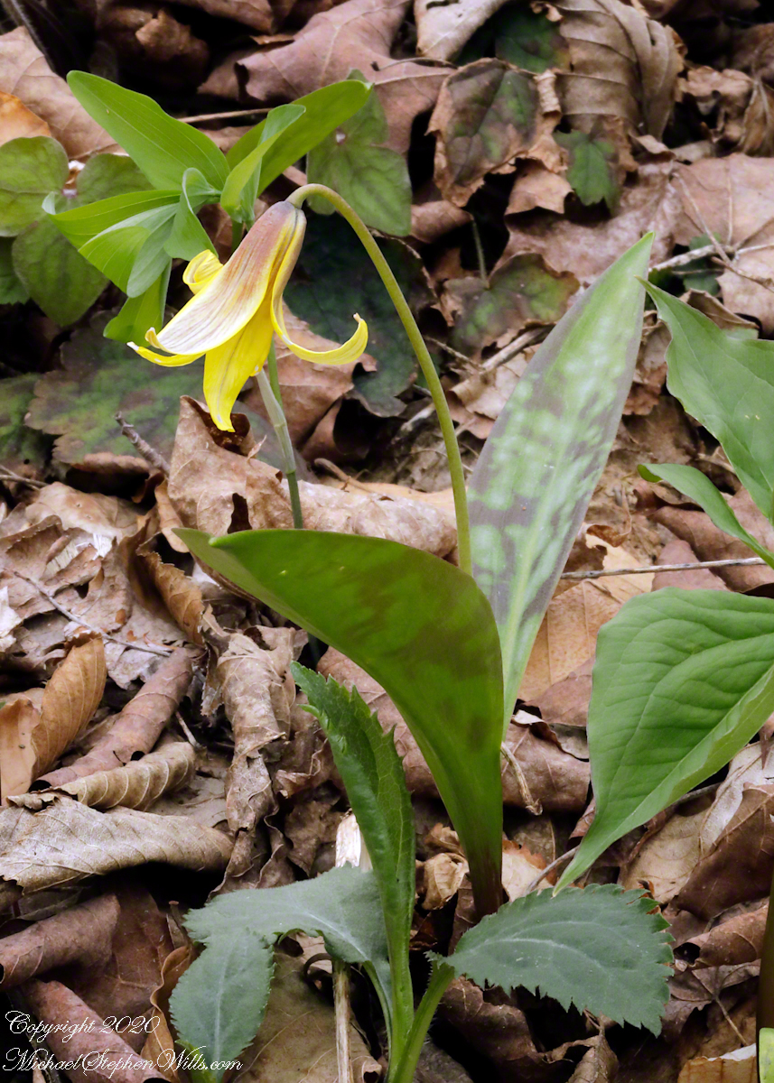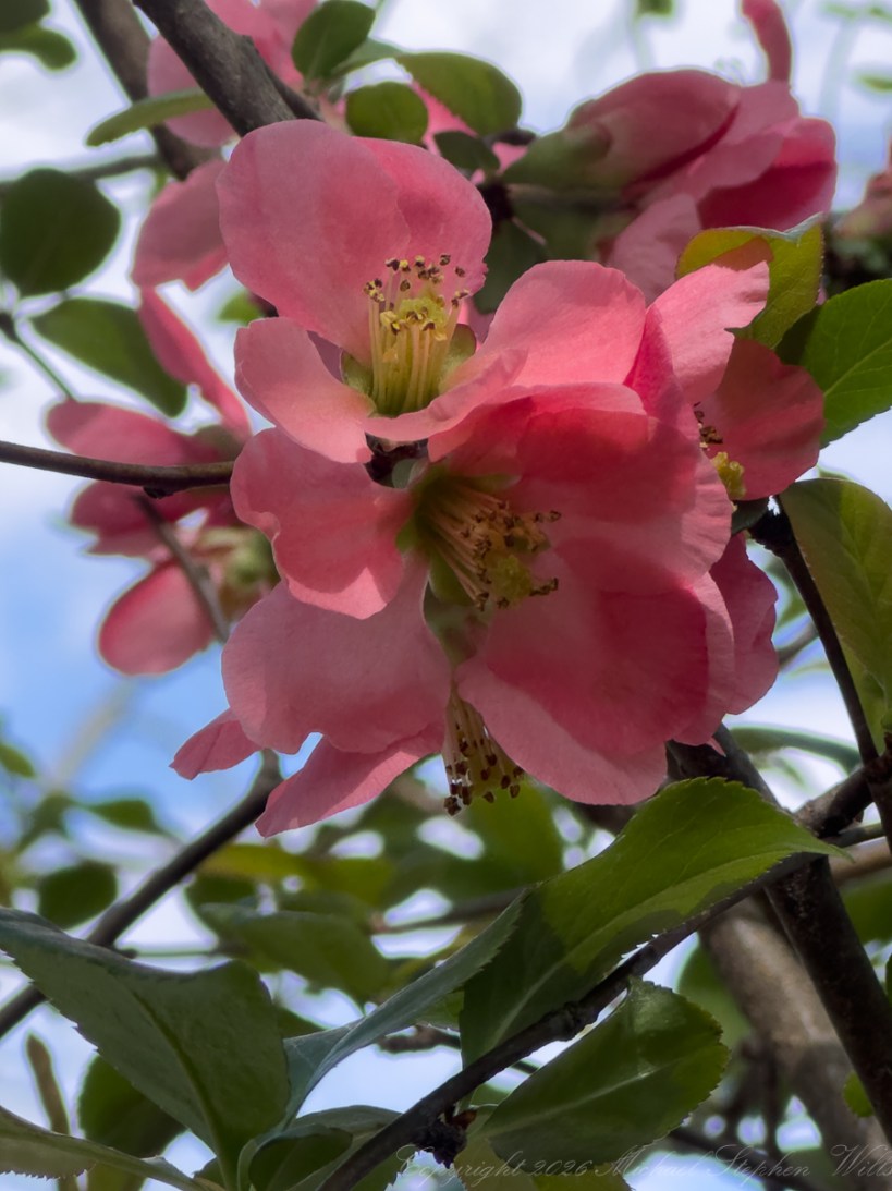
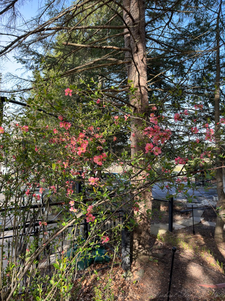
In early spring, before the trees have fully committed themselves to leaf, flowering quince makes its announcement with a theatrical confidence. Against the dark lacework of spruce, bare twigs, old fencing, and the still-waking ground of Ithaca’s West Hill, the blossoms appear like embers held in suspension: coral-pink petals gathered around bright yellow stamens. My photographs, taken in April 2023 and 2026, capture a living inheritance—one planted by Charles and Betty Sprinkle and still answering the calendar long after the original hands that set it in place have passed from the daily life of the garden.
Flowering quince belongs to the genus Chaenomeles, in the rose family, Rosaceae. It is related not only to roses, but also to apples, pears, hawthorns, cherries, and true quince. The common name can be confusing: flowering quince is not the same as the orchard quince, Cydonia oblonga, grown primarily for its large aromatic fruit. Botanists separated Chaenomeles from Cydonia in the nineteenth century, partly on floral and fruit-anatomy differences; in ordinary garden terms, Chaenomeles is the ornamental, early-blooming shrub, while Cydonia is the more familiar fruiting quince tree.
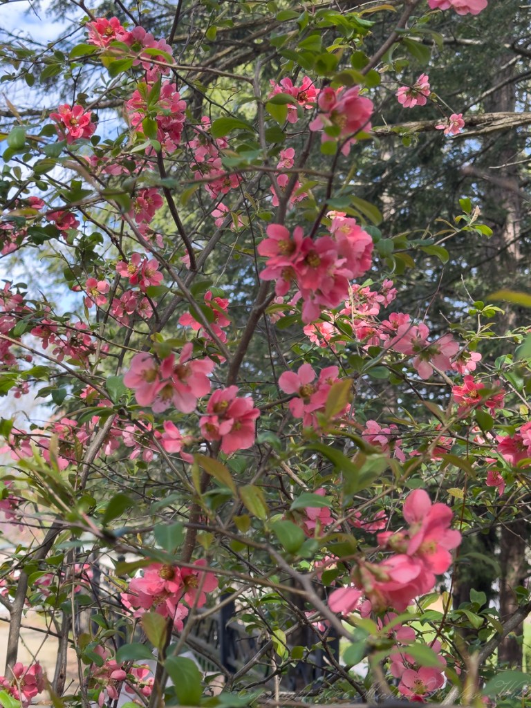
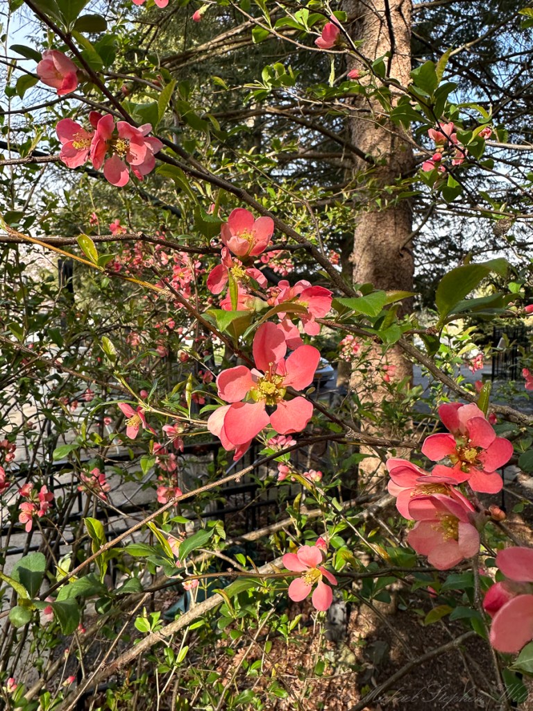
The plant in these photographs is the old-fashioned flowering quinces commonly planted around mid-century homes—possibly Chaenomeles speciosa, one of its cultivars, or a hybrid involving C. speciosa and C. japonica. C. speciosa is native to China, Tibet, and Myanmar, while C. japonica is native to Japan and South Korea; many garden forms have been selected or hybridized for flower color, compactness, and bloom density. The soft rose-pink color here suggests one of the pink-flowered ornamental selections rather than the scarlet-orange forms often illustrated in plant guides.
Its structure is as important as its bloom. Flowering quince is typically a dense, twiggy, deciduous shrub, often with tangled or spiny branches. That architecture is visible in the photographs: a weave of dark stems, new leaves, and blossoms occupying the middle layer of the garden, neither groundcover nor tree, but a persistent shrub-wall of spring. In older plantings, such shrubs can become almost sculptural, their branches accumulating years of pruning, browsing, weather, and recovery. The thorns, absent in our planting, are part of some quince varietys defensive character and can explain its frequent use as a barrier hedge or boundary planting.
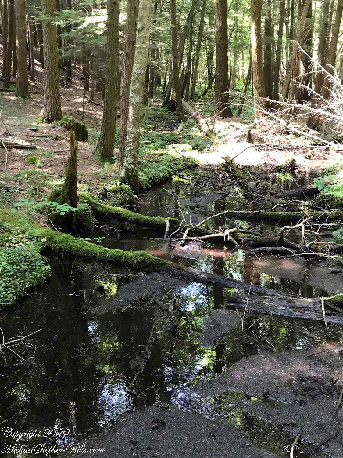
Ecologically, flowering quince is most valuable because of its timing. It blooms very early—often late March into April in temperate gardens—when many woody plants are still dormant and early insects are beginning to forage. Its open, bowl-shaped flowers present pollen accessibly, and the golden stamens in these images show why bees and other early pollinators may visit. In a cold-spring landscape like Ithaca, a shrub that blooms before the canopy closes and before herbaceous growth thickens can become a small seasonal resource station. The plant is not native to New York, so it does not occupy the same ecological role as serviceberry, spicebush, willow, or native cherries; nevertheless, in a settled garden, it participates in the spring economy of nectar, pollen, shelter, and fruit.
After bloom, flowering quince may produce hard, yellow-green, apple-like fruits. These can be too hard and tart to enjoy raw, but they have traditionally been used in preserves, jellies, and cooked preparations, much like true quince. We have yet to enjoy the fruits of this plant in this way.
The success of our quince in Ithaca is not surprising. Flowering quince is notably tough: tolerant of cold winters, urban edges, clay or loam soils, and partial shade, though it blooms best with good sun. The shrubs prefer reasonably well-drained, slightly acidic to neutral soils and may object to strongly alkaline conditions. On West Hill, where our home holds layered plantings of conifers, shrubs, fences, paths, and family memory, it fits the vernacular garden perfectly—durable, somewhat unruly, generous in season, and never entirely domesticated.

What my photographs gather in their emotional force is the contrast between delicacy and persistence. Each blossom looks temporary, almost papery, the petals thin enough to hold sunlight. Yet the shrub itself is a survivor. It has endured winters, dry spells, shade competition, pruning, neglect, and the ordinary upheavals of family life. Charles and Betty Sprinkle planted it for beauty and simple spring pleasure. Decades later, it continues to bloom on their behalf.
In that sense, flowering quince is a fitting legacy plant. It does not ask for ceremony. It returns by season rather than by command. One April afternoon it is just bare stems and swelling buds; another, it becomes a spray of coral lights beneath the evergreens. Its flowers open into the cool air of Ithaca, briefly bright, then gone—yet the shrub remains, holding memory in wood, root, and bloom.