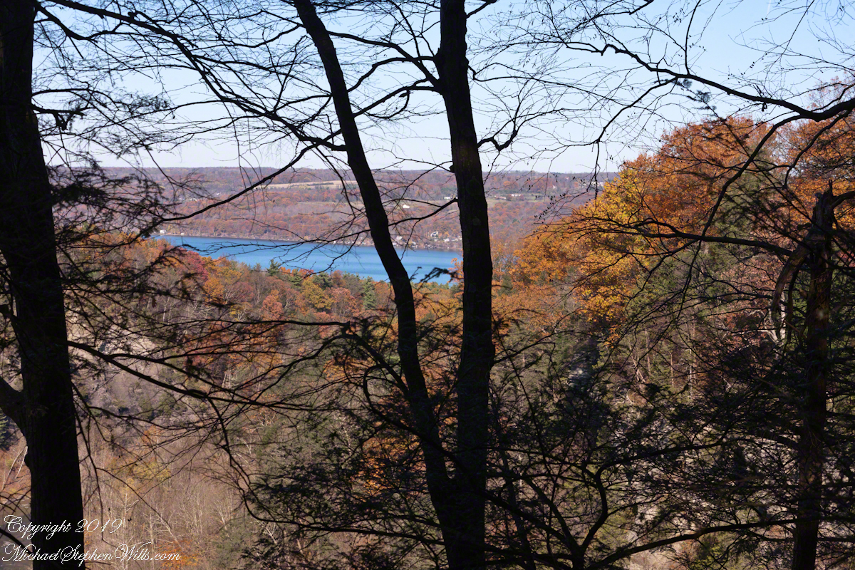
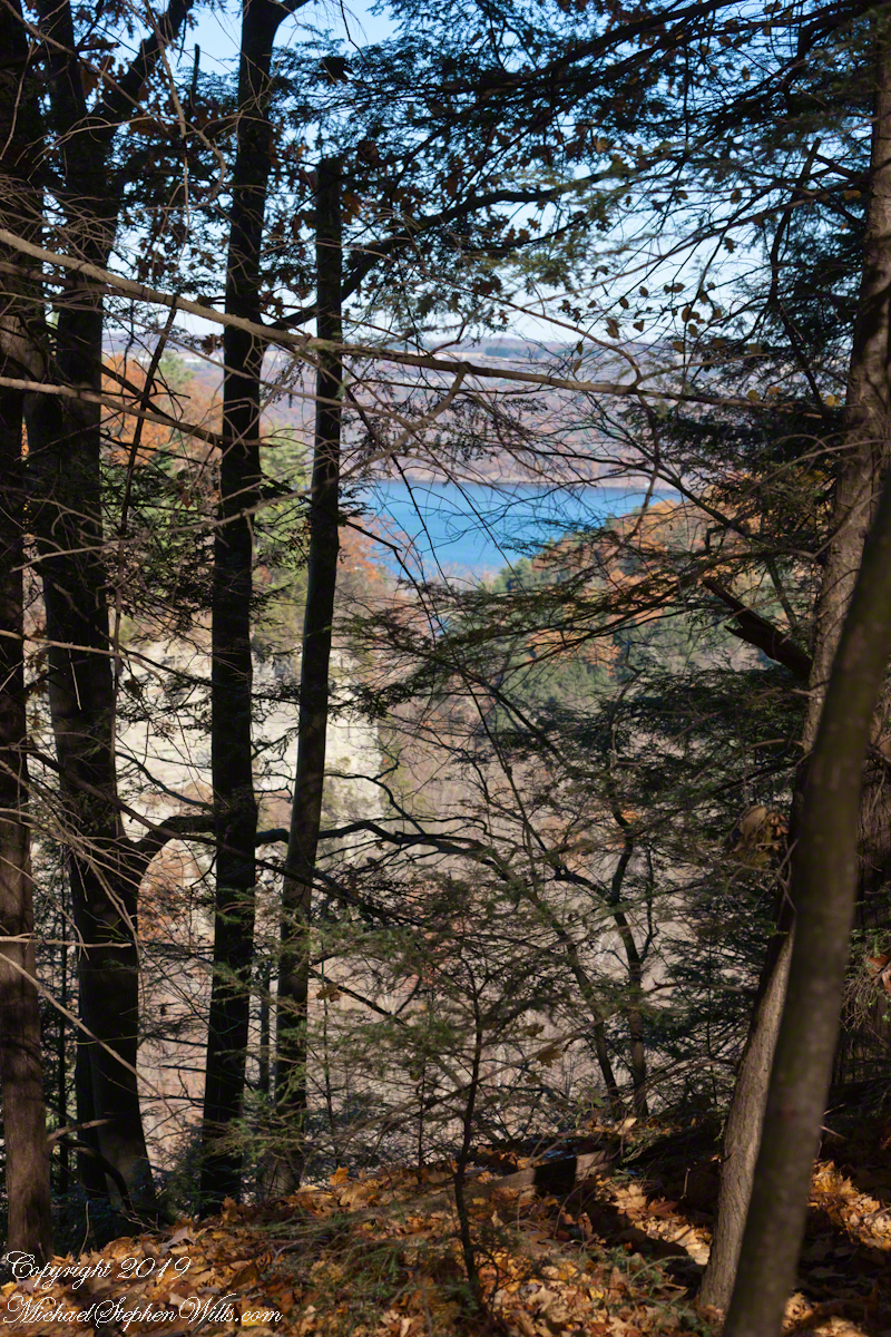
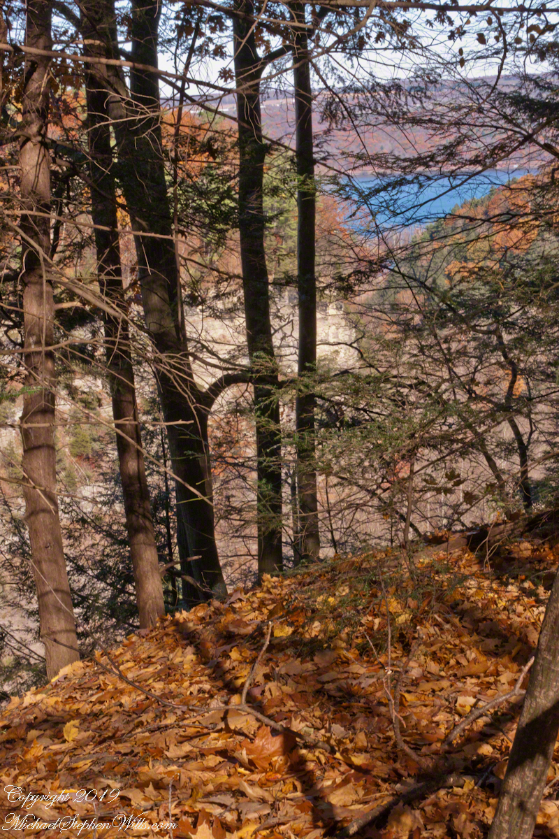
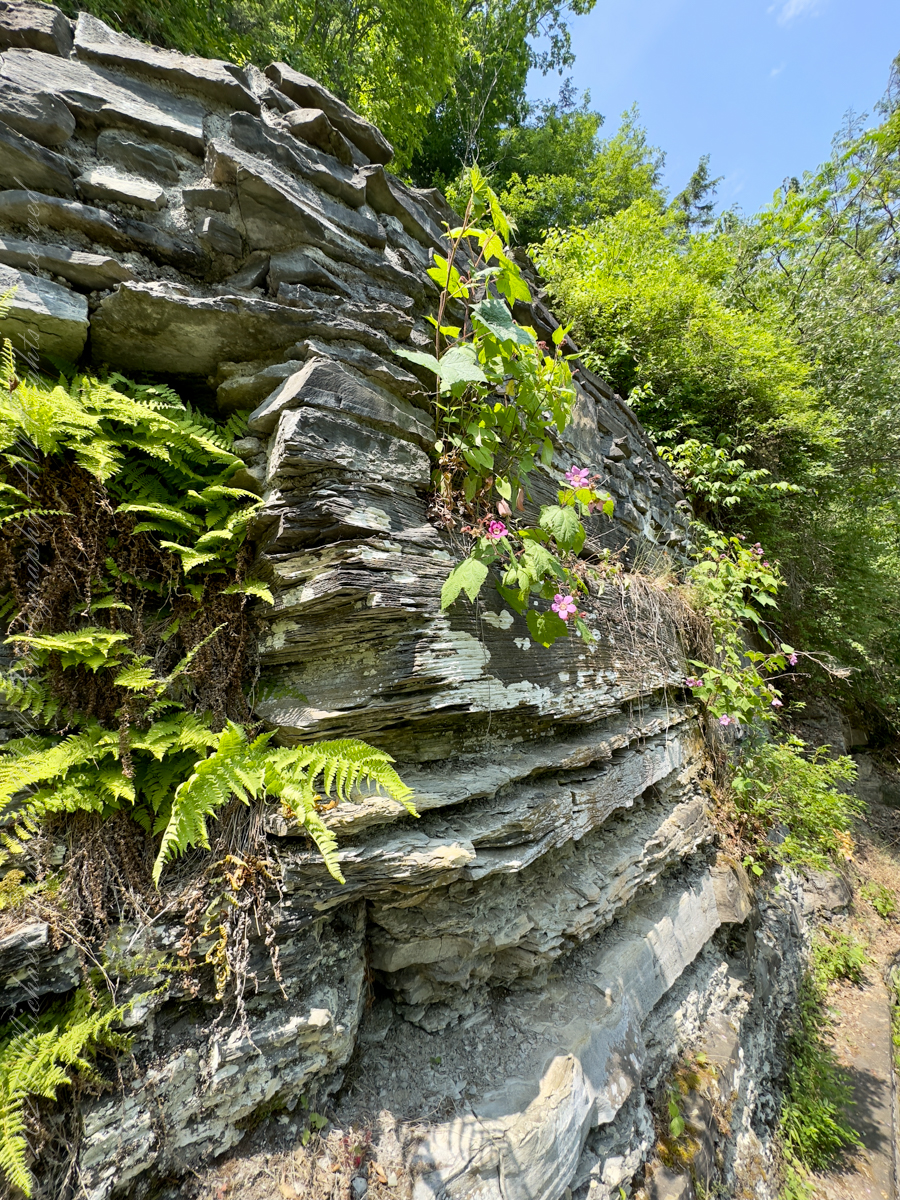
I first encountered the purple-flowered raspberry while walking the Gorge Trail at Fillmore Glen State Park. Dry Creek murmured below, working patiently within ancient shale walls that confine its course. Waterfalls spilled from ledges overhead, cool mist drifted through the narrow passage, and sunlight filtered down in shifting patches through the summer canopy. It was a landscape dramatic enough to command all of one’s attention.
Yet it was a flower growing quietly beside the trail that stopped me in my tracks.
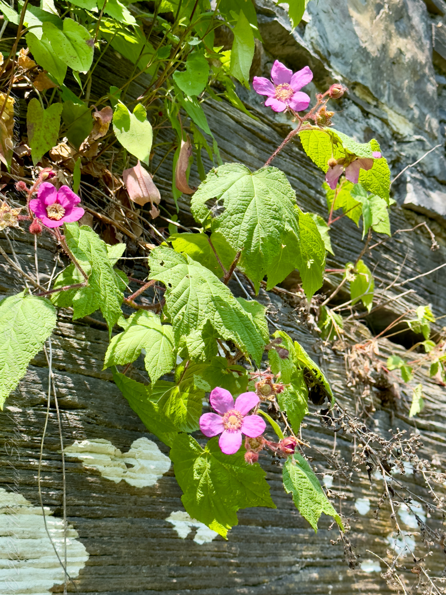
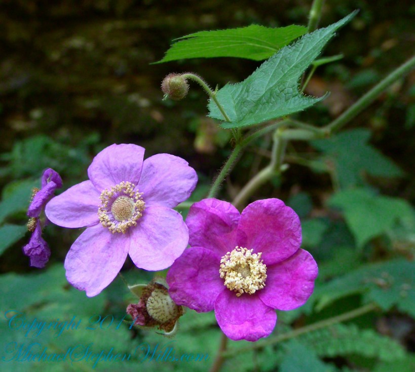
At first glance, I thought I had stumbled upon an escaped garden plant. The blossoms were impossible to ignore—large, open, and an exuberant shade of rose-purple that glowed against the surrounding green. They seemed too extravagant for the subdued palette of a northeastern woodland. The petals had the simple elegance of wild roses, but there was something else about the plant that resisted easy identification.
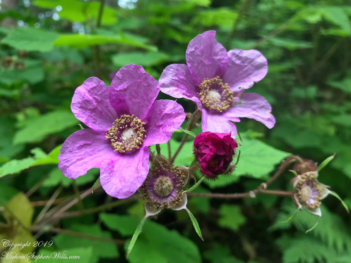
The purple-flowered raspberry, Rubus odoratus, is a plant of delightful contradictions. Its blossoms are among the largest in the raspberry family, often two inches across. They appear over an extended season, beginning in early summer and continuing well toward autumn. Unlike the brief fireworks of many woodland wildflowers, this plant stages an encore performance, offering fresh blooms long after others have taken their final bow.
Over the years, I returned often to Fillmore Glen. Dry Creek became an old acquaintance, its voice changing with the seasons—boisterous after spring rains, subdued during the heat of late summer. And almost every year, somewhere along the Gorge Trail, I would encounter those same remarkable shrubs. Familiarity deepened into appreciation, and appreciation eventually became affection.
The flowers also serve a practical purpose beyond their beauty. Native bees and other pollinating insects visit them regularly, gathering nectar and pollen throughout the season. The plant has become part of an intricate ecological conversation that has been unfolding for thousands of years.
Then there are the leaves. The first time I noticed them closely, they triggered another moment of confusion. Broad and softly textured, divided into five lobes, they looked uncannily like oversized maple leaves. Some can grow nearly ten inches across, creating islands of lush greenery along shaded streambanks and woodland edges.
It is as though nature, in one of her playful moods, decided to combine the leaf of a maple, the flower of a rose, and the fruit of a raspberry.
Most raspberries and blackberries demand respect from a distance. Their prickles and thorns snag clothing and skin with equal enthusiasm. Purple-flowered raspberry breaks that expectation as well. Its stems are fuzzy rather than fierce. There are no hooked defenses waiting to punish curiosity. The plant invites close examination.
By late summer, the blossoms yield to flattened red fruits. Technically, they are raspberries, though they lack the sugary richness of their cultivated cousins. I have sampled them occasionally, appreciating them more for the experience than the flavor. Birds, however, are less discriminating. The fruits provide nourishment for wildlife, becoming another thread in the web of life that surrounds Dry Creek and countless other woodland habitats.
Native to eastern North America, purple-flowered raspberry ranges from Nova Scotia westward into Ontario and Wisconsin, extending south through the Appalachian Mountains. It thrives along forest margins, rocky slopes, stream corridors, and disturbed areas where sunlight penetrates the canopy. Through underground shoots, it gradually forms colonies that stabilize soil and provide shelter for small creatures.
It belongs exactly where I first found it. There is a temptation, especially among gardeners, to seek novelty elsewhere—to import the exotic, the unusual, the unfamiliar. Yet some of the most extraordinary plants are those that have quietly shared our landscapes all along.
The purple-flowered raspberry reminds me of this truth each time I encounter it. It teaches the value of paying attention. A hurried walk through Fillmore Glen might focus exclusively on the waterfalls, the sculpted rock formations, or the cool refuge of the gorge itself. All are worthy of admiration. But along the margins of the trail stand these shrubs, offering their own quieter marvels.
A rose-colored flower where one expects white. Maple leaves on a raspberry cane. Soft stems where thorns should be. Fruit that feeds the forest. A native plant that asks for nothing more than the chance to flourish where it has always belonged. Years after that first encounter beside Dry Creek, the sight of those blossoms still stops me as I find them in all the Finger Lakes gorges.
Certain plants become landmarks in our personal geography. They root themselves not only in the soil but in memory. The purple-flowered raspberry has become one of those companions for me—a recurring presence marking the passage of summers, a familiar face in a beloved landscape.
Dry Creek continues its patient work of carving stone. The waterfalls continue to descend in silver ribbons through the gorge. And each year, as if renewing an old friendship, the purple-flowered raspberries lift their improbable blossoms toward the filtered light. In their presence, wonder becomes less an emotion than a habit of attention.
Sometimes the greatest discoveries are not rare because they are hidden. They are rare because we have not yet learned to see them. The purple-flowered raspberry taught me to look more closely. Along a trail I thought I knew by heart, it revealed that nature still keeps delightful surprises in reserve.