In November 2003, at fifty and traveling Arizona with my son Sean, I returned to the University of Arizona for my first Homecoming since graduating in 1975. I’d made the freshman cheerleading squad my first year in Tucson, and when the alumni invitation arrived, I couldn’t resist.
At the cheer alumni reception on November 7, the room felt instantly familiar—handshakes, stories, and a current squad packed with scholars as well as athletes. I mentioned to advisor Phoebe Chalk that I hoped to photograph the parade. “The squad already had photographers”, she said, so I planned to work from the sidelines.
I came prepared the next day with a Sony Cybershot F828. It was “Sony’s flagship prosumer digital camera” at the time. It worked well that day, the variable lens was especially helpful.
At the staging site, I solved access with a simple ask. I approached UA President Peter Likins, explained I wanted to photograph the cheerleaders, and he nodded, made a quick call, and waved me on. The team recognized me from the evening before, and I fell in step with them at the head of the procession
As we passed the Flandrau Science Center and crossed Cherry Avenue, a stunt group set quickly: bases J. Justin VandenBerg, Ricardo Abud (captain), and Robert Scoby with flyer Taylor Hendrickson. They launched her high for a full flip and clean catch. I caught the moment of collective focus—an image I call Mind.
We progressed until the stunt group reset. This time I framed the instant of takeoff—limbs aligned like clockwork—I call this image Aerialists.
The next flyer to launch was Kristen Ortega, here standing on the shoulders of her partner.
In front of the review stand, flyer Kristen Ortega rose into a poised extension and flight returned safely to the same three pairs of hands. Grace is the image title.
The rest of the parade streamed past in a blur of alumni, bands, and banners. Afterward, a squad member took a picture of me with the team—two eras in one frame. The cheers change; the spirit doesn’t.
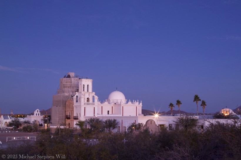
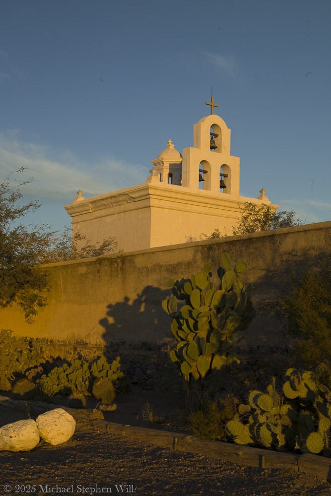
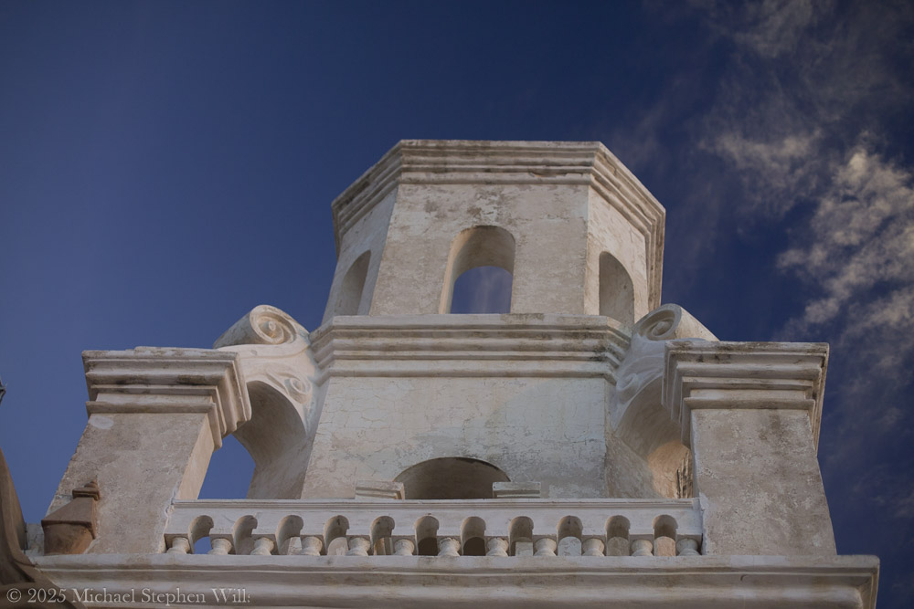
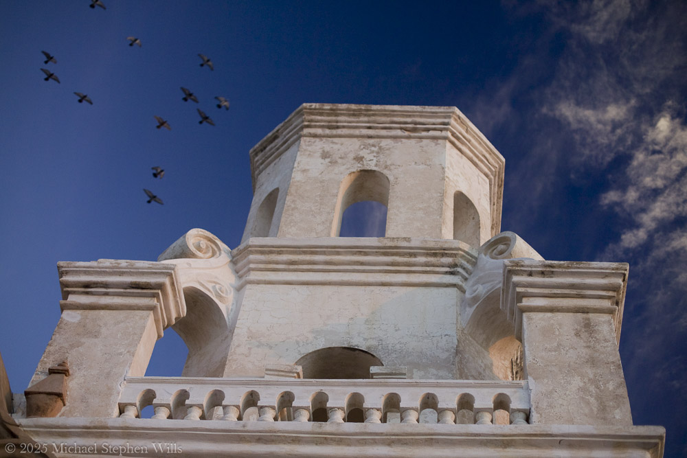
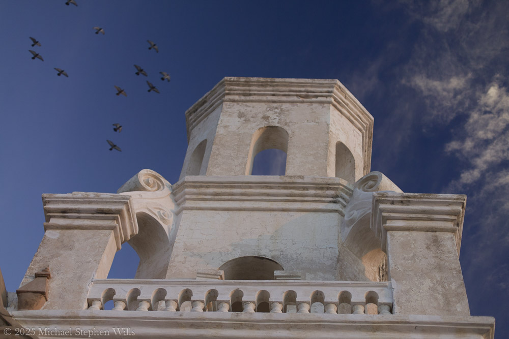
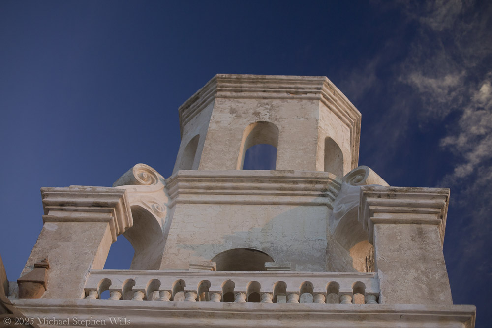
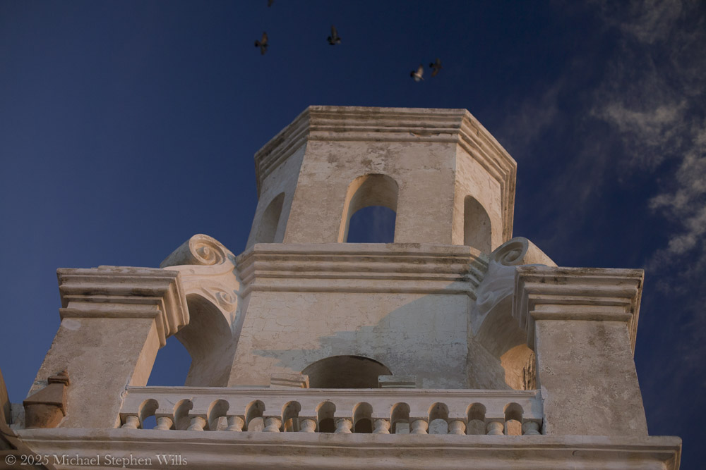
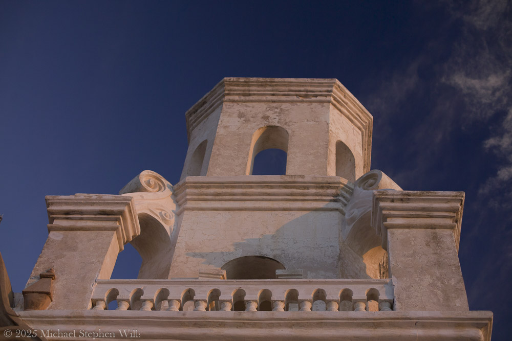
San Xavier del Bac, known as the “White Dove of the Desert,” embodies rich history and spirituality, blending Indigenous and Spanish influences, while remaining a vibrant community centerpiece today.
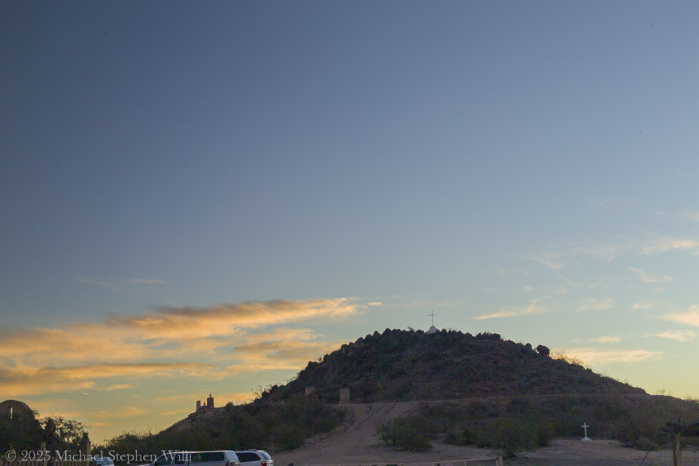
I remember how the rising sun washes the mission’s white adobe walls in soft gold. Mission San Xavier del Bac stands about 10 miles south of downtown Tucson, on the San Xavier Indian Reservation of the Tohono O’odham Nation.
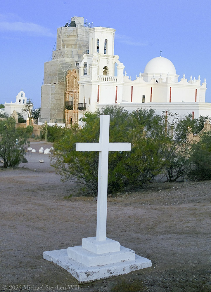
Before sunrise, I climb Grotto Hill, just east of the mission. A well-worn path and a few stone steps lead upward, passing stations of the cross and a humble grotto shrine nestled in the slope. As I ascend, the soft golden light gathers. Ocotillo stems and saguaros dot the hillside, their long shadows stretching over the desert floor. Reaching the top, I find a lone white cross planted firmly into the rocky soil. The cross is simple, yet it holds a quiet gravity – a silent witness to the prayers and hopes of those who have come here. I stand beside it to catch my breath. Below me spreads the mission complex, glowing white and rose in the gathering dawn. From this height, the scene is breathtaking: the desert expands in every direction, painted in brushstrokes of copper, violet, and gold. The distant Tucson mountains catch the first light. There is a profound peace up here. It’s easy to imagine Father Kino himself climbing a similar hill, surveying this “Water Place” and dreaming of a mission that would stand the test of time.
Often called the “White Dove of the Desert”the church gleams against the wide Sonoran sky, its twin bell towers and central dome radiant in the glow. In this moment, the 18th-century mission seems to hover between earth and heaven – a bright vision in the desert, tethered by history and faith.
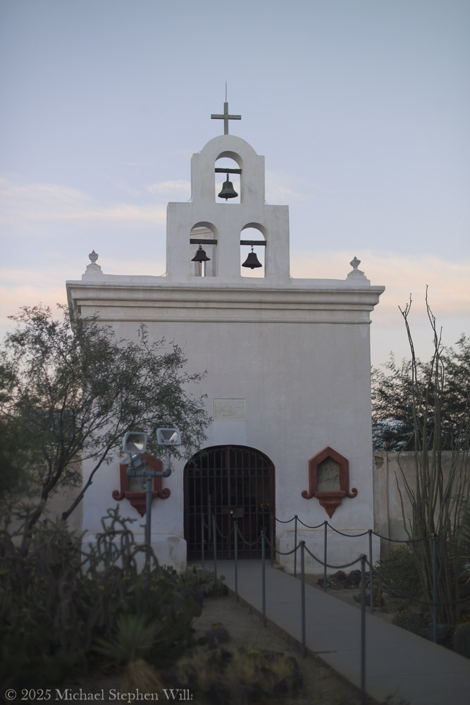
I walk toward the old mission, feeling the crunch of desert sand beneath my feet and brushing past creosote bushes and prickly pear cacti. There is a hush here, broken only by a gentle breeze and the distant coo of a dove – as if nature itself respects the sanctity of this place. In my mind I rell that this mission was first founded in 1692 by the Jesuit missionary Father Eusebio Kino, who encountered the O’odham community living at this oasis they called Wa:k, meaning “Water Place”
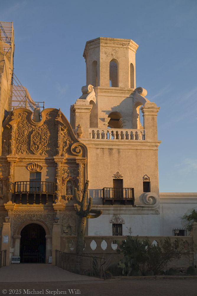
The springs have long since gone dry, but the name lives on, a reminder that this now-arid land once nurtured life-giving water. The church before me isn’t the original Kino saw, but the one begun in 1783 under Spanish Franciscan friars who raised these walls with the help of O’odham artisans. I marvel that I am standing before a structure over two centuries old – the oldest European-built structure in Arizona– yet still alive with spirit.
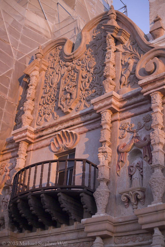
Stepping into the courtyard, I tilt my head back to absorb the facade’s details. The ornate Baroque façade is a symphony of carved plaster and painted relief, an exuberant blend of Moorish, Spanish, and Indigenous influences. Faded yet still vivid, saints and angels watch from their niches on the church front. Every arch and cornice is edged in shadow and dawn light, revealing craftsmanship considered one of the finest examples of Mexican Baroque architecture in the United States
The front entrance is flanked by intricate scrolls and whimsical carvings – floral motifs, seashell patterns, and statuary wearing serene expressions. I gently run my fingers along the weathered wooden doors, feeling the grain that generations of hands have touched. Through a crack in the door, I catch a glimpse of the dim interior: candles flicker on the altar and the air carries a hint of melted wax and sweet incense. Thesanctuary seems to exude centuries of devotion. Even outside, I sense a whisper of ancient prayers in the silence.
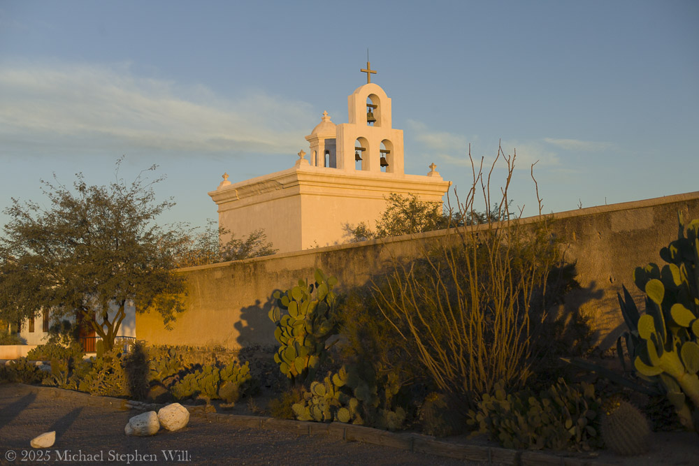
The Bell Tower in dawn light
As the day progresses, the world feels alive again. A pair of children laugh and chase each other across the dusty plaza, their voices echoing off the thick adobe walls. Nearby, the aroma of fresh frybread lingers – evidence of Tohono O’odham vendors who often set up stands by the church, selling frybread “popovers” and Indian tacos to visitors. This mingling of old and new, sacred and every day, makes the mission feel utterly genuine, the heart of a living community. I see an elderly O’odham woman in a shawl kneel at a side shrine, lips moving in quiet prayer, and I realize that for the Tohono O’odham, this mission is more than a historic landmark. It is a living spiritual home that continues to anchor their community. Indeed, the church is still an active parish that serves the local O’odham families, with regular Masses and gatherings held within its walls
The sense of continuity is palpable – the faith that built this place in the 18th century endures unwaveringly today.
Standing in front of San Xavier del Bac, I feel a personal connection that is hard to put into words. The centuries-old mission glows fresh in morning light. I close my eyes and sense the presence of all who have been here before – the O’odham villagers, the Spanish padres, the countless pilgrims and visitors. In the stillness, time blurs. Past and present mingle in the desert air. When I finally turn to leave, my heart is quiet, uplifted by the encounter. In this sacred and remote place, I have touched a living history and felt the embrace of a peace that transcends centuries. I carry that gentle peace with me into the day, grateful for the memories of light, silence, and the enduring soul of San Xavier del Bac.
Bibliography
Wikipedia. “Mission San Xavier del Bac.” (2025).
National Park Service. “San Xavier del Bac Mission.” (2021).
Patronato San Xavier. “History of the Mission – Timeline.” (2025).
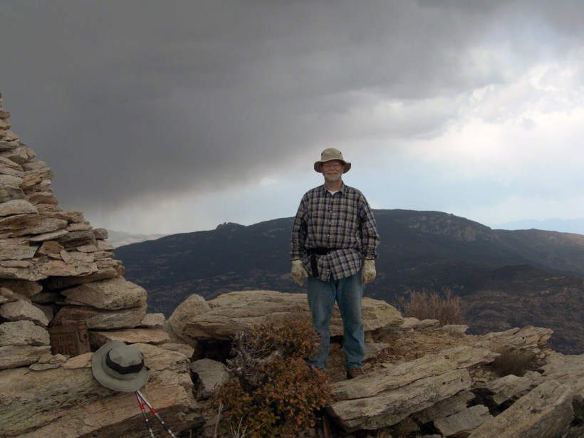
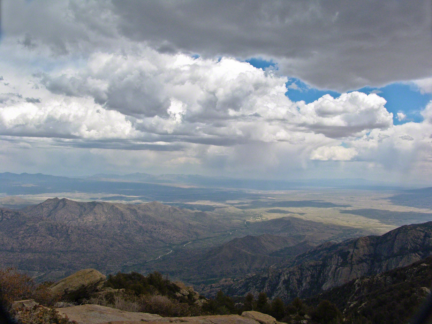
As we stood atop Rincon Peak, the sky darkened with the approach of a sudden thunderstorm. Below us, the San Pedro River valley sprawled, with the Mae West Peaks to the left and the legendary Dragoon Mountains straight ahead. This photograph captures that exhilarating moment—standing on the summit with the world at our feet and the wild Arizona sky closing in. Curious about how we got there and our race against nature’s fury? Join me on the blog to delve into the full adventure and explore more stunning images from the heart of the Rincon Wilderness.
The Rincons are one of 42 Sky Island mountains isolated from each other due to gradual warming and drying climate changes since the last ice age, 10,000 years ago. While this marvelous environment of oak and pine forests is accessible only on foot and with significant effort, it is visible from every point of the Tucson valley, home to a million inhabitants.
The name ‘Rincon,’ Spanish for ‘corner,’ reflects the mountains’ shape as they enclose a space on the west and northwest. This area, formerly used for ranching, is now being developed for tract housing. In contrast, the mountains themselves are preserved as wilderness, with parts designated within the Saguaro National Park and the Coronado National Forest.
In the past 51 years, I have been lucky enough to visit the Rincon Wilderness interior four times, shouldering different style backpacks onto the mountain and walking in different boots. My first trip was during college in the 1970s, when a party of six of us left from the end of Speedway, heading up the Douglas Springs trail. The climb was an exercise in desert survival that several friendships did not survive, replaced by new friends met on Mica Mountain. I have no photographs from that experience, only memories and the backpack.
Decades later, reconnecting with Arizona in 2004—thirty-one years after that first experience—I took no chances. This time, my attempt on Rincon Peak was a success. I reduced risk and effort, though not eliminating them, by hiring a guide for the four-day trip. We reached Rincon Peak via the Turkey Creek Trail out of Happy Valley, climbing a mountain buttress with views that widened and lengthened with every step.
Capturing these moments, I took several photographs during that experience. Two years later I added a landscape of the peak at sunset.
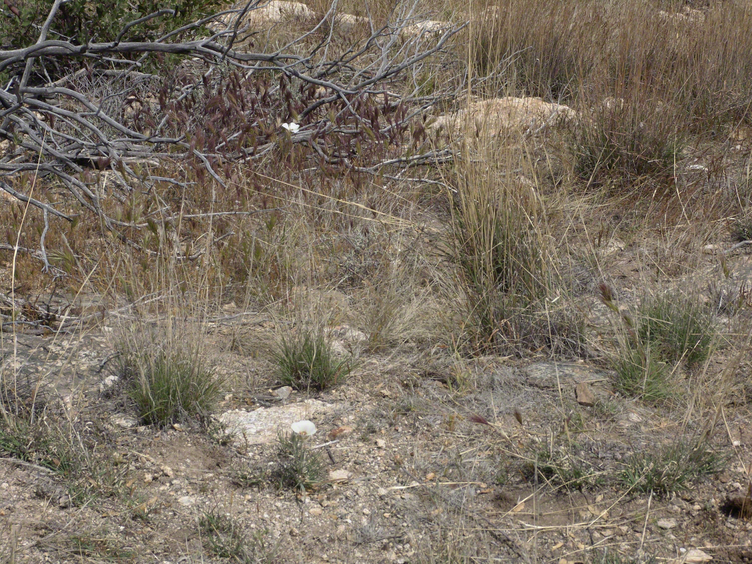
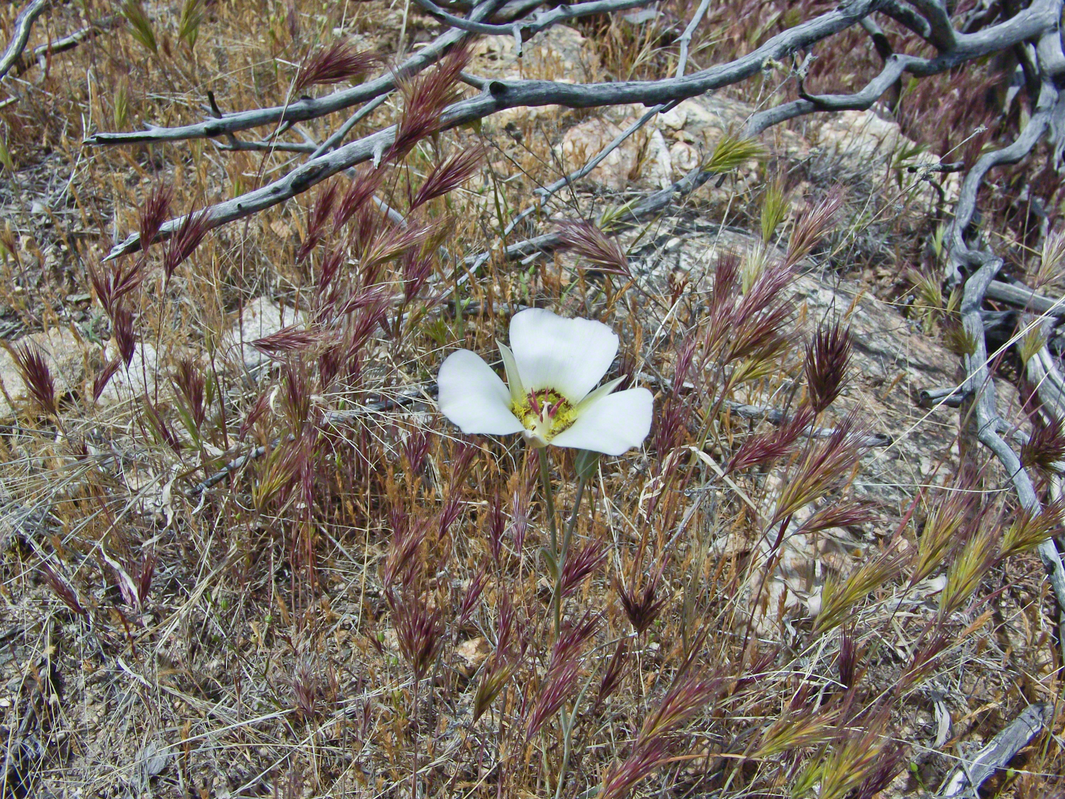
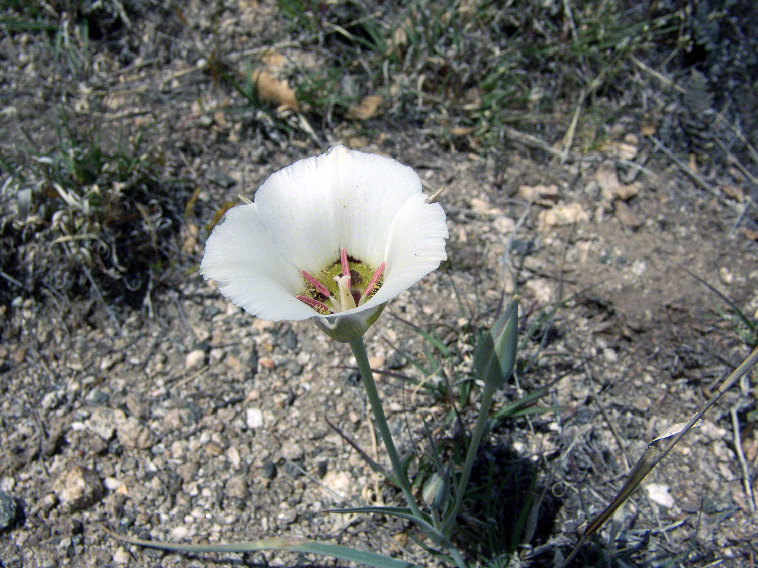
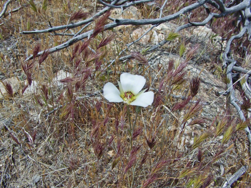
Along the Turkey Creek trail, Sego Lilies bloomed among a stricken oak and drying grasses, offering a vivid glimpse into the region’s delicate ecosystem. It is the winter rains that trigger such a bloom.
Enthralled by their beauty, we paused while I unpacked my gear to photograph the Sego Lilies growing along the trail.
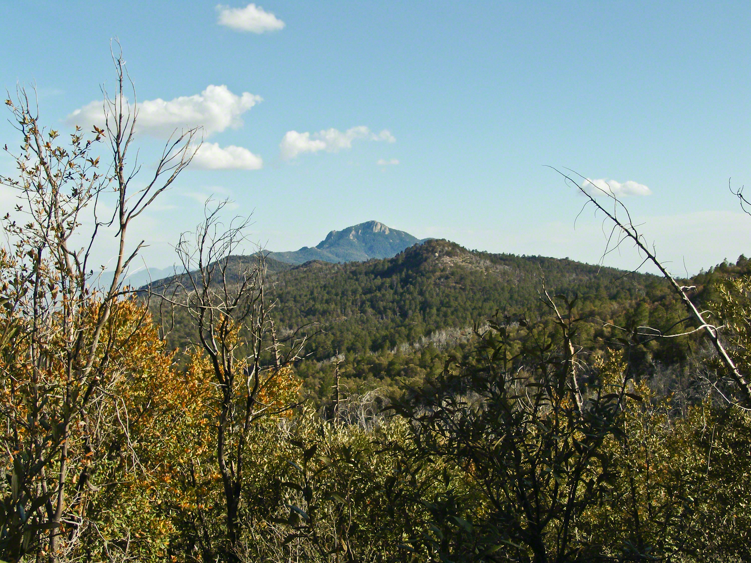
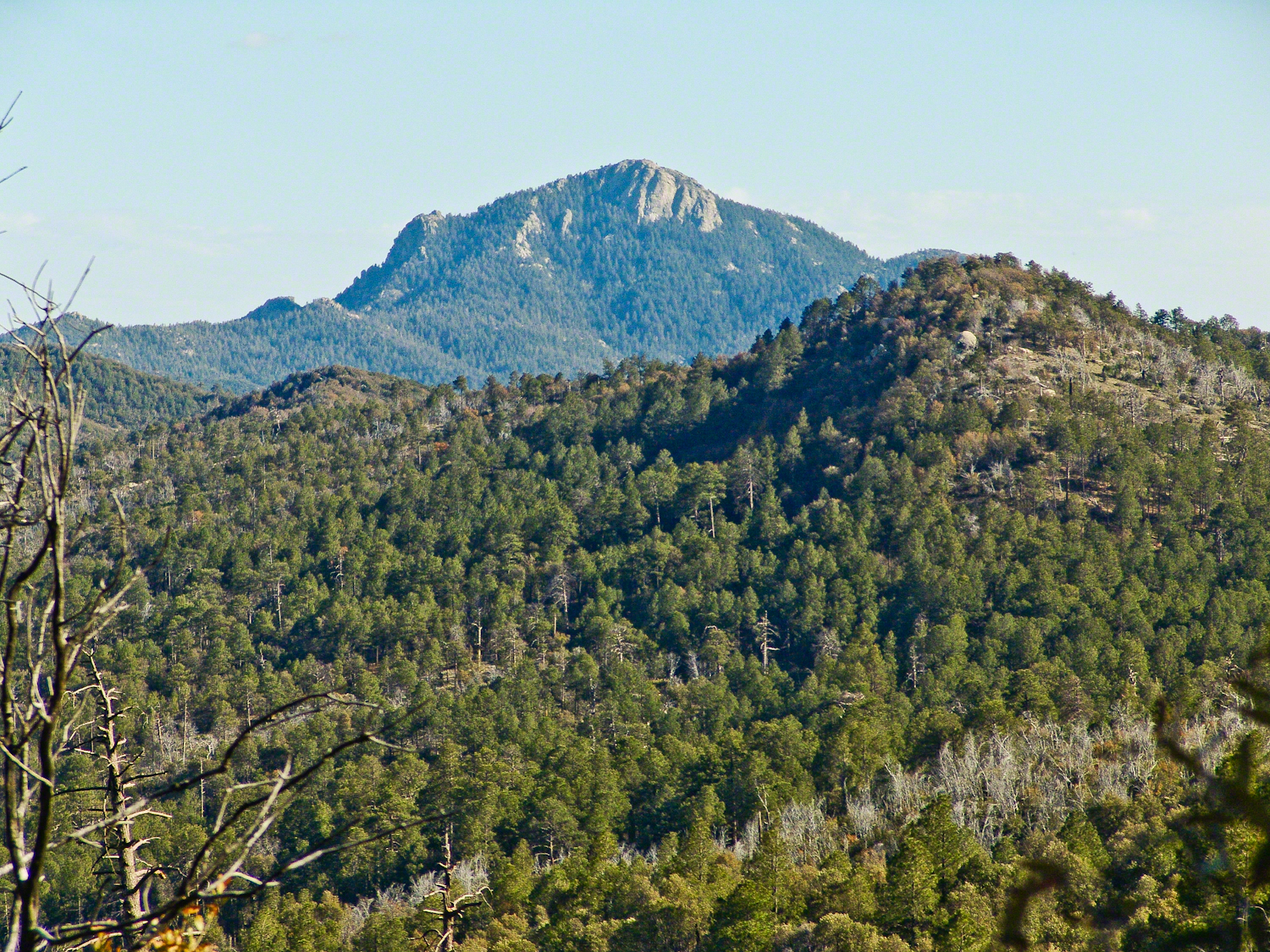
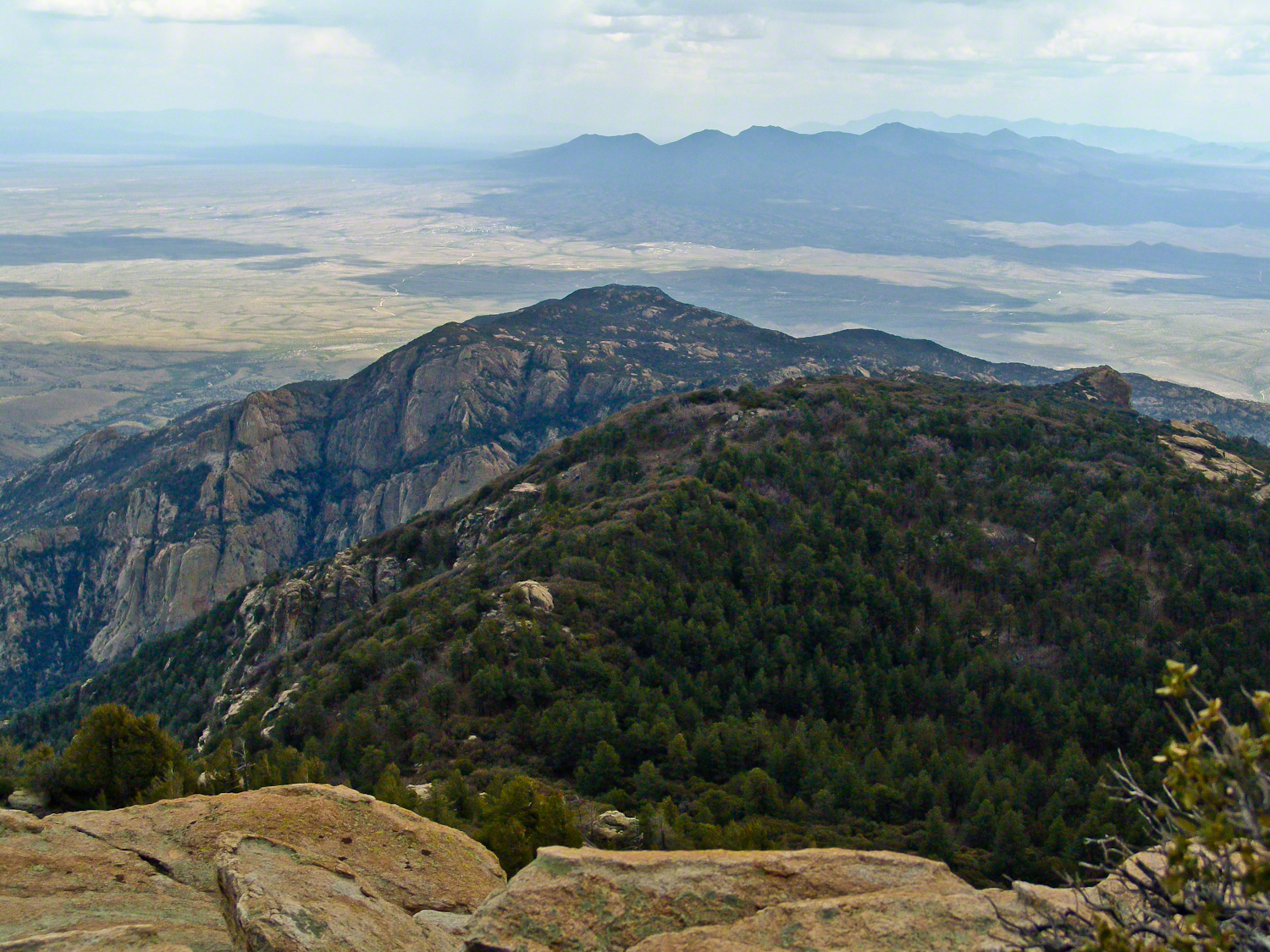
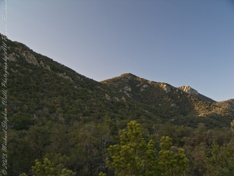
When we reached Deer Head Spring at the top of Turkey Creek Trail on April 27, 2004, it was a moist spot with no accessible water. With only about a gallon of water each remaining, we pressed ahead to Heartbreak Ridge and climbed into Happy Valley Saddle, where, thankfully, the creek—though low and full of algae—was usable. It was here that I caught my first glimpses of Rincon Peak, looking across the aptly named Heartbreak Ridge and Happy Valley Saddle.
From Rincon Peak, the view to the south was breathtaking. The white rocks at the lower right formed the Valley of the Moon wall. Below lay the San Pedro River valley, with the Mae West Peaks at the left margin and the Dragoon Mountains with Cochise Stronghold at the center. I took this photograph around 12:30 PM on April 28, 2004, just as a thunderstorm was approaching.
Rotating the camera to the south-southwest, the view stretched over the Valley of the Moon to the eastern Tucson Valley and the Sky Islands of the Whetstone Mountains (Apache Peak), with the Santa Ritas behind them. In this vast landscape, the works of man are overpowered by sky, rock, and distance.
We made a hasty departure ahead of the thunderstorm. Attempting the peak that day had been a touch-and-go decision, but we reached the summit with moments to spare.
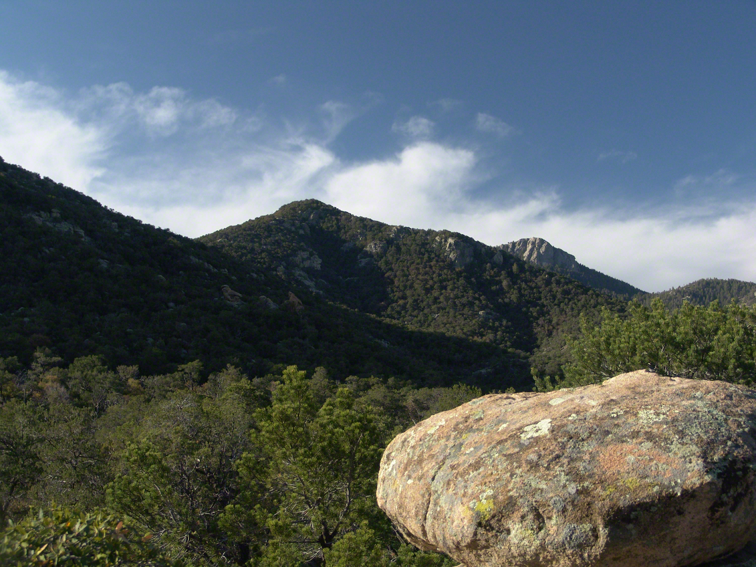
On the morning of April 29, 2004, the day after reaching Rincon Peak, I set up my tripod near our Happy Valley Saddle camp. In the serene early morning sunlight, I captured images of Rincon Peak, reflecting on the previous day’s ascent.
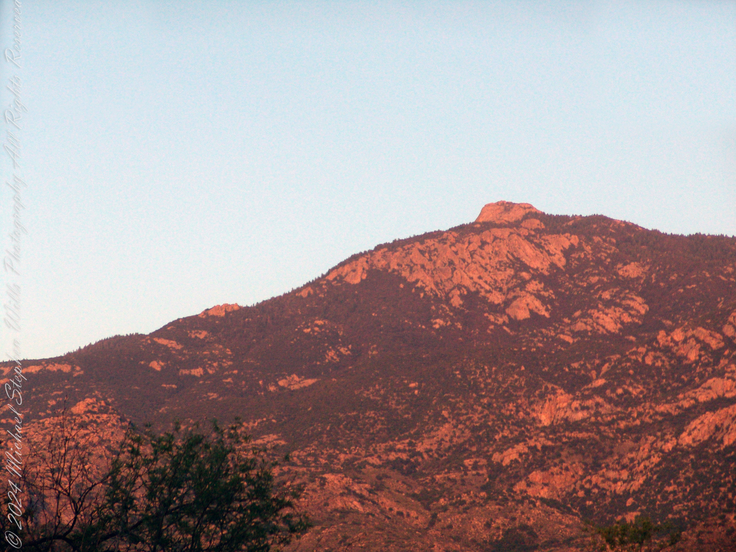
On the day we descended to the X9 Ranch via the Rincon Creek trail, we were granted a unique opportunity. My guide’s grandfather had a homestead at the X9, and his access to the trailhead through private lands opened this ro ute for us. That evening, I took a photograph of the sunset on Rincon Peak from the X9 Ranch, looking east from the ‘Rincon’—the corner formed by the massifs of Rincon Peak, Mica Mountain, and Tanque Verde Ridge.
The X9 ranch sits in the Rincon (spanish for corner) made by the massifs Rincon Peak, Mica Mountain and Tanque Verde ridge.
Two years later, on the evening of November 2, 2006, I climbed the Tanque Verde trail in Saguaro National Park East for about 30 minutes to reach a vantage point of Rincon Peak. Intending to capture the peak bathed in golden light, I waited until just before the sun set behind the Tucson Mountain. Afterwards, I raced the sun hiked back to the car. In my hurry, I tripped on a stepped turn and dove headfirst into a large prickly pear cactus. It was a very painful experience. Large spines pierced my face, while tiny, pesky spines covered my chest and back. The large spines, not being barbed, came out easily, but I needed to visit a physician to remove the rest.
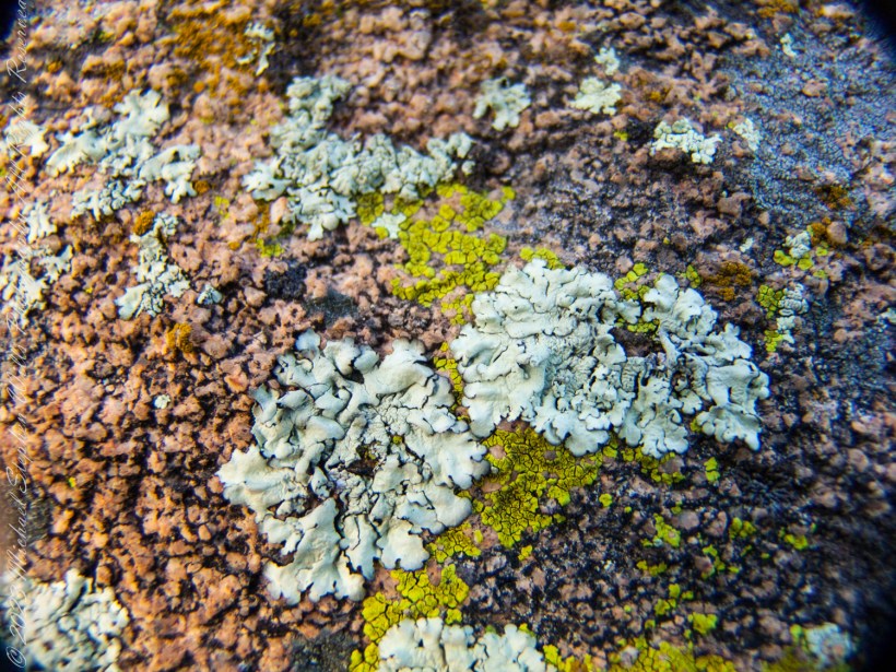
Discover a timeless world through my lens: delve into Arizona’s Rincon Wilderness, where lichens and hedgehog cacti narrate Earth’s enduring, untold story. Join me.
Step into the serene embrace of Happy Valley Saddle through our latest blog post, and wander with us as the dawn unfolds over the majestic Rincon Peak.
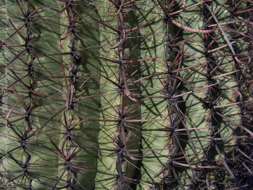
Imagine yourself in the vast desert, face-to-face with these hooked spines, a fortress hiding bittersweet water within. Hope your Valentines Day is less prickly.
Discover the Sego Lily, Calochortus nuttallii, a symbol of resilience and beauty in the arid deserts of the West. Uncover its role in pioneer survival and its captivating presence on a serene April backpack into the Rincon Wilderness. Join us in exploring the enduring grace of this desert gem.
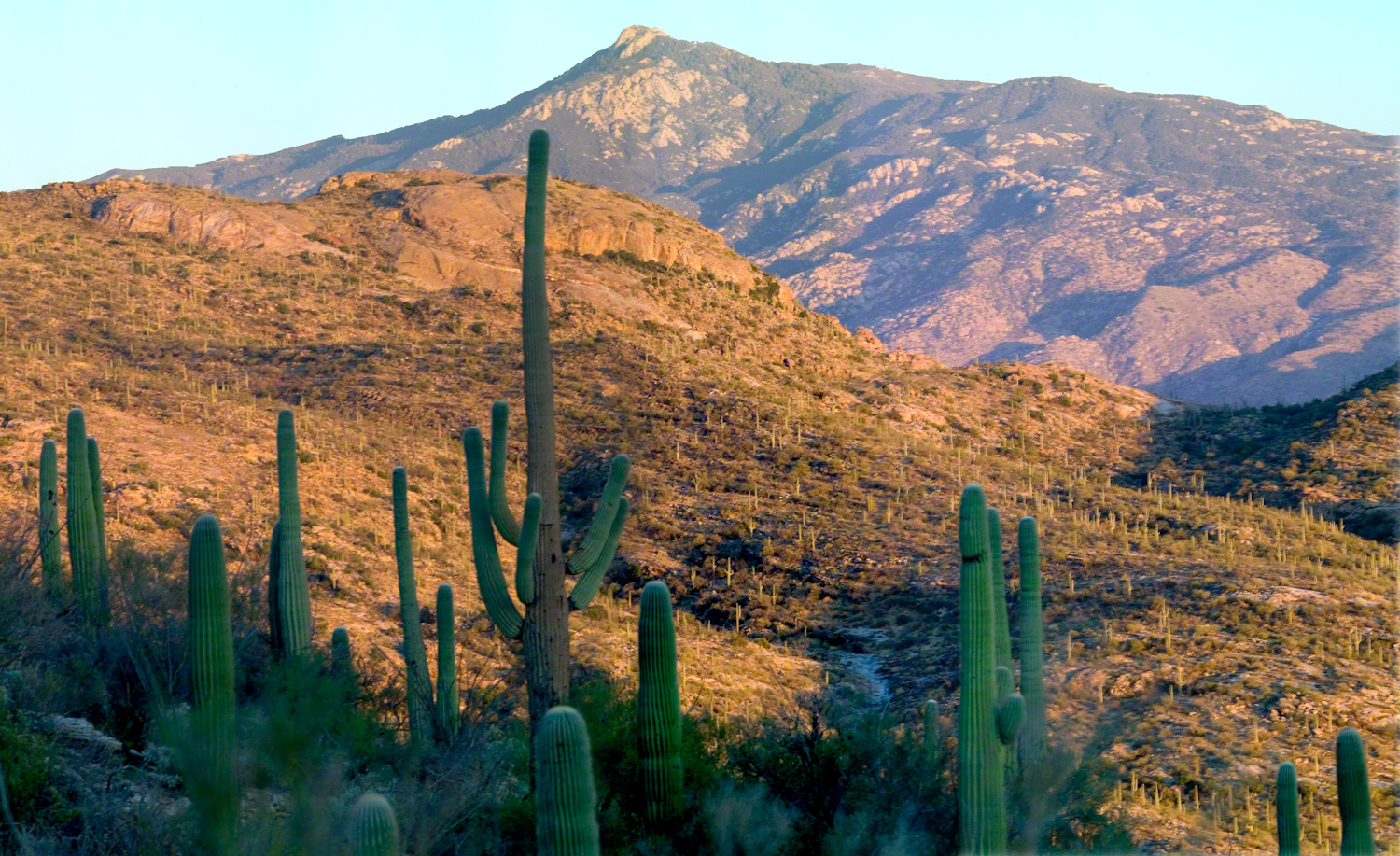
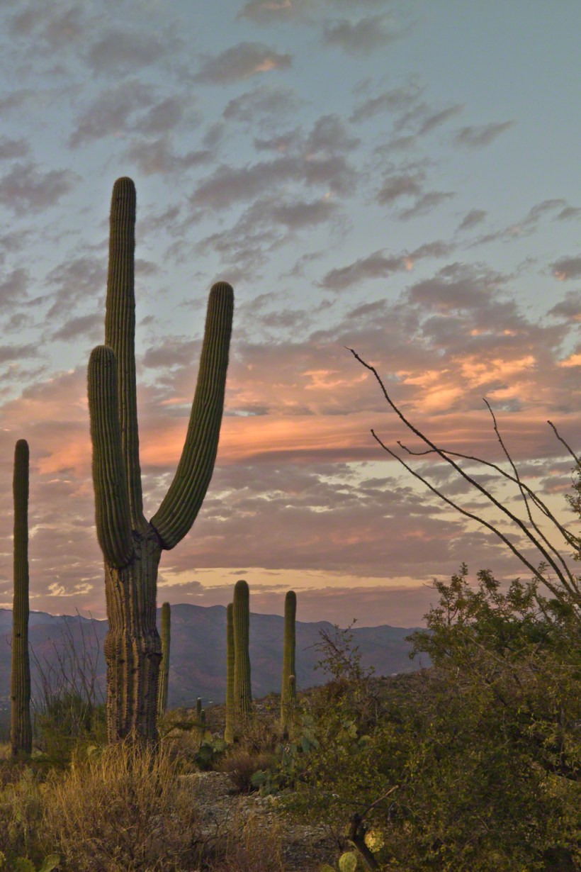
Embrace with me the unique splendor of southern Arizona’s deserts in November. Join me atop the Tanque Verde Ridge as we capture the last light accentuating the saguaros against an evolving sky.
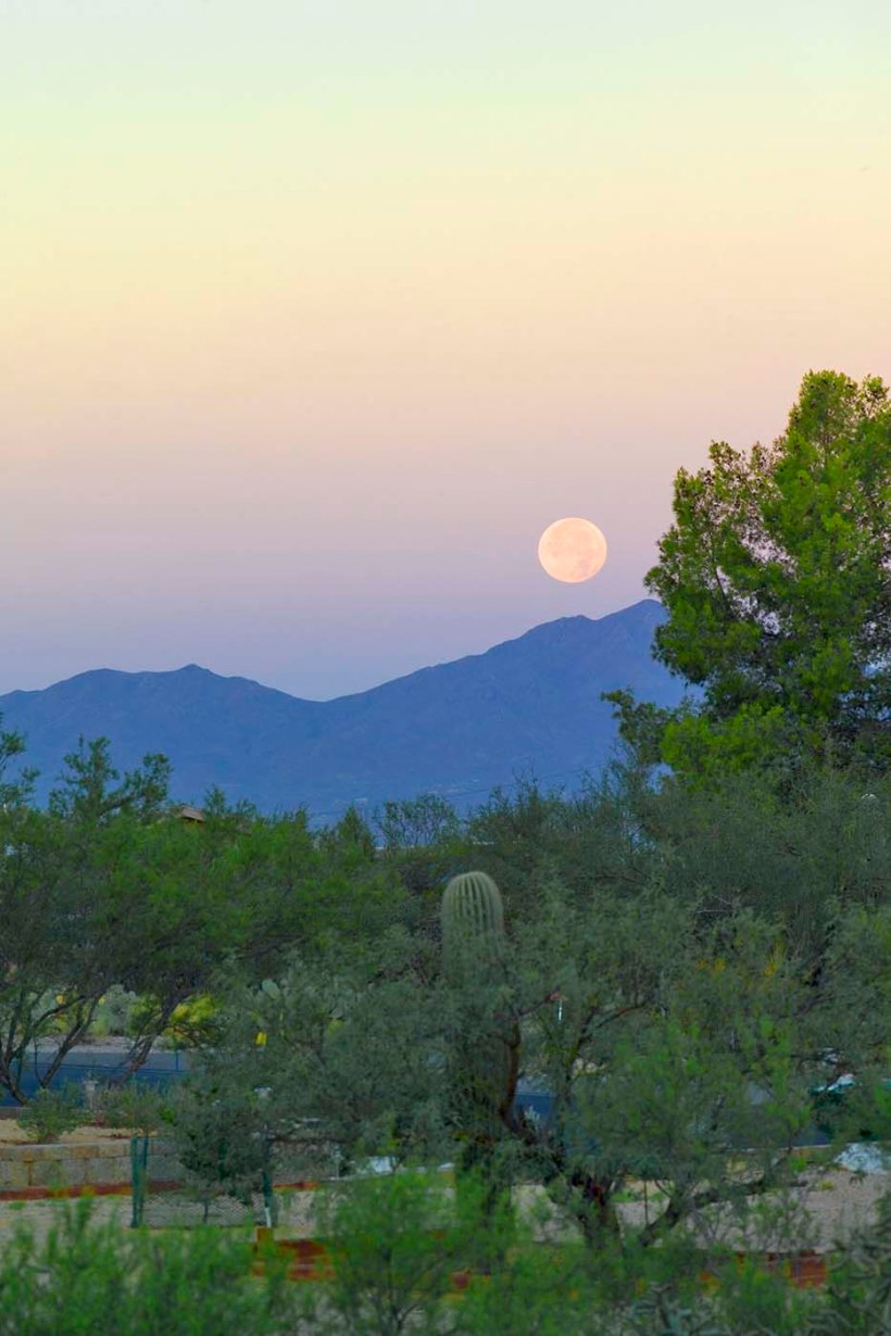
Join me in exploring the depths of “Hamlet,” where the phrase “revisits thus the glimpses of the moon” unveils a world where the supernatural meets the mysterious moonlight. Let’s unravel this imagery together, reflecting on life’s transient beauty, seeking understanding, and contemplating the cycles of change under the moon’s spell.
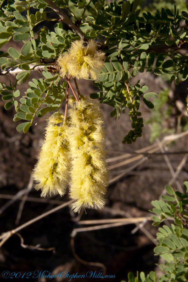
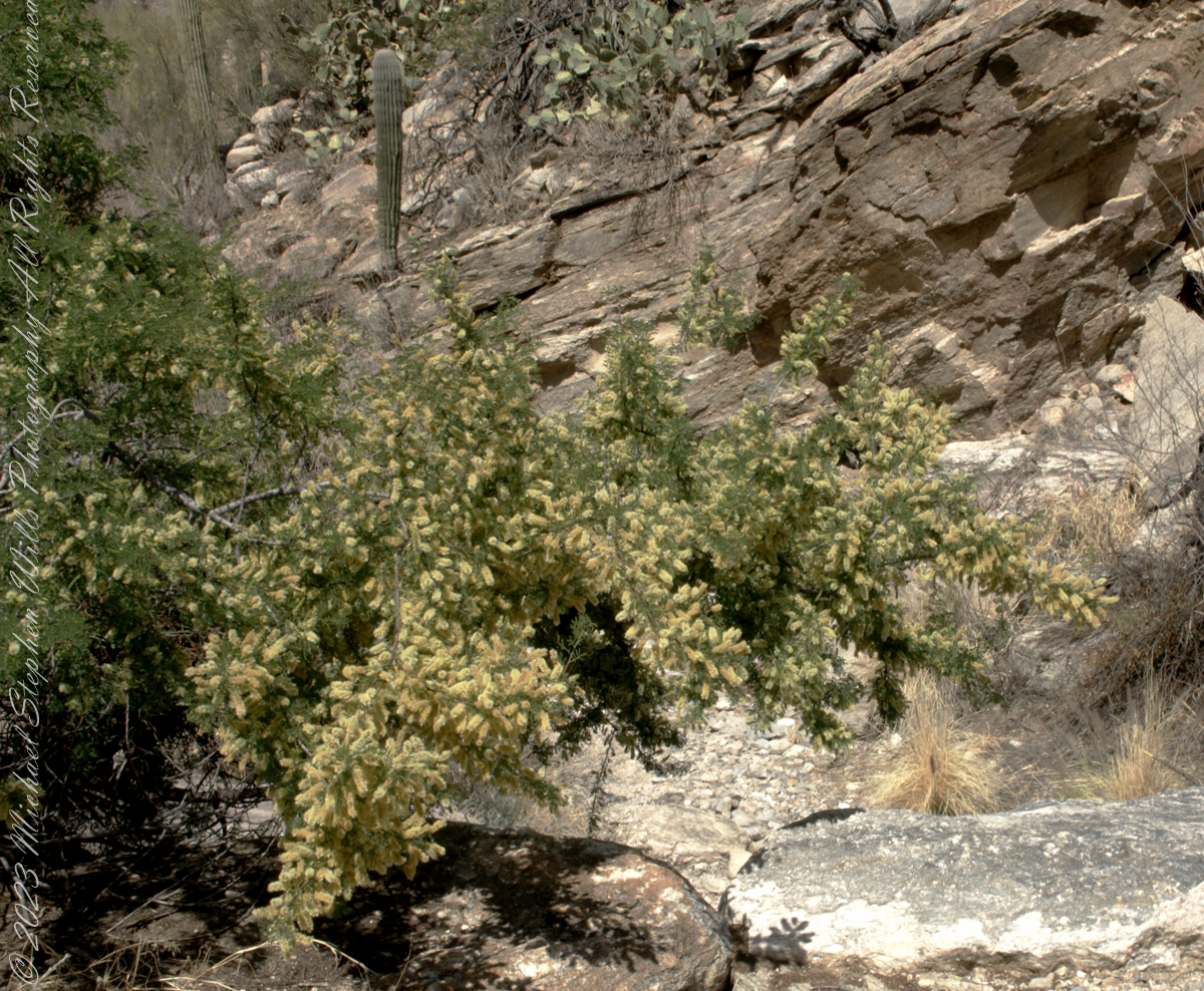
Mesquite is the Sonoran Desert smell carried by distant rain, omnipresent and humble, a survivor with tap root extending 190 feet down to draw on the water table.
Prosopis is the scientific name for about 40 species of leguminous trees. Present in North America since the Pliocene era, mesquite wood has been dated to 1300 BC.
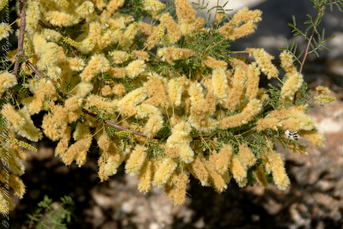
I found this flowering mesquite bush in Finger Rock Canyon of the Catalina Mountains outside Tucson, Arizona.
They are thought to have evolved with megafauna in the New World. The loss of North American megafauna at the end of the Pleistocene era gave way to one theory of how the Prosopis spp. were able to survive.
One theory is that the loss of the megafauna allowed Prosopis spp. to use their fruit pods to attract other organisms to spread their seeds; then, with the introduction of livestock, they were able to spread into grasslands.
The plentiful legumes that develop from these flowers are edible when cooked. The shape and color of the seeds can be understood from this empty seed pod that happens to lie near a tarantula burrow.