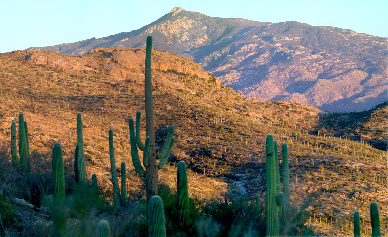
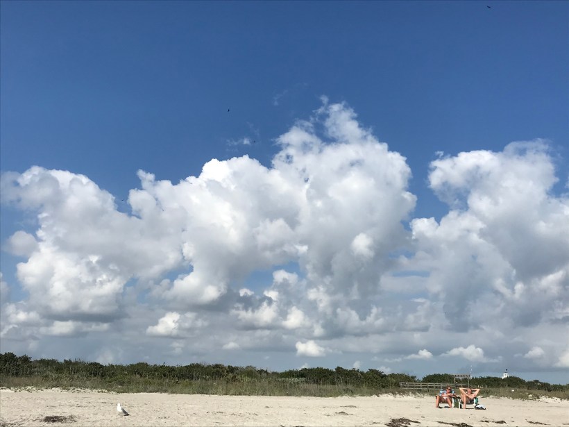
In the cool predawn, strangers from every background climb a stone stairway above Phoenix, trading city lights for desert silence as sunrise spills gold across Piestewa Peak.
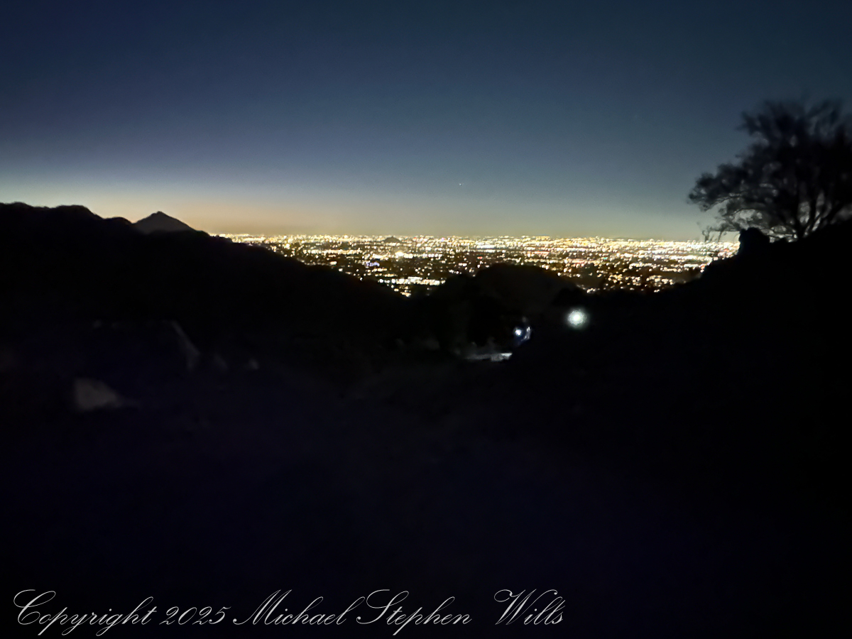
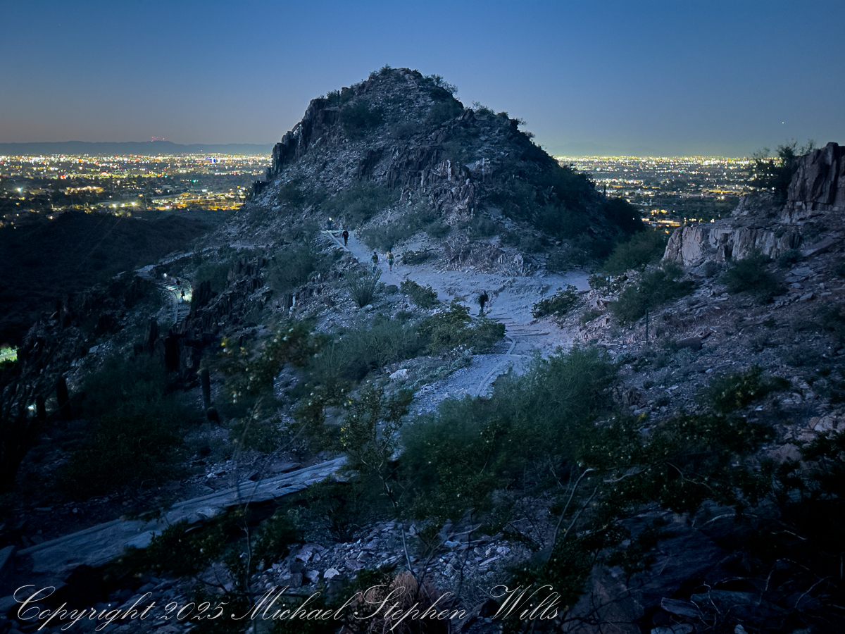
Arriving at 5 am there is a line of trucks and cars and Piestewa Peak parking almost full when I grab a spot in the predawn darkness. The desert air has that deep, merciful coolness it offers before sunrise, edged with the long-remembered scent of creosote. Car doors close with soft thuds, headlamps blink on, and a loose procession of strangers begins to funnel toward the trailhead like pilgrims, even now white and red headlamps sprinkle the upper slopes.
At first the climb exists only in a narrow cone of light, my lamp illuminates the scant gravel, uneven steps, and each scuff of boot or shoe sounds loud in the hush. Somewhere below, the city hums, but here the conversation is mostly breath and the occasional murmur of greeting as we fall into the rhythm of the climb.
My beam catches a young couple just ahead, their hands knotted together. They speak Spanish, laughing quietly as they miss a step and bump shoulders. Behind me an older man in a Veterans cap leans heavily on trekking poles, his companion—maybe daughter, maybe friend—matching her shorter stride to his with patient care. A group of women in bright leggings and braided hair moves past us in a burst of energy, their languages overlapping—English, maybe Vietnamese, something I cannot place—like the weaving of a rug. A man passes me, a drum on his back. Piestewa draws them all, before dawn, to this rib of stone in the center of the Phoenix basin.
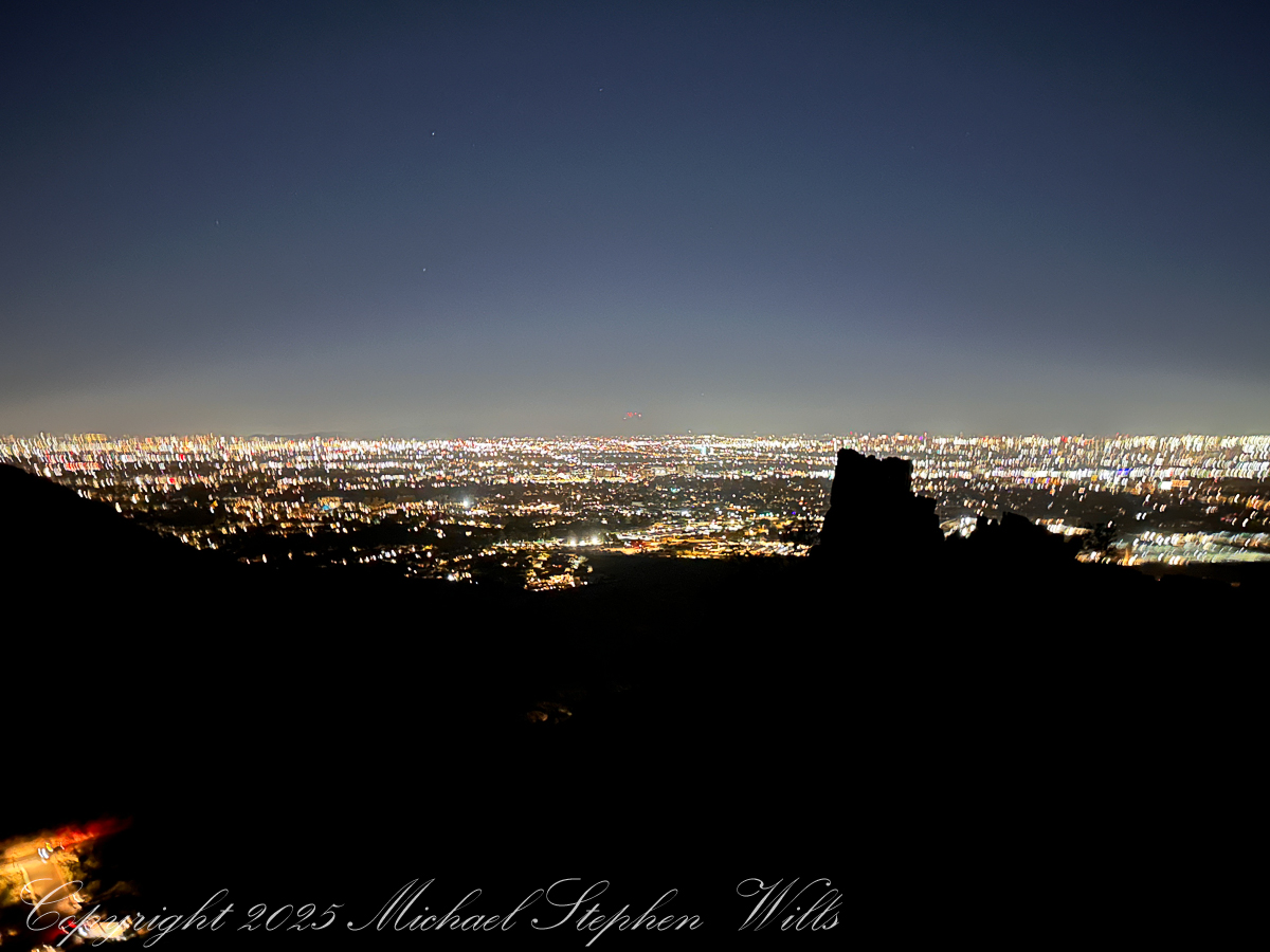
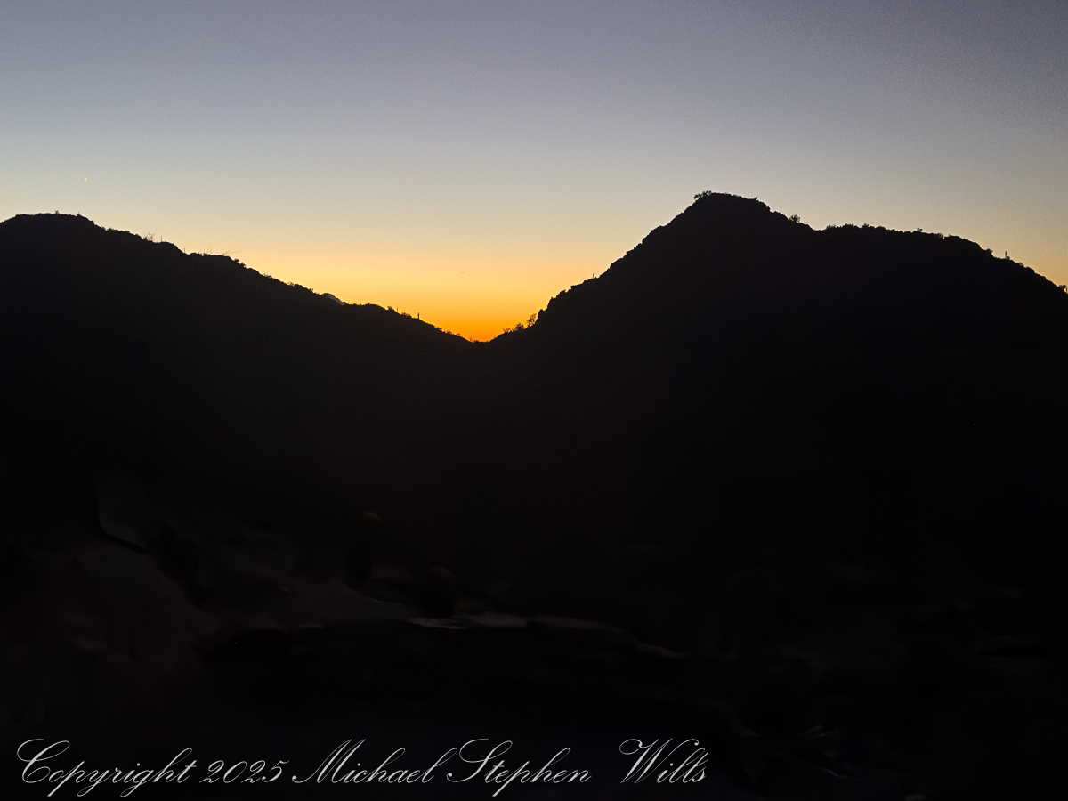
As I stop to rest myself and turn off my headlamp, ahead the trail tilts steeper the steps fade to rock, irregular and unforgiving: a stairway carved from ancient volcanic bones. With my dark adaptation, surfaces reflect star and city light, leading the eye down the ridge toward the dark quilt of neighborhoods below. Later, captured in the photograph, those steps will twist away like a stone dragon’s spine, the city waking beyond in soft pastels. Now they are simply work for legs and lungs.
The desert plants materialize around us as shapes before they acquire color. Saguaros stand like sentinels along the slopes; their arms lifted in silhouette. Ocotillo rise as witchy bundles of sticks, each spine leafed out from October rains the leaves catching a little light. On a small plateau a family has paused; the father adjusts a tiny headlamp on his son, no more than six, who is insisting, with fierce determination, that he can carry his own water. “Almost there, campeón,” his father says, and the child straightens like a soldier.
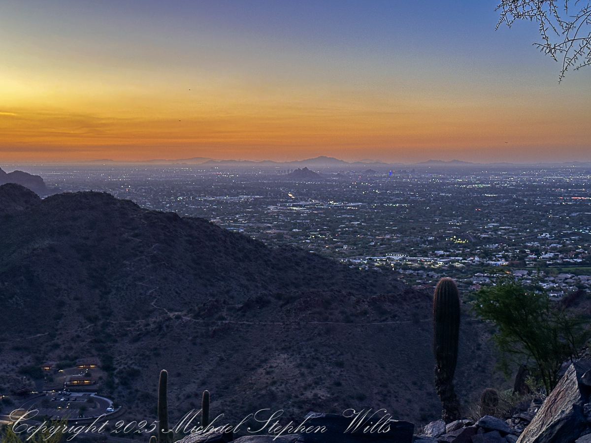
The dark begins to soften at the edges. Over the eastern horizon a thin band of orange appears, a delicate seam between night and day. In one direction, the city stretches out in a glittering net of streetlights, the squares of parking lots and subdivisions catching the last of the darkness. In the other, the mountains are still black cutouts, their profiles sharp as paper against a gradually brightening sky. One of my images will hold that moment: the jagged ridge of Piestewa in shadow, the valley below already spangled with light, a single towering saguaro rooted at the cliff’s edge like a punctuation mark.
November 2025 while visiting Pam’s family in Phoenix
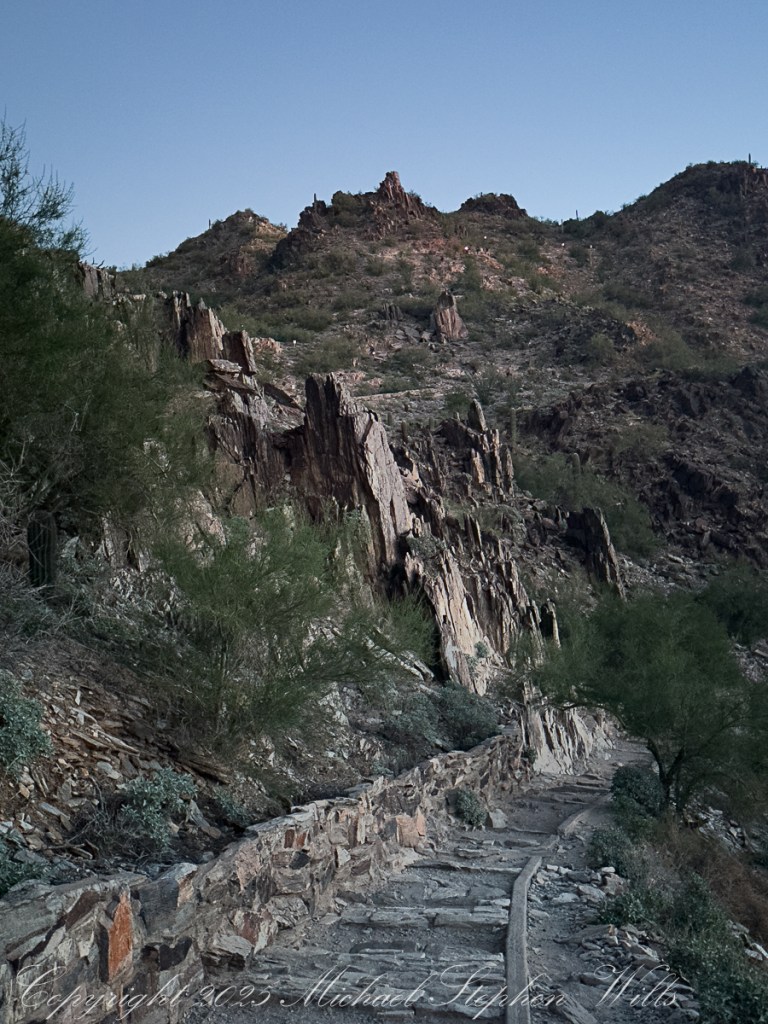
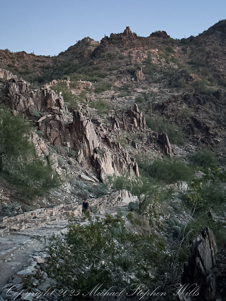
Higher up, the trail narrows and the rock turns rougher. We fall into single file, strangers linked by a line of effort. A runner comes flying down, feet barely touching stone, breath steady and controlled. “On your left,” he calls, and we part for him like water. A woman with a hijab tucked neatly under her ball cap leans against the retaining wall, stretching a calf muscle, her friend counting in accented English: “Ten more seconds, you can do it.” Near one bend a hiker pauses to press a hand against the rock face, whispering a quiet prayer in a language I do not recognize. It is a small, intimate moment, gone almost before I register it.
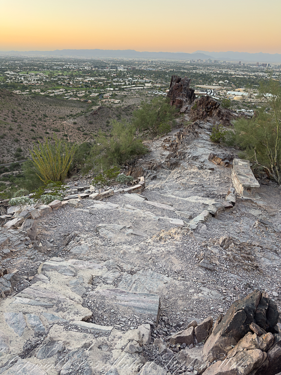
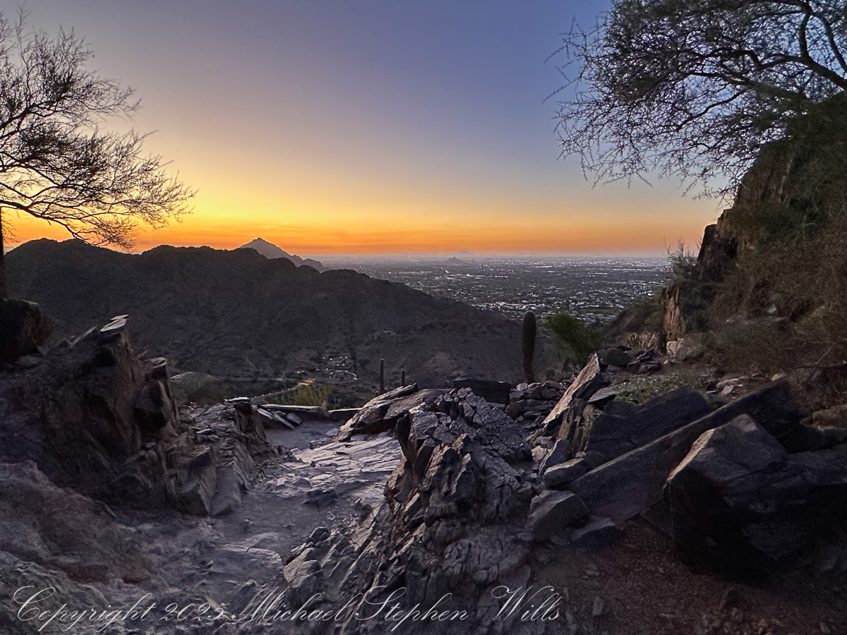
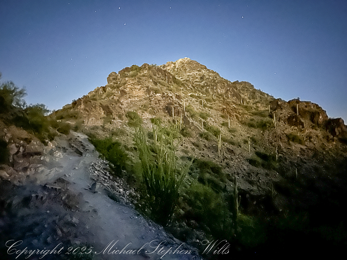
The last push to the saddle is steep, the steps uneven, the sky now a cascade of colors—copper, rose, faint lavender melting into a high dome of blue. The silhouettes of distant ranges sharpen: the Estrellas?, the Superstitions?, low ridges whose names I do not know. On the horizon, the first thin line of sun breaks free, setting fire to the edges of clouds. In another photograph, framed by dark rock and desert trees, that sunrise becomes a golden portal at the end of a shadowed corridor of stone.
We reach a broad ledge just shy of the summit as the light finally spills over us. People are already gathered there: a trio of college students taking selfies, a pair of retirees sharing thermos coffee, a solitary man sitting cross-legged with eyes closed, face open to the warmth. The city below is suddenly transformed. The carpet of lights dims, replaced by the clear geometry of streets and rooftops, golf courses and parking lots, all laid out like a model at our feet. The mountains that hem the basin—once anonymous shapes—now reveal their ridges and ravines in sharp relief.
For a few minutes conversation dies away. Everyone seems to feel the same thing: that fragile instant when the sun clears the horizon and the desert shifts from silver-blue to gold. The rocks around us, sharp and broken in the photographs, glow honey-colored. Saguaros catch light on their spines, each thorn a tiny ember. Even the dusty air seems to shimmer.
Down below, a new wave of hikers starts up the trail, latecomers walking into full daylight. We, the predawn climbers, share a small, quiet complicity. We have seen the city from the backside of night, watched the day arrive from a perch of jagged stone. Piestewa Peak has turned us, for an hour or two, into a single, breathing organism: many hearts, one climb, all of us stitched together by the steep path and the slow unveiling of the sun.
Enter your email to receive notification of future postings. I will not sell or share your email address.
Copyright 2025 All Rights Reserved Michael Stephen Wills
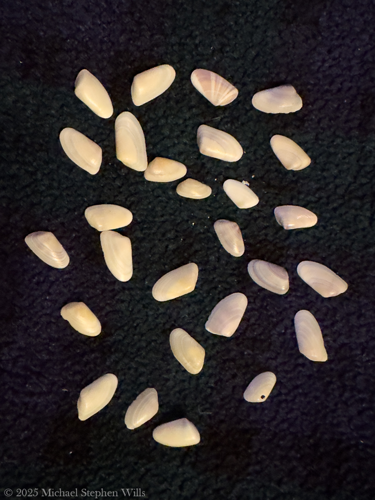
After 25 years of visiting Cocoa Beach, a discovery of coquina clams transformed my appreciation for the ecosystem, revealing its beauty, complexity, and intrinsic connections to life.
For nearly two and a half decades, I’ve strolled the sands of Cocoa Beach—since my first visit in March 2001—comforted by the rhythmic Atlantic waves and the familiar stretch of shoreline. I thought I knew this beach intimately; from the way the sunrise paints the water orange to the feel of wet sand under my feet. Yet it wasn’t until a clear morning in February 2025 that I recognized one of its tiniest treasures: the coquina clam. In the past, I might have walked past countless little shells and the tiny siphons and feet in the sand without a second glance. Now, with newfound awareness, I realize an entire world had been bustling at my toes all along.
February 2025: Discovering the Coquina Clams
Early one February morning, as the high tide receded, I noticed something magical happening at the water’s edge. Tiny coquina clams—each no larger than a fingernail—were emerging from the sand only to swiftly burrow down again between each wave.
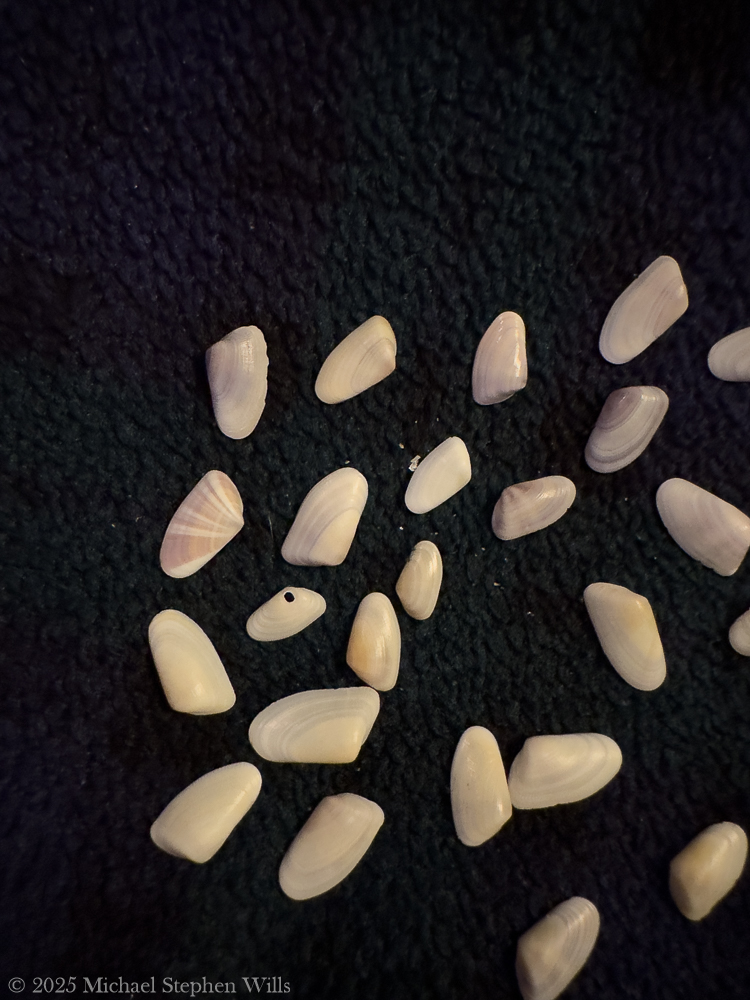
These living coquina clams were found in the receeding high tide on a February 2025 morning on Cocoa Beach, Brevard County, Florida
Their small wedge-shaped shells, in colors of pastel pinks, purples, yellows, and whites, peeked out for a moment and then vanished, synchronized with the pulse of the ocean. It was as if the beach itself had come alive with confetti-like jewels, re-positioning themselves with every ebb and flow. I stood entranced, wondering how I’d missed this subtle dance for so many years. That morning marked the beginning of my quest to learn about these little clams that had been hiding in plain sight.
Life Beneath the Sand
Once my eyes were opened, I began observing and researching the coquina clams’ hidden world. I learned that each delicate clam is a filter feeder, siphoning in microscopic phytoplankton, algae, and organic particles from the surf. This constant filtering not only feeds the clam but also helps clean and clarify the coastal waters by removing excess nutrients. Coquinas live a fast-paced, transient life by necessity: they typically survive 1–2 years in the wild and can endure a mere few days without the ocean’s moving water.
No wonder they race to burrow when the waves recede—staying submerged is a matter of life and death, as they rely on the surf for both food and oxygen. In their brief lifespan, they continually ride the tides, migrate in swarms up and down the beach, and rebury themselves between each wave to avoid being swept away.
I found it astonishing that such small creatures possess the agility and tenacity to “surf” the waves and dig themselves back into wet sand within seconds, a graceful routine I had unknowingly witnessed that February morning.
Beyond their daily habits, coquina clams also undergo a remarkable life cycle beneath the sand. They spawn in the warmer months, releasing gametes into the water for external fertilization. The resulting larvae drift as plankton for a time before settling into the sand and metamorphosing into tiny clams. With no parental care to guide them these young coquinas must immediately fend for themselves in the surf zone. Perhaps it’s this independent, perilous beginning that drives them to cluster in large colonies—while they aren’t social in a communicative sense, hundreds of coquinas often live side by side in favorable spots, turning patches of wet sand into vibrant mosaics of color and life.
Walking the beach now, I recognize these patches: slightly raised, pebbly areas that, when a wave washes over, suddenly bristle with tiny siphons and feet as the clams feed and reposition. It’s humbling to realize that under each footstep, an entire hidden ecosystem of coquinas might be thriving.
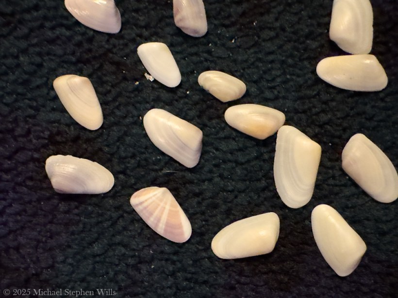
Shells on the Shore: Beauty and Predation
With my new awareness, even the empty shells strewn along the high tide line told a story. I began to collect some of the colorful coquina shells scattered on the sand, marveling at their variety—no two looked exactly alike. Some were solid orange or yellow, others striped with purple and white, each as delicate as a butterfly wing. Many of these shells were intact, evidence of clams that had lived out their short lives or perhaps fallen prey to gentle endings. Others, however, bore mysterious perfectly round holes on their surfaces. At first glance, I thought a tiny drill had punched through them, and in a way, I was right. Those small holes are the signature of predatory snails that haunt the sands: creatures like moon snails (also known as shark’s-eye snails) and whelks that prey on coquinas by literally boring into their shells. These sand-dwelling snails wrap themselves around a clam and use a tongue-like organ called a radula—akin to a miniature saw—to drill a neat hole through the coquina’s shell, aided by acidic secretions to soften the calcium carbonate. Once the hole is complete, the snail devours the clam from within, leaving behind an empty, perforated shell as a grim calling card of the food chain in action.
Seeing those tiny “murder holes,” as beachcombers jokingly call them, on coquina shells transformed my perspective on the shell collections I had casually admired for years. Each shell in my hand represented a life that had been an integral part of the beach ecosystem. Some had been snatched by shorebirds or fish the instant they were exposed by the retreating tide, becoming breakfast for a sanderling or a pompano. Others, as the holes revealed, had been victims of an even stealthier predator under the sand. It struck me that every fragment and hollowed shell on the beach is evidence of a relationship—predator and prey, life and death intertwined on the shore. Instead of seeing a random assortment of pretty shells, I now saw a record of the beach’s vibrant food web written in calcium carbonate. The realization filled me with both wonder and respect: this sunny tourist beach holds quiet tales of survival as dramatic as any wilderness, if one knows where to look.
The Coquina’s Ecological Role
As I dug deeper (both into the sand and the literature), I discovered that coquina clams are far more than a footnote in the beach ecosystem—they are a keystone of coastal ecology. By filtering plankton and detritus from the surf, countless coquinas collectively act as tiny water purifiers, helping maintain water quality along the shore. Their presence in large numbers indicates a beach’s health; in fact, abundant coquina populations signal that the beach environment is robust and unspoiled. A stretch of sand teeming with coquina clams suggests natural, shifting sands and minimal human interference, as these clams thrive best where coastal processes remain undisturbed. In this way, coquinas are like a barometer for the shoreline: if I continue to find them at Cocoa Beach, it means the beach is still alive and supporting complex life.
Coquina clams also form a critical link in the food chain. Numerous shorebirds rely on them as a food source—those flocks of little sandpipers and plovers skittering at the water’s edge have, all along, been feasting on coquinas right under my nose. Fish that patrol the surf, like the Florida pompano and various kinds of drum (whiting), gulp them up as the waves churn the sand.
These coquina clam shells were found February 2025 on Cocoa Beach, Brevard County, Florida
Even ghost crabs and other scavengers benefit, feeding on clams that wash ashore. And of course, the predatory snails under the sand have a specialized taste for them. It’s a reminder that even a creature only an inch long can be a cornerstone of an entire food web, sustaining animals up the chain from mollusks to birds to fish. Standing on the beach now, I often pause and watch the frenetic chase of the shorebirds in the surf, aware that without the coquina clams beneath the foam, that familiar coastal ballet could cease to exist.
Humanity and the Coquina: Intertwined Histories
It’s not only animals that have interacted with coquina clams—we humans have a longstanding relationship with them as well. Historically, Floridians made use of coquinas as a food source. Local folklore and old recipes describe coquina broth and chowder, a delicate soup made by briefly boiling these tiny clams to extract their flavor.
Because each clam is so small, you’d need hundreds to make a pot of soup, so it’s not a common dish today except perhaps as a novelty. Still, the idea that the sands I walk on could literally be cooked into a chowder is a charming and earthy connection between food and place. Early indigenous peoples and European settlers alike would have recognized coquinas as an edible bounty in times when every bit of protein counted.
For best experience, click on “Watch on YouTube”
Humans have also found value in the shells of coquinas beyond admiring their beauty. Over time, vast deposits of coquina shells on ancient beaches hardened into a soft limestone rock called coquina stone (the term “coquina” itself comes from the Spanish for “shellfish” or “cockle,” reflecting its composition).
In a fascinating twist of fate, this sedimentary rock—essentially millions of fused clam shells—became a building material. Here in Florida, coquina stone was quarried and used to construct some of our oldest structures. The historic fortifications in St. Augustine, like Fort Matanzas and Castillo de San Marcos, were built from coquina stone, their walls made resilient by a matrix of coquina clam shells.
I find it poetic that the same little clams I only just learned to appreciate have literally been the building blocks of human shelters that have stood for centuries. Even today, crushed coquina shells are used in landscaping and as decorative ground cover—perhaps you’ve seen driveways or garden paths that gleam with fragments of pink and purple shells.
Our lives overlap with the coquina in subtle ways: from the architecture of coastal Florida to the aesthetics of our beach towns.
Modern conservationists note another connection: by protecting natural beach dynamics, we also protect coquina populations, which in turn supports the whole ecosystem. This means being mindful about coastal development, beach renourishment projects, and even how many shells tourists collect. I’ve become more aware that picking up a few pretty coquina shells as souvenirs is fine, but we must leave plenty behind for the beach to recycle and for other creatures to use. For example shorebirds glean minerals from them. The humble coquina clam has given me a new appreciation for how intimately tied human activity is to the smallest inhabitants of the shore.
Reflections: Wonder in the Little Things
My journeys to Cocoa Beach were enhanced: what began as a casual observation in 2025 has blossomed into a profound shift in the way I experience the beach. I feel as if I’ve been given new eyes—now I notice the glint of tiny shells in the sand and know there’s life (or a story of life) attached to each one. The joy of discovery I felt upon noticing the coquina clams has reignited a childlike curiosity in me. It’s astounding that after decades of visits, there was still a secret to uncover on those familiar shores. This realization makes me wonder: What else have I been missing? It’s a reminder that nature has layers upon layers of wonder, even in places we think we know intimately. Sometimes it just takes a shift in perspective, a bit of knowledge, or a quiet moment of attention to peel back the veil.
In reflecting on the coquina clams of Cocoa Beach, I’ve learned not only about a specific species and its role in the world, but also about myself and the value of lifelong learning. These clams, in their smallness and ubiquity, taught me to slow down and appreciate the intricate tapestry of life at my feet. Now, each time I visit the beach, I smile seeing the waves bring in that rush of foam and sand, knowing a hidden troupe of coquinas is hard at work filtering water, dodging predators, and holding up the very balance of the shore. I often kneel down now, running my fingers gently through the wet sand to feel them retreat, and I silently thank them — for cleaning the water, for feeding the birds and fish, for building historic forts (unbeknownst to themselves), and for showing me that wonder can be found in the smallest of places. Cocoa Beach, through the lens of the coquina clam, feels like a brand new world I’ve been lucky enough to discover, even after all these years
I look forward to other hidden marvels awaiting discovery on my next visit.
References
Abbott, R. T. (1974). American Seashells: The Marine Mollusca of the Atlantic and Pacific Coasts of North America. Van Nostrand Reinhold Company.
Andrews, J. (1994). Shells and Shores of Texas. University of Texas Press.
Brusca, R. C., & Brusca, G. J. (2003). Invertebrates (2nd ed.). Sinauer Associates.
Denny, M., & Gaines, S. (2000). Encyclopedia of Tidepools and Rocky Shores. University of California Press.
Futch, C. R., & Burger, J. (1976). The ecology of coquina clams (Donax variabilis) in the southeastern United States. Marine Biology Journal, 34(2), 157-168.
Leal, J. H. (2002). Seashells of Southern Florida: Living Marine Mollusks of the Florida Keys and Adjacent Regions. Smithsonian Institution Press.
Mikkelsen, P. M., & Bieler, R. (2008). Seashells of Southern Florida: Marine Bivalves, The Bivalvia. Princeton University Press.
Morton, B. (1988). Particulate Matter Processing in Bivalves: An Overview. Journal of Marine Ecology, 19(3), 103-123.
Ruppert, E. E., Fox, R. S., & Barnes, R. D. (2004). Invertebrate Zoology: A Functional Evolutionary Approach (7th ed.). Cengage Learning.
Stanley, S. M. (1970). Relation of shell form to life habits of the Bivalvia. Geological Society of America Memoir, 125, 1-296.
Voss, G. L. (1980). Seashells of the Gulf and Atlantic Coasts. Houghton Mifflin Harcourt.
Wells, H. W., & Gray, I. E. (1960). Habitat selection and the distribution of the coquina clam (Donax variabilis). Ecological Monographs, 30(1), 55-77.
Enter your email to receive notification of future postings. I will not sell or share your email address.
Copyright 2024 All Rights Reserved Michael Stephen Wills
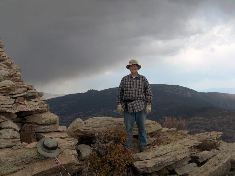
As we stood atop Rincon Peak, the sky darkened with the approach of a sudden thunderstorm. Below us, the San Pedro River valley sprawled, with the Mae West Peaks to the left and the legendary Dragoon Mountains straight ahead. This photograph captures that exhilarating moment—standing on the summit with the world at our feet and the wild Arizona sky closing in. Curious about how we got there and our race against nature’s fury? Join me on the blog to delve into the full adventure and explore more stunning images from the heart of the Rincon Wilderness.
The Rincons are one of 42 Sky Island mountains isolated from each other due to gradual warming and drying climate changes since the last ice age, 10,000 years ago. While this marvelous environment of oak and pine forests is accessible only on foot and with significant effort, it is visible from every point of the Tucson valley, home to a million inhabitants.
The name ‘Rincon,’ Spanish for ‘corner,’ reflects the mountains’ shape as they enclose a space on the west and northwest. This area, formerly used for ranching, is now being developed for tract housing. In contrast, the mountains themselves are preserved as wilderness, with parts designated within the Saguaro National Park and the Coronado National Forest.
In the past 51 years, I have been lucky enough to visit the Rincon Wilderness interior four times, shouldering different style backpacks onto the mountain and walking in different boots. My first trip was during college in the 1970s, when a party of six of us left from the end of Speedway, heading up the Douglas Springs trail. The climb was an exercise in desert survival that several friendships did not survive, replaced by new friends met on Mica Mountain. I have no photographs from that experience, only memories and the backpack.
Decades later, reconnecting with Arizona in 2004—thirty-one years after that first experience—I took no chances. This time, my attempt on Rincon Peak was a success. I reduced risk and effort, though not eliminating them, by hiring a guide for the four-day trip. We reached Rincon Peak via the Turkey Creek Trail out of Happy Valley, climbing a mountain buttress with views that widened and lengthened with every step.
Capturing these moments, I took several photographs during that experience. Two years later I added a landscape of the peak at sunset.
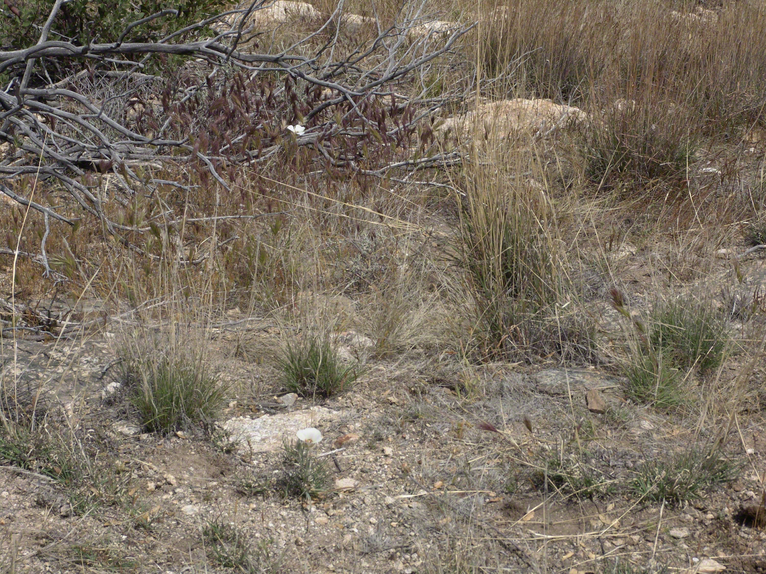
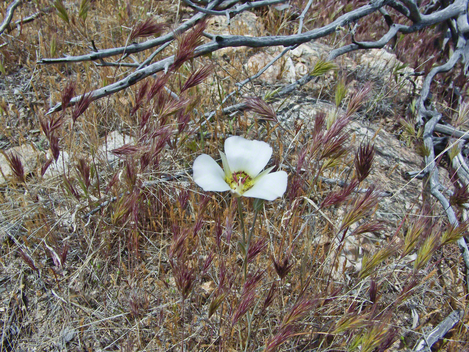
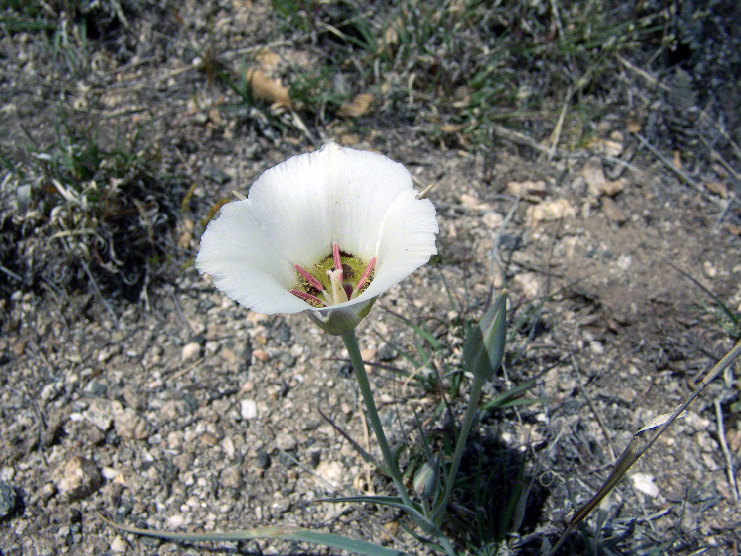
Along the Turkey Creek trail, Sego Lilies bloomed among a stricken oak and drying grasses, offering a vivid glimpse into the region’s delicate ecosystem. It is the winter rains that trigger such a bloom.
Enthralled by their beauty, we paused while I unpacked my gear to photograph the Sego Lilies growing along the trail.
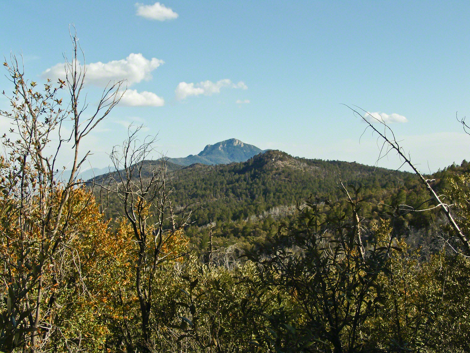
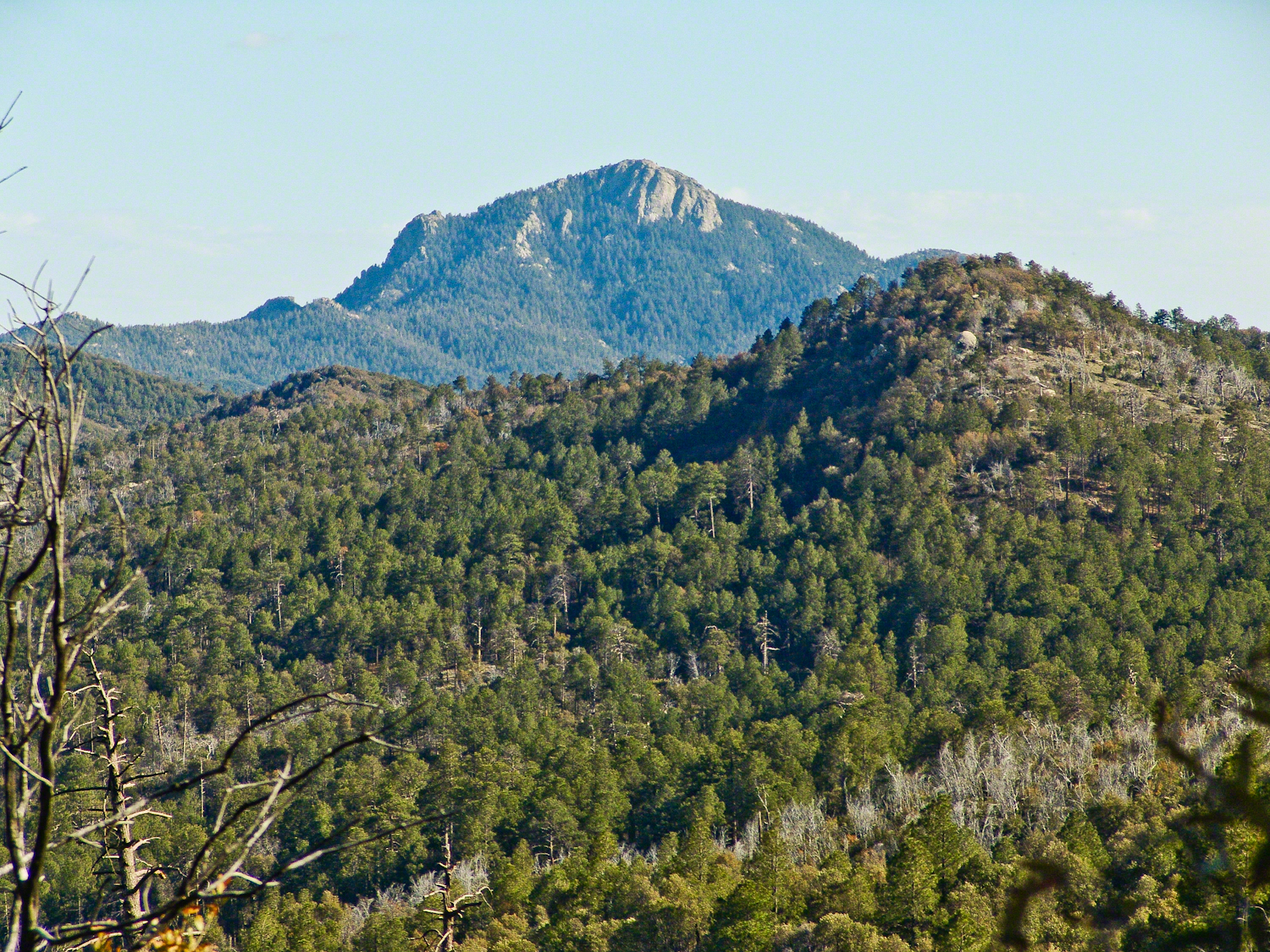
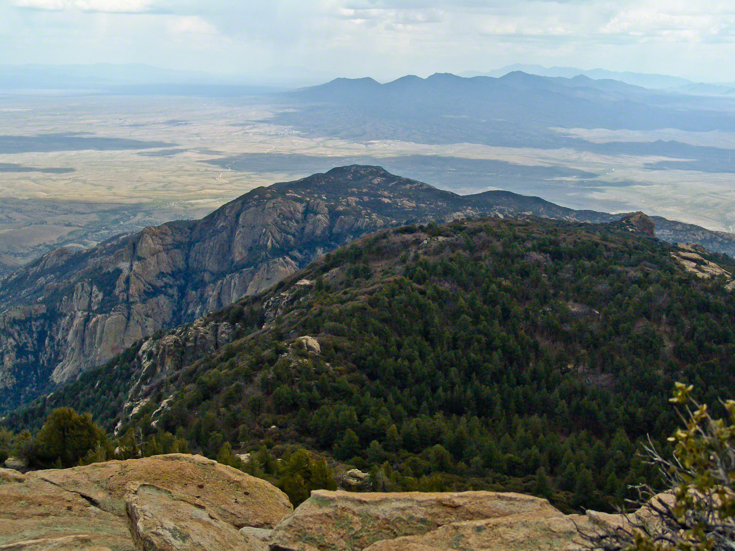
When we reached Deer Head Spring at the top of Turkey Creek Trail on April 27, 2004, it was a moist spot with no accessible water. With only about a gallon of water each remaining, we pressed ahead to Heartbreak Ridge and climbed into Happy Valley Saddle, where, thankfully, the creek—though low and full of algae—was usable. It was here that I caught my first glimpses of Rincon Peak, looking across the aptly named Heartbreak Ridge and Happy Valley Saddle.
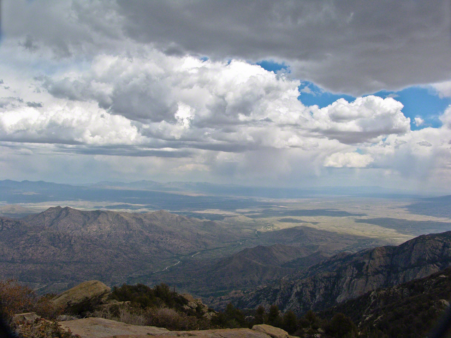
From Rincon Peak, the view to the south was breathtaking. The white rocks at the lower right formed the Valley of the Moon wall. Below lay the San Pedro River valley, with the Mae West Peaks at the left margin and the Dragoon Mountains with Cochise Stronghold at the center. I took this photograph around 12:30 PM on April 28, 2004, just as a thunderstorm was approaching.
Rotating the camera to the south-southwest, the view stretched over the Valley of the Moon to the eastern Tucson Valley and the Sky Islands of the Whetstone Mountains (Apache Peak), with the Santa Ritas behind them. In this vast landscape, the works of man are overpowered by sky, rock, and distance.
We made a hasty departure ahead of the thunderstorm. Attempting the peak that day had been a touch-and-go decision, but we reached the summit with moments to spare.
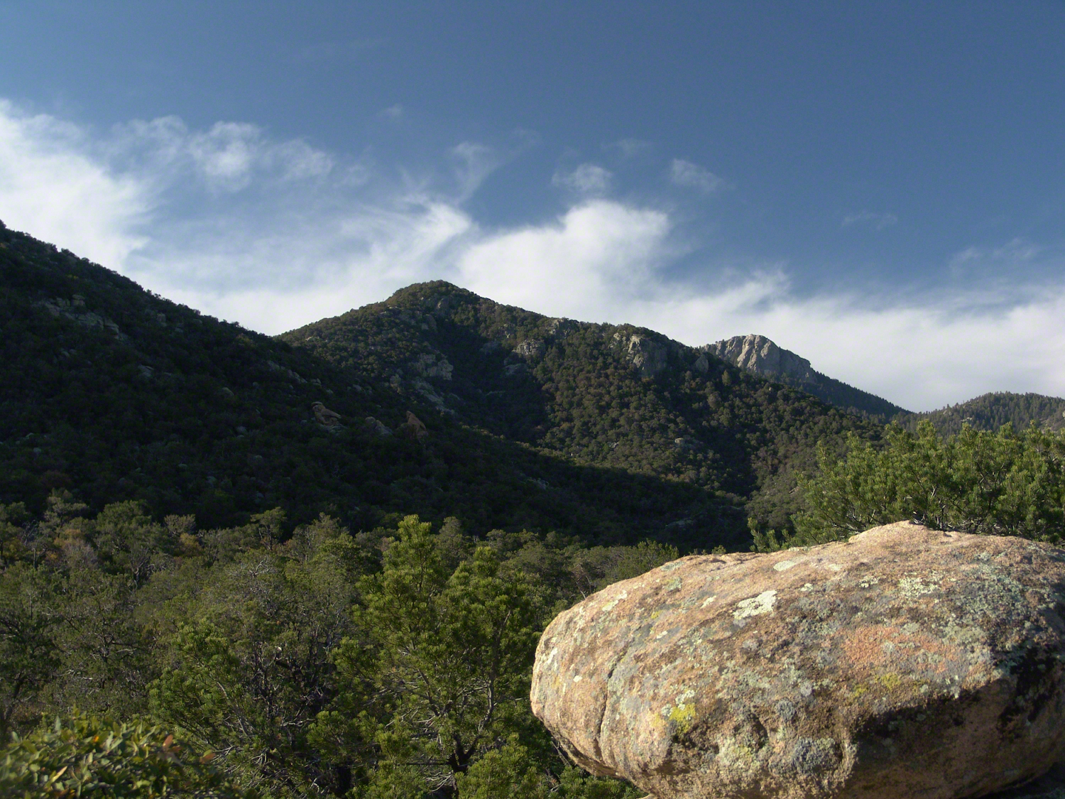
On the morning of April 29, 2004, the day after reaching Rincon Peak, I set up my tripod near our Happy Valley Saddle camp. In the serene early morning sunlight, I captured images of Rincon Peak, reflecting on the previous day’s ascent.
On the day we descended to the X9 Ranch via the Rincon Creek trail, we were granted a unique opportunity. My guide’s grandfather had a homestead at the X9, and his access to the trailhead through private lands opened this ro ute for us. That evening, I took a photograph of the sunset on Rincon Peak from the X9 Ranch, looking east from the ‘Rincon’—the corner formed by the massifs of Rincon Peak, Mica Mountain, and Tanque Verde Ridge.
The X9 ranch sits in the Rincon (spanish for corner) made by the massifs Rincon Peak, Mica Mountain and Tanque Verde ridge.
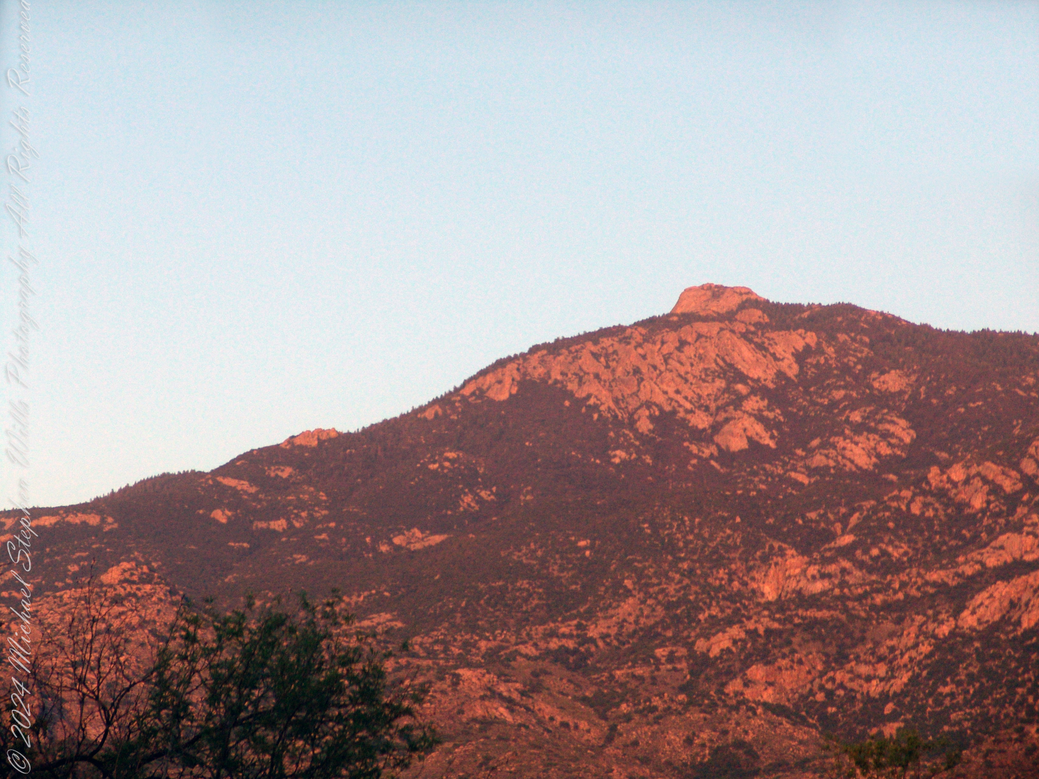
Two years later, on the evening of November 2, 2006, I climbed the Tanque Verde trail in Saguaro National Park East for about 30 minutes to reach a vantage point of Rincon Peak. Intending to capture the peak bathed in golden light, I waited until just before the sun set behind the Tucson Mountain. Afterwards, I raced the sun hiked back to the car. In my hurry, I tripped on a stepped turn and dove headfirst into a large prickly pear cactus. It was a very painful experience. Large spines pierced my face, while tiny, pesky spines covered my chest and back. The large spines, not being barbed, came out easily, but I needed to visit a physician to remove the rest.
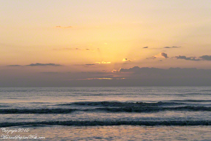
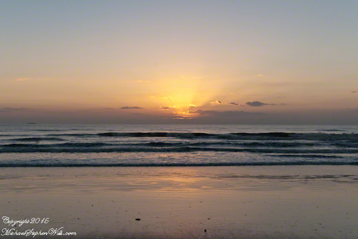
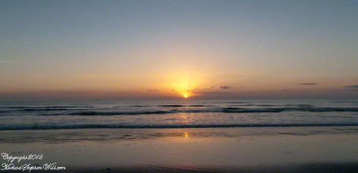
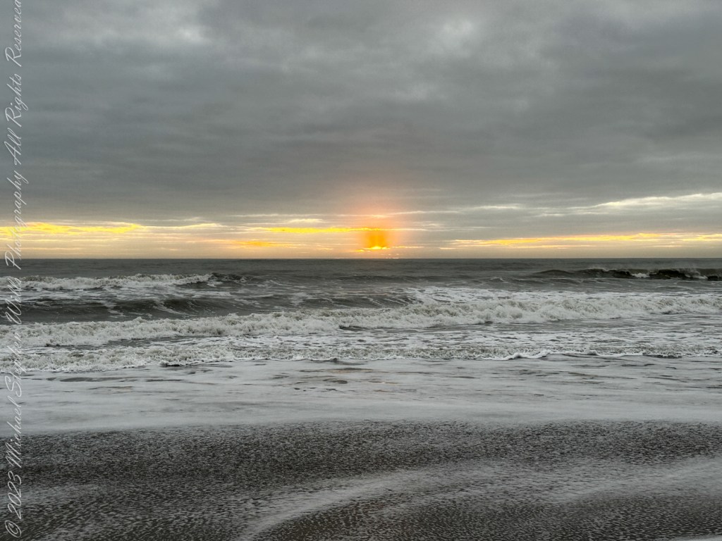
Experience the breathtaking sunrise at Cocoa Beach, where the sky and sea blend in a symphony of colors. Discover the tranquility and beauty that awaits as the day dawns on Florida’s stunning Space Coast.
Cocoa Beach, nestled in Brevard County, Florida, is renowned for its pristine sandy shores and the rhythmic lullaby of the Atlantic Ocean. It’s a place where the day often begins with an awe-inspiring sunrise. On the Space Coast, the first light of day is a daily masterpiece, a silent symphony of colors that paints the sky and reflects off the water.
As dawn approaches, the eastern horizon begins to glow with a soft, pre-dawn light. This quiet time, when the world is still asleep, offers a unique tranquility. The beach, usually bustling with surfers, sunbathers, and families, is calm and serene. The sand, cool underfoot, stretches out like a vast canvas, waiting for the sun to begin its artwork.
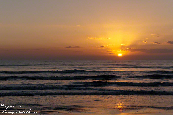
The first hues of sunrise start as a gentle blush, a hint of pink that softly caresses the sky. As the moments pass, this blush deepens into shades of orange and red, reminiscent of a painter’s palette. The ocean mirrors these colors, creating a breathtaking scene where sky and sea blend into one continuous expanse. It’s a moment that feels almost sacred, as if nature itself is preparing for a grand reveal.
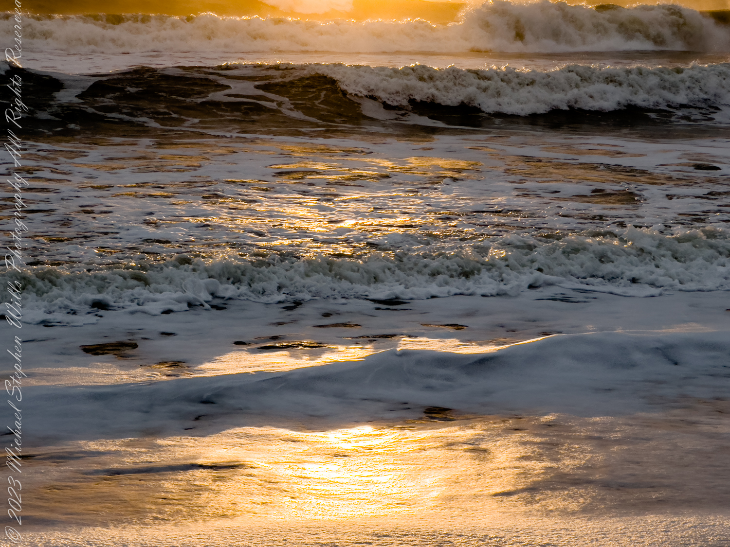
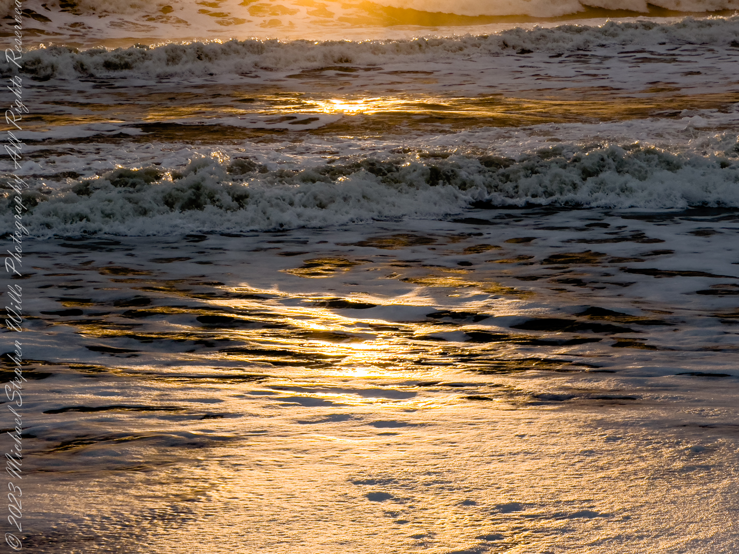
The sun finally peeks above the horizon, a fiery orb that illuminates the world in golden light. This is the crescendo of the sunrise, a moment that seems to hold the breath of the world. The rays of light stretch out across the water, casting a shimmering path that invites the eyes to follow. It’s a path that feels both real and ethereal, leading not just across the sea, but into a day full of possibilities.
As the sun rises higher, the colors in the sky shift and change. The deep reds and oranges give way to softer yellows and then to the clear, bright light of morning. The ocean, too, transforms, taking on a deeper blue as the sunlight penetrates its depths. The waves, which had been gentle ripples in the pre-dawn light, now dance and sparkle, as if celebrating the arrival of the new day.
For those fortunate enough to witness it, a sunrise at Cocoa Beach engages all the senses. The cool breeze carries the fresh scent of saltwater, a reminder of the ocean’s vastness and power. The sound of the waves, steady and rhythmic, provides a soothing background score, while the occasional cry of a seabird adds a touch of the wild to the scene.
Click on a photo for a closer look.
There is a sense of community among the early risers who gather to watch the sunrise. Strangers often share nods and smiles, united by the shared experience of witnessing something so beautiful and ephemeral. It’s a reminder that, no matter our differences, moments of natural beauty can bring people together, fostering a sense of connection and shared humanity.
Cocoa Beach, known for its proximity to the Kennedy Space Center and its surf culture, offers much more than meets the eye. The sunrise is a daily reminder of the simple yet profound beauty of nature, a beauty that exists beyond the man-made attractions and the hustle and bustle of everyday life. It’s a call to pause, reflect, and appreciate the world around us.
In a place where rockets soar into the sky, touching the very edge of space, the sunrise at Cocoa Beach brings us back to Earth, grounding us in the timeless rhythm of the natural world. It’s a moment of peace and renewal, a gift from the universe to start the day with a heart full of wonder and gratitude.
So, whether you’re a local or a visitor, taking the time to watch the sunrise at Cocoa Beach is an experience not to be missed. It’s a chance to witness the world waking up, to feel a part of something larger than oneself, and to start the day with a renewed sense of awe and possibility.
Copyright 2024 Michael Stephen Wills All Rights Reserved
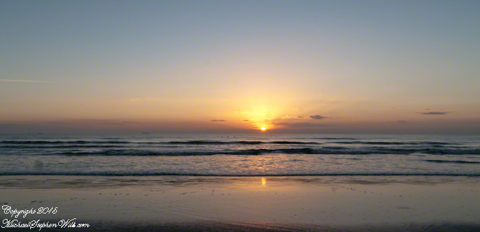
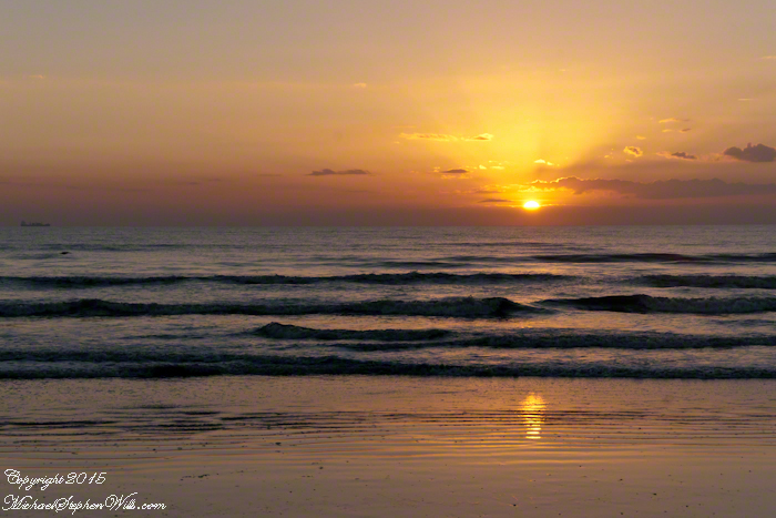
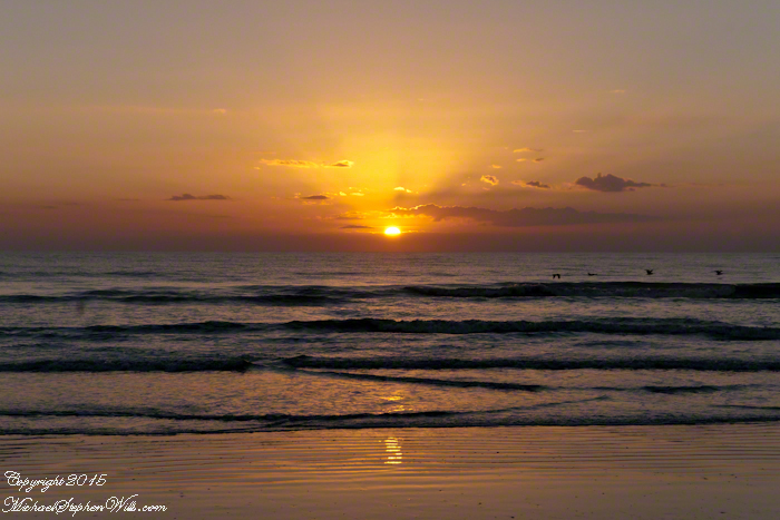
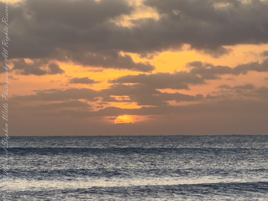
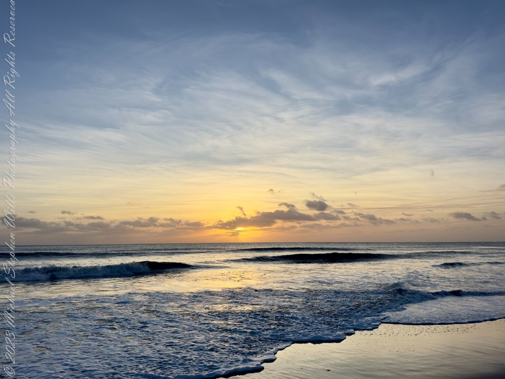
The first blush of morning caresses the horizon, the palette of colors unfurling across the sky like a softly whispered promise of the day ahead. The soft pinks and blues deepen, brushing the clouds with strokes of lavender and orange, as the sun peeks just above the watery edge of the world. Today, I find myself strolling along Cocoa Beach, capturing the tender moments of dawn breaking over this tranquil Florida beachscape in early January 2024.
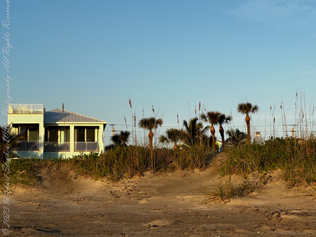
Each step I take along the sandy shores brings a new perspective, a new detail, revealed in the emerging light. To my right, a lone beach house sits nestled behind a veil of sea oats and palmettos, the sky behind it a canvas of warming hues. The house seems to slumber still, its windows reflecting the first golden rays of the sun. This dwelling, isolated and serene, hints at the countless summers of laughter and salty air, and the quiet winters of introspective solitude.
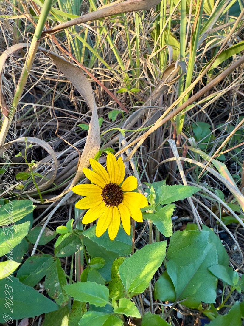
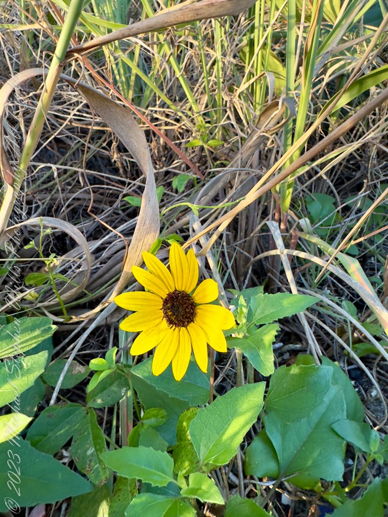
The sun disk breaks the horizon, visible through the clouds. Cocoa Beach, Brevard County, Florida. The Space Coast.The sun disk breaks the horizon, visible through the clouds. Cocoa Beach, Brevard County, Florida. The Space Coast.The sun disk breaks the horizon, visible through the clouds. Cocoa Beach, Brevard County, Florida. The Space Coast.Cocoa Beach, Brevard County, Florida. On the Space CoastDune sunflower (Helianthus debilis) on the path to our condo. Cocoa Beach, Brevard County, Florida. On the Space Coast.
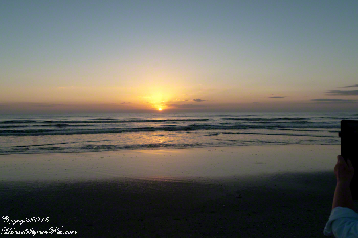
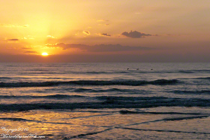
As the morning progresses, the sun asserts itself, climbing higher and burning off the last vestiges of night. I point my camera towards the ocean, capturing the waves as they roll in with rhythmic persistence. The sea is a creature of profound mystery in these early hours, its surface a moving mirror that catches the fire of the sunrise and dances with light. Each wave is a note in an aquatic symphony, played just for those who are awake to hear it.
Turning my gaze down, I focus on the smaller, often overlooked inhabitants of the beach. A single flower, a stubborn and resilient dune sunflower, stands boldly above the sands. It’s an unexpected sight—this splash of vibrant yellow against the muted earth tones of the sandy beach. The flower turns its face towards the sun, basking in the glow, thriving in its own patch of the world. It’s a poignant reminder of the tenacity of life, of nature’s relentless pursuit of existence against the odds.
The beauty of Cocoa Beach at dawn is not just in its sweeping vistas or the dramatic play of light and shadow. It’s also in these small, intimate encounters: the texture of the sand, the whisper of the grass, the solitary bloom. Each element is a brushstroke in a larger picture, a note in a grander melody. As I walk, my feet leave temporary impressions on the wet sand, soon to be erased by the incoming tide. It feels symbolic, this transient mark-making, reflective of the fleeting nature of life and the enduring beauty of the world around us.
Cocoa Beach this morning is a place of peace and contemplation. As I capture these moments with my camera, I am also capturing them in my heart, storing them as a balm for busier, noisier days. The photographs will speak of quiet and calm, of the soft hush of dawn, and the gentle awakening of the earth. They will tell of a morning when the world seemed to pause, just for a moment, to revel in the simplicity and beauty of another beginning.
As the sun climbs higher, its light becomes too harsh for the soft magic of dawn photography. I pack up my camera, my heart full of the morning’s calm. The beach is waking up now, the first joggers and dog walkers appearing, their morning routines intersecting with the tail end of my photographic journey. I leave Cocoa Beach carrying the quiet joy of the morning, a joy found in the dance of light on water, in the solitude of a beach house, and in the vibrant defiance of a sunflower. Dawn here is not just a time, it’s an experience—a delicate, powerful reminder of the world’s wonders, witnessed at the edge of the day.
In the crisp solitude of Cocoa Beach at dawn, witness a world untouched: golden light dances on waves, the chill air whispers, and a singular peace reigns over the empty shore.
Upon Cocoa’s shore at dawn’s first light, Where waves dance and shimmer with cold delight, A lone watcher, I stand in solitude’s embrace, Feeling the north wind’s brisk and biting trace.
The sand, a canvas of untouched grains, Bears witness to the sun’s golden reins, As it climbs, a fiery charioteer, Breaking the grip of night’s lingering fear.
Windy February Sunrise
The sea froths in a wild, wind-driven churn, As the day ignites and the horizons burn. Forty degrees, a chill to the bone, Yet in this brisk morn, I find myself alone.
No footprints mar the beach’s pristine face, Save mine, etched briefly in time’s fleeting grace. The gulls have fled the gusts’ relentless push, Leaving the skies to the clouds’ rosy blush.
In this brisk February gale, I watch the sun’s rays like warriors pale, Brandishing light against the cold, dark sea, A spectacle of warmth, just for me.
The beach, expansive, a desolate stage, A world apart from the human age. The waves, the wind, the chill, the light, Compose a symphony of nature’s might.
I breathe in deep the saline air, Each gust a verse in the morning’s prayer. The sea’s rhythm against the shore, A melody I’ve come to adore.
Here in this chill, this wind, this hue, I find a peace profound and true. Cocoa Beach at sunrise, a sight to behold, A memory in my heart, forever enfolded.
Copyright 2024 Michael Stephen Wills All Rights Reserved
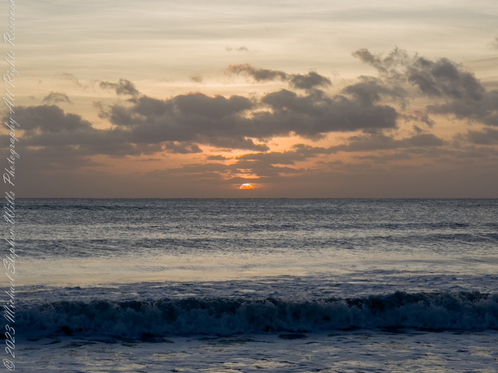
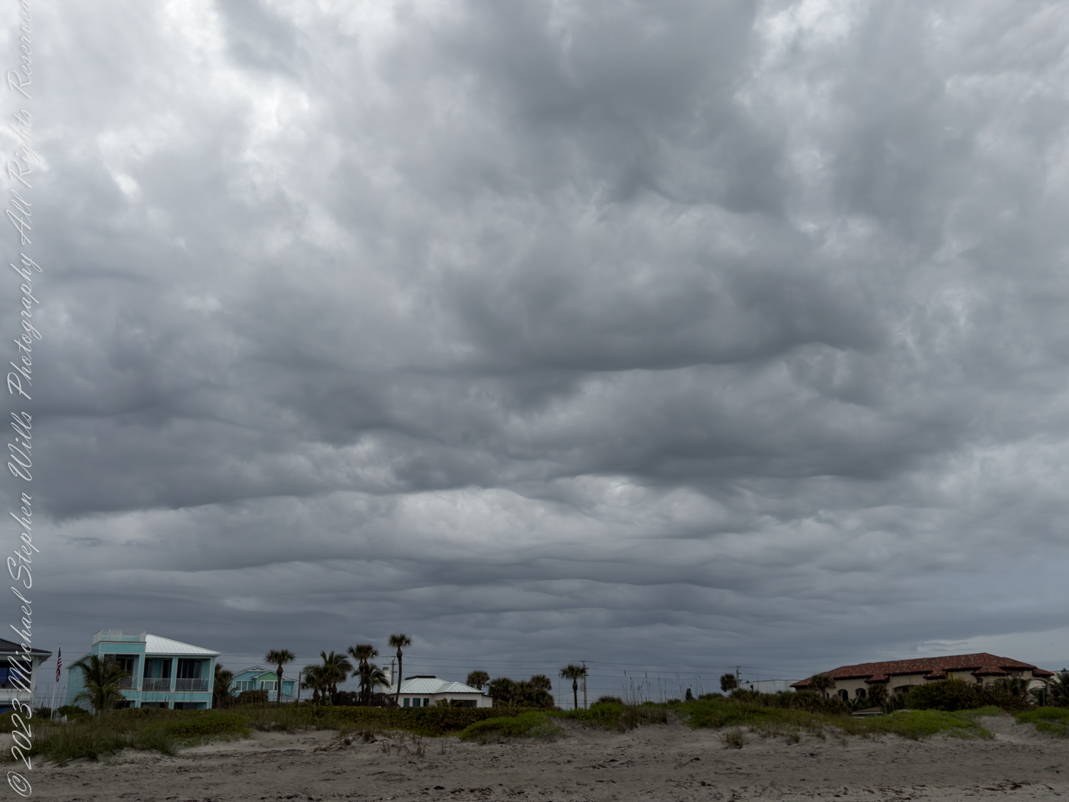
Beneath the brooding storm clouds moving with silent intent, I stood, the air electric with the storm’s approach. Yet, turning east, the Sun’s Eye winked at the horizon, igniting the sky in defiance—a fleeting warmth against the impending tempest’s chill.
Amidst the sprawling canvas of Cocoa Beach, a beachcomber such as I stands witness to the theater of the skies, a stage upon which the sun and storm perform their eternal dance. The dawn of this particular February morning brought with it a spectacle of dual realms, a chiaroscuro of the celestial drama that unfolds in minutes and lingers in the heart.
To the east, ‘the Sun’s Eye’—a fierce, glowing orb—peered over the horizon, its gaze cutting through the cool morning mist. The sea, a mirror of the skies, blushed with the hues of a blooming peach, its waves whispering secrets as they lapped the shore. Each frothy crest reflected the sun’s burgeoning fire, a symphony of light that sang of the world’s awakening. It was a moment of birth and beginning, the kindling of a day where the potential hung ripe as the citrus in the Floridian groves.
This radiance, however, was but a half of the morning’s tale. As I turned, facing west, the sky told a different story. Here, the heavens grew heavy with brooding storm clouds, a tumultuous sea of gray above the green. These undulating specters crept forward, a procession of ashen waves threatening to swallow the day’s young light. The air, charged with the tension of an impending tempest, hummed with the promise of nature’s fury.
Twenty-one minutes—a mere breath in the lifespan of the cosmos—was all it took for the scenery to shift, the mood to transform. To the east, the promise of warmth and the whisper of daylight’s caress; to the west, the cold omen of a storm’s embrace. This juxtaposition, this confrontation of fire and shadow, was a testament to the Earth’s ephemeral beauty.
In the presence of such a display, I—a mere beachcomber—was a sentinel between two worlds. The sunrise spoke to me of hope, of the unyielding rhythm of time that brings renewal each day. Its golden fingers painted the world in a palette of possibility, a reminder that each dawn brings its own story, its own song to be sung.
The approaching storm, in contrast, murmured of respect for the forces beyond our grasp, the humbling power that nature wields with indifferent grace. Its darkening clouds, layered like the furrowed brows of ancient gods, were a canvas of the world’s raw strength, its capacity for change, for washing the old away with a torrent.
Here, on this stretch of sand, the universe seemed to converge—a meeting point of opposing forces, a confluence of light and darkness, creation and destruction. In the face of such majesty, I found a profound tranquility, a sense of my place in the grand tapestry. For what are we but observers, participants in the grand design, bearing witness to the moments when the world reveals its contrasting character?
This morning’s display was a parable of life itself, written in the language of the skies. The Sun’s Eye, ever-watchful, ever-prescient, promised the comfort of the familiar, the steady passage of time marked by the constancy of its rise and fall. The storm, brooding and unpredictable, was a reminder of life’s uncertainty, the inevitability of change and the beauty found within it.
As the light grew and the darkness encroached, I stood at the crossroads of day and night, life and experience. With the sand beneath my feet and the salt air filling my lungs, I embraced the duality of existence, knowing well that each sunrise heralds not just the day, but the inescapable storm that follows. In Cocoa Beach, on the Space Coast, the universe had unfolded its dual nature before me, an eternal beachcomber, in the span of a single, breathtaking morning.
Copyright 2024 Michael Stephen Wills All Rights Reserved
Embark on a serene journey through a fog-enshrouded Cocoa Beach at dawn. Feel the mystique of Florida’s Space Coast in this introspective walk captured in poignant blank verse.
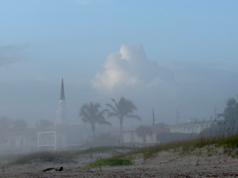
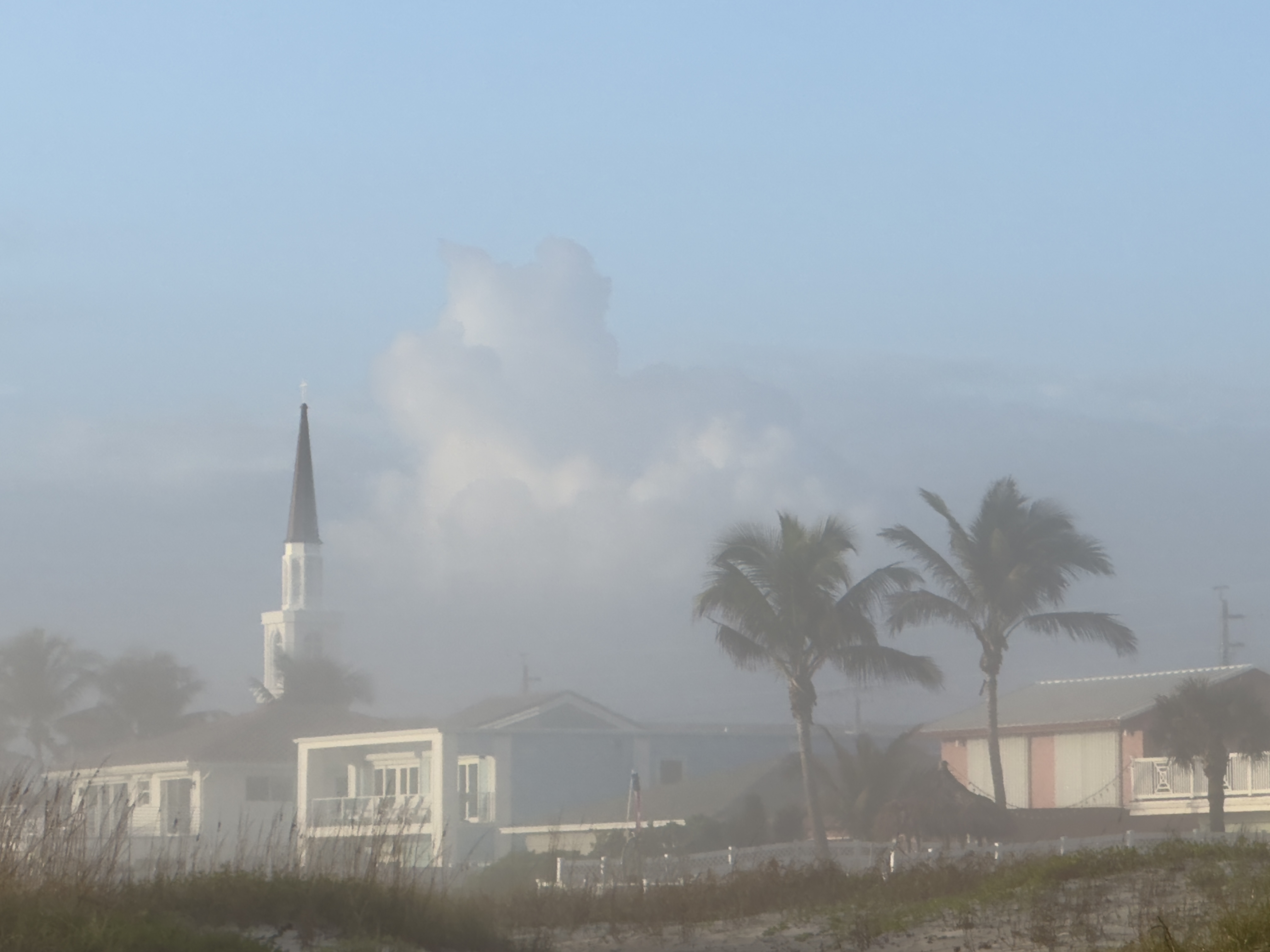
Upon Cocoa Beach, in morning’s gentle embrace, The world lies shrouded in a silken fog’s lace. Soft sands whisper ‘neath my solitary feet, As dawn’s quietude and ocean’s breath meet.
The sky, a canvas of muted grey, A prelude to the coming of day. The air, cool and moist upon my skin, A tender caress, a whispering kin.
The steeple rises, a ghostly spire, Amidst the mist, it stands, silent and dire. Palm trees sway with a rhythmic grace, In this hazy realm, time slows its pace.
A hammock hangs, still and forlorn, Awaiting the laughter of a day reborn. Houses peek, their outlines blurred, In this soft world, all is unstirred.
The sea’s soft roar, a distant sound, A symphony in the fog, profound. I walk, and my thoughts begin to roam, In this misty morning, I find a home.
The light grows, a gradual birth, As the sun climbs to illuminate the earth. The fog begins to lift, to rise, Revealing the awakening of the skies.
Yet, in this moment, I am alone, A soul adrift in a world of its own. Here, where space and time coast, I am but a specter, a fleeting ghost.
Copyright 2024 Michael Stephen Wills All Rights Reserved