Exploring Taughannock Falls State Park: September Light in the Finger Lakes

A September walk at Taughannock Falls reveals layered cliffs, white snakeroot, drifting clouds, Cayuga Lake, and the quiet threshold between summer and autumn.

On September 14, 2026, Taughannock held itself between seasons. Summer had not yet departed; autumn had not yet claimed the gorge. The trees still wore their full green abundance. Yet, here and there, high on the rims and tucked into the ravine walls, yellow had begun its quiet work. I experienced it as hints, as first thoughts, as small flames beginning among the maples and shrubs.
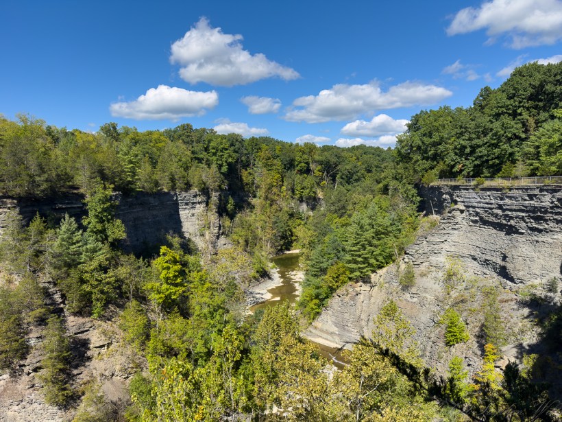
The view from the South Rim Trail. From a walk around Taughannock Falls State Park, down the South rim Trail, up the North Rim Trail. September 14, 2026

The gorge opened first as architecture: a long cleft of layered stone, inhuman shades of gray, cut by water through an immensity of time. From the rim, the creek below seemed almost modest, a brown-green ribbon moving through a corridor it had patiently made. The cliffs did not appear carved so much as remembered into shape. Bed after bed, ledge after ledge, they held the ancient sea in their faces. The rock seemed written in lines, a ledger of vanished depths, pressure, uplift, frost, collapse, and flow. Trees clung wherever they could. Roots found cracks. Cedars leaned over voids. Hardwood trunks rose from impossible perches, answering stone with leaf.

An extravagant sky above all. This blue, saturated and clean, carried great white clouds across the park like slow, wandering thoughts; too soft for a place so sternly cut by geology. Yet that contrast is part of Taughannock’s power: air and stone, cloud and shale, the brief and the enduring sharing one frame. The clouds drifted without urgency while the gorge below testified to forces that measure themselves in millennia. Standing there, the human mind is pulled in two directions at once—toward the fleeting weather of the day and toward the deep patience of the earth.
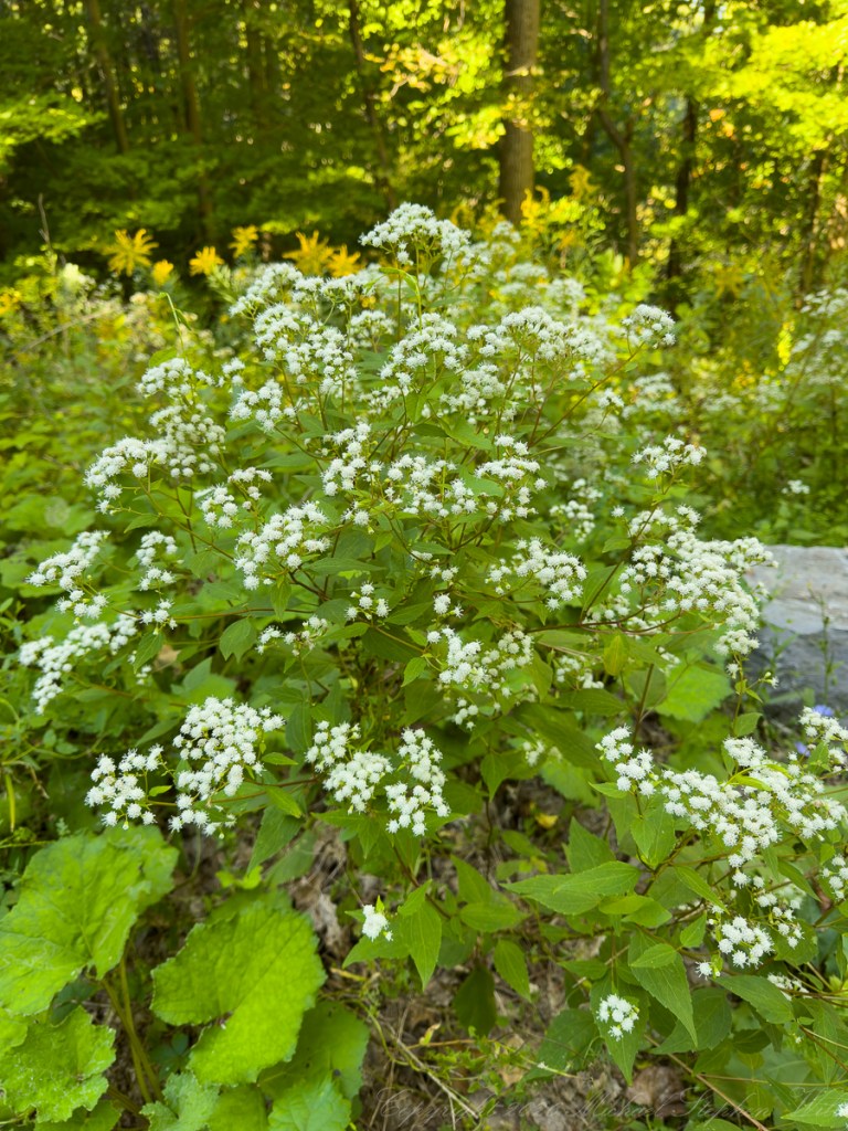
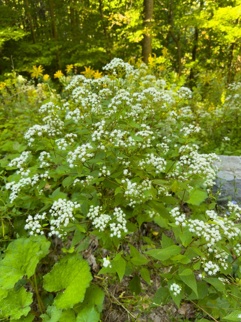
Snakeroot, a poisonous perennial herb

Along the wooded trail, the eye dropped from grandeur to intimacy. White snakeroot bloomed in loose clusters, each tiny flower a small, tufted star gathered into a milky constellation above serrated leaves. Behind it, the forest glowed with the filtered green light of late summer. Goldenrod rose farther back, blurred into warmth. The plants seemed not lesser than the falls or cliffs, only quieter. Requiring a different scale of attention. The gorge overwhelms; the flower invites. One must bend inward to see it properly.
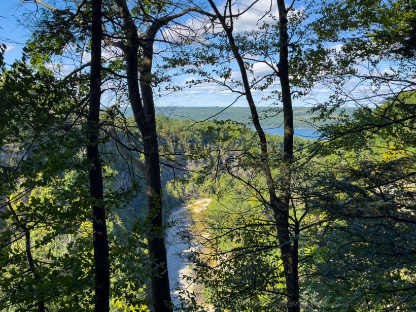
Seen from the South Rim Trail.

Through the trees, Cayuga Lake appeared like a blue promise beyond the gorge. Branches crossed the view in dark strokes, turning the scene into a natural stained-glass window: cliff, water, sky, leaf. The lake lay beyond the ravine’s mouth, broad and reflective, suggesting release after confinement. The creek that had moved through shadow and stone would eventually find that open water. There was comfort in that progression: narrowness giving way to breadth, descent becoming arrival.
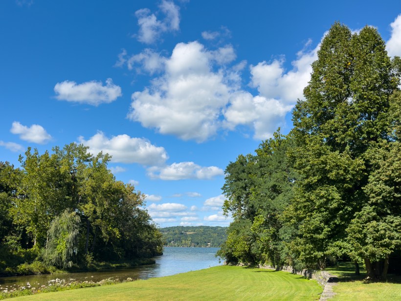
Mouth of Taughannock Creek as it enters Cayuga Lake

At the lakeside, the mood changed again. The same day, the same park, but another world. A green lawn sloped toward the water, bordered by trees heavy with leaves. The lake opened between them, wind-textured and blue-gray beneath the marching clouds. The place felt pastoral after the sternness of the gorge. Here the land breathed easily: gorge cliffs were replaced by open distance, by the far shore softened with trees and scattered houses. The park became a threshold between cultivated calm and wild excavation.
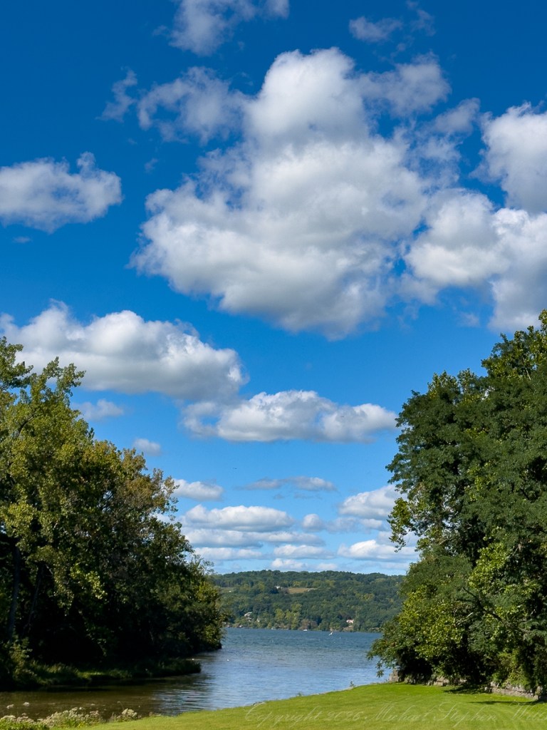
I enjoy the layered effects of clouds.

Then the camera turned upward, giving the sky its own portrait. The clouds took on presence, no longer background but subject—rounded, luminous, casting faint shadows upon themselves. Below them, lake and shore narrowed into a band, as though the world had been rearranged so that sky could speak first. There is a kind of mercy in such a sky. It loosens the mind. It reminds us that even above a gorge, above evidence of erosion and collapse, there is spaciousness.
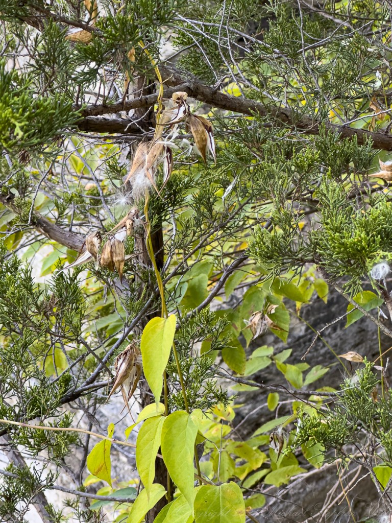
Black Swallow-wort (Vincetoxicum nigrum). Found along the North Rim Trail.

Among the cedars, split pods had released their silk. Pale filaments caught on rough branches and evergreen sprays, small scraps of flight arrested in mid-escape. The pods hung dry and curled, their work nearly done. Seeds that had been hidden were now entrusted to air. This, too, was September’s language: opening, loosening, letting go. Not the dramatic fall of leaves yet, but a subtler surrender. The season had begun to unfasten its clasps.
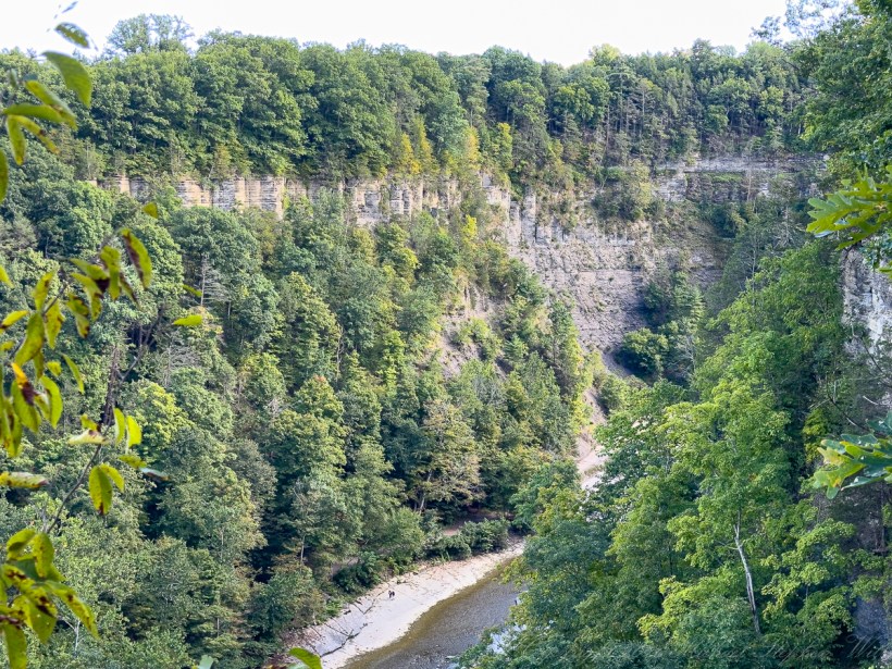
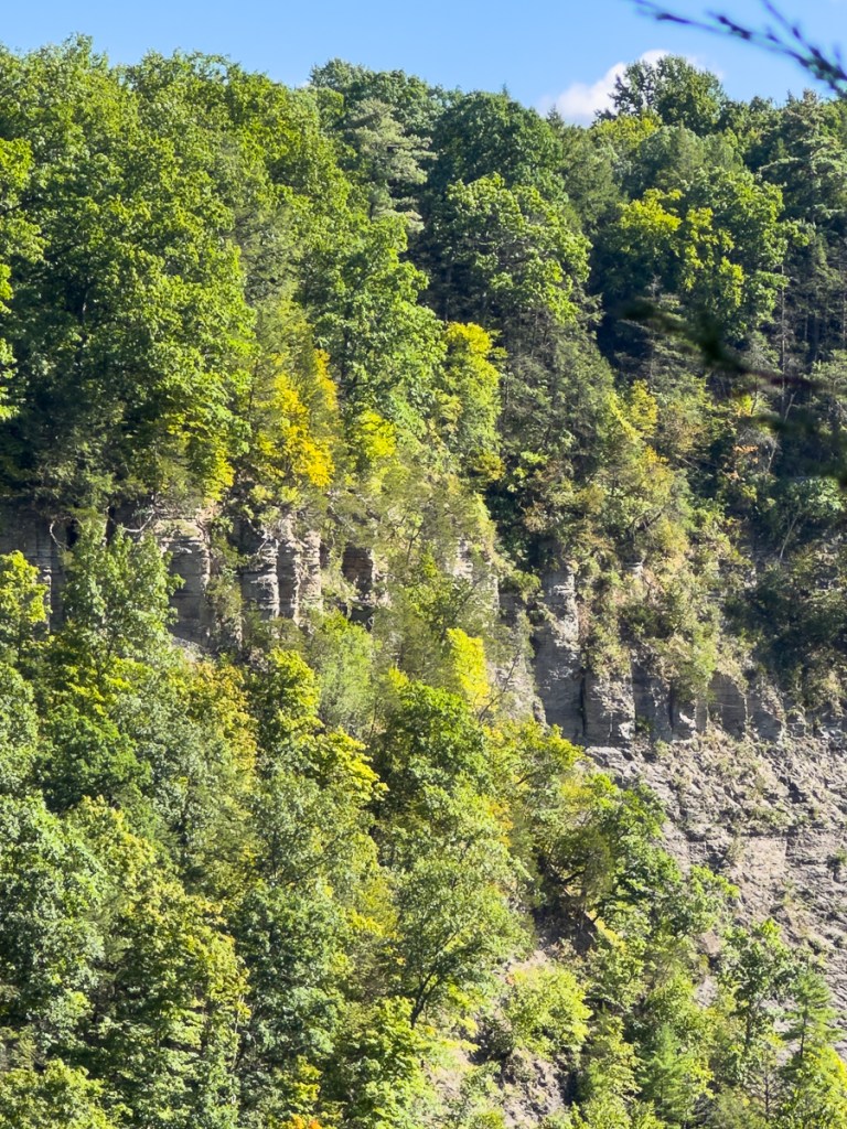
A view from the North Rim Trail.

From another rim view, the gorge wall rose in broken columns and pale faces, half-covered by green. Vegetation softened the precipice but did not conceal it. The cliff remained adamant, a vertical memory of water’s persistence. Far below, the creek bent through bars of exposed stone, and tiny figures on the gorge floor gave scale to the scene. The people were scarcely marks against the immensity, yet their presence mattered. They reminded the eye that wonder is not abstract. Someone stands there, looks up, and receives the place.
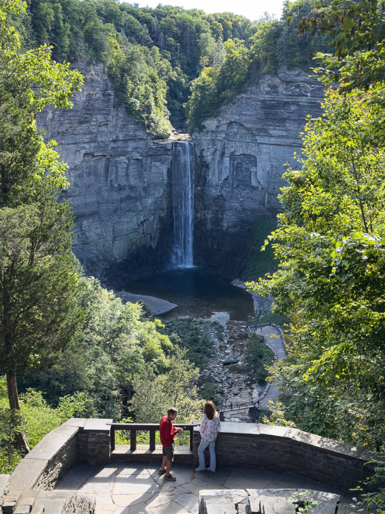
The visitors are on the overlook, in the gorge on the bridge and below the falls.

At the overlook, Taughannock Falls appeared framed by stone and leaf, descending in a long white irrepressible column into the dark basin below. The falls seemed both powerful and delicate, a veil and a force. Water dropped from the high lip in strands, gathered itself in motion, then shattered into mist and sound. Around it, the cliffs bore stains, fractures, alcoves, and ledges—the wounds and ornaments made by time. Layers of visitors receed in the foreground, small and temporary, held for a moment before the great amphitheater.
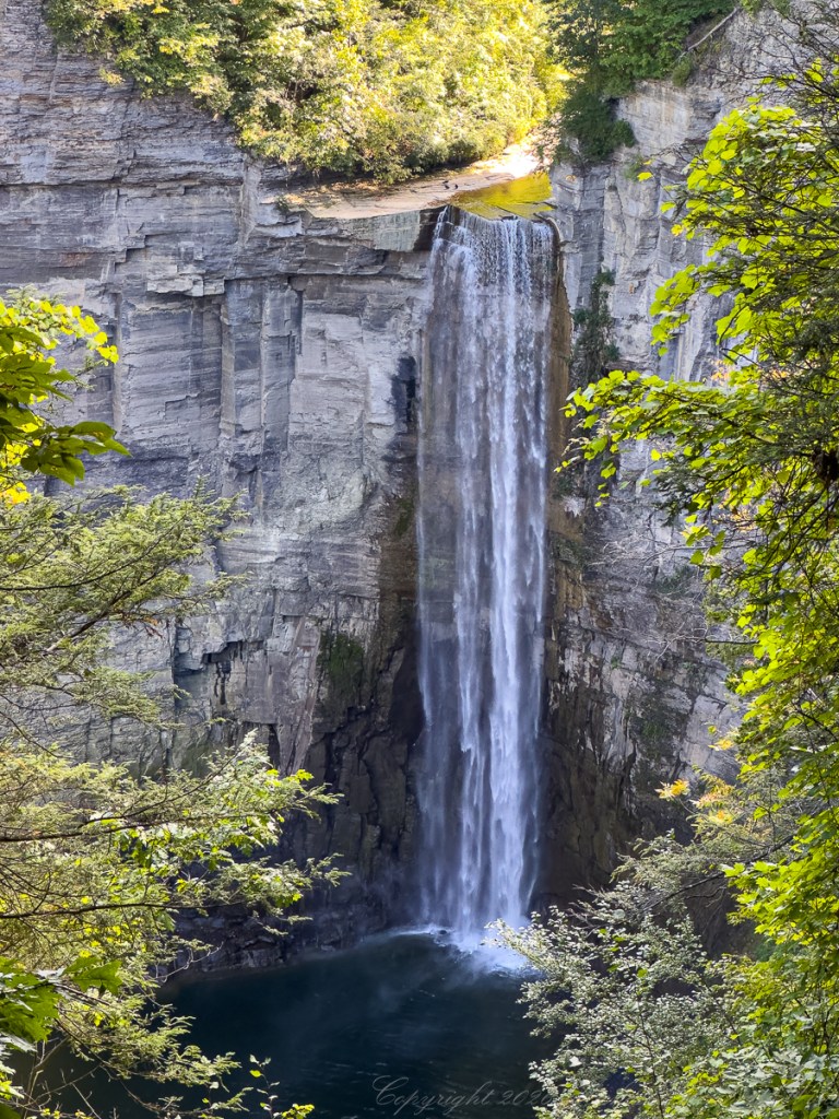
For this view proceed south on the North Rim Trail from the observation area parking. Did you spot the gathering of crows?

Farther along the North Rim Trail, the falls filled the vision. Sunlight touched the rim above; shadow deepened the plunge pool below. The water seemed to fall from brightness into mystery. That is often how memory works: a clear edge, a shining beginning, then a descent into depths we cannot entirely see. Yet the sound continues. The motion continues. The stream that vanishes in shadow reappears downstream, moving toward the lake.

Watch on YouTube for the best experience.

For me, what remains from this walk is a whole sequence: cliff and cloud, snakeroot and seed silk, lake and lawn, distant figures and enduring stone. Taughannock on September 14, 2026, offered no single lesson. It offered a composition of scale. The vast does not cancel the small. The flower belongs beside the gorge. The seed silk belongs beside the falls. The human figure belongs, briefly, gratefully, at the overlook.

By God’s Grace the water keeps falling.
Click me to visit Michael Stephen Wills Online Finger Lakes Gallery.

Enter your email to receive notification of future postings. I will not sell or share your email address.

Drombeg Fulacht Fiadh: A Journey Through History

Join Mike and Pam at Drombeg Stone Circle to explore stone hut remains and a mysterious hearth beside the Fulacht Fiadh in Ireland’s green landscape.

A narrow path, a handful of low stone walls, and small white flowers scattered through the grass: the photographs of our exploration at Drombeg preserve details that invite a closer look. Beside the Fulacht Fiadh, two adjoining huts survive as outlines in the ground. Exploring this part of the site with my wife, Pam, gives me a way to think about the people behind the stones, even when so much of their story remains beyond our reach.

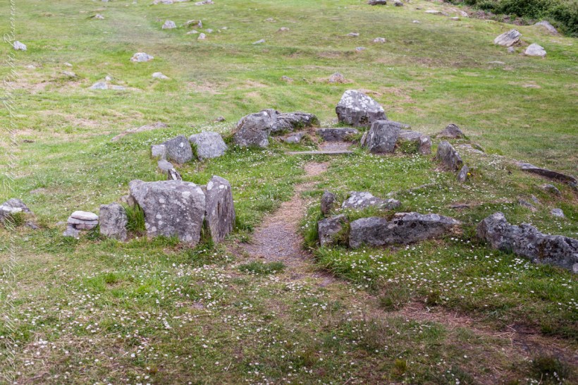
Approach to Hut A

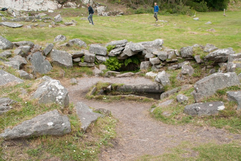
The first photograph, one of the huts, draws the eye along a worn strip of earth toward an opening between upright stones. Beyond it, the hut’s curved boundary gathers a patch of grass into something recognizable as a space. Some stones stand prominently; others barely rise above the turf. Pale lichen marks their faces. Small flowers grow around their bases, softening the edges without quite concealing the arrangement.

Looking at that opening, I imagine the simple act of entering. It is an ordinary movement, one Pam and I have made through countless doorways together. Here, the surviving stones give that familiar action an unfamiliar setting. What would it have meant to cross this threshold when the hut was in use? The photograph cannot answer, but it makes the question feel close enough to linger over.
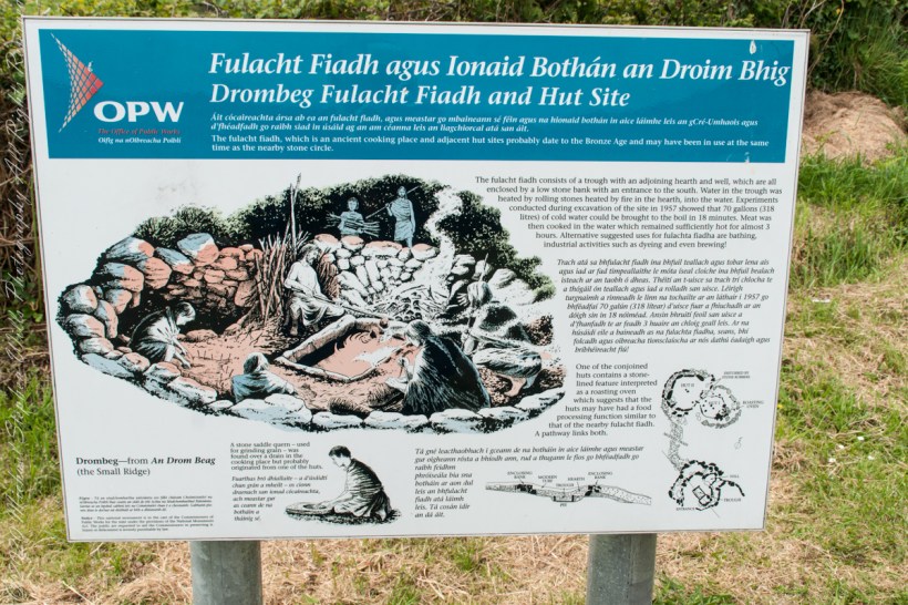
Drombeg Fulacht Fiadh and Hut Site The fulacht fiadh, which is an ancient cooking place and adjacent hut sites probably date to the Bronze Age and may have been in use at the same time as the nearby stone circle.
The fulacht fiadh consists of a trough with an adjoining hearth and well, which are all enclosed by a low stone bank with an entrance to the south. Water in the trough was heated by rolling stones heated by fire in the hearth, into the water. Experiments conducted during excavation of the site in 1957 showed that 70 gallons (318 litres) of cold water could be brought to the boil in 18 minutes. Meat was then cooked in the water which remained sufficiently hot for almost 3 hours. Alternative suggested uses for fulachta fiadha are bathing, industrial activities such as dyeing and even brewing!
One of the conjoined huts contains a stone-lined feature interpreted as a roasting oven which suggests that the huts may have had a food processing function similar to that of the nearby fulacht fiadh. A pathway links both.
A stone saddle quern – used for grinding grain – was found over a drain in the cooking place but probably originated from one of the huts.
Drombeg—from An Drom Beag
(the Small Ridge)

The accompanying OPW placard give us a few firm details. Drombeg has two huts adjoining the Fulacht Fiadh, with a connecting path. Hut B incorporates a rock-lined hearth that possibly served as an oven. Those few words change the way I read the scene. The low remains become places with a relationship to one another, and the path becomes a useful thread to follow through the scattered stone.

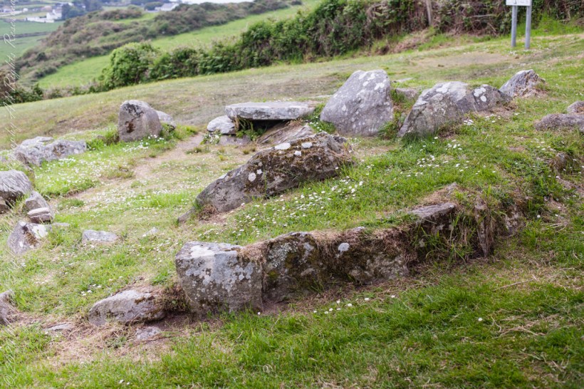
Hut B with a view of the landscape.

In the wider view, the ground slopes away toward hedges, green fields, and distant buildings. Closer to the camera, irregular stones trace the hut through grass and patches of bare earth. A broad, flat slab rests above a dark recess. Nothing in the photograph announces itself with grandeur. Its interest lies in how closely we look, and in the small connections we begin to make.

The hearth is a detail that holds my attention. The OPW placard notes are careful: it possibly served as an oven. I want to keep that uncertainty intact. It leaves room for curiosity without turning a suggestion into a fact. Even with that restraint, the possibility of cooking brings a human scale to the ruins. An oven suggests work to be done, something to prepare, someone waiting.

Can this be anything but a comfortable perch to take in the view? No, the OPW placard suggests its use as a hearth.
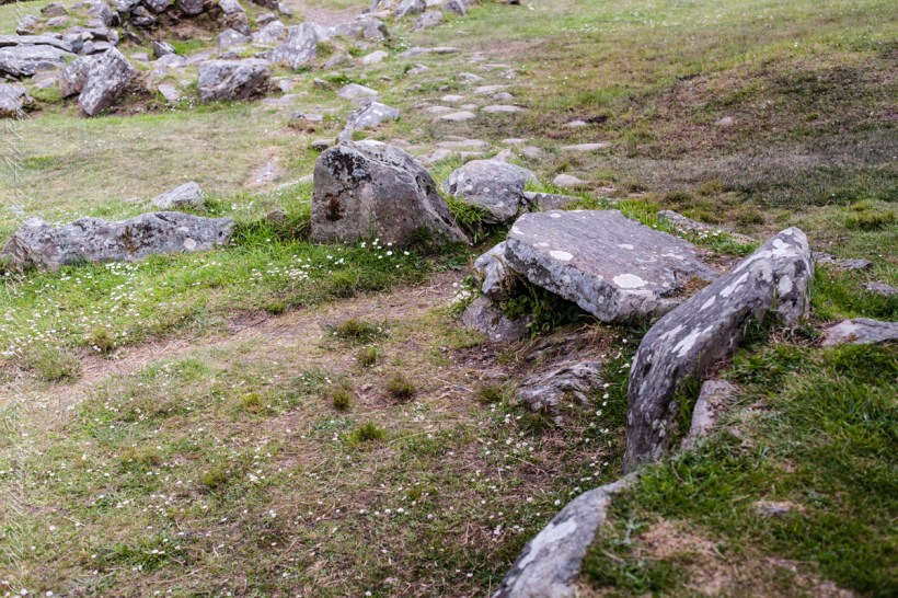
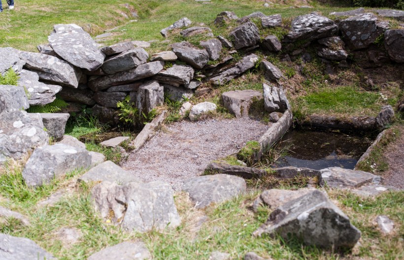
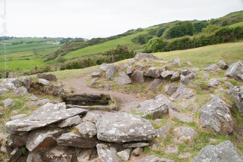
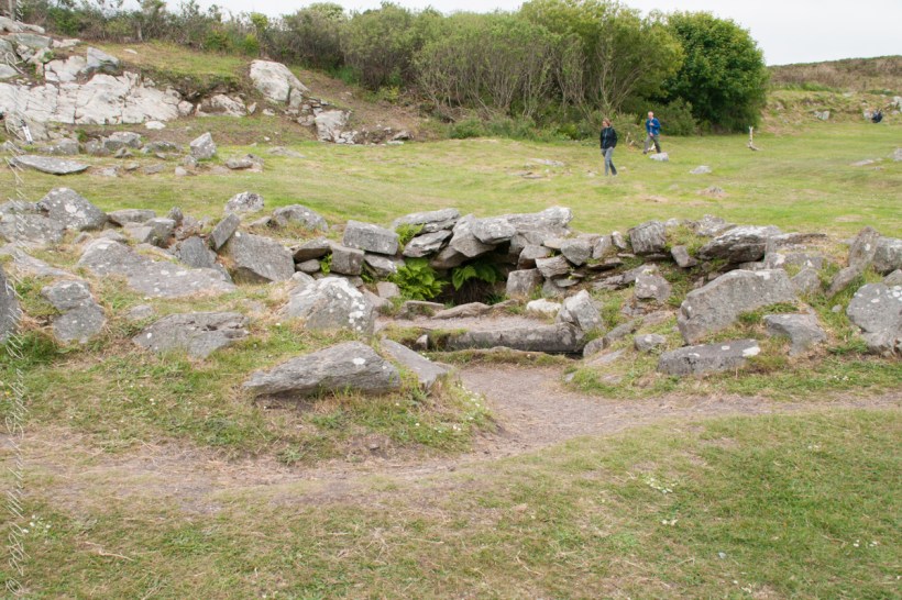
The closest photograph brings the hearth into sharper focus. White patches of lichen spread across the the irregular rock wall. Plants fill small gaps beneath it. The stones lean at different angles, and the trough leads the eye onward. The view holds the intimate detail and the larger setting together, allowing us to consider how these neighboring spaces might have related.

I imagine a person tending heat there, watching carefully, occupied with a task that mattered in the moment. That is an imagined scene, not something these photographs establish. Yet it helps me approach the stones with a different kind of attention. Whoever used this place had practical concerns that we can wonder about, even when their names, words, and particular circumstances are lost to us.

Approaching the Fulacht Fiadh…

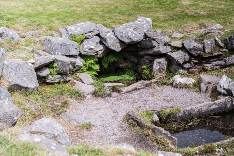
The Fulacht Fiadh site contains a hearth as well.

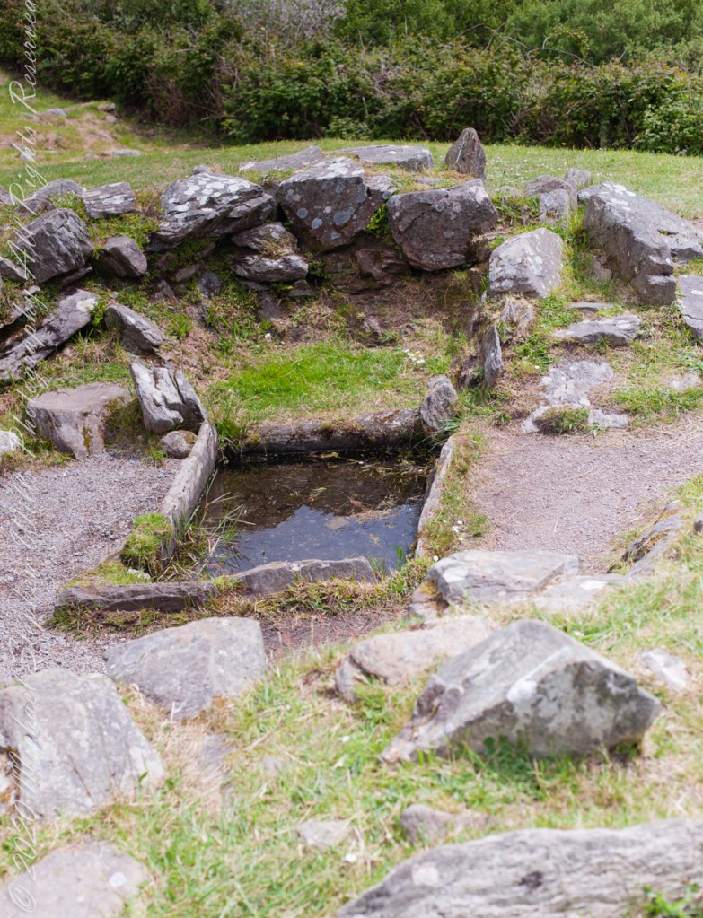
The hearth is to the right of the rock-lined trough, a spring above.
In Fulacht Fiadh investigated there is a link to preparation activity involving heat and moisture. Found throughout Ireland, Great Britan and the Isle of Man where the sites are called “Burnt Mounds”.
In the center of the Fulacht Fiadh is a trough, a water filled pit, which at Drombeg is lined with rock. A water source, a spring to the left (not visible in this photograph), a hearth above.
The water source, a spring.

For me, sharing an exploration like this with Pam offers its own pleasure: having someone beside whom to consider what remains. I cannot supply a remembered conversation from these pictures. I can, however, imagine the questions we might carry away. How much can a surviving outline tell us? At what point does looking become imagining? How do we appreciate a place while leaving its unanswered questions open?

Here we stand behind the sping for a broad view of the landscape. The hearth is to the right of the trough.

These photographs bring back to mind a low doorway, a path, and the hearth. Together, they offer a modest but absorbing way into Drombeg. The flowers are small enough to overlook; so are some of the stones. Giving them attention becomes part of the experience. In this telling of our visit, that is what I would keep: Pam and me exploring the surviving shapes of a place, following what we can see, and letting a few careful questions accompany us.

Click me to visit Michael Stephen Wills Online Finger Lakes Gallery.

Enter your email to receive notification of future postings. I will not sell or share your email address.

From Limestone to Pasture: How the People of Inis Mór Created Soil on this Aran Island

Beneath the green fields of Inis Mór lies a remarkable story of persistence as generations of islanders created fertile soil atop bare limestone.

Standing atop the cliffs of Dún Aonghasa on Inis Mór (Inishmore), one is struck by contradiction. Beneath your feet lies a landscape of exposed limestone, fractured and weathered into the unmistakable geometry of karst. These unworked, barren slopes have a pale green covering growing seemingly on air. The Atlantic crashes hundreds of feet below, while inland the island stretches toward Galway Bay in shades of gray and pale green. It seems an improbable place for agriculture.

Yet there they are: fields enclosed by dry stone walls, dotted with cattle and thick enough with grass to sustain them. Looking out across this island, a question naturally arises. Where did the soil come from?

Click the link for my Getty IStock photography of the Aran Islands

The answer is simple to describe and astonishing to contemplate. The soil of Inis Mór was, in large measure, made by human hands.

The Aran Islands are composed primarily of limestone deposited some 350 million years ago when this part of the world lay beneath warm tropical seas. The shells and skeletal remains of ancient marine organisms accumulated on the seabed and, through immense pressure and time, became stone. Today, limestone accounts for the overwhelming majority of the islands’ bedrock.

Limestone landscapes possess a severe beauty. Rainwater, slightly acidic from dissolved carbon dioxide, which in turn slowly dissolves the rock, creating fissures known as grykes separated by flat blocks called clints. Soil drains rapidly through these cracks. Left to natural processes alone, only thin accumulations of organic material develop and much of the landscape will resemble a stony pavement.

For generations, survival on Inis Mór required transforming that pavement into productive land.

Islanders gathered seaweed from the shoreline, hauling it inland by cart and hand. The seaweed provided organic matter and nutrients, particularly potassium and trace minerals. Sand from the beaches added texture and volume. Mixed together atop the limestone surface, these materials slowly decomposed into something capable of supporting plant life. Over decades—and in some places centuries—layers accumulated.

The process demanded persistence. Storms could strip away exposed earth. Atlantic winds threatened erosion. Each year required renewal: more seaweed, more organic matter, more labor. Roots from grasses and crops helped bind the developing soil together. Animal manure returned nutrients to the ground. What had begun as an artificial growing medium gradually became a living soil ecosystem.

As understood by modern soil science, soil formation is often explained through five factors: climate, organisms, relief, parent material, and time. On Inis Mór, all five are present, but there is a sixth factor impossible to ignore: culture.

Without human intervention, much of the island would likely remain dominated by exposed limestone and sparse vegetation. Instead, generations of residents imposed patience upon geology. Their work transformed an inhospitable environment into a functioning agricultural landscape.

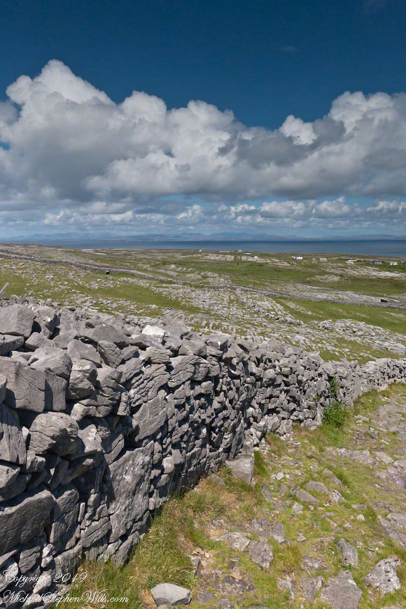
The dry stone walls that divide the island tell the same story. Built from limestone cleared from the fields, they required no mortar. Each stone was carefully selected and placed, creating boundaries that controlled livestock, sheltered plants from relentless winds, and marked family holdings. The walls themselves became part of the ecological fabric, providing habitat for insects, mosses, lichens, and wildflowers.

Visitors often admire these walls for their picturesque quality. They are indeed beautiful and are also evidence of necessity. Every stone removed from a field made space for soil to deepen and grasses to spread. The very act of creating pasture simultaneously generated the material for the island’s defining architecture.

There is poetry in this relationship between hardship and abundance.

In many places, fertile soil is taken for granted. Deep glacial deposits or river sediments create agricultural wealth with little awareness of the thousands of years involved in their formation. On Inis Mór, however, the origins of fertility remain visible. The limestone still protrudes through the fields. The seaweed-strewn shore lies only a short distance away. The walls reveal the labor embedded in the land.

To walk these fields is to encounter a collaboration between people and place extending across centuries. The islanders did not conquer the landscape so much as negotiate with it. They worked within its constraints, borrowing from the sea to enrich the stone and relying upon time to complete what effort had begun.

The resulting landscape offers a quiet lesson. Soil, the foundation of civilization, is created through intricate interactions among rock, water, organisms, and time. On Inis Mór, soil also represents inheritance: the accumulated labor of countless individuals who refused to accept barrenness as destiny.

Viewed from the heights of Dún Aonghasa, the green fields scattered across the gray limestone are miraculous.

Not a miracle of sudden transformation, but one measured in generations—made from seaweed and sand, from patience and persistence, and from the enduring belief that even the most unpromising ground can, with enough care, be coaxed into life. 

The answer is simple hard work, hundreds, a thousand years of hauling seaweed and sand, mixing it on the barren limestone, allowing the rot of time to work. Hold it down with roots, till and refresh.

Click me for the first post of this series, “Horse Trap on Inishmore.”

Enter your email to receive notification of future postings. I will not sell or share your email address.

“Great Blue Herons at Cocoa Beach: A Space Coast Morning on the Atlantic

Along the luminous seam of surf and sand, a heron reads the tide’s slow grammar, patience embodied, until water yields a silver secret and morning becomes ceremony.

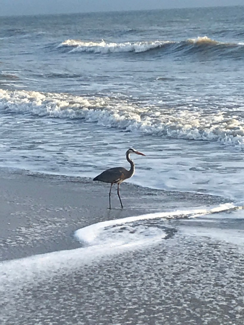
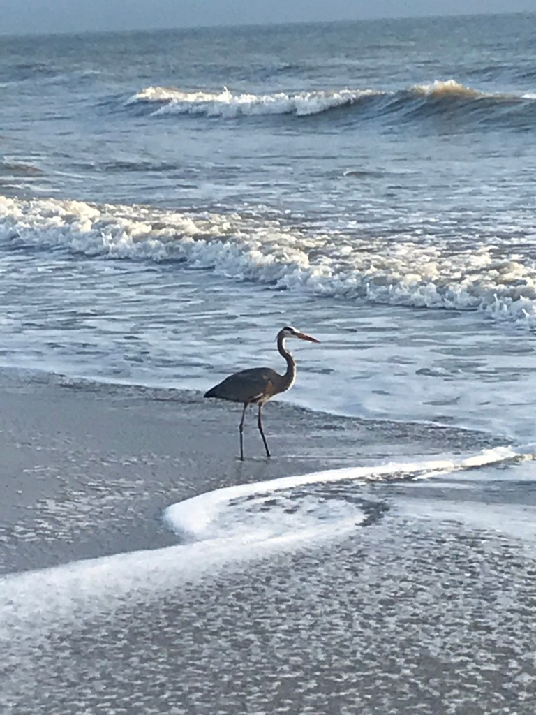
We walk the long seam where the Atlantic writes its restless script, and our beachcombing becomes a study in attention. The shore’s edge—where foam loosens shells from sand and the wind arranges salt on the tongue—draws other walkers too: grey herons, patient and arrow-straight, patrolling the surf line as if reading a language older than tides. They halt us without trying. We stand, quieted, while they work the boundary between water and land, between hunger and satisfaction.

I pack an iPhone sometimes for beachcombing as a lightweight alternative to SLRs. This post features iPhone photographs.

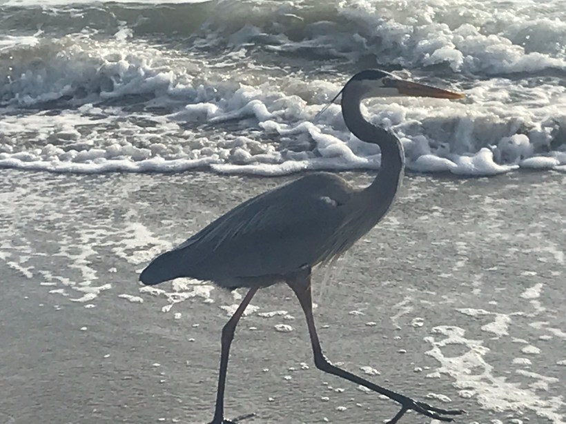
Along this narrow world of sand and surf, herons keep two distinct manners. Some linger near anglers, learning the thrift of handouts and the craft of appearing inevitable. Others refuse that bargain and hunt on their own, staking the wash with a slowness that is not delay but method. These independent operators move along the ocean’s margin: high enough to let the breakers fold ahead of them, low enough that their long legs stir the small lives hidden in the cross-hatching currents. To follow one with the eye is to adopt a different clock. Sandpipers skitter and dash; the heron lengthens time.

A perfect place to stalk the surf

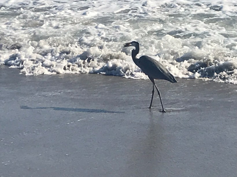
At first the bird seems merely spellbound by light on water. Then a shift: a narrow cant of the head, the smallest realignment of the eye to the glare. The neck—serpentine and stored with intention—uncoils quick as a strike, and the bill cleaves the surface. The world either yields or it doesn’t. Often it doesn’t. When it does, the beak lifts an impossibly large, glinting fish, as if the ocean had lent out a secret.

Success!!

What follows is ceremony. The heron stands and calibrates, turning the silver length with almost invisible nods until head and prize agree. A sharp jerk aligns the fish with beak and gullet; the upper throat swells, accepting the whole, unchewed. Two more pulses and the catch is a memory traveling inward. It is an astonishment every time, not because we do not understand what is happening but because we do, and still it exceeds us.

We carry a smart phone on these morning circuits, a slim stand-in for heavier glass, enough to witness without intruding. Backlit by the early sun, the herons are cut from bronze and shadow, working the luminous edge while the day composes itself behind them. In the afternoons we meet fewer of the solitary hunters when the strand belongs more to the opportunists near the thinning knots of anglers. Why the shift, we cannot say. The ocean has its schedule; so, it seems, do its readers.

If we keep our distance, we are permitted to watch. Cross a line we don’t perceive and the bird will rise all at once, the long body unfolding, the voice a rasping scold torn from the throat of reed beds and marsh dawns; but, grant it enough space, and the heron returns us to the lesson it keeps teaching: that patience is a kind of movement; that the boundary of things is where change is clearest; that the most astonishing acts require the courage to do very little, very well, for a long time.

We come to linger where the waves erase our tracks, apprenticed to that slow grammar, trying to learn the tide’s careful verbs before the light turns and the day becomes something else—a different text, the same shore, the heron already a thin signature against the horizon.

Enter your email to receive notification of future postings. I will not sell or share your email address.

Glacial Echoes: Dryden Lake Park’s Mirror-Calm Morning in Upstate New York

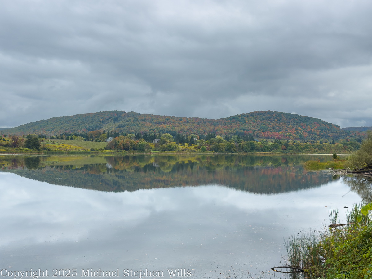
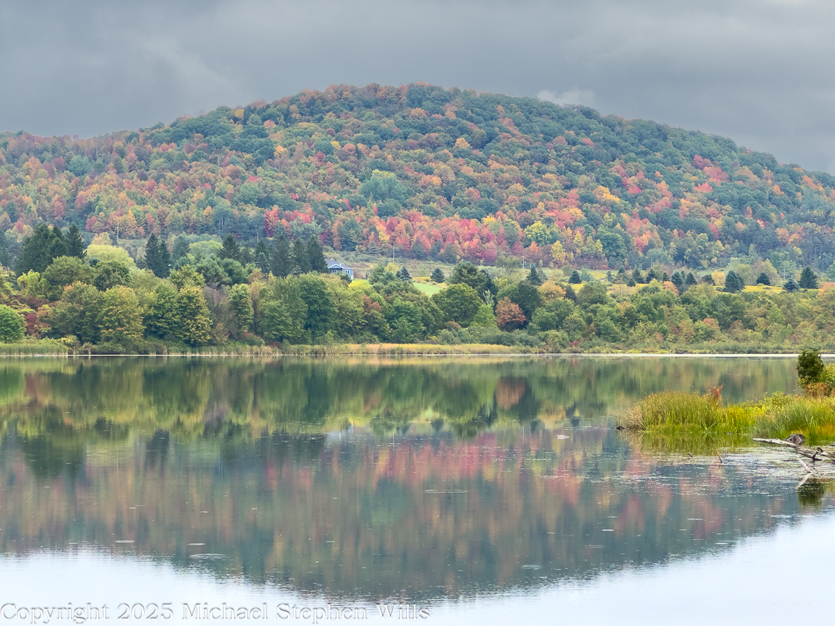
Morning clouds hang over Dryden Lake as hills kindle first color; reflections hold breath while a lone walker reads the valley’s glacial and human-written past.

He came to the water before the people woke, the road a still ribbon of cold tar snaking beneath the low hills. Mattocks of cloud hung over the valley and the lake took in the sky like a mirror dropped yet not broken. The trees were beginning to color. A patient fire working from within the leaves. He parked where the grass ran down to the shore and stood a long while without moving. Birds made small sounds in the reeds. Somewhere a single truck labored up the grade and was gone. The surface held the hills with a steadiness the hills themselves could not keep. He thought how the quiet of a place can be the loudest thing it owns.

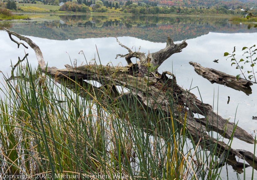
He went along the margin along the damp sedges where old drift lay silvered and light as bones. A drowned trunk angled from the shallows. The lake was old in the way of things made by ice and time. A kettle in the outwash of the last glacier, some men said, a bowl left when the buried ice eased away. He pictured the ice receding into the valley heads, the meltwaters choked with gravel, a hand larger than memory scribing the floor of this country. The earth never told it plain but the lay of it was witness enough. Across later centuries men cribbed a dam across the outlet and drew the water to a shape that pleased them and served their work.

A trail ran the length of the water on the old rail bed. The ties were long gone and the iron and cinders buried under years of leaf fall and gravel. He had walked it as a boy beside his father and now he walked it alone. Benches stood at half-mile intervals like waystations in a country of small pilgrimages. The signs told what once was here and what remains. They had renamed the path for a townman who argued it into being after the railroad had passed from the world and the right-of-way grew up with sumac and rumor. It was an easy trail and he carried nothing. His hands hung at his sides as if the day might place something in them when it was ready.

In another era the lake was a workshop. Men whipsawed timber in the wet air and fed small mills with the grove’s dark boards. Winter flowed over the flats, and they built icehouses and set the blocks within like blue stone, an industry that died when cold could be called from a switch. The hills have learned to forget the noise of it, though on certain mornings the fog takes a shape and you could believe rising from the ponded sawdust and the lading of sleds. He thought of the labor of those gone hands and of how work is a scripture every place keeps in its own tongue.

Before any of that, the ground here was a summer camp. People came with the season and went with it, laying their fires in the lee of the knoll and taking fish where the cattails thin. He could feel them in the open places, not as ghosts but as the first understanding the land ever had of itself. The words used for them now are museum words, yet the wind still crosses the water as it did and empties the same smell of iron and leaf into the lungs of whoever stands to breathe.

The town took its name from a poet long dead, a scholar’s choosing in the years after the war for independence when this tract of country was parceled out to soldiers of that same war. Virgil lay to the east as if they were shelving Latin across a map. The creek that bears that name threads the villages and finds Fall Creek at Freeville, and the combined waters go their own slow way toward Cayuga where the glacial hand scooped deeper yet. He said these names under his breath and they tasted of chalk and river stone.

A kingfisher rattled across the cove. The fish rose in rings that spread and vanished like time seen from above. Out on the water an old man pushed a skiff with an electric motor that hummed like a trapped bee, for the lake allows no gas engines now. The wildlife area ran around the shore in a ragged collar of field and wetland and alder, near two hundred acres under the state’s keeping, and the lake itself a little over a hundred. He watched the man aim for the lily line and thought how rules arise from the wish that a thing endure, though nothing does. Still we make the rules and we keep them as if the earth were listening.

Wind came down the slope with a smell of rain. He turned back and the hills lay again in the water, entire, and for a moment he could not tell which world had claim to the other. He thought of the rails pulled up and the mills gone to weeds and of the icehouses fallen into their own shadows and he thought of the people before all that and of the long winter pressing its thumb into the land and lifting it away. He thought of his father walking the rail bed beside him a lifetime ago and saying nothing. There are places where the past crowds close and will not be argued with. He stood until the first drops dimpled the surface and the reflection shattered and reformed. A train no longer runs here. The only sound was the soft percussion of rain on water and the slow turning of the earth beneath both. He put his hand to the damp trunk of a fallen tree and felt the grain and the coolness and the old patient labor of rot. Then he went up from the reeds, his pockets full of acorns, and out to the road where his truck waited and the day, austere and sufficient, came along with him.

References

Geological History and Glacial Formation of the Finger Lakes

Jim Schug Trail

The Dryden Lake area in the 19th century

Indian Campsite on west side of Dryden Lake

Dryden New York (wikipedia)

Dryden Lake (New York State DEC)

Geohydrology, Water Quality, and Simulation of Groundwater Flow in the Stratified-Drift Aquifer System in Virgil Creek and Dryden Lake Valleys, Town of Dryden, Tompkins County, New York

Enter your email to receive notification of future postings. I will not sell or share your email address.

Historical Wonders of Ashford Castle and Its Natural Surroundings

At Ashford Castle, swans glide on the Cong River’s glassy waters, weaving together myth, history, and cinema in a timeless reflection of Ireland’s enduring spirit.

Headed south from Cong Village, past the venerable Cong Abbey then Saint Mary’s Church of Ireland, the road bends into the Ashford Castle estate. Time seems to shift here. The stonework of the abbey lingers in memory, only to give way to manicured parkland, ancient trees, and the shimmer of water. The road itself, aptly named Ashford Castle, carries the traveler to a place where history, nature, and imagination meet.

I do not recall passing a guard box on my first visit, though one now stands firmly on the roadside, manned and proper, as though the estate were never meant to be entered without ceremony. In truth, Ashford Castle has always carried the air of a threshold—between village and wild, past and present, myth and reality.

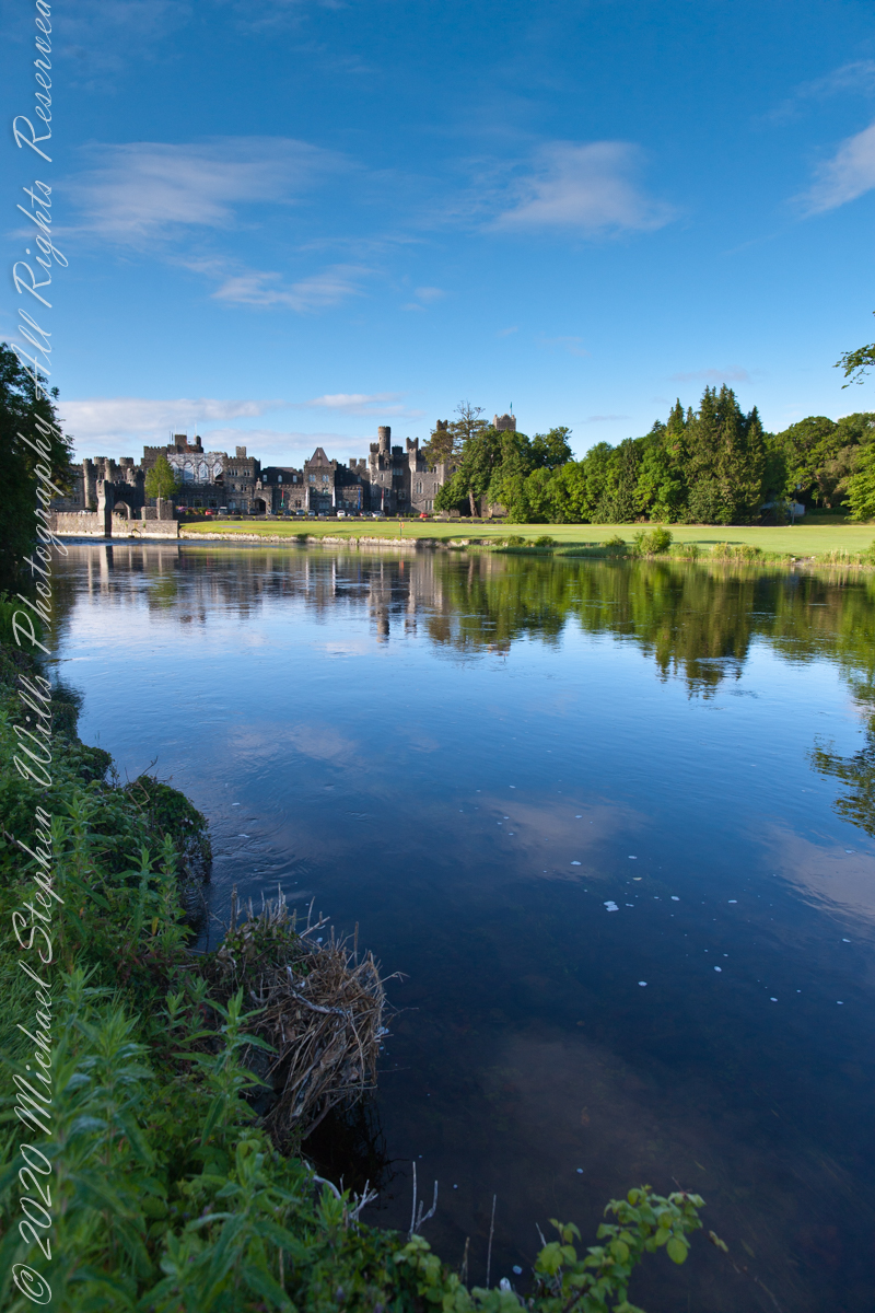
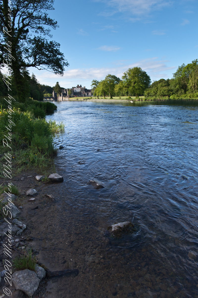
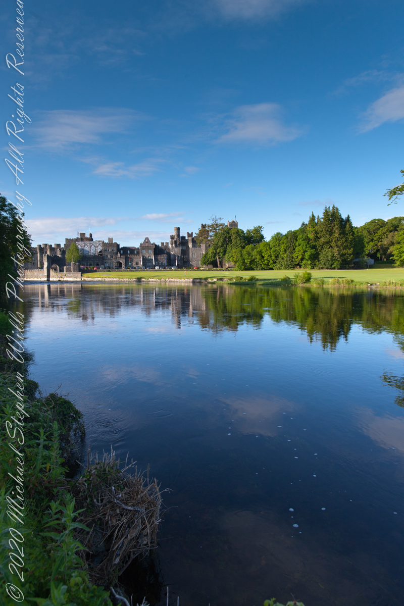
Soon the road brings one to the banks of the Cong River. Here the water widens, flowing calm and sure, and across it rises the battlemented silhouette of Ashford Castle itself. Its towers, turrets, and stony walls seem to grow from the riverbank like something inevitable, a fortress transformed into elegance. The castle’s mirrored reflection on the water doubles the grandeur, as though the real and imagined castle exist side by side.

It is no wonder filmmakers found inspiration here. Scenes from the classic 1952 film The Quiet Man—the tale of Sean Thornton, played by John Wayne, and the fiery Mary Kate Danaher, embodied by Maureen O’Hara—were shot on the far bank of this very river. To watch them walking by these waters is to see Ashford Castle woven into Hollywood’s Irish dreamscape, a backdrop both romantic and enduring.

Yet long before cinema, the river was already a stage. The Cong River is a natural marvel. It emerges from the same Carboniferous limestone that shapes the Burren of County Clare—an austere landscape of limestone pavements etched with fossils and caves, where rare alpine and Mediterranean plants thrive among ancient tombs. Through fissures in this ancient bedrock, the waters of Lough Mask find their way underground before rising again at Cong. This subterranean journey, through stone filters laid down some 350 million years ago, leaves the water clarified, luminous, and cold. By the time it slides past Ashford Castle, it has the purity of glass.

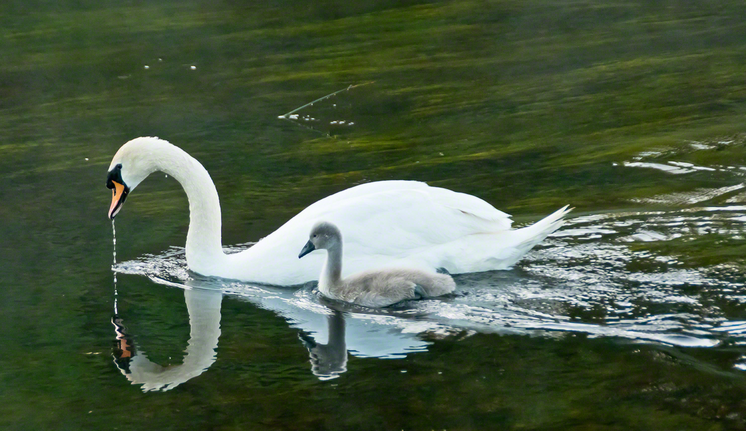
It is in this clarity while walking the opposite bank on a different morning I found a parent swan and its cygnet feeding. The adult glided, immaculate, its long neck bowed as drops of river fell from its beak. At its side, the cygnet paddled with earnest strokes, gray down still clinging, a fragile shadow of what it would one day become. Together they traced a quiet path across the water, ripples fanning behind them.

Few images so perfectly match their setting: a medieval castle, guardian of centuries, reflected in the same waters where these swans carried on their timeless rhythm of nurture and growth. It was as if the river itself composed the scene—a blending of stone, water, bird, and sky that belonged nowhere else but here.

The swan has long been a symbol in Irish lore. The Children of Lir, cursed to live as swans for nine hundred years, are among the most haunting figures of Celtic mythology. To see the white bird with its offspring before Ashford Castle was to glimpse that myth breathing still, alive on the Cong River.

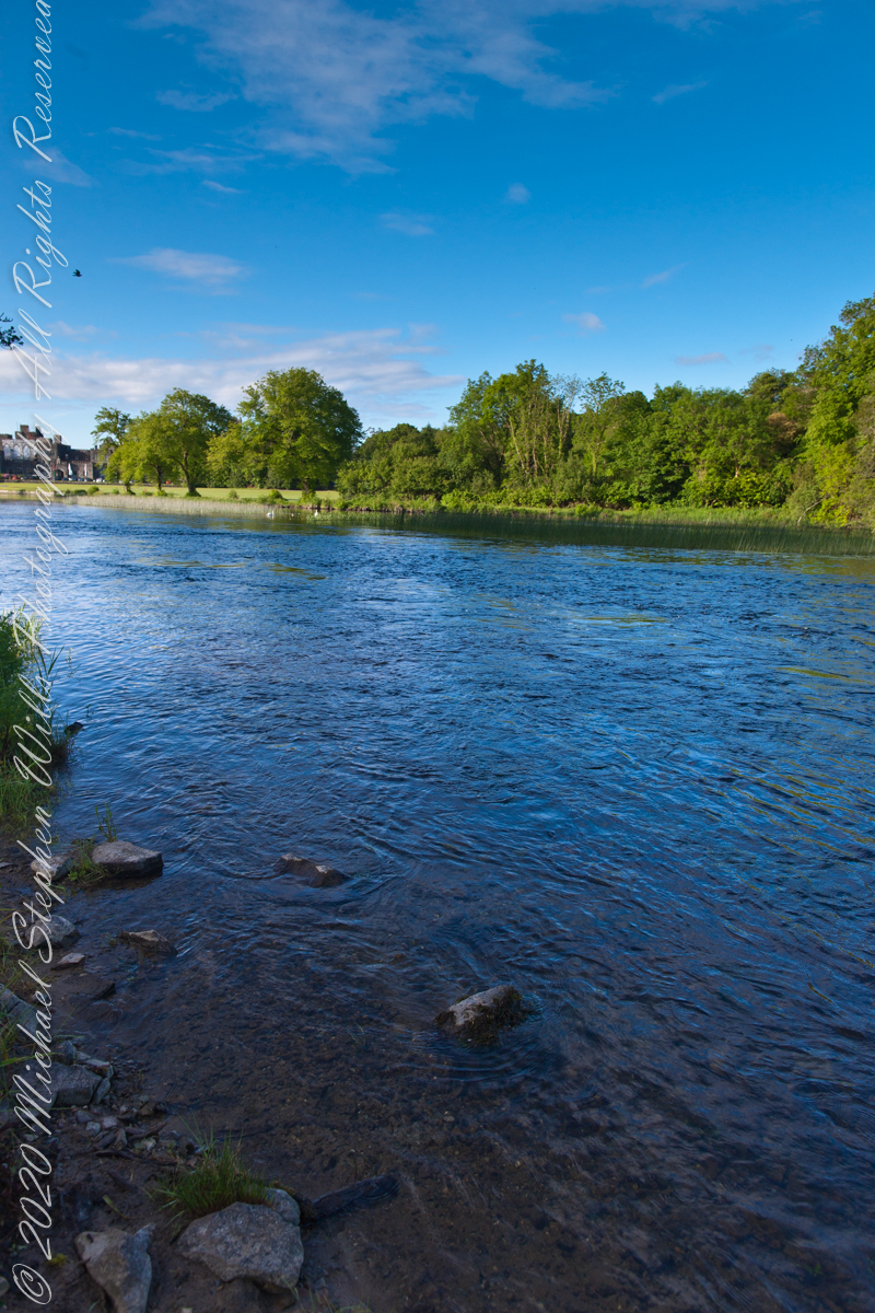
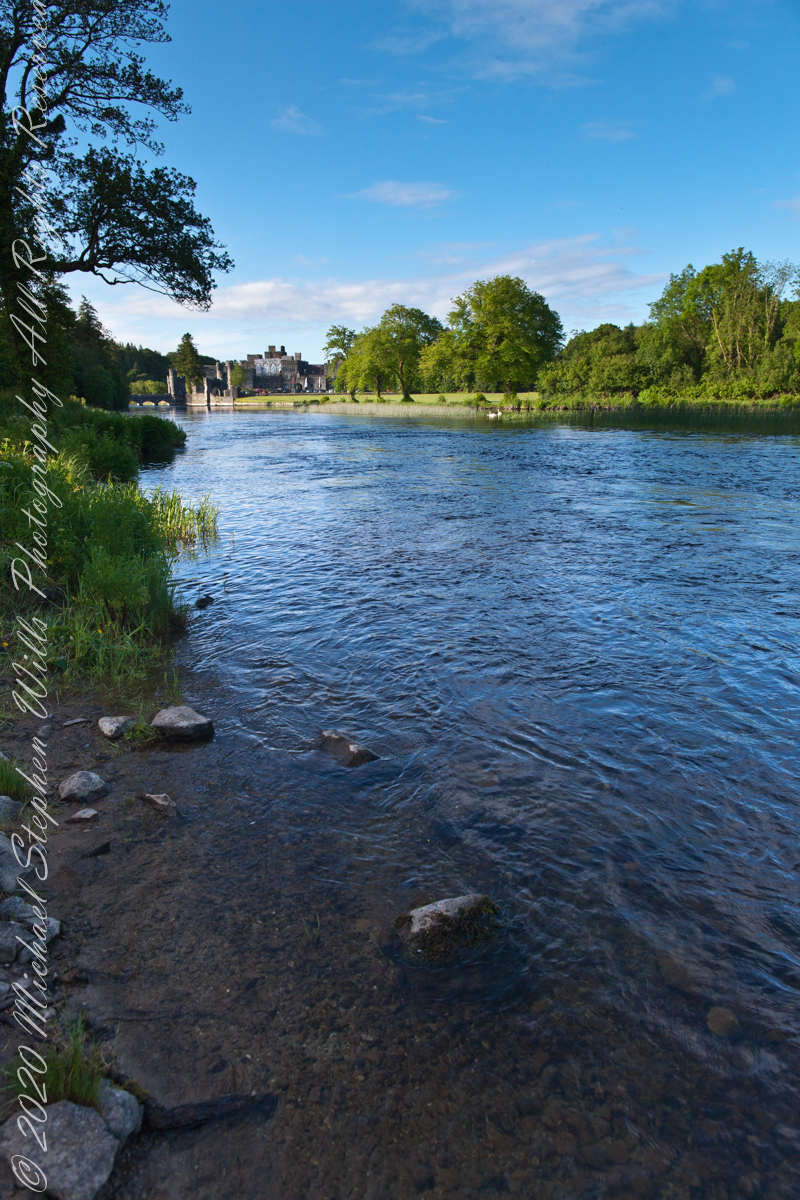
Photographers know the difficulty of capturing water and stone without losing the life between them. On that morning, however, the river gave freely—its surface alternately smooth as glass and dappled with breeze. Stones at the water’s edge appeared like stepping-stones into history. Each frame revealed another face of the estate: the wide reach of the Cong, the castle framed by trees, the play of cloud shadows across the current.

The castle itself, though reshaped as a luxury retreat, still speaks of older times. Founded in the 13th century by the Anglo-Normans, Ashford passed through centuries of conquest and change before becoming, in the 19th century, a romantic Victorian pile. Today its battlements remain picturesque rather than defensive, but the sense of continuity—of lives unfolding along these banks—has not faded.

Standing there, camera in hand, I was struck by the layered meaning of this place. The Cong River flows from unseen caverns, purified by limestone older than memory. It nourishes swans, reeds, and trout alike. It reflects both a castle and a sky. Along its opposite bank, legends of cinema and Celtic lore alike find footing.

As the swan and cygnet drifted slowly downstream, I thought of them as part of the same enduring thread. Parent and child mirrored castle and village, past and future, permanence and change. The ripples they left widened until they touched both banks, an unbroken gesture across centuries.

Click this link to read another Ireland story “The Cloigtheach of Glendalough.”

Click this link to read another Ireland story “Killeany Bouy.”
Enter your email to receive notification of future postings. I will not sell or share your email address.

Myth and Art: The Sirens of Punta de las Salinas

At Punta de las Salinas, Lily Perkins’ sculptures embody siren mythology, merging art with the rugged beauty of nature’s edge.

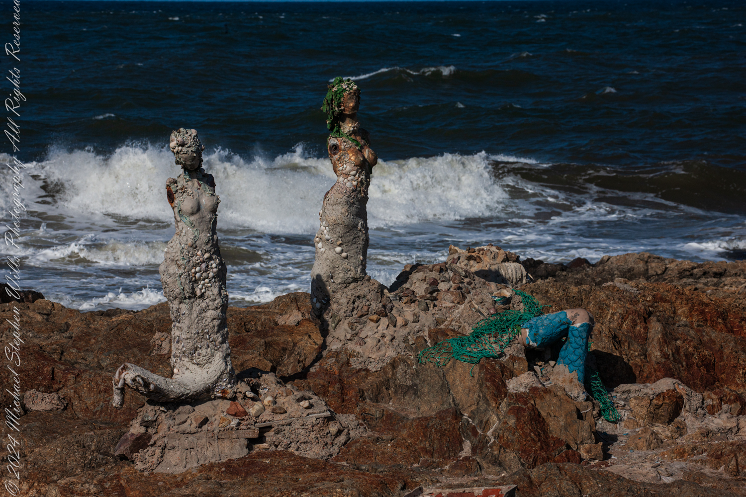
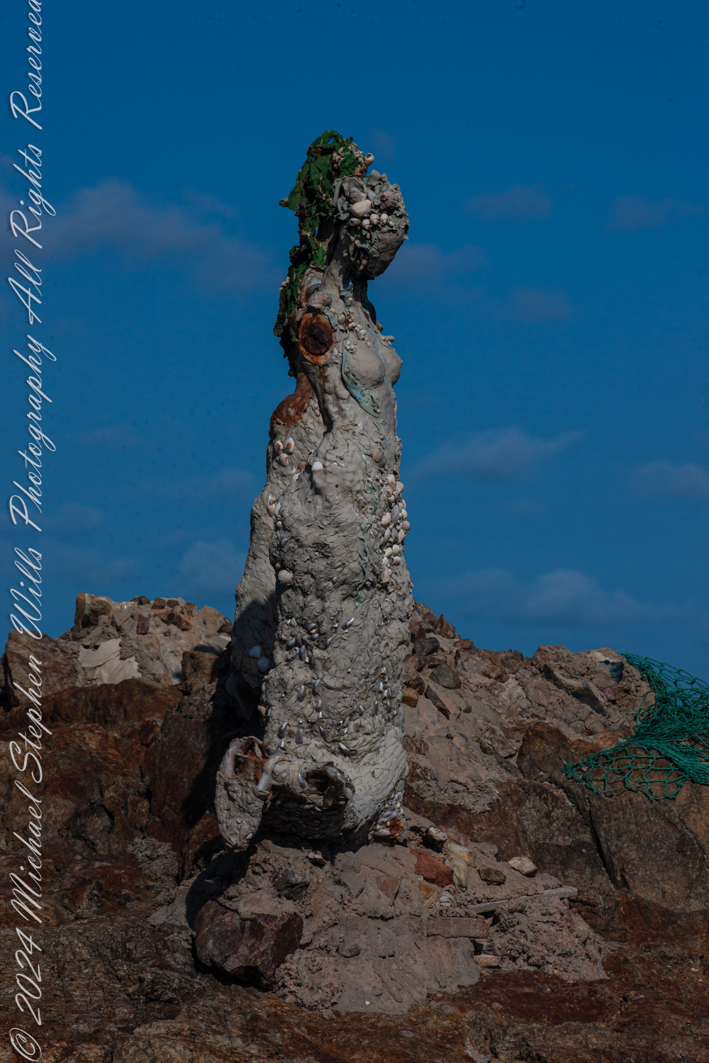
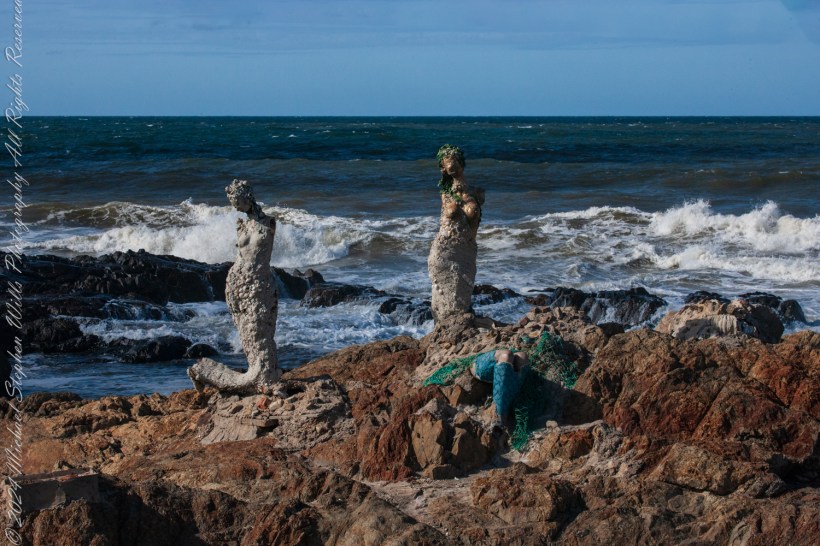
The wind carried the scent of the sea as we stood at Punta de las Salinas, the furthest tip of Punta del Este, Uruguay. This was a place of myth and mystery for us, where the Atlantic Ocean merged with the Río de la Plata, and where the rocks bore witness to the timeless interplay of water and stone. Here stood “El Canto de las Sirenas” (The Song of the Mermaids), an evocative art installation by Lily Perkins, first completed in 2012. The sculptures seemed perfectly at home here, their placement deeply intertwined with the mythology they evoked.

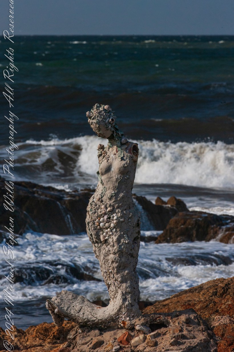
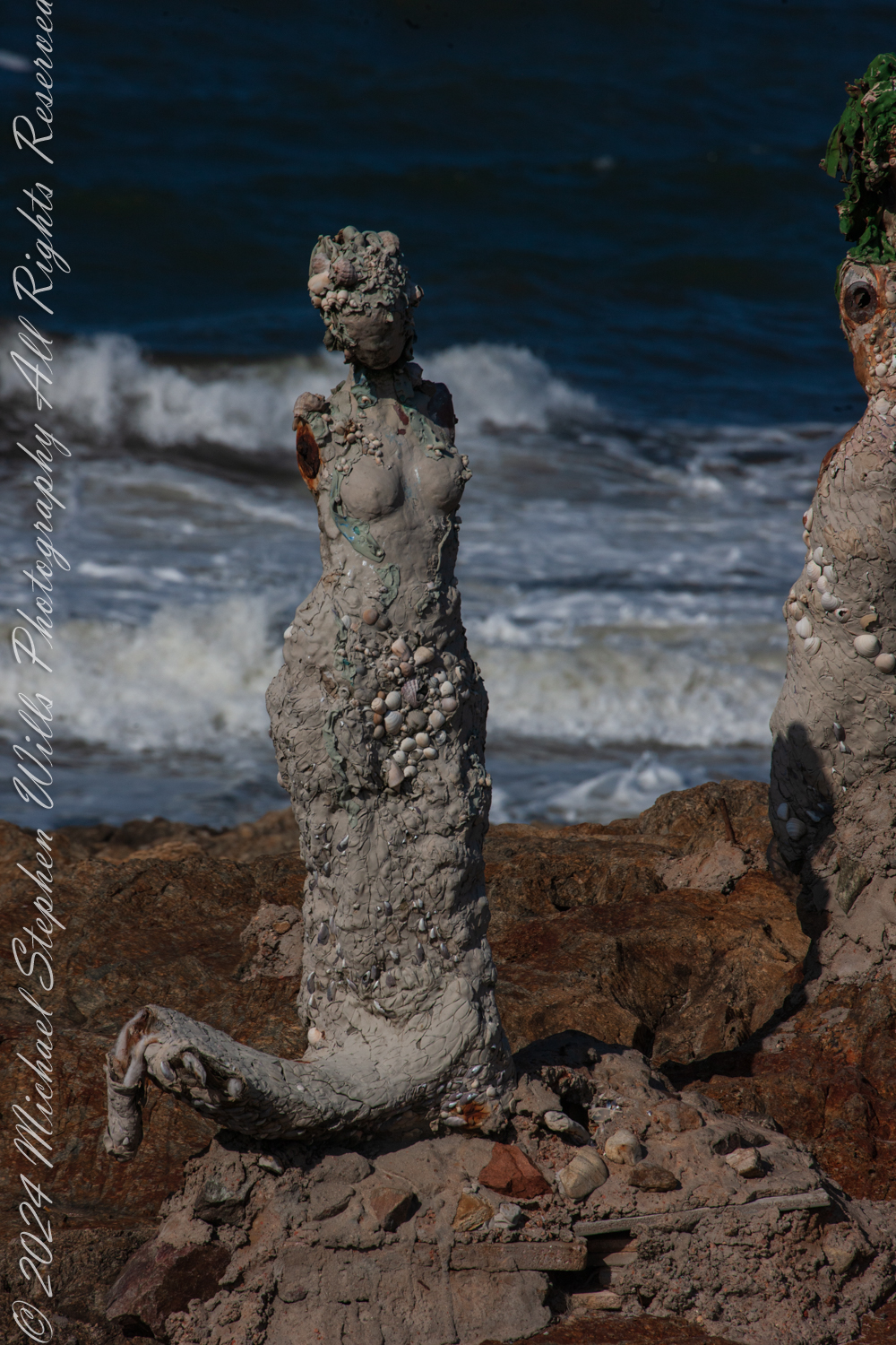
This is at Great Britain Square, Punta de las Salinas of Punta del Este. We are at the tip of the peninsula, the easternmost point of Uruguay. This is the art installation El Canto de las Sirenas” (The Song of the Mermaids) (2012) by the artist Lily Perkins. Punta del Este, Departamento de Maldonado, Uruguay

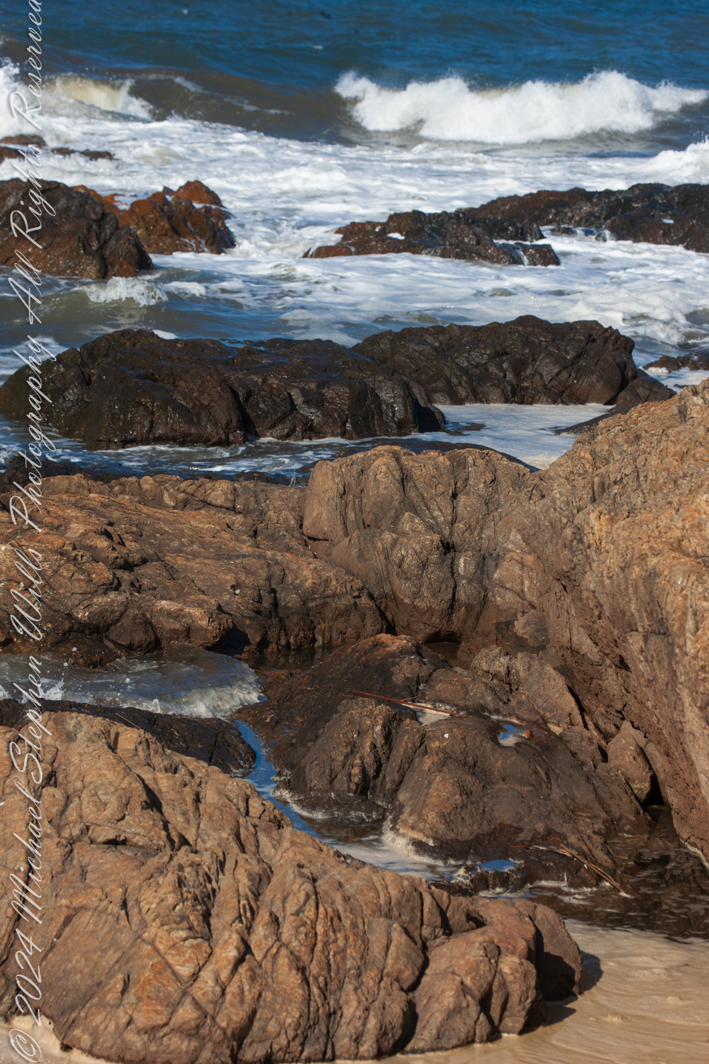
The sirens of ancient lore were said to dwell at perilous points where land met the untamed sea, luring sailors to their doom with haunting songs. These rocky outcrops, both a boundary and a threshold, have long held symbolic power as places where the natural world is at its most raw and elemental. Punta de las Salinas is such a place. Its jagged rocks and churning waves create an environment as beautiful as it is treacherous. It is easy to imagine mythical sirens choosing this very spot to weave their spellbinding melodies.

This is at Great Britain Square, Punta de las Salinas of Punta del Este. We are at the tip of the peninsula, the easternmost point of Uruguay. This is the art installation El Canto de las Sirenas” (The Song of the Mermaids) (2012) by the artist Lily Perkins. Punta del Este, Departamento de Maldonado, Uruguay

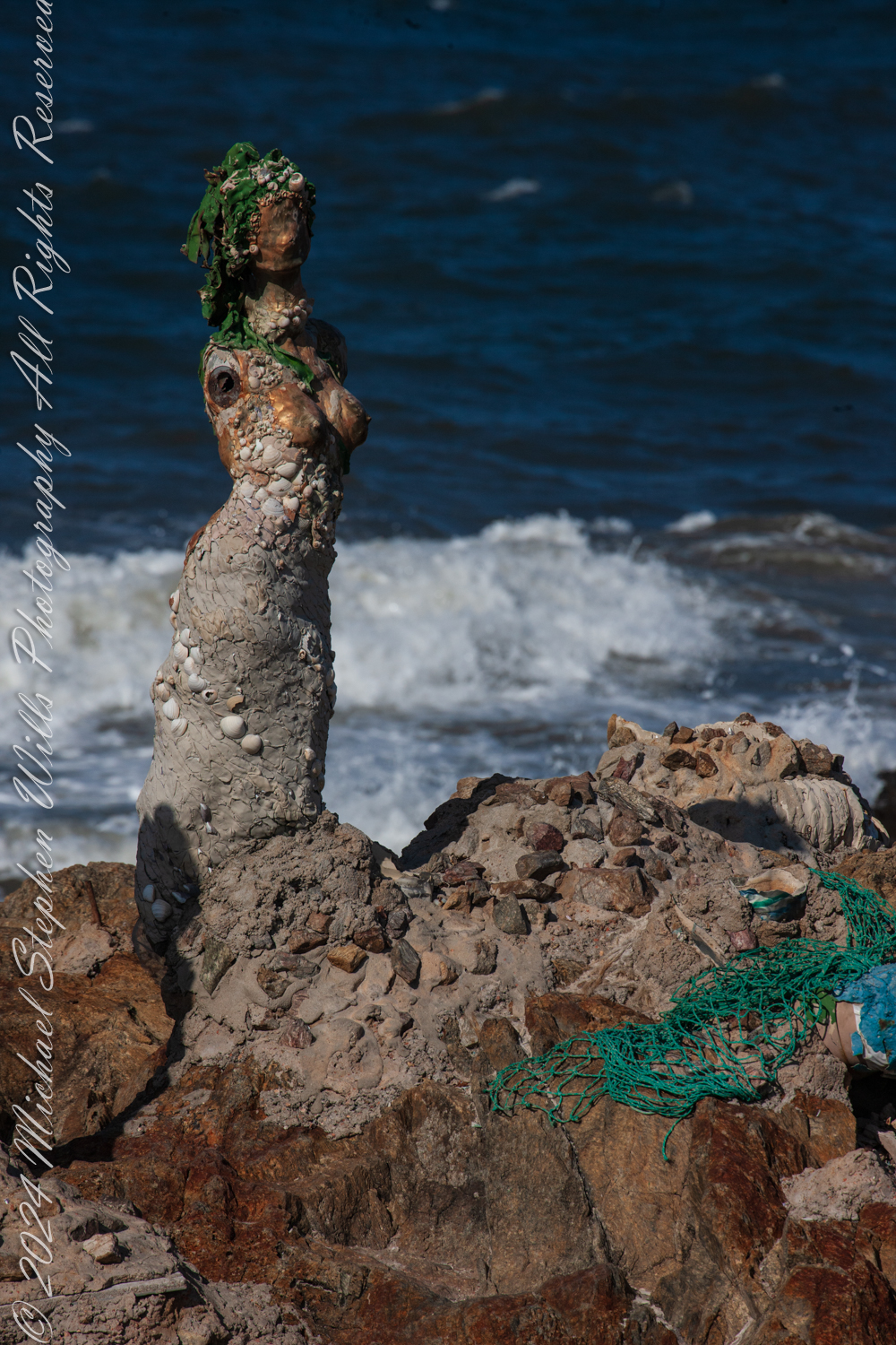
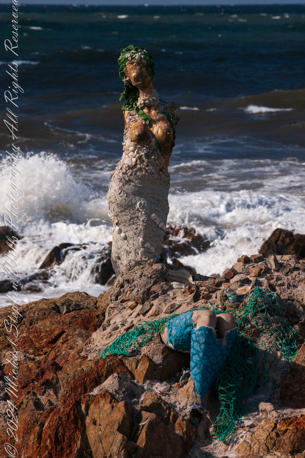
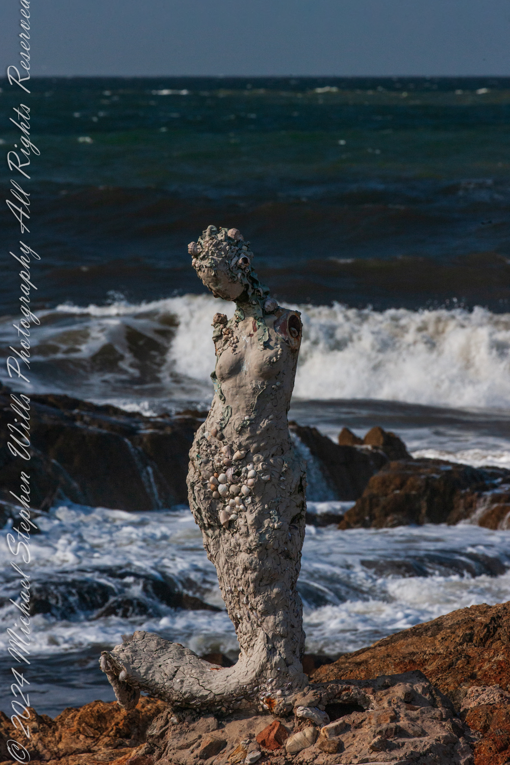
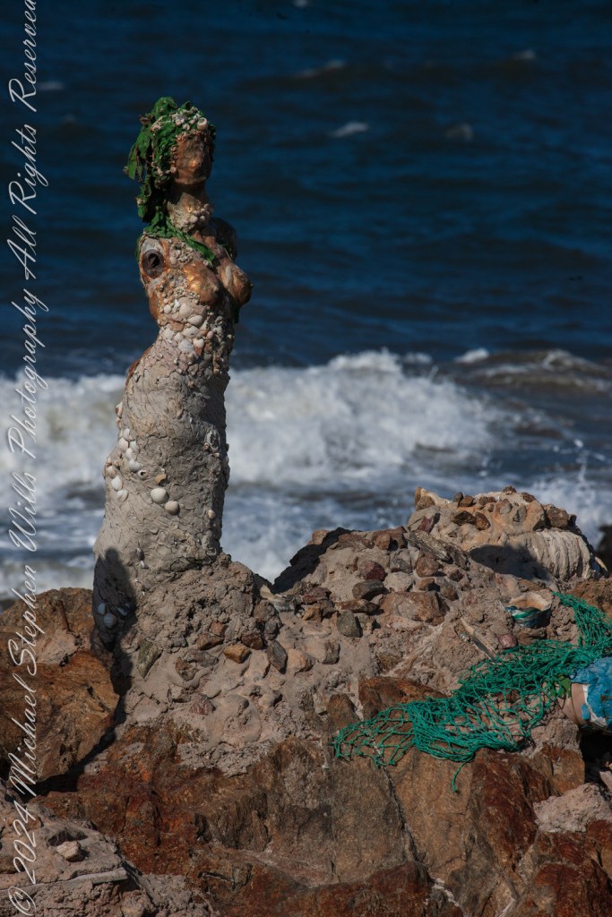
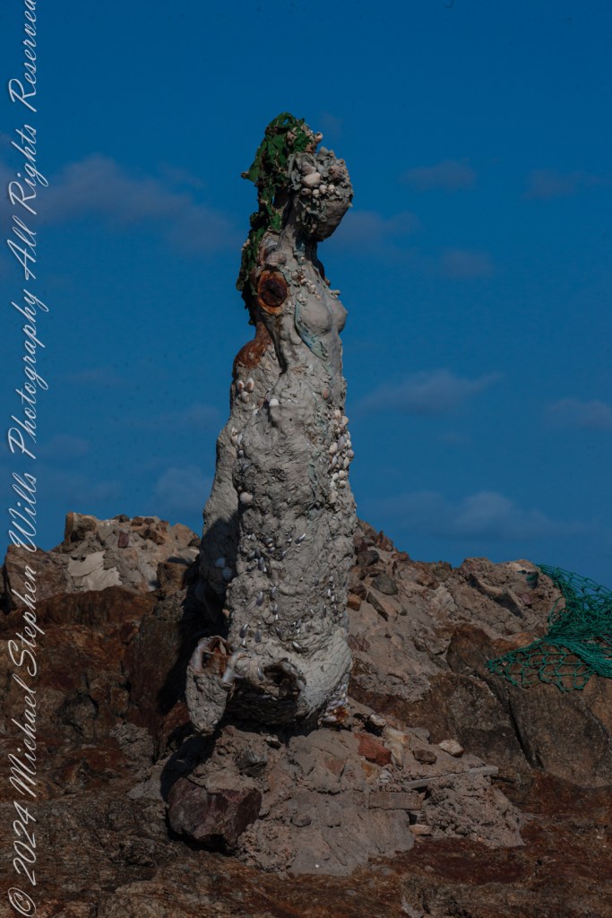
Lily Perkins’ installation captures this essence. The sculptures are not idealized depictions of mermaids; they are rugged and raw, encrusted with shells, stones, and marine debris. Their weathered forms mirror the harsh, untamed beauty of their surroundings. It is as if they have emerged from the ocean itself, born of the waves and the salt-laden air, to stand as sentinels at the edge of the world.

The central figure, with her face turned skyward, evokes the myth of the siren’s song—a melody so enchanting that it drove sailors to risk their lives against the rocks. Her posture suggests longing, perhaps for a connection beyond the horizon, or perhaps for the very mortals she is fated to ensnare. Nearby, a broken figure reclines against the rocks, her form partially encased in green netting and mosaic-like tiles. She seems more grounded, her siren’s call muted, as if weighed down by the realities of the modern world. The use of marine materials in her construction—a blend of natural and human-made debris—suggests an awareness of humanity’s impact on the seas.

The third figure, slightly apart, is the most enigmatic. Encrusted with barnacles and weathered by the elements, she seems lost in thought. Her gaze is directed not toward the sea but toward the land, as if contemplating her place at this meeting of worlds. In mythology, sirens were liminal creatures, existing between realms—the sea and the shore, the mortal and the divine. This figure embodies that in-between state, rooted in the rocks yet shaped by the sea.

The placement of these sculptures at Punta de las Salinas is no accident. This headland is the easternmost point of Uruguay, a natural boundary and a crossroads where two vast bodies of water meet. For centuries, sailors navigated these waters, their journeys fraught with danger. The rocks here are unforgiving, and the waves crash with relentless power. To stand at this point is to feel the raw energy of the ocean and to understand why myths of sirens arose in such places. The sirens symbolize both allure and peril, a reminder of the ocean’s capacity to inspire and to destroy.

As I walked among the sculptures, the mythology seemed to come alive. The sound of the waves crashing against the rocks could easily be imagined as the sirens’ song—a hypnotic rhythm that draws you in and holds you spellbound. The figures, though silent, seemed to hum with an energy that echoed the sea’s eternal motion.

I feld these sculptures were not merely placed at Punta de las Salinas; but had emerged from it, their forms shaped by the same forces that shaped the rocks beneath our feet. The shells and stones embedded in their surfaces tied them physically to the sea, while their mythical resonance tied them spiritually to the place.

The mythology of the sirens speaks to the duality of the sea—its beauty and its danger, its capacity to give and to take away. Standing at Punta de las Salinas, surrounded by Perkins’ sculptures, I felt that duality in a profound way. The ocean stretched endlessly before us, a vast, unknowable expanse, while behind us lay the solid ground of the peninsula—a place of safety, but also a place that ended here, at this edge.

Lily Perkins sculptures are restored…..

As we left, the figures seemed to watch us go, their silent song lingering in my mind. The sirens of Punta del Este are more than art; they are a dialogue between myth and reality, between the natural world and the human imagination. In their weathered beauty, they remind us of the stories the sea has always told, and of the enduring power of those who give those stories form.

Enter your email to receive notification of future postings. I will not sell or share your email address.

Guardians of the Plateau: Brigham’s Tomb, the Stagecoach, and the King on His Throne

Here is a journey to Brigham’s Tomb in Monument Valley, reflecting on the land’s timelessness, silent presence, and the profound connection between the observer and natural formations.

He did not come seeking answers, nor was he lost. The road had summoned him—as it had summoned others before him—and he followed its arc with the steadiness of one who does not hurry time. The sun was descending behind him, slow and inevitable, casting long golden blades across the plateau. That was how it wanted to be seen, and he did not interfere.

He had come this way before in dreams, further south where the great stone mittens reached into the sky. There, the land had risen in clarity, each formation distinct in its declaration. But now the evening had deepened, and the land changed its tongue. It spoke more slowly. With greater weight. And he listened.

The air was thin with silence. Even the wind moved differently here—more cautious, more reverent. And then the shapes came into view. Not suddenly, but as if they had always been there and were only now permitting themselves to be noticed.

Here stood Brigham’s Tomb.

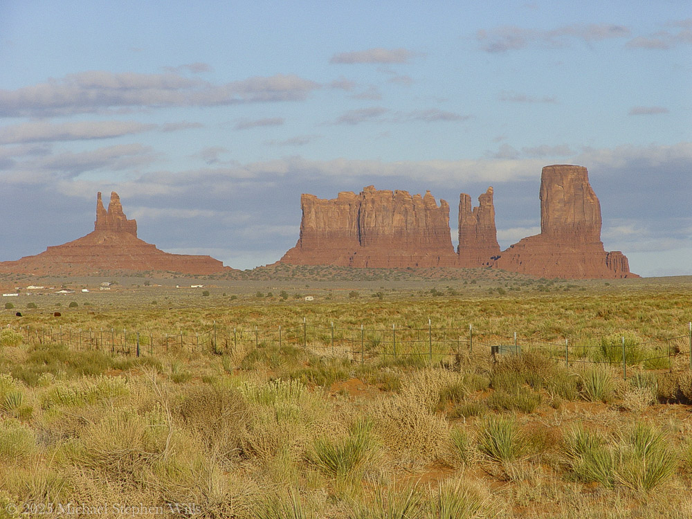
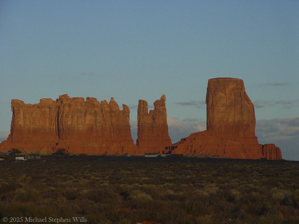
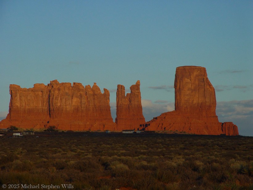
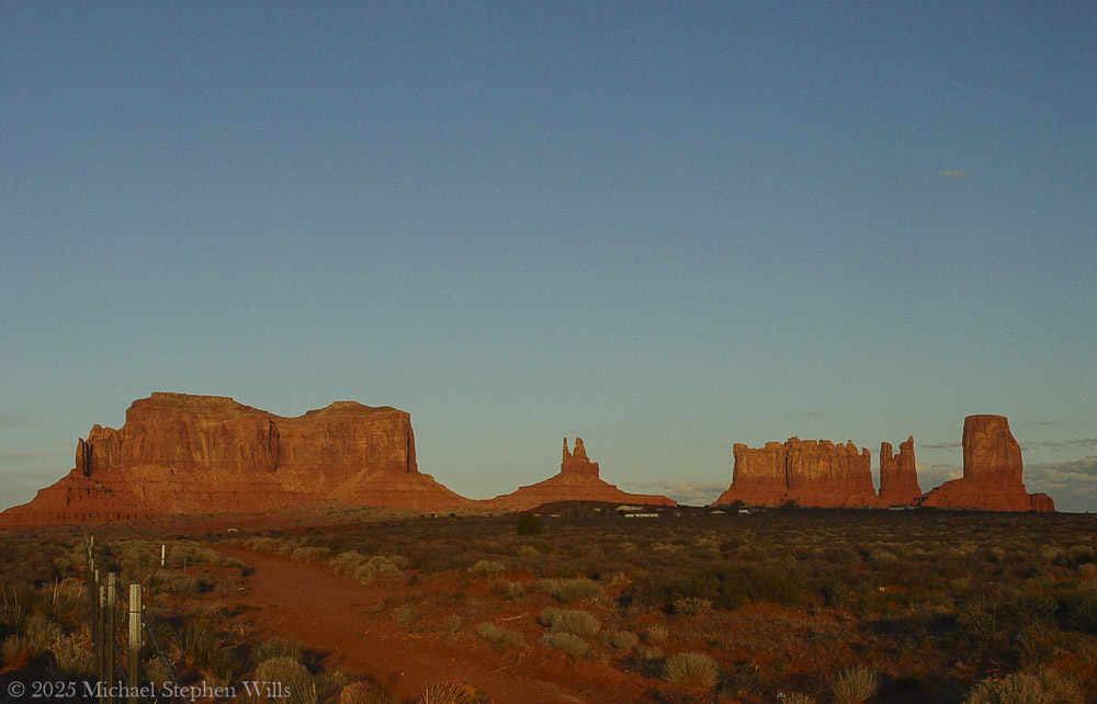
On the way to Monument Valley Tribal Park as the sunset for this view on Sullivan Road (Route 163). Navajo County, Arizona. Brigham’s Tomb. On the way to Monument Valley Tribal Park as the sunset for this view on Sullivan Road (Route 163). Navajo County, Arizona. Brighams Tomb is situated six miles (9.7 km) northeast of Oljato–Monument Valley, Utah, on Navajo Nation land. It is an iconic landform of Monument Valley and can be seen from Highway 163. Precipitation runoff from this landform’s slopes drains into the San Juan River drainage basin. Topographic relief is significant as the summit rises 1,000 feet (305 meters) above the surrounding terrain in 0.25 mile (0.4 km). The mountain’s name refers to Brigham Young, the first governor of the Utah Territory. This landform’s toponym was officially adopted/revised in 1988 by the United States Board on Geographic Names after having been officially named “Saddleback” from 1964 through 1987. Some older maps will still show the Saddleback name. Geology Brighams Tomb is composed of three principal strata. The bottom layer is slope-forming Organ Rock Shale, the next stratum is cliff-forming De Chelly Sandstone, and the upper layer is Moenkopi Formation capped by Shinarump Conglomerate. The rock ranges in age from Permian at the bottom to Late Triassic at the top. The buttes and mesas of Monument Valley are the result of the Organ Rock Shale being more easily eroded than the overlaying sandstone..

It rose alone, square and solemn, its flanks pressed by the last warmth of the day. The light traced every fracture, every line of sediment like the spine of something ancient and vast. It had no vanity. Its strength was in endurance, in the simplicity of mass. The world had spun uncounted times around this throne of stone, and still it stood—unmoved, unwitnessed except by sky and the slow-growing desert at its feet.

He paused there—not because he was uncertain, but because the monument required it. Some things must be received in silence.

Their topographic relief is significant: Stagecoach rises 900 feet (274 meters) above the surrounding terrain in 0.35 mile (0.56 km), while King-on-his-Throne rises 565 feet (172 meters) in 0.2 mile (0.32 km). Each butte’s toponym has been officially adopted by the United States Board on Geographic Names—Stagecoach is named for its resemblance to a stagecoach, and King-on-his-Throne is said to resemble a monarch surveying his domain. Stagecoach’s first summit ascent was made in 1995 by John Middendorf, Carl Tobin, and Dan Langmade; King-on-his-Throne’s first was in 1967 by Fred Beckey, Marlene Dalluge, Joe Brown, and Don Liska.

To the southeast, past a stretch of ochre earth and sagebrush, rose two more forms. The King on His Throne, upright and proud, shaped as if he had emerged from the stone itself to bear witness. An artifact of erosion, also a sovereign presence—crowned in shadow and wind. There was no question of who he was. His seat was eternal, and no rider passed without first meeting his gaze.

Beside him stood The Stagecoach. Its resemblance to the name was almost too perfect, as if the form had stepped from the myth fully formed. But he knew better. It had not become a stagecoach. The coach had become it. The names were backwards, as names often are. The land had come first. All else was echo.

The giants stood together across the basin, their red-gold skin kindled in the last light. Their arrangement was no accident. One rose alone. Two more aside, bound by rhythm but not repetition. Together they formed a sequence—pause, proclamation, passage.

He walked the trail slowly, camera at his side but silent for a long while. There were things beyond framing. This was not a scene to be taken. It was a truth to be approached.

At the edge of the frame—a photograph not yet taken, but inevitable—the fence stretched taut across the scrub. Old wood. Rusted wire. Man’s line scratched against the land’s permanence. It held nothing. It said nothing. But it was there, and so he acknowledged it, as one acknowledges a child’s drawing pinned beside a mural.

Overhead, the sky was deepening into steel. But the earth still burned, even gently. The buttes and mesas were not dimmed by dusk. They only leaned inward, as if the heat of the day had carried them toward some great remembering.

He had seen many monuments in his life, but these were not monuments in the human sense. These were not built. They were born. They had no need for marble or inscription. Their gospel was in their silence, their liturgy the erosion of time itself.

He stood long, unmoving.

Not lost. Not searching. Just witnessing.

As the light slipped and the forms began to release their edges to shadow, he turned once—not away, but forward. The road still called. And the giants behind him did not diminish. They merely remained, as they always had, and always would.

Waiting.

Enter your email to receive notification of future postings. I will not sell or share your email address.

Discovering La Sirena de la Garza at Punta de las Salinas

At Punta del Este, Uruguay, the beauty of the ocean and sculptures creates a profound connection between nature, art, and mythology.

As I stood at the edge of Punta del Este, Uruguay, I marveled at the wild beauty of the place. We were at Punta de las Salinas, the very tip of the peninsula, the edge of where the Atlantic Ocean meets the Río de la Plata. This easternmost point of Uruguay, where time feels suspended as restless waves crash against rocky shores. A sea breeze carries a distinct salty tang.

This is at Great Britain Square, Punta de las Salinas of Punta del Este. We are at the tip of the peninsula, the easternmost point of Uruguay. Punta del Este, Departamento de Maldonado, Uruguay

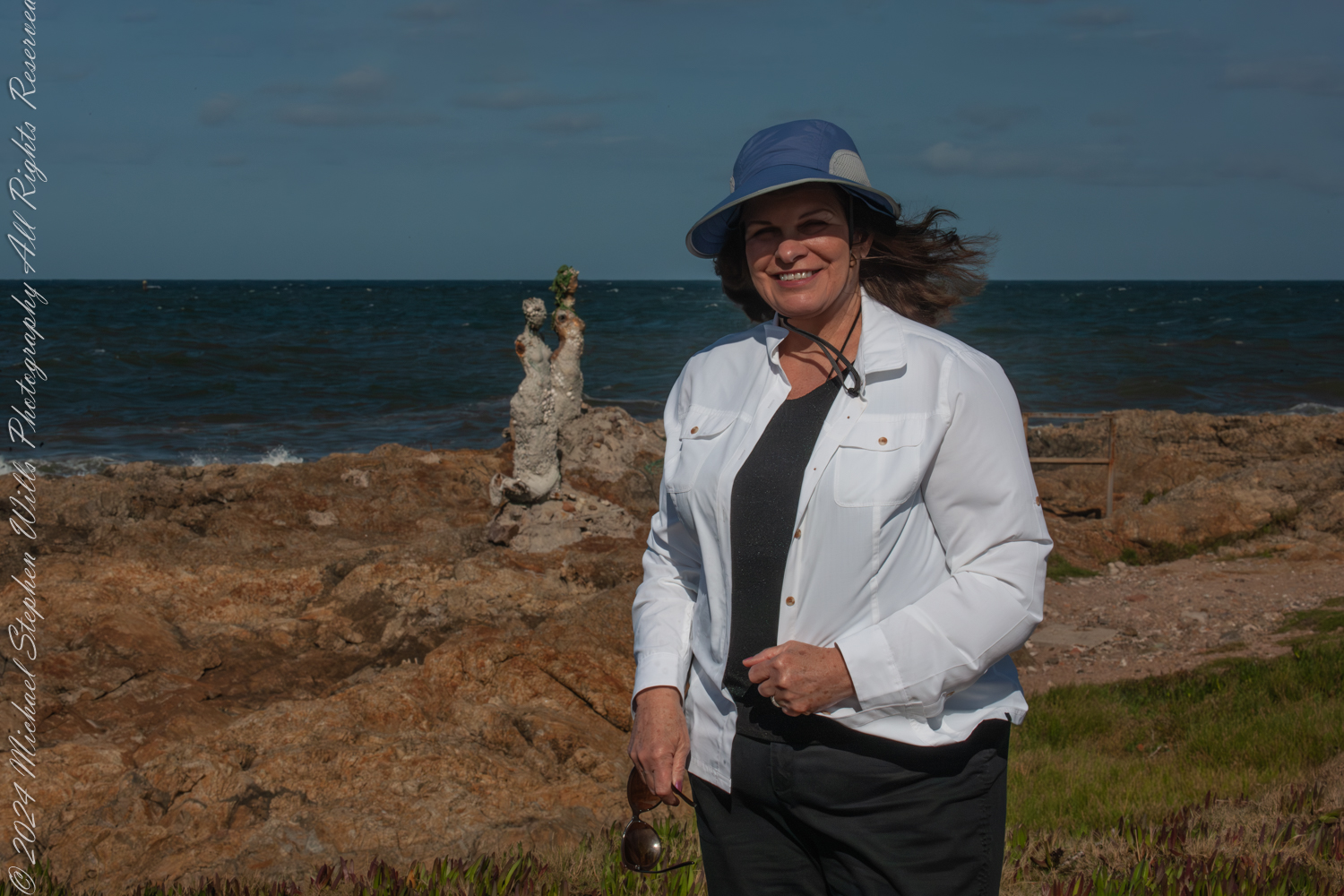
Pam, my wife, stood beside me, a bright smile on her face as the ocean wind tugged at her sunhat. Behind her, rising among the rocks, was an art installation that seemed to embody the spirit of the place “El Canto de las Sirenas” (The Song of the Mermaids). These sculptures by the artist Lily Perkins, their forms shaped and worn by the elements, appeared almost as though they were natural extensions of the rocky coastline. They gazed out to sea, their haunting beauty a poignant reminder of myth and humanity’s eternal connection with the ocean.

The sirens, crafted with an earthy texture and adorned with bits of marine debris, seemed to tell a story of resilience and adaptation. They stood stoically against the backdrop of the churning waves, their barnacle-like surfaces merging seamlessly with their rugged surroundings. I felt a strange connection to them, as if they were silent witnesses to the ever-changing dance of the sea and sky.

Pam during our 2016 South American tour. This is at Great Britain Square, Punta de las Salinas of Punta del Este. We are at the tip of the peninsula, the easternmost point of Uruguay. Over her shoulder is the art installation “El Canto de las Sirenas” (The Song of the Mermaids) (2012) by the artist Lily Perkins. Punta del Este, Departamento de Maldonado, Uruguay

The morning was perfect for photography. I adjusted my Canon camera, capturing the interplay of light and shadow across the jagged rocks, the turquoise waves, and the statues. The textures of the sirens came alive through the lens, each detail hinting at the passage of time and the endless conversations between water and stone. Pam posed in front of one of the sculptures, her presence adding a touch of humanity to the scene, as though she were part of this mythological tableau.

I took a moment to step back and absorb the scene. The coastline stretched out before me, rugged and raw, with the waves crashing in an eternal rhythm. The sirens belonged here, their forms shaped artist hands, then also by the elements. They merged into this unique place, much like the wind, the rocks, and the ocean.

As we walked along the rocky outcrop, the sound of the waves filled the air, drowning out any other noise. It was easy to lose oneself in the hypnotic patterns of the water, the spray catching the sunlight like tiny jewels. I found myself reflecting on the history of this place—Punta del Este, a meeting point of cultures and stories, a place where the natural world and human creativity converge.

Great Britain Square, where we started this journey, seemed an apt setting for such an installation. The name itself evokes a sense of exploration and connection across vast distances, much like the sirens that seem to call out across the waves. The symbolism was not lost on me as I thought about how we, too, were travelers, drawn to the edges of the earth by a desire to explore and understand.

Plaza Gran Bretana (Great Britain Square) is named for the World War II naval battle near here between the German battleship Graf Spee and the English ships Ajax, Achilles and Exeter. The plaza also has an anchor marking the boundary between Rio de la Plata and the Atlantic Ocean.

Pam and I lingered for a while longer, taking in the scenery and enjoying the peacefulness of the moment. The sculptures seemed almost alive, their forms shifting subtly as the light changed. They reminded me of the stories of sirens from ancient mythology—creatures that lured sailors to their doom with their enchanting voices. But here, they seemed more like guardians, watching over the waters and the land, their presence a testament to the enduring power of art and nature.

As the morning wore on, we made our way back, leaving the sirens behind to their eternal vigil. The experience stayed with me, though, a vivid memory of a place where myth and reality intertwine. Punta de las Salinas, with its rugged beauty and its mysterious sirens, had left an indelible mark on my heart.

Enter your email to receive notification of future postings. I will not sell or share your email address.

Sunrise at Cocoa Beach: A Symphony of Colors on the Space Coast

Experience the breathtaking sunrise at Cocoa Beach, where the sky and sea blend in a symphony of colors. Discover the tranquility and beauty that awaits as the day dawns on Florida’s stunning Space Coast.

Click this link for my Online gallery

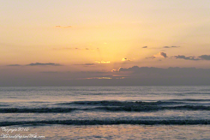
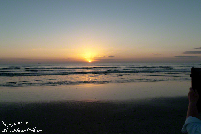
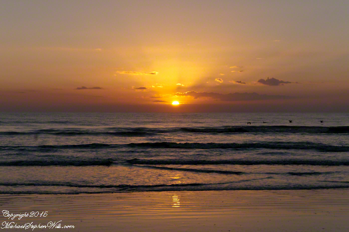
Cocoa Beach, nestled in Brevard County, Florida, is renowned for its pristine sandy shores and the rhythmic lullaby of the Atlantic Ocean. It’s a place where the day often begins with an awe-inspiring sunrise. On the Space Coast, the first light of day is a daily masterpiece, a silent symphony of colors that paints the sky and reflects off the water.

As dawn approaches, the eastern horizon begins to glow with a soft, pre-dawn light. This quiet time, when the world is still asleep, offers a unique tranquility. The beach, usually bustling with surfers, sunbathers, and families, is calm and serene. The sand, cool underfoot, stretches out like a vast canvas, waiting for the sun to begin its artwork.

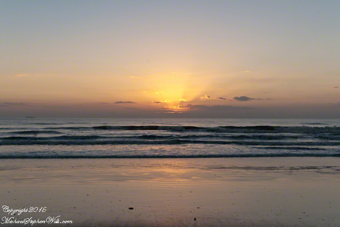
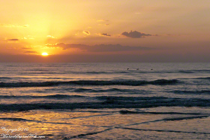
The first hues of sunrise start as a gentle blush, a hint of pink that softly caresses the sky. As the moments pass, this blush deepens into shades of orange and red, reminiscent of a painter’s palette. The ocean mirrors these colors, creating a breathtaking scene where sky and sea blend into one continuous expanse. It’s a moment that feels almost sacred, as if nature itself is preparing for a grand reveal.

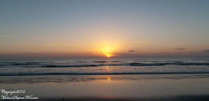
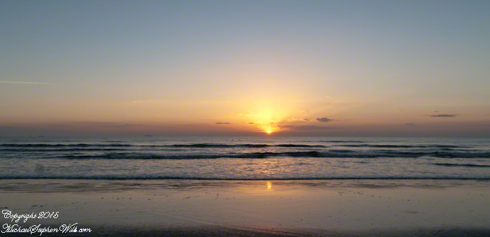
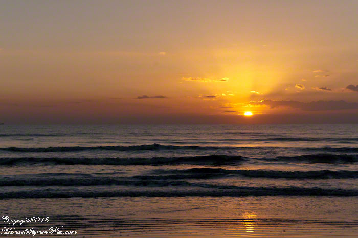
The sun finally peeks above the horizon, a fiery orb that illuminates the world in golden light. This is the crescendo of the sunrise, a moment that seems to hold the breath of the world. The rays of light stretch out across the water, casting a shimmering path that invites the eyes to follow. It’s a path that feels both real and ethereal, leading not just across the sea, but into a day full of possibilities.

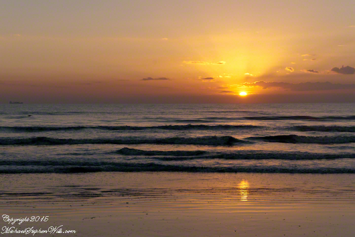
As the sun rises higher, the colors in the sky shift and change. The deep reds and oranges give way to softer yellows and then to the clear, bright light of morning. The ocean, too, transforms, taking on a deeper blue as the sunlight penetrates its depths. The waves, which had been gentle ripples in the pre-dawn light, now dance and sparkle, as if celebrating the arrival of the new day.

For those fortunate enough to witness it, a sunrise at Cocoa Beach engages all the senses. The cool breeze carries the fresh scent of saltwater, a reminder of the ocean’s vastness and power. The sound of the waves, steady and rhythmic, provides a soothing background score, while the occasional cry of a seabird adds a touch of the wild to the scene.

Click on a photo for a closer look.

There is a sense of community among the early risers who gather to watch the sunrise. Strangers often share nods and smiles, united by the shared experience of witnessing something so beautiful and ephemeral. It’s a reminder that, no matter our differences, moments of natural beauty can bring people together, fostering a sense of connection and shared humanity.

Cocoa Beach, known for its proximity to the Kennedy Space Center and its surf culture, offers much more than meets the eye. The sunrise is a daily reminder of the simple yet profound beauty of nature, a beauty that exists beyond the man-made attractions and the hustle and bustle of everyday life. It’s a call to pause, reflect, and appreciate the world around us.

In a place where rockets soar into the sky, touching the very edge of space, the sunrise at Cocoa Beach brings us back to Earth, grounding us in the timeless rhythm of the natural world. It’s a moment of peace and renewal, a gift from the universe to start the day with a heart full of wonder and gratitude.

So, whether you’re a local or a visitor, taking the time to watch the sunrise at Cocoa Beach is an experience not to be missed. It’s a chance to witness the world waking up, to feel a part of something larger than oneself, and to start the day with a renewed sense of awe and possibility.

Copyright 2024 Michael Stephen Wills All Rights Reserved