Drombeg Fulacht Fiadh: A Journey Through History

Join Mike and Pam at Drombeg Stone Circle to explore stone hut remains and a mysterious hearth beside the Fulacht Fiadh in Ireland’s green landscape.

A narrow path, a handful of low stone walls, and small white flowers scattered through the grass: the photographs of our exploration at Drombeg preserve details that invite a closer look. Beside the Fulacht Fiadh, two adjoining huts survive as outlines in the ground. Exploring this part of the site with my wife, Pam, gives me a way to think about the people behind the stones, even when so much of their story remains beyond our reach.
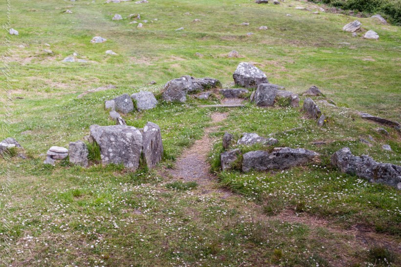
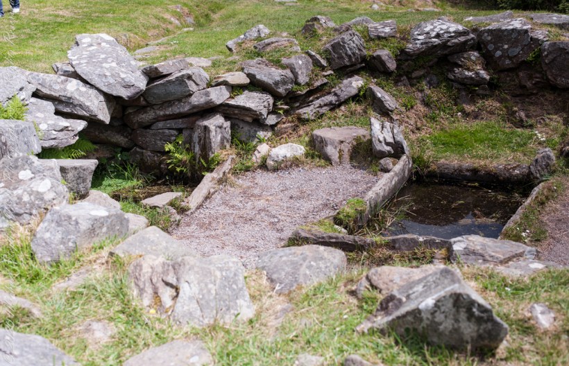
Approach to Hut A

The first photograph, one of the huts, draws the eye along a worn strip of earth toward an opening between upright stones. Beyond it, the hut’s curved boundary gathers a patch of grass into something recognizable as a space. Some stones stand prominently; others barely rise above the turf. Pale lichen marks their faces. Small flowers grow around their bases, softening the edges without quite concealing the arrangement.

Looking at that opening, I imagine the simple act of entering. It is an ordinary movement, one Pam and I have made through countless doorways together. Here, the surviving stones give that familiar action an unfamiliar setting. What would it have meant to cross this threshold when the hut was in use? The photograph cannot answer, but it makes the question feel close enough to linger over.
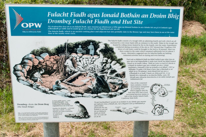
Drombeg Fulacht Fiadh and Hut Site The fulacht fiadh, which is an ancient cooking place and adjacent hut sites probably date to the Bronze Age and may have been in use at the same time as the nearby stone circle.
The fulacht fiadh consists of a trough with an adjoining hearth and well, which are all enclosed by a low stone bank with an entrance to the south. Water in the trough was heated by rolling stones heated by fire in the hearth, into the water. Experiments conducted during excavation of the site in 1957 showed that 70 gallons (318 litres) of cold water could be brought to the boil in 18 minutes. Meat was then cooked in the water which remained sufficiently hot for almost 3 hours. Alternative suggested uses for fulachta fiadha are bathing, industrial activities such as dyeing and even brewing!
One of the conjoined huts contains a stone-lined feature interpreted as a roasting oven which suggests that the huts may have had a food processing function similar to that of the nearby fulacht fiadh. A pathway links both.
A stone saddle quern – used for grinding grain – was found over a drain in the cooking place but probably originated from one of the huts.
Drombeg—from An Drom Beag
(the Small Ridge)

The accompanying OPW placard give us a few firm details. Drombeg has two huts adjoining the Fulacht Fiadh, with a connecting path. Hut B incorporates a rock-lined hearth that possibly served as an oven. Those few words change the way I read the scene. The low remains become places with a relationship to one another, and the path becomes a useful thread to follow through the scattered stone.
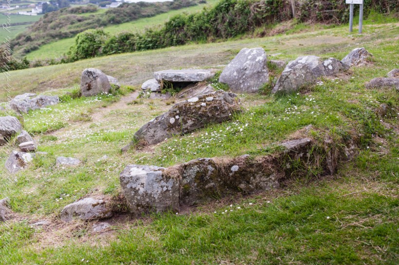
Hut B with a view of the landscape.

In the wider view, the ground slopes away toward hedges, green fields, and distant buildings. Closer to the camera, irregular stones trace the hut through grass and patches of bare earth. A broad, flat slab rests above a dark recess. Nothing in the photograph announces itself with grandeur. Its interest lies in how closely we look, and in the small connections we begin to make.

The hearth is a detail that holds my attention. The OPW placard notes are careful: it possibly served as an oven. I want to keep that uncertainty intact. It leaves room for curiosity without turning a suggestion into a fact. Even with that restraint, the possibility of cooking brings a human scale to the ruins. An oven suggests work to be done, something to prepare, someone waiting.
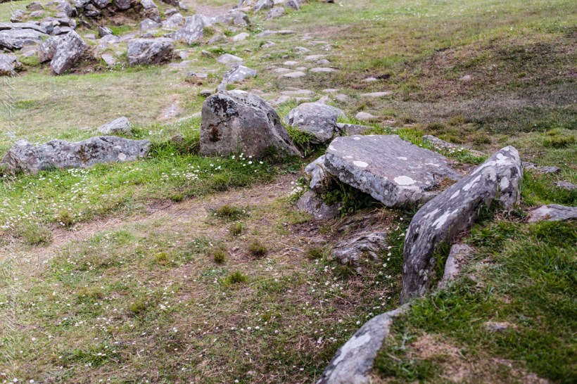
Can this be anything but a comfortable perch to take in the view? No, the OPW placard suggests its use as a hearth.

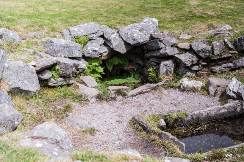
The closest photograph brings the hearth into sharper focus. White patches of lichen spread across the the irregular rock wall. Plants fill small gaps beneath it. The stones lean at different angles, and the trough leads the eye onward. The view holds the intimate detail and the larger setting together, allowing us to consider how these neighboring spaces might have related.

I imagine a person tending heat there, watching carefully, occupied with a task that mattered in the moment. That is an imagined scene, not something these photographs establish. Yet it helps me approach the stones with a different kind of attention. Whoever used this place had practical concerns that we can wonder about, even when their names, words, and particular circumstances are lost to us.
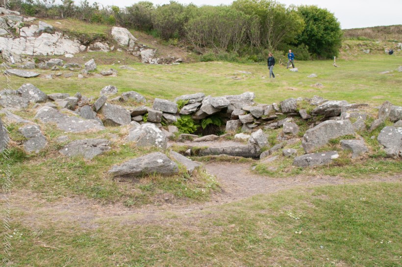
Approaching the Fulacht Fiadh…

The Fulacht Fiadh site contains a hearth as well.
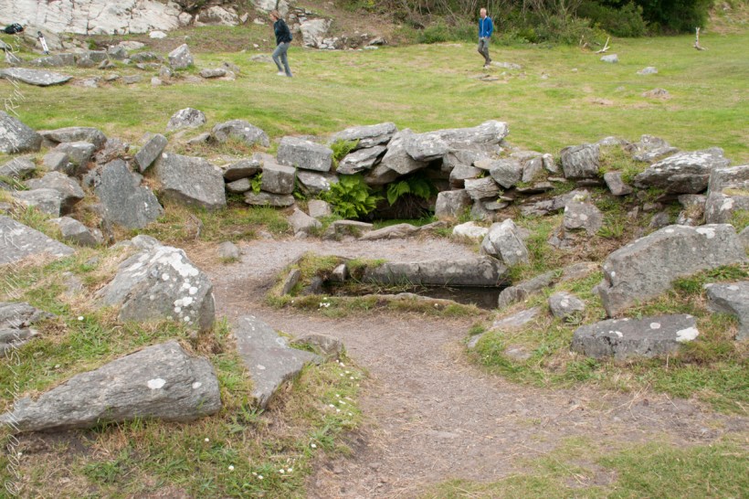
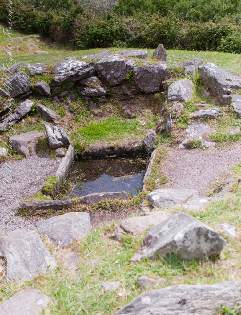
The hearth is to the right of the rock-lined trough, a spring above.
In Fulacht Fiadh investigated there is a link to preparation activity involving heat and moisture. Found throughout Ireland, Great Britan and the Isle of Man where the sites are called “Burnt Mounds”.
In the center of the Fulacht Fiadh is a trough, a water filled pit, which at Drombeg is lined with rock. A water source, a spring to the left (not visible in this photograph), a hearth above.
The water source, a spring.

For me, sharing an exploration like this with Pam offers its own pleasure: having someone beside whom to consider what remains. I cannot supply a remembered conversation from these pictures. I can, however, imagine the questions we might carry away. How much can a surviving outline tell us? At what point does looking become imagining? How do we appreciate a place while leaving its unanswered questions open?
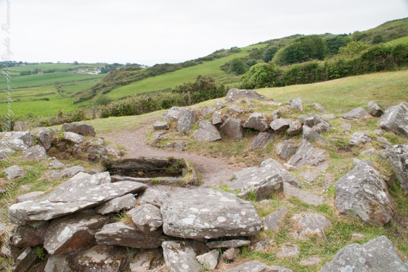
Here we stand behind the sping for a broad view of the landscape. The hearth is to the right of the trough.

These photographs bring back to mind a low doorway, a path, and the hearth. Together, they offer a modest but absorbing way into Drombeg. The flowers are small enough to overlook; so are some of the stones. Giving them attention becomes part of the experience. In this telling of our visit, that is what I would keep: Pam and me exploring the surviving shapes of a place, following what we can see, and letting a few careful questions accompany us.
Click me to visit Michael Stephen Wills Online Finger Lakes Gallery.

Enter your email to receive notification of future postings. I will not sell or share your email address.

Historical Wonders of Ashford Castle and Its Natural Surroundings

At Ashford Castle, swans glide on the Cong River’s glassy waters, weaving together myth, history, and cinema in a timeless reflection of Ireland’s enduring spirit.

Headed south from Cong Village, past the venerable Cong Abbey then Saint Mary’s Church of Ireland, the road bends into the Ashford Castle estate. Time seems to shift here. The stonework of the abbey lingers in memory, only to give way to manicured parkland, ancient trees, and the shimmer of water. The road itself, aptly named Ashford Castle, carries the traveler to a place where history, nature, and imagination meet.

I do not recall passing a guard box on my first visit, though one now stands firmly on the roadside, manned and proper, as though the estate were never meant to be entered without ceremony. In truth, Ashford Castle has always carried the air of a threshold—between village and wild, past and present, myth and reality.

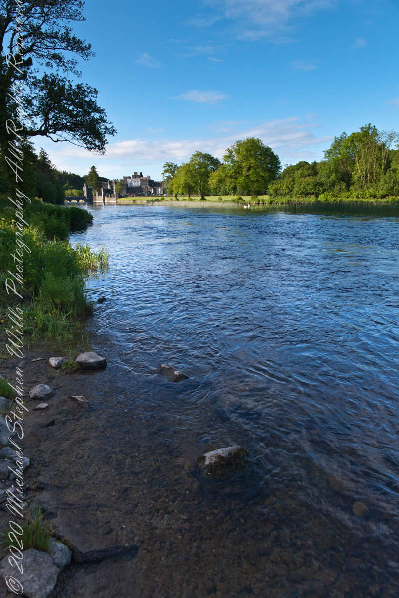
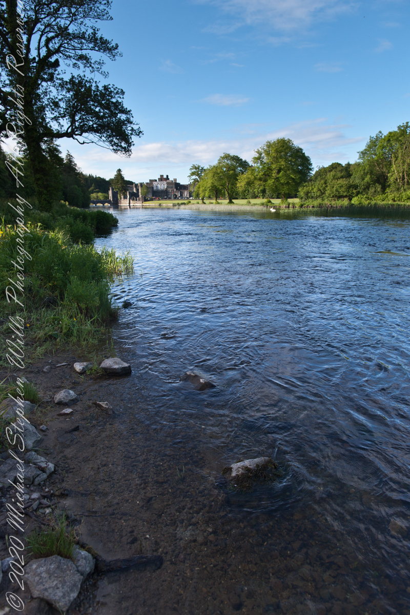
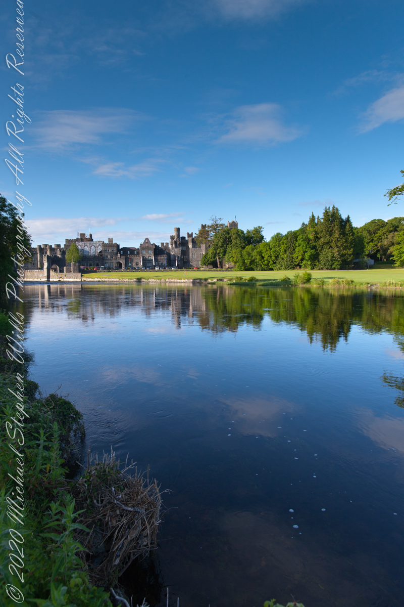
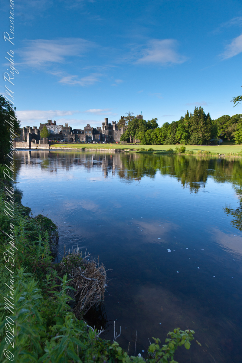
Soon the road brings one to the banks of the Cong River. Here the water widens, flowing calm and sure, and across it rises the battlemented silhouette of Ashford Castle itself. Its towers, turrets, and stony walls seem to grow from the riverbank like something inevitable, a fortress transformed into elegance. The castle’s mirrored reflection on the water doubles the grandeur, as though the real and imagined castle exist side by side.

It is no wonder filmmakers found inspiration here. Scenes from the classic 1952 film The Quiet Man—the tale of Sean Thornton, played by John Wayne, and the fiery Mary Kate Danaher, embodied by Maureen O’Hara—were shot on the far bank of this very river. To watch them walking by these waters is to see Ashford Castle woven into Hollywood’s Irish dreamscape, a backdrop both romantic and enduring.

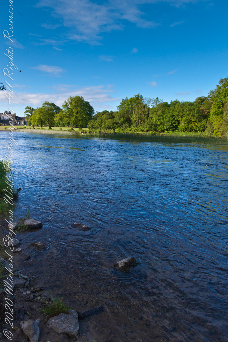
Yet long before cinema, the river was already a stage. The Cong River is a natural marvel. It emerges from the same Carboniferous limestone that shapes the Burren of County Clare—an austere landscape of limestone pavements etched with fossils and caves, where rare alpine and Mediterranean plants thrive among ancient tombs. Through fissures in this ancient bedrock, the waters of Lough Mask find their way underground before rising again at Cong. This subterranean journey, through stone filters laid down some 350 million years ago, leaves the water clarified, luminous, and cold. By the time it slides past Ashford Castle, it has the purity of glass.

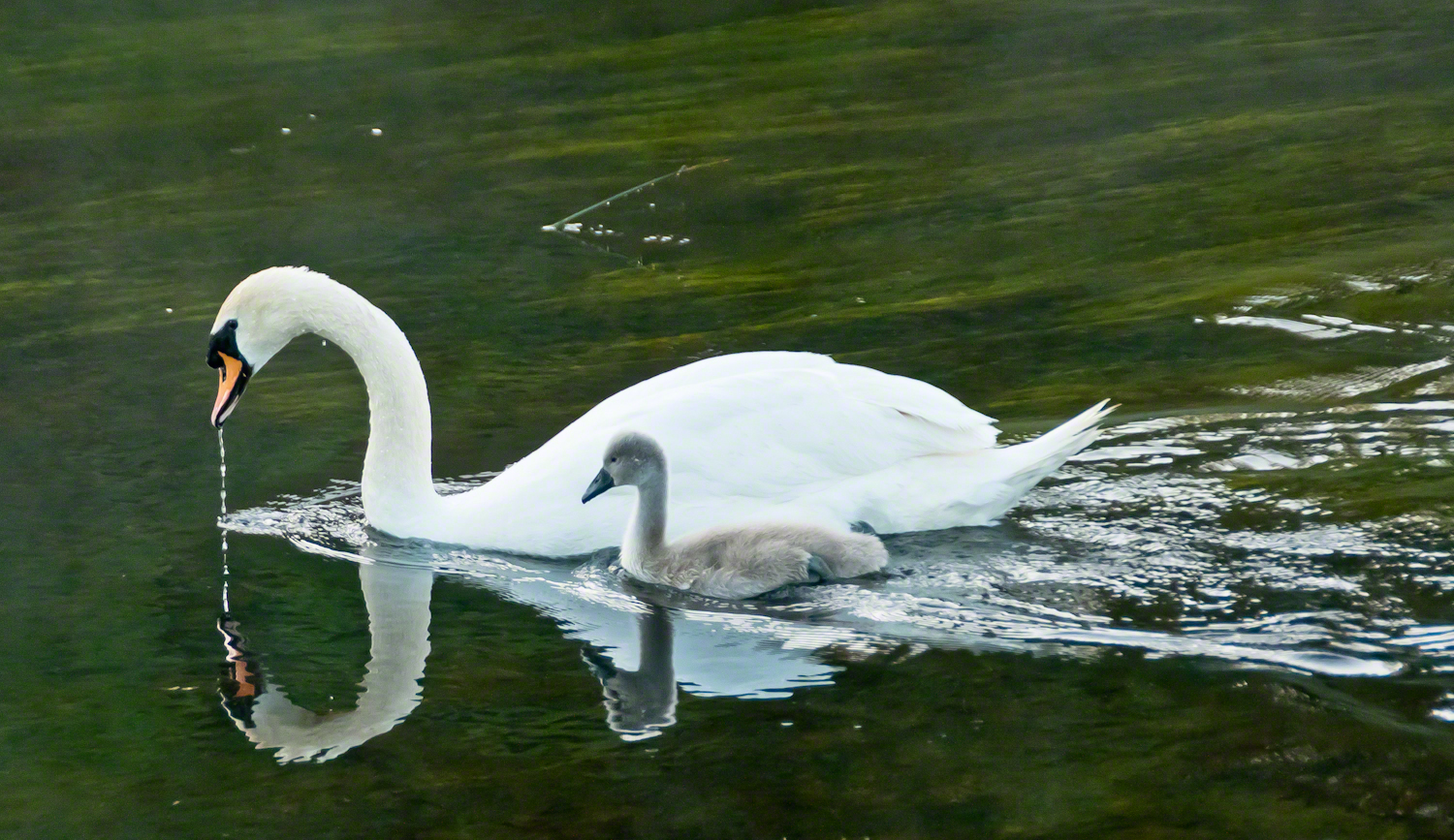
It is in this clarity while walking the opposite bank on a different morning I found a parent swan and its cygnet feeding. The adult glided, immaculate, its long neck bowed as drops of river fell from its beak. At its side, the cygnet paddled with earnest strokes, gray down still clinging, a fragile shadow of what it would one day become. Together they traced a quiet path across the water, ripples fanning behind them.

Few images so perfectly match their setting: a medieval castle, guardian of centuries, reflected in the same waters where these swans carried on their timeless rhythm of nurture and growth. It was as if the river itself composed the scene—a blending of stone, water, bird, and sky that belonged nowhere else but here.

The swan has long been a symbol in Irish lore. The Children of Lir, cursed to live as swans for nine hundred years, are among the most haunting figures of Celtic mythology. To see the white bird with its offspring before Ashford Castle was to glimpse that myth breathing still, alive on the Cong River.

Photographers know the difficulty of capturing water and stone without losing the life between them. On that morning, however, the river gave freely—its surface alternately smooth as glass and dappled with breeze. Stones at the water’s edge appeared like stepping-stones into history. Each frame revealed another face of the estate: the wide reach of the Cong, the castle framed by trees, the play of cloud shadows across the current.

The castle itself, though reshaped as a luxury retreat, still speaks of older times. Founded in the 13th century by the Anglo-Normans, Ashford passed through centuries of conquest and change before becoming, in the 19th century, a romantic Victorian pile. Today its battlements remain picturesque rather than defensive, but the sense of continuity—of lives unfolding along these banks—has not faded.

Standing there, camera in hand, I was struck by the layered meaning of this place. The Cong River flows from unseen caverns, purified by limestone older than memory. It nourishes swans, reeds, and trout alike. It reflects both a castle and a sky. Along its opposite bank, legends of cinema and Celtic lore alike find footing.

As the swan and cygnet drifted slowly downstream, I thought of them as part of the same enduring thread. Parent and child mirrored castle and village, past and future, permanence and change. The ripples they left widened until they touched both banks, an unbroken gesture across centuries.

Click this link to read another Ireland story “The Cloigtheach of Glendalough.”

Click this link to read another Ireland story “Killeany Bouy.”
Enter your email to receive notification of future postings. I will not sell or share your email address.

Church Ruin on Inishmore

Join me on a journey through Inishmore, Galway Bay on a horse-drawn carriage. We’ll see a ruined church, horse pasture, and iron age fort, Dun Aengus, with reflections on the word ‘riven.’

Continue reading “Church Ruin on Inishmore” →

Kinsale Walking Tour

Kinsale, a historic seaport in County Cork, showcases unique architecture and geography, with its streets and houses built on steep inclines near the river Bandon.

The first of a series of idiosyncratic posts from a 2014 walking tour of Kinsale.

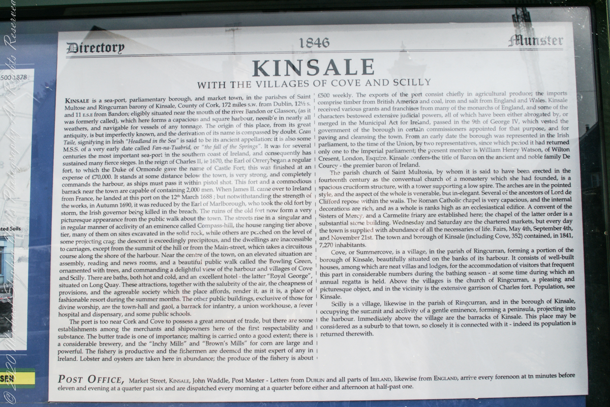
Text from an poster behind glass accessible to all and sundry. Directory 1846 Munster, Kinsale with the villages of Cove and Scilly. Kinsale is a seaport, parliamentary borough and market town in the parishes of Saint Multose and Ringcurran barony of Kinsale, County of Cork, 172 miles s.w. from Dublin, 121/2 s and 11 e.s.e. from Bandon; eligibly situated near the mouth of the river Bandon or Glasson, (as it was formerly called), which here forms a capacious and square harbor, accessible in nearly all weathers, and navigable for vessels of any tonnage. the origin of this place, from its great antiquity, is but imperfectly known, and the derivation of its name is compassed by doubt. Cean Taile (Cionn tSáile), signifying in Irish “Headland in the Sea” is said to be its ancient appellation. (see more in the photograph).

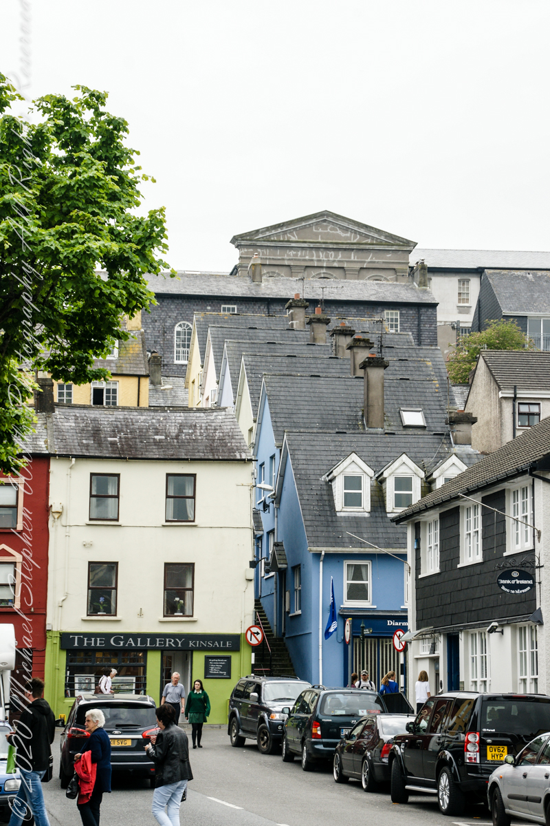
Here we are on Emmet Place. There is a row of houses built along a steep alley named “The Stoney Steps.” At top is the aptly named Higher O’Connell Street.

From the informative poster…The streets rise in a singular and in regular manner of acclivity of an eminence called Compass Hill, the house ranging tier above tier, many of them on sites excavated in the solid rock, while other are perched on the level of some projecting crag: the descent is exceedingly precipitous, and the dwelling are inaccessible to carriages, except from the summit of the hill or from Main street, which takes a circuitous course along the shore of the harbor.


Click Me for the next post in this series. 

Enter your email to receive notification of future postings. I will not sell or share your email address.