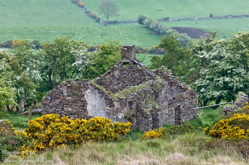
It was the kind of overcast morning that seems to cradle the island in a blanket of mist, a gentle hush falling over the land as though even the Atlantic held its breath. Pam and I had arrived by ferry at Kilronan, the main settlement on Inishmore (Inis Mór), the largest of the Aran Islands nestled in Galway Bay. There, amid the bustle of arrivals and greetings, we found our driver—a wiry, weather-worn man with a soft brogue and kind eyes—and his horse trap, a simple two-wheeled carriage with room enough for three and the sounds of hooves to accompany our journey.
We set out up Cottage Road, the stone-paved track winding westward from the harbor. The sea fell away behind us as we climbed, a gray shimmer stretching to the hazy outline of Connemara’s mountains on the far side of the bay. Our destination was the dramatic cliffside ringfort of Dún Aonghasa, a place older than memory. But it was the unexpected moments in between—the ones not printed in guidebooks—that linger longest in the mind.
As we rounded a bend flanked by low stone walls, wildflowers blooming defiantly in the cracks, our driver pulled the reins gently and pointed with his crop.
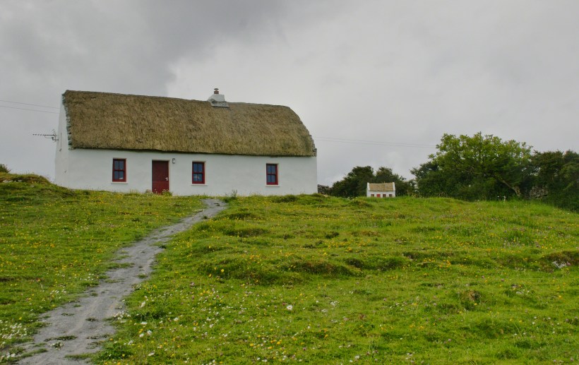
“There,” he said, nodding ahead, “is a fine example of a traditional Aran cottage.”
And there it was—a vision from another time. The thatched roof curved softly like a that blanket itself, straw golden against the brooding sky. The walls were whitewashed to a perfect matte sheen, gleaming in spite of the cloud cover. A crimson door and two window frames punctuated the front façade like punctuation in a poem. Just to its right, set further back on the hill, stood a tiny replica of the same cottage, identical in every feature. I blinked, half believing it was an illusion.
Click the link for my Getty IStock photography of the Aran Islands

We only stopped briefly—it was a private residence—but the sight of it left a kind of imprint. I turned in the trap seat to keep it in view as long as I could. The cottage was perfectly placed, facing Galway Bay with a commanding view. I imagined the light pouring across the line of mountains, catching the glint of sea and sky.
“There’s a name for that finish,” I said, recalling something I’d read, “whitewash, or lime paint.”
Our driver nodded. “That’s the old way. Made from slaked lime. We’d call it ‘whitening’ when I was a lad.”
Whitewash differs from paint in the most elemental of ways. It becomes part of the stone, absorbed into the very surface. Like a memory of bone. And yet, it requires care. Apply it to a wall not properly cleaned or moistened, and it flakes, pulls away like a broken promise. But done right, it lasts, breathes with the building.
Upon our return, researching “whitewash,” if found this photograph from the Yarloop railway workshops Yarloop, Western Australia. There, on a shelf, where three old boxes sat like relics: DURABLO, WESCO, and CALCIMO. All contained kalsomine—the powdered form of lime paint. CALCIMO promised to “beautify walls and ceilings” and was proudly marked “LIME PROOF.” There was something quietly heroic in that. Lime-proof, as though against time itself.
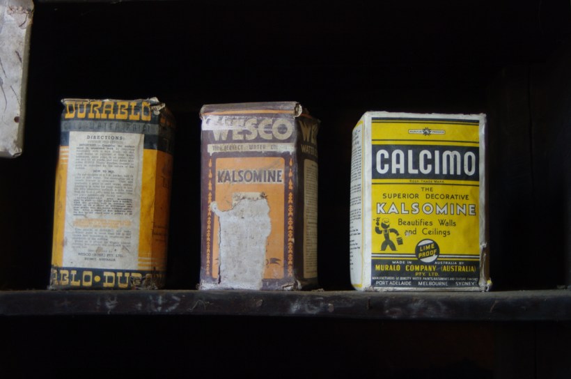
Looking at the box of Calcimo, a product of the Murabo Company of Australia, I was struck by how far the tradition had traveled. From island cottages in the Atlantic to distant corners of the Southern Hemisphere, the language of whitewash—of simplicity and purity—had touched the world.
We returned by the same road, past that same cottage, the small one still keeping watch beside it like a child beside a parent. And I knew then that the islands hadn’t just given me sights—they had offered stories, silent ones written in thatch and stone, in lime and wind.
Sources for this post: search wikipedia for “White Wash”. White wash photo author: Wikipedia commons user Gnangarra