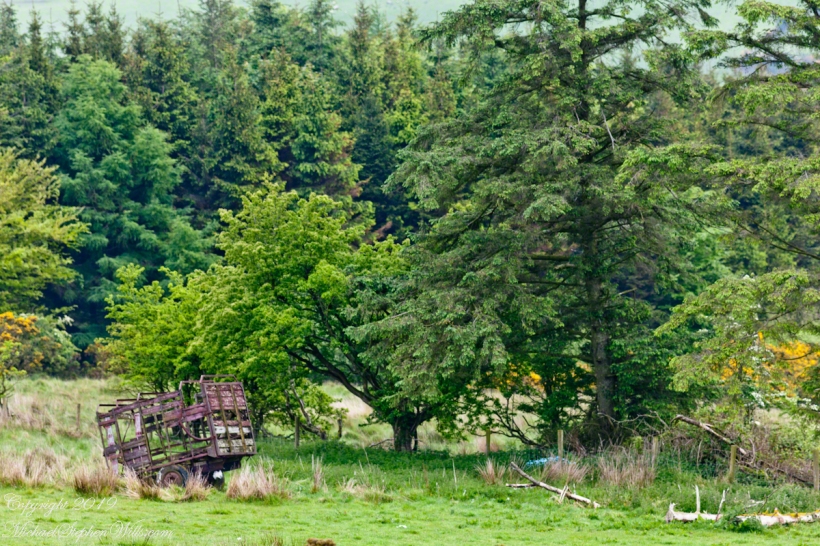
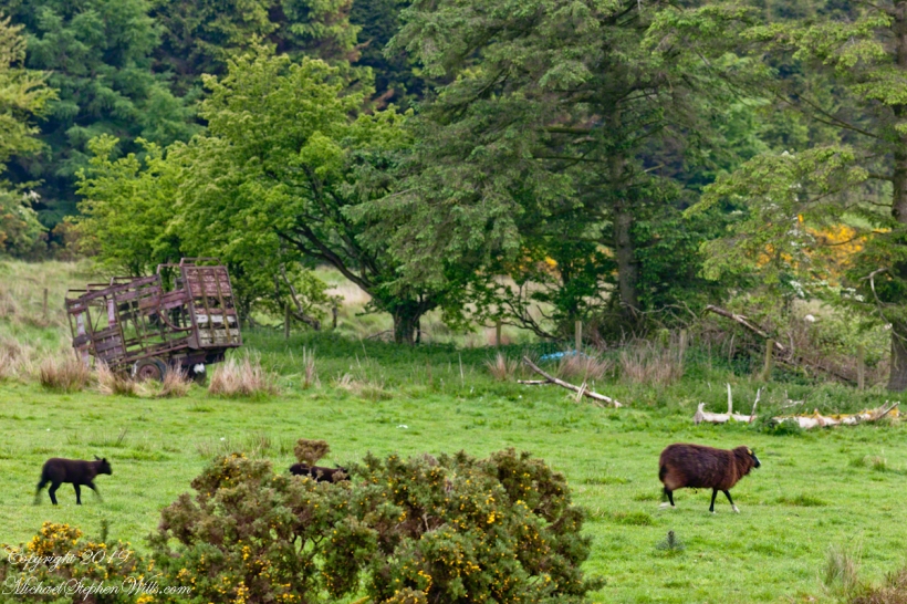
In the early dawn, I walked the path to Killen, drawn by the legacy of my mother’s Irish youth. An abandoned hay wagon stood, a relic amidst the whispers of history and myth. Join me in uncovering the roots that intertwine family and the enduring Irish land.
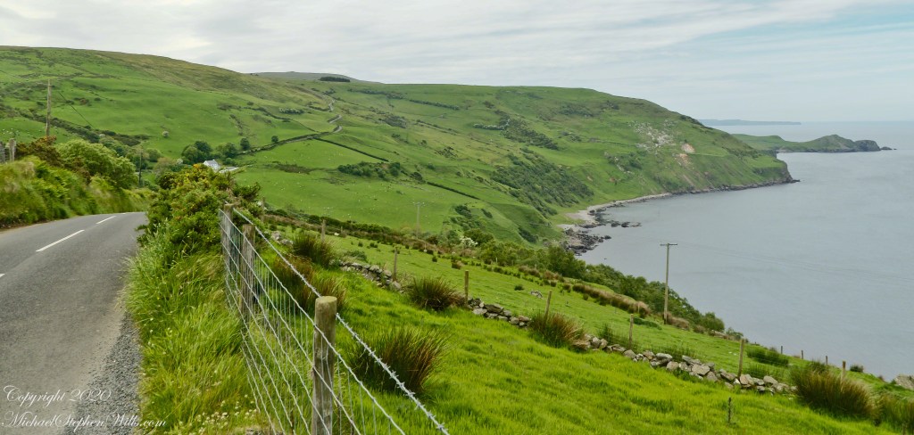
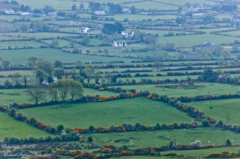
This photograph from the bottom of the Torr Road hill takes in Coolranny Townland. a slice of land running from the ridge to Loughan Bay. We see a number of hawthorne trees in flower, yellow flowering Whin Bush, houses and the Roman Catholic church Saint Mary’s Star of the Sea.
Tor in Irish is a steep rocky height. Likewise, Corr means odd, uneven, rounder, convex, curved, peaked, projecting, smooth. Combined Torcorr is the townland where we stopped on the Torr Road, halted by our wonder at this sight. In the distance, Torr Head projects into North Channel, the closest land to Scotland. Following the coast, the cliffs in front of Torr Head is home to numerous sea birds. The curved bay is named Loughan, the rocky sand beach are ruins of cottages emptied by Irish emigration. The white building is Saint Mary’s Star of the Sea Roman Catholic Church. County Antrim, Northern Ireland.
View of Coolranny townland with Saint Mary’s Star of the Sean Roman Catholic Church from Torcorr townland, Torr Road . County Antrim, Northern Ireland.
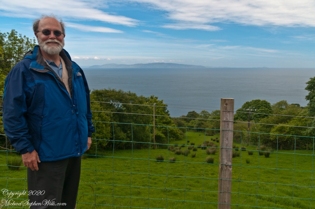
The photograph of the header, taken by Pam, is from either Coolranny or Loughan Townland, looking across a sheep pasture, the North Channel of the Irish Sea toward the Mull of Kintyre, Scotland just twelve miles distant.
Here is a slideshow of this post’s images. To visit from WordPress Reader, you need to first click the title of this post to open a new page.
Tor in Irish is a steep rocky height. Likewise, Corr means odd, uneven, rounder, convex, curved, peaked, projecting, smooth. Combined Torcorr is the townland where we stopped on the Torr Road, halted by our wonder at this sight. In the distance, Torr Head projects into North Channel, the closest land to Scotland. Following the coast, the cliffs in front of Torr Head is home to numerous sea birds. The curved bay is named Loughan, the rocky sand beach are ruins of cottages emptied by Irish emigration. The white building is Saint Mary’s Star of the Sea Roman Catholic Church. County Antrim, Northern Ireland.View of Coolranny townland with Saint Mary’s Star of the Sean Roman Catholic Church from Torcorr townland, Torr Road . County Antrim, Northern Ireland.On the way to Torr Head we stopped at this spot in Coolranny Townland to take in this view of the Irish Sea. The land overlooks Loughan Bay toward the Mull of Kintyre and Sanda Island, Scotland. County Antrim, Northern Ireland.
Copyright 2023 All Rights Reserved Michael Stephen Wills
This the fifth and final of a series of landscape photographs taken from this position.
Click photograph for a larger view. To do this from WordPress Reader, you need to first click the title of this post to open a new page.
Slievenaglogh View with road, east
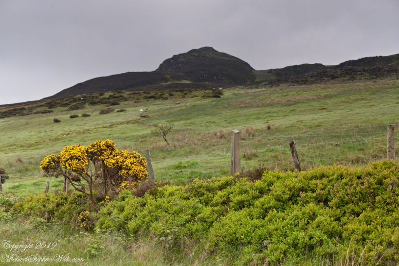
The peak is named, in the English language, Slievenaglogh. It is so strange as it’s not English, being instead a transliteration of the Irish name “Sliabh na gCloch.” This is “Rock Mountain” translated literally. Slievenaglogh is carried to the townland, a long thin swath of land being the peak and associated ridge-line.
The rocks up there are called “gabbro,” a type of magma slowly cooled under ground. Slievenaglog, Slieve Foy across the valley, and the Morne mountains all formed within volcano magma chamber(s) of the Paleocene, 66 million years ago, a time associated with extensive volcanism and the Cretaceous–Paleogene extinction event that gave rise to the current age.
Our younger cousin has been up there, optimistically we left it for a later trip.
Slievenaglogh View, northeastSlievenaglogh View, east northeastSlievenaglogh View, east northeastSlievenaglogh View, north northeastSlievenaglogh View with road, east
This the fourth of a series of landscape photographs taken from this position.
Click photograph for a larger view. To do this from WordPress Reader, you need to first click the title of this post to open a new page.
Slievenaglogh View, north northeast
The distant ridge, Slieve Foy, is the site of a mythic battle from the epic “The Cattle Raid of Cooley” (Irish: Táin Bó Cúailnge).
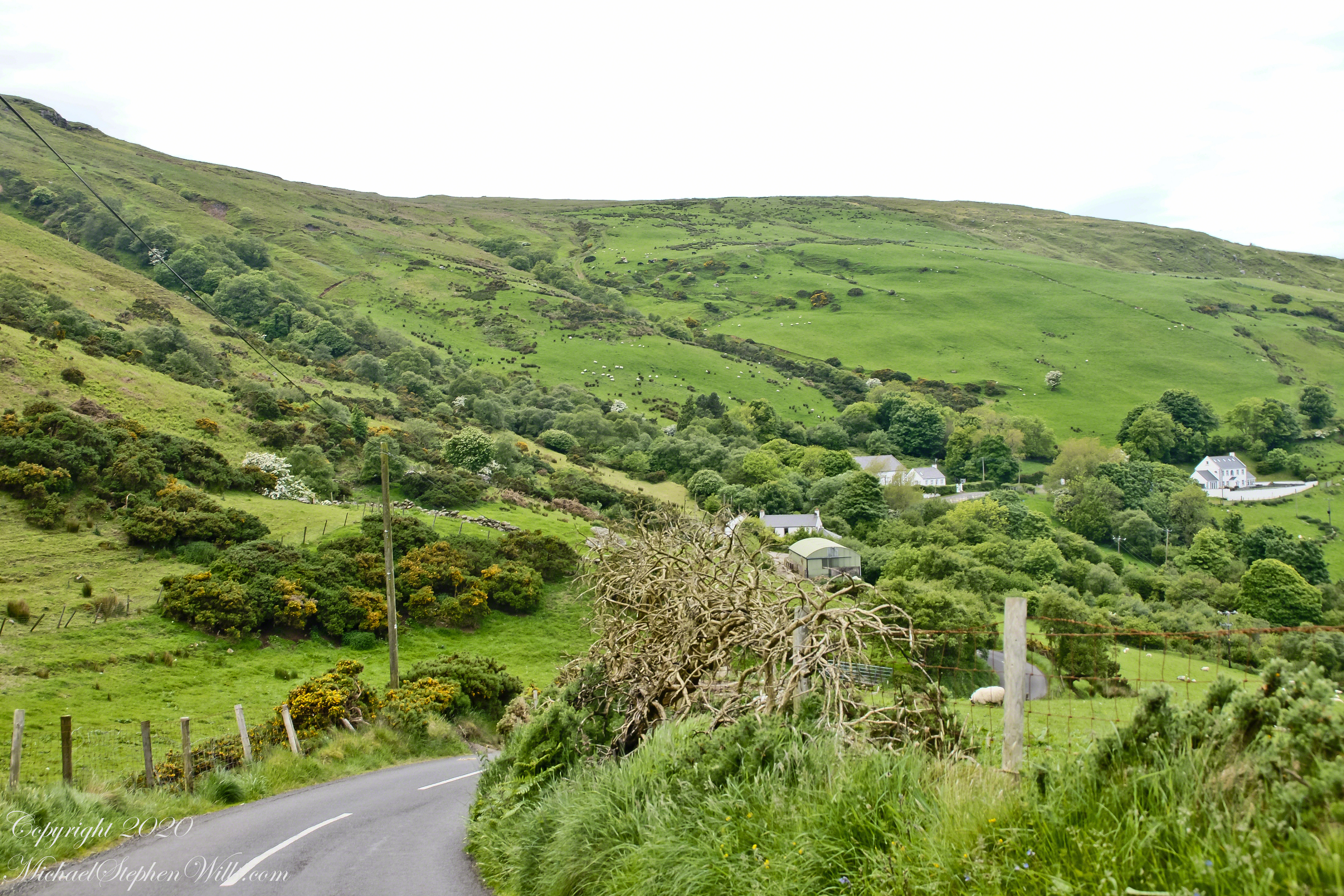
Pam and I did a circuit of the island, returning to the home of my Mom’s first cousin. Our last full day on Ireland a cousin took us on the Tain Trail, over Maeve’s Gap of Slieve Foy and into Carlingford town.
Our route is partly visible to the right of the ridge, hidden in low clouds.
These are the second and third of a series of landscape photographs taken from this position. See the previous post for the first.
Click photograph for a larger view. To do this from WordPress Reader, you need to first click the title of this post to open a new page.
Slievenaglogh View, east northeastSlievenaglogh View, east northeast
I visited here early morning of the Monday Pam and I embarked on a trip around the island of Ireland.
Arrived the previous Saturday when, after some sites between Dublin airport and the Cooley Peninsula, we met my Mom’s first cousin who had invited us for a visit. We had a grand time meeting them.
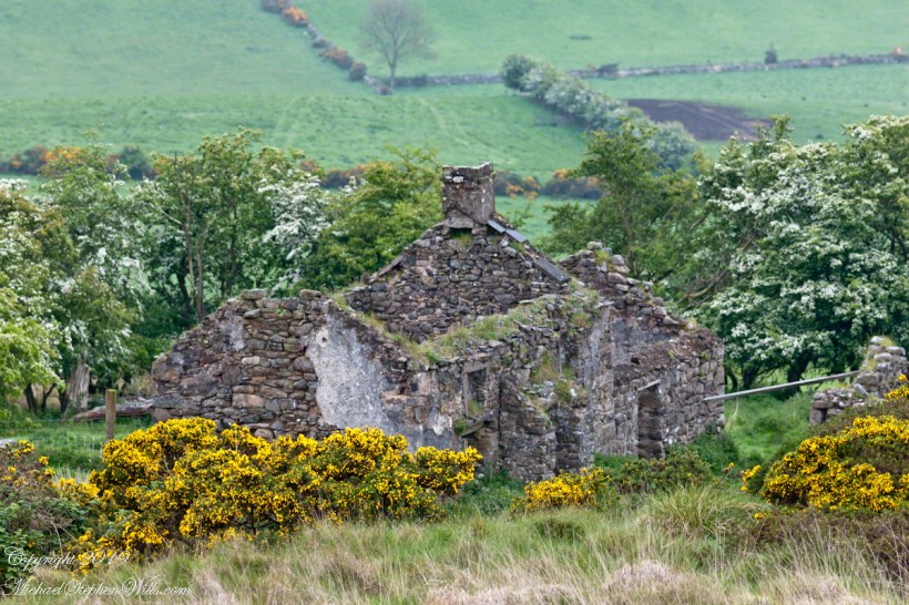
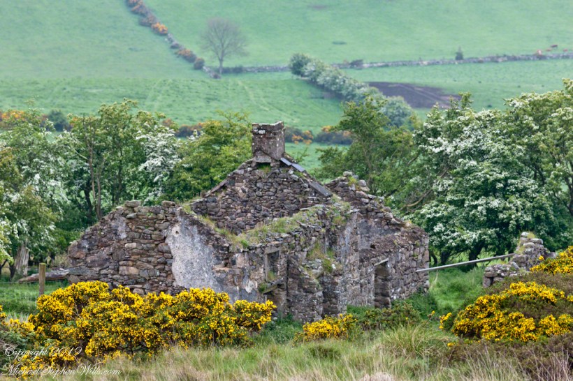
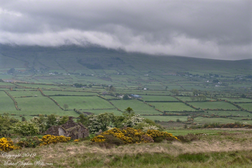
The ruin in this view is on the slopes of the peak. Some of these ruins are former homes with the replacement nearby. This appears to be an abandoned farm.
Slievenaglogh is the name of a peak on the Cooley Peninsula of County Louth, Ireland near to the birthplace of my Mom, Proleek, a few townlands to the west.
Click photograph for a larger view. To do this from WordPress Reader, you need to first click the title of this post to open a new page.
Slievenaglogh View, northeast
On the northeast slope of Slievenaglogh peak (Irish: Sliabh na gCloch) on the road from Mullaghattin Townland to Riverstown.
Here we look northeast from the Slievenaglogh Townland, the valley between Slieve Foy and Slievenaglogh peaks.
The view includes Little River, Ballycoly Townland and Castletown River.
Adjacent is a sheep pasture with a farm ruin behind the yellow flowered gorse (whin bush, scientific name Ulex).
Slieve Foy is the far ridge lost in clouds. Early morning, late May 2014.
On the northeast slope of Slievenaglogh peak (Irish: Sliabh na gCloch) on the road from Mullaghattin Townland to Riverstown. This day I swapped lenses and took in the same general direction for each. This is the first and last of a series using the Canon EF 50mm f/1.4 USM lens and I pulled in the shots from the Canon 24mm f1.4 L II USM lens, published in previous posts.
Click photograph for a larger view. To do this from WordPress Reader, you need to first click the title of this post to open a new page.
Slievenaglogh View, northeast, 50mm
Slievenaglogh View, northeast
Here we look northeast from the Slievenaglogh Townland over the valley between Slievenaglogh and Slieve Foy peaks. Slieve Foy is the far ridge lost in clouds.
This is the first and last of a series using the Canon EF 50mm f/1.4 USM lens.
Slievenaglogh View, north northeast. 50mm
Slievenaglogh View, north northeast
The view includes Little River, Castletown River, Ballycoly and Glenmore Townlands. Adjacent is a sheep pasture with a farm ruin behind the yellow flowered gorse (Whin bush, scientific name Ulex).
Slievenaglogh View, east, 50mm
Slievenaglogh View with road, east
Early morning, late May 2014.
Here is a slideshow of the 50mm and 24mm images of this post.