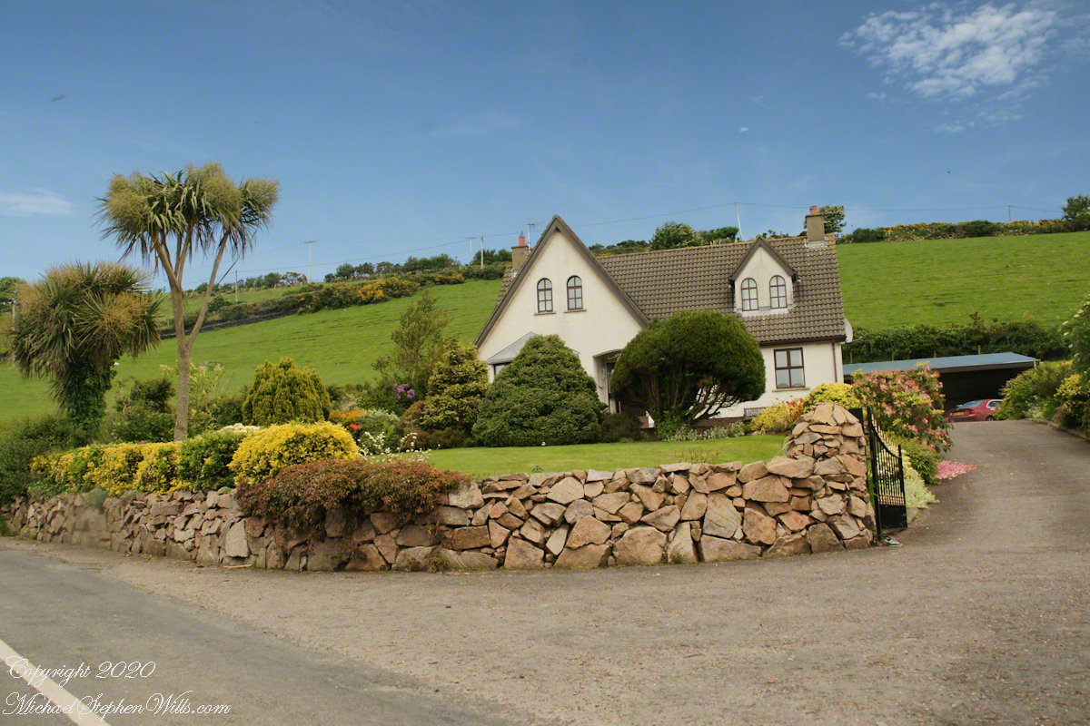
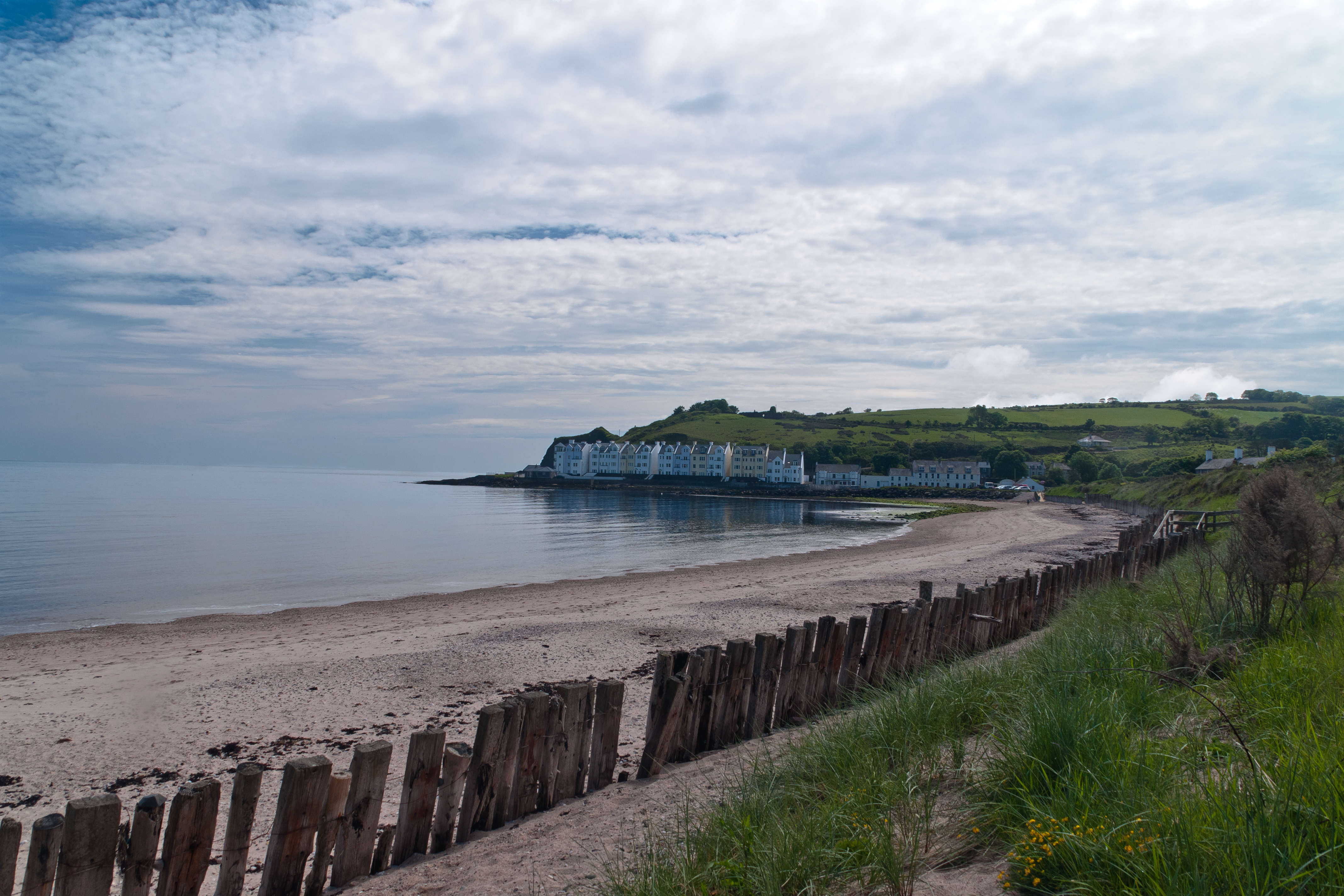
Cushendun (from Irish: Cois Abhann Doinne, meaning “foot of the River Dun”) is a small coastal village in County Antrim, Northern Ireland. It sits off the A2 coast road between Cushendall and Ballycastle.
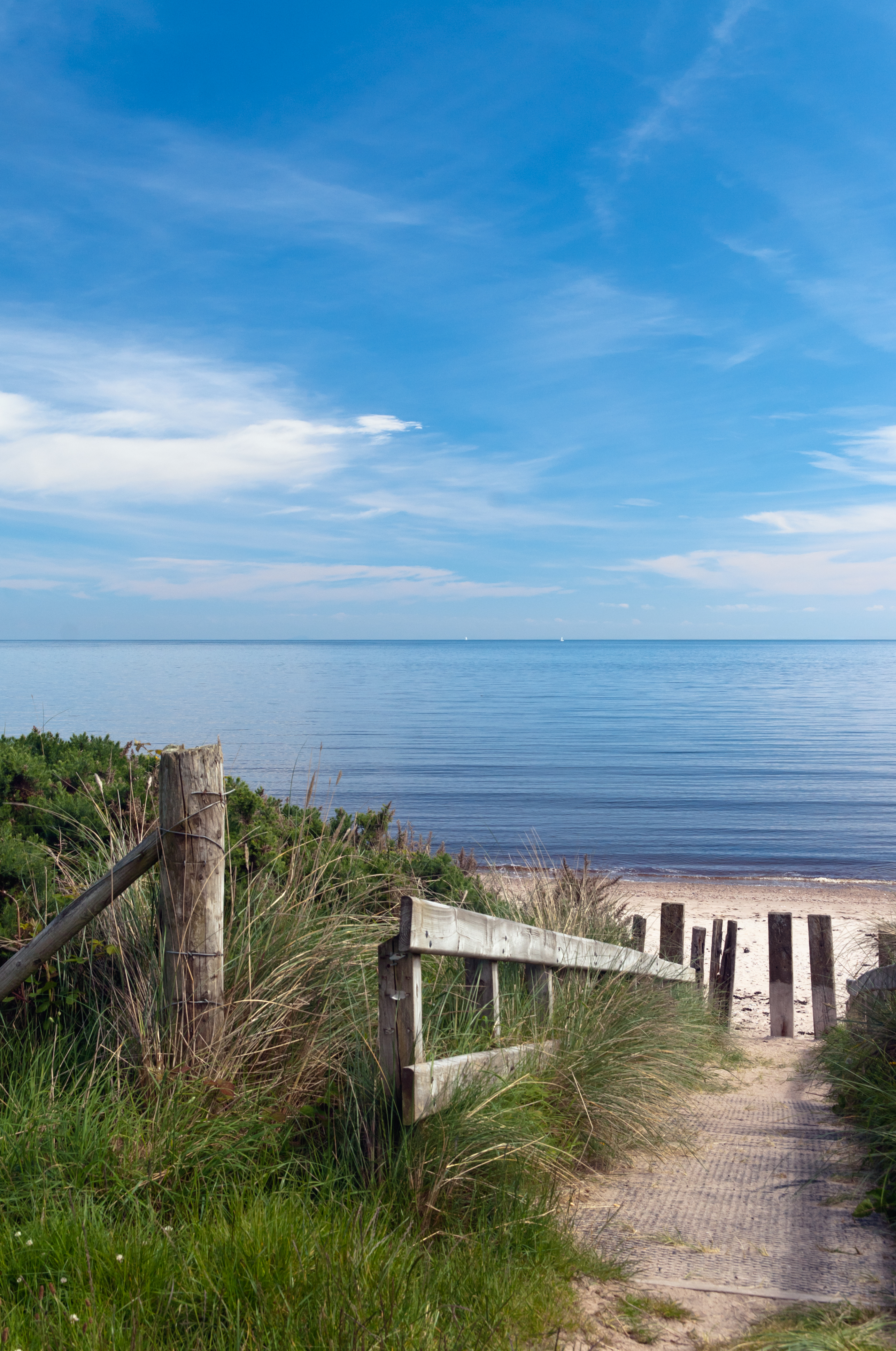
It has a sheltered harbor and lies at the mouth of the River Dun and Glendun, one of the nine Glens of Antrim. The Mull of Kintyre in Scotland is only about 15 miles away across the North Channel and can be seen easily on clear days.
In the 2001 Census it had a population of 138 people. Cushendun is part of Causeway Coast and Glens district.
SONY DSC
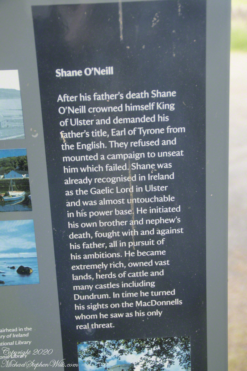
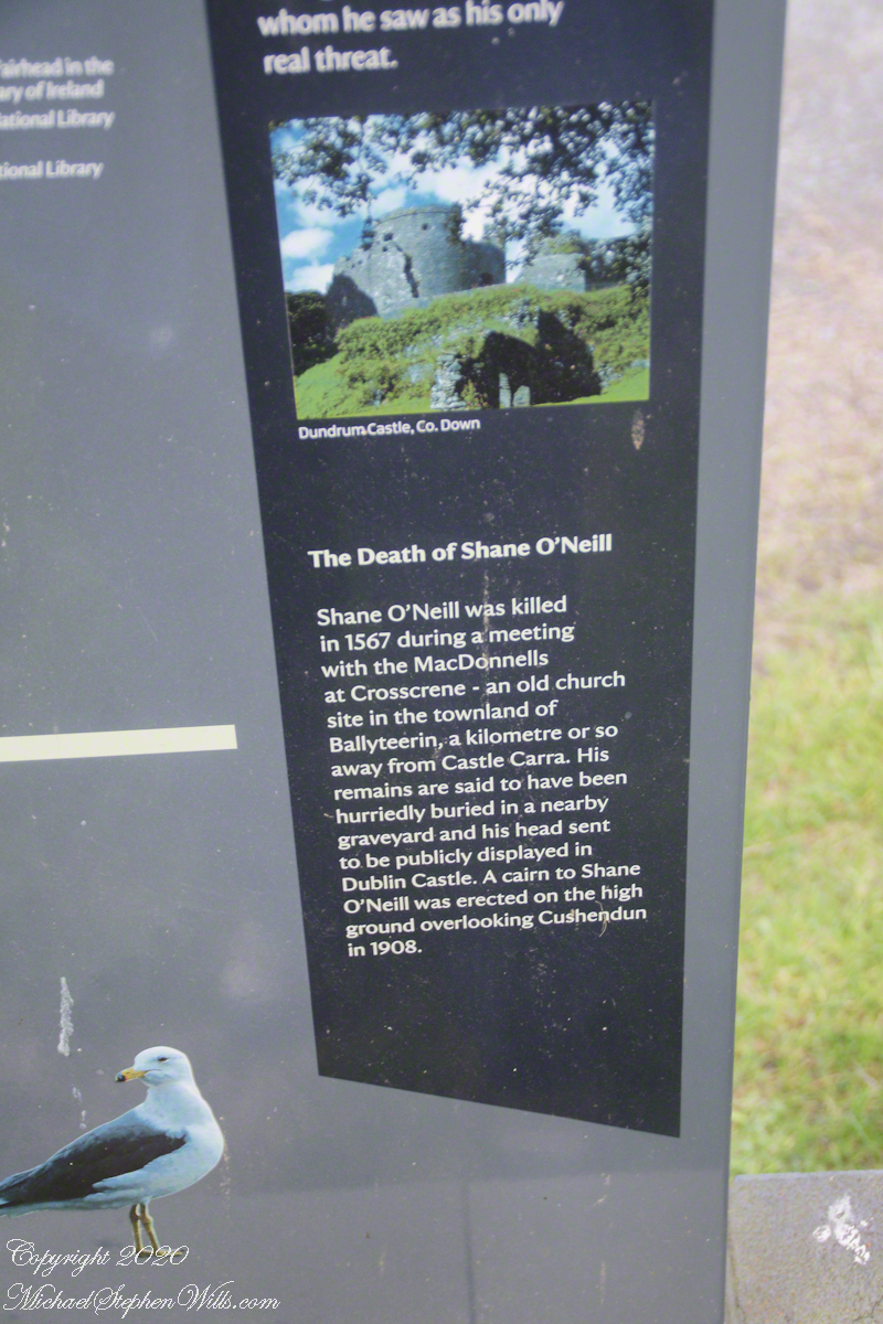
Here are several of the information placards near the harbor explaining some local history.
.
Ballyteerin townland, where Shane O’Neill was killed, is on the road to Torr Head.
Reference: Wikipedia, “Cushendun.”
Enter your email to receive notification of future postings. I will not sell or share your email address.
Copyright 2025 All Rights Reserved Michael Stephen Wills
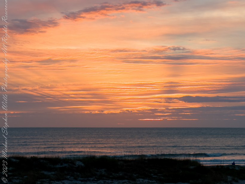
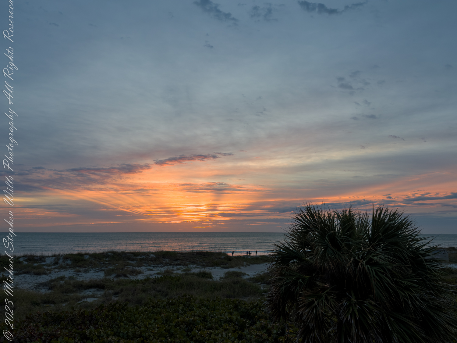
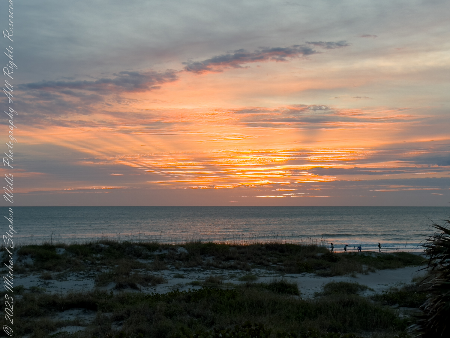
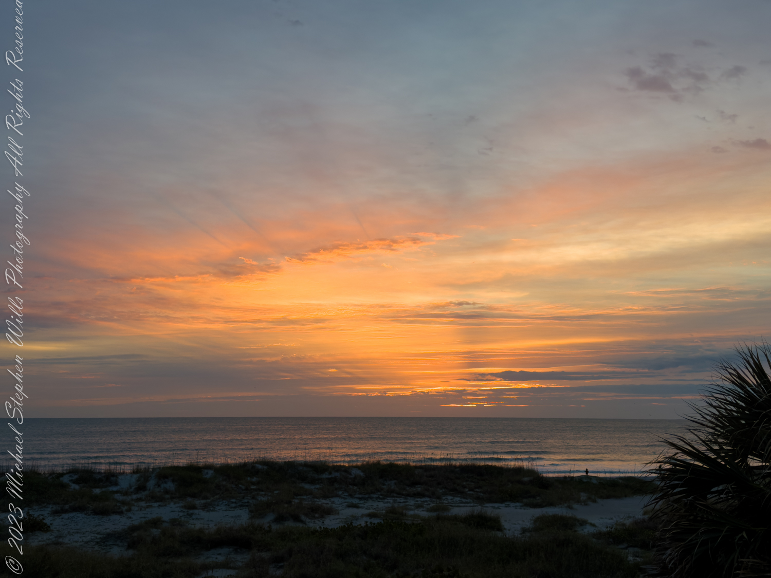
Awake to the radiant grace of dawn, where golden light adorns the sky and the ocean reflects its splendor. Witness the serene dance of nature in a peaceful, inspiring January sunrise at Cocoa Beach.
Awake, my soul, to morning’s radiant grace, as dawn’s first light adorns the sky’s embrace. Behold the scene where heaven meets the sea, a tapestry of hues, divinely free.
The eastern sky ignites with golden fire, each ray a herald of the sun’s desire. In softest pinks and boldest crimsons cast, the night retreats, and day arrives at last.
The ocean, kissed by dawn’s ethereal light, reflects the splendor of the coming sight. Waves gently lap upon the sandy shore; their whispered secrets speak of days of yore.
The palm trees sway in rhythmic, gentle dance, their silhouettes in morning’s light enhance. A peaceful stillness wraps the world in awe, as nature’s beauty strikes the heart with awe.
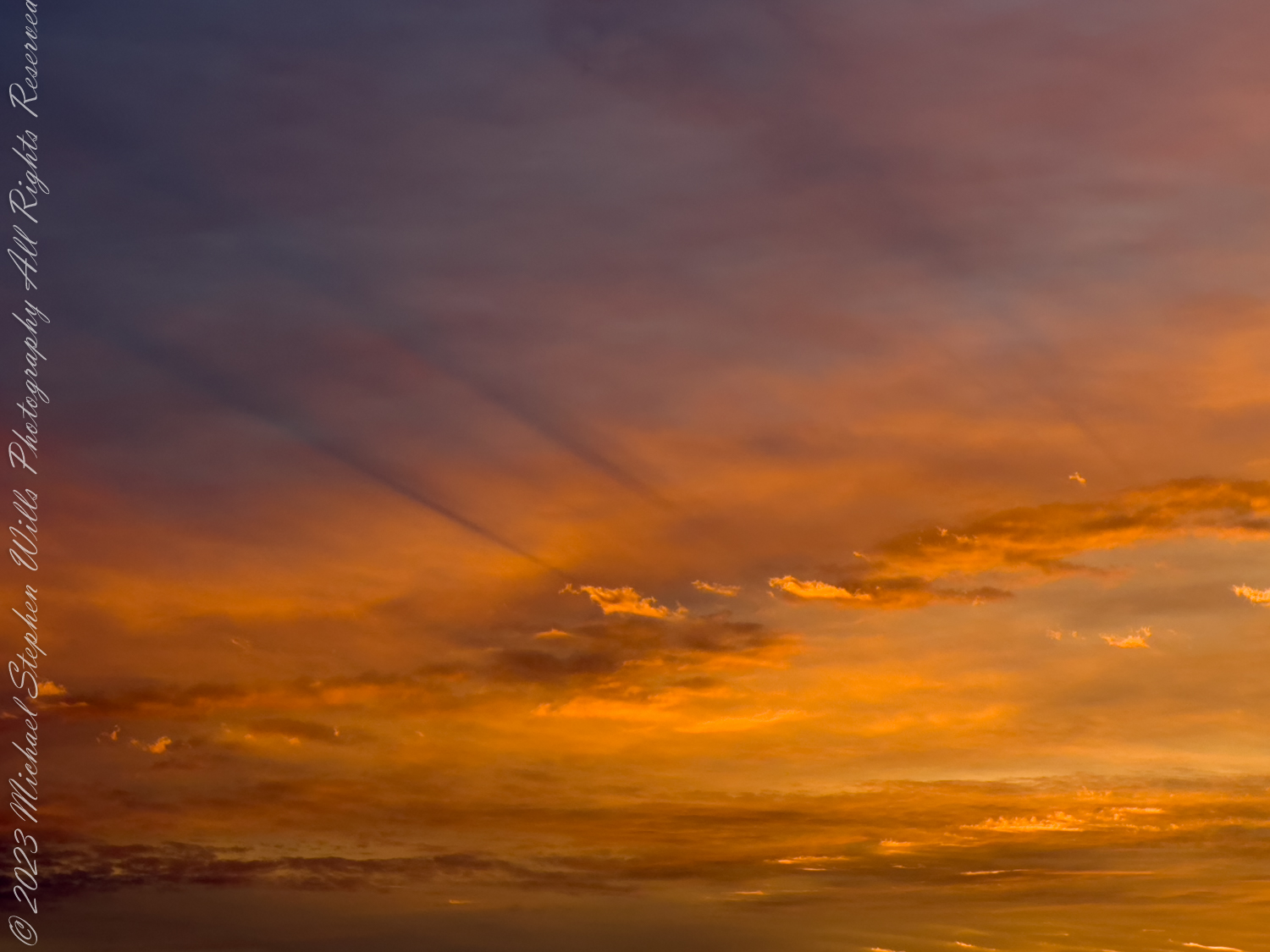
The scattered clouds, with edges tinged in gold, Frame the horizon as the day unfolds. They drift like dreams upon the waking breeze, in harmony with rustling leaves of trees.
And as the sun ascends its royal throne, Its warmth and light through every vein is known. A new day born, with promise in its wake, invites the heart to rise and dreams to take.
Imagine, seagulls soar on wings of pure delight, their cries a chorus to the morning’s light. They glide and dive with effortless grace, their freedom echoes in this sacred space.
On distant sands, the footprints of the few mark early risers greeting morning’s hue. Their presence, fleeting, soon to be erased, by tides that sweep the shore in gentle haste.
Oh, glorious dawn, thy beauty so profound, Inspire the soul where peace and love abound. Let hearts be lifted by thy gentle hand, to cherish all that’s wondrous in this land.
For in this moment, all the world is still, the chaos of the night’s dark dreams to kill. A symphony of light and life begins, as morning’s joy through every fiber sings.
So let us honor this celestial show, where sky and sea in radiant colors glow. In silent reverence, we stand and gaze, at dawn’s first light, and marvel at its blaze.
Awake, my soul, and bask in morning’s gleam, embrace the beauty of this waking dream. For in the sunrise, hope and peace reside, a timeless gift the heavens do provide.
Copyright 2024 Michael Stephen Wills All Rights Reserved
Discover a heartfelt story woven from the sands of Cocoa Beach on New Year’s Eve, where shells and stars intertwine, inviting you to ponder the delicate dance of near and far.
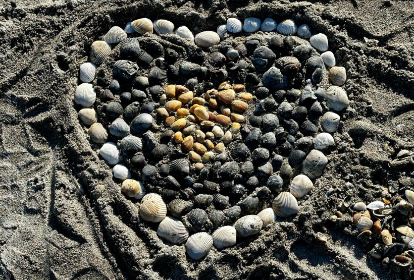
On the last day of 2023, as the sun began its descent on Cocoa Beach, I found myself tracing the contours of a heart laid out in Ark Clam shells. Each shell, with its ridges and grooves, felt like a chronicle of the ocean’s whispers. This artful mosaic, set against the granular canvas of the beach, was a testament to the playful hands of time and tide. I marveled at the intention behind it, the human desire to create and connect, to leave a mark, however fleeting, on the vastness of nature.
I found this beach heart while walking on Cocoa Beach on the last day of 2023. It is composed of the various shade of Ark Shells. Ark clam is the common name for a family of small to large-sized saltwater clams or marine bivalve molluscs in the family Arcidae. These are the most common shells found there.
The shells were cool and firm under my fingertips, each one a unique piece of the year’s mosaic. Some were a pristine white, while others bore the earthy tones of the sea’s floor. I pondered the journeys they had taken, tumbling in the ocean’s embrace before resting here, on the threshold of a new year. The act of arranging them into a symbol of love felt like an ode to the past year’s collective joys and sorrows, an offering to the unknown adventures of the year to come.
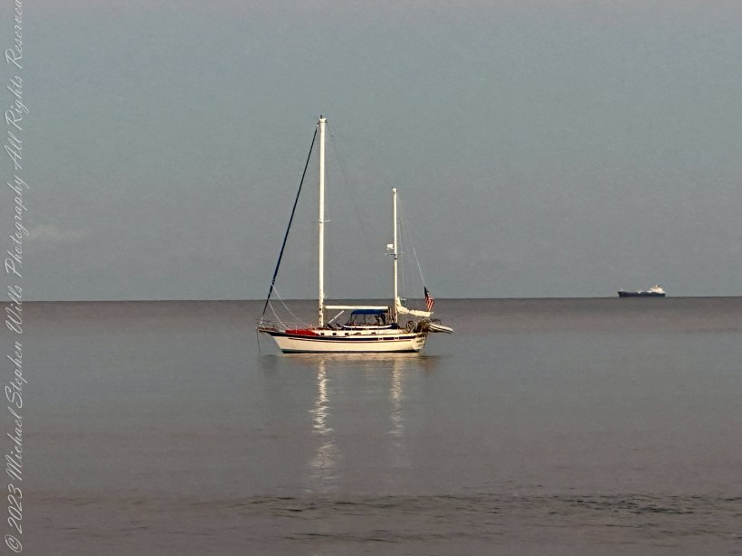
As the day waned, my gaze shifted from the shells to where the water met the sky. There, a sailboat floated serenely, a silent sentinel between two worlds. It was a picture of solitude, a single vessel on the brink of the infinite sea, beneath the expanding dome of the heavens. On the horizon, the silhouette of a cargo ship whispered stories of distant lands and the ceaseless pulse of commerce and exploration that defined our modern era.
On New Years Eve 2023 this sailboad moored off North 1st Street, Cocoa Beach, Brevard County, Space Coast, Florida.
The beach was quiet, the sounds of the day giving way to the evening’s peaceful lull. The sailboat’s stillness was a stark contrast to the perpetual motion of the cargo ship, each representing different paths on the water’s vast canvas. One was an emblem of leisure and simplicity, the other of industry and complexity. Both near and far, they were the day’s quiet companions, their stories part of the fabric of the Space Coast.
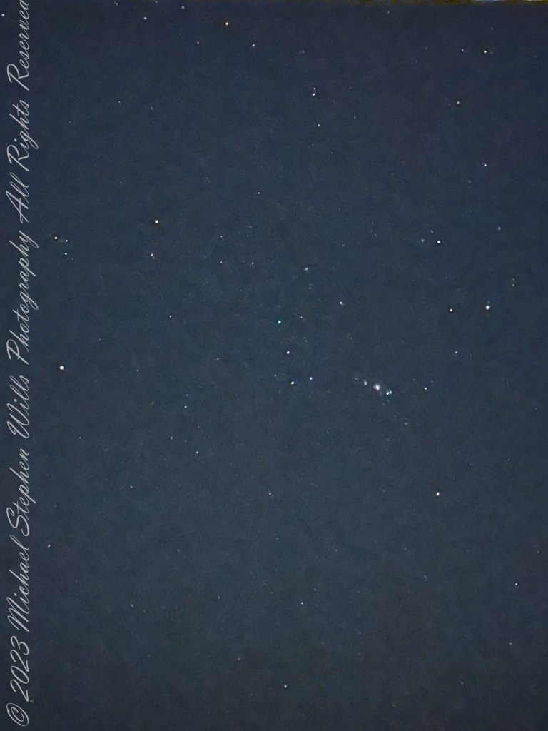
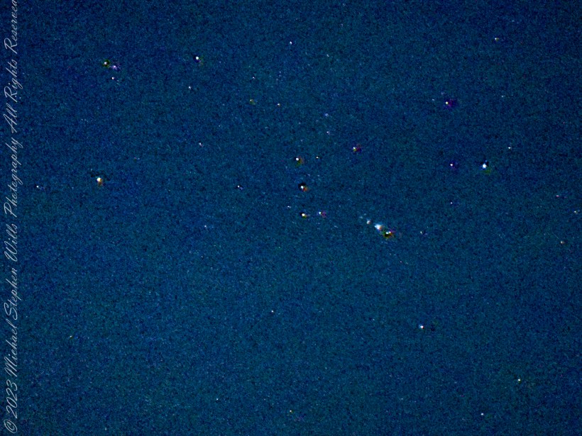
As twilight deepened into night, the stars began to emerge, one by one, until the sky was a tapestry of celestial wonder. With my iPhone 14 Pro Max, I captured this cosmic dance, the constellation of stars that had been the silent witnesses to Earth’s revolutions. The constellations, those mythic shapes that have long sparked human imagination, seemed to hold the secrets of what had been and what was to come. They were distant suns, their light traveling unfathomable distances to reach me, to reach us, as we stood on the brink of a new beginning.
Orion
I couldn’t help but feel a connection to the stars, a kinship with their ancient light. They reminded me that we, too, are part of this grand cosmic design, our lives stitched into the universe’s expansive quilt. On the beach, with the shells at my feet and the stars overhead, I was caught in the delicate balance of near and far—the tangible reality of the shells I could touch and the distant glow of starlight from ages past.
Orion, the belt and sword in center.
As the year ticked closer to its end, I stood between the intimate artistry of the shell heart and the boundless majesty of the star-filled sky, a lone observer of time’s relentless march. The Space Coast, with its unique blend of earthly beauty and human aspiration, was the perfect stage for this reflection. Here, on Cocoa Beach, I embraced the last moments of 2023, ready to welcome the new year, with its promise of continuance and change, its constant dance of near and far.
Copyright 2024 Michael Stephen Wills All Rights Reserved
Join me in reminiscing about a memorable trip to Ireland, marked by the now-closed Breezemount House B&B and the scenic Dunseverick Castle Ruin. Dive into my journey and the advice that shaped it
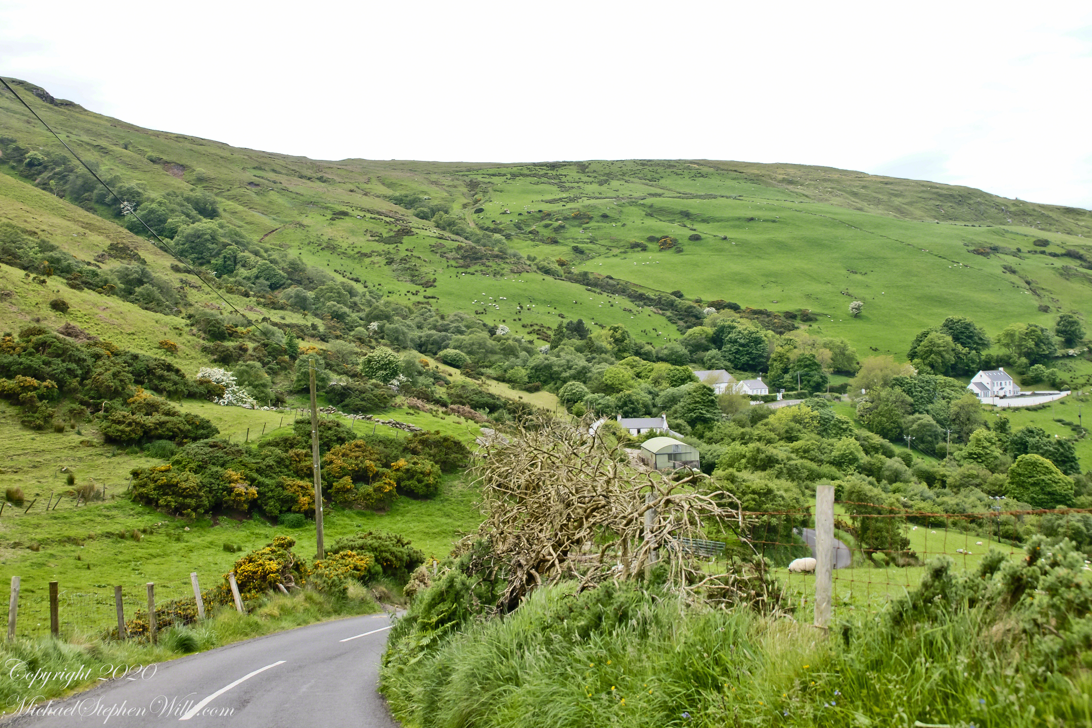
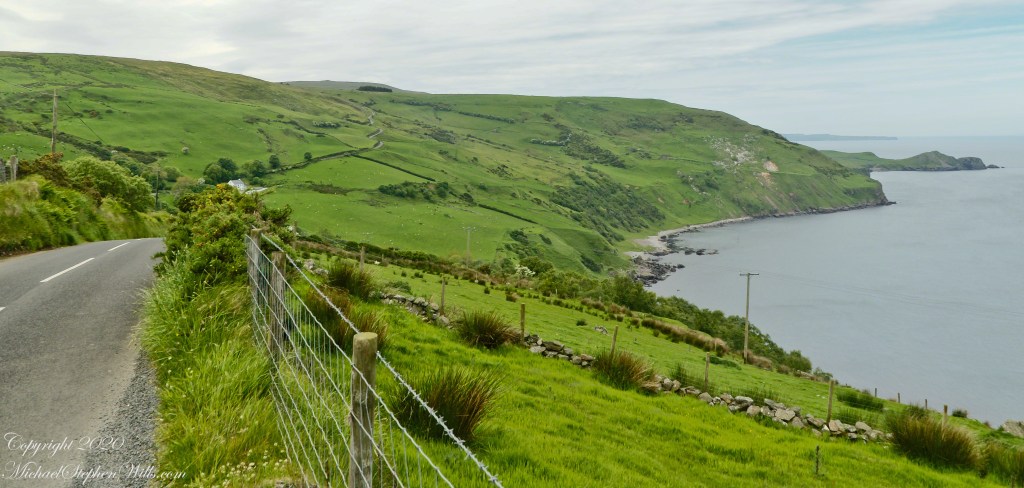
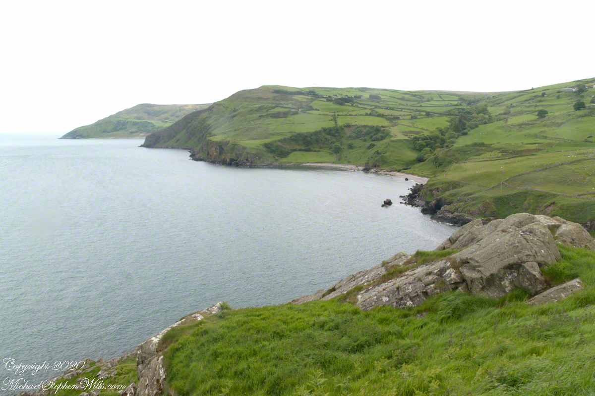
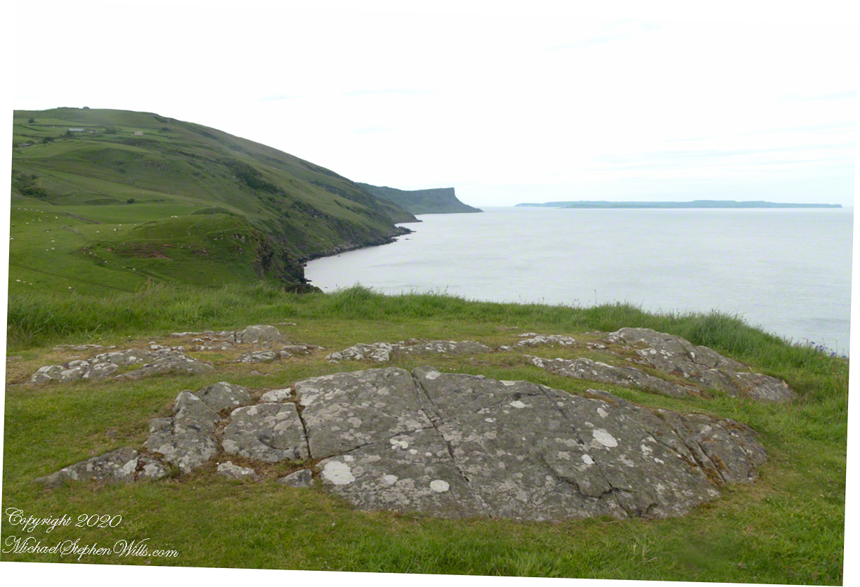
This photograph from the bottom of the Torr Road hill takes in Coolranny Townland. a slice of land running from the ridge to Loughan Bay. We see a number of hawthorne trees in flower, yellow flowering Whin Bush, houses and the Roman Catholic church Saint Mary’s Star of the Sea.
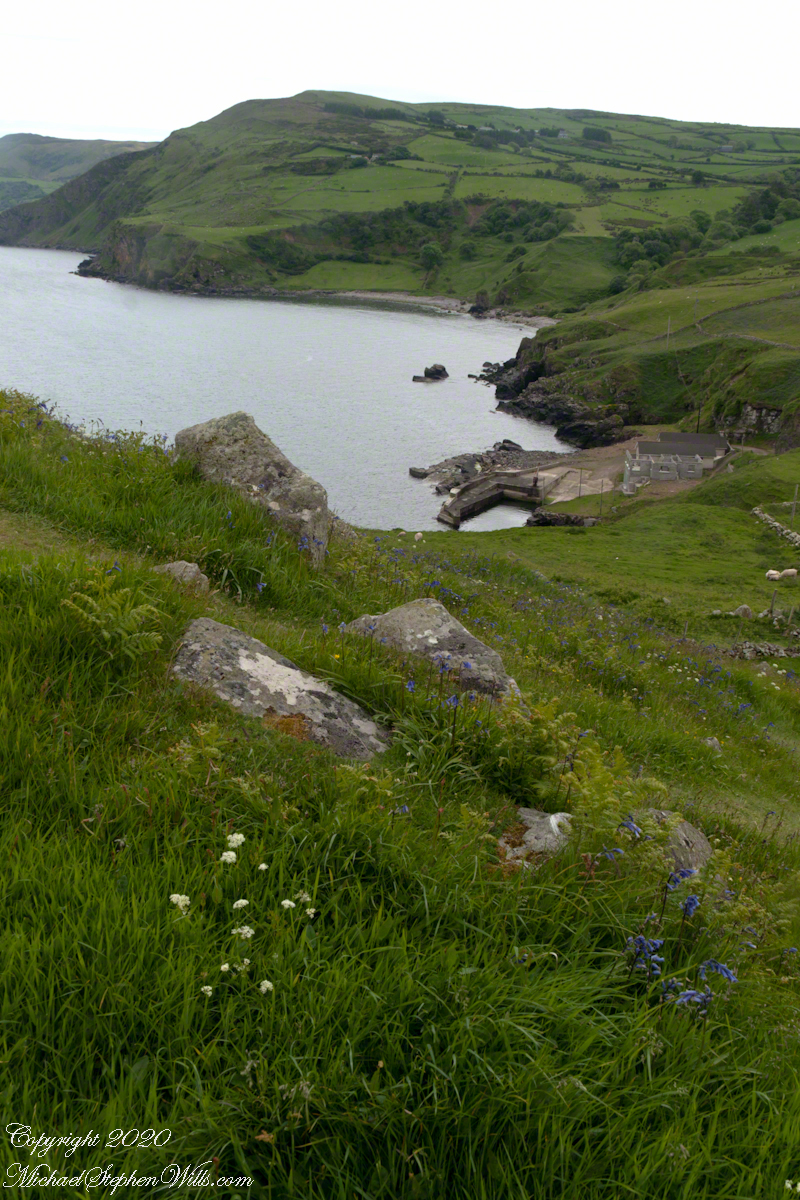
Tor in Irish is a steep rocky height. Likewise, Corr means odd, uneven, rounder, convex, curved, peaked, projecting, smooth. Combined Torcorr is the townland where we stopped on the Torr Road, halted by our wonder at this sight. In the distance, Torr Head projects into North Channel, the closest land to Scotland. Following the coast, the cliffs in front of Torr Head is home to numerous sea birds. The curved bay is named Loughan, the rocky sand beach are ruins of cottages emptied by Irish emigration. The white building is Saint Mary’s Star of the Sea Roman Catholic Church. County Antrim, Northern Ireland.
View of Coolranny townland with Saint Mary’s Star of the Sean Roman Catholic Church from Torcorr townland, Torr Road . County Antrim, Northern Ireland.
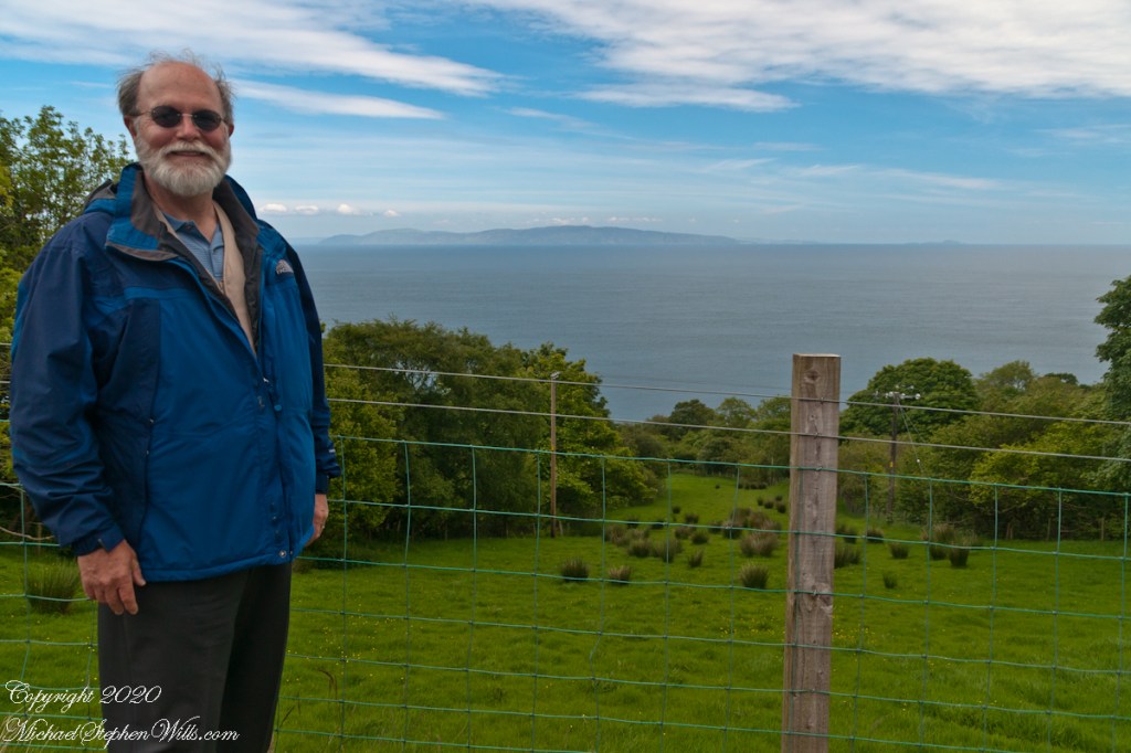
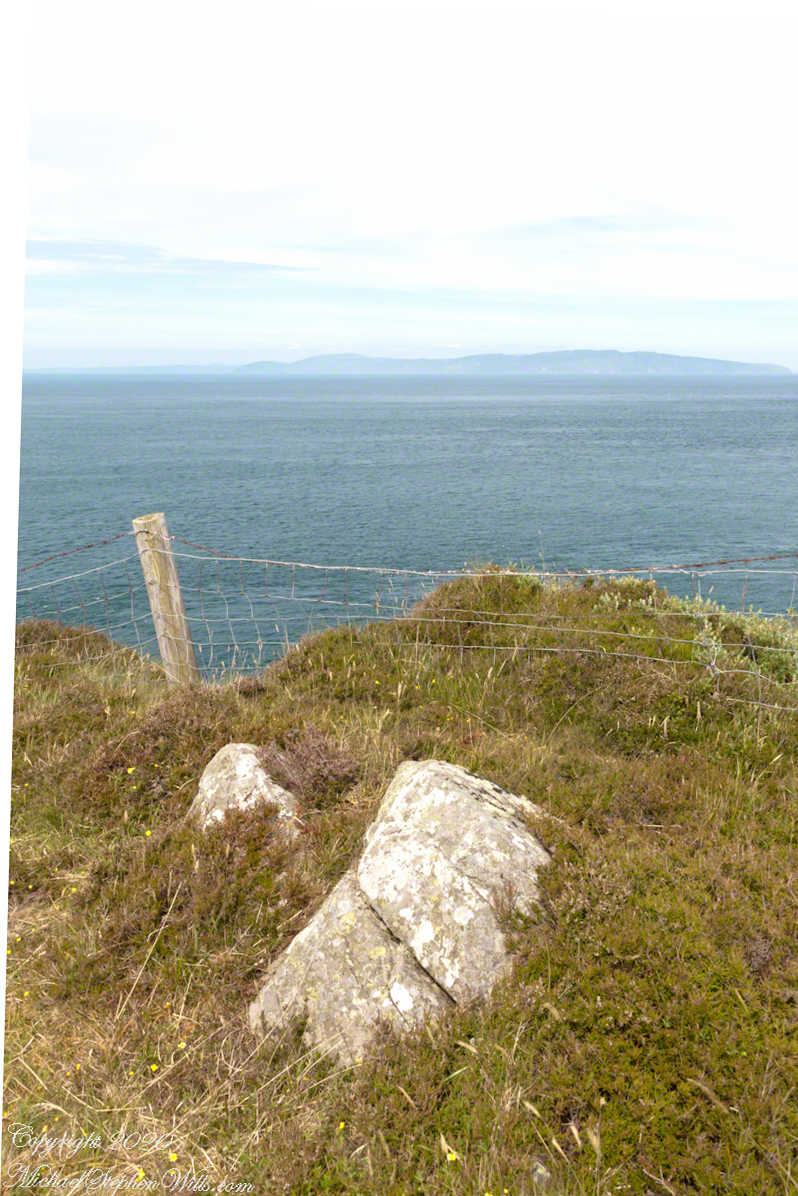
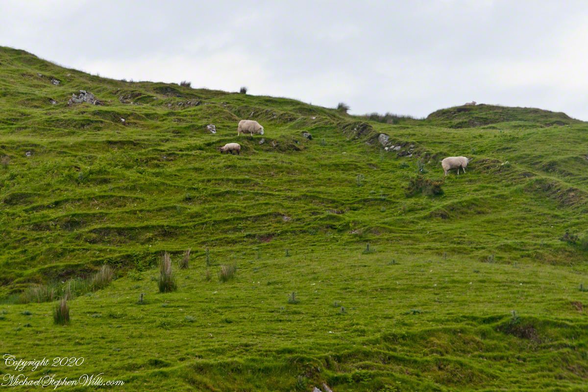
The photograph of the header, taken by Pam, is from either Coolranny or Loughan Townland, looking across a sheep pasture, the North Channel of the Irish Sea toward the Mull of Kintyre, Scotland just twelve miles distant.
Here is a slideshow of this post’s images. To visit from WordPress Reader, you need to first click the title of this post to open a new page.
Tor in Irish is a steep rocky height. Likewise, Corr means odd, uneven, rounder, convex, curved, peaked, projecting, smooth. Combined Torcorr is the townland where we stopped on the Torr Road, halted by our wonder at this sight. In the distance, Torr Head projects into North Channel, the closest land to Scotland. Following the coast, the cliffs in front of Torr Head is home to numerous sea birds. The curved bay is named Loughan, the rocky sand beach are ruins of cottages emptied by Irish emigration. The white building is Saint Mary’s Star of the Sea Roman Catholic Church. County Antrim, Northern Ireland.View of Coolranny townland with Saint Mary’s Star of the Sean Roman Catholic Church from Torcorr townland, Torr Road . County Antrim, Northern Ireland.On the way to Torr Head we stopped at this spot in Coolranny Townland to take in this view of the Irish Sea. The land overlooks Loughan Bay toward the Mull of Kintyre and Sanda Island, Scotland. County Antrim, Northern Ireland.
Copyright 2023 All Rights Reserved Michael Stephen Wills
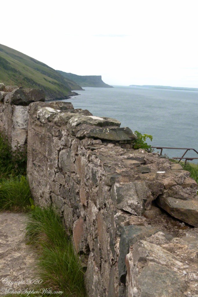
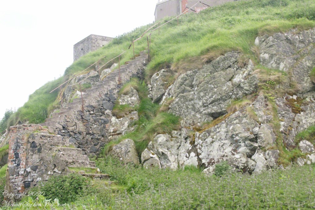
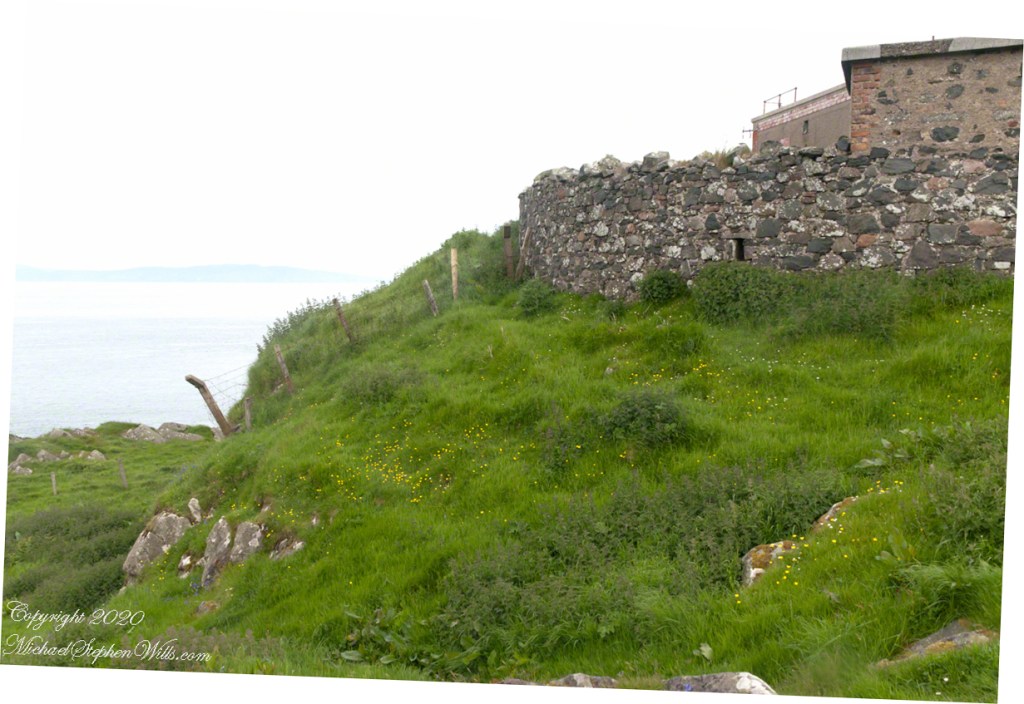
Weathered masonry at the height of Torr Head was there to serve the custom house and as support for a spotting station where ships transiting the Strait of Moyle (Irish Sruth na Maoile), the 12 miles of water to the Mull of Kintyre.
Lloyd’s of London, vitally interested in the appearance of ships’ progress crossing the oceans, had notice of passage via semaphore (and, later, Marconi’s “wireless”). Destination ports were copied in.
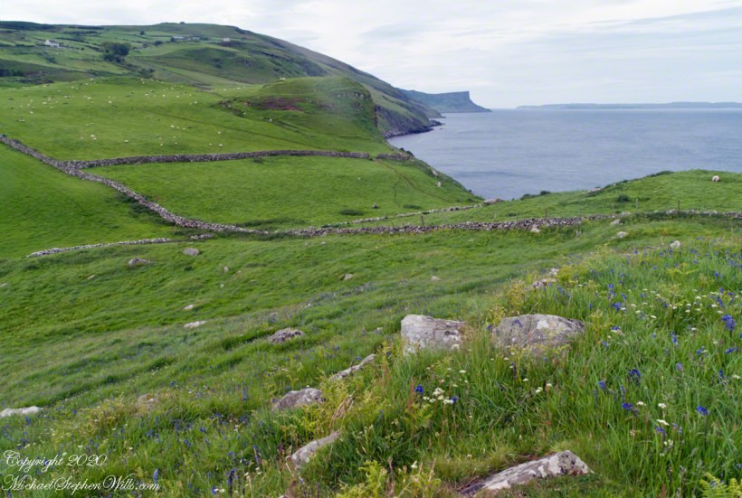
Scottish influences touched the landscape covered by yesterday’s post, today we continue on this subject with these south facing views from Torr Head. The far ridge of Torrcor marks Loughan Bay.
A townland on the other side of Torrcor hill (and townland) has an eponymous ruin, Altagore Cashel. Mores the pity we did not visit this site, a thick drystone enclosing wall from the 5th century (you can see photographs from another site at this link). Cashel is from the Irish Caiseal, a circular, defensive fort (“ring fort”).
Books such as “Antrim and Argyll: Some Aspects of the Connections” tell of connections over the millennia, clan associations between the islands and ring forts such as Altagore Cashel.
Argylshire Scotland across the North Channel from Torr Head
Late spring and summer, weekdays, a net is stretched across the bay to catch salmon nosing up the coast, searching for their home spawning stream, here called Altmore Burn. “Burn” is a Scottish term for a fresh water source, evidence of the influence 12 miles across the north channel.
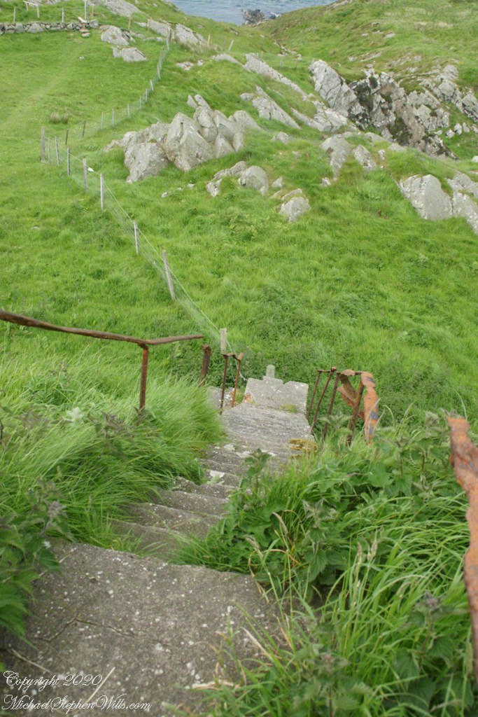
The small harbor seen here from Torr Head is for the salmon fishery. Small boats will seek shelter here from the wind and tides strong enough to roar in passing the Head, like a fast flowing river.
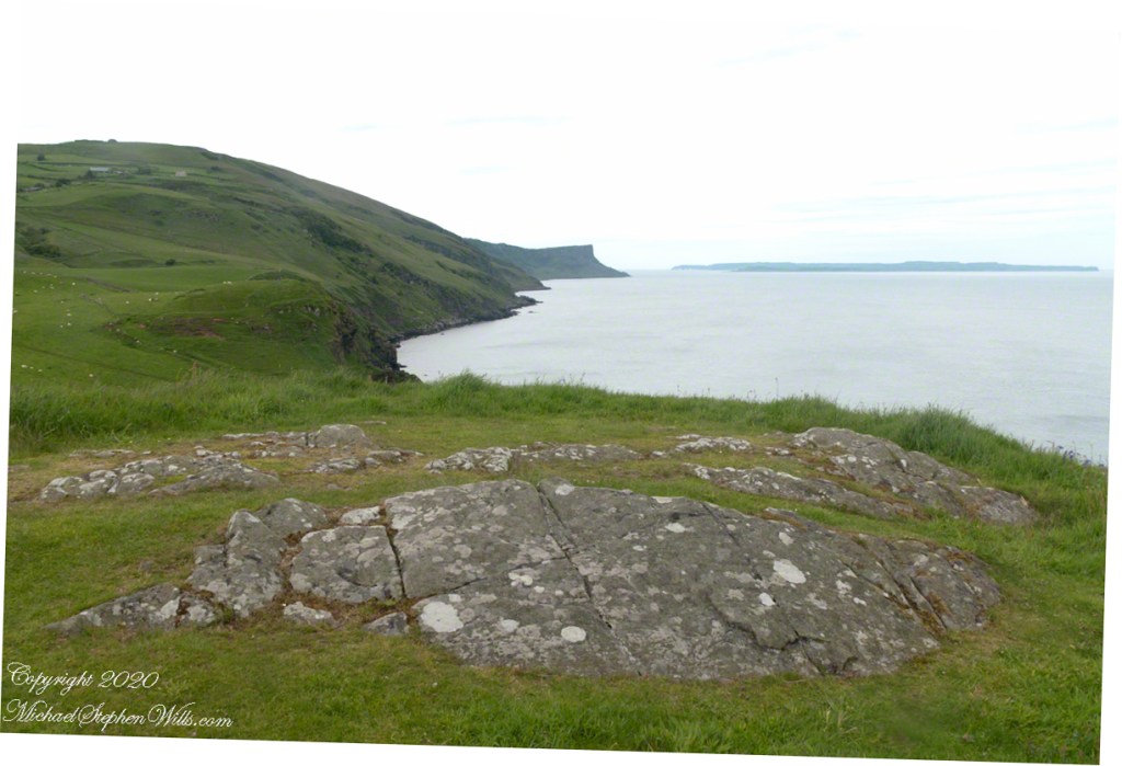
Taking in a flower meadow, foreground, coaster sheep pastures, the photograph, below, looks north from Torr Head. The high hill, midground, is Greenanmore, notable for a the largest passage tomb of the Antrim Glens. Locally known as “Barrach’s Tomb,” for the Red Branch knight of the 1st Century AD fort on Torr Head, tree ring research of the mid-20th Century dates these tombs in the neolithic The hilltop passage tomb was an ancient relic when the mortar of Barrach’s Torr Head fort was drying.
When I enlarge the original photograph, visible on the ridge is a decommissioned Cold War listening post, the tomb is near that. The distant land across the North Channel water is Rathlin Island.
Click photograph for a larger view. To do this from WordPress Reader, you need to first click the title of this post to open a new page.
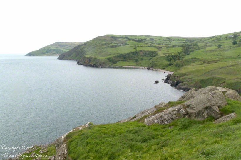
Knights of the Red Branch appear towards the end of “Deirdre and the sons of Uisneach”, a tale from 1st century AD Ireland, as protectors of the lovers Dierdre and one of the sons of Uisneach, named Naoise. The two fled to Rathlin Island, seen in the distance in the following photograph.
Distant Rathelin Island from Torr Head
From Rathlin Island they passed over the Irish Sea to Scotland where they lived happily for a term of years.
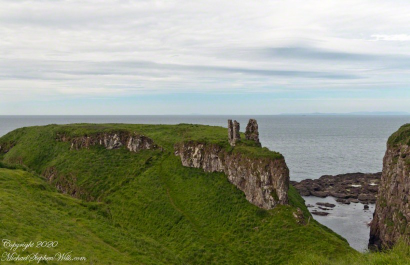
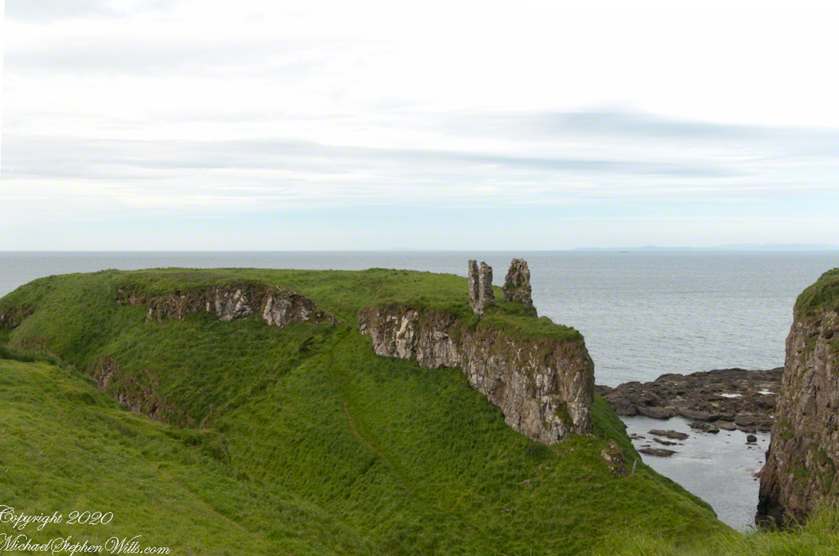
Barrach’s fort no longer exists, a Coast Guard Station was built over the site. There are other intact ruins on this picturesque coast. Here is one close to the Giant’s Causeway, Dunseverick Castle.
Dunseverick Castle
Copyright 2022 All Rights Reserved Michael Stephen Wills