
Dunseverick Castle Ruin
Join me in reminiscing about a memorable trip to Ireland, marked by the now-closed Breezemount House B&B and the scenic Dunseverick Castle Ruin. Dive into my journey and the advice that shaped it
Join me in reminiscing about a memorable trip to Ireland, marked by the now-closed Breezemount House B&B and the scenic Dunseverick Castle Ruin. Dive into my journey and the advice that shaped it
Pride of History on display
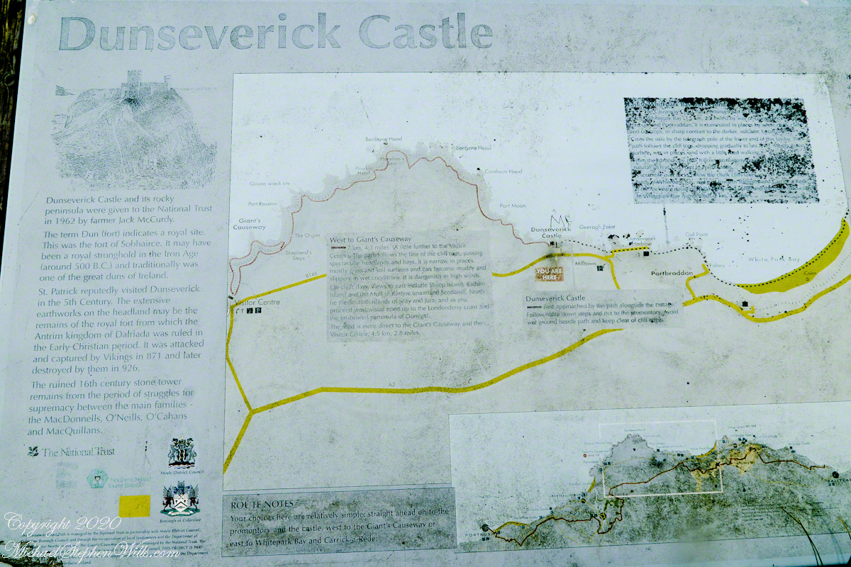
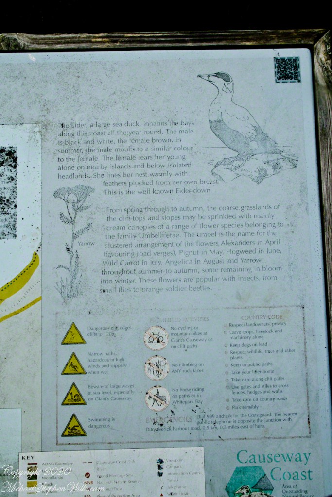
On Causeway Road there is a turnoff an information placard for Dunseverick Castle near a cottage. This is the left side of the placard with the historical context. The right side is natural history of the area.
Click photograph for a larger view. To do this from WordPress Reader, you need to first click the title of this post to open a new page.
Click me for the first post of this series.

Copyright 2020 All Rights Reserved Michael Stephen Wills
Recollections of Saint Patrick
Slight pangs of regret recalled in my first Dunseverick Castle post are recalled this morning on remembering the long Slige Midluachra (aka “High King’s Road”) of which Dunseverick Castle was the terminus, beginning from the Hill of Tara. Walk the High King’s Road, “why not?.”
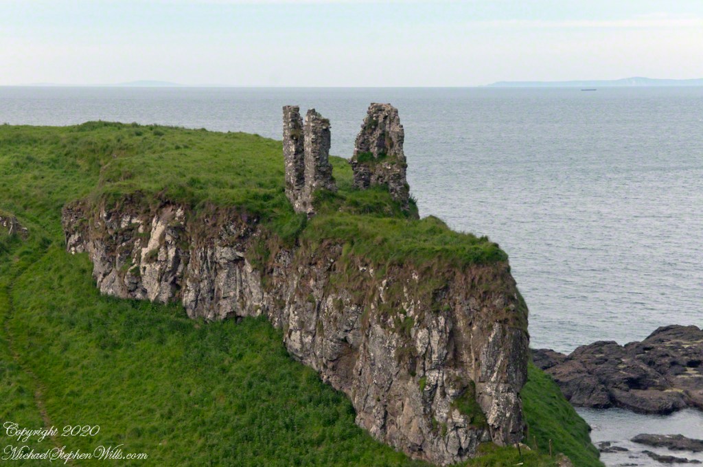
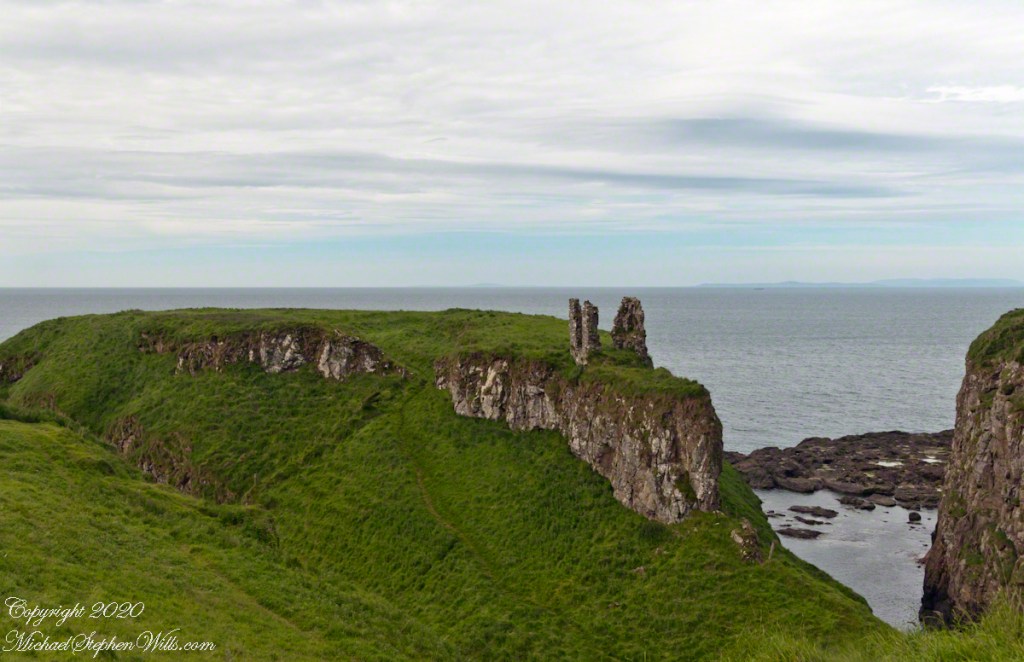
Here we can see the two partial wall, remains of a gate house, destroyed in the 17th century. I can imagine making the climb up the foot path, examine the earthworks from before the Viking invasions, middle of the first millennium A.D. Recall a visit by Saint Patrick, trodding the path from his Easter fire on the Hill of Slane.
Click photograph for a larger view. To do this from WordPress Reader, you need to first click the title of this post to open a new page.
Explore my photography on Shutterstock for use with your blogs
Copyright 2020 All Rights Reserved Michael Stephen Wills
