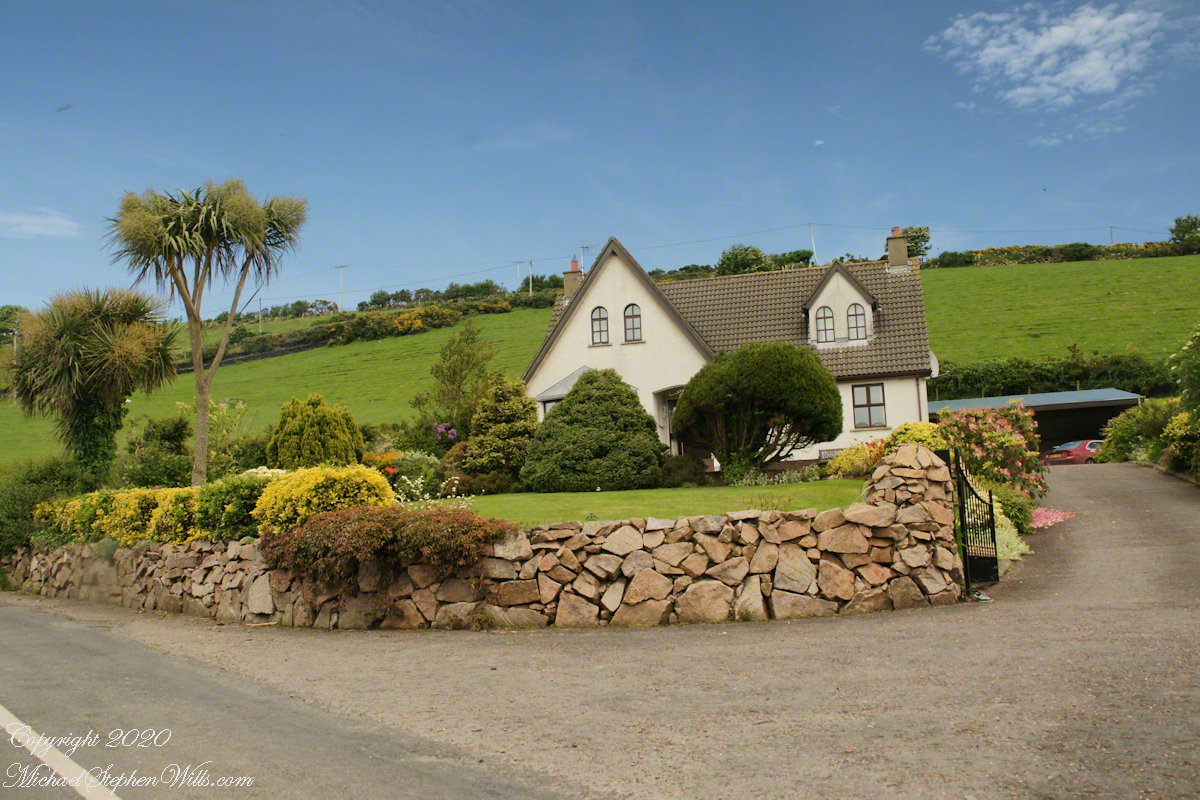
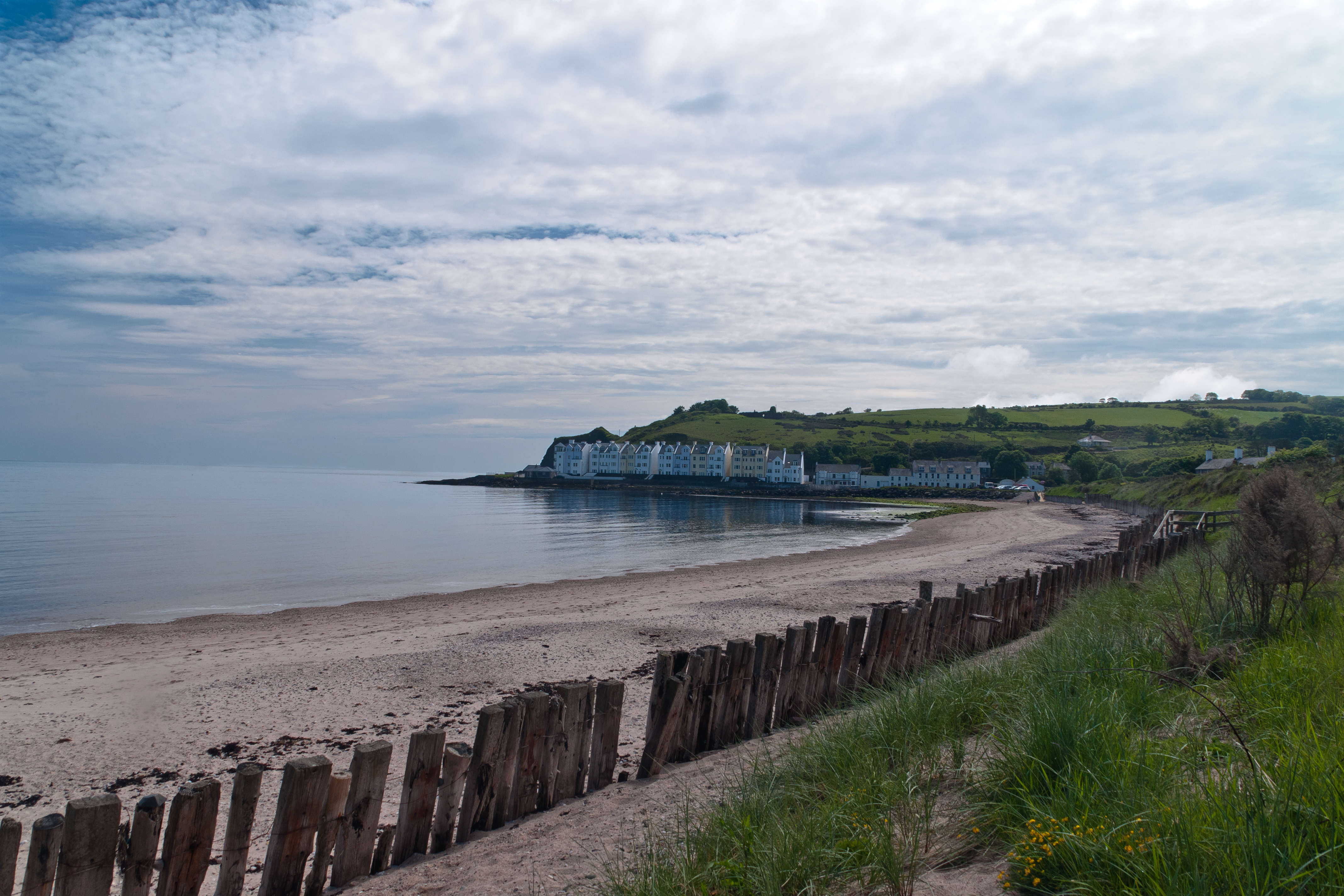
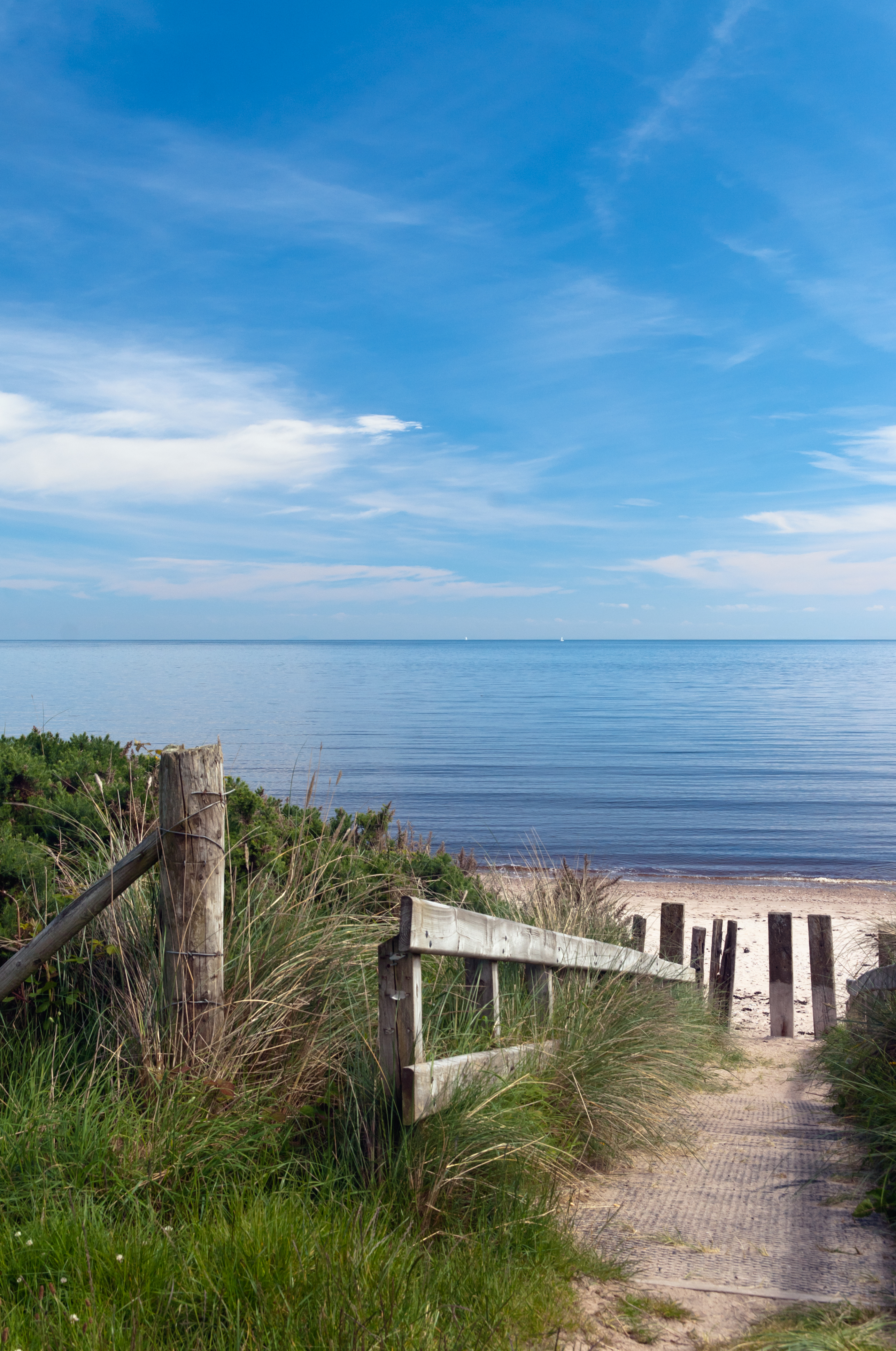
Cushendun (from Irish: Cois Abhann Doinne, meaning “foot of the River Dun”) is a small coastal village in County Antrim, Northern Ireland. It sits off the A2 coast road between Cushendall and Ballycastle.
It has a sheltered harbor and lies at the mouth of the River Dun and Glendun, one of the nine Glens of Antrim. The Mull of Kintyre in Scotland is only about 15 miles away across the North Channel and can be seen easily on clear days.
In the 2001 Census it had a population of 138 people. Cushendun is part of Causeway Coast and Glens district.
SONY DSC
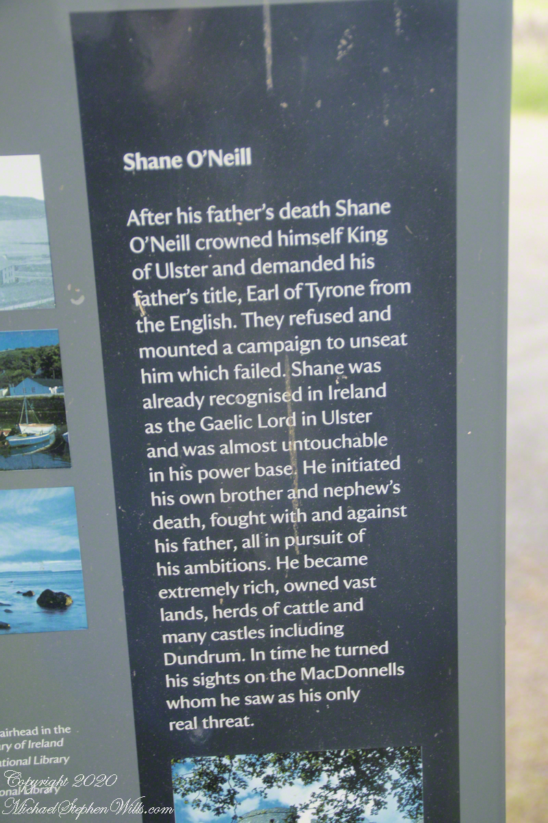
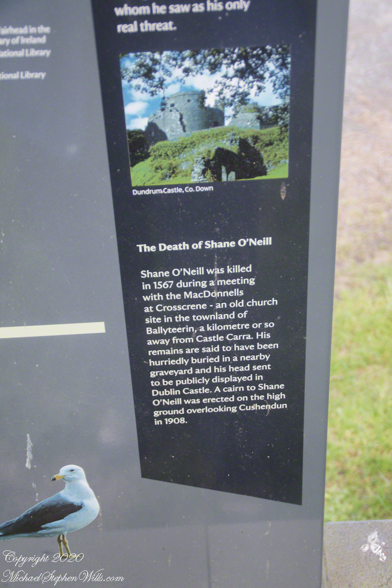
Here are several of the information placards near the harbor explaining some local history.
.
Ballyteerin townland, where Shane O’Neill was killed, is on the road to Torr Head.
Reference: Wikipedia, “Cushendun.”
Enter your email to receive notification of future postings. I will not sell or share your email address.
Copyright 2025 All Rights Reserved Michael Stephen Wills
Saint Fin Barre’s Cathedral features stunning Victorian Gothic artistry, with symbolic ceilings and intricate designs reflecting divine themes and craftsmanship.
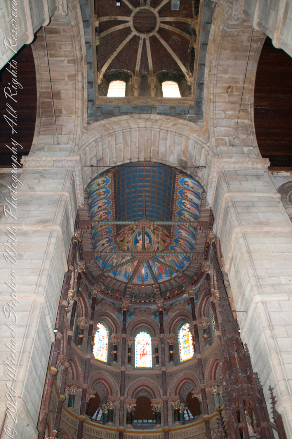
As I stood on the floor of Saint Fin Barre’s Cathedral in Cork, Ireland, I gazed upward toward the Apse and sanctuary ceiling at the eastern end. Turning my eyes directly to the west, I found myself captivated by the crossing ceiling—the very heart where the nave intersects with the transepts, forming the iconic cross shape typical of Gothic cathedral architecture.
In my imagination the central tower and spire soared majestically above the crossing ceiling. The ceiling there featured intricate architectural elements like ribbed vaults and a lantern tower, allowing light to flood into the space below. This crossing served as a beautiful transitional space between the sanctuary and the main body of the cathedral, the nave.
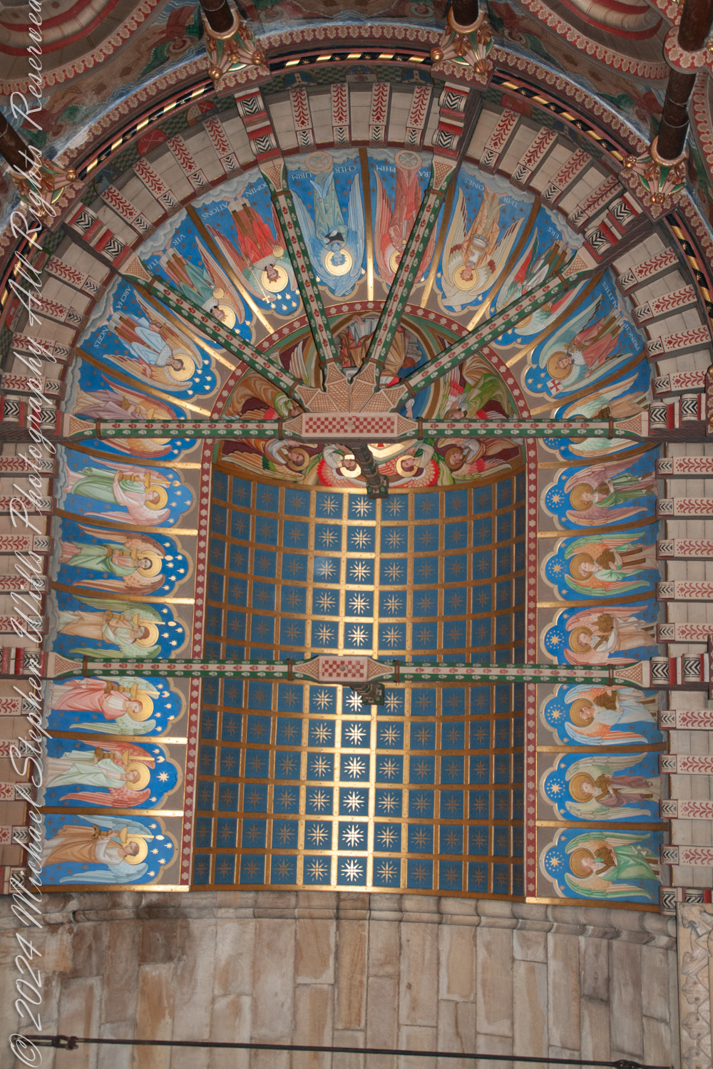
Focusing my camera on the Sanctuary Ceiling of Saint Fin Barre’s Cathedral, I was struck by the stunning example of Victorian Gothic Revival artistry before me. Designed by the architect William Burges, who envisioned every detail of the cathedral, the ceiling reflected his meticulous attention to detail and his love for vibrant colors and symbolic ornamentation.
The rich iconography drew me in. Angels adorned the ceiling, likely representing the celestial hierarchy or the glorification of Christ. Each angel held symbolic items—trumpets, stars, or scrolls—emphasizing their roles as messengers and worshippers of God.
The radiant color scheme was breathtaking. Deep blues, shimmering golds, lush greens, and vivid reds combined to create a striking visual effect, symbolizing heaven and divine majesty. Gold accents caught and reflected the light, reinforcing the idea of heavenly glory.
Geometric and star patterns embellished the vaults. The blue panels dotted with gold stars symbolized the heavens—a common motif in Gothic church ceilings. These stars seemed to represent divine guidance or eternity, adding another layer of meaning to the already rich tapestry above me.
The structural elements themselves were works of art. Painted ribs intersected across the ceiling, highlighting the Gothic architecture’s ribbed vaulting. Their intricate designs in green and red emphasized both structural beauty and functional elegance.
The symbolism was profound. The angels with their instruments and the starry heavens collectively evoked themes of divine worship and the glory of God’s kingdom. This alignment with the Victorian Gothic ideal of infusing spiritual symbolism into architectural elements was evident in every brushstroke.
Knowing that William Burges envisioned Saint Fin Barre’s Cathedral as a “Bible in stone,” I felt a deep connection to his purpose. Standing beneath the Sanctuary Ceiling—the focal point above the altar—I sensed how it served to elevate worshippers’ gaze and spirits toward the divine.
Capturing these scenes through my lens, I was documenting a testament to the artistic and architectural achievements of the 19th century. Saint Fin Barre’s Cathedral is a place of worship and also a living gallery of history, faith, and unparalleled craftsmanship.
Enter your email to receive notification of future postings. I will not sell or share your email address.
Copyright 2024 All Rights Reserved Michael Stephen Wills
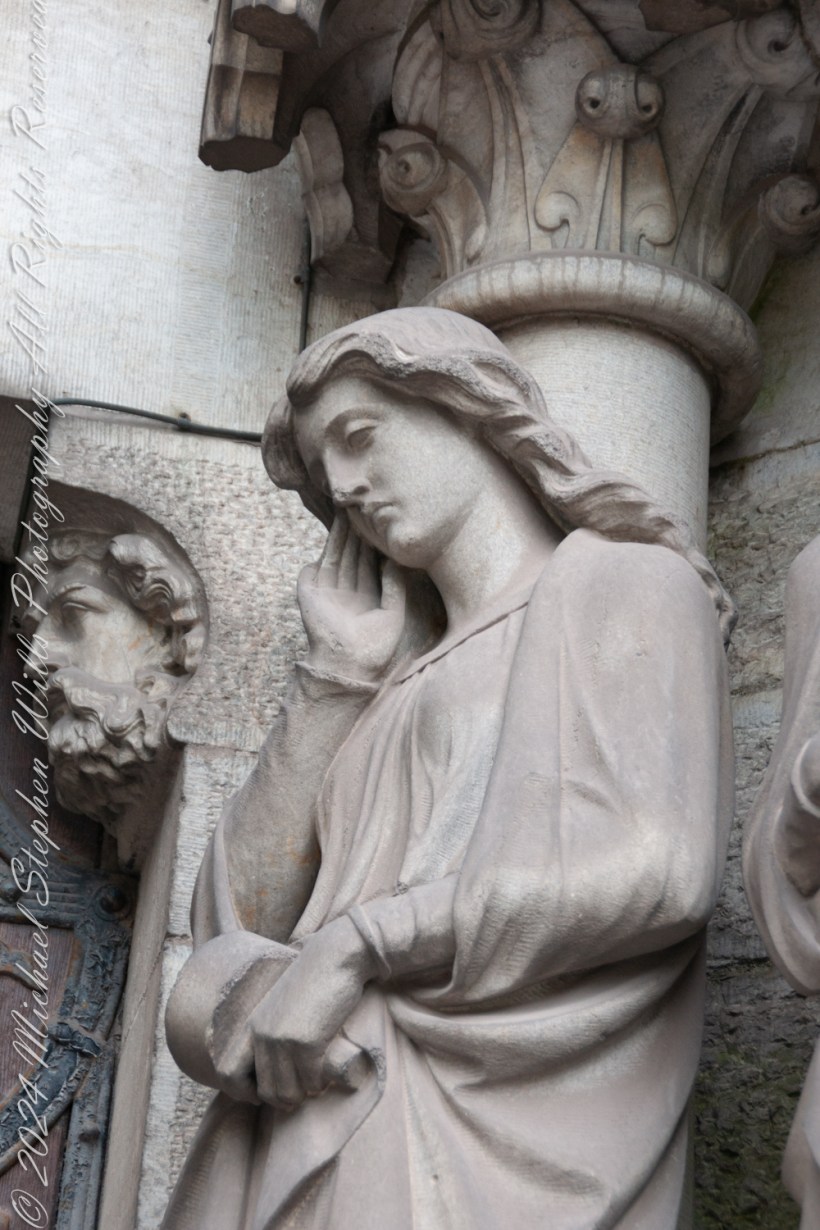
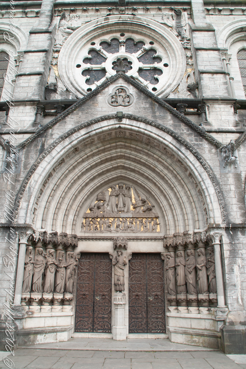
The towering Western Portico of Saint Fin Barre’s Cathedral leads into the sacred space of the church while serving as a canvas for a profound narrative of divine judgment and grace. Standing before it, I am drawn into its intricate details, particularly the central set of doors flanked by the ten virgins—five wise and five foolish—embodied in stunning columnar statues. Their story is drawn from the Gospel of Matthew (25:1–13), a parable of spiritual preparedness that echoes throughout the cathedral’s architecture.
The parable tells of ten virgins who go out to meet the bridegroom, each carrying a lamp. The wise virgins take oil with their lamps, while the foolish take none. When the bridegroom is delayed, all ten fall asleep. At midnight, the cry rings out, “Here is the bridegroom! Come out to meet him!” The virgins awaken and trim their lamps. The foolish ones, realizing their lamps are going out, plead with the wise to share their oil, but the wise refuse, saying, “There may not be enough for both us and you. Instead, go to those who sell oil and buy some for yourselves.” While the foolish virgins are away buying oil, the bridegroom arrives, and the wise virgins go with him into the wedding banquet. The door is shut. Later, the foolish virgins return, crying, “Lord, Lord, open the door for us!” But he replies, “Truly I tell you, I do not know you.” The parable concludes with the warning: “Therefore, keep watch, because you do not know the day or the hour.”
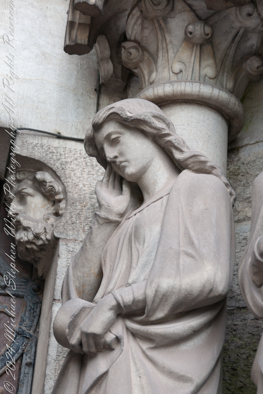
On either side of the central door, the virgins stand as sentinels, embodying this story. The wise virgins, to the right of Christ, hold their lamps aloft, flames burning brightly, symbols of readiness and spiritual vigilance. Their faces are serene, reflecting a sense of fulfillment in their preparedness to meet the bridegroom. To the left, the foolish virgins clutch their unlit lamps, their postures and expressions marked by despair and regret. The detail in their sculpting is exquisite—draped garments, forlorn gazes, and, in the case of the leftmost virgin, a subtle gesture of mourning, her hand resting thoughtfully against her cheek as though lamenting her unpreparedness.
Beneath each figure lies a pedestal adorned with imagery that amplifies their symbolic meaning. The wise virgins stand upon a foundation of flourishing life: vines, flowers, and fruits, evoking the vitality and promise of spiritual readiness. In contrast, the pedestals of the foolish virgins are carved with desolation—withered branches, skeletal forms, and motifs of death, stark reminders of the spiritual decay brought by neglect and complacency.
At the heart of the narrative stands Christ, the Bridegroom. His figure, commanding yet compassionate, turns toward the wise virgins, his gesture one of welcome and blessing. The flowing robes and the serene expression of the Christ figure emphasize his dual roles as judge and redeemer. It is a moment of movement captured in stone—Christ leaning into the wise while his back turns on the foolish, a subtle yet striking commentary on divine justice.
Above the door, the tympanum deepens this narrative, depicting the ultimate moment of judgment. Surmounted by three angels announcing the resurrection, their imagery and gold background harking to the Resurrection Angel of the east cathedral side with gold a symbol of purity and divine light; the dead rise from their graves, their fates determined by their spiritual choices. On the right, angels extend their hands to the faithful, pulling them upward toward eternal life. Their forms radiate lightness, their wings creating a sense of ascension and joy. On the left, the scene is markedly darker: angels, stern and unyielding, drive the condemned downward, their bodies twisted in expressions of agony. Flames lick at the edges of the scene, signaling the fires of damnation.
The weight of this imagery is palpable. The parable of the ten virgins, brought to life in stone, underscores the centrality of vigilance and readiness in the Christian faith. The Western Portico is a story carved in stone, a vivid testament to the choices each person must make. Standing before it, I am not merely a viewer but a participant, invited to reflect on my own readiness and my place in this cosmic drama. The intricacy and theological depth of this space leave an indelible impression, a reminder of the eternal truths that the cathedral seeks to communicate through its art.
Enter your email to receive notification of future postings. I will not sell or share your email address.
Copyright 2024 All Rights Reserved Michael Stephen Wills
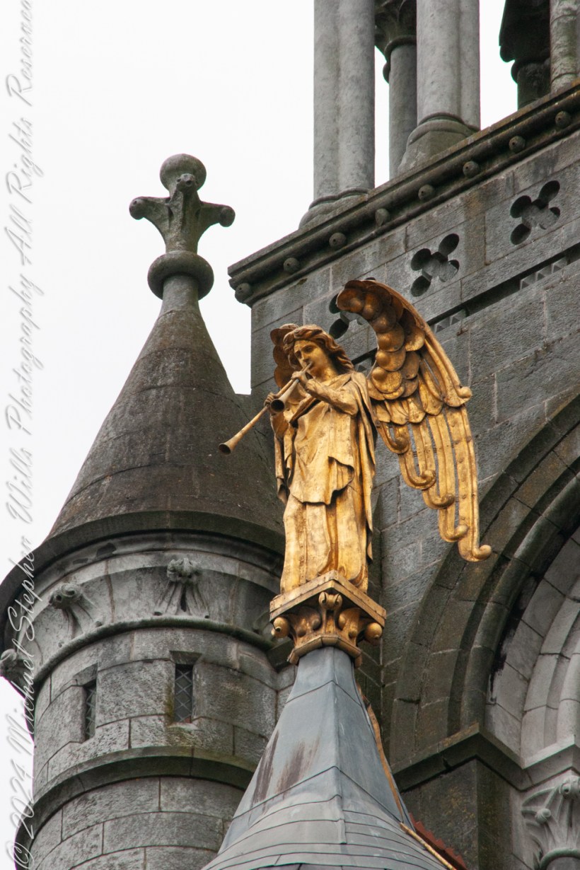
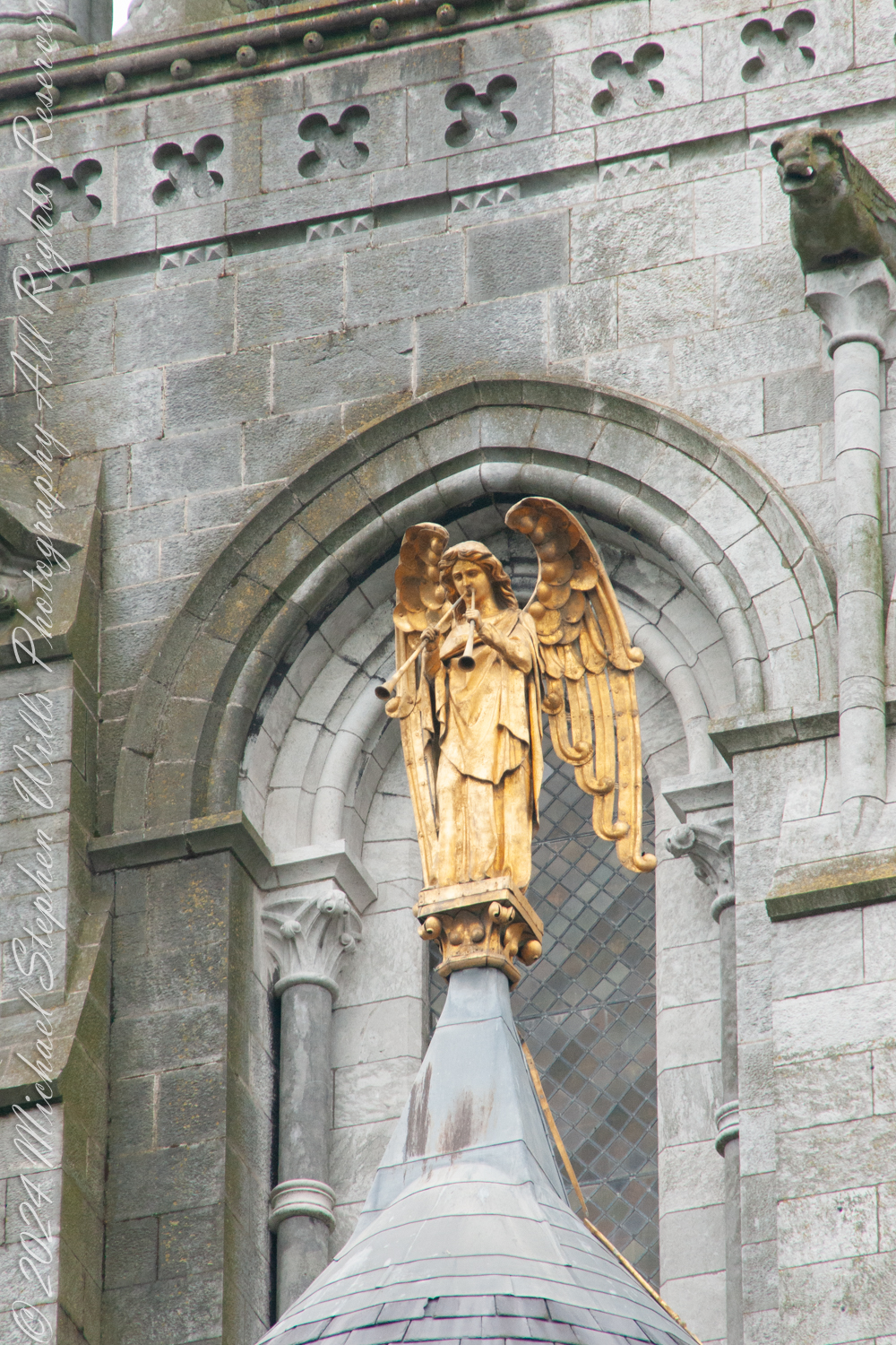
Standing on the east side of Saint Fin Barre’s Cathedral, I lift my gaze to the gilded angel high above the polygonal apse. Known as “The Resurrection Angel,” this radiant figure with its trumpet held aloft commands both awe and contemplation. As an enduring symbol of hope, renewal, and spiritual vigilance this angel carries a profound and dramatic promise: the sound of its trumpet will one day warn the people of Cork of the world’s imminent end, giving them the opportunity to be among the first to ascend to heaven.
The Resurrection Angel’s trumpet echoes the apocalyptic imagery of the Book of Revelation, particularly Revelation 11:15, where the seventh trumpet announces, “The kingdoms of this world have become the kingdoms of our Lord.” Yet in Cork, this celestial figure is imbued with a uniquely local significance. It stands as both guardian and guide, poised to fulfill its divine purpose when the end of days draws near. The legend elevates the angel’s presence beyond theology or art—it becomes a tangible connection between the celestial and the earthly, rooted in the lives of Cork’s citizens.
From an epistemological perspective, the Resurrection Angel poses fascinating questions about how we prepare for the unknown. What does it mean to live in the shadow of an angelic trumpet, one that might sound at any moment? Its silence is a paradox, a quiet yet profound proclamation of life’s transience. The legend suggests that the people of Cork, by virtue of the angel’s warning, are uniquely favored—a notion that intertwines faith with identity and imbues the city with a sense of divine guardianship.
The angel’s golden form shines brightly against the gray stone of the cathedral, a deliberate contrast that speaks to its otherworldly purpose. Gold, a symbol of purity and divine light, captures the eternal amid the temporal. The Resurrection Angel reflects the ambitions of the cathedral’s architect, William Burges, who intended every detail of Saint Fin Barre’s to serve as a testament to faith and artistry. This angel was the final piece installed, marking the cathedral’s completion and fulfilling Burges’ vision of a “perfect work.” According to lore, Burges himself declared that if the angel were ever to fall, it would signal the end of the world—a statement that deepens the mystique surrounding this celestial figure.
For Cork, the angel embodies the city’s resilience and collective spirit. Over centuries, Cork has weathered fires, floods, and rebellion, yet it has always risen anew. The angel, with its legend of warning and redemption, mirrors this cyclical journey of challenge and renewal. Its trumpet, silent but ever-present, reminds the people of Cork to stay vigilant, to hope, and to strive for goodness in the time they have.
As I stand beneath its watchful gaze, I feel the weight of the legend and its implications. If the angel’s trumpet were to sound today, would we be ready? It invites not fear but reflection—a challenge to live with purpose and awareness of the sacred in the everyday. And as I step away, the angel remains, steadfast and golden, a silent guardian over Cork, holding its promise and its warning aloft for generations to come.
Enter your email to receive notification of future postings. I will not sell or share your email address.
Copyright 2024 All Rights Reserved Michael Stephen Wills
Here is a recapitulation of my latest posts in the form of a slideshow.
Click photograph to start show. To do this from WordPress Reader, you need to first click the title of this post to open a new page.
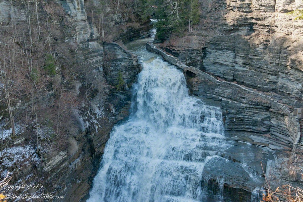
Robert H. Treman New York State Park.
Lower Lucifer Falls, early spring eveningLucifer Falls, early spring eveningPam on the Cliff StaircasePam examines the mossSo Like a Christmas TreeCliff StairLucifer Falls with Hemlock CurtainIcicle WonderlandSudden Frost April, Cliff StairsIcicles, Cliff StairSedimentary WallsIcicles hang over Fish KillRim Trail AscentRim Trail iciclesRim Trail icicles with lichen, moss and fern.Rim Trail icicles with lichen, moss and fern.Gully IGully IIVernal Pool with Vinca VineBeneath the Cliff Stairs IIBeneath the Cliff Stairs IRim Trail AscentFern, Moss, young trees, April SnowFresh Icicle with FernFern Frond with Early April SnowLate April Snow dusted with light
Copyright 2024 All Rights Reserved Michael Stephen Wills
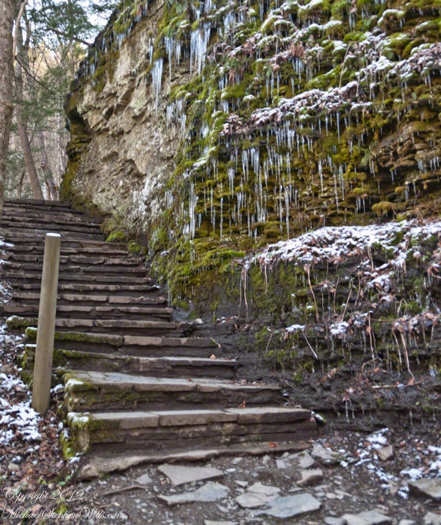
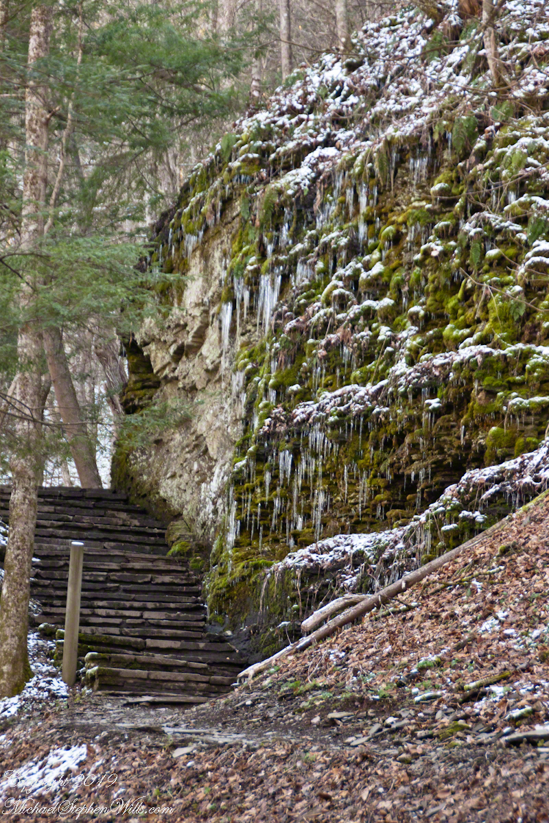
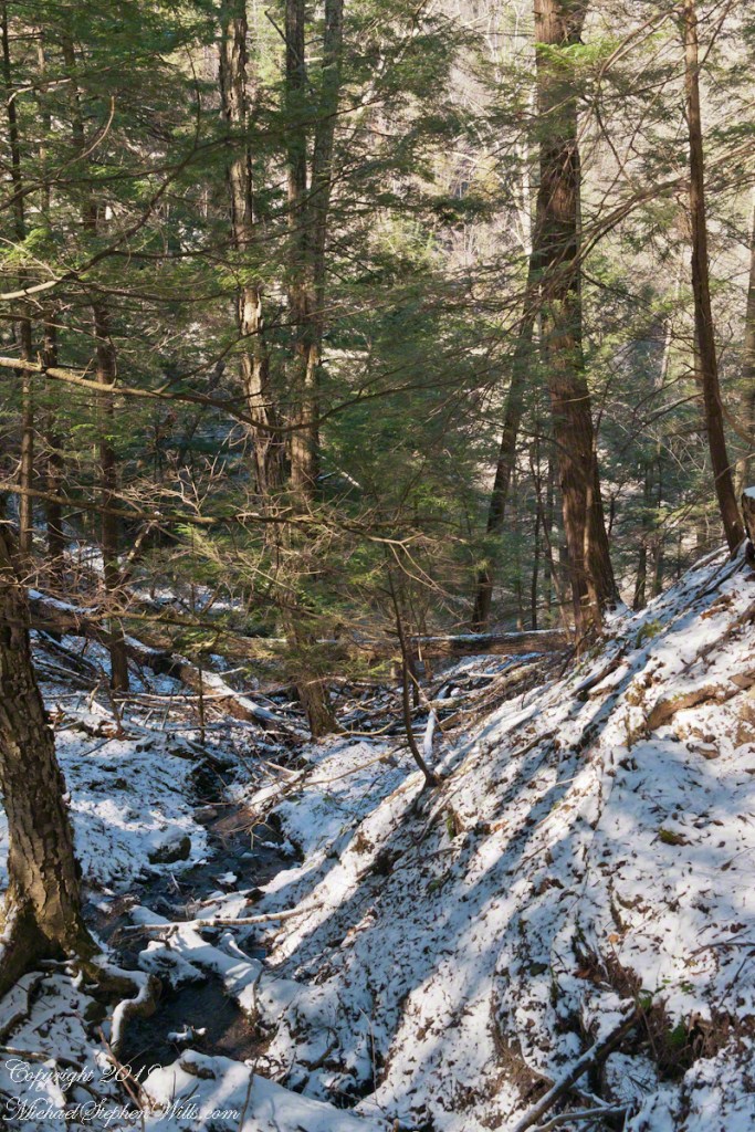
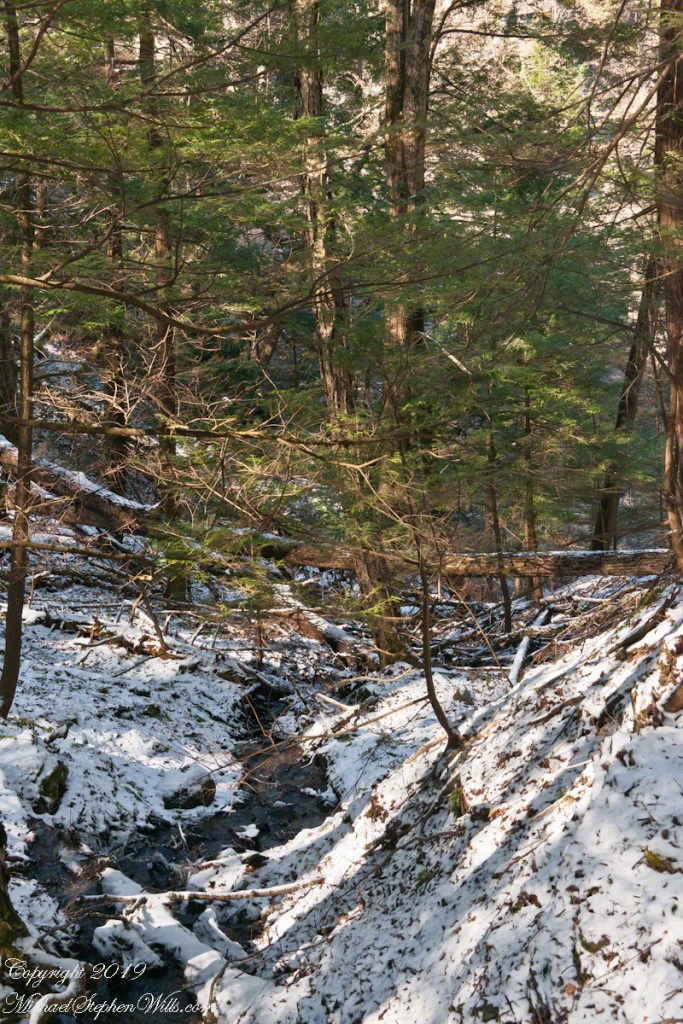
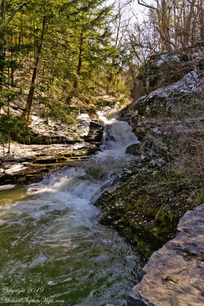
It is the Gorge Trail that’s closed for the cold months, November through April. The Rim Trail remains open for those who dare icy, steep paths Unlike Gorge Trail, Rim Trail climbs above the dangerous cliffs from which rocks are wedged free by ice to fall on the trail. On an early spring day, after a sudden frost, we walked the Rim Trail to capture the moment.
Here is the steep start, climbing up from the Upper Park where a footbridge crosses Fish Kill. Kill is the old Dutch word for creek. Fish Kill mergers with Enfield Creek a few hundred feet downstream.
Click photograph for a larger view. To do this from WordPress Reader, you need to first click the title of this post to open a new page.
Rim Trail Ascent
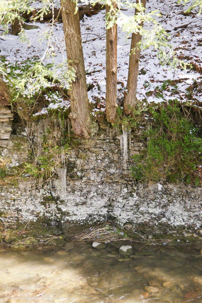
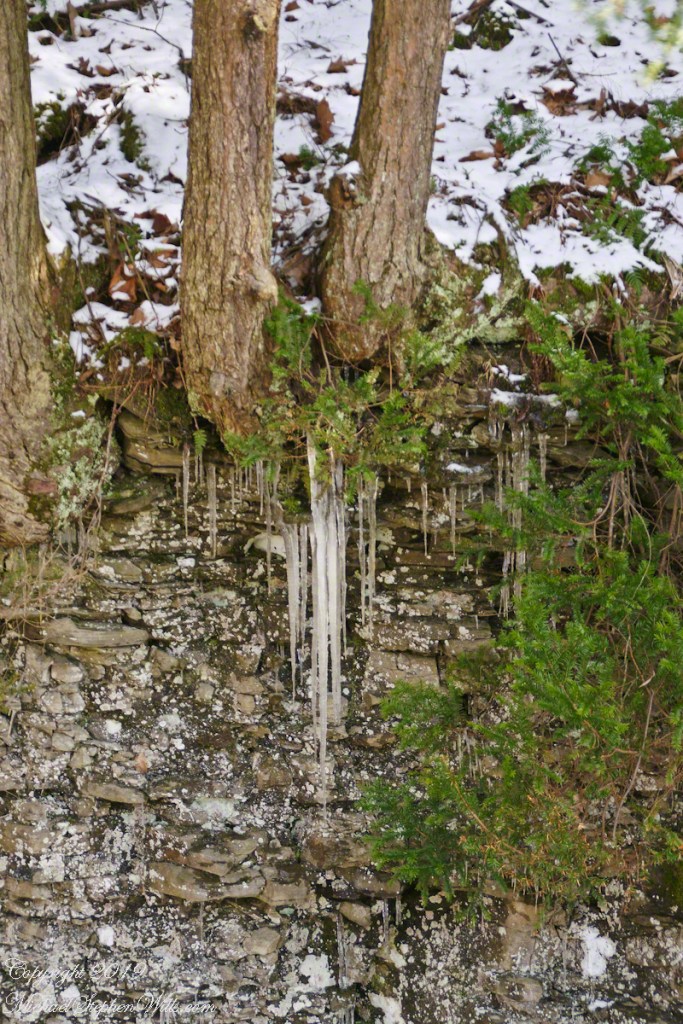
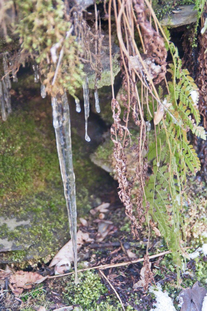
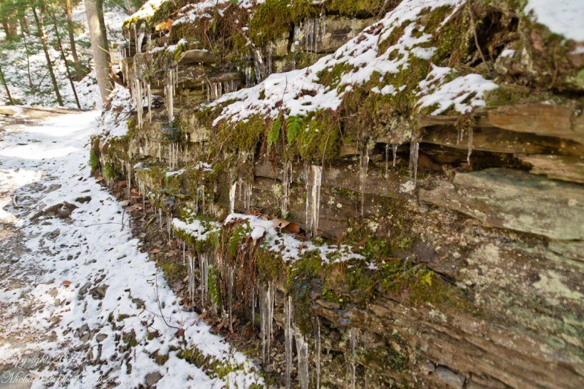
This north facing slope stays frozen into May. Here layers of the sedimentary rock shale, laid down in a shallow warm sea over 350 million years ago, are slowly pried apart. Hemlock tree roots wedge between rock layers, slowly growing. The action of ice, water expands in volume at the point of freezing, aids the process.
In places the rock face appears to be a hastily made dry stone wall, the rock layers are so disrupted by plant and frost.
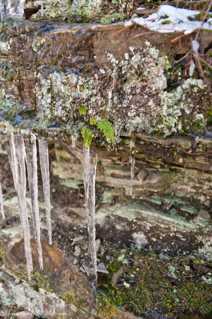
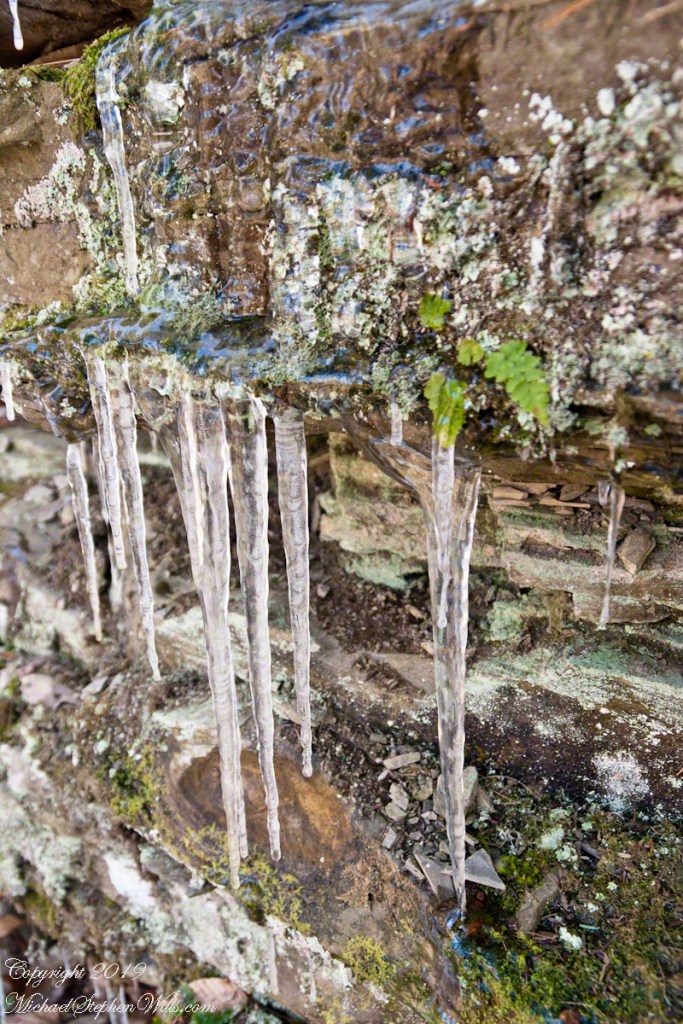
Rim Trail icicles
These shots were hand held. I used a Sony Alpha 700 dslr with a variable “zoom” lens, great for framing compositions.
Robert H. Treman New York State Park.
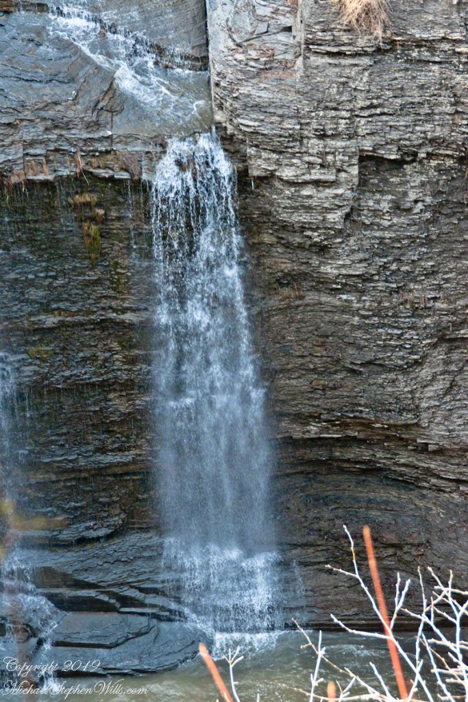
Click for a slideshow of this Waterfall of the Old Mill sequence
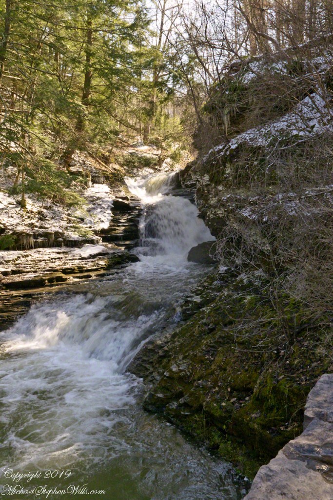
Falls by the Old Mill, early springThe falls run free of ice. On an early spring day, after a sudden frost, we walked the Rim Trail to capture the moment.The falls run free of ice. On an early spring day, after a sudden frost, we walked the Rim Trail to capture the moment.New icicles formed overnight from seeps through the sedimentary walls around the Waterfall by the Old Mill. On an early spring day, after a sudden frost, we walked the Rim Trail to capture the moment.Rim Trail icicles
Copyright 2024 All Rights Reserved Michael Stephen Wills
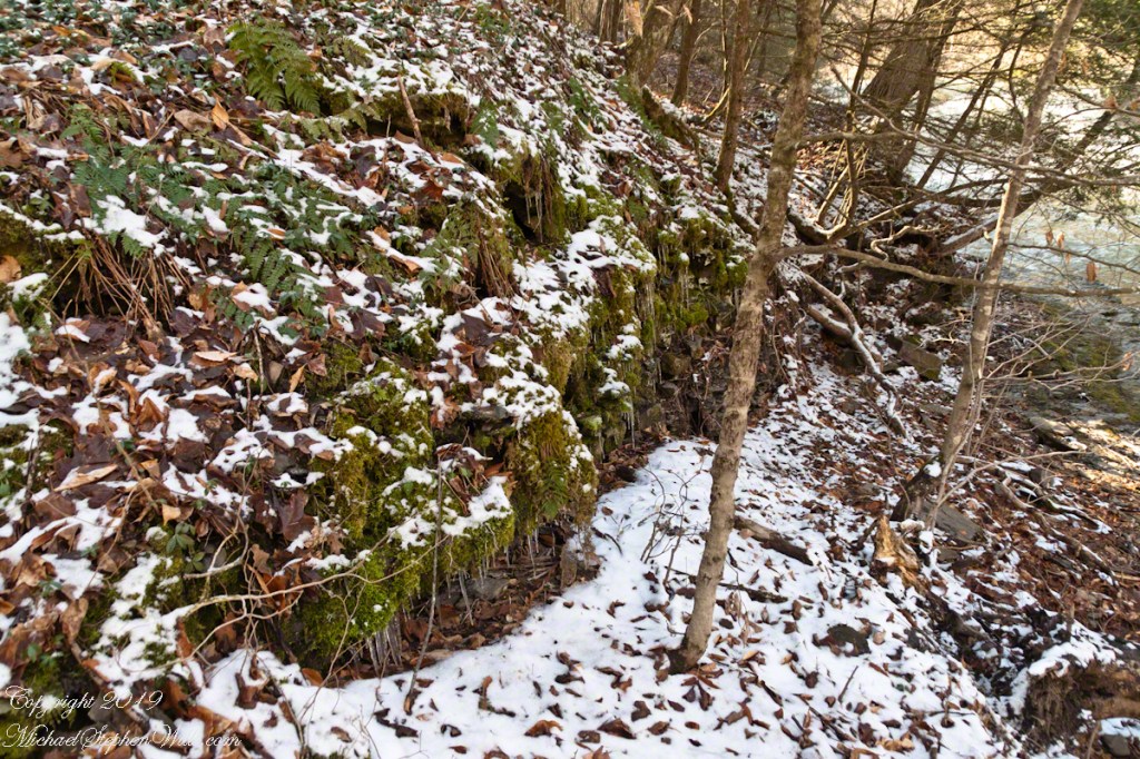
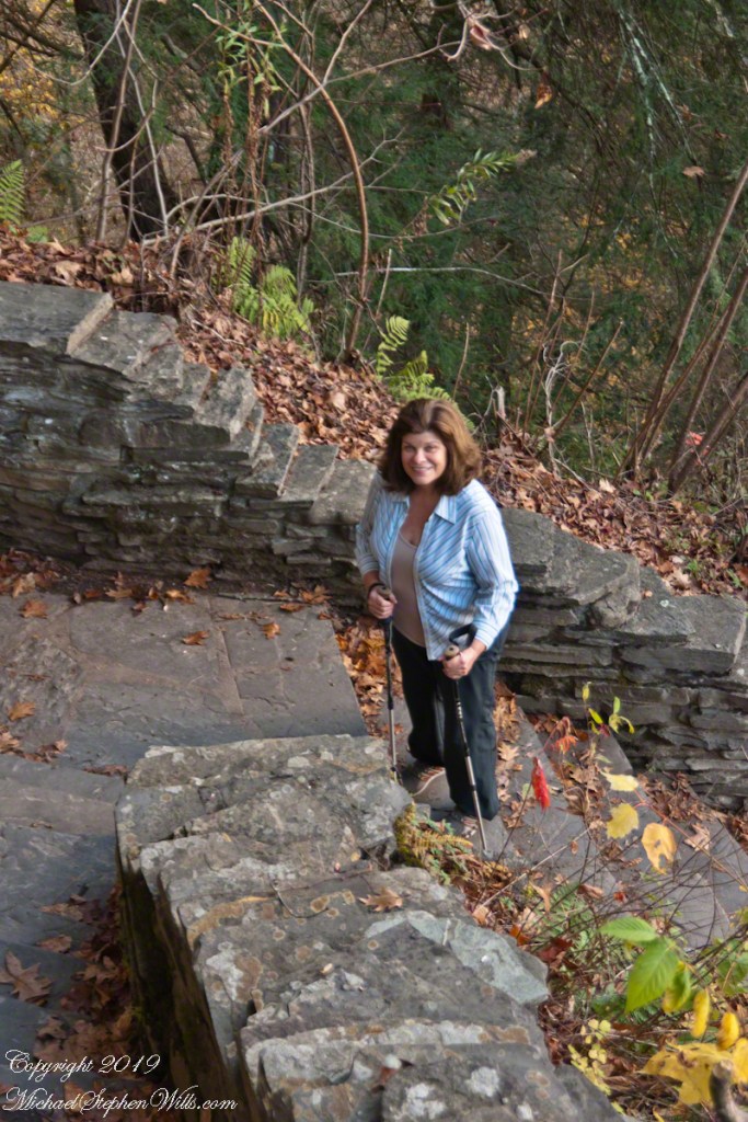
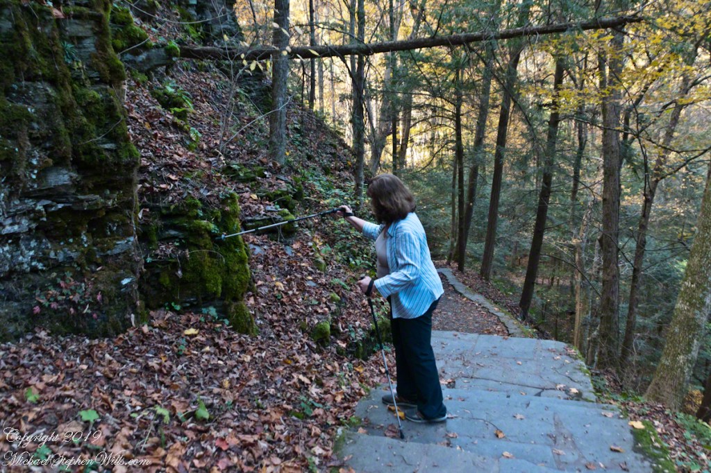
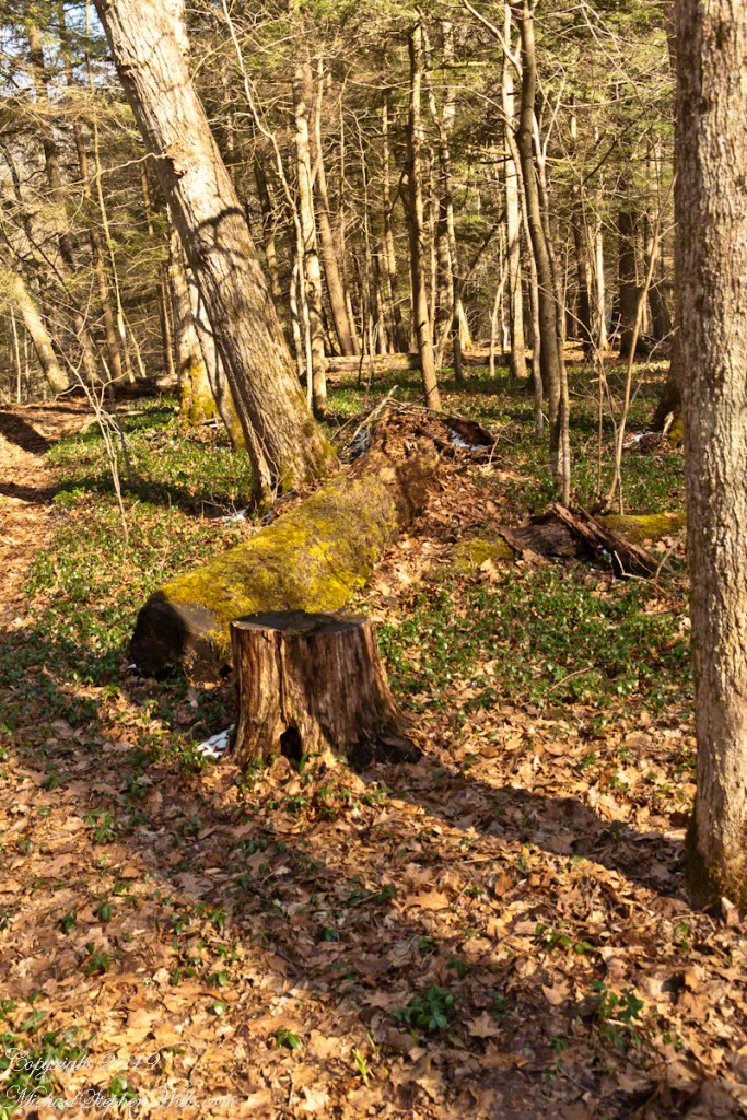
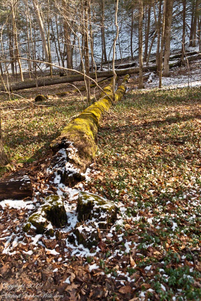
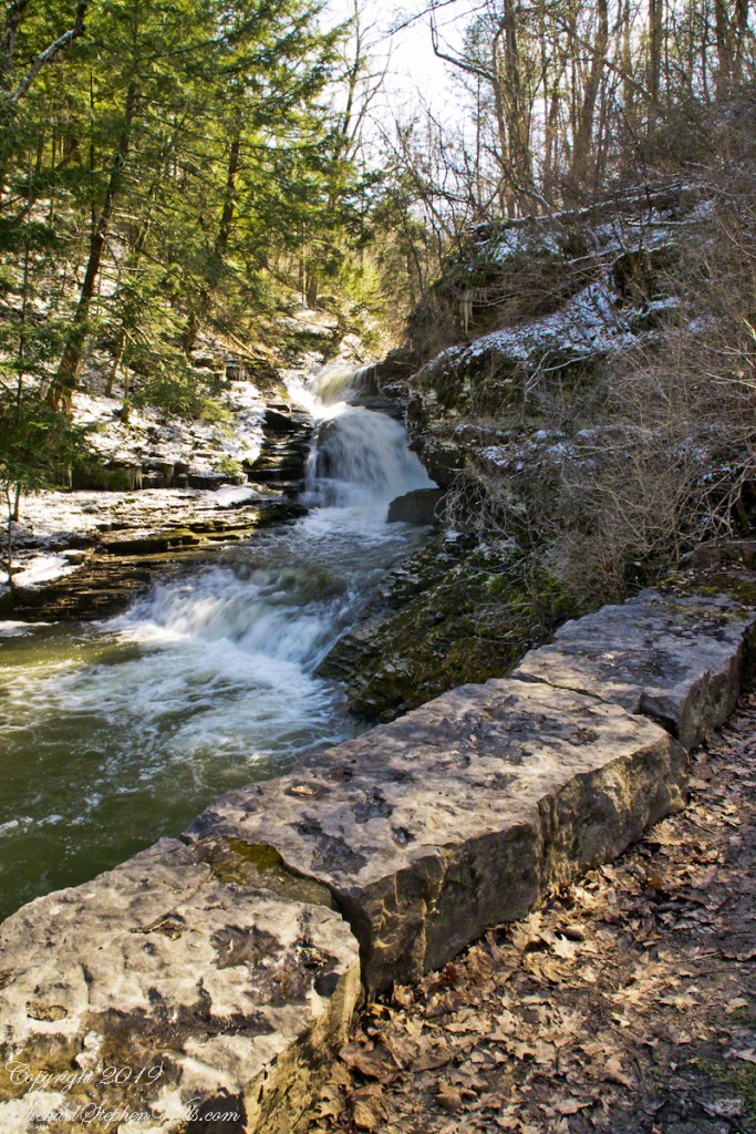
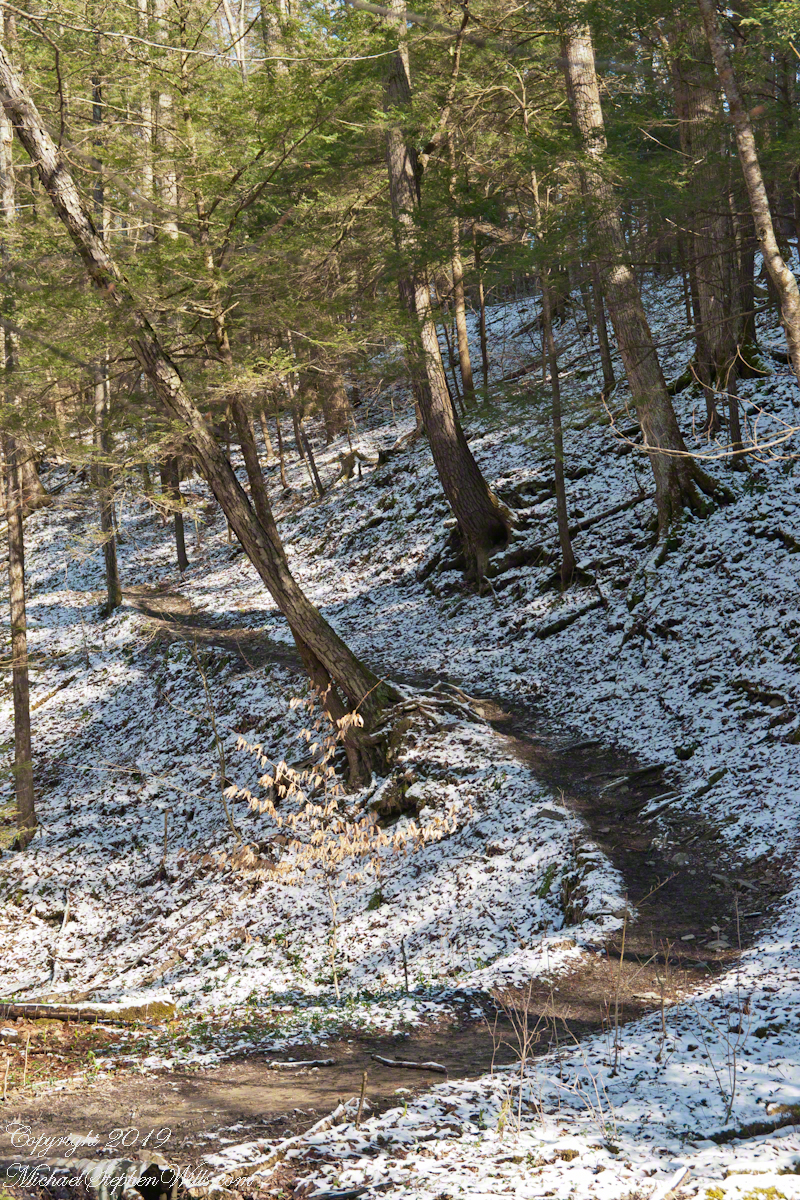
Here the Rim Trail climbs out of the flats beneath the Cliff Stairs, away from Enfield Creek, onto the upper slopes of the gorge.
Click photograph for a larger view. To do this from WordPress Reader, you need to first click the title of this post to open a new page.
Rim Trail Ascent
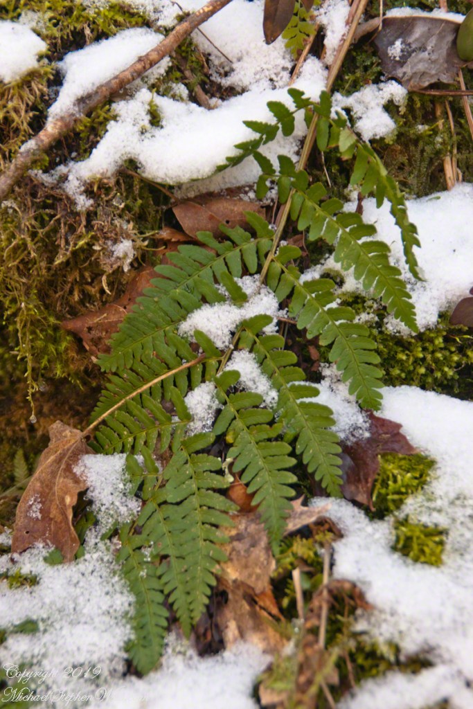
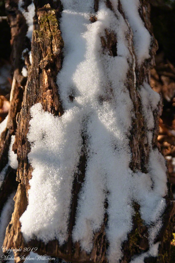
Early spring snow highlights the path, threading between hemlocks. The American realistic painter Andrew Wyeth comes to mind with I see the mottled texture of this light snow. He captured some of this in landscape paintings such as “Snow Flurries.”
Here is more of this effect……
Fern, Moss, young trees, April Snow
These shots were hand held. I used a Sony Alpha 700 dslr with a variable “zoom” lens, great for framing compositions.
Robert H. Treman New York State Park.
Click for a slideshow of this Fertile Flats sequence.
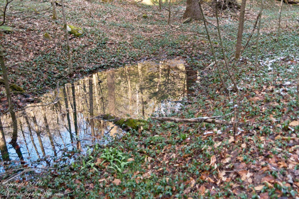
Beneath the Cliff Stairs IBeneath the Cliff Stairs IIRim Trail AscentVernal Pool with Vinca VineFern, Moss, young trees, April Snow
Copyright 2024 All Rights Reserved Michael Stephen Wills