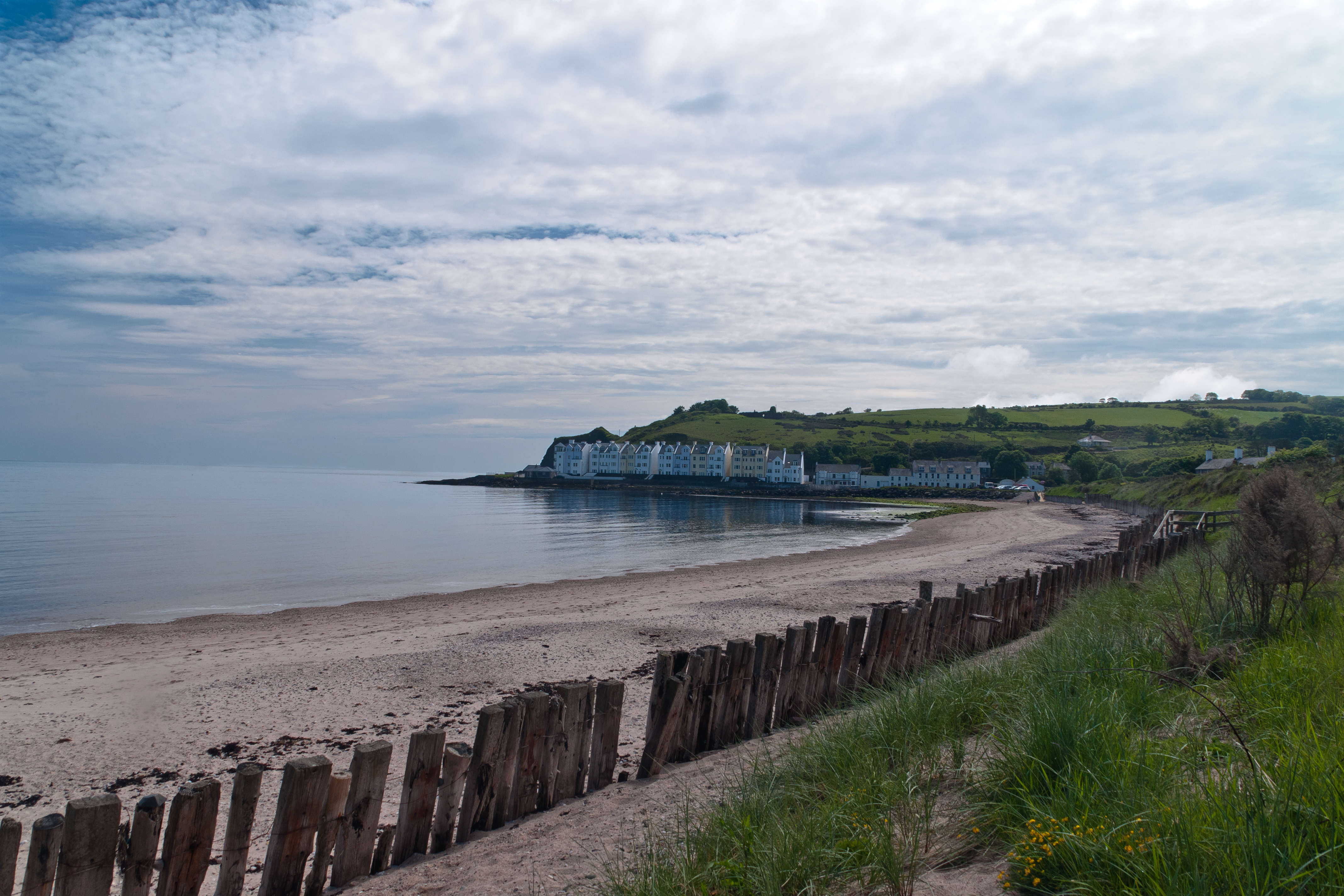
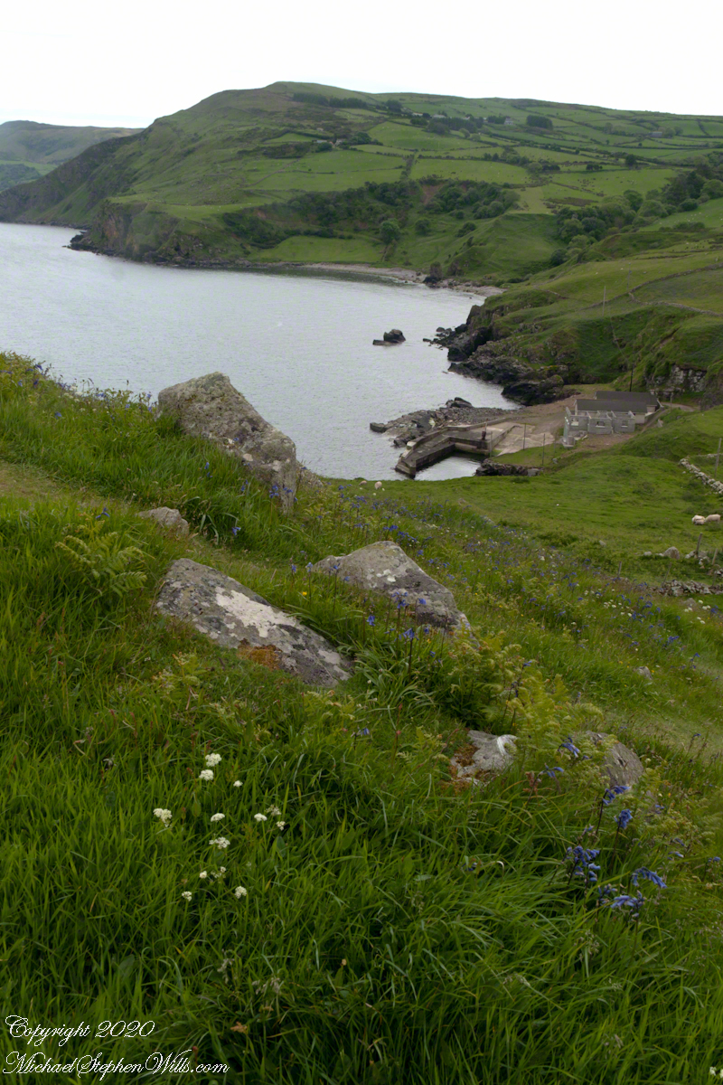
Cushendun (from Irish: Cois Abhann Doinne, meaning “foot of the River Dun”) is a small coastal village in County Antrim, Northern Ireland. It sits off the A2 coast road between Cushendall and Ballycastle.
It has a sheltered harbor and lies at the mouth of the River Dun and Glendun, one of the nine Glens of Antrim. The Mull of Kintyre in Scotland is only about 15 miles away across the North Channel and can be seen easily on clear days.
In the 2001 Census it had a population of 138 people. Cushendun is part of Causeway Coast and Glens district.
SONY DSC
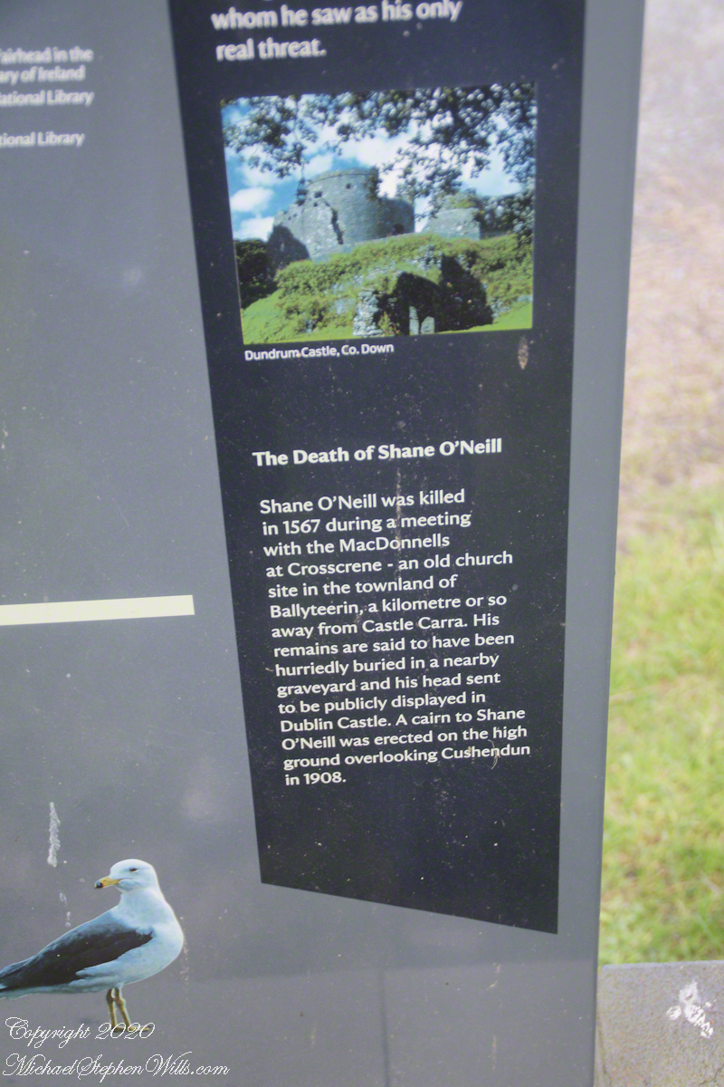
Here are several of the information placards near the harbor explaining some local history.
.
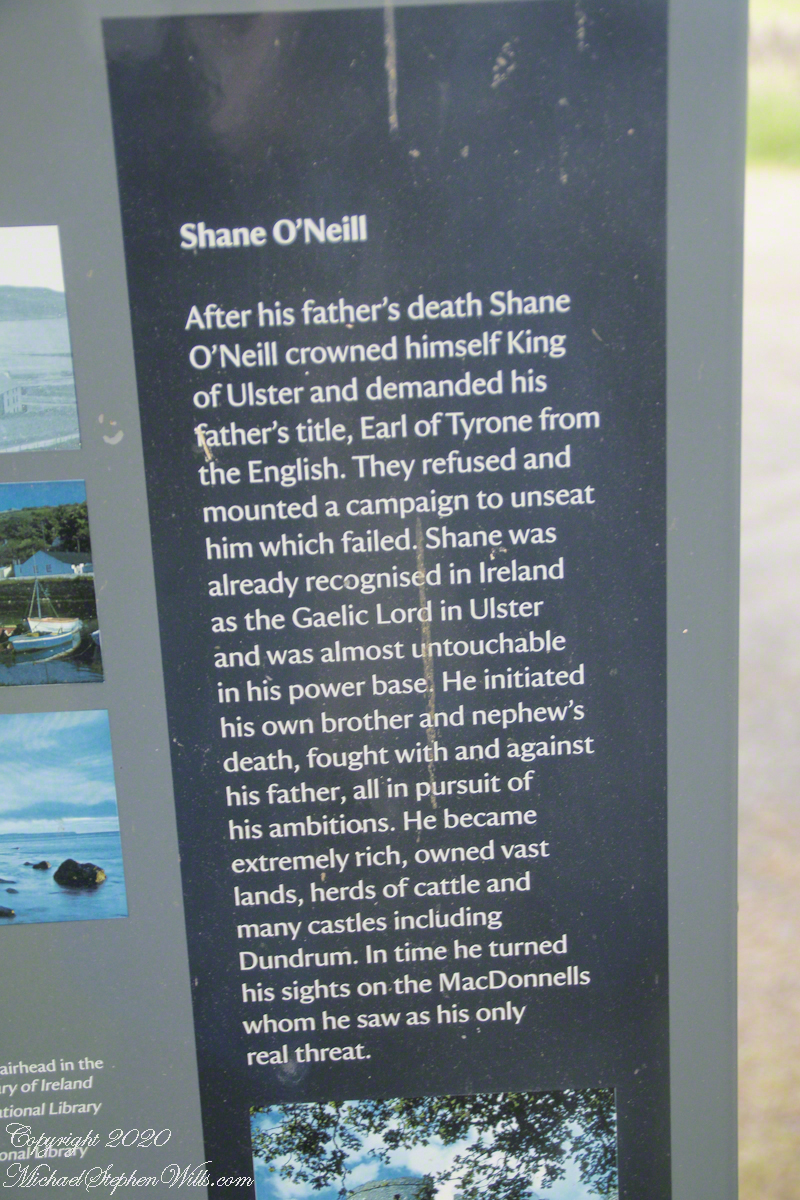
Ballyteerin townland, where Shane O’Neill was killed, is on the road to Torr Head.
Reference: Wikipedia, “Cushendun.”
Enter your email to receive notification of future postings. I will not sell or share your email address.
Copyright 2025 All Rights Reserved Michael Stephen Wills
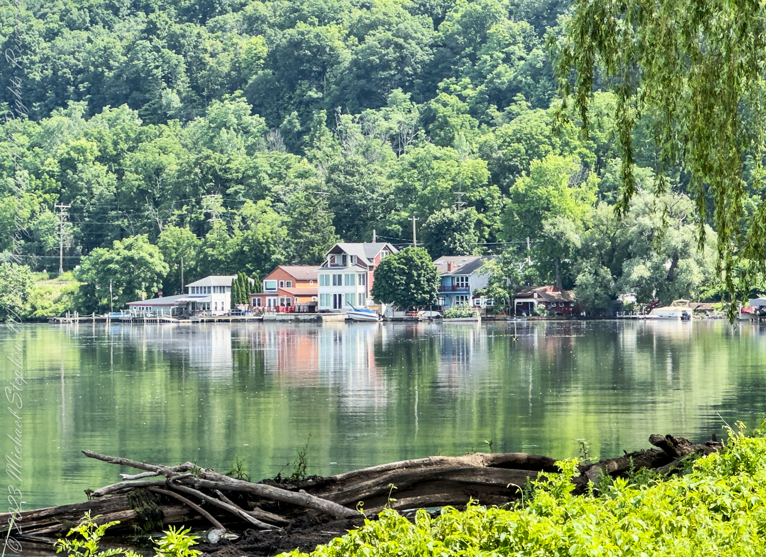
Seen from Stewart Park, these lakefront homes line the southern shore of Cayuga Lake. Tompkins County, Ithaca, New York State. The Finger Lakes Region
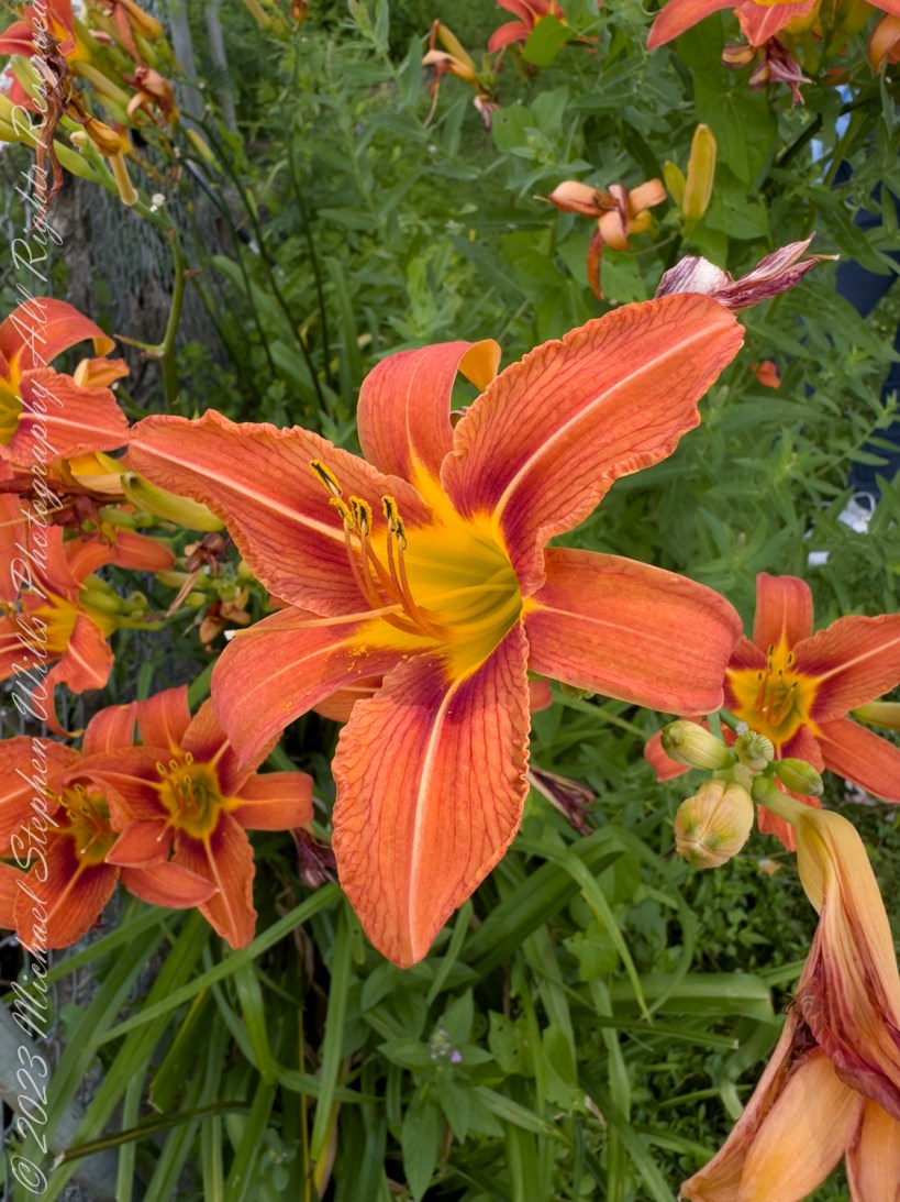
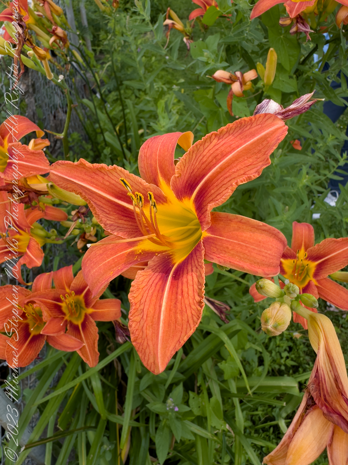
On a warm June morning, with the early summer sun casting a golden glow across the shores of Cayuga Lake, Pam and I set out for a walk around Stewart Park. The soft lapping of the water against the shore mixed with the calls of distant birds, and the familiar hum of life in the park settled into a rhythm that has long been a part of this place. As I strolled along a familiar path, a flash of orange caught my eye—the unmistakable brilliance of the Hemerocallis fulva, the Tawny Daylily, in full bloom.
A Glimpse of the Familiar
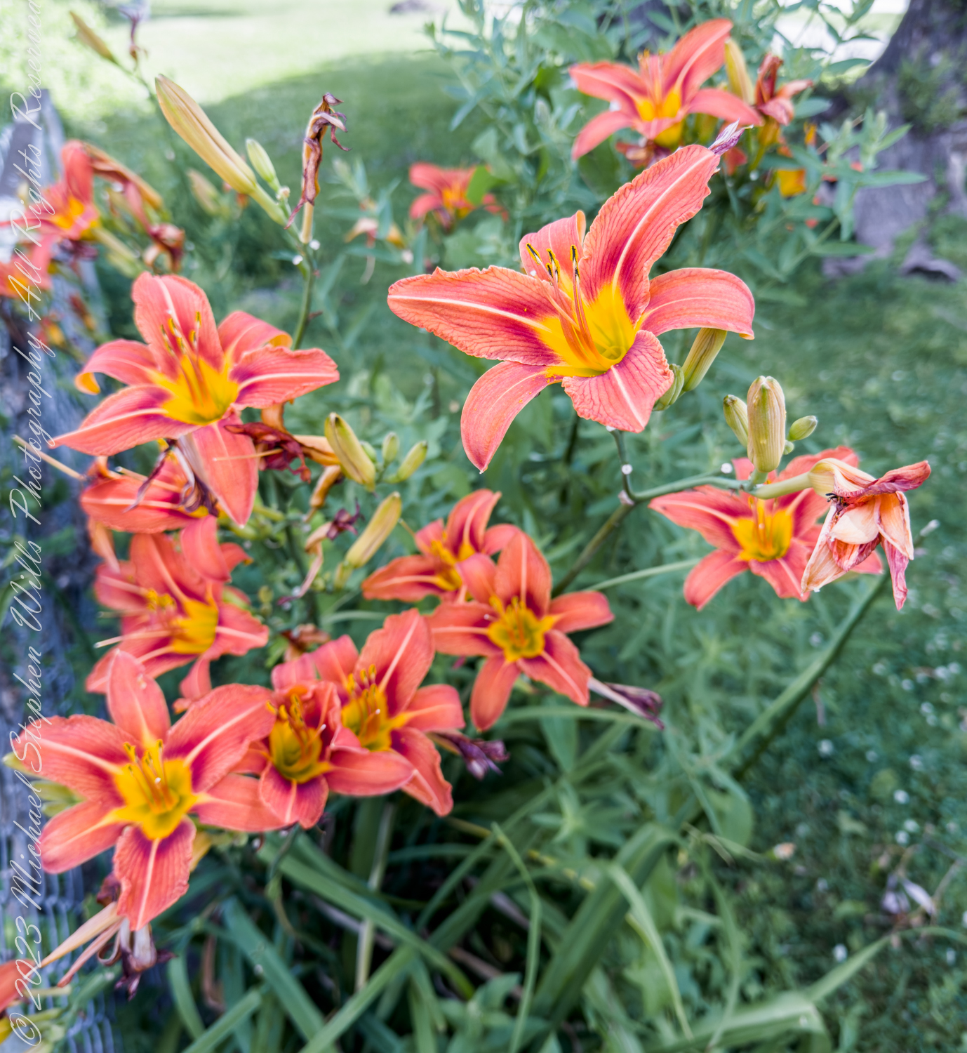
At first glance, the orange petals of the daylily seemed like small flames scattered across the green of the park, their brightness undimmed by the heat of the day. The sight was both familiar and captivating, for these daylilies are common in garden, parks and roadsides around Ithaca and much of New York State. Despite their prevalence, each encounter feels fresh, like meeting an old friend who always has something new to share.
I knelt closer, letting my eyes follow the curve of the petals, which unfurled gracefully from a vibrant yellow throat. The delicate lines streaked down the petals like rays of sunlight. Though each flower lives only a day, I felt the quiet confidence of this plant, as though it knew its bloom was fleeting, yet still essential in the tapestry of summer.
The Resilience of a Traveler
The daylily’s ubiquity belies its status as a traveler from distant lands. Hemerocallis fulva is not native to New York, nor to any part of North America. It came to these shores from Asia, introduced by gardeners who admired its hardiness and vibrant color. Over time, the daylily escaped the bounds of cultivated gardens, spreading to roadsides, fields, and yes, even here, to the edges of Stewart Park.
I find myself reflecting on the journey of this plant, which began in the faraway lands of China, Korea, and Japan. In its homeland, daylilies have long been symbols of devotion and motherhood, their roots used in traditional medicine, their blooms celebrated in art. Now, as I stand in Stewart Park, I marvel at how far the Hemerocallis fulva has come, adapting to new lands and naturalizing in the wild corners of the American landscape.
The irony of its “wild” appearance does not escape me—this orange beauty, so deeply associated with our rural and parkland settings, is still very much an outsider. And yet, in the soft breeze of the morning, it feels as though this plant has always belonged here, as much a part of the park’s landscape as the willows by the lake or the ducks bobbing in the water.
Nature’s Balancing Act
As lovely as they are, daylilies are not without their complications. The very same traits that make Hemerocallis fulva such a beloved garden plant—its resilience, its ability to thrive in poor soil, and its spreading rhizomes—also make it an unintentional invader. Without careful tending, these plants can spread aggressively, pushing out native species and altering the ecological balance of the areas where they take root.
Here in Stewart Park, where cultivated gardens meet the untamed edges of the lake, the daylilies are a reminder of nature’s delicate balance. They offer nectar to bees and butterflies, providing sustenance to the creatures that flit through the morning air and also represent challenge to the native wildflowers that have long called this place home.
I wonder what plants might have once thrived in this very spot before the Hemerocallis fulva arrived. Perhaps native species, like the delicate Asclepias tuberosa—Butterfly Weed—or the sturdy Rudbeckia hirta, the Black-eyed Susan, held court here, their blooms attracting the same bees now drawn to the daylilies.
The Fleeting Bloom
Despite its role as a naturalized non-native, the daylily has a fleeting grace that draws me in. By tomorrow, these orange blooms will have withered and fallen, replaced by new blossoms that will unfurl in their place. Each bloom’s brief life is a reminder of the ephemerality of beauty, and I find myself appreciating the daylily all the more for its transient nature.
We continue our walk, leaving behind the patch of daylilies but taking with me a sense of quiet reflection. As invasive as they may be, these plants offer a meditation on the impermanence of life and the ways in which non-native species can become a part of the landscape’s fabric, for better or worse. The Hemerocallis fulva may not belong here by birthright, but it has made a place for itself, a symbol of survival and adaptation in the ever-changing world around it.
A Lesson from the Daylily
As I near the edge of the lake, watching the sunlight dance across the water’s surface, I think about the lessons that the daylily offers. Life is fleeting, yes, but also full of color and vibrancy, no matter how brief the bloom. And in that brief bloom, there is the possibility of resilience, growth, and belonging, even in a place far from home.
Much like the daylily, we too find ourselves in unfamiliar places at times, learning to adapt, to thrive, and to leave our mark on the world—if only for a day.
Copyright 2024 Michael Stephen Wills All Rights Reserved
Join me in reminiscing about a memorable trip to Ireland, marked by the now-closed Breezemount House B&B and the scenic Dunseverick Castle Ruin. Dive into my journey and the advice that shaped it
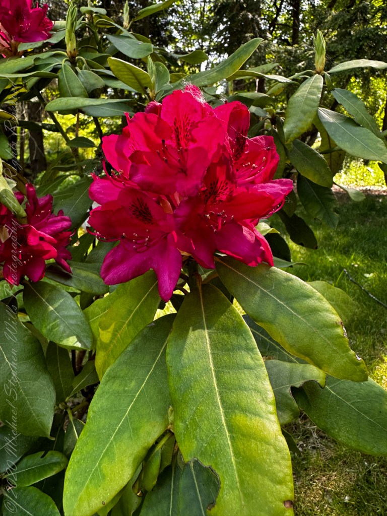
“Like other ericaceous plants (i.e. of the heather family -Ericaceae), most rhododendrons prefer acid soils with a pH of roughly 4.5–5.5; some tropical Vireyas and a few other rhododendron species grow as epiphytes and require a planting mix similar to orchids.”
“Rhododendrons have fibrous roots and prefer well-drained soils high in organic material. In areas with poorly drained or alkaline soils, rhododendrons are often grown in raised beds using media such as composted pine bark. Mulching and careful watering are important, especially before the plant is established. Rhododendron species have long been used in traditional medicine.”
“Animal studies and in vitro research have identified possible anti-inflammatory and hepatoprotective activities which may be due to the antioxidant effects of flavonoids or other phenolic compounds and saponins the plant contains.”
“In the language of flowers, the Rhododendron symbolizes danger and to beware. Floriography (language of flowers) is a means of cryptological communication through the use or arrangement of flowers.”
“Meaning has been attributed to flowers for thousands of years, and some form of floriography has been practiced in traditional cultures throughout Europe, Asia, and Africa. Plants and flowers are used as symbols in the Hebrew Bible, particularly of love and lovers in the Song of Songs, as an emblem for the Israelite people, and for the coming Messiah. William Shakespeare ascribed emblematic meanings to flowers, especially in Hamlet. Interest in floriography soared in Victorian England and in the United States during the 19th century.”
“Gifts of blooms, plants, and specific floral arrangements were used to send a coded message to the recipient, allowing the sender to express feelings which could not be spoken aloud in Victorian society. Armed with floral dictionaries, Victorians often exchanged small “talking bouquets”, called nosegays or tussie-mussies, which could be worn or carried as a fashion accessory.”
Reference: text in italics and quotes is from Wikiedia, “Rhododendron.”
Copyright 2023 Michael Stephen Wills All Rights Reserved
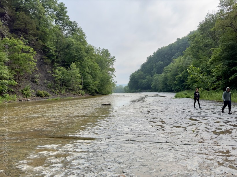
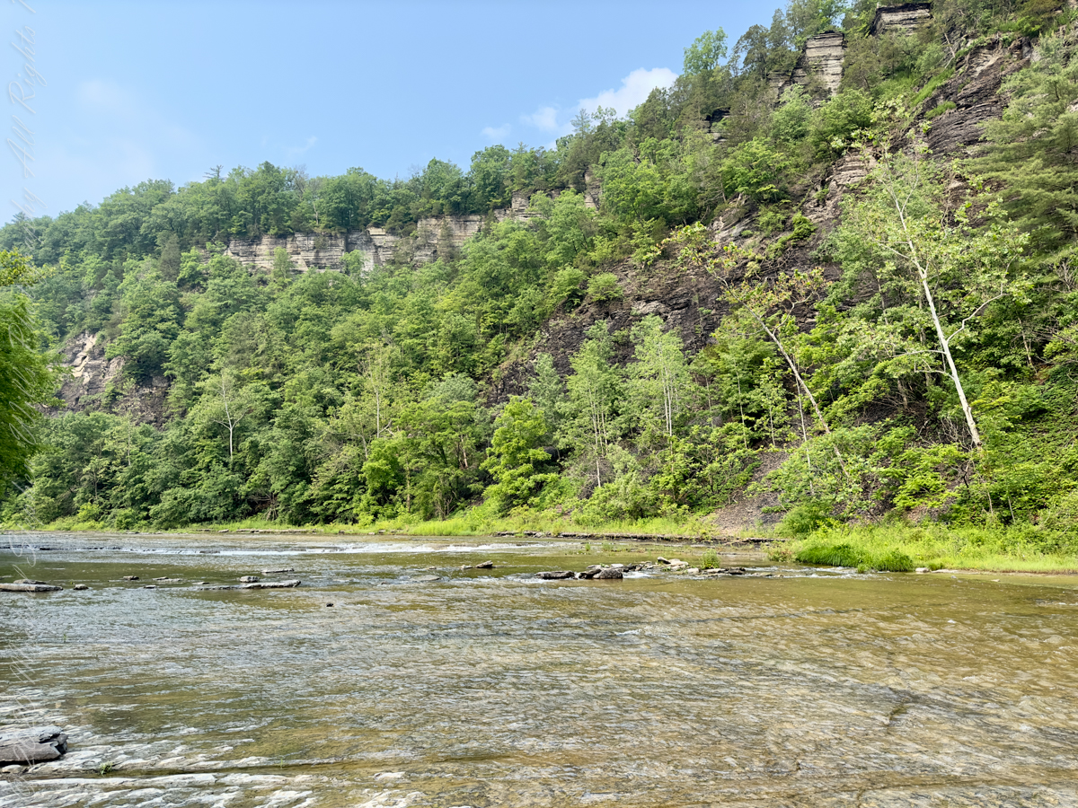
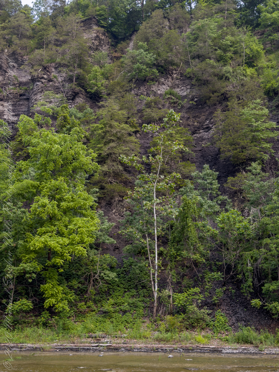
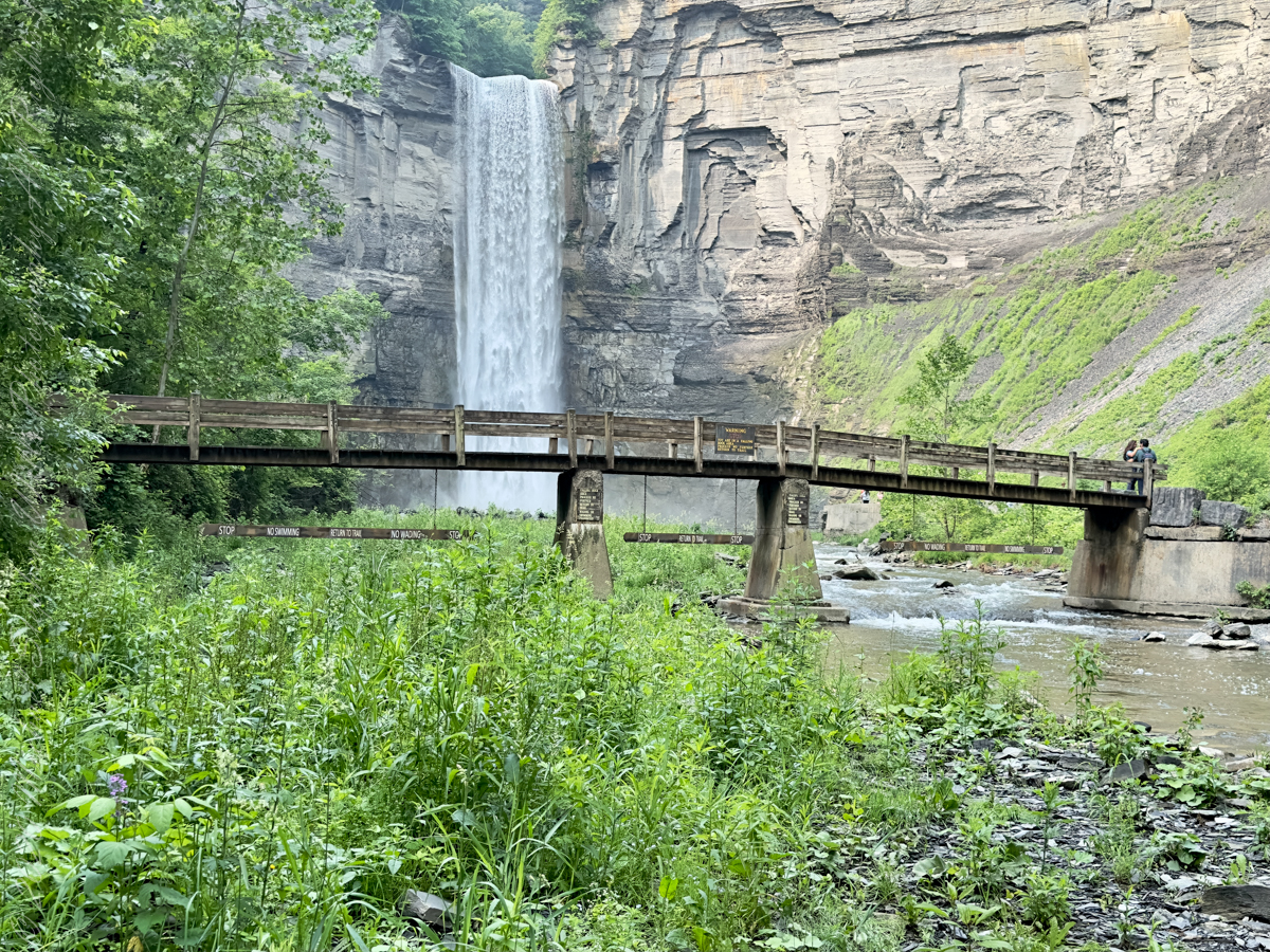
The waterfall and gorge comprise an example of a hanging valley, formed where Taughannock Creek’s stream-carved valley meets the deeper glacially carved valley that contains Cayuga Lake.
The gorge has continued to retreat westward from Cayuga Lake as easily eroded shale near the fall’s base is worn away by the stream, which supports erosion-resistant siltstone and sandstone found in the upper portions of the gorge.
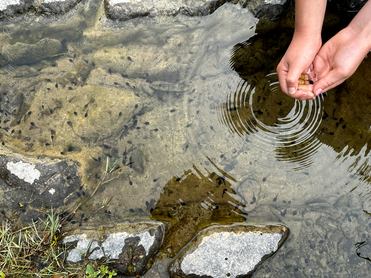
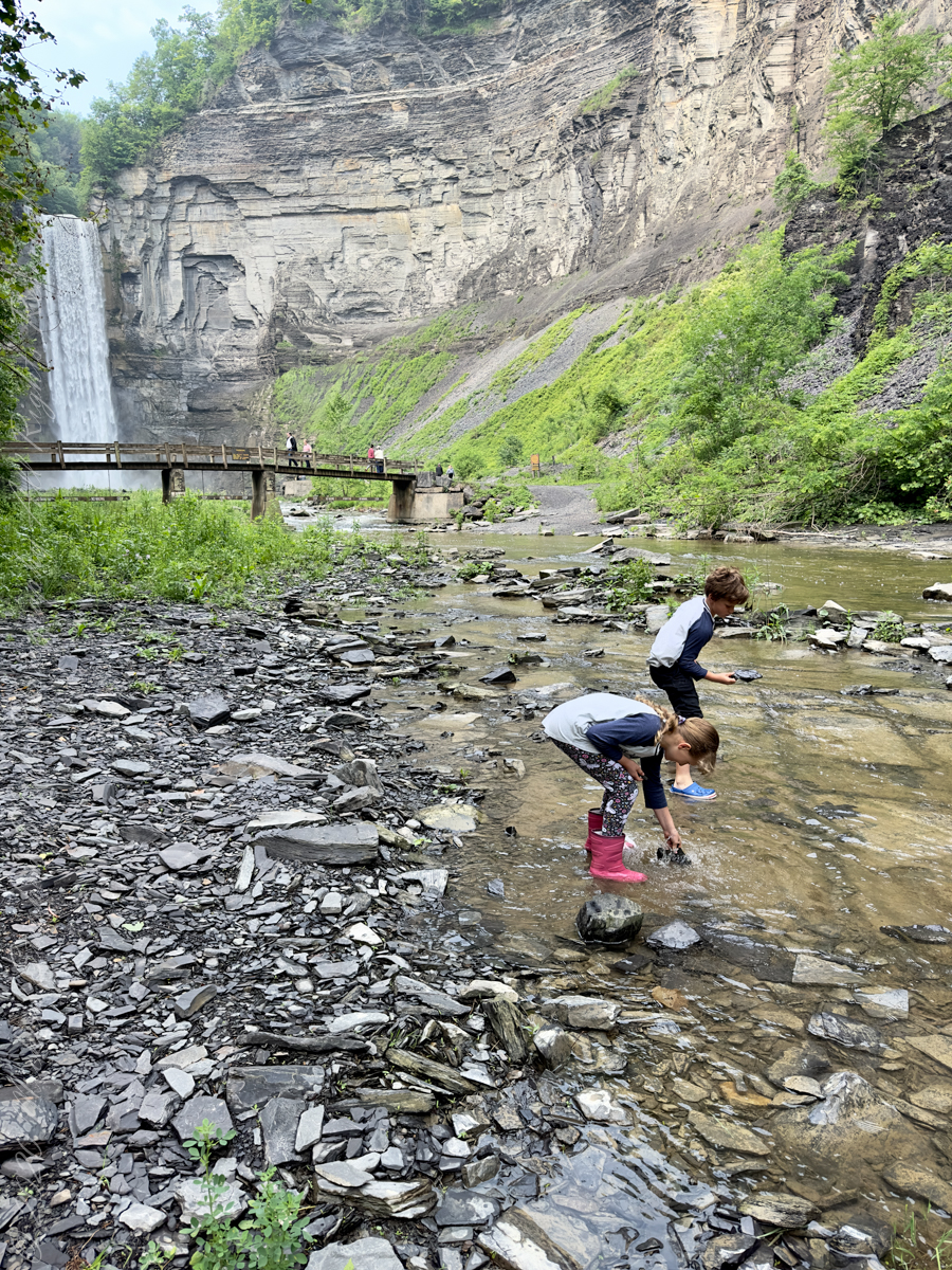
Pollywogs!! Catch and release
Annual freeze and thaw cycles also act upon small faults in the rock, causing large sections to occasionally break away, further expanding the gorge.
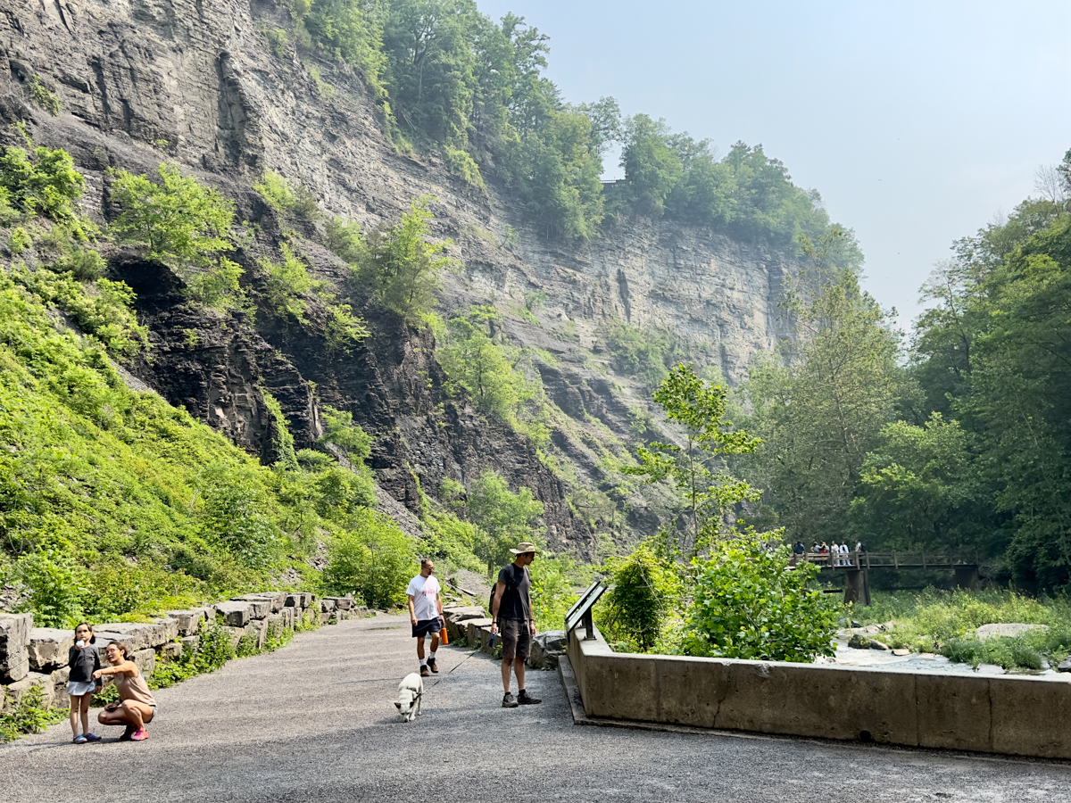
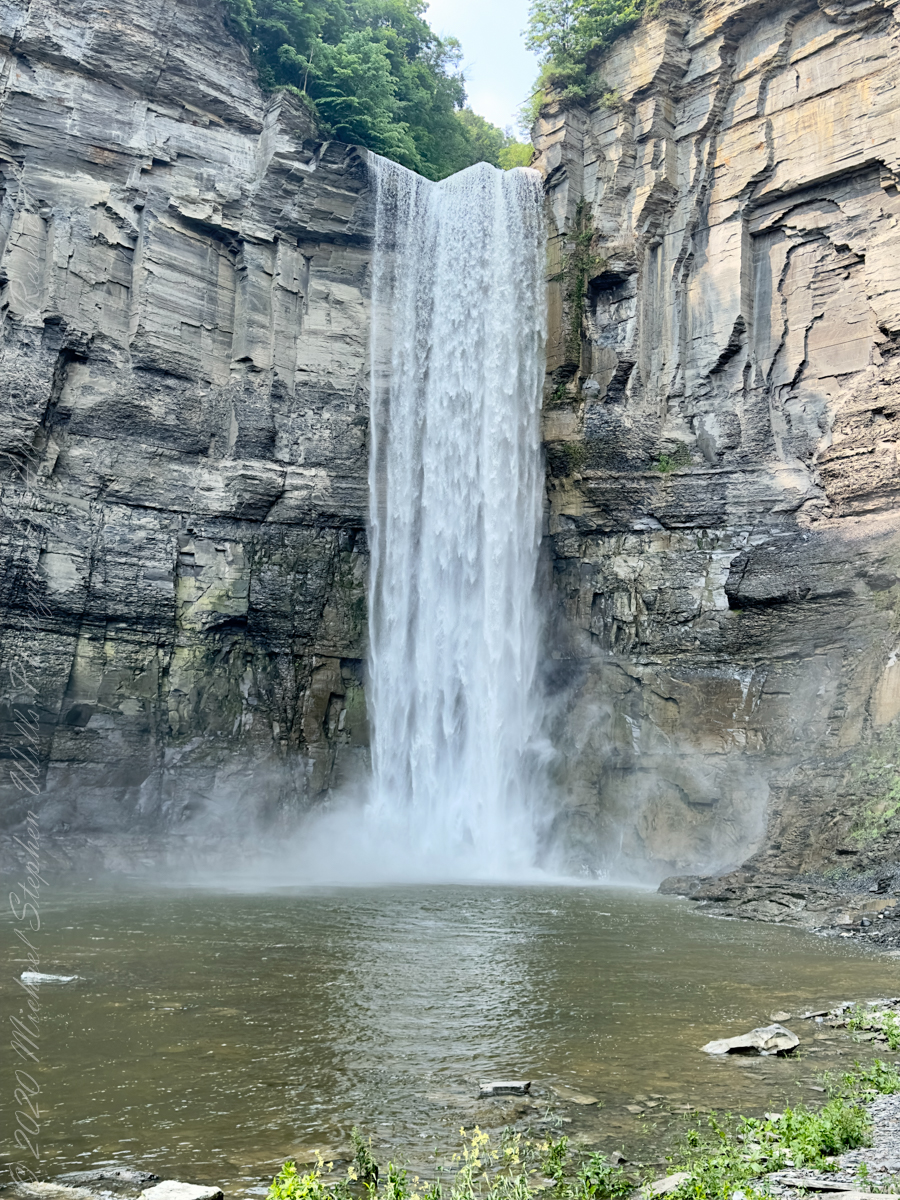
Taughannock Falls’ main cataract is a 215-foot drop (66 m), making it 33 feet (10 m) taller than Niagara Falls. It is the tallest single-drop waterfall east of the Rocky Mountains. The waterfall is located along Taughannock Creek, which flows through a long gorge with cliffs up to 400 feet (120 m) high.
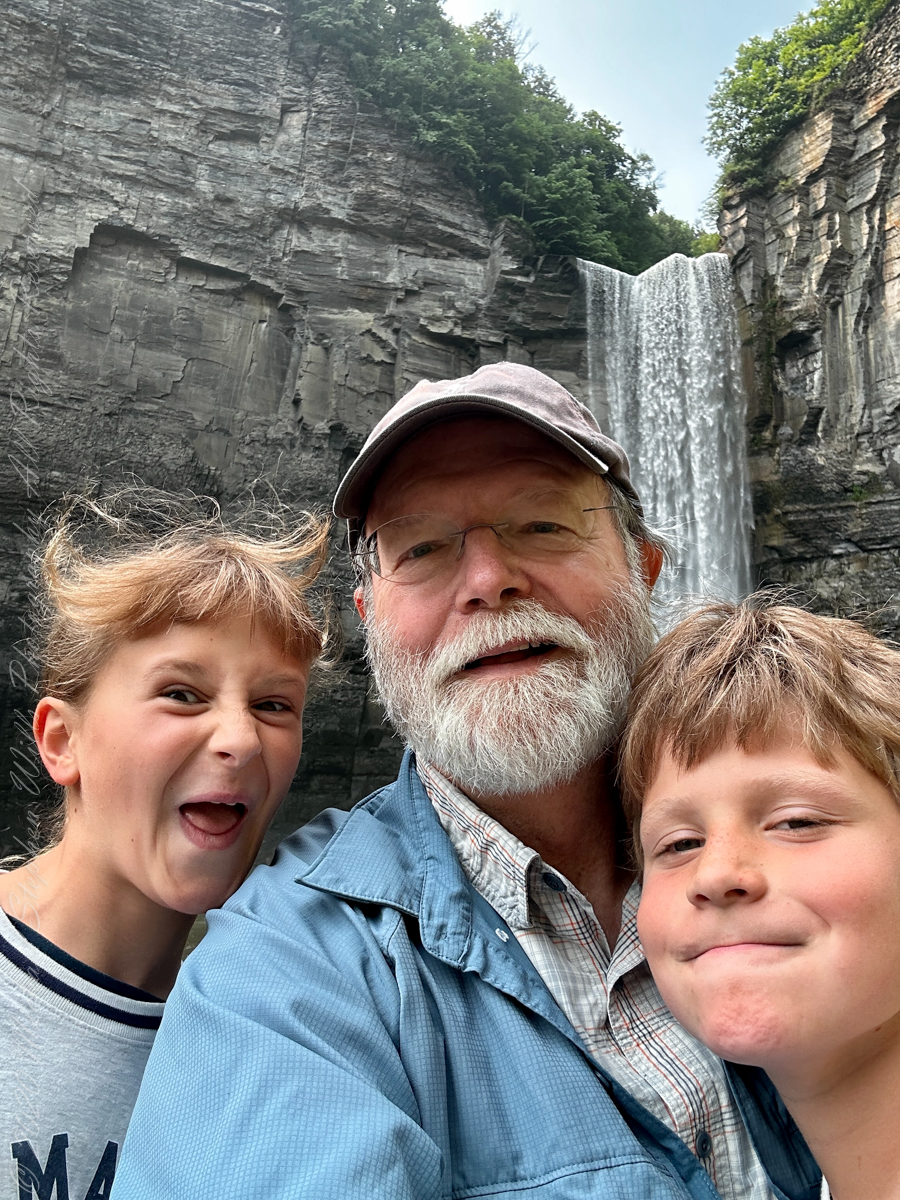
Enjoy!!
Copyright 2023 Michael Stephen Wills All Rights Reserved
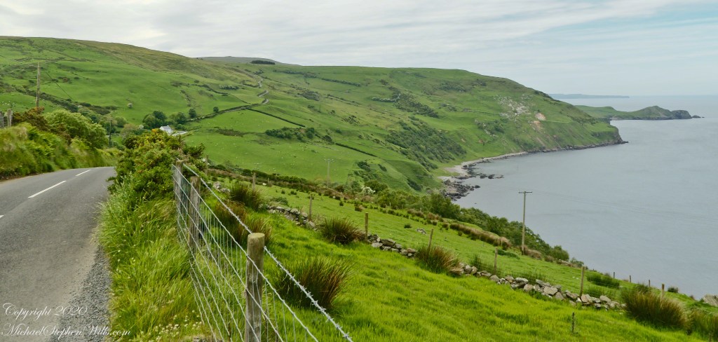
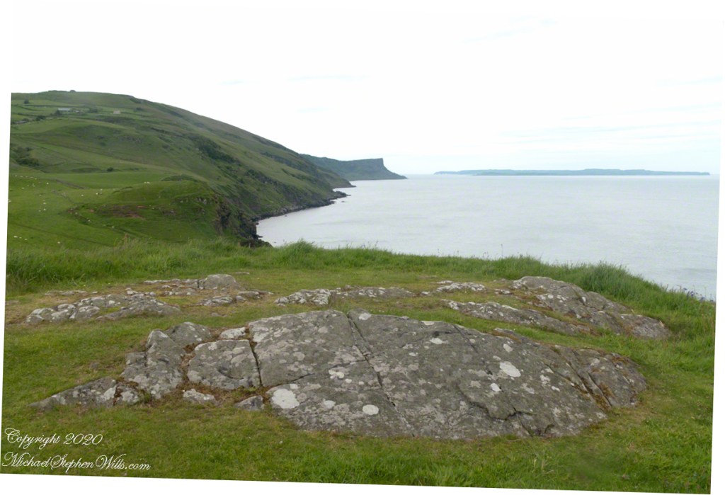
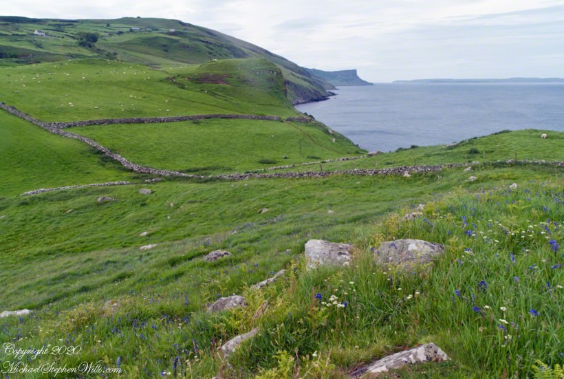
This photograph from the bottom of the Torr Road hill takes in Coolranny Townland. a slice of land running from the ridge to Loughan Bay. We see a number of hawthorne trees in flower, yellow flowering Whin Bush, houses and the Roman Catholic church Saint Mary’s Star of the Sea.
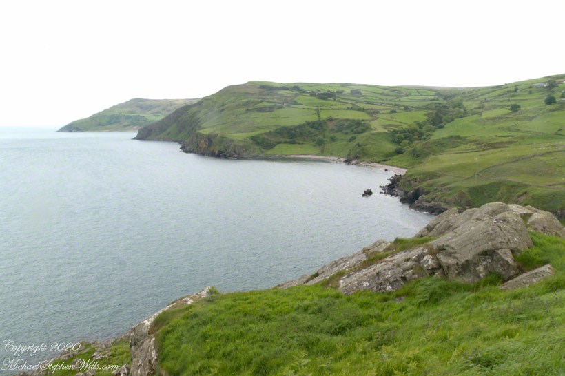
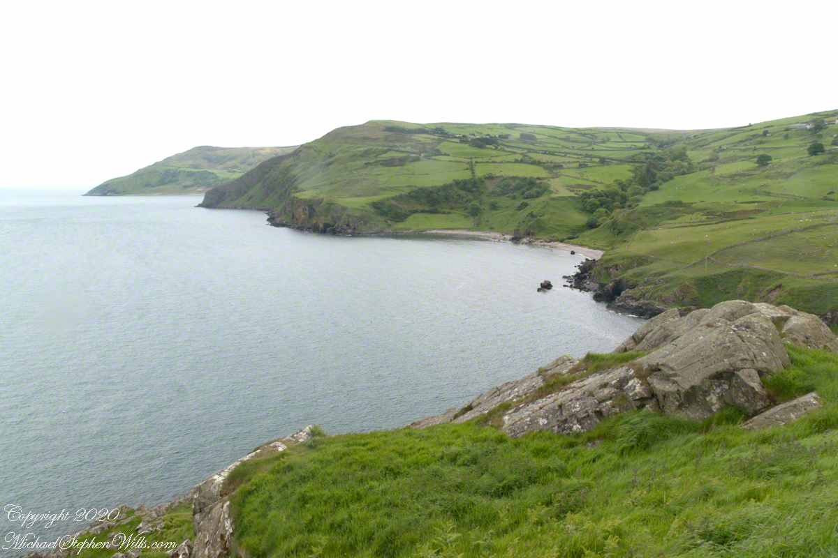
Tor in Irish is a steep rocky height. Likewise, Corr means odd, uneven, rounder, convex, curved, peaked, projecting, smooth. Combined Torcorr is the townland where we stopped on the Torr Road, halted by our wonder at this sight. In the distance, Torr Head projects into North Channel, the closest land to Scotland. Following the coast, the cliffs in front of Torr Head is home to numerous sea birds. The curved bay is named Loughan, the rocky sand beach are ruins of cottages emptied by Irish emigration. The white building is Saint Mary’s Star of the Sea Roman Catholic Church. County Antrim, Northern Ireland.
View of Coolranny townland with Saint Mary’s Star of the Sean Roman Catholic Church from Torcorr townland, Torr Road . County Antrim, Northern Ireland.
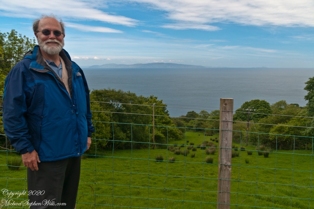
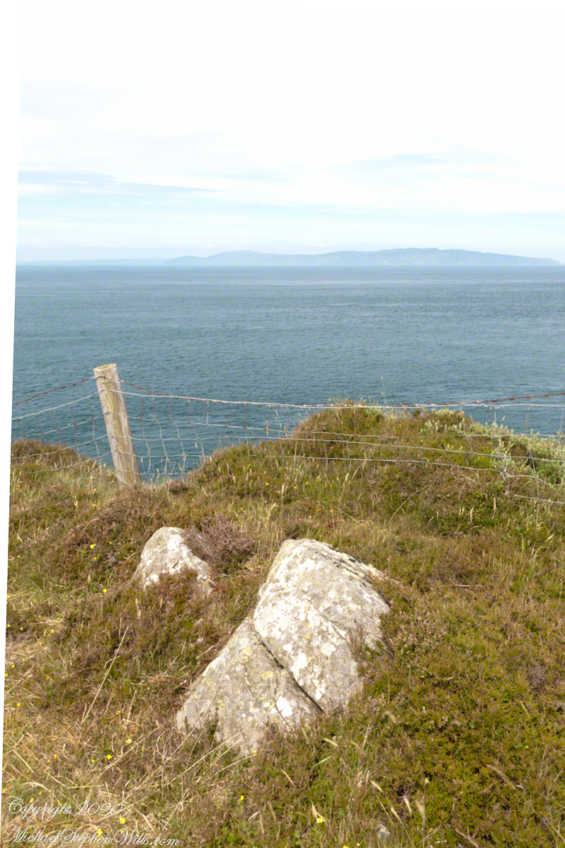
The photograph of the header, taken by Pam, is from either Coolranny or Loughan Townland, looking across a sheep pasture, the North Channel of the Irish Sea toward the Mull of Kintyre, Scotland just twelve miles distant.
Here is a slideshow of this post’s images. To visit from WordPress Reader, you need to first click the title of this post to open a new page.
Tor in Irish is a steep rocky height. Likewise, Corr means odd, uneven, rounder, convex, curved, peaked, projecting, smooth. Combined Torcorr is the townland where we stopped on the Torr Road, halted by our wonder at this sight. In the distance, Torr Head projects into North Channel, the closest land to Scotland. Following the coast, the cliffs in front of Torr Head is home to numerous sea birds. The curved bay is named Loughan, the rocky sand beach are ruins of cottages emptied by Irish emigration. The white building is Saint Mary’s Star of the Sea Roman Catholic Church. County Antrim, Northern Ireland.View of Coolranny townland with Saint Mary’s Star of the Sean Roman Catholic Church from Torcorr townland, Torr Road . County Antrim, Northern Ireland.On the way to Torr Head we stopped at this spot in Coolranny Townland to take in this view of the Irish Sea. The land overlooks Loughan Bay toward the Mull of Kintyre and Sanda Island, Scotland. County Antrim, Northern Ireland.
Copyright 2023 All Rights Reserved Michael Stephen Wills
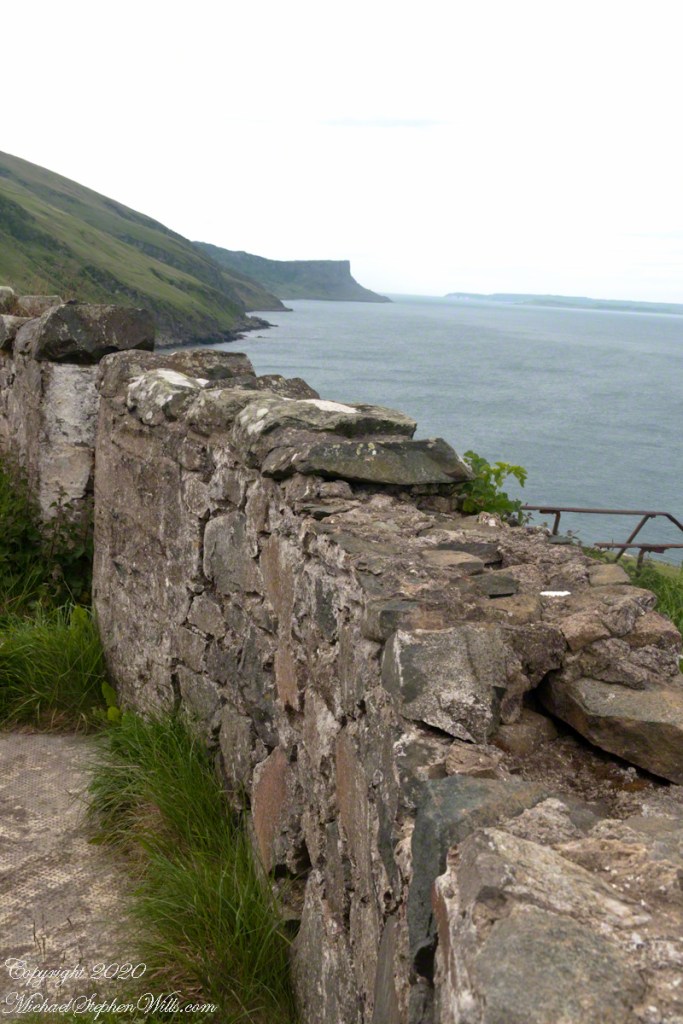
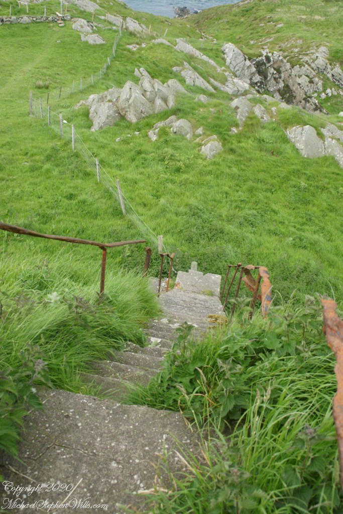
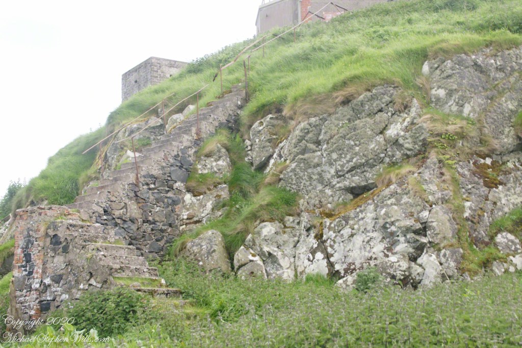
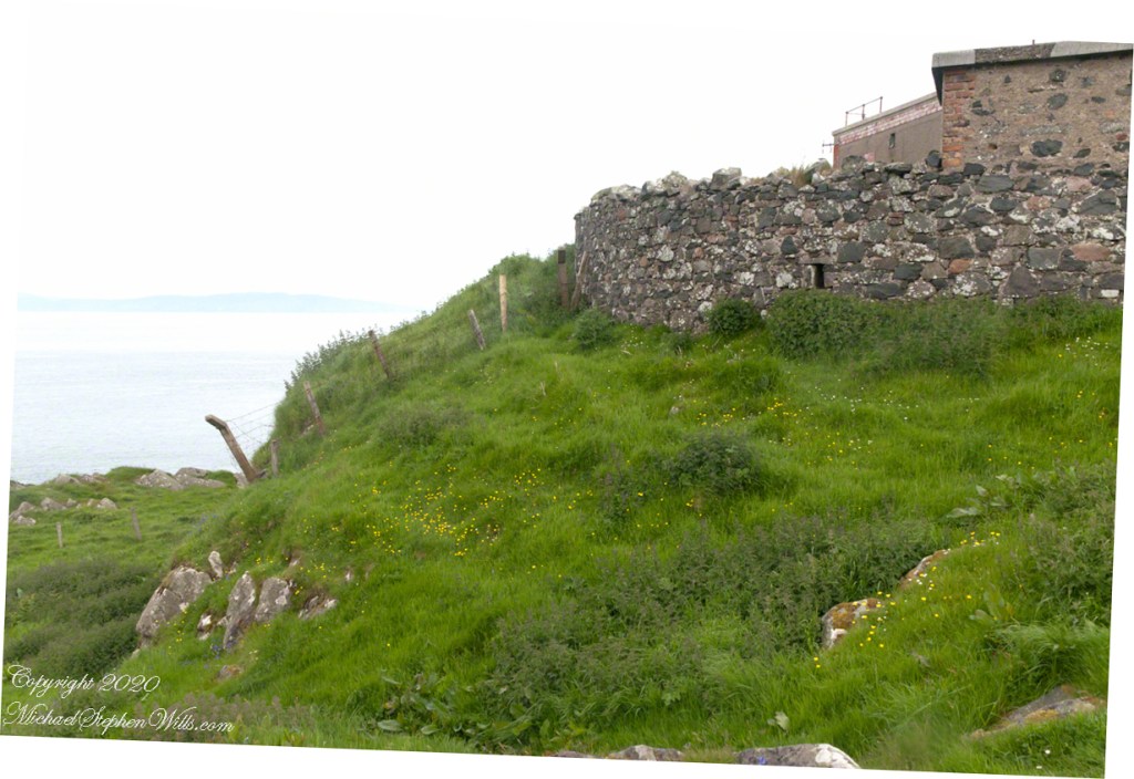
Weathered masonry at the height of Torr Head was there to serve the custom house and as support for a spotting station where ships transiting the Strait of Moyle (Irish Sruth na Maoile), the 12 miles of water to the Mull of Kintyre.
Lloyd’s of London, vitally interested in the appearance of ships’ progress crossing the oceans, had notice of passage via semaphore (and, later, Marconi’s “wireless”). Destination ports were copied in.
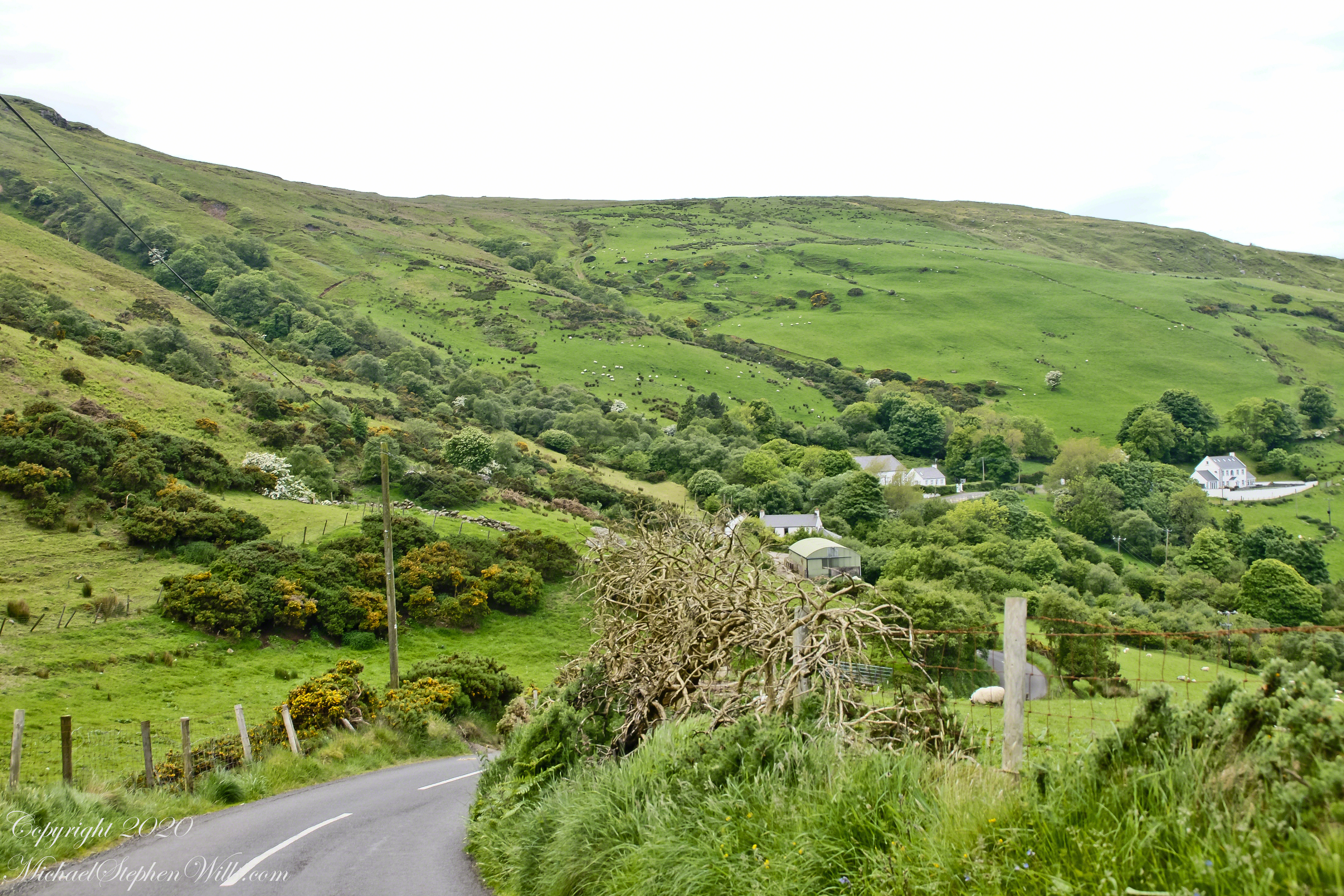
Scottish influences touched the landscape covered by yesterday’s post, today we continue on this subject with these south facing views from Torr Head. The far ridge of Torrcor marks Loughan Bay.
A townland on the other side of Torrcor hill (and townland) has an eponymous ruin, Altagore Cashel. Mores the pity we did not visit this site, a thick drystone enclosing wall from the 5th century (you can see photographs from another site at this link). Cashel is from the Irish Caiseal, a circular, defensive fort (“ring fort”).
Books such as “Antrim and Argyll: Some Aspects of the Connections” tell of connections over the millennia, clan associations between the islands and ring forts such as Altagore Cashel.
Argylshire Scotland across the North Channel from Torr Head
Late spring and summer, weekdays, a net is stretched across the bay to catch salmon nosing up the coast, searching for their home spawning stream, here called Altmore Burn. “Burn” is a Scottish term for a fresh water source, evidence of the influence 12 miles across the north channel.
The small harbor seen here from Torr Head is for the salmon fishery. Small boats will seek shelter here from the wind and tides strong enough to roar in passing the Head, like a fast flowing river.
Taking in a flower meadow, foreground, coaster sheep pastures, the photograph, below, looks north from Torr Head. The high hill, midground, is Greenanmore, notable for a the largest passage tomb of the Antrim Glens. Locally known as “Barrach’s Tomb,” for the Red Branch knight of the 1st Century AD fort on Torr Head, tree ring research of the mid-20th Century dates these tombs in the neolithic The hilltop passage tomb was an ancient relic when the mortar of Barrach’s Torr Head fort was drying.
When I enlarge the original photograph, visible on the ridge is a decommissioned Cold War listening post, the tomb is near that. The distant land across the North Channel water is Rathlin Island.
Click photograph for a larger view. To do this from WordPress Reader, you need to first click the title of this post to open a new page.