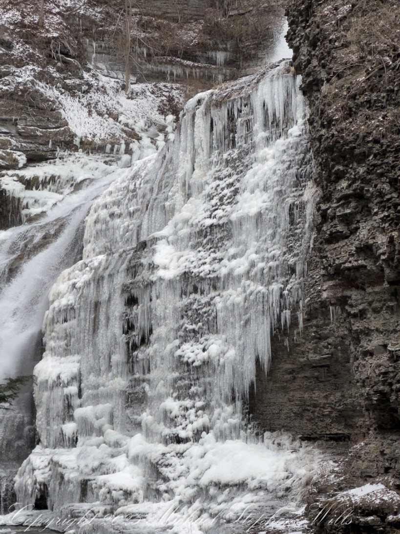
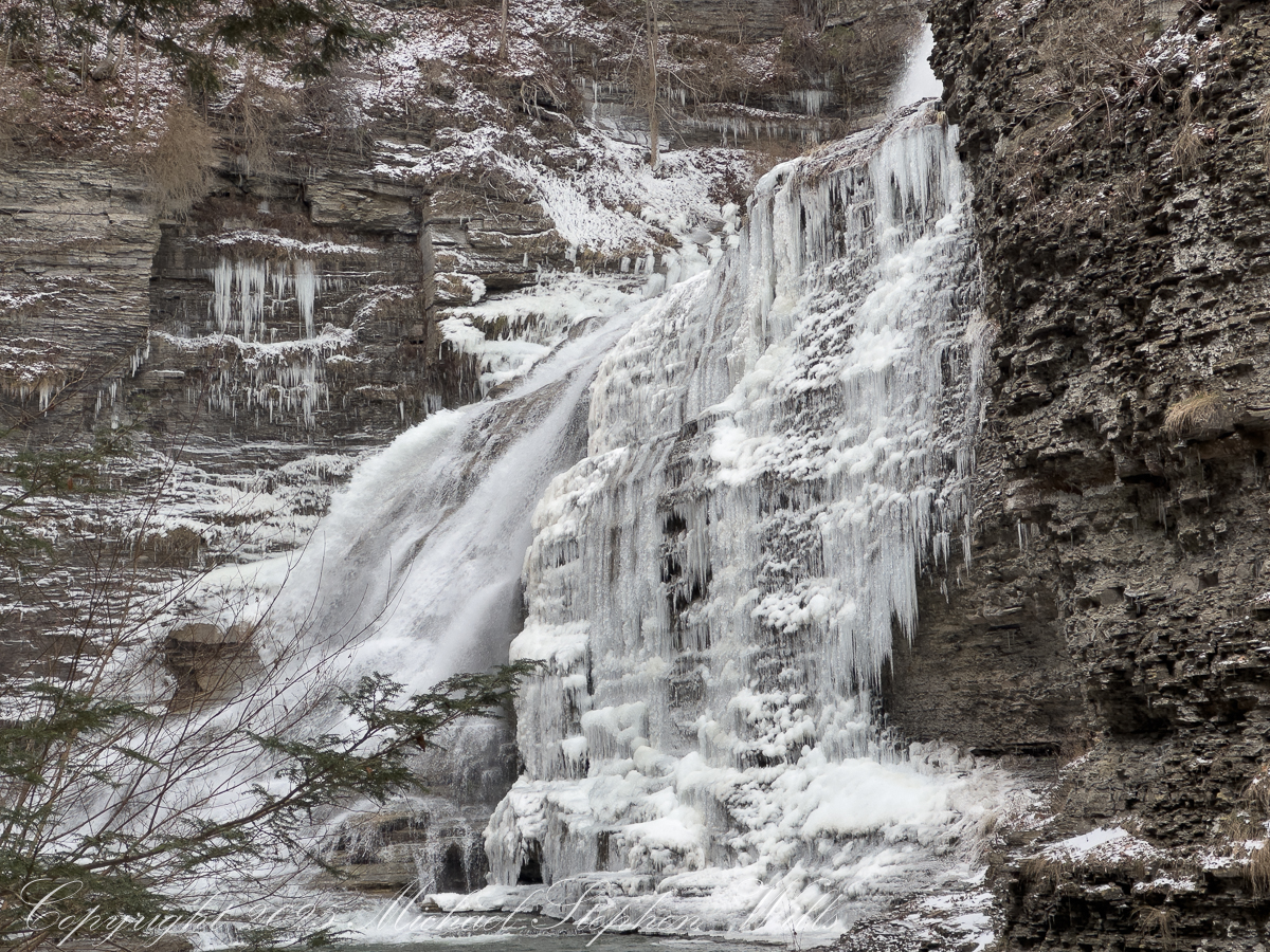
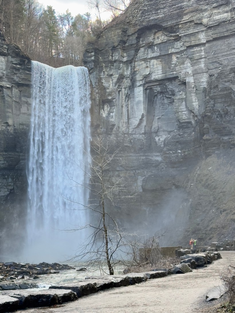
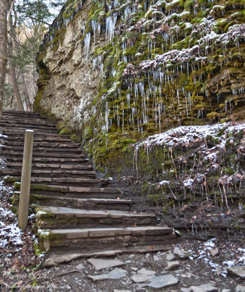
A careful winter walk along the South Rim reveals Lucifer Falls transformed—ice chutes, frozen veils, and flowing water beneath stone, inviting patience, attention, and quiet awe.
January pares the gorge to essentials. Color withdraws, sound sharpens, and the land reveals its underlying grammar—stone, water, cold, and time. Reaching Lucifer Falls by the South Rim Trail on a winter morning feels less like an initiation, a careful passage through ice-chutes and shadowed ledges where the creek rehearses its ancient work in a new key.
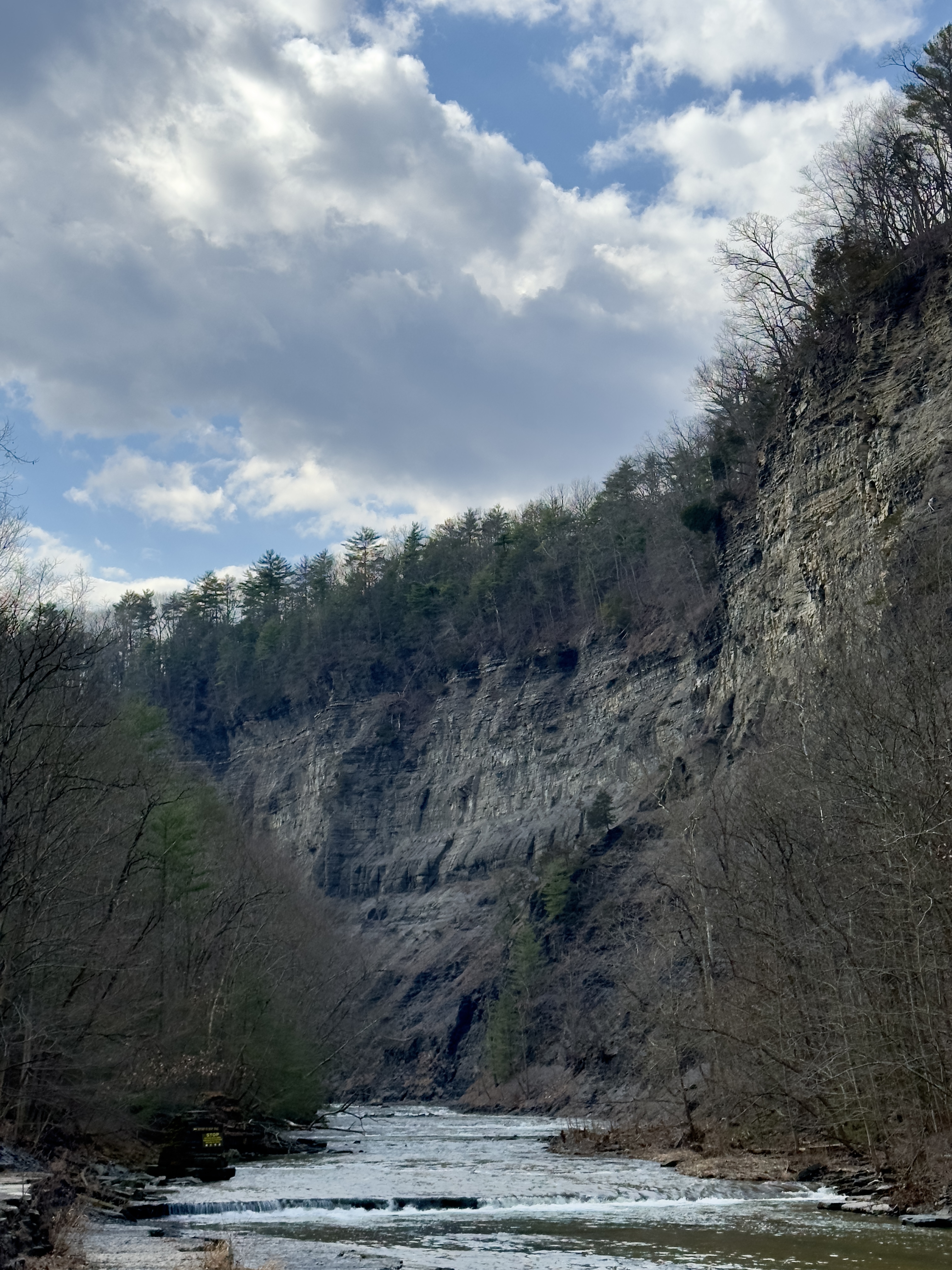
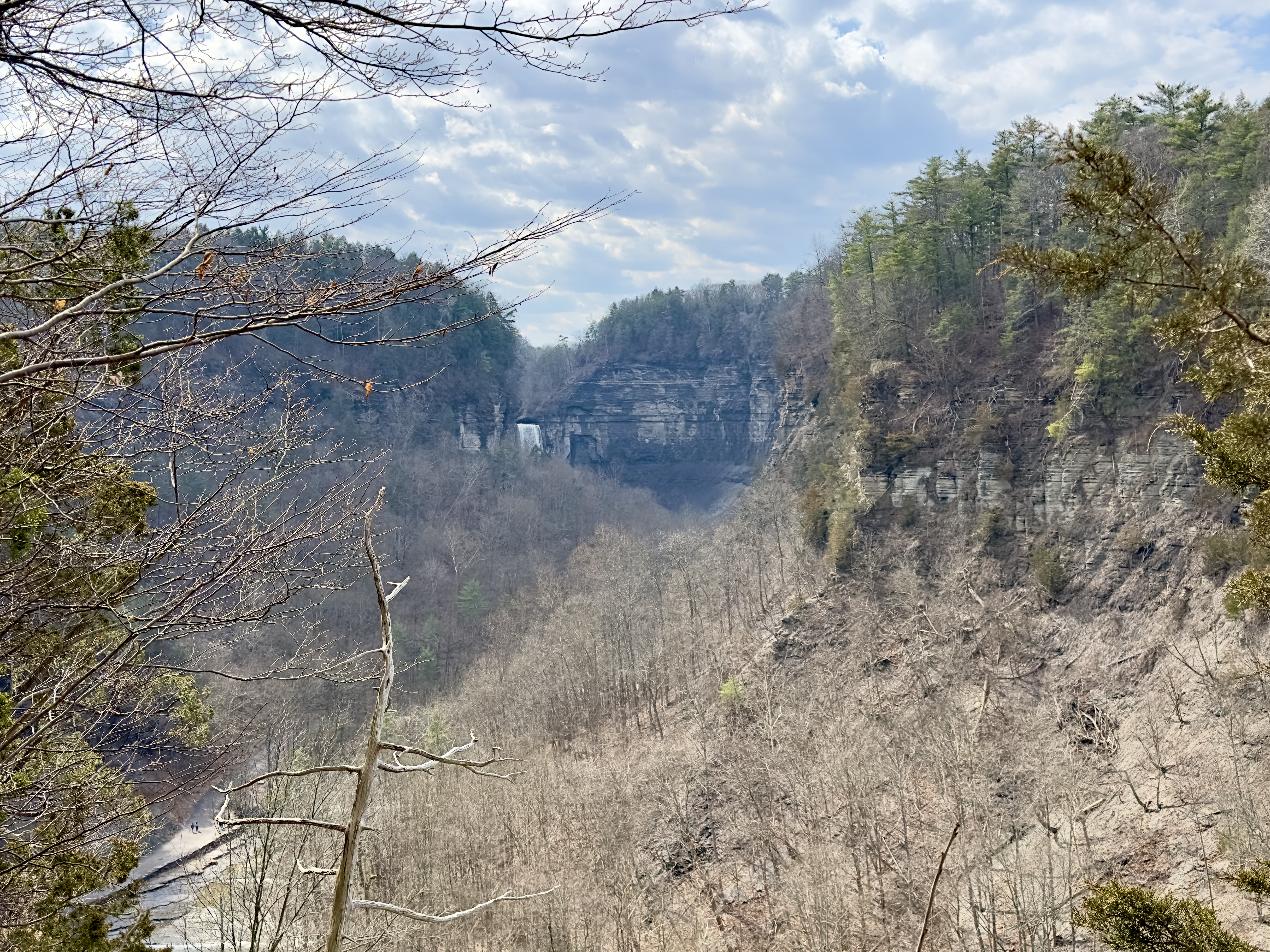
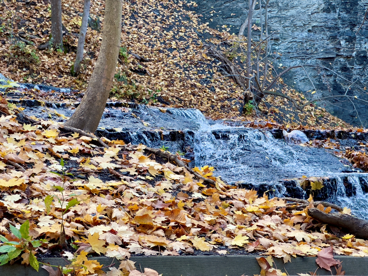
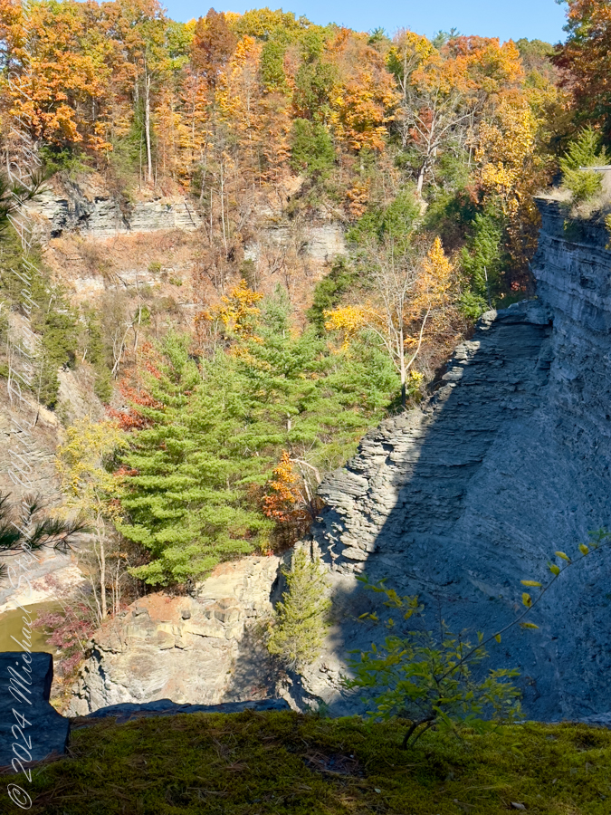
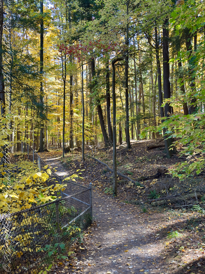
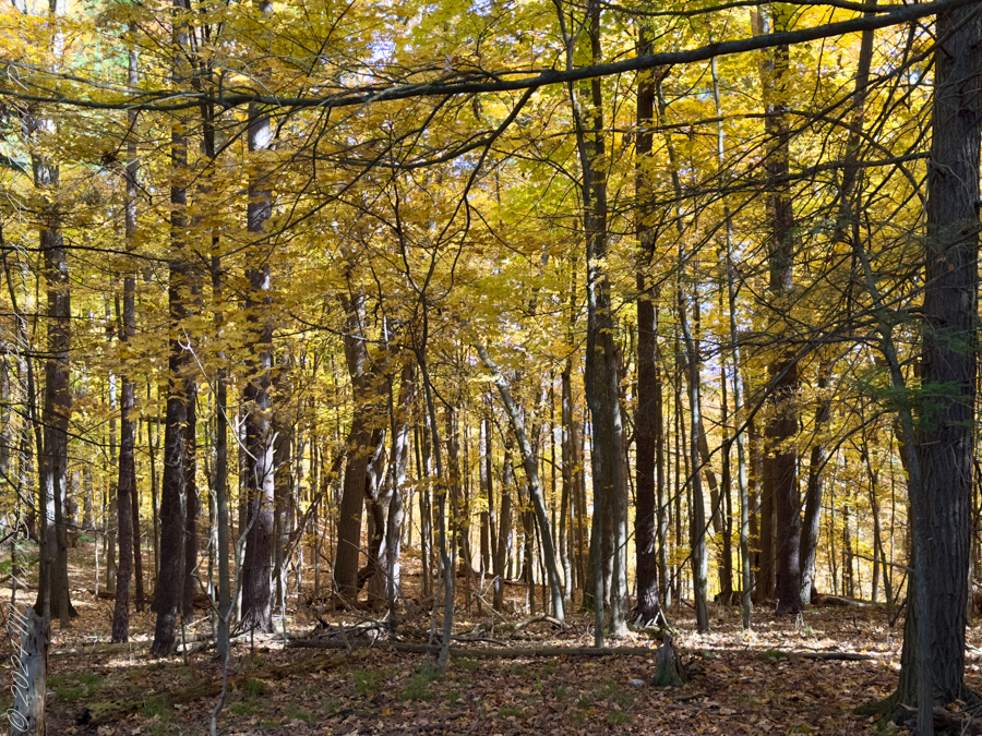
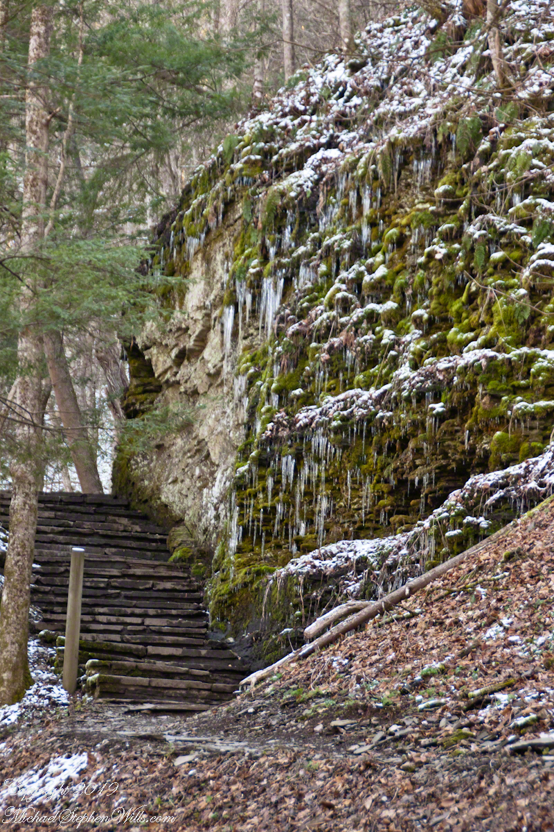
Wintertime scene along the South Rim Trail of Robert H. Treman State park. The trail is solid ice. Ithaca, Tompkins County New York State
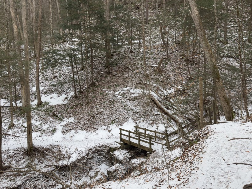
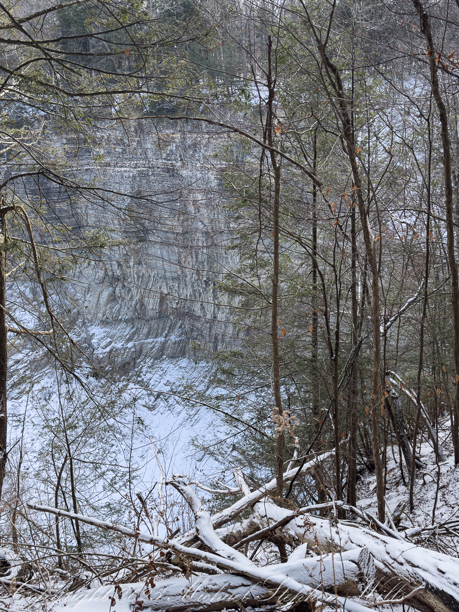
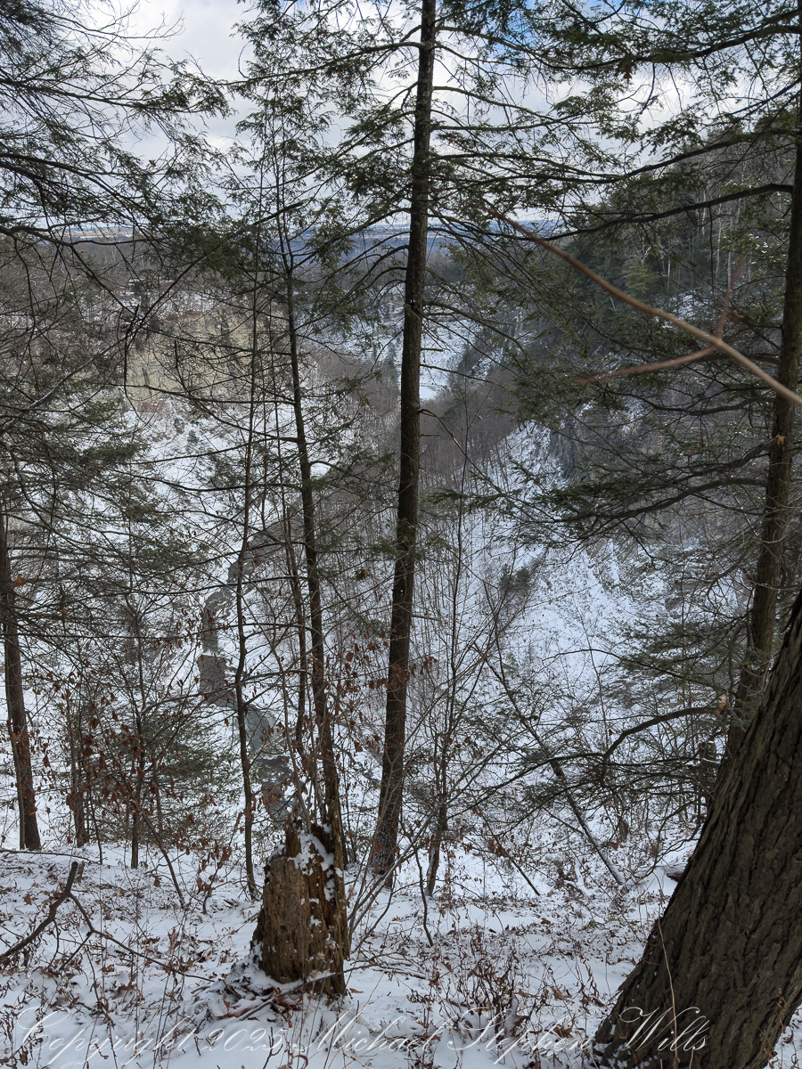
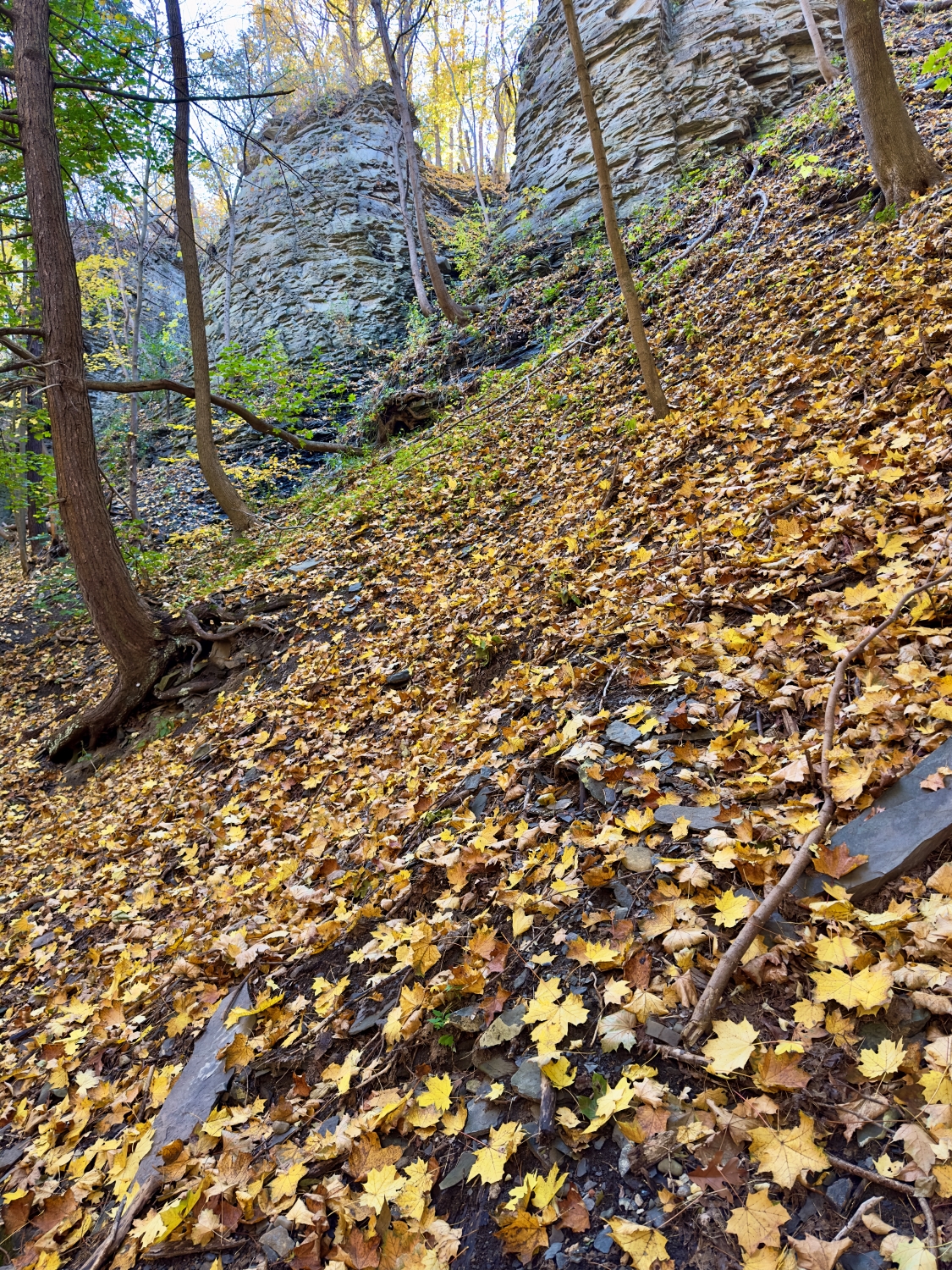
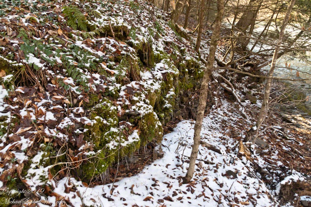
The trail begins quietly, a soft crunch underfoot where snow thins to leaf litter. Hemlocks hold their breath. The gorge opens in increments, not all at once, and the creek’s voice arrives in fragments—first a whisper, then a steady insistence. Winter edits the landscape with a clean hand. The clutter of summer understory is gone; what remains is structure: stratified shale stacked like a book left open to a single, patient chapter. Every footfall demands attention. Ice slicks the stone where seeps cross the path, and the trail teaches a winter gait—short steps, weight centered, the quiet confidence of traction earned rather than assumed.
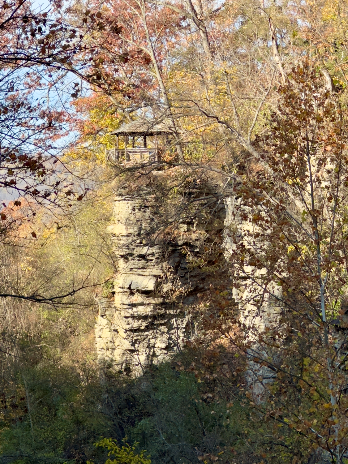
As the rim narrows, the air cools perceptibly. The gorge walls rise higher, their layered faces stippled with frost and snow. Icicles form a punctuation along ledges, commas and exclamation points caught mid-sentence. In places, the trail descends into ice chutes—steep, polished corridors where meltwater has glazed the rock. Here, the body listens more closely. Boots test, then commit. Hands brush the cold bark of a leaning tree, a borrowed handrail. There is pleasure in this concentration, the way winter insists on presence. You cannot hurry. You cannot drift.
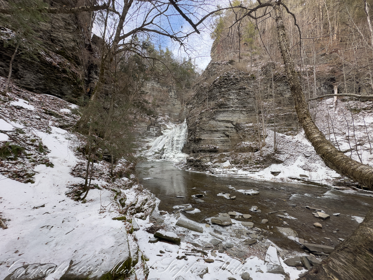
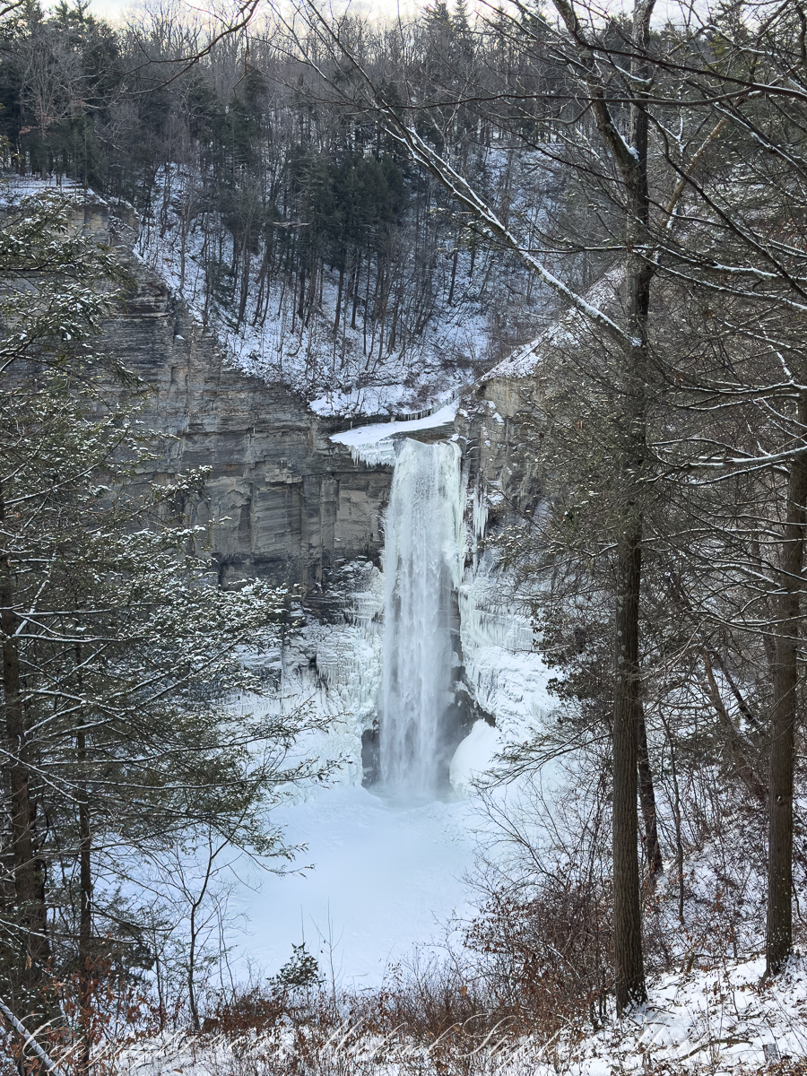
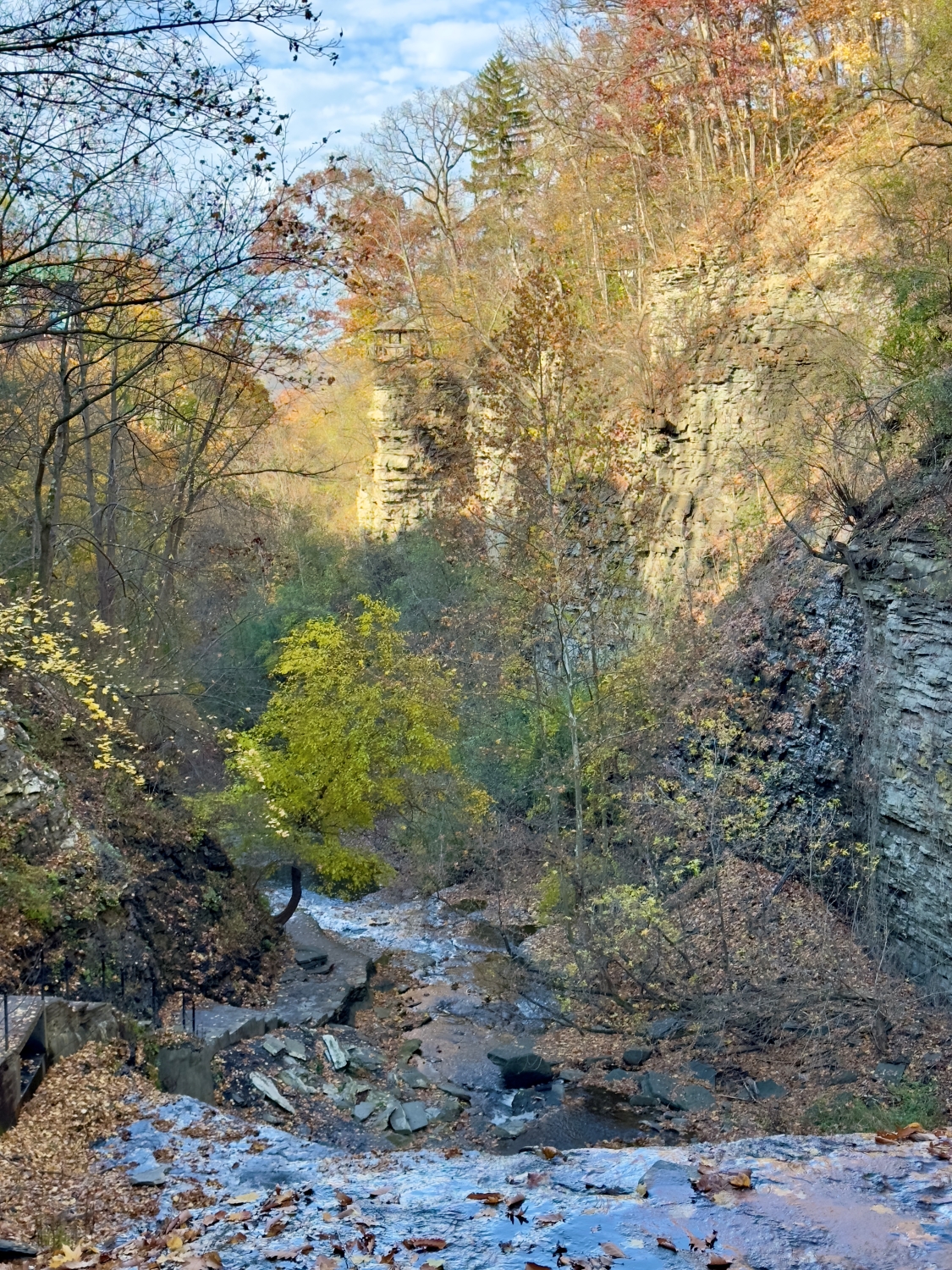
Below, the creek widens into a quiet pool, its surface a muted mirror. Thin plates of ice drift and collide, sounding a faint porcelain clink. The sound carries upward, amplified by the gorge’s acoustics, a delicate counterpoint to the deeper hush of falling water. The trail curves, and suddenly the falls announce themselves—not in full view, but as a white presence beyond the bend, a brightness lodged between walls of stone.
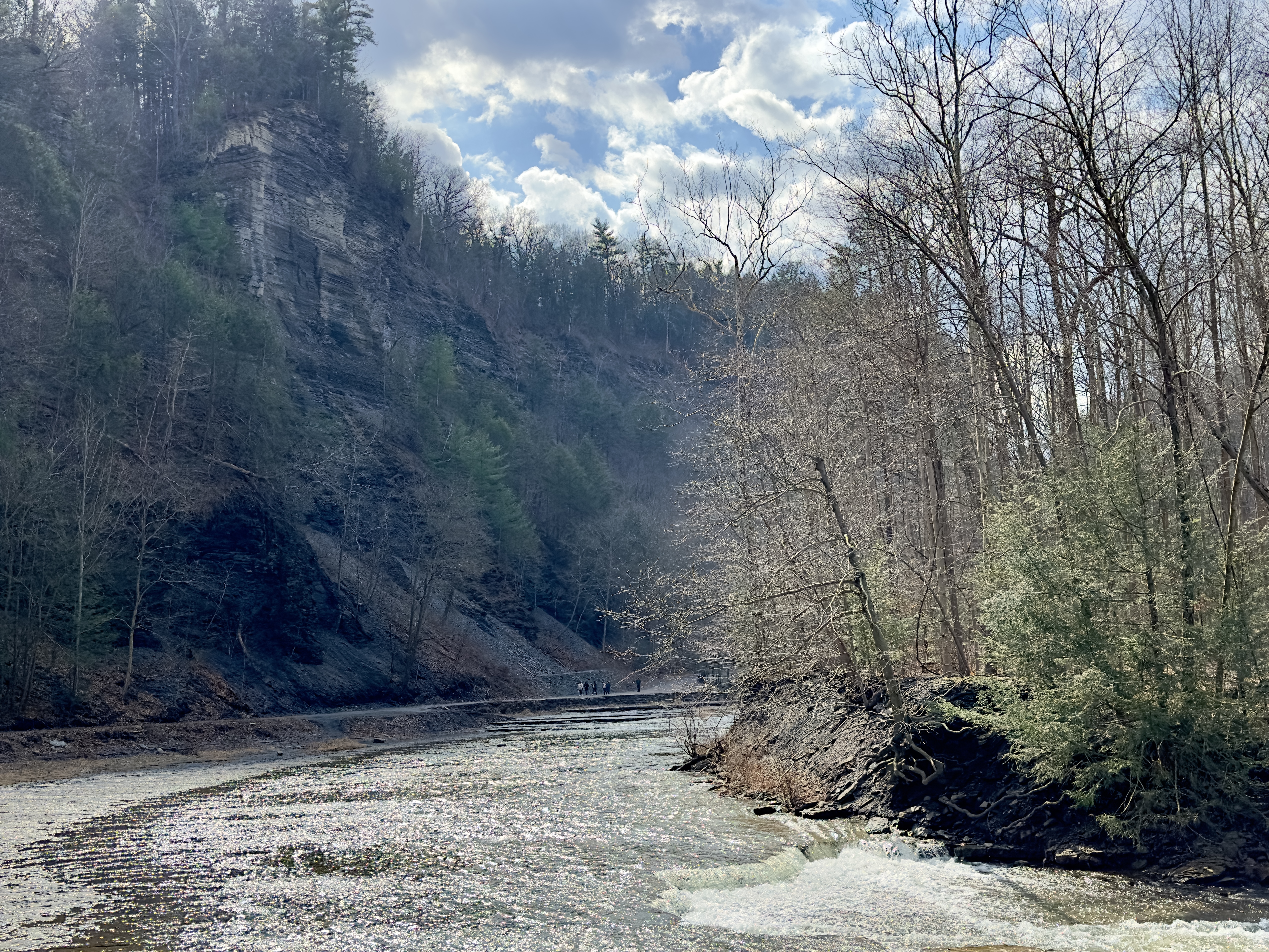
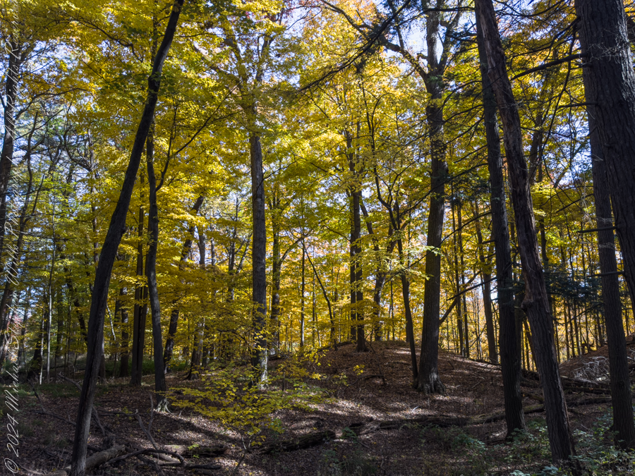
The trails this day were solid ice. I arrived via the South Rim Trail, the only way to access this site. Robert H. Treman State Park, Ithaca, Tompkins County, New York State
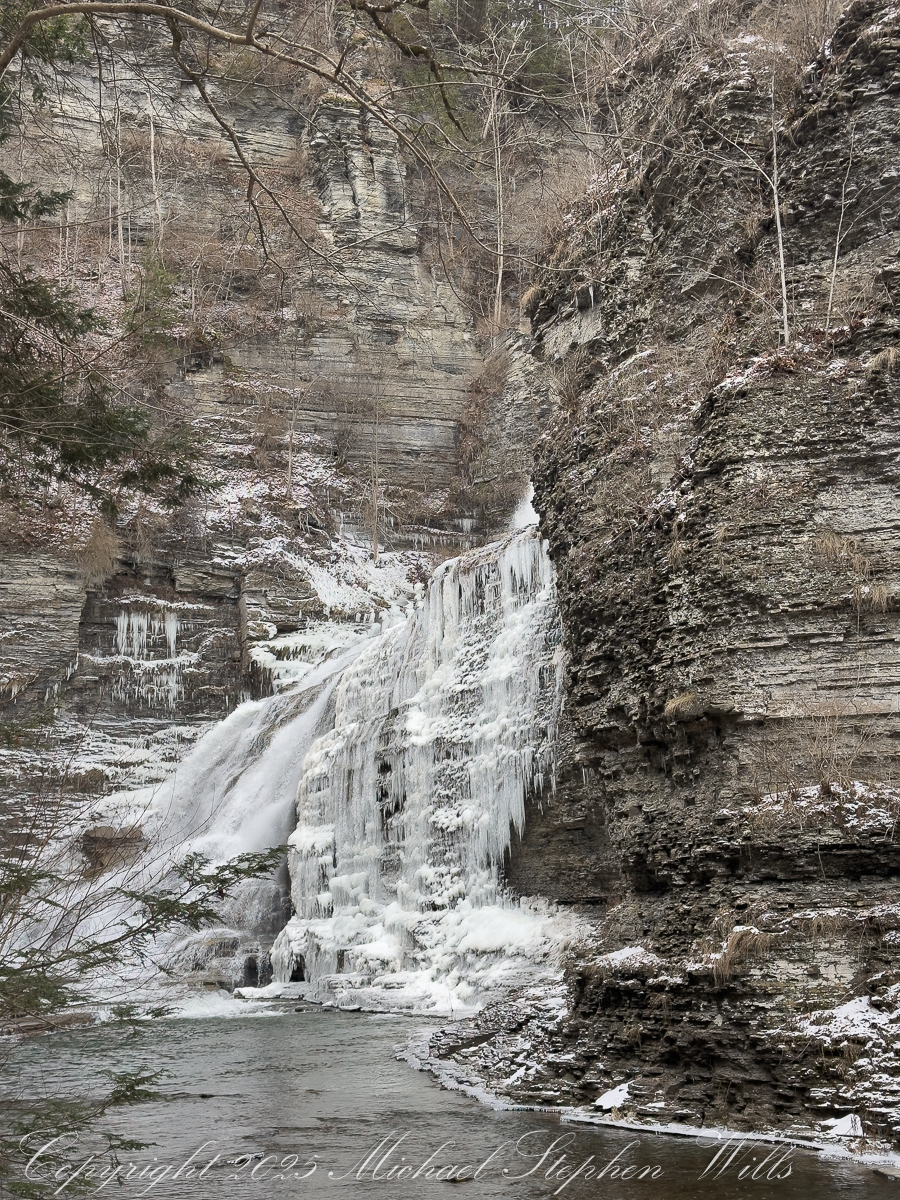
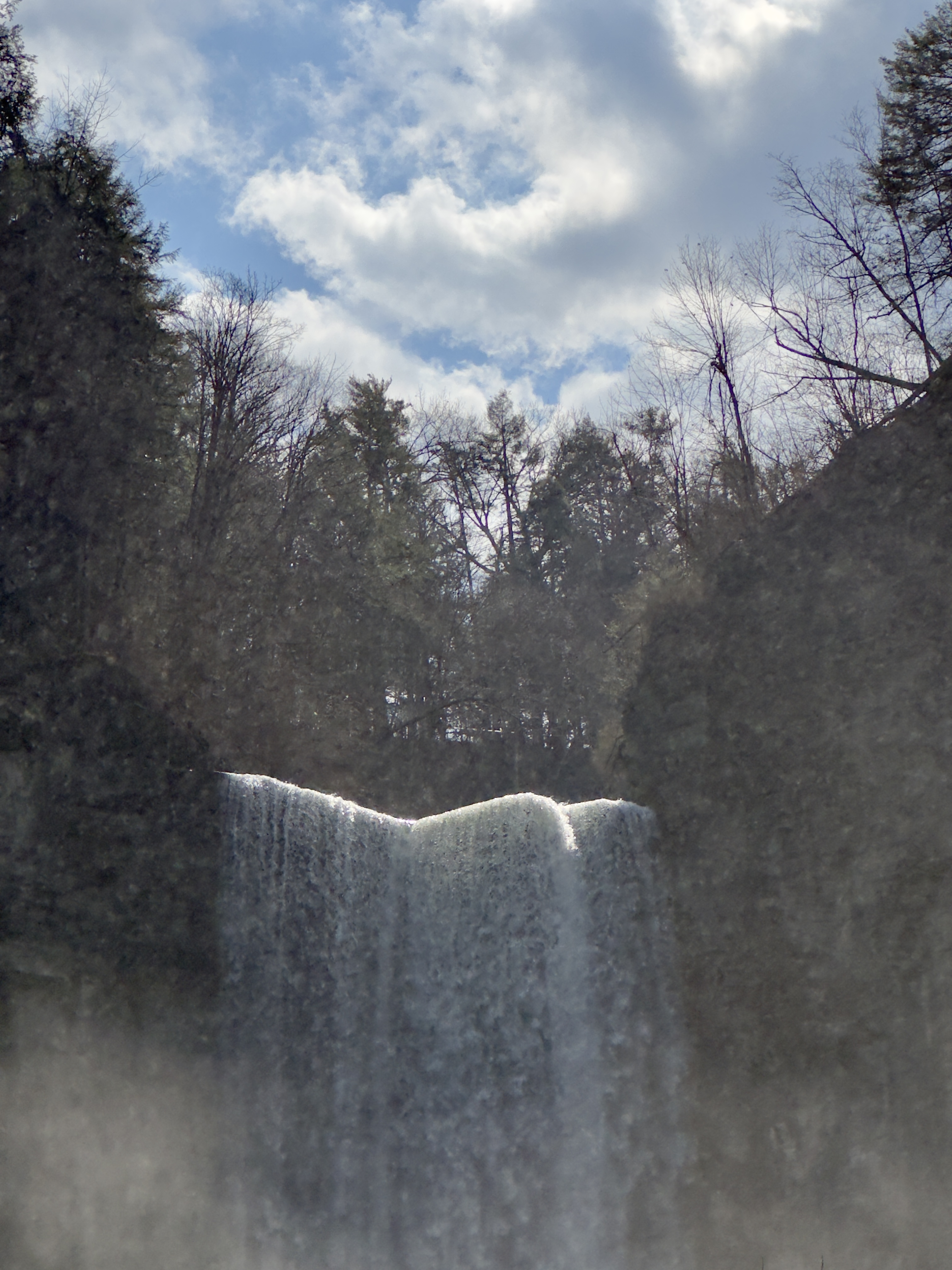
Approaching from the South Rim offers a measured reveal. First the upper cascades appear, water fanning across rock that has become a winter canvas. Ice has claimed the margins, building ribs and curtains that thicken day by day. The falls do not stop in January; they change. Water threads through ice, slips behind it, emerges again in translucent veils. Gravity persists, but its expression is altered—slower, more deliberate, sculptural.
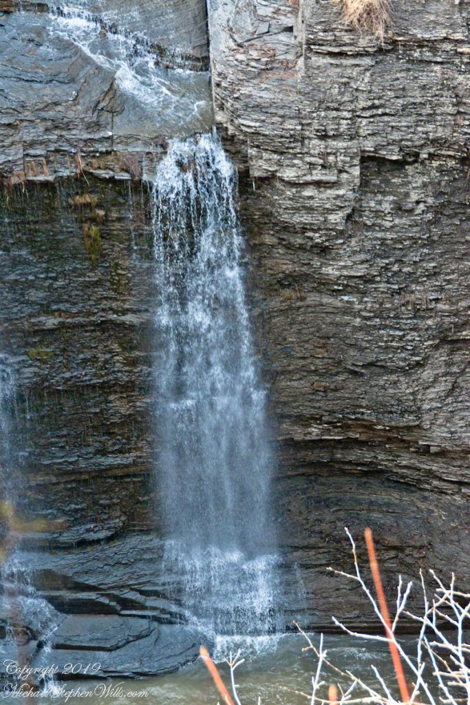
At the base,Lucifer Falls stands transformed. The familiar plunge has become a tiered architecture of frozen flow, a stepped amphitheater where icicles hang like organ pipes and snow pillows settle into hollows. The water still moves, a silver ribbon finding its way down the left flank, while the right side has grown into a cathedral of ice. The gorge walls close in, amplifying the sound—a low, resonant murmur that feels as much felt as heard.
The cold sharpens every sense. Breath fogs, then clears. Fingers tingle through gloves as the camera comes out, metal biting through insulation. Framing becomes an act of translation: how to honor motion when much of it has paused; how to suggest the hidden currents beneath the frozen skin. A short video will later catch what stillness cannot—the soft shiver of water behind ice, the way the falls breathe even in winter—but for now, the eye lingers on texture and line. Shale layers echo the ice’s striations. Time repeats itself in different materials.
Standing there, it’s impossible not to feel the weight of deep history. These rocks remember glaciers and warmer seas; this creek has been at work since before memory had a word. January merely adds a chapter. Snow feathers the ledges. A stray sunbeam slips into the gorge, briefly igniting the ice, and then is gone. The falls return to their monochrome palette, as dignified as an old photograph.
The return along the rim is lighter, the path now familiar, confidence earned. The ice chutes yield more easily on the way back, as if acknowledging the careful passage. Above the gorge, the forest resumes its quiet, and the trail leads out into the open day. What lingers is the sense of having witnessed something intimate and exacting—a winter conversation between stone and water, conducted without haste, inviting those willing to slow down and listen.
January asks little and gives much. Reaching Lucifer Falls by the South Rim is a reminder that beauty is not diminished by cold; it is clarified.
Enter your email to receive notification of future postings. I will not sell or share your email address.
Copyright 2026 All Rights Reserved Michael Stephen Wills
Winter distills Taughannock Gorge to stone, water, and silence, where careful footsteps along icy rim trails reveal deep connections between landscape, memory, and quiet joy.
Winter pares the world down to its essential lines, and nowhere is that more apparent than on the rim trails of Taughannock Falls State Park. On a Wednesday afternoon walk, a three-mile pilgrimage, the gorge revealed itself as a living corridor of connections—between water and stone, past and present, effort and joy. The season sharpened every sensation: the crunch and slip of ice underfoot, the hush of leafless woods, the long exhale of the falls echoing unseen below.
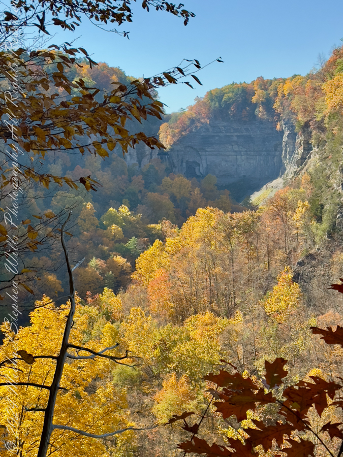
From the overlook, the gorge opens like a vast stone book, its pages written in shale and time. Taughannock Falls drops away in the distance, not so much seen as felt—its presence announced by scale and gravity. Even before stepping onto the trail, the walk establishes its rhythm: pause, look, breathe. Winter insists on this slower tempo. Ice dictates caution, and caution invites attention.
Heading along the Rim Trail my progress became deliberate. The path, glazed in places with solid ice, turned each step into a negotiation. Yet this was no impediment to pleasure. Slowness allowed for noticing the quiet labor of the park maintenance crew, whose careful clearing and repairs spoke of spring already anticipated. Their work stitched the present moment to the coming season, a reminder that parks, like stories, are maintained through this unseen devotion.
The gorge itself is a system of thresholds. A bridge crossing the creek marks the transition from North to South Rim, but it also frames one of the most dramatic views in the park. Standing above the chasm, one senses connection: water flowing beneath, trails diverging and rejoining, human passage layered lightly atop geological endurance. The gorge is a conversation between forces, ongoing and unresolved.
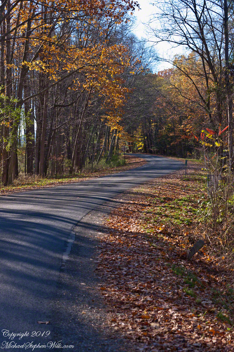
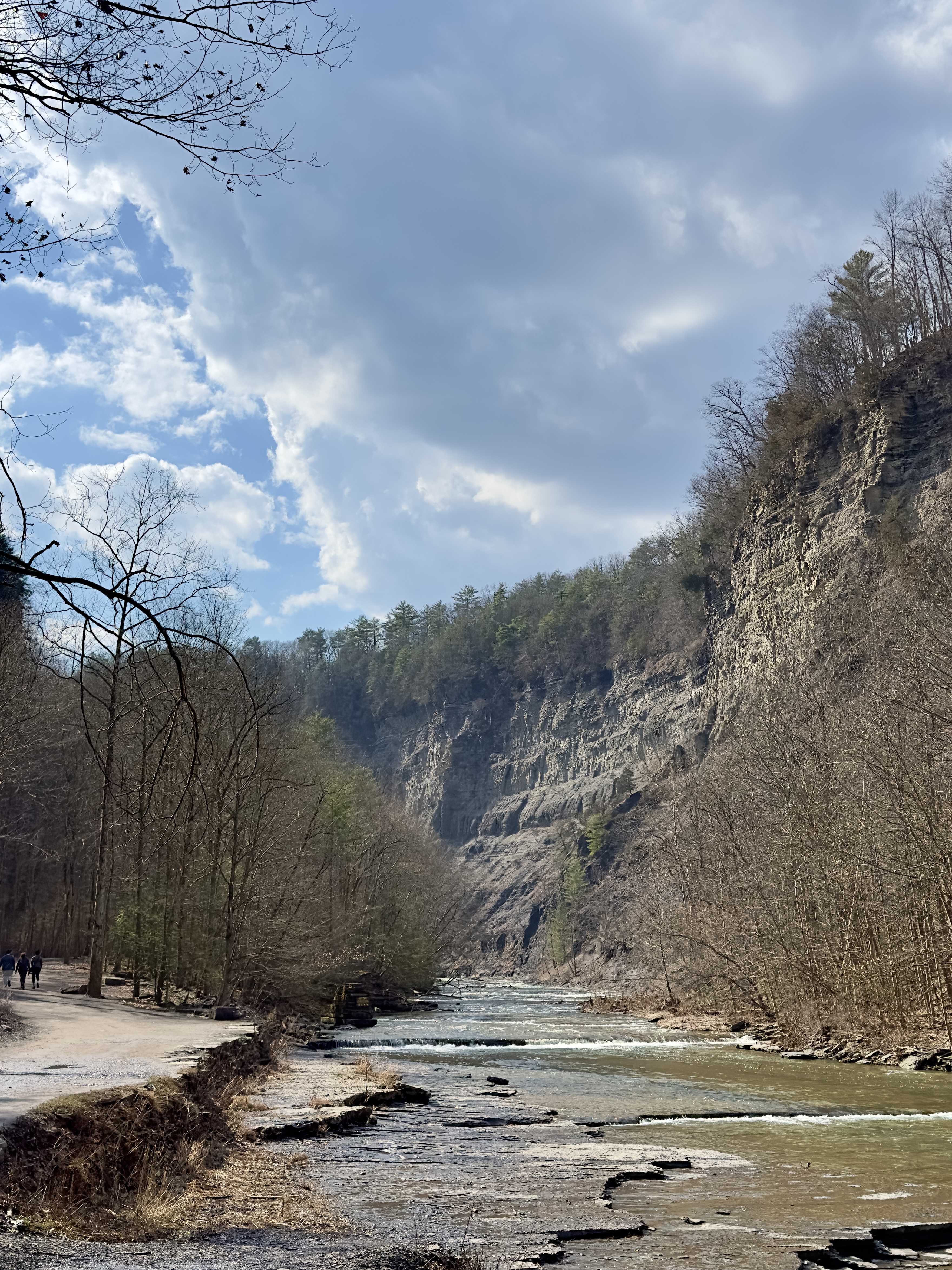
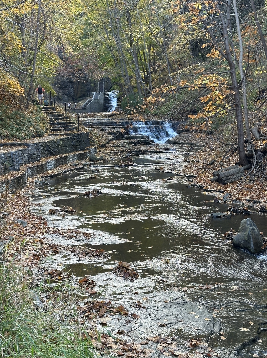
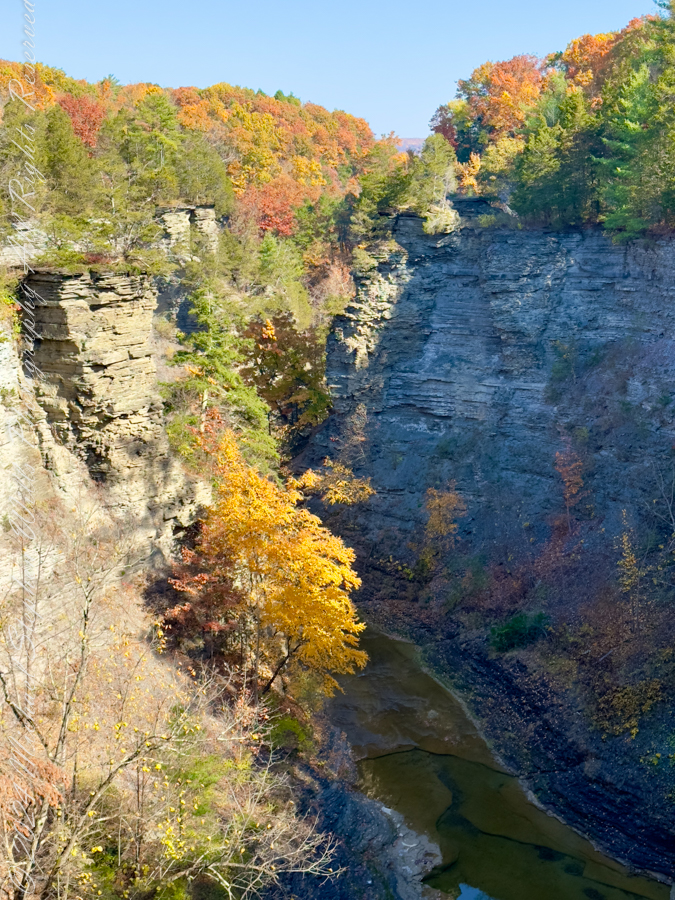
Gorge Road, early NovemberFrom the South Rim Trail. Taughannock Falls, New York State Park, Ulysees, Tompkins County, Finger Lakes Region.Click any photograph for a larger image
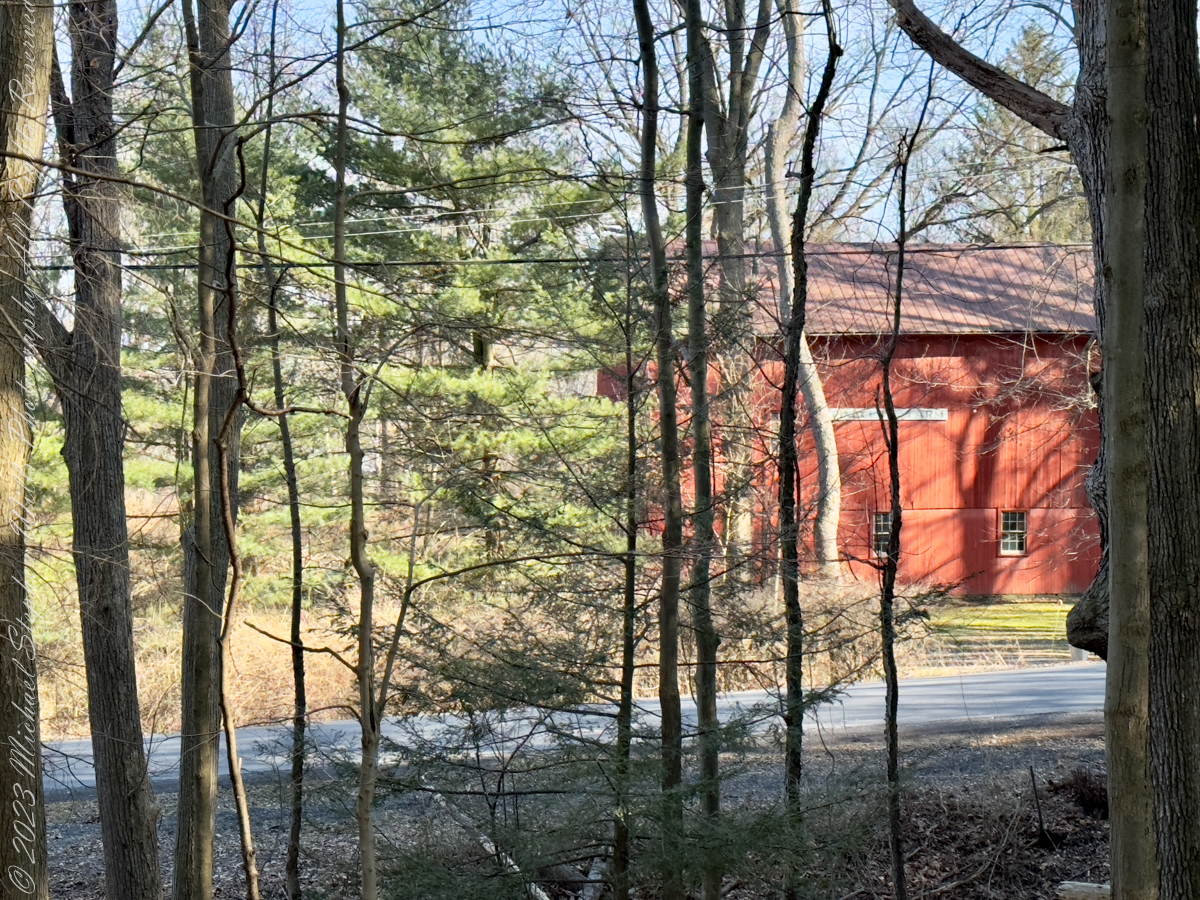
Ice eventually nudged my walk onto Gorge Road, which parallels the South Rim Trail like a quieter narrative strand. Here, the landscape shifts from wild drama to human memory. A curve in the road reveals a farmhouse, modest and fragile beside its outsized barn. In winter, the absence of leaves makes the scene stark and honest. The farmstead buildings do not ask for nostalgia; they simply stand, bearing witness to lives tethered to this steep land. The structures emerge gradually as I walk downhill, as if the land itself were choosing when to reveal them.
Overview of this small cemetery overlooking Cayuga Lake
A short detour leads to a small cemetery perched on a shelf above Cayuga Lake, near the Taughannock Farms Inn. In winter, cemeteries feel less like places of mourning and more like rooms of quiet conversation. Headstones rise from frozen ground, their inscriptions softened by time and distance. From this vantage point, lake and sky merge in pale bands, and the lives commemorated here feel gently folded into the larger story of the landscape. The dead, too, are part of the park’s web of connections.
Another detour brings the lower falls into view—a more intimate expression of the same water that plunges dramatically upstream. Here the sound is closer, the movement more conversational. It is easy to imagine this water traveling, moment by moment, linking ravine to lake, winter to spring, memory to presence.
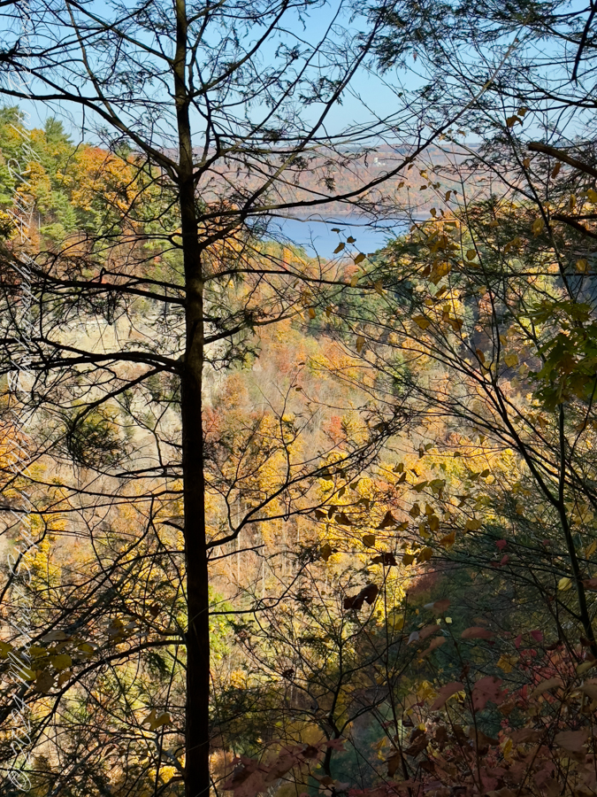
One of many Rim Trail overlooks. That is the Gorge Trail, below.
Rejoining the rim trail for the final climb north, the gorge offers repeated overlooks where the Gorge Trail can be seen threading below. These moments collapse distance: walker and walker, above and below, bound by the same route at different elevations. Over the course of roughly three miles and almost 600 feet of cumulative elevation change, effort becomes its own reward. Two hours pass not as measured time but as a sustained attentiveness, a gift winter offers to those willing to meet it on its terms.
Walking these trails in winter is about entering a conversation with the land—listening to ice, stone, water, and history speak in a quieter register. The joy lies in connection: trail to trail, gorge to road, past to present, and walker to place. In winter, Taughannock invites, gently and honestly, those who are willing to walk slowly enough to see.
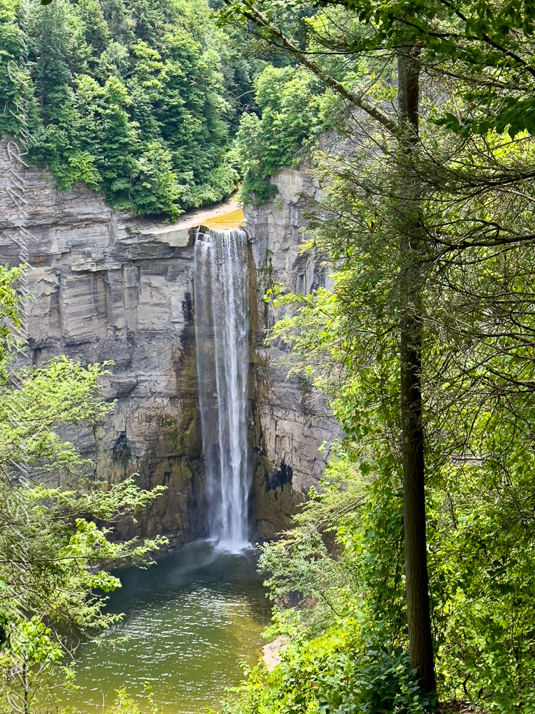
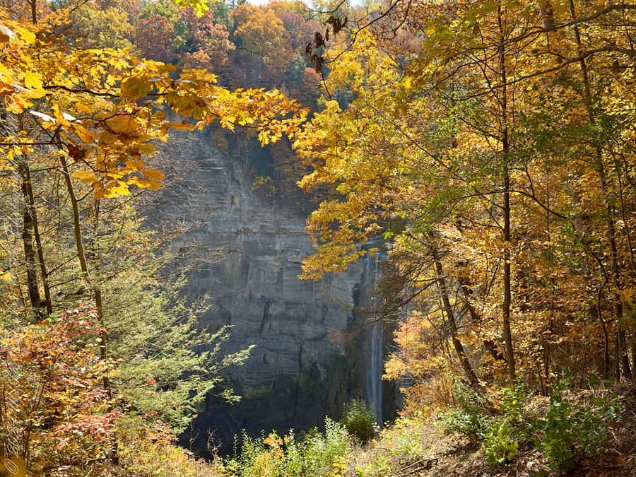
Taughannock Falls, a majestic 215-foot waterfall, showcases nature’s beauty and power, intertwining geological history with vibrant ecosystems in New York.
Introduction Nestled in the heart of the Finger Lakes region of New York, Taughannock Falls stands as a testament to the delicate balance of power and beauty in nature. This iconic waterfall plunges 215 feet—one of the tallest single-drop waterfalls east of the Rocky Mountains—into a gorge whose story is written in stone. The park surrounding this natural wonder offers a symphony of sights, from towering cliffs to lush greenery, inviting visitors to explore its ancient secrets and vibrant life.
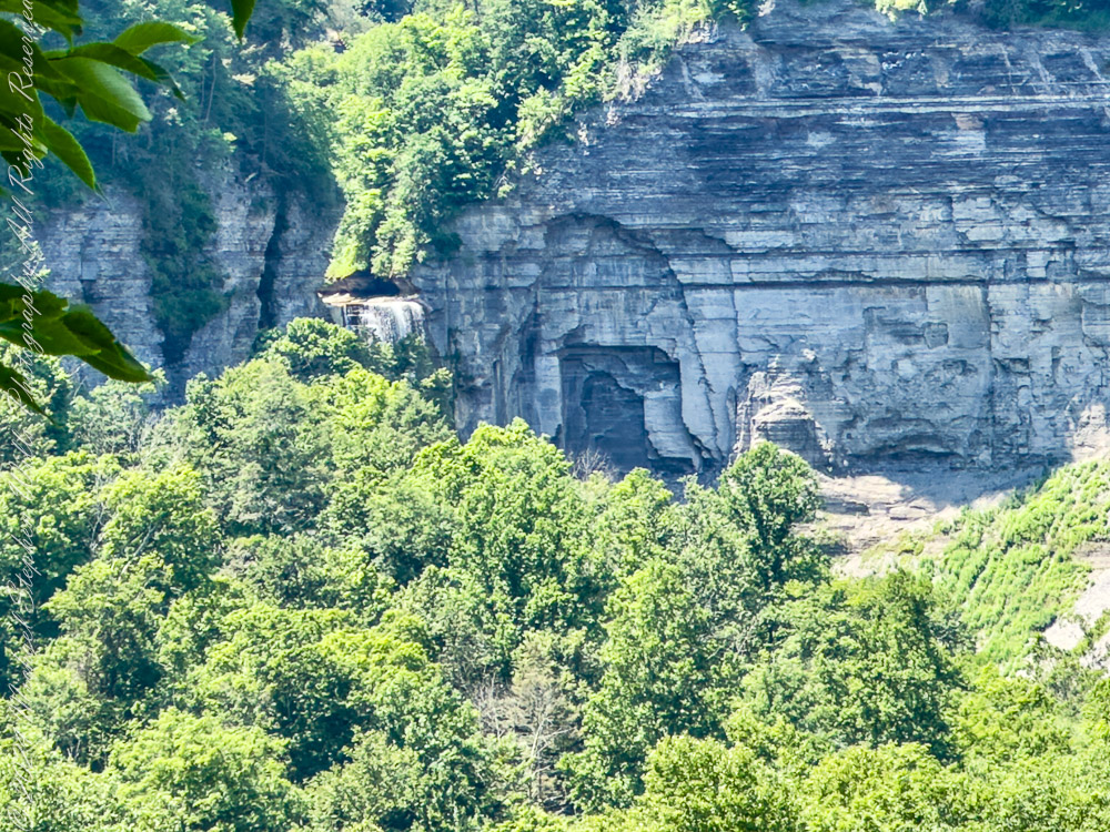
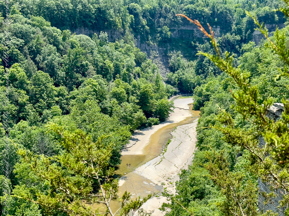
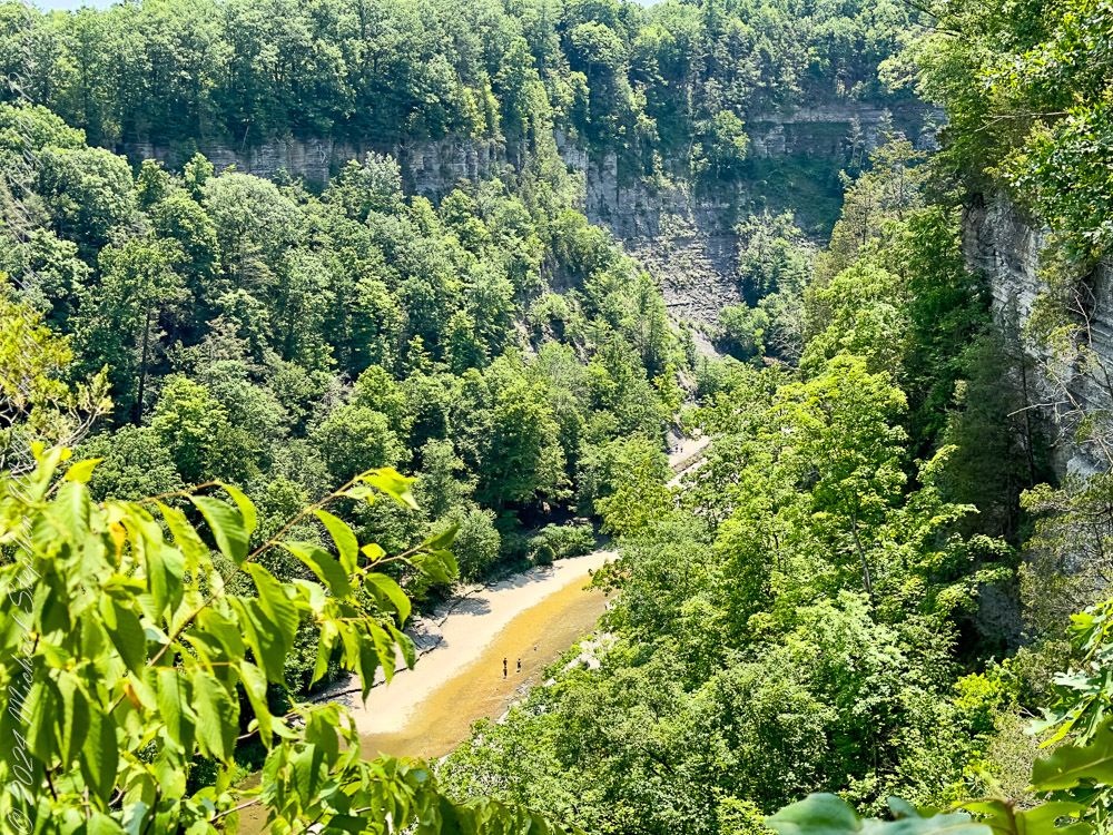
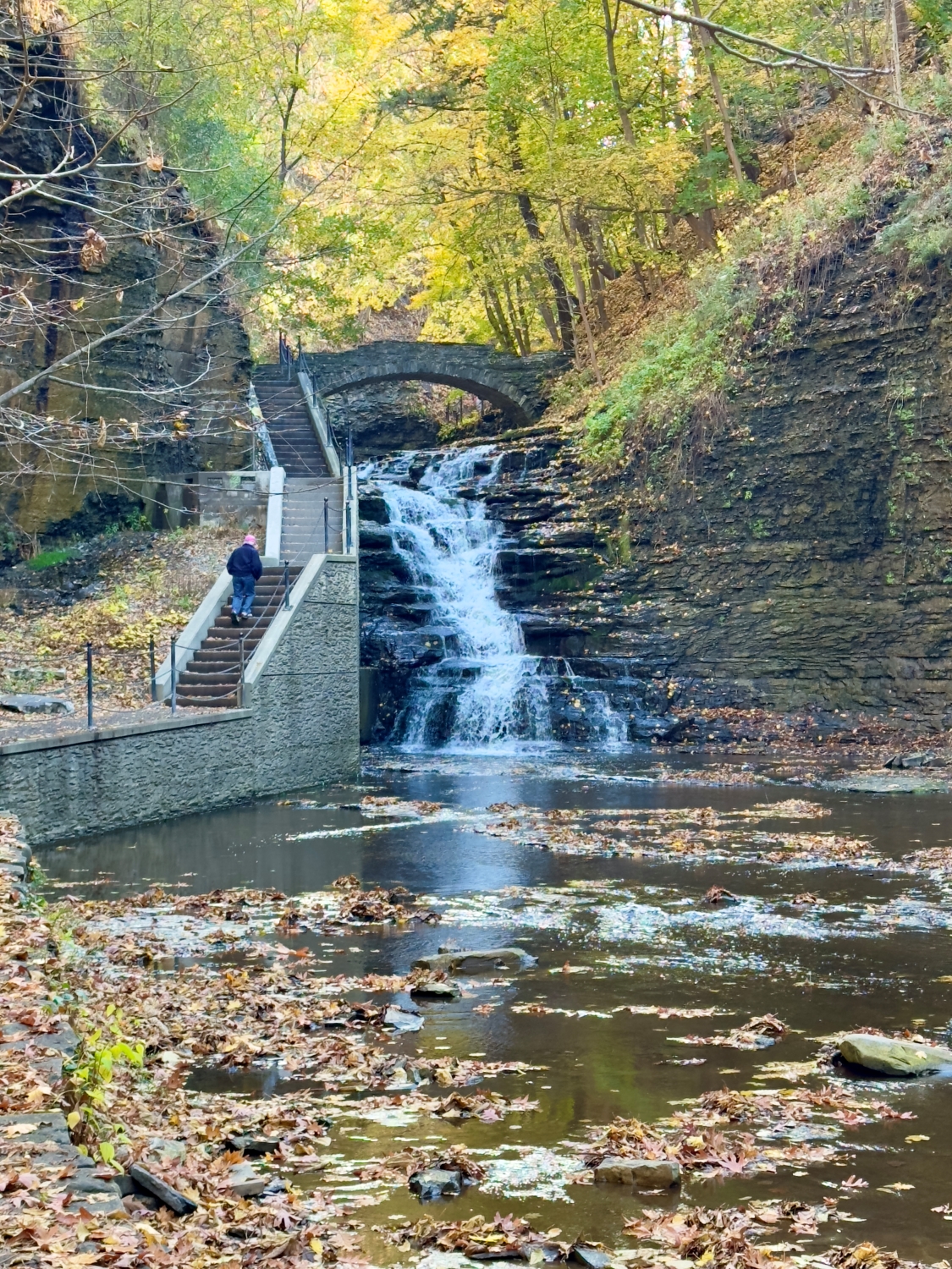
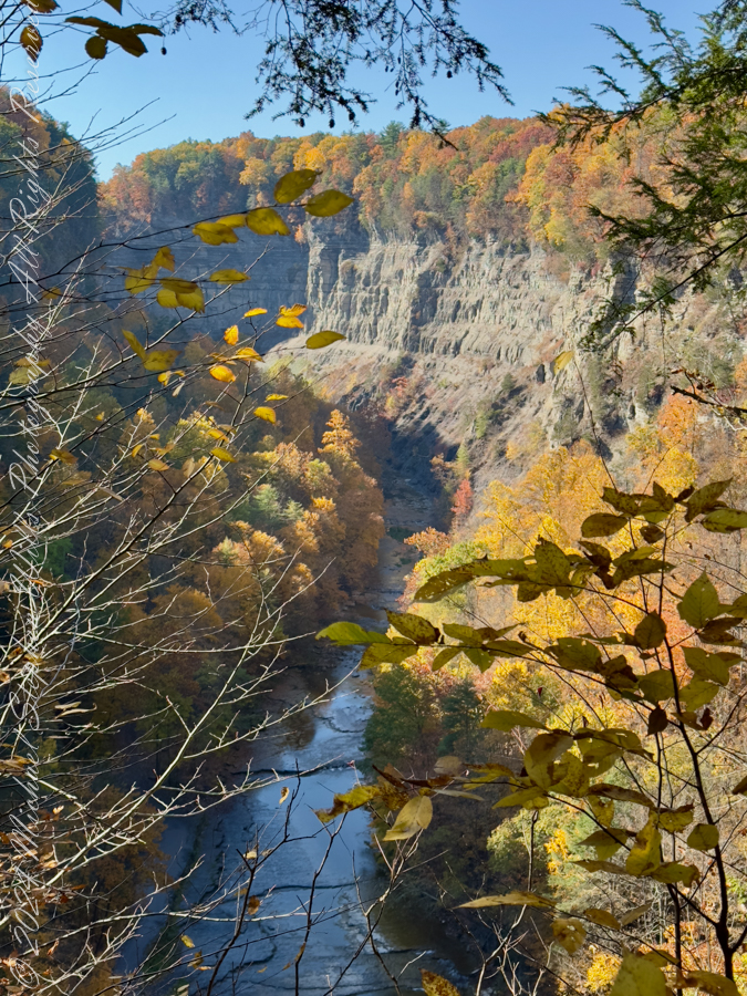
View of taughannock Falls from the South Rim Trail. Taughannock Falls New York State Park, Trumansburg, Tompkins County, Finger Lakes Region
A Story Written in Stone The rocks of Taughannock Falls tell a story that stretches back 380 million years to the Devonian Period, a time when the region was submerged beneath a shallow inland sea. Layer upon layer of shale, sandstone, and limestone formed as sediment settled to the ocean floor, preserving the fossils of marine life that once thrived here. These rocks have endured the passage of eons, but the gorge itself is a far more recent creation.
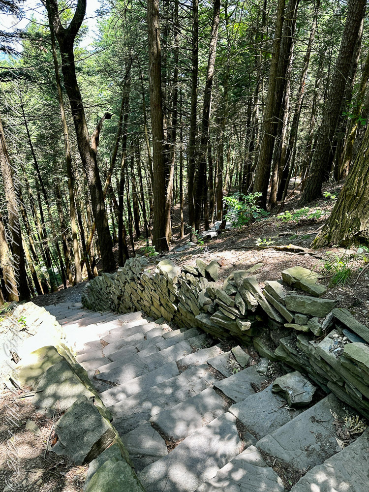
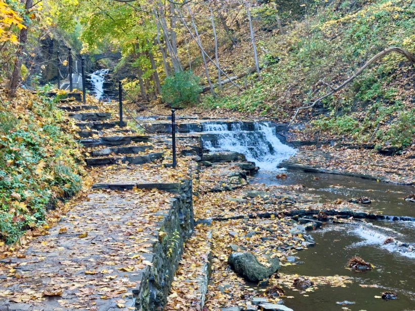
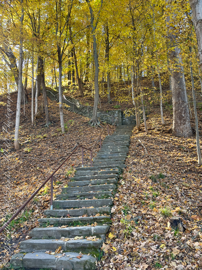
Limestone Steps on the South Rim Trail descend to the gorge floor.
It was the retreat of the mighty Laurentide Ice Sheet, approximately 10,000 years ago, that set the stage for Taughannock’s grandeur. As glaciers melted, torrents of water carved the U-shaped valleys that now cradle the Finger Lakes. Taughannock Creek, a tributary of Cayuga Lake, began its work, etching its path through ancient rock, sculpting the gorge we see today. In just 10,000 years—a fleeting moment in geological time—the relentless force of water carved its way 3/4 of a mile upstream, creating the awe-inspiring chasm and waterfall that continue to evolve even now.
Taughannock Creek carved this landscape over thousands of years.
The Gorge’s Living Tapestry Beyond its geological wonders, Taughannock Falls State Park bursts with life. Along the North and South Rim Trails, Eastern Hemlocks (Tsuga canadensis) stand tall, their evergreen branches weaving shadows that dance across stone stairways and forest floors. These silent sentinels are habitats for myriad creatures and protectors of the delicate ecosystem.
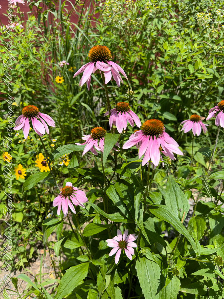
Wildflowers were planted by park staff at the Falls Overlook. The bright yellow of Black-eyed Susans (Rudbeckia hirta) and the vibrant purple of Coneflowers (Echinacea purpurea) attract bees and butterflies, their nectar fueling the intricate web of life that thrives here. Along the trail, on the forest floor, mosses and ferns cling to rocks, softening the edges of the gorge with their verdant touch.
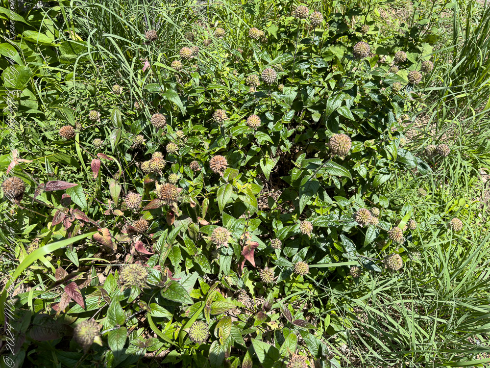
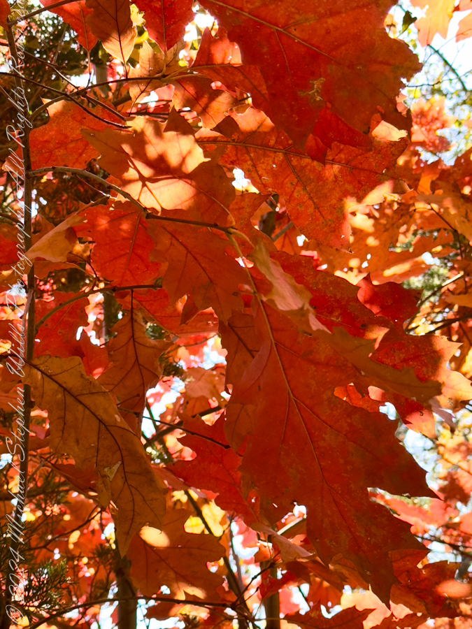
Cone FlowersCone Flowers gone to seedFrom a walk around Taughannock Falls State Park “Rim Trails” October 22nd, 2024. Trumansburg, Tompkins County, Finger Lakes Region, New York State.
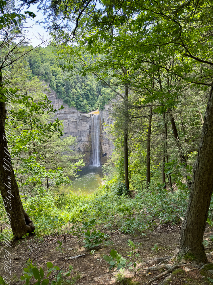
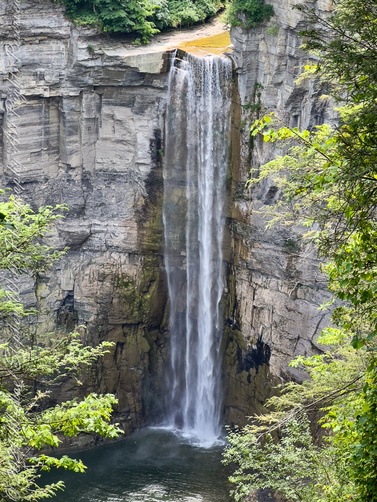
The Fall’s Eternal Dance At the heart of the park is the waterfall itself, its roar both a hymn and a whisper of time’s passage. The view from the North Rim Trail reveals the waterfall framed by steep cliffs, their striations like pages in a book written by water, wind, and time. The plunge pool below, shimmering in sunlight, seems almost sacred—a place where the forces of nature meet in harmony.
Viewed from the North Rim Trail on a summer morning. Taughannock Falls New York State Park, Trumansburg, Tompkins County, Finger Lakes Region
Even as we marvel at its beauty, the falls are a reminder of the earth’s constant transformation. Each drop of water that cascades down the cliff face carries away tiny fragments of rock, continuing the slow, deliberate work of reshaping the land. What we witness today is but one moment in an ongoing process—a fleeting glimpse of a masterpiece in progress.
A Place of Wonder To stand at the edge of Taughannock Falls is to feel both small and connected. The cliffs, formed over hundreds of millions of years, whisper of ancient seas and forgotten worlds. The gorge, carved in the blink of an eye by geological standards, speaks to the power of water and time. And the vibrant life that fills the park reminds us of nature’s resilience and beauty.
As the sun filters through the trees, illuminating the mist that rises from the falls, it’s easy to believe that this place holds magic. Perhaps it’s in the way the water sparkles like diamonds in the sunlight or the way the breeze carries the scent of pine and earth. Or maybe it’s in the knowledge that here, in this park, we are witnesses to a story billions of years in the making.
Conclusion Taughannock Falls State Park is a place of wonder where geology, ecology, and history converge. It invites us to reflect on the immense forces that shape our world and to cherish the fleeting beauty of each moment. Whether you come to marvel at the towering waterfall, walk among the hemlocks, or simply stand in awe of the gorge, Taughannock Falls leaves an indelible mark on the heart—a reminder of nature’s power, resilience, and enduring grace.
Enter your email to receive notification of future postings. I will not sell or share your email address.
Copyright 2024 All Rights Reserved Michael Stephen Wills
Beneath the burdened boughs, where birches bend, And rivers rush through rocks that time has torn, The shadowed cliffs, their crowns with pine trees pinned, Stand sentinel, proud guardians of the morn.
Through chasms carved by countless, ceaseless years, The water whispers tales of days gone by; Its misty breath, a shroud for winter’s tears, A silver veil beneath the leaden sky.
Each trickling stream sings sonnets to the stone, And echoes dance through chambers cold and vast; Where silence dwells, a realm of moss and bone, As sunlight lingers, fleeting, yet steadfast.
The waterfall, a weeping wall of light, Cascades its crystal chords with thund’rous grace; An argent arc, a marvel for the sight, That draws all souls into its soft embrace.
The river curls, through curving cliffs confined, Its molten silver sculpts the winter’s skin; While gnarled roots from ancient oaks entwined Grip granite walls where life dares to begin.
Upon the path, where earth and echoes meet, The fragile frost dissolves with fleeting flame; Beneath bare limbs, our footsteps firm and sweet, Trace tales that timeless, towering stones proclaim.
The afternoon, aglow with golden hue, Finds stillness stitched in shadows soft and deep; For here, in late-day’s light and lucid view, The earth exhales her secrets slow to sleep.
Enter your email to receive notification of future postings. I will not sell or share your email address.
Copyright 2024 All Rights Reserved Michael Stephen Wills
As I step into Cascadilla Gorge from the Linn Street entrance, I’m greeted by the soft rustling of leaves and the constant, soothing rush of water. The air this Halloween Day is warm, the autumn colors vibrant against the cool blue sky. I know Cascadilla Gorge is part of the Cornell Botanical Gardens, but the immediate beauty of this natural sanctuary makes it easy to forget I’m still within the city limits of Ithaca. The sounds of the gorge draw me in, as if whispering there’s more to see, more to explore. With a deep breath, I begin my journey up the trail, eager to discover what lies ahead.
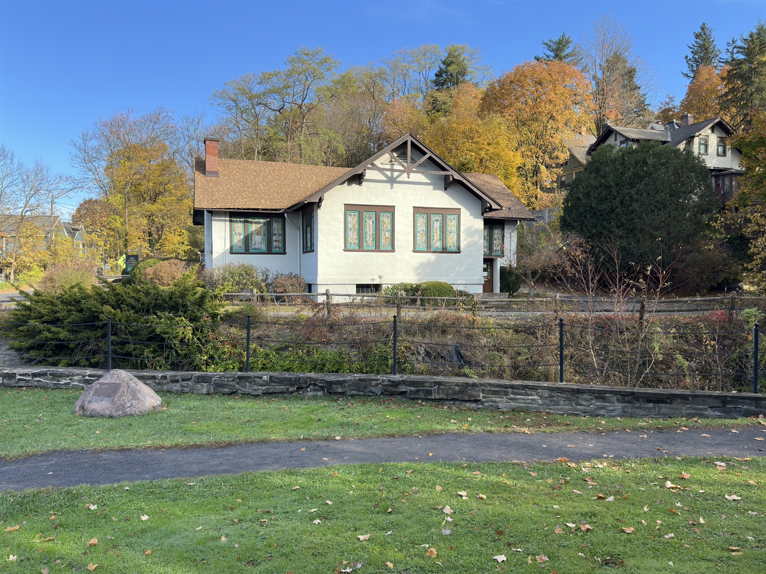
Just a short way in, I notice the First Church of Christ, Scientist perched on the corner of University Avenue and Cascadilla Park Road. The architecture of the church is both quaint and elegant, with its light-colored facade framed by dark trim and roof. Surrounded by foliage, it feels like the church belongs here, as much a part of the landscape as the trees and rocks. The sight of this historic building nestled so close to the gorge reminds me that this wild and ancient place is woven into the fabric of Ithaca’s community life.
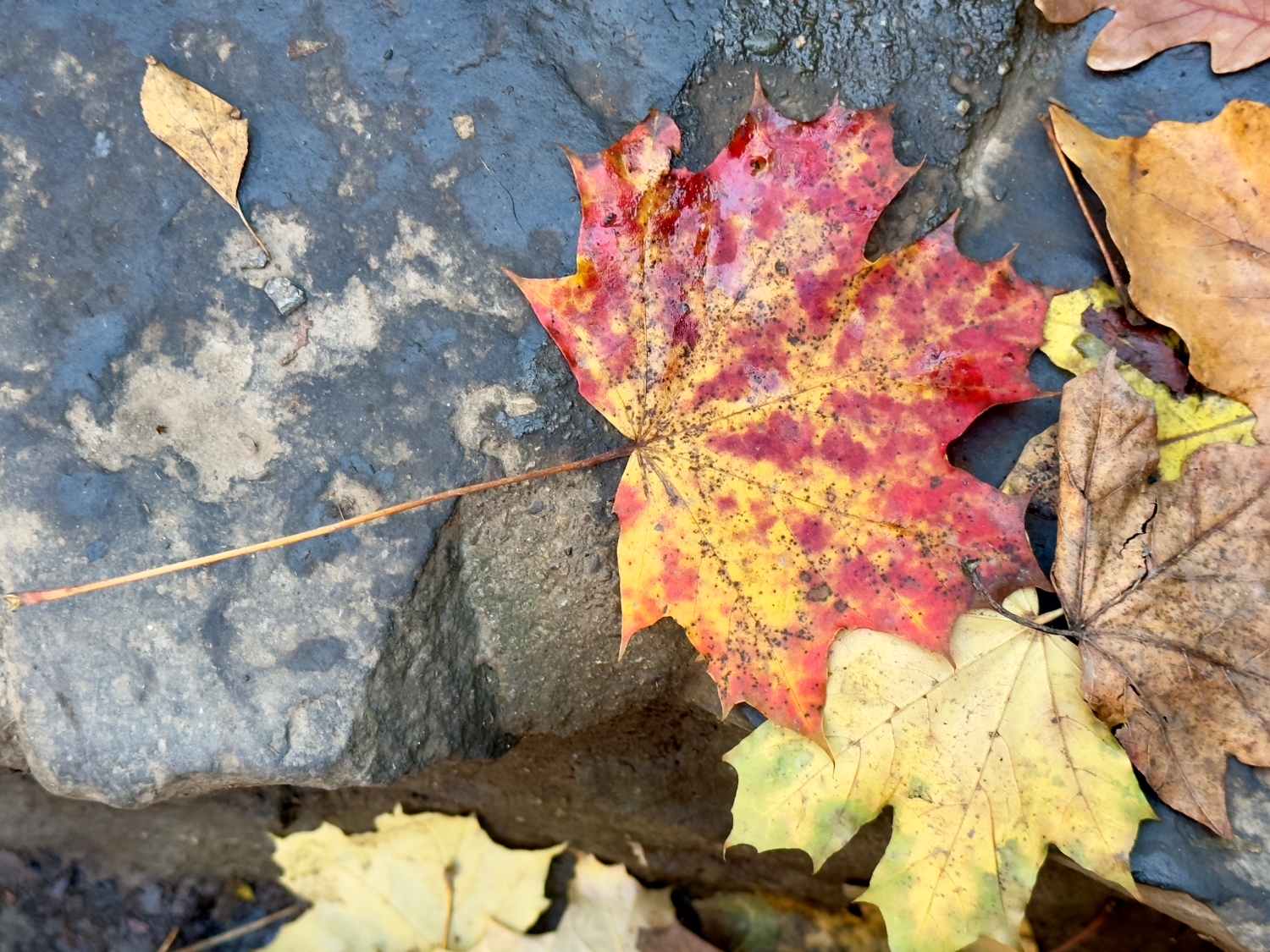
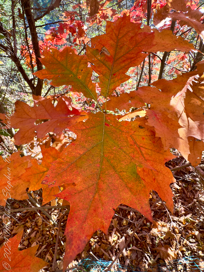
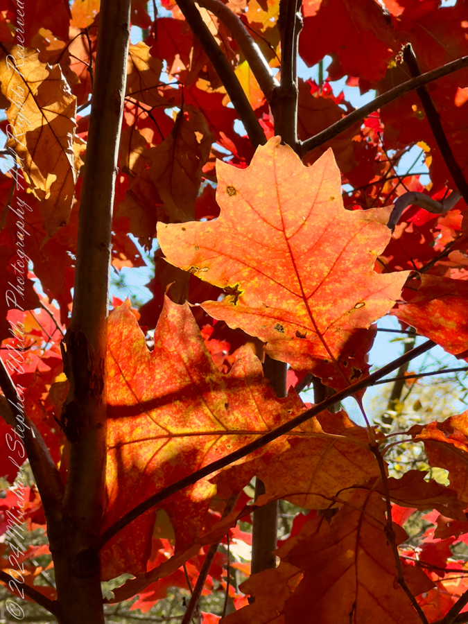
I move further along the trail, and the terrain begins to shift. Fallen leaves create a golden carpet along the path, their crisp shapes overlapping like nature’s confetti celebrating the season. Each step crunches underfoot, adding my own rhythm to the symphony of sounds. The trees overhead are a kaleidoscope of colors—deep golds, fiery oranges, and the occasional flash of red from Virginia Creeper vines (Parthenocissus quinquefolia). Together, the trees create a canopy that filters sunlight, casting dappled patterns on the gorge walls. It’s an ever-changing play of light and shadow, one moment bright and the next subdued, adding a layer of magic to the experience.
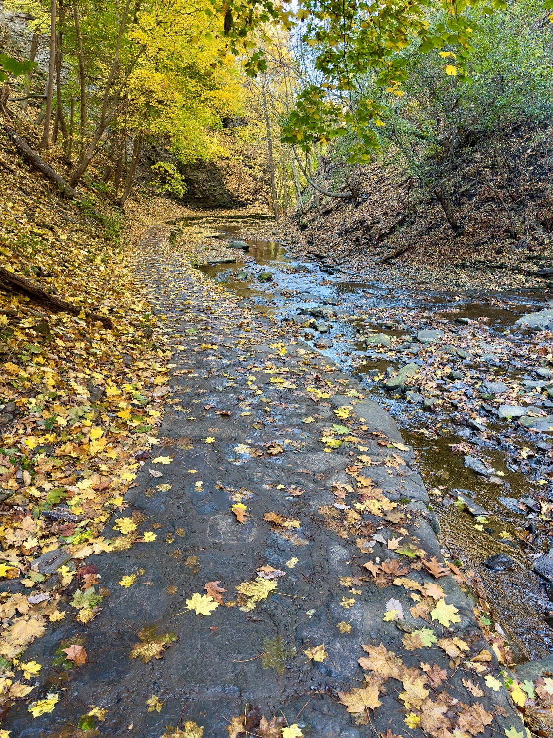
As I follow the trail upward, the gorge narrows, and I find myself surrounded by towering walls of rock. Here, layers of siltstone and shale formed more than 300 hundred million years ago are exposed, a testament to the forces of water and time that carved this place across mere millennia of recent geologic time. The rock formations are fascinating, with the water flowing over them in gentle cascades, finding every groove and crevice. There’s something humbling about standing in a place shaped by forces so much larger and older than myself. I pause, letting the rush of water and the stillness of stone fill my senses.
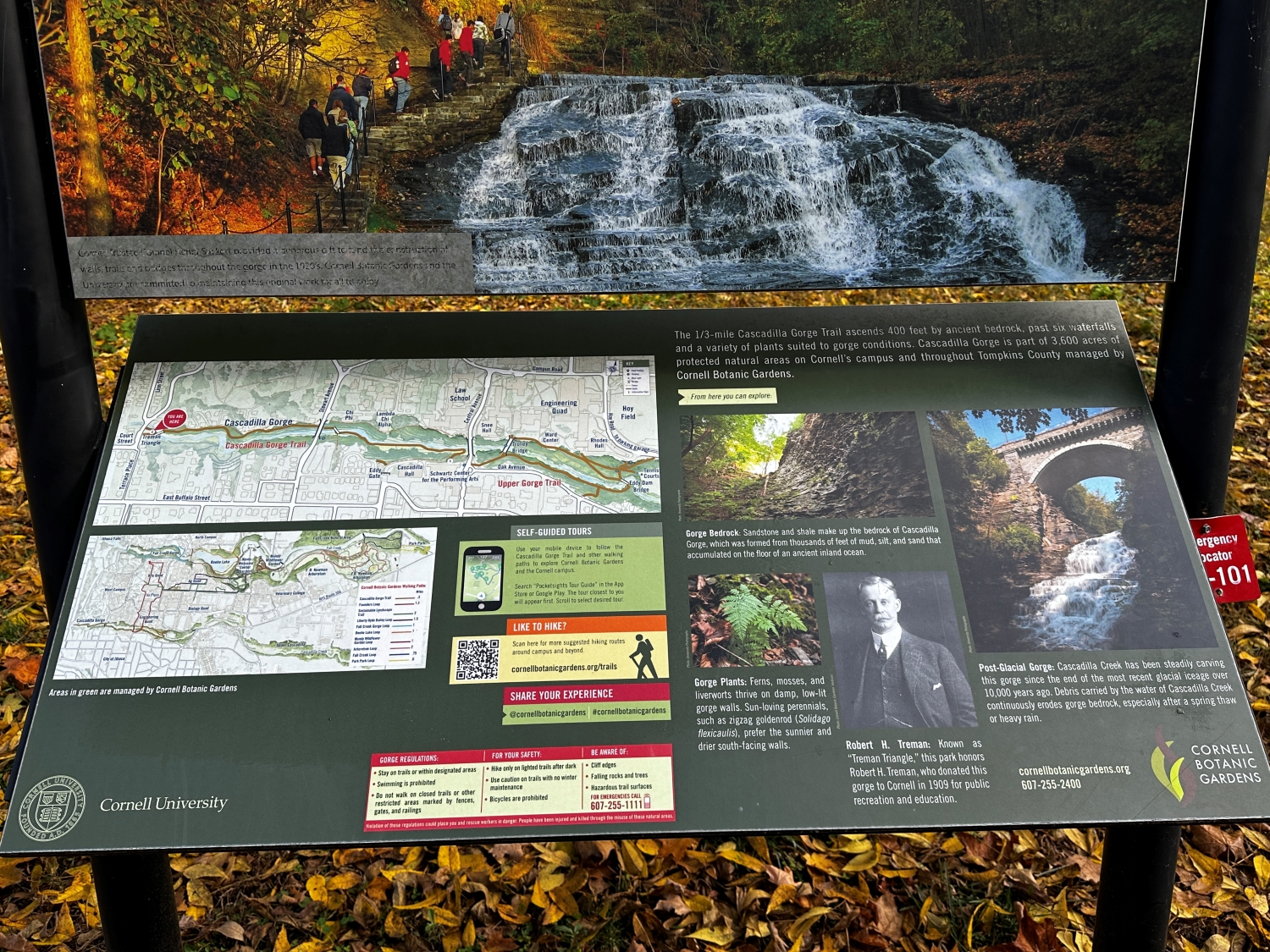
Along the way, I come across an interpretive sign provided by the Cornell Botanical Gardens. They tell the story of Cascadilla Gorge, how it was formed from the bedrock of sandstone and shale that eroded from mountains to the east, in the Devonian era when an ancient inland sea covered the region. The signs also introduce Robert H. Treman, a philanthropist who saw the beauty and educational value of the gorge. Thanks to him and the efforts of many, this natural wonder is preserved for all to experience. Knowing this adds depth to my walk; it’s a reminder that places like this exist not only by chance but because people cared enough to protect them.
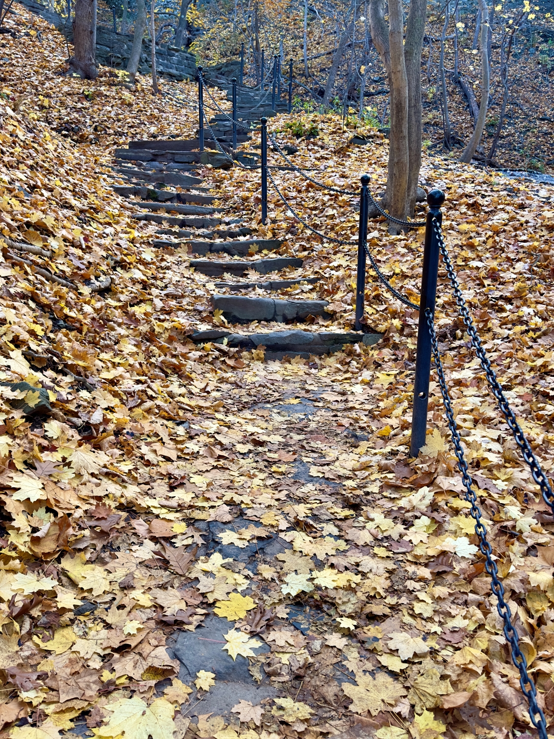
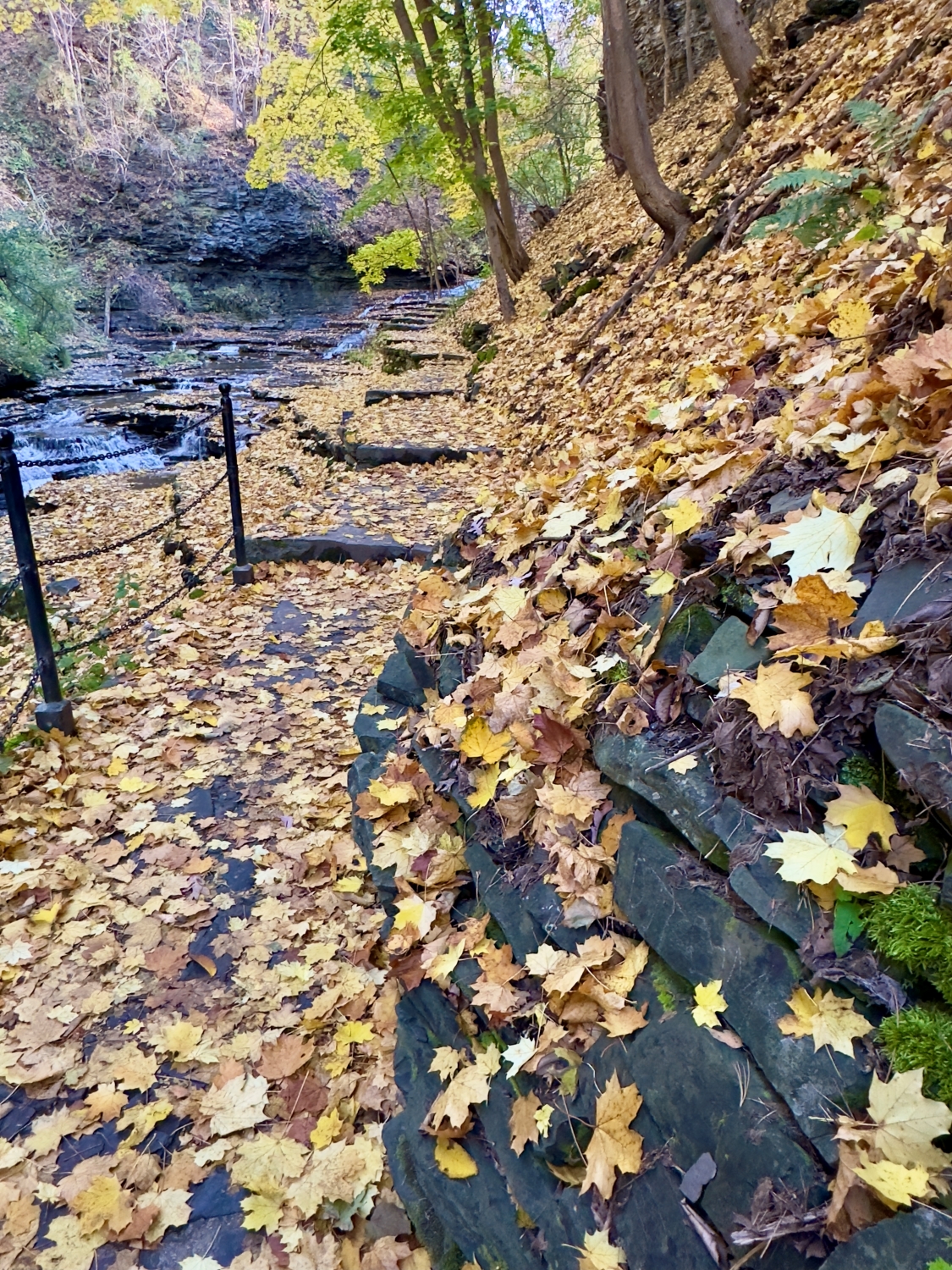
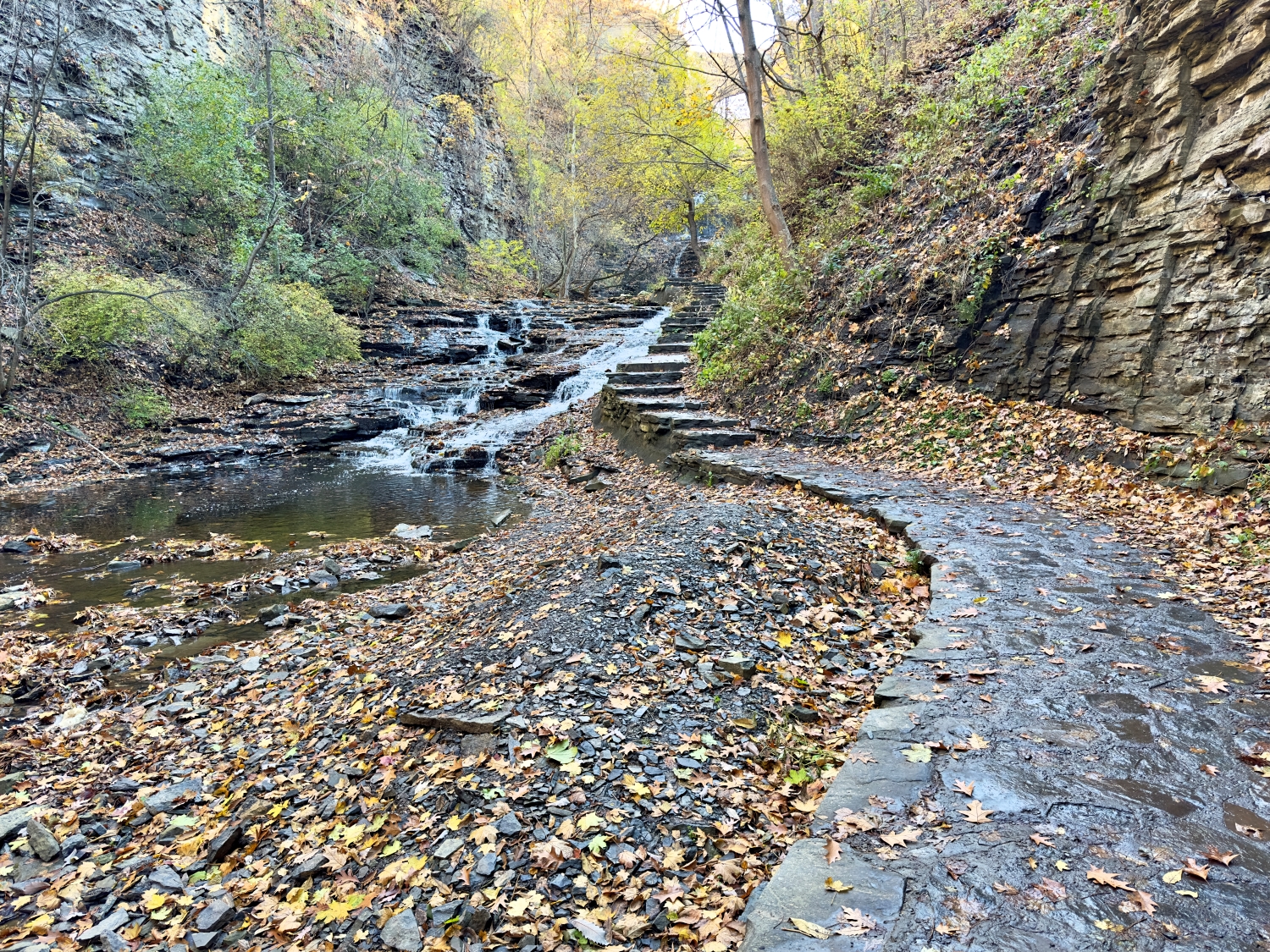
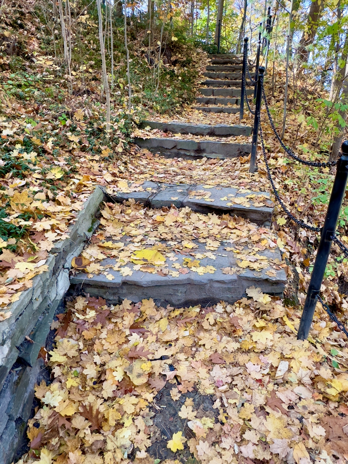
The sandstone staircases along the trail are a marvel in themselves. Some sections are steep, winding up the gorge in a series of steps that seem to have been placed with precision, blending seamlessly into the natural landscape. The steps are covered with leaves now, making each ascent feel a bit like climbing through a fairy-tale forest. The chains along the path provide a comforting grip, especially as I climb higher. I look back and see how far I’ve come, the creek below winding its way over rocks and around bends, each step a small journey of its own.
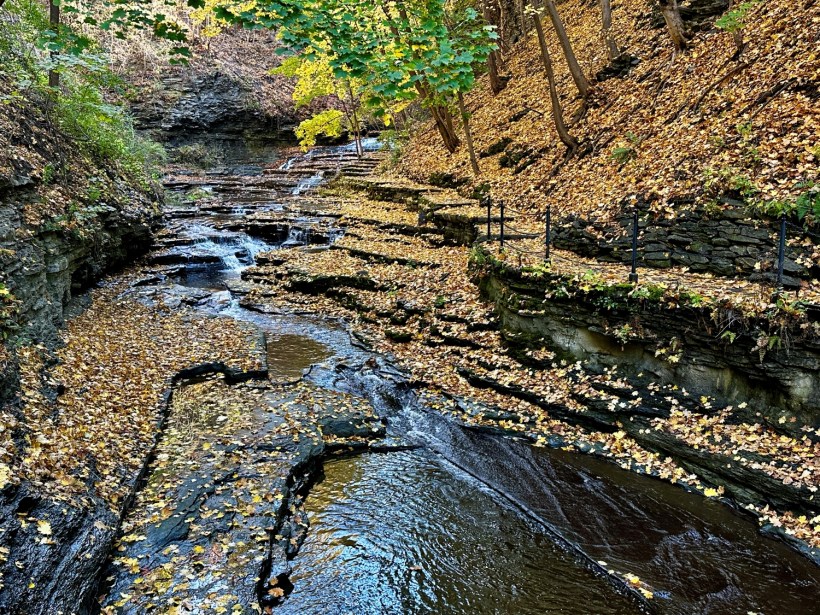
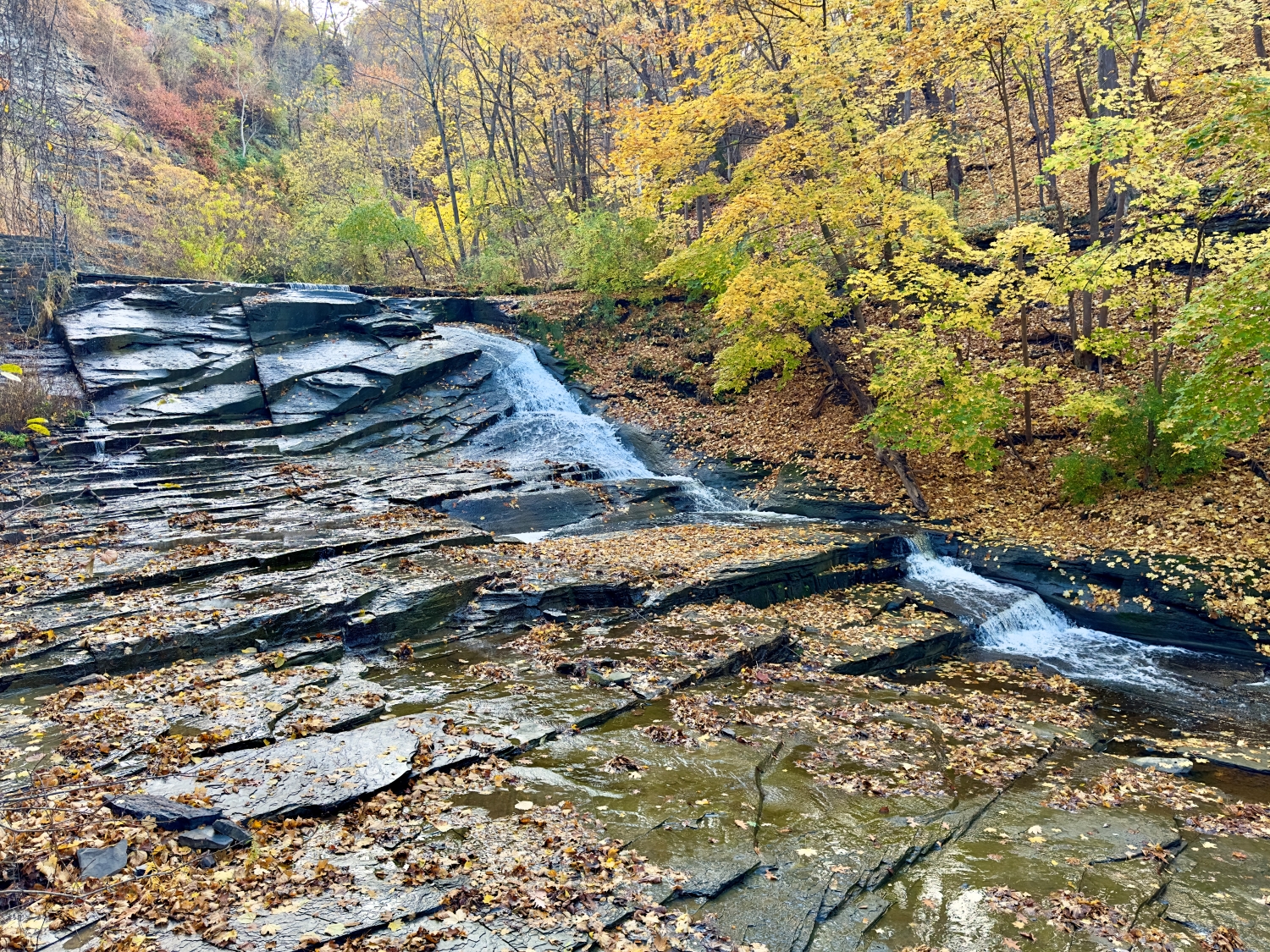
I pass several small waterfalls, each one unique in its character. Some are gentle trickles, while others pour over the rocks with more force, their sound reverberating off the gorge walls. I stop frequently, entranced by the way the water carves its path, eternally moving, adapting, wearing down even the hardest stone. Leaves float down from above, landing in the creek and swirling in miniature whirlpools before being carried downstream. It’s mesmerizing to watch nature at work in such a quiet, persistent way.
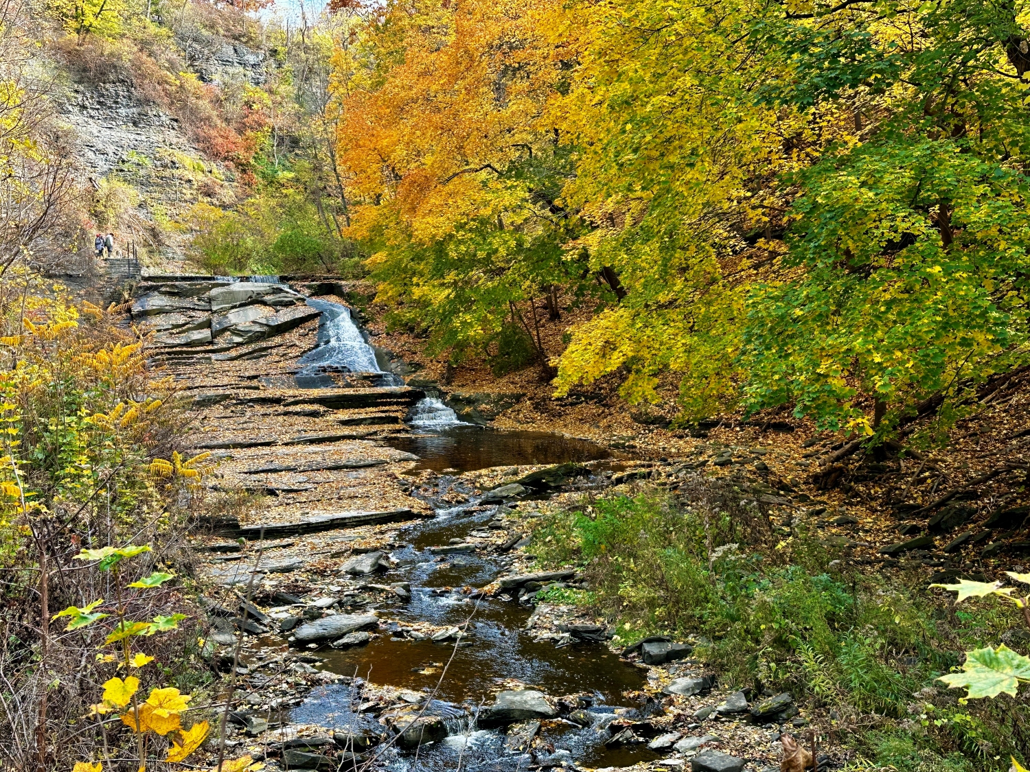
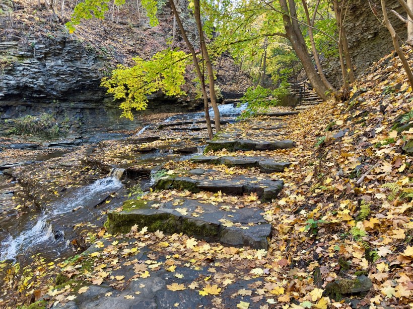
Further up the gorge, the views open up, and I can see the layers of rock descending in terraces, each level a little cascade of its own. I watch as the water flows across these steps, catching the light as it moves—a silvery ribbon winding through the golden autumn landscape. The tranquility of the scene is meditative. Around me, the trees stand as silent witnesses, their branches bare in places but still adorned with clusters of leaves clinging through the last days of fall.
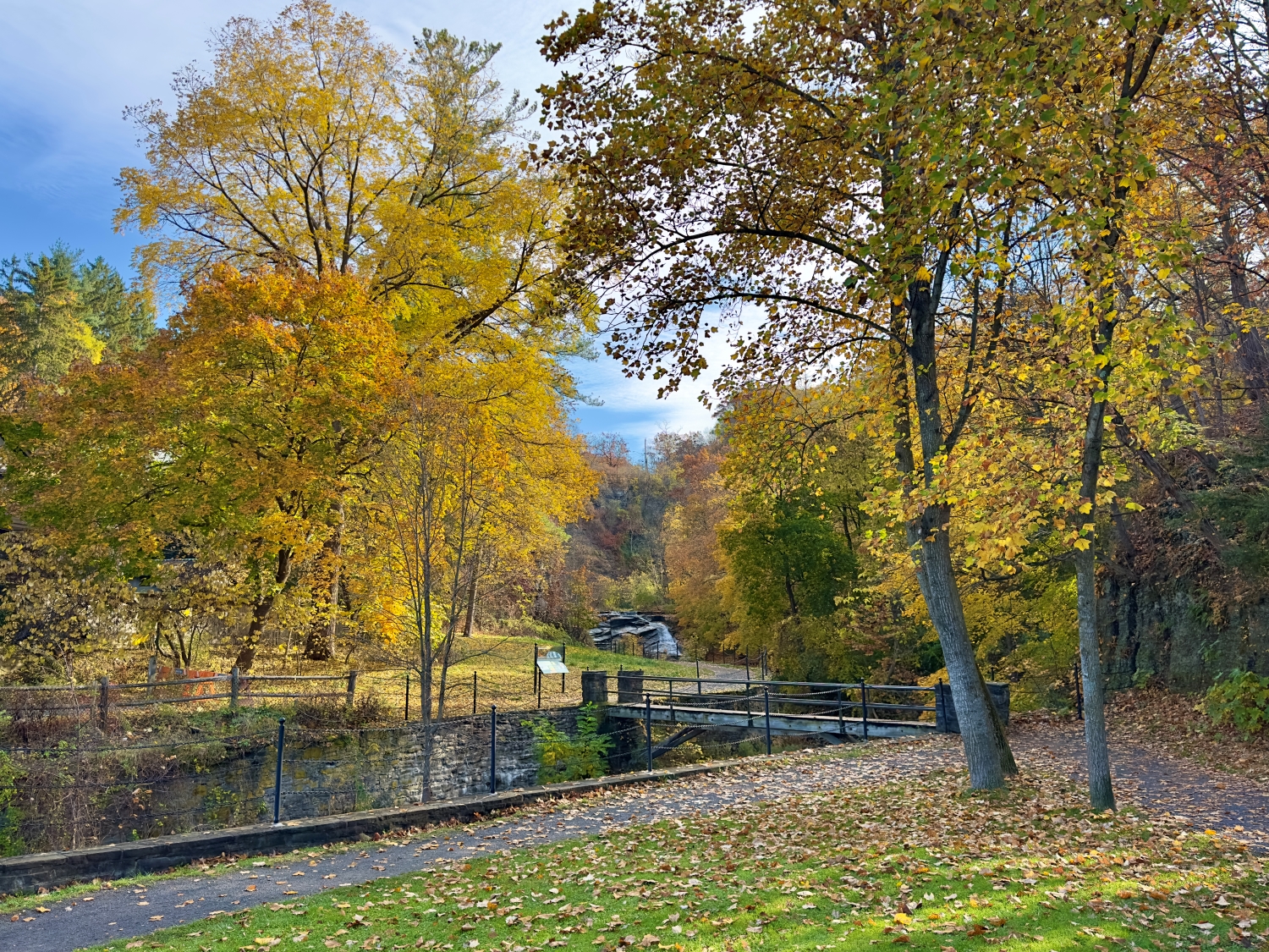
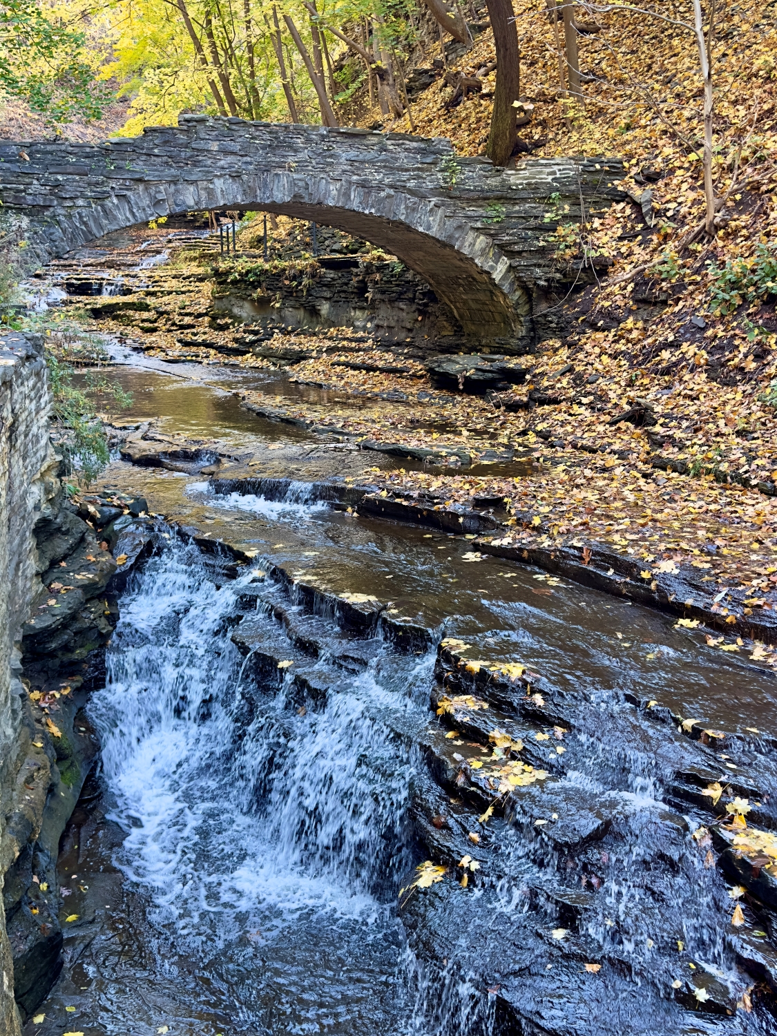
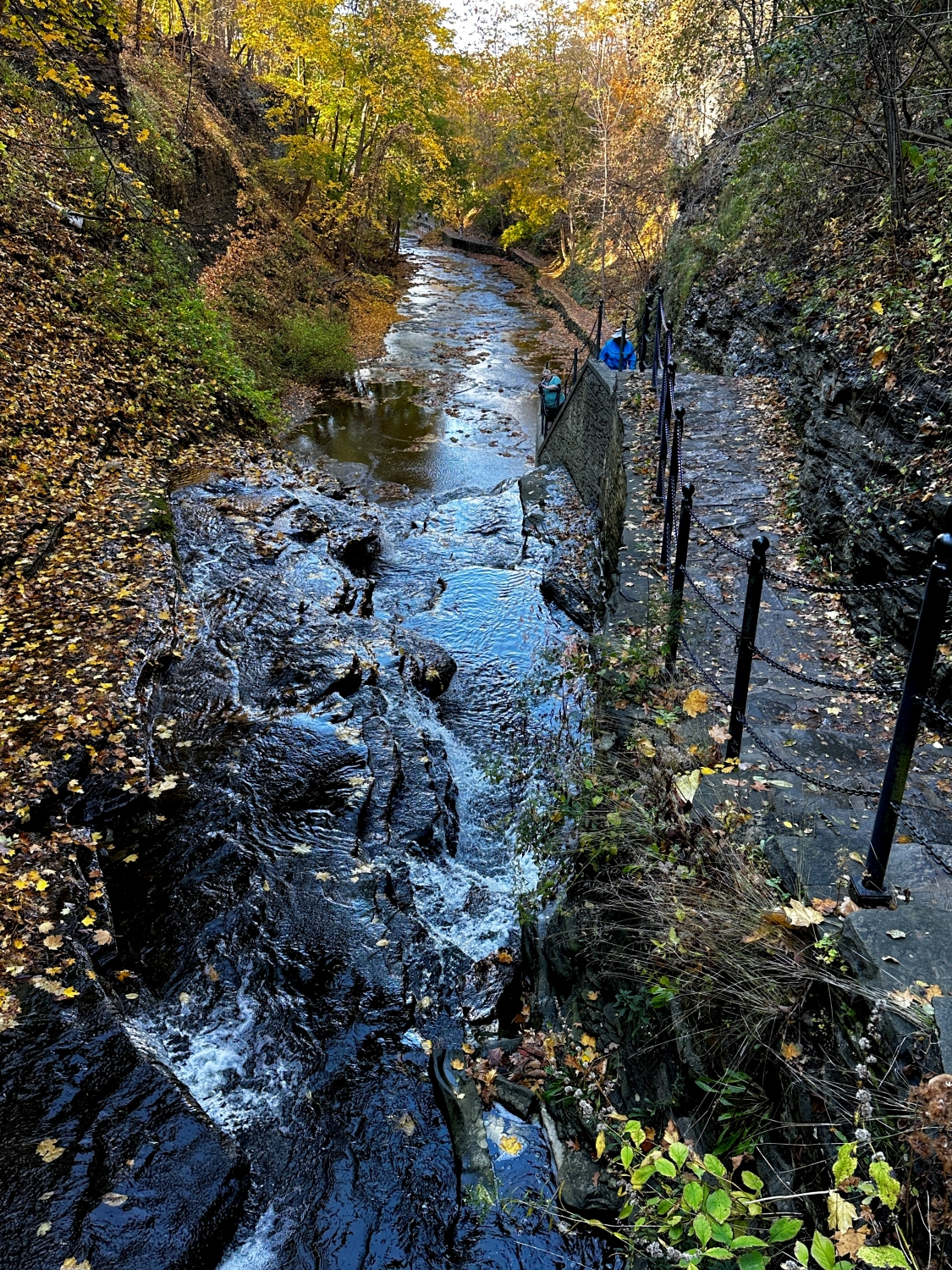
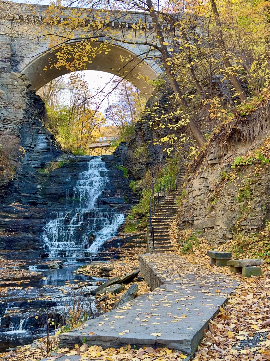
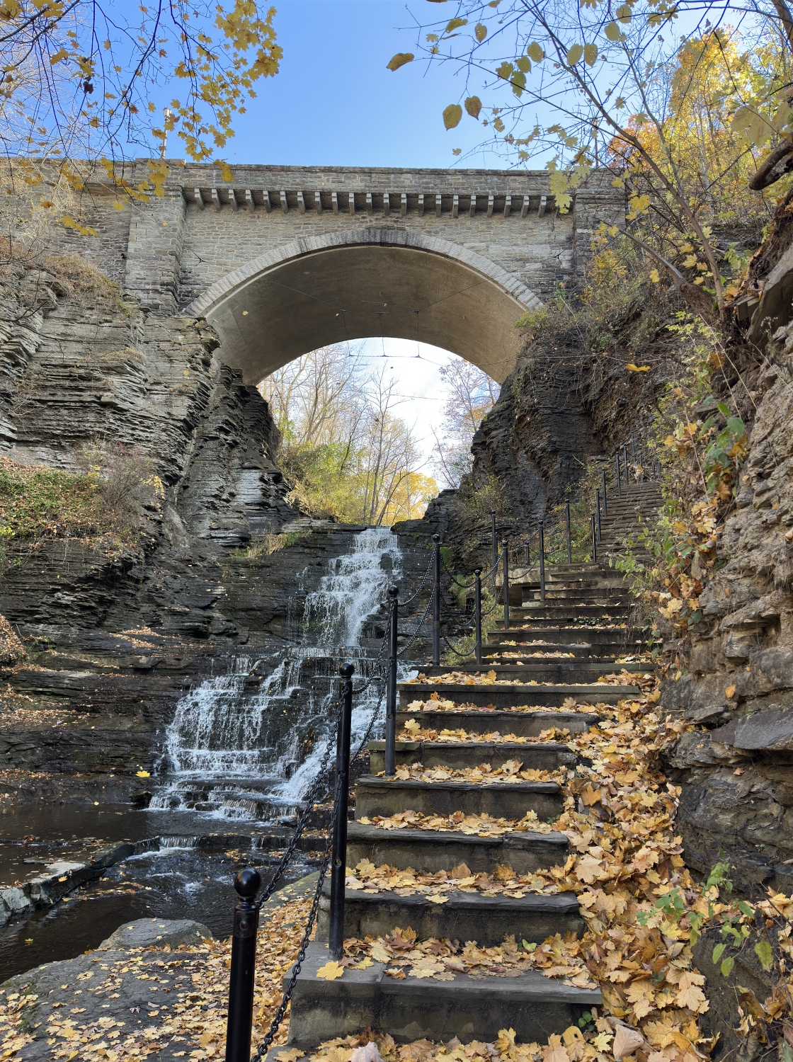
Finally, I reach one of the larger waterfalls, framed by a graceful stone arch bridge that crosses high above. The scene is something out of a painting. Water pours over the rocks, gathering in pools below before spilling onward. I pause on the bridge, looking down at the gorge below and the trail I’ve followed, grateful for the journey.
Along the way, artists are positioned along the path, each lost in the beauty of Cascadilla Gorge. They stand or sit in quiet reverie, brushes or pencils in hand, capturing the gorge’s unique character. Some focus on the play of light over the water’s surface, while others seem intent on the rugged details of the rock formations. Their presence adds a contemplative depth to the scene; it’s as if each artist has uncovered a hidden aspect of the gorge that I have overlooked in my journey upward.
I slow my pace to take it all in, appreciating how the artists interpret this natural wonder through their own eyes. Their canvases reveal layers of colors that shift as the sun filters through the leaves, casting vibrant golds and subtle greens on the cascading water. The scene feels almost collaborative—nature and human hand creating art together, each reflection of the gorge as unique as the individual capturing it. I’m tempted to pause beside them, to see how they choose to frame the towering walls, the stone bridge arching above the water, and the gentle curves of the creek as it meanders downstream. I can imagine each artist’s work holding a different piece of this place, like fragments of a memory.
Bridge View looking up Cascadilla CreekBridge View looking back the way I came
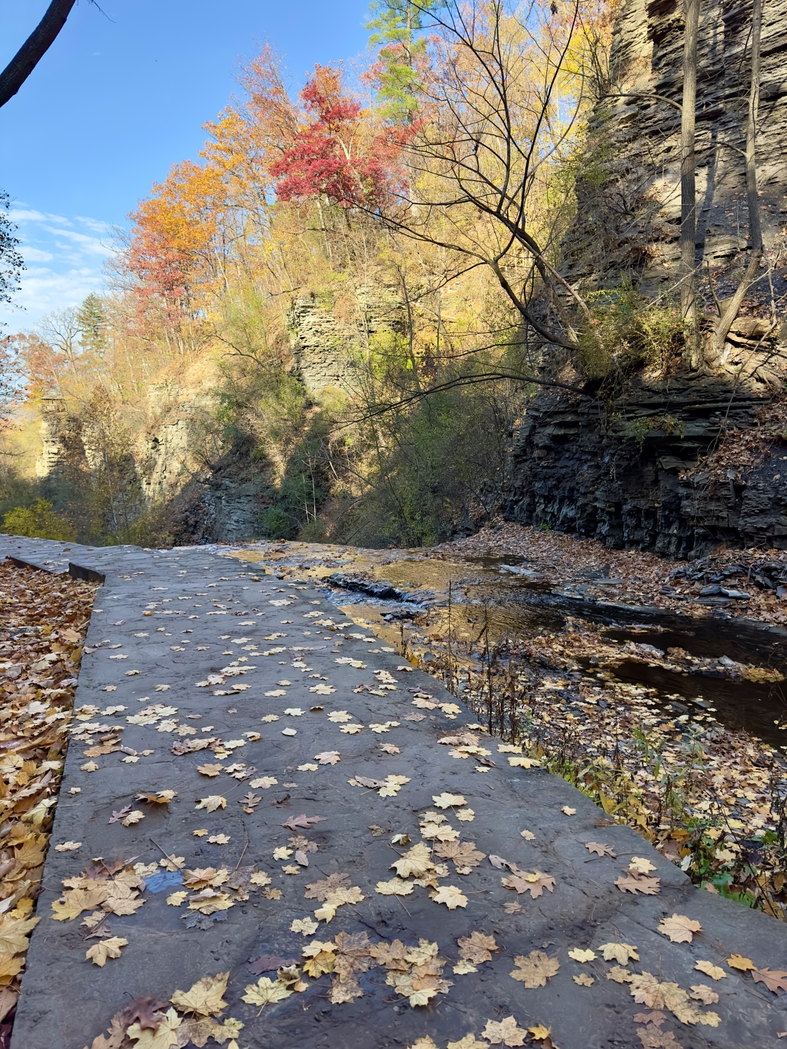
As I continue, the sound of rushing water grows louder, drawing me towards another cascade that tumbles in steps down the gorge. The rocks are layered in angular formations, giving the water a zigzagging path to follow. Leaves are scattered across the stones, their colors—yellows, browns, and the occasional splash of red—standing out against the dark, wet rock. There’s a timelessness here, a feeling that this scene has remained unchanged for centuries, save for the shifting leaves and the ever-present flow of the creek. The thought makes me feel like a small part of something much larger, a guest in an ancient place shaped by nature’s slow, steady hand.
The path narrows again, following the edge of the creek where the water has worn smooth channels into the stone.
Moving forward, the trail climbs steeply, and I find myself surrounded by tall rock faces on either side. The walls are layered and weathered, a geological history book open to the forces that shaped this land. It’s humbling to see how this place puts everything into perspective, how it reminds us of our place in the natural world.
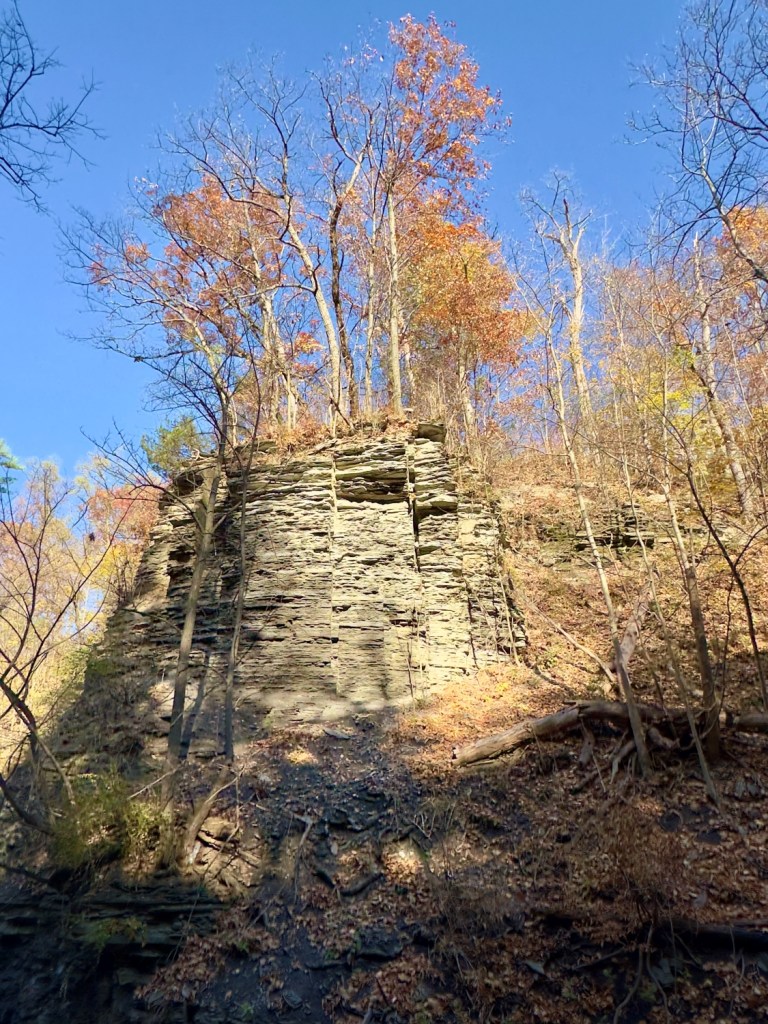
Columns of sedimentary rock
Ahead, the path becomes more rugged, the air feels cooler here, shaded by the gorge’s high walls, and the sounds of the city are long gone, replaced by the steady rhythm of water and the drift of leaves. The layers of ancient limestone that form these towering walls give shape to our landscape and ecosystem. As rainwater falls and seeps through the porous rock, the limestone raises the pH of the water, neutralizing its natural acidity. This subtle alchemy nurtures the flora and fauna, fostering a unique biome that thrives in the gorge. The artists fade from view as I move further into the solitude of the trail, but their presence lingers in my mind. Each turn of the path reveals another scene worthy of capturing, another moment that seems to call out for remembrance.
Looking back toward the way I came
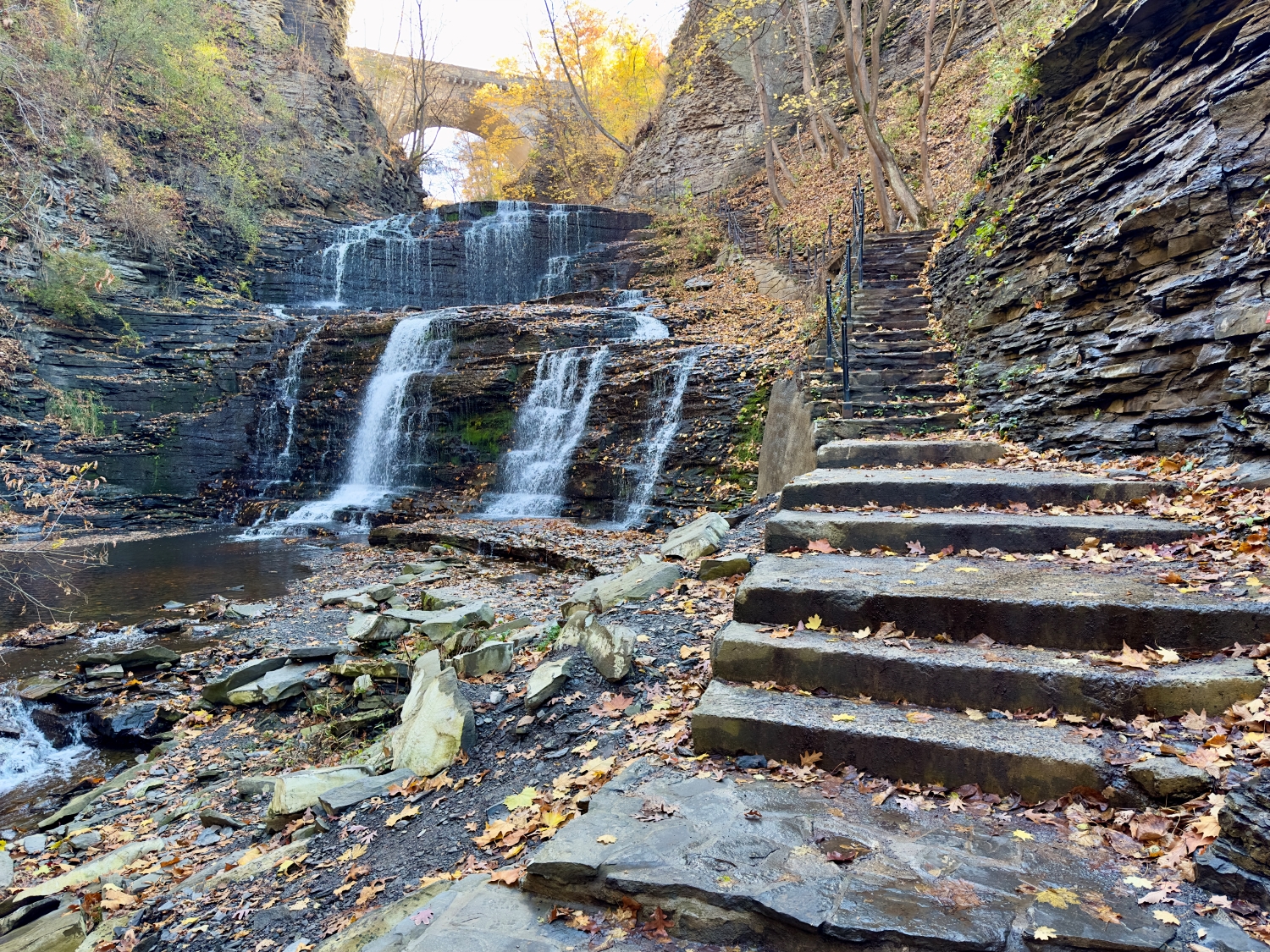
The trail steepens, and I press onward, the sound of the water intensifying as I near a grand waterfall framed by the impressive stone steps leading up to the College Avenue Stone Arch. Each step is littered with leaves, their colors vivid against the worn stone—golds, russets, and the occasional brilliant red, like embers scattered along my path. The waterfall beside me spills down in steady streams, each cascade creating rivulets that catch the light as they flow downward.
The gorge walls rise sharply on either side, embracing the path in rugged layers that tell stories of geological time. I feel as if I’m climbing a passage through history itself. These rocks, these trees, the very water carving its way through the stone—all have been here far longer than I can fathom, shaped by forces beyond my understanding. There’s a certain thrill in being among such enduring elements, a reminder of how small and fleeting we are in the face of nature’s grandeur.
Reaching the next tier of the trail, I pause to take in the sight of the massive stone arch spanning the gorge above. The bridge is a striking feature, its wide arch perfectly framing the sky and the last vibrant colors of autumn. It feels like a gateway, a fitting culmination to the journey. Standing beneath it, I’m struck by how well it harmonizes with the gorge, the careful craftsmanship of its stonework complementing the rough beauty of the surrounding cliffs.
The sunlight flows around the arch, illuminating the leaves that cling to the branches above, casting a warm glow over the scene. I feel a sense of reverence here, a quiet acknowledgment of both human artistry and the relentless beauty of nature.
I paused to capture this video of the moment.
Sights and Sounds of Autumn
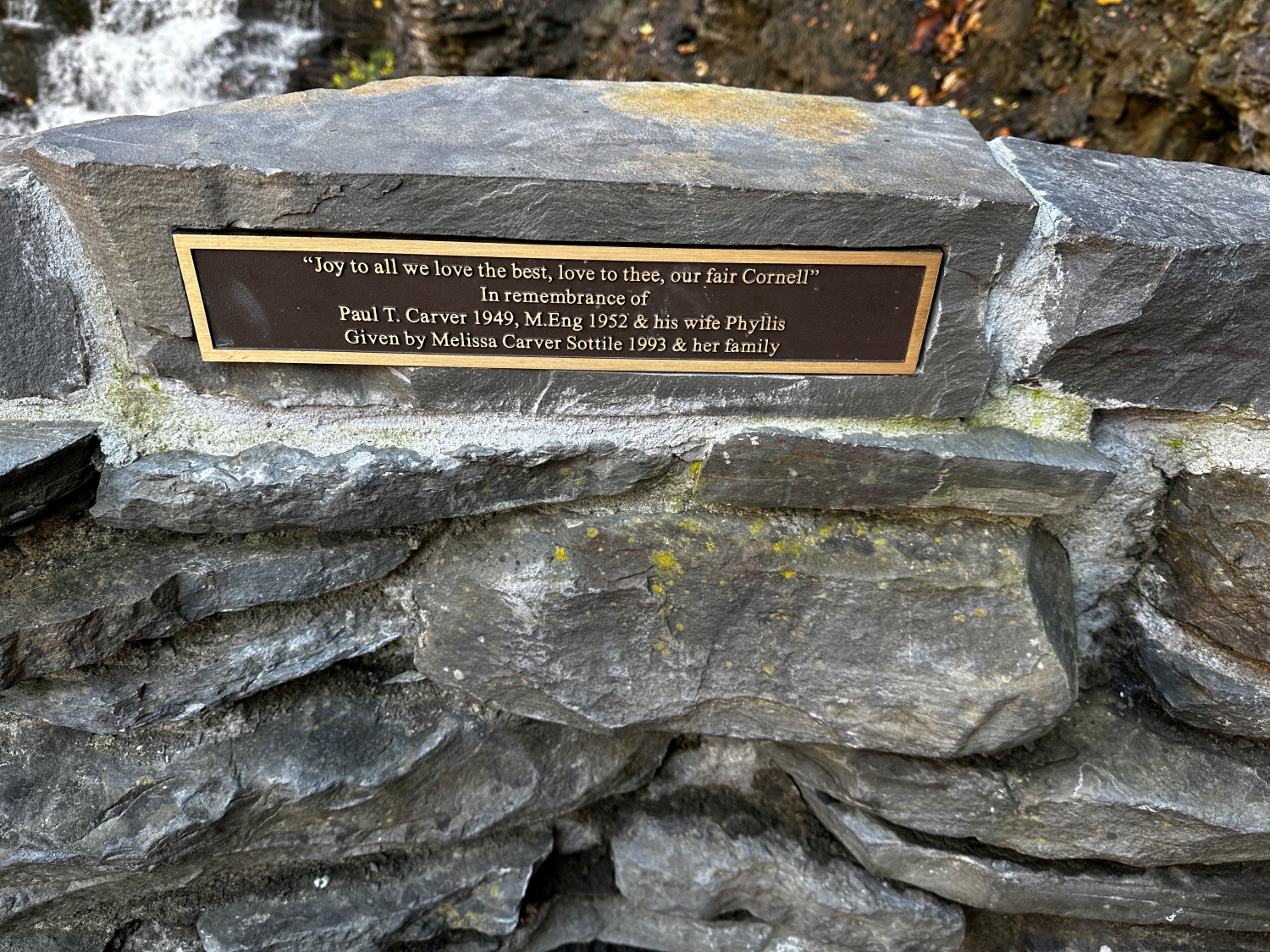
The final ascent is graced by a bench where a stone plaque catches my eye. It’s a tribute, etched with words that resonate in this place: “Joy to all we love the best, love to thee, our fair Cornell.” A gift from a family whose lives intertwined with Cornell, it serves as a reminder of the deep connections people have to this landscape, to the university, and to the memories rooted in these trails and gorges. I pause, reflecting on my own connection to this path, which has taken me through an ever-unfolding tapestry of nature and history.
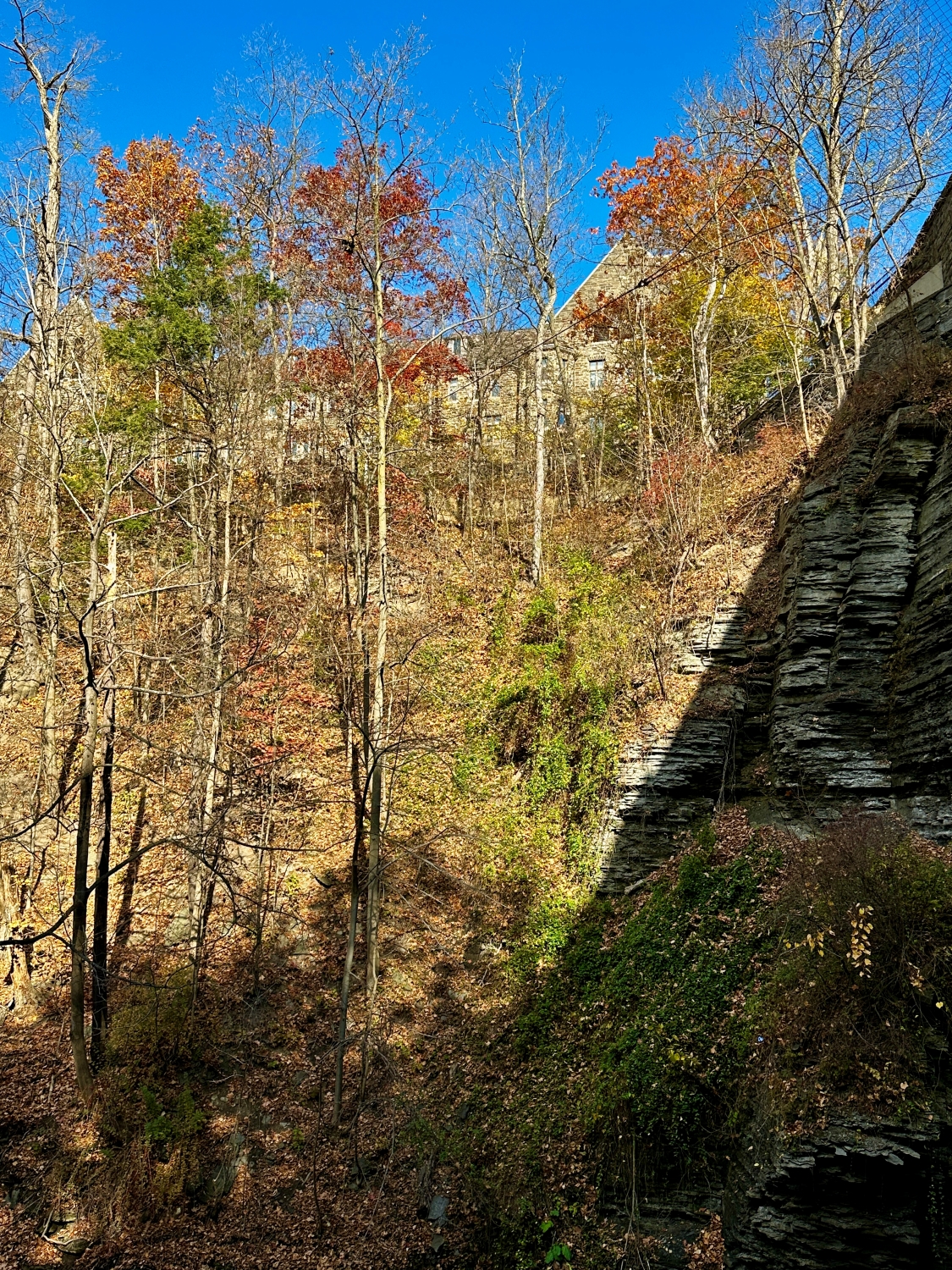
The last stretch of steps is leaf blanketed, their shapes and colors a beautiful final mosaic before I emerge from the shaded coolness of the gorge. The sun filters down through the thinning trees, illuminating the stone buildings of the Cornell campus that peek through the branches ahead. With each step, I feel the transition, moving from the curated wildness of Cascadilla Gorge and its trail to the structured beauty of the university grounds.
Myron Taylor Hall, Cornell Law School from the gorge.
As I reach the top, the Schwartz Center for the Performing Arts comes into view, its modern architecture a contrast to the ancient rocks I’ve left behind. Here, in this space where art, education, and nature converge, I take a last look back into the gorge and a journey, a gem in the heart of the Finger Lakes, a place that holds stories, both old and new, and invites every visitor to become a part of them.
Enter your email to receive notification of future postings. I will not sell or share your email address.
Copyright 2024 All Rights Reserved Michael Stephen Wills
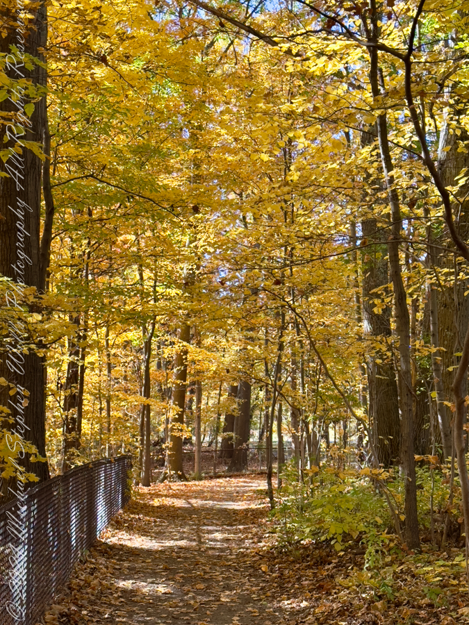
A few days before Halloween, I found myself on the rim of Cascadilla Gorge, Ithaca’s autumnal crown jewel. The air had that crisp October quality, each breath carrying a hint of the colder days to come yet still tempered by the lingering warmth of early fall. A breeze carried a scent of damp earth and decaying leaves, a rich, organic aroma that signaled the turning of the seasons. The path beneath my feet was a tapestry of fallen leaves—russet, gold, and burnt orange—a natural carpet leading me through a world suspended between vibrancy and rest.
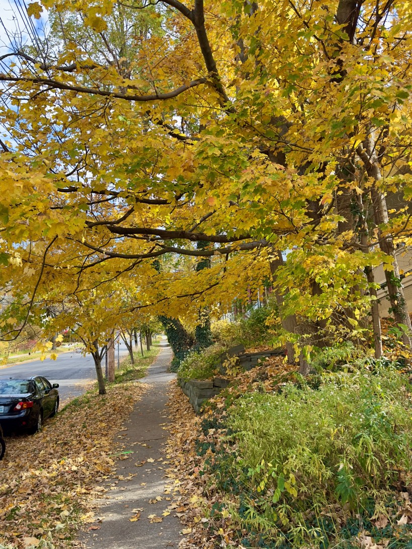
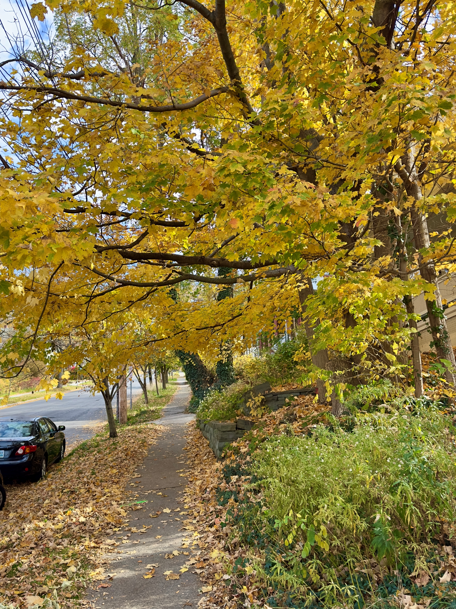
Golden Canopy over Buffalo Street Sidewalk
Continuing up Buffalo Street, I marveled at the trees, their branches thick with yellow and gold leaves, creating a canopy above. The leaves shivered with every gust, whispering the ancient secrets of the forest. The air was infused with the sweet, woody fragrance of maple and oak, mingling with the faint scent of chimney smoke from nearby houses. The sunlight filtered through, casting a dappled pattern on the sidewalk, a fleeting mosaic as the leaves danced in the wind. A sense of impermanence struck me; soon, these leaves would be gone, leaving bare branches silhouetted against a winter sky.
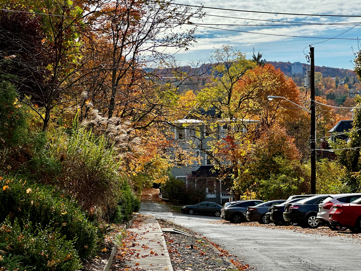
Scene from Dewitt Place toward South Hill and Ithaca College
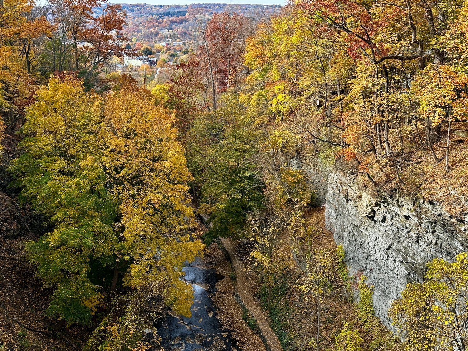
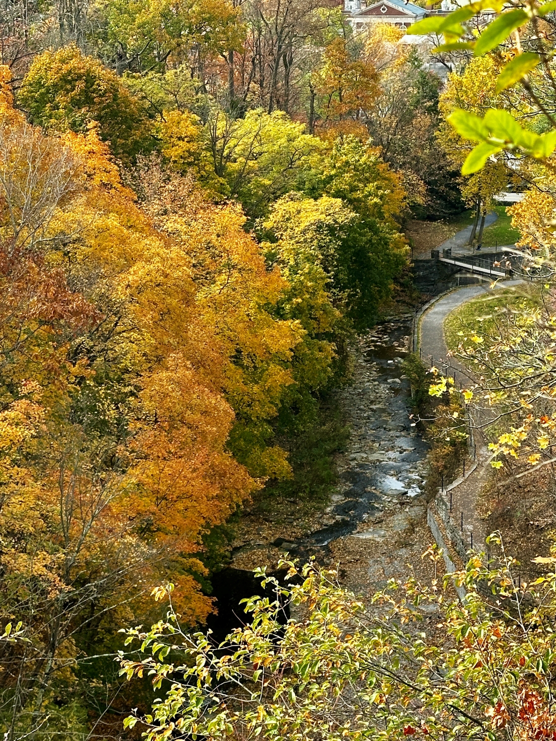
Crossing the Stewart Avenue bridge, the Cascadilla Gorge came into view, a steep wall of stratified rock layers standing guard over the gently flowing stream below. The contrast between stone and foliage was breathtaking—the hard, unyielding rock juxtaposed with the softness of leaves in full autumnal bloom. The earthy scent of wet stone mixed with the crisp aroma of the flowing water, creating a sensory tapestry unique to the gorge. The colors seemed to intensify against the gray and brown of the cliff, each leaf like a brushstroke on nature’s canvas, celebrating the season’s final flourish before surrendering to winter.
Below footpath along the gorge rim, the creek wound through, its banks littered with leaves that had completed their journey from branch to earth. They floated on the water’s surface, spinning gently in the current as though reluctant to leave this last dance. The sound of the water was a steady undercurrent, soothing and rhythmic, as it tumbled over stones and carved its way through the gorge. I paused to watch, entranced by the way water and rock, ephemeral and eternal, seemed to coexist in a kind of harmony.
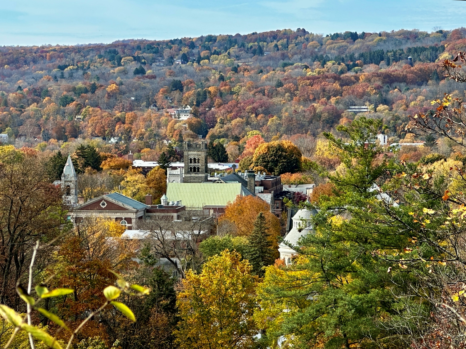
I stopped at a lookout point and surveyed the town sprawled out below, nestled amidst the fiery colors of the surrounding hills. The architecture of Ithaca’s buildings peeked through the trees, each roof and spire framed by the season’s palette. This was a town embraced by nature; its rhythm dictated as much by the seasons as by human hands. The sight stirred a sense of gratitude within me; here was a place that reminded you to slow down and observe, to notice the subtle shifts in light, in color, in the way a single gust of wind could change a landscape.
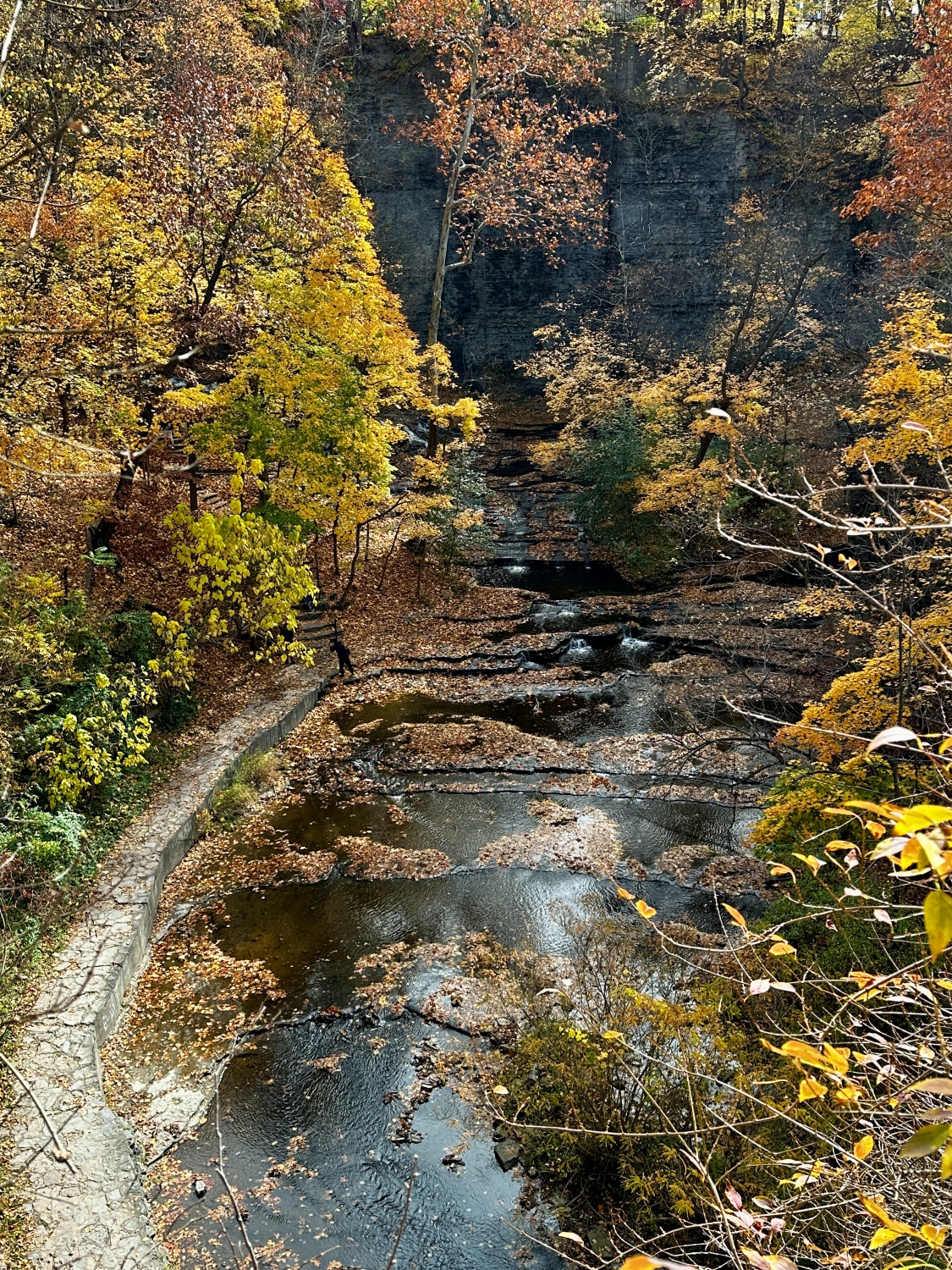
I continued along the rim, passing a small waterfall that spilled over the rocks with a quiet insistence. The water had carved smooth pathways in the stone, evidence of its long journey and persistent power. The sunlight hit the spray just right, casting a fleeting rainbow that shimmered and then disappeared as I moved. I felt a sense of companionship with the water—both of us moving forward, shaped by the paths we traverse, yet always adapting to whatever lay ahead.
The last part of the trail led me through a dense thicket of trees, their branches hanging low, forming a natural archway. The air was heavy with the musky scent of fallen leaves and the spicy aroma of pine needles underfoot. Here, the light was softer, muted by the thick canopy overhead. The quietness enveloped me, broken only by the occasional rustle of a squirrel in the leaves or the distant caw of a crow. It was the kind of silence that feels sacred, where each sound, no matter how small, becomes profound.
Entering Cascadilla Gorge from Linn Street
Emerging from the shaded path, I took one last look back at the gorge. The scene was both familiar and new—a blend of natural beauty and the nostalgia of seasons past. I felt a sense of peace, grounded by the cycles of the earth, by the ebb and flow of life around me. In this moment, on the brink of Halloween, the world felt both hauntingly beautiful and reassuringly steadfast, a reminder that even as the leaves fall and the days grow shorter, there is a promise of renewal in the quiet persistence of nature.
Enter your email to receive notification of future postings. I will not sell or share your email address.
Copyright 2024 All Rights Reserved Michael Stephen Wills
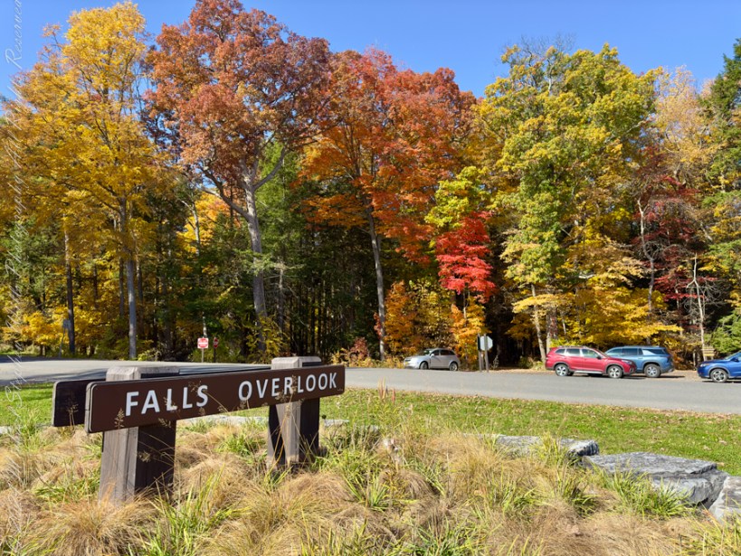
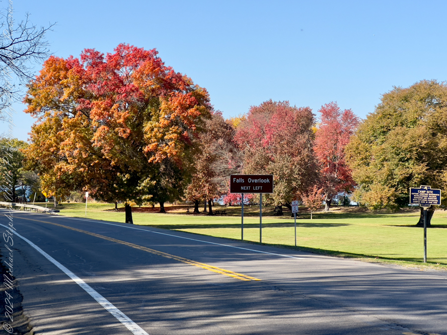
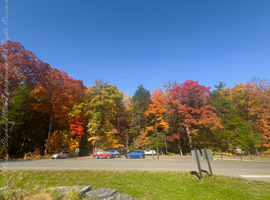
As I set foot on the Falls Overlook at Taughannock Falls State Park, I was greeted by a symphony of autumn colors in their full glory. The vibrant oranges, reds, and yellows of the trees framed the scene, setting the stage for a perfect fall day. I lingered, taking in the view of cars nestled among the foliage, their colors almost merging with the rich autumn hues surrounding them. The sign for the “Falls Overlook” hinted at the journey ahead.
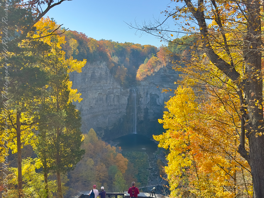
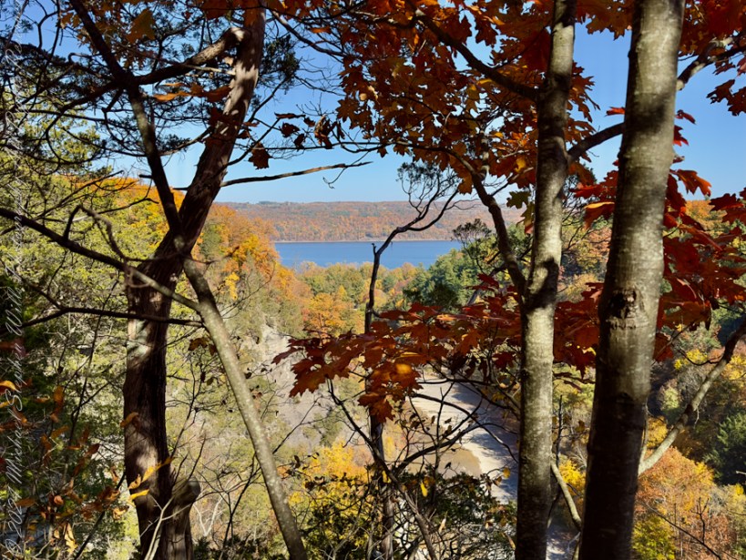
The overlook offered a breathtaking view, a gentle reminder of nature’s power as Taughannock Falls cascaded far below, framed by rugged cliffs and vibrant trees. Through gaps in the golden leaves, I could catch glimpses of the waterfall, a delicate white ribbon against the slate-gray rock. The sunlight filtered through the canopy, casting dappled shadows and illuminating leaves like stained glass, painting the landscape in a thousand shades.
I began my ascent up the North Rim Trail, where the path twisted beneath a tunnel of golden branches. The trail was carpeted with leaves, crunching underfoot with each step. The air was crisp, filled with the earthy scent of decaying leaves and moist earth. Sunlight poured through gaps in the canopy, lighting up patches of ferns and casting long shadows on the rocky path. Here and there, the yellow and brown hues gave way to a burst of crimson, the leaves vivid and almost glowing in the sunlight.
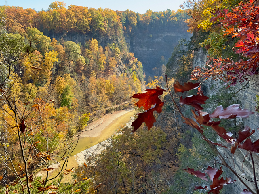
The trail led me along the cliff’s edge, where the river carved its path below. Pausing on the footbridge to the south rim, a former railroad, I looked out over the gorge, admiring the mosaic of colors stretching as far as the eye could see. In the distance, the sound of the falls drifted up to me, a soft, continuous roar that lent the forest an almost mystical air. It was hard not to feel a sense of awe at the raw beauty of the scene.
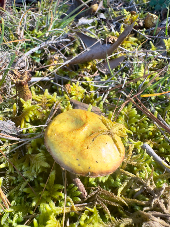
Eventually, I made my way down the South Rim Trail. There were ample distractions from the glorious foliage. A lone mushroom, golden and nestled in a bed of moss, caught my eye—a small reminder of the forest’s quiet life. I bent down to examine it, marveling at its delicate cap and the way it seemed to glow against the lush green moss. The trees here were denser, casting cool shadows that contrasted with the sun-drenched north side. The leaves here were thicker underfoot, their earthy scent more pronounced, grounding me in the moment.
As I reached the lower section of the trail, I noticed an old stone staircase winding up through the trees to the north rim—a relic from another time, adding a touch of mystery to the path. Each step was worn smooth by countless feet, each one a reminder of the generations that had walked these trails before me. The stairs climbed through a cathedral of trees, each trunk tall and straight, as if standing guard over the trail.
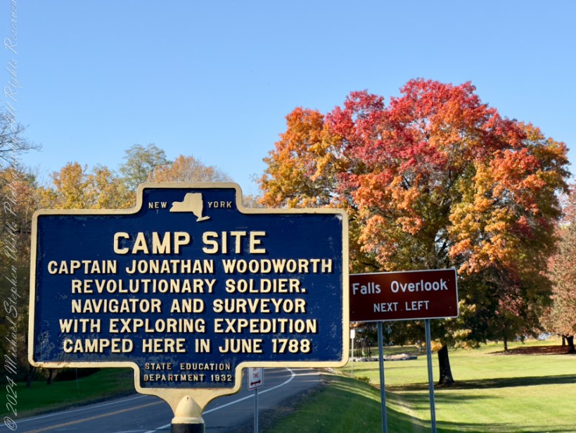
On my way around I passed by a historical marker, a blue and yellow sign commemorating the camp site of Captain Jonathan Woodworth, a Revolutionary soldier who camped here in June 1788. It was a reminder that these trails, this land, had been cherished long before my steps fell upon it.
After reaching the base of the South Rim Trail, I looped back up the North Rim. The trail now felt familiar, yet the changing light gave it a new character. The sun was lower, casting a golden glow across the tops of the trees.
As I returned to my starting point, the sun cast a soft, warm light across the landscape, bathing the park in an ethereal glow. With one last look over the falls and the vivid tapestry of trees, I felt a sense of gratitude. Taughannock Falls State Park in autumn is an experience, one that leaves an indelible mark, reminding us of the beauty and timelessness of the natural world.
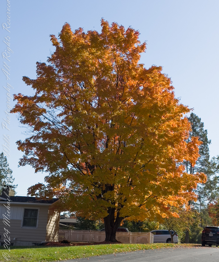
On the drive home I paused to admire a neighbor’s maple tree’s full autumn glory.
Enter your email to receive notification of future postings. I will not sell or share your email address.
Copyright 2024 All Rights Reserved Michael Stephen Wills
One hundred and fifty feet in a series of steep climbs is the effort expended to reach the relatively level portion of South Rim Trail where the tall Red Pines briefly reign. Here the trees thrive on the northeast facing slope. They grow in this way in one other location, in the upper park, on an eponymous trail.
Encounters with groups of people descending always demanded I step off the trail to allow social distancing. Everyone work a flimsy face covering, although Governor Coumo’s order covers situations where social distancing is not possible. As of you, we do not have the loose masks; but only the N95 or a full respirator (both acquired very early on, our respirators were purchased for spreading lawn chemicals and spray painting).
Click photograph for a larger view. To do this from WordPress Reader, you need to first click the title of this post to open a new page.
Red Pine
Red Pine (Pinus resinosa), also know as Norway Pine, shed pollen prolifically. Some Aprils my boots are covered with it, a dusting of yellow. Not today.
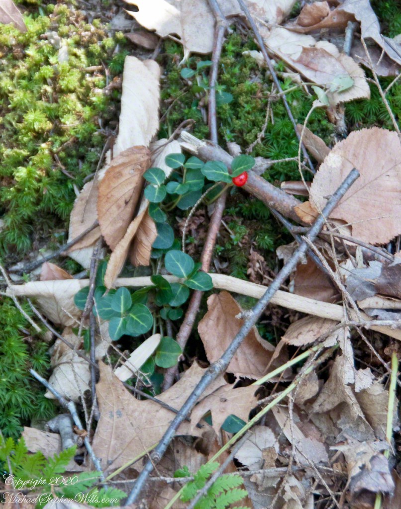
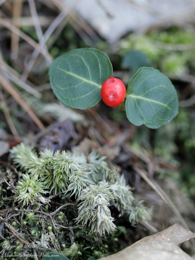
Wintergreen with Red Berry
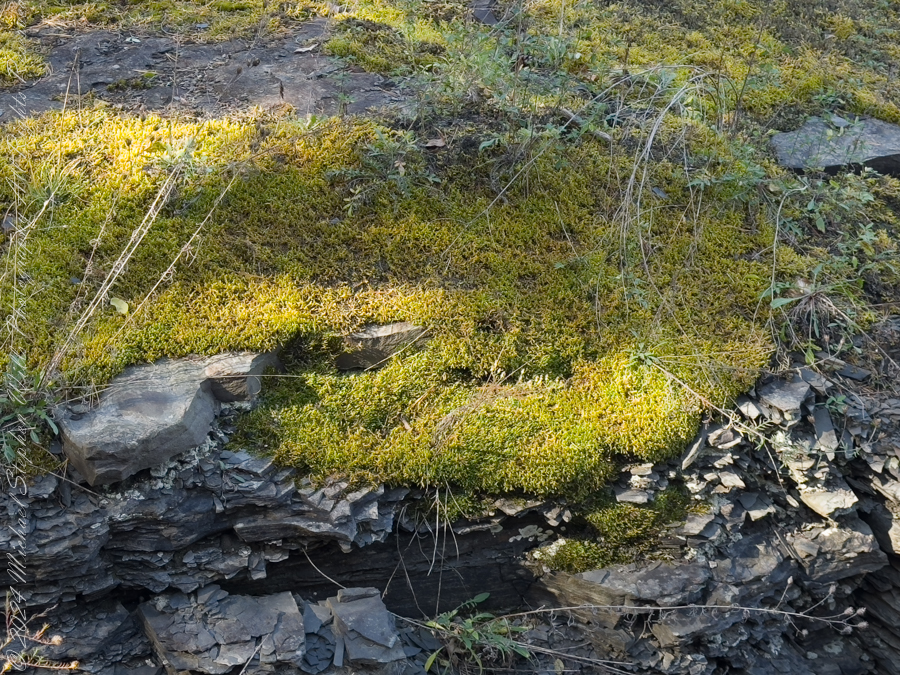
A species easy to spot among the green, an example of a shrub of the genus Gaultheria, though a very small specimen. The common name is wintergreen and I have never found larger specimens in Treman park. It is growing among the mosses on the wall of Enfield Glen South Rim.
Macro, Red Berry and Leaves of Wintergreen with unidentified moss
The tough wintergreen leaves endue the cold seasons, the name is synonymous with evergreen.
Both shots are handheld, the macro is from a 100 mm “macro” fixed focus lens. ISO 2500, the f-stop to be wide open at 2.8 to gather the sparse light and present the subjects, blurring the immediate background. The overview shot is also a high ISO, 2000, the f-stop 5.8 on a variable focus lens set to 60 mm.
Copyright 2024 All Rights Reserved Michael Stephen Wills