From a modest bench above Taughannock Gorge, Cayuga Lake shifts from distant glimmer to presence—a quiet invitation to pause, breathe, and follow the water down.
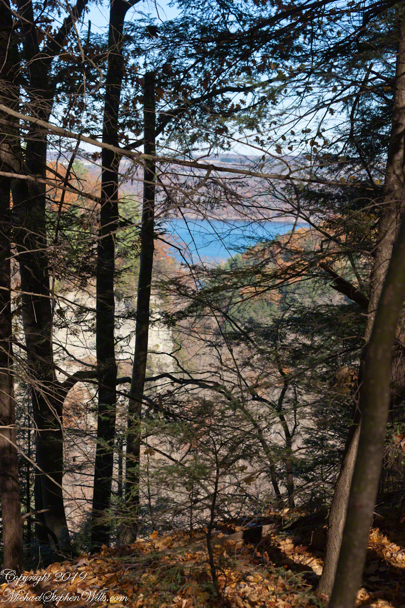
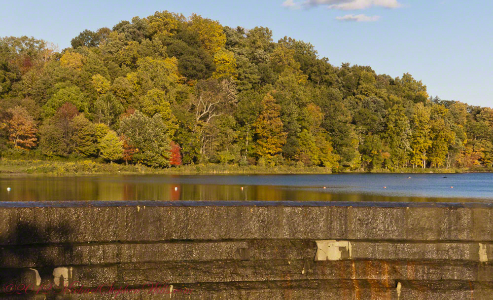
From the south rim of Taughannock Gorge, Cayuga Lake appears like a distant strip of sapphire, framed today by a soft veil of hemlock and oak. The overlook here is modest—a fence, a bit of open sky—but someone wisely added a comfortable bench, an invitation to pause between gorge and lake, rock and water.
I stood in front of that bench, resting the camera body on the fence, fingers braced against the wood to steady the shot. This is not the grand, sweeping vista of a postcard. Instead, it is a quieter, more human vantage point, the way a person actually encounters the lake after walking the rim: emerging from the trees, breath easing, eyes adjusting to the light on water.
From here, the trail descends toward Cayuga’s shore, each turn bringing you lower and closer, trading the lofty perspective for the intimate sounds of waves and stone. In Distant Sapphire I and II, the lake was a glimpse—caught between branches, distant beyond the gorge. Now, in this “Bench View,” the water feels nearer, almost within reach, as though the landscape itself is drawing you gently down.
Click photograph for a larger view. To do this from WordPress Reader, you need to first click the title of this post to open a new page.
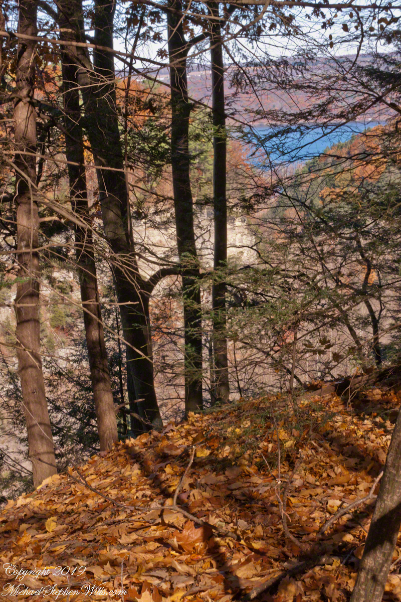
Cayuga Lake Bench View
I’ve gathered the three photographs—Glimpse of Cayuga Lake, Gorge View with Oak Leaves, and this Cayuga Lake Bench View—into a small gallery, a progression of approach. Each frame is a step closer: from suggestion, to invitation, to the quiet promise of the bench, waiting for whoever needs to sit and look a little longer.
A gallery of the three Cayuga Lake photographs for comparison.
Glimpse of Cayuga LakeGorge View with Oak LeavesCayuga Lake Bench View
Enter your email to receive notification of future postings. I will not sell or share your email address.
Copyright 2025 All Rights Reserved Michael Stephen Wills
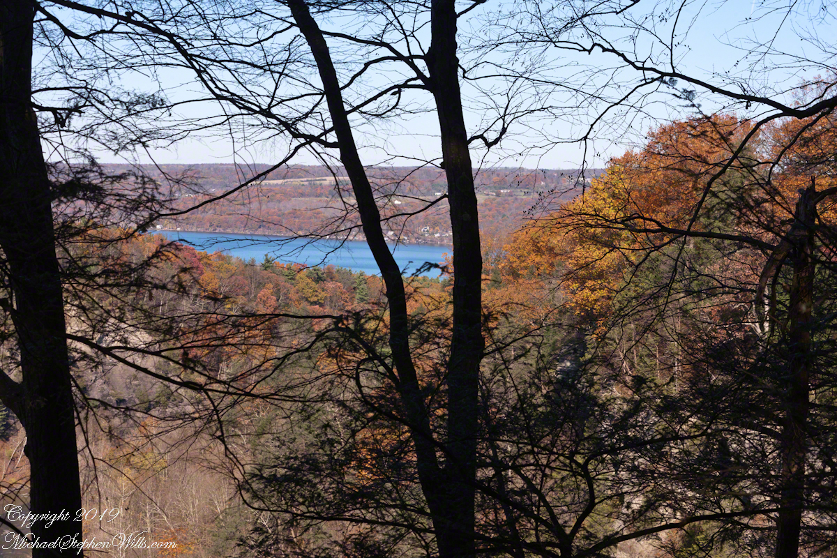
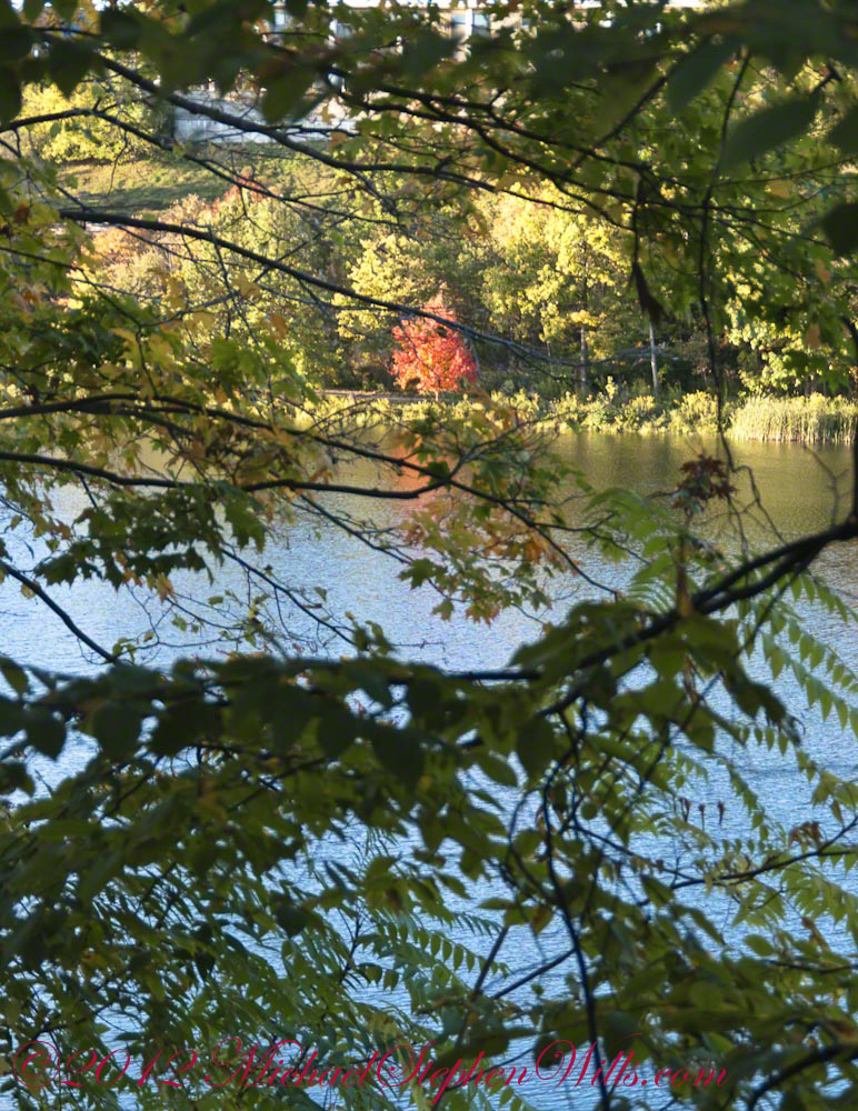
Cayuga Lake from the south rim of Taughannock Gorge, seen through a veil of hemlock with a carpet of fallen oak leaves, foreground. This is a companion to the previous post, both were handheld. For this the foreground was included to increase interest. For added stability, I rested the camera body on the fence bracketed with my fingers.
Click photograph for a larger view. To do this from WordPress Reader, you need to first click the title of this post to open a new page.
Gorge View with Oak Leaves
A gallery of the two photographs for comparison.
Glimpse of Cayuga LakeGorge View with Oak Leaves
Enter your email to receive notification of future postings. I will not sell or share your email address.
Copyright 2025 All Rights Reserved Michael Stephen Wills
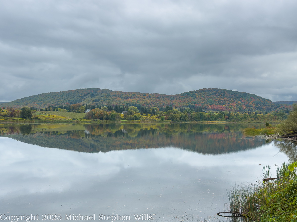
Morning clouds hang over Dryden Lake as hills kindle first color; reflections hold breath while a lone walker reads the valley’s glacial and human-written past.
He came to the water before the people woke, the road a still ribbon of cold tar snaking beneath the low hills. Mattocks of cloud hung over the valley and the lake took in the sky like a mirror dropped yet not broken. The trees were beginning to color. A patient fire working from within the leaves. He parked where the grass ran down to the shore and stood a long while without moving. Birds made small sounds in the reeds. Somewhere a single truck labored up the grade and was gone. The surface held the hills with a steadiness the hills themselves could not keep. He thought how the quiet of a place can be the loudest thing it owns.
He went along the margin along the damp sedges where old drift lay silvered and light as bones. A drowned trunk angled from the shallows. The lake was old in the way of things made by ice and time. A kettle in the outwash of the last glacier, some men said, a bowl left when the buried ice eased away. He pictured the ice receding into the valley heads, the meltwaters choked with gravel, a hand larger than memory scribing the floor of this country. The earth never told it plain but the lay of it was witness enough. Across later centuries men cribbed a dam across the outlet and drew the water to a shape that pleased them and served their work.
A trail ran the length of the water on the old rail bed. The ties were long gone and the iron and cinders buried under years of leaf fall and gravel. He had walked it as a boy beside his father and now he walked it alone. Benches stood at half-mile intervals like waystations in a country of small pilgrimages. The signs told what once was here and what remains. They had renamed the path for a townman who argued it into being after the railroad had passed from the world and the right-of-way grew up with sumac and rumor. It was an easy trail and he carried nothing. His hands hung at his sides as if the day might place something in them when it was ready.
In another era the lake was a workshop. Men whipsawed timber in the wet air and fed small mills with the grove’s dark boards. Winter flowed over the flats, and they built icehouses and set the blocks within like blue stone, an industry that died when cold could be called from a switch. The hills have learned to forget the noise of it, though on certain mornings the fog takes a shape and you could believe rising from the ponded sawdust and the lading of sleds. He thought of the labor of those gone hands and of how work is a scripture every place keeps in its own tongue.
Before any of that, the ground here was a summer camp. People came with the season and went with it, laying their fires in the lee of the knoll and taking fish where the cattails thin. He could feel them in the open places, not as ghosts but as the first understanding the land ever had of itself. The words used for them now are museum words, yet the wind still crosses the water as it did and empties the same smell of iron and leaf into the lungs of whoever stands to breathe.
The town took its name from a poet long dead, a scholar’s choosing in the years after the war for independence when this tract of country was parceled out to soldiers of that same war. Virgil lay to the east as if they were shelving Latin across a map. The creek that bears that name threads the villages and finds Fall Creek at Freeville, and the combined waters go their own slow way toward Cayuga where the glacial hand scooped deeper yet. He said these names under his breath and they tasted of chalk and river stone.
A kingfisher rattled across the cove. The fish rose in rings that spread and vanished like time seen from above. Out on the water an old man pushed a skiff with an electric motor that hummed like a trapped bee, for the lake allows no gas engines now. The wildlife area ran around the shore in a ragged collar of field and wetland and alder, near two hundred acres under the state’s keeping, and the lake itself a little over a hundred. He watched the man aim for the lily line and thought how rules arise from the wish that a thing endure, though nothing does. Still we make the rules and we keep them as if the earth were listening.
Wind came down the slope with a smell of rain. He turned back and the hills lay again in the water, entire, and for a moment he could not tell which world had claim to the other. He thought of the rails pulled up and the mills gone to weeds and of the icehouses fallen into their own shadows and he thought of the people before all that and of the long winter pressing its thumb into the land and lifting it away. He thought of his father walking the rail bed beside him a lifetime ago and saying nothing. There are places where the past crowds close and will not be argued with. He stood until the first drops dimpled the surface and the reflection shattered and reformed. A train no longer runs here. The only sound was the soft percussion of rain on water and the slow turning of the earth beneath both. He put his hand to the damp trunk of a fallen tree and felt the grain and the coolness and the old patient labor of rot. Then he went up from the reeds, his pockets full of acorns, and out to the road where his truck waited and the day, austere and sufficient, came along with him.
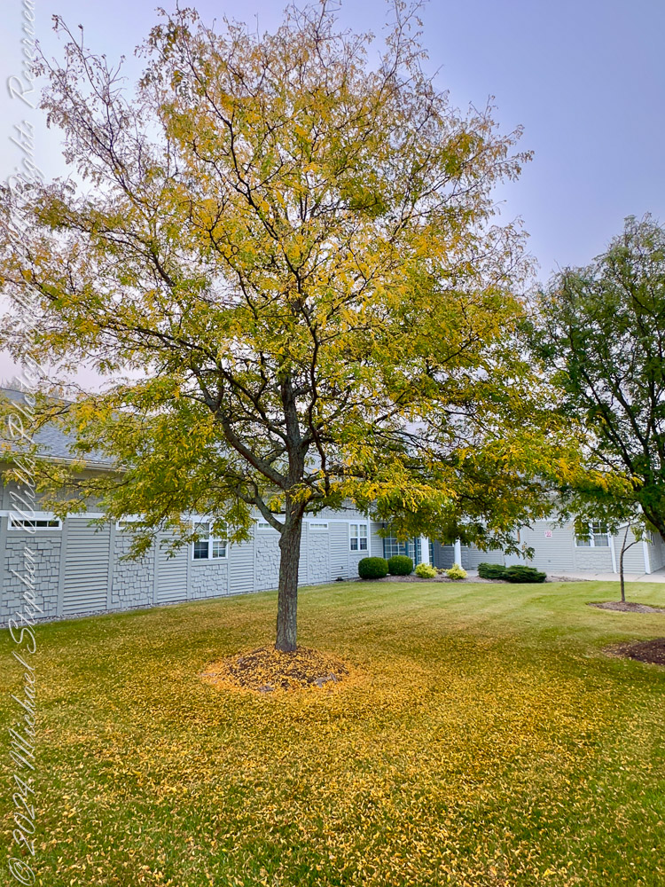
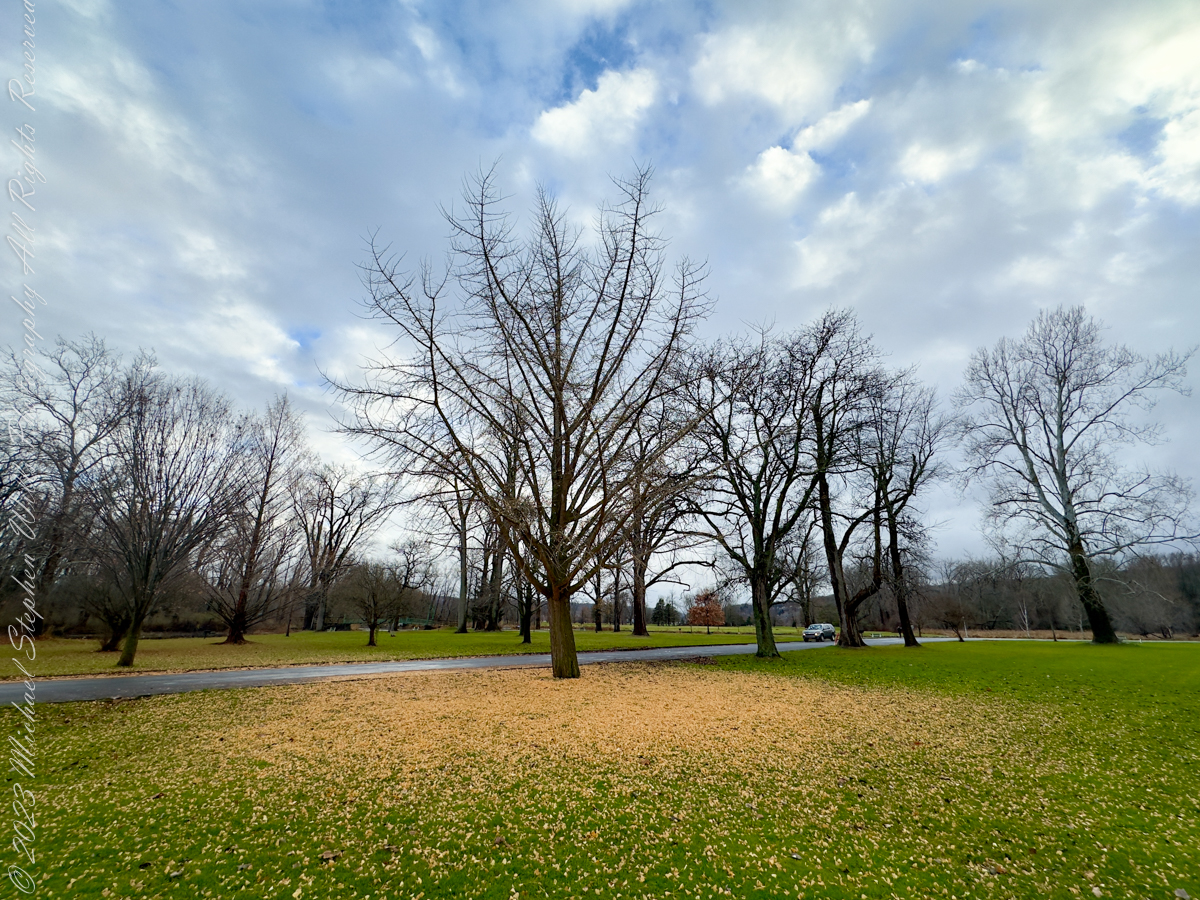
Standing before these two trees on a unseasonably warm autumn day, I am struck by the intricate patterns of their fallen leaves. Against the vibrant green of the grass, the golden leaves form halos around the trunks, as if nature herself were sketching mandalas. There’s something profoundly mathematical about these arrangements—a quiet order amidst what might initially seem like chaos.
The first tree, its barren branches reaching skyward, stands on a carpet of yellow that radiates outward in near-perfect symmetry. The leaves have fallen in such a way that their density decreases as the distance from the trunk increases. It reminds me of the inverse square law—a principle in physics that governs how light, gravity, and sound diminish with distance. Here, instead of energy dispersing, it’s the leaves thinning out, their graceful scatter dictated by the wind’s whims and gravity’s pull. There’s an undeniable harmony in this seemingly random process, a convergence of natural forces creating an elegant gradient.
Stewart Park, Ithaca, New York
The second tree presents a different story, yet one equally mesmerizing. Its leaves, still clinging in part to the branches, form a looser ring at the base. The distribution is uneven, hinting at prevailing winds or the sheltering influence of nearby buildings. But even in this asymmetry, I see fractals—the self-similar patterns that repeat at different scales throughout nature. Look closely, and you’ll notice clusters of leaves mimicking the broader structure of the canopy above. It’s as if the tree’s essence is echoed in the ground below, a reminder of how deeply interconnected every part of a system can be.
Robinia pseudoacacia, commonly known as the black locust
These patterns invite reflection on the mathematical principles governing our world. Fibonacci sequences, golden ratios, and fractals—abstract concepts are not confined to textbooks. They are etched into the fabric of existence, visible in the spiral of a sunflower’s seeds, the curve of a nautilus shell, and the fall of leaves beneath a tree. Even the chaos of autumn is underpinned by order, a dance choreographed by countless variables: the angle of the branches, the strength of the wind, the moisture in the air.
I find myself wondering about the unseen forces at play. How many leaves fell straight down, obeying only gravity? How many were carried aloft by a breeze before settling farther afield? Could we model these patterns with algorithms, tracing the arc of each leaf’s descent? Would the data reveal a perfect equation, or would it remind us that some mysteries resist full comprehension?
As I stand here, I feel a deep gratitude for these natural equations. They ground me in the present moment while also connecting me to the infinite. The pattern of leaf fall is a reminder of life’s balance: chaos and order, randomness and structure, fleeting moments and timeless principles. The trees, now shedding their golden crowns, invite me to pause, observe, and marvel at the beautiful mathematics of autumn.
Enter your email to receive notification of future postings. I will not sell or share your email address.
Copyright 2025 All Rights Reserved Michael Stephen Wills
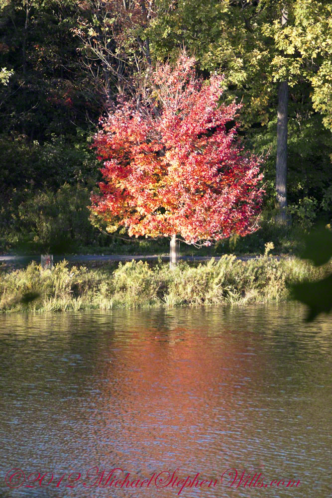
On a serene autumn afternoon by Beebe Lake, a solitary red maple stood out against the backdrop, showcasing its vibrant colors and resilience, symbolizing autumn’s fleeting beauty.
It was one of those serene autumn afternoons that linger in memory, the kind where the sky seems impossibly clear, the air crisp and gently scented with fallen leaves. I stood at the edge of Beebe Lake, my gaze first drawn to the textured concrete dam holding back the water, its weathered facade contrasting sharply with the soft reflections shimmering across the lake’s calm surface. Beyond, the wooded hillside rose gently, a tapestry woven with the warm hues of autumn—golds, greens, oranges, and reds mingling like brush strokes on a canvas.
An October Glory, turning before all others
Yet amidst this collective beauty, one tree captured my attention, singular in its brilliance—a solitary red maple standing proudly on the lakeshore. Its leaves had turned a vivid crimson, blazing brightly as though defying the muted earth tones surrounding it. Even from a distance, framed and partially obscured by larger trees, its vibrant reflection cast a fiery echo on the water, rippling softly in the afternoon breeze.
The maple, Acer Rubrum, seemed perfectly at home here, thriving robustly at the water’s edge. I remembered reading how adaptable red maples are, able to flourish in conditions ranging from dry uplands to swampy shores. This spot, near the edge of the tranquil Beebe Lake, seemed to showcase its resilient character perfectly.
Up close, the maple’s glow was even more striking. Its leaves cascaded in fiery clusters, hues deepening from bright scarlet at the tips to a darker maroon closer to the branches. This dramatic gradient seemed symbolic of autumn itself—beautiful, fleeting, and subtly tinged with the melancholy reminder of winter’s approach.
The Red Maple (Acer Rubrum) to tolerant of diverse conditions, making it a perfect choice for this spot on the short of Beebe Lake.
A memory surfaced of early spring in the Finger Lakes region, a time when maples, including this red maple, generously share their sap. Though not traditionally tapped like its sweeter cousin, the sugar maple, this species’ sap can indeed be boiled down into syrup, a surprising sweetness hidden within its sturdy trunk. Standing in its shadow, imagining those early spring days, it seemed astonishing that the same tree could offer both the delicate sweetness of syrup and the fierce beauty now on display.
Curiously, the transformation of the tree appeared methodical yet whimsical—it changed colors from the top down, its upper branches already bare, exposing slender twigs pointing skyward. Like an artist carefully removing layers to reveal something deeper beneath, the maple unveiled its upper bare bones first, as though reminding observers of the quiet strength supporting its autumn splendor.
This Red Maple (Acer Rubrum) turns from the top down and has already bare for most top branches.
As I lingered, taking in this turning tree, joggers passed by along the path, their rhythmic footsteps a gentle percussion beneath the rustling leaves. Briefly, they glanced toward the vivid maple, perhaps drawn, like me, by its striking contrast to the surrounding foliage. It felt like we shared a secret admiration for this singular tree, recognizing in it a quiet assertion of individuality amidst conformity.
Eventually, I viewed the maple once more from afar, framed now by broader sweeps of branches and leaves, partially obscured but no less vivid. Through layers of leaves and dappled sunlight, it glowed like a distant flame, a beacon that seemed to encapsulate the entire mood of the season—warm yet cool, bright yet transient.
The Red Maple (Acer Rubrum) is the first to flower in spring and the first to turn in autumn.
Walking away, the image of that maple lingered, its reflection shimmering gently in the afternoon sun, a moment suspended between summer’s lush vitality and winter’s bare stillness. Beebe Lake had offered scenic beauty, a quiet meditation, a reflection mirrored not only on its tranquil surface but in the heart of an observer captivated by a single tree’s fleeting glory.
Enter your email to receive notification of future postings. I will not sell or share your email address.
Copyright 2025 All Rights Reserved Michael Stephen Wills
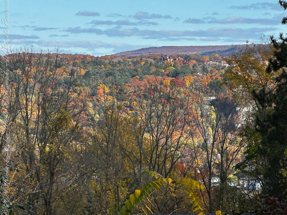
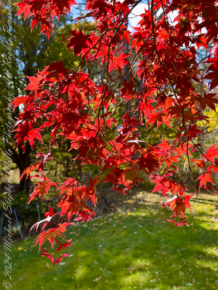
The Finger Lakes region, renowned for its natural beauty and changing seasons, put on a stunning performance on October 24, 2024. From the vibrant reds of a Japanese maple (Acer palmatum) to the golden hues of oak leaves (Quercus spp.), this photographic journey through our home captures the essence of autumn in upstate New York.
A Panoramic Tapestry
In the first photograph, the landscape unfolds like a watercolor painting. Hills dressed in fiery oranges and golds stretch across the horizon, with hints of evergreen pines (Pinus spp.) providing contrast. The sky, dotted with wispy clouds, serves as a serene backdrop, while the foreground frames the scene with bare tree limbs—a reminder that autumn is both a celebration of life and a prelude to winter’s dormancy. This image evokes a sense of timelessness, connecting us to the rolling hills that have witnessed countless seasons of change.
View from our porch across Ithaca to East Hill, Cornell University, Ithaca Falls on an October 2024 afternoon. Tompkins County, Finger Lakes Region, New York State
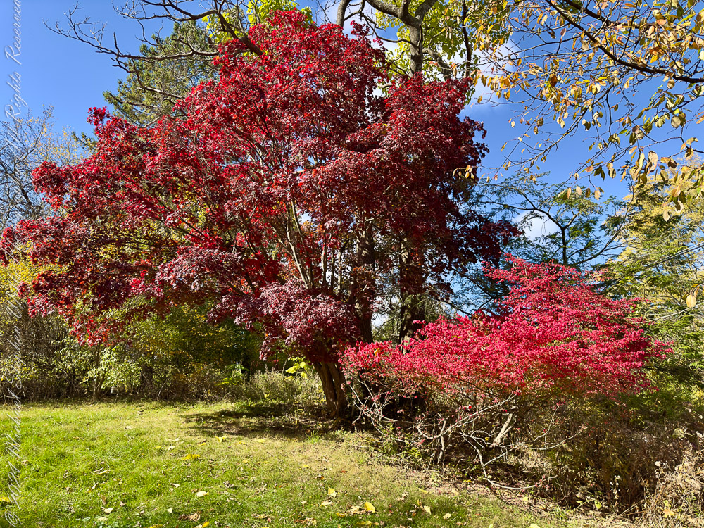
Japanese Maple: A Crimson Jewel
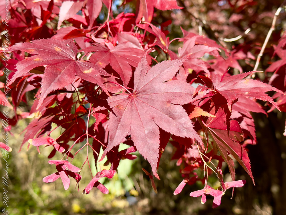
The next series of images focuses on the Japanese maple (Acer palmatum), a tree whose vibrant red foliage becomes a magnet for admiration in autumn. One close-up reveals delicate leaves, their intricate lobes illuminated by the afternoon sun. The interplay of light and shadow transforms each leaf into a tiny stained-glass window. Another photograph showcases the tree in its entirety, a commanding presence against the verdant lawn. It is a poignant reminder of nature’s artistry, where every branch and leaf contributes to the symphony of color.
Firebush and Japanese Maple in autumn colorsJapanese maple leaves and samara in autumn colors. From our yard October 2024Japanese maple leaves and samara in autumn colors. From our yard October 2024
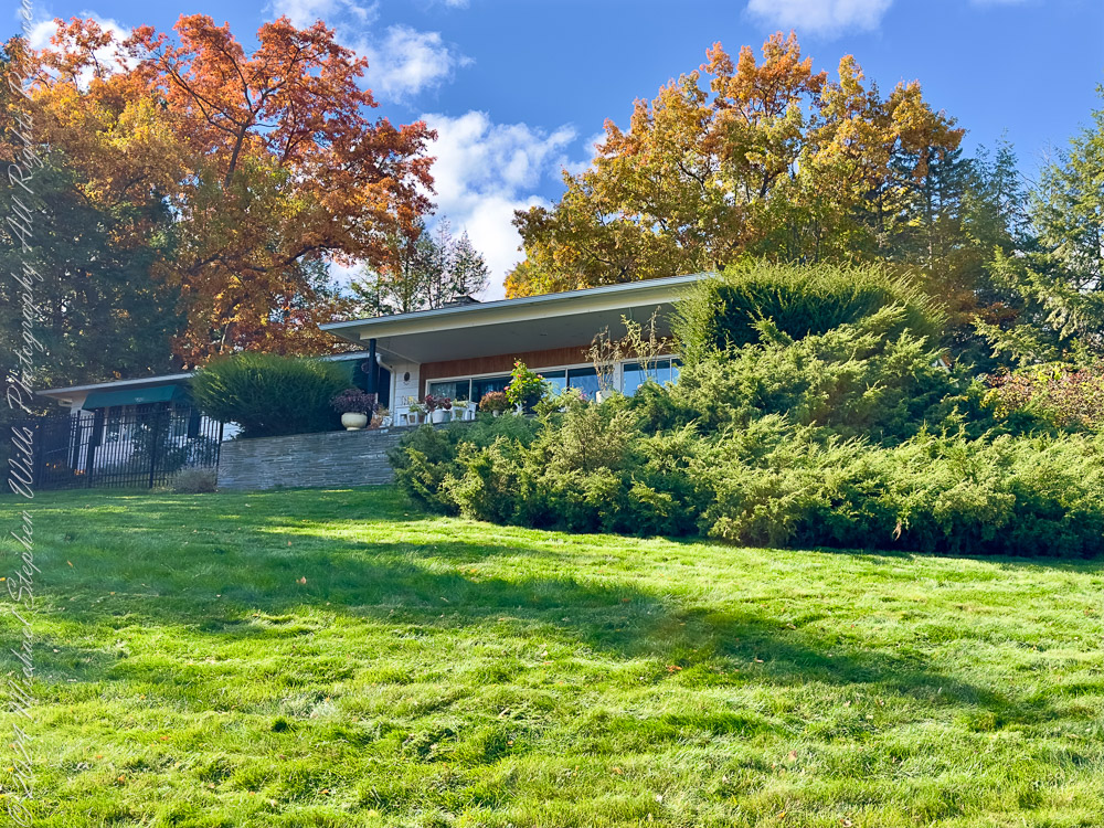
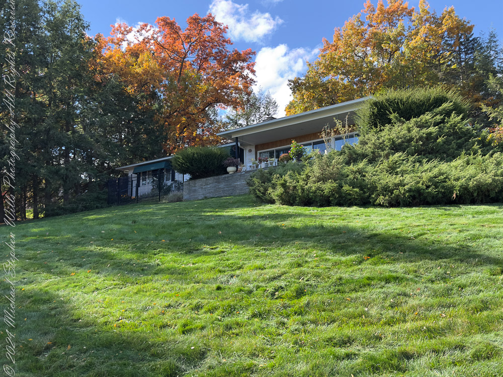
Home Amid the Foliage
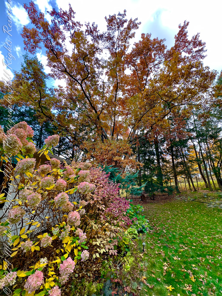
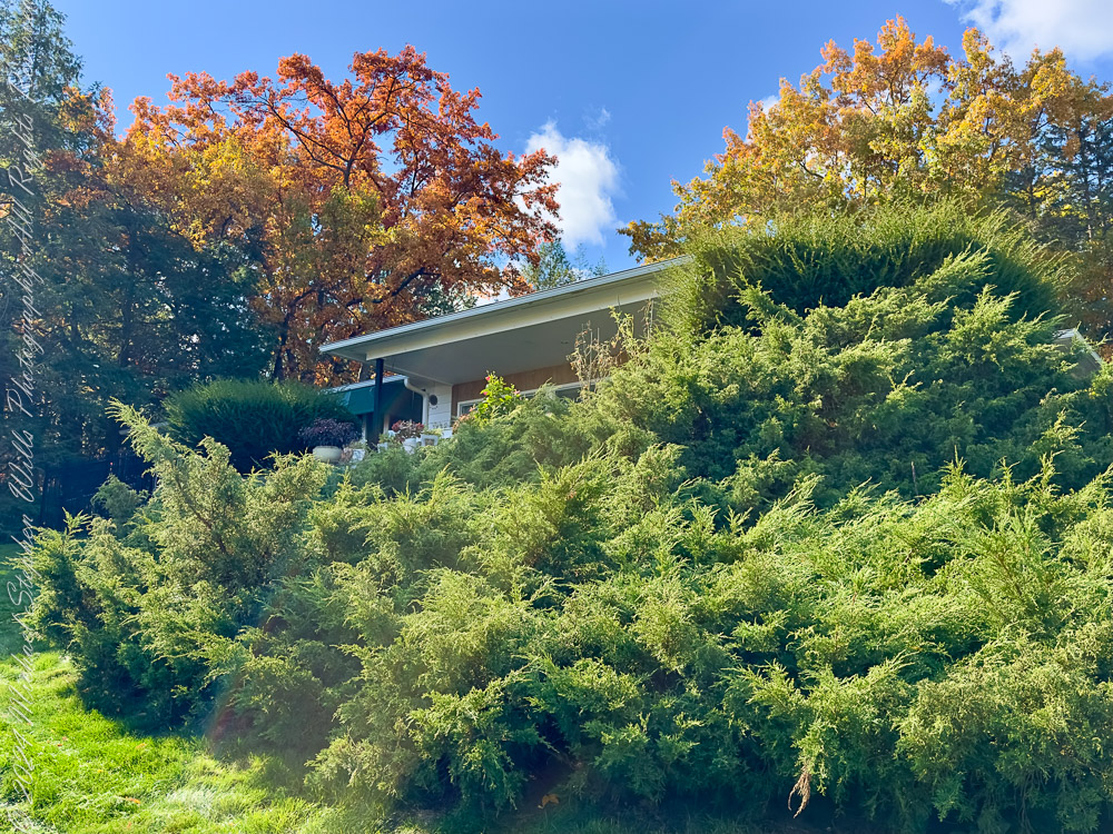
Nestled within this autumnal palette is our home, a mid-century structure that seems almost inseparable from its surroundings. The expansive lawn, a lush carpet of green, contrasts with the fiery colors of nearby oak (Quercus spp.) and maple trees (Acer spp.). In one angle, the house appears almost tucked away, sheltered by Eastern Hemlock (Tsuga canadensis) and junipers (Juniperus spp.) that add a sense of permanence to the scene. This juxtaposition of human habitation and natural splendor underscores how our lives are intertwined with the land we call home.
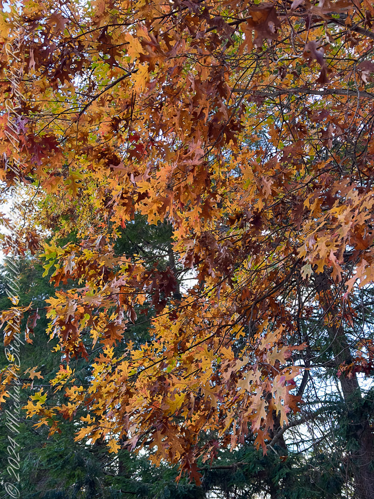
Our oak trees in autumn colors
Oak Leaves: A Study in Texture
A close-up of oak leaves (Quercus spp.) showcases their rugged beauty, with jagged edges and deep veins that seem etched by time itself. Their colors—ranging from deep amber to burnished copper—are a testament to the richness of autumn’s palette. These leaves, clinging tenaciously to their branches, remind us of resilience and the fleeting beauty of the season.
Our oak tree in autumn colors. Helmock backdrop
Hydrangeas in Transition
The hydrangea bushes (Hydrangea paniculata) by the house present a softer side of autumn. Their once-vivid blooms have faded to pastel pinks and creams, lending an air of nostalgia. These flowers, in their gentle decline, mirror the transition of the season, where vibrancy gives way to a quieter beauty. The hydrangea blooms seem to whisper the story of the summer past, offering a delicate contrast to the bolder hues of the surrounding trees.
Our oak tree in autumn colors. Pam’s hydrangia.
The Resilient Shrubs
Creeping Juniper (Juniperus horizontalis), here in the foreground, provides a grounding element in the composition, with a steadfast green the reminder of life persisting even as deciduous leaves fall. The dense shrubbery near the house creates a protective cocoon, framing the building with a sense of natural security. The dynamic interplay between these evergreens and the changing foliage of maples and oaks reflects the layered complexity of this landscape.
Reflections on an Afternoon
As I wandered through these scenes with camera in hand, I was struck by the interplay of light, color, and texture. Each photograph captures a fleeting moment, a slice of a season that, despite its predictability, never fails to surprise and inspire. Autumn in the Finger Lakes is a time of reflection, a reminder to pause and appreciate the world around us.
These images, taken on a single afternoon, tell a story of a landscape alive with color and character. From the steadfast junipers to the delicate hydrangea blooms, from the fiery maples to the enduring oaks, they invite us to celebrate not just the beauty of nature but also our place within it—a home nestled among trees that have stood for decades, witnessing the rhythms of the earth.
Enter your email to receive notification of future postings. I will not sell or share your email address.
Copyright 2024 All Rights Reserved Michael Stephen Wills
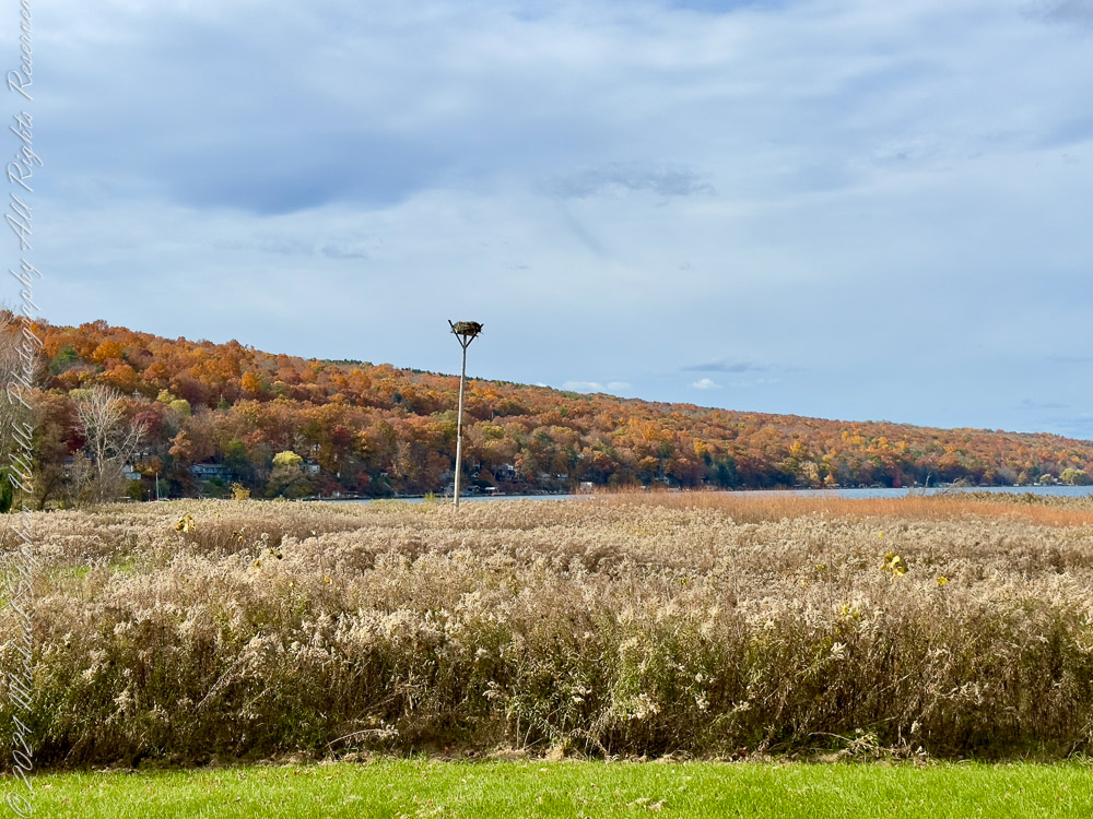
In Autumn 2024, the Treman Park Lake Loop of the Cayuga Waterfront Trail in Ithaca, New York, unfurled a vibrant display of seasonal transition. The natural landscape, adorned with fiery hues of reds, oranges, and yellows, reflected in the rippling waters of Cayuga Lake, creating a harmony of color and light. This is a scenic journey through stories of plant and animal life that call this place home—including the majestic Osprey (Pandion haliaetus) that nests along the shore.
The Osprey’s Watchtower
A sight to greet visitors is the solitary osprey nest perched high on a pole. Used by Osprey families during their breeding season, this nest stands as a testament to their remarkable recovery in the Finger Lakes region. Ospreys, once declining due to pesticide use, have rebounded significantly following conservation efforts.
With a wingspan of up to 6 feet, these raptors are expert fish hunters, often seen diving talons-first into the lake to snatch their prey. During autumn, as their young take flight, the nest remains an empty marker of the summer’s success—a reminder of the cyclical nature of life along the lake.
Did You Know? Ospreys are often referred to as “fish hawks” because fish make up 99% of their diet.
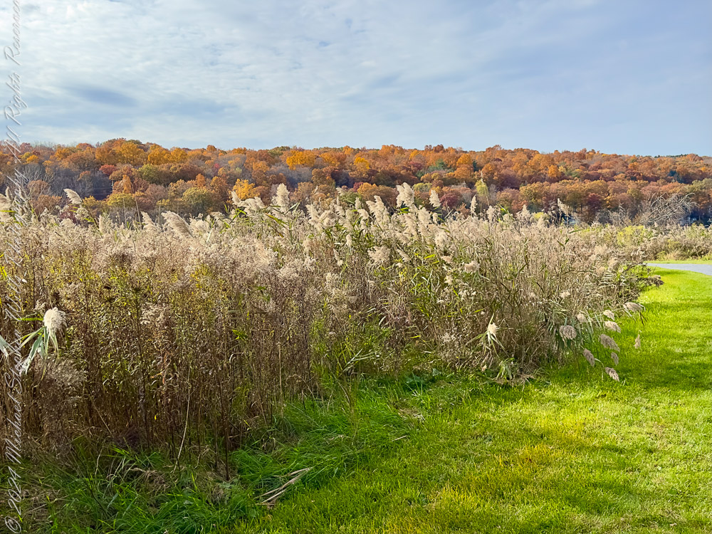
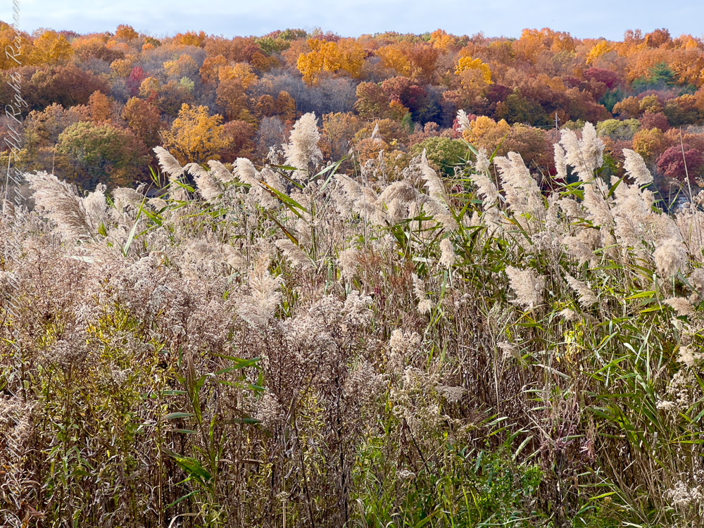
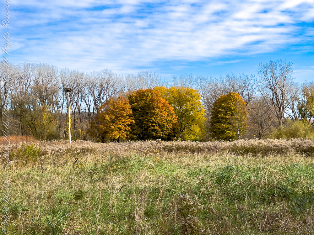
The Meadow and Its Golden Touch: Reedbeds and Goldenrod
Surrounding the osprey pole, expansive meadows of grasses and reeds sway with the breeze. Among these are stands of Common Reed (Phragmites australis), a tall grass with feathery plumes that catch the sunlight. While Phragmites can sometimes be invasive, they provide crucial shelter and food for various species of birds and insects.
Intermixed with the reeds are patches of Goldenrod (Solidago spp.), whose bright yellow flowers are a signature of late summer and autumn in the Northeast. Goldenrods are critical for pollinators, offering nectar to bees, butterflies, and migrating insects like the Monarch butterfly (Danaus plexippus).
Ecological Note: Goldenrods are often mistakenly blamed for allergies; the real culprit is ragweed (Ambrosia artemisiifolia), which blooms at the same time but releases airborne pollen.
A Lake Alive with History and Beauty
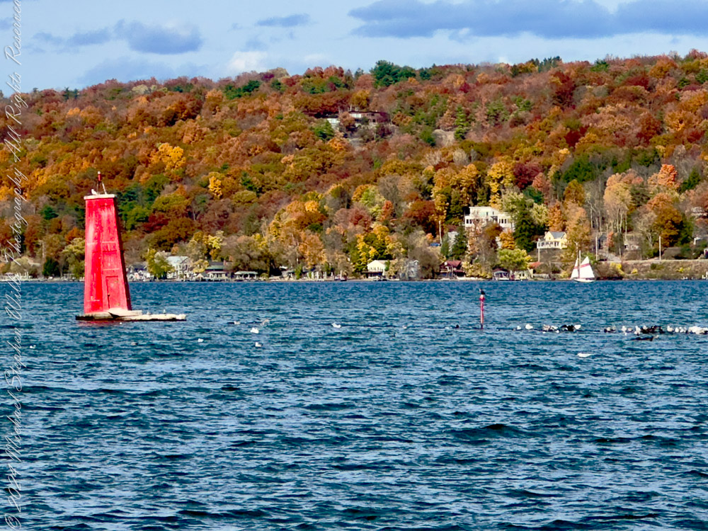
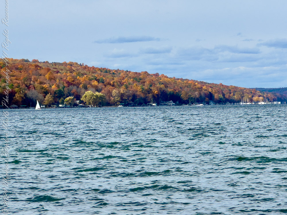
The shimmering blue waters of Cayuga Lake form the centerpiece of this trail. The lake, stretching nearly 40 miles, is the longest of the Finger Lakes and steeped in geological and cultural history. Its name is derived from the Cayuga Nation, part of the Haudenosaunee Confederacy, who inhabited the region for centuries.
The striking red lighthouse in the water serves as a vivid counterpoint to the natural surroundings. Built to aid navigation, it now stands as a picturesque focal point for photographers and nature enthusiasts alike.
Cayuga Inlet Light Beacon
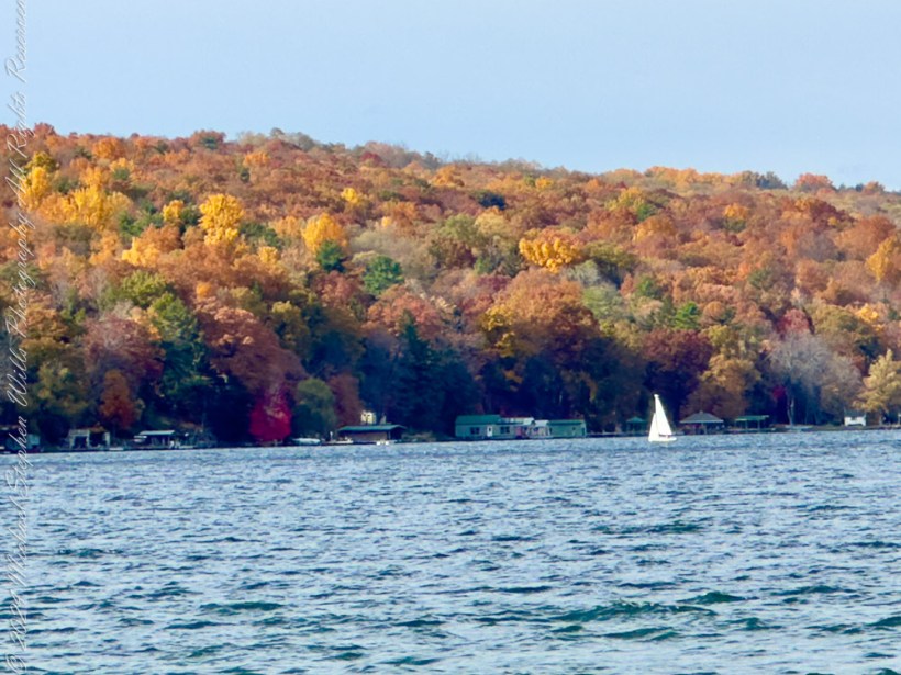
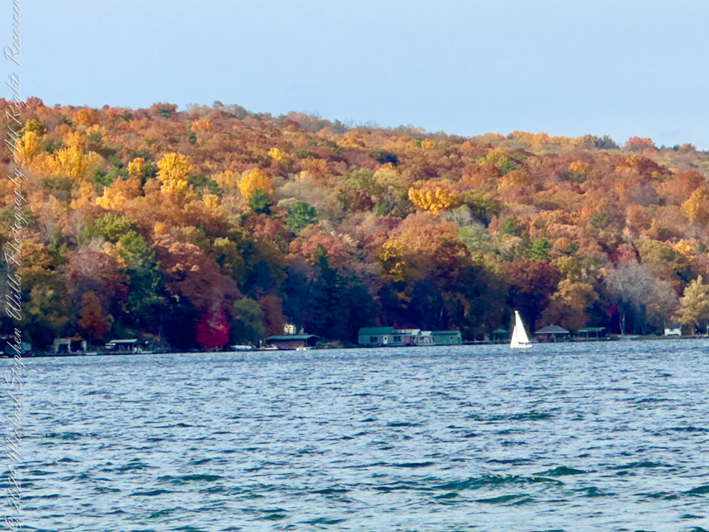
In the distance, a sailboat glides across the lake—a serene reminder of the recreational draw that Cayuga Lake holds year-round.
West shore with sailboat and lake houses
The Forest Fringe: A Kaleidoscope of Color
The forests that fringe the meadow and the lake present an explosion of autumn color. Trees such as Sugar Maple (Acer saccharum), Red Oak (Quercus rubra), and Black Cherry (Prunus serotina) dominate the canopy, their leaves transforming into brilliant oranges, scarlets, and deep burgundies. The Sugar Maple, in particular, is renowned for its vibrant golden-orange foliage, a hallmark of the northeastern fall.
The Ithaca Yacht Club lies south of Maplewood Point
Closer to the ground, the understory hums with the activity of migrating birds and foraging mammals. Squirrels can be seen gathering acorns, preparing for the winter months ahead, while chickadees flit among the branches, calling their cheerful “fee-bee” notes.
Historical Fact: The Finger Lakes were carved out by retreating glaciers over 10,000 years ago, leaving behind these deep, elongated lakes and fertile soil that supports rich biodiversity.
A Path Through Time and Nature
Walking the Treman Park Lake Loop is a sensory journey—the crispness of the autumn air, the rustling of reeds, and the rhythmic lapping of waves against the shore combine to evoke a timeless tranquility.
From the vibrant meadows to the osprey’s lofty perch and the quiet expanse of Cayuga Lake, this section of the Waterfront Trail encapsulates the beauty and diversity of the Finger Lakes ecosystem. Whether for quiet reflection or active exploration, it remains a treasured destination in every season.
Closing Thoughts
As autumn deepens, this landscape prepares for the dormancy of winter. Yet the stories it holds—from the osprey’s nest to the goldenrod’s bloom—remain alive, waiting to be rediscovered with each new season. The Treman Park Lake Loop is not just a trail; it is a canvas of life, change, and history painted by nature’s hand.
Reflection: To walk this trail is to connect with a land shaped by glaciers, nurtured by waters, and home to countless species that continue to thrive amid the ever-turning wheel of the seasons.
Enter your email to receive notification of future postings. I will not sell or share your email address.
Copyright 2024 All Rights Reserved Michael Stephen Wills
The Cayuga Waterfront Trail beautifully showcases autumn’s colors, history, and ecological significance through its landscapes and trees like Sugar Maples.
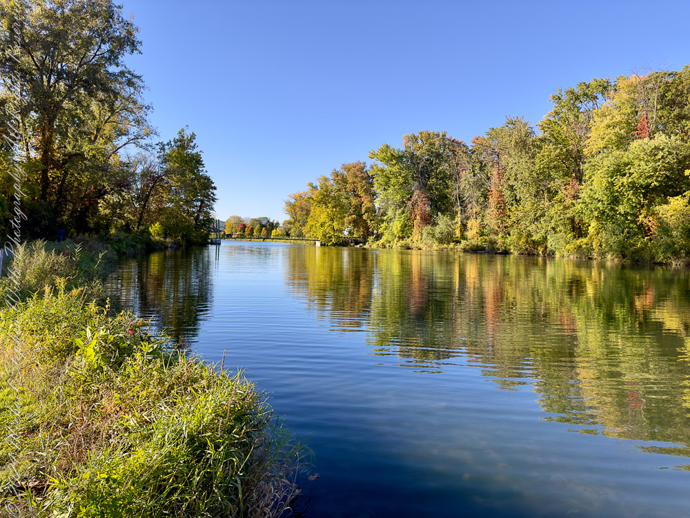
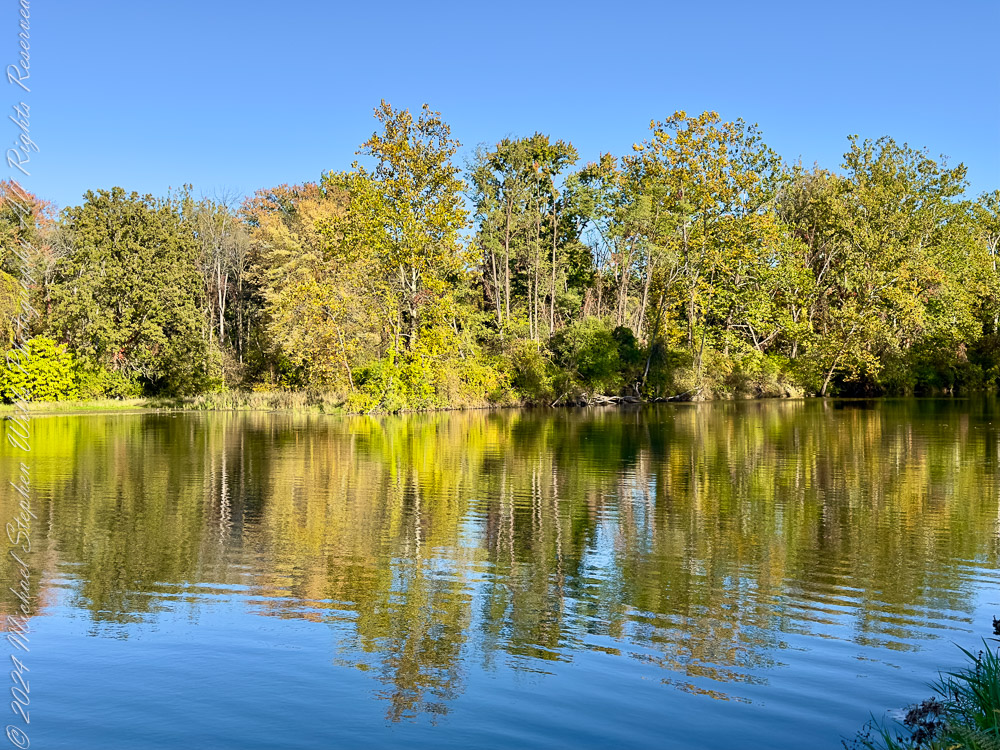
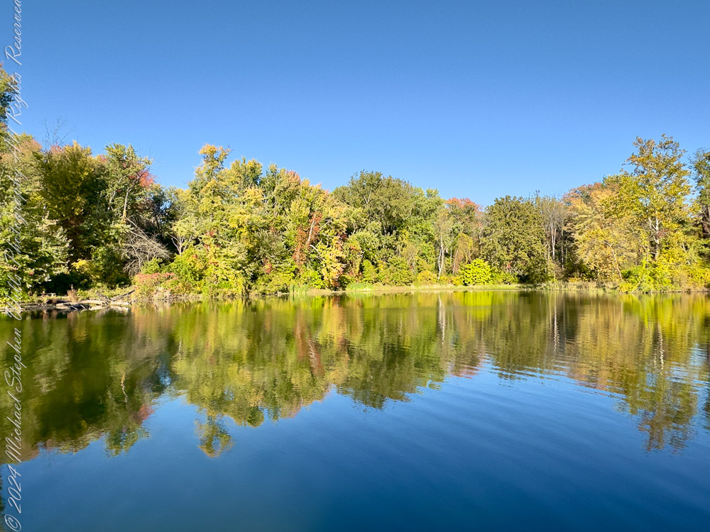
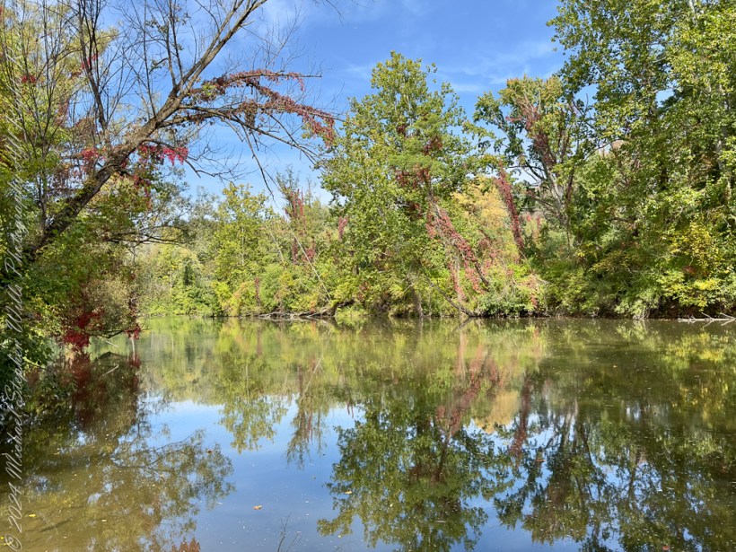
Where Fall Creek Meets Cayuga Lake Here, where Fall Creek flows gently into Cayuga Lake, the merging waters reflect the season’s colors like a painter’s palette. Across the shimmering surface, Renwick Woods of Stewart Park stands as a quiet sanctuary of mixed hardwoods and wetlands. The reflections capture our trees together with the essence of autumn’s stillness.
Dominating the shoreline, you can spot Silver Maple (Acer saccharinum) and Cottonwood (Populus deltoides), trees that thrive in damp soils. Silver Maples, with their elegant, deeply lobed leaves, are perfectly suited for this riparian environment. The cottonwood, recognizable by its broad, triangular leaves, plays a vital role in stabilizing streambanks.
Quick Fact: Cottonwoods are among the fastest-growing trees in North America, capable of sprouting leaves within weeks of being washed ashore as driftwood.
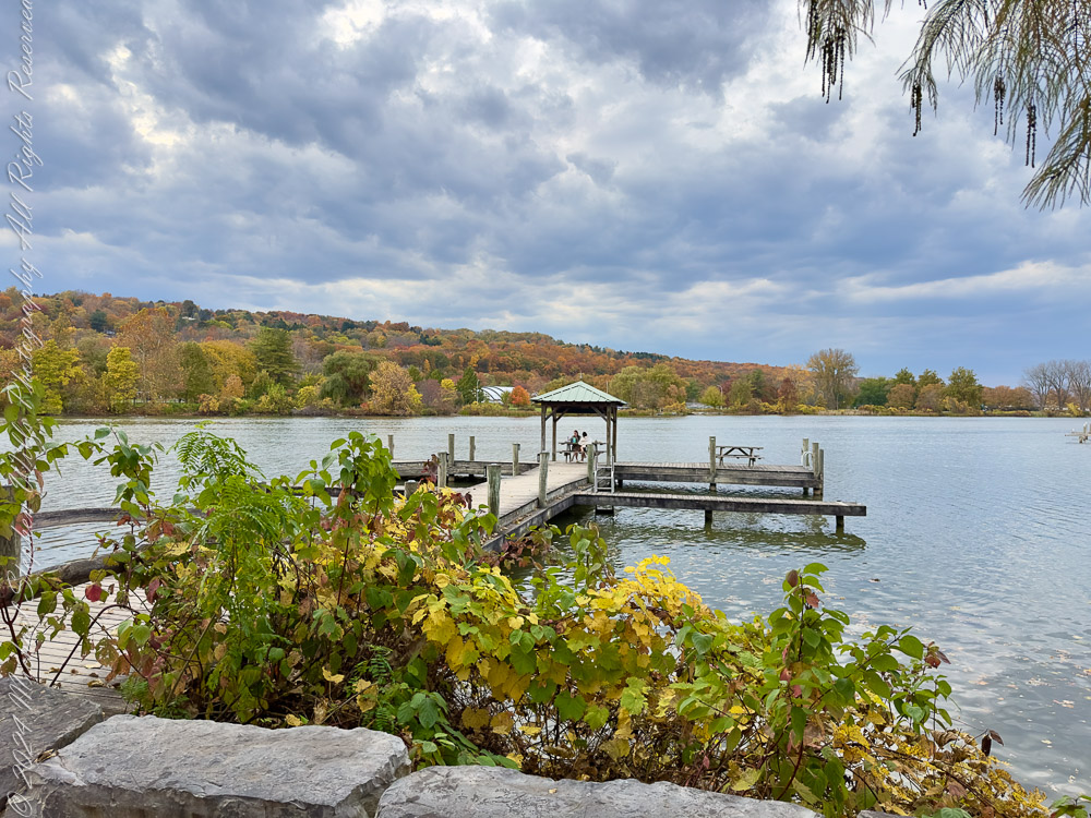
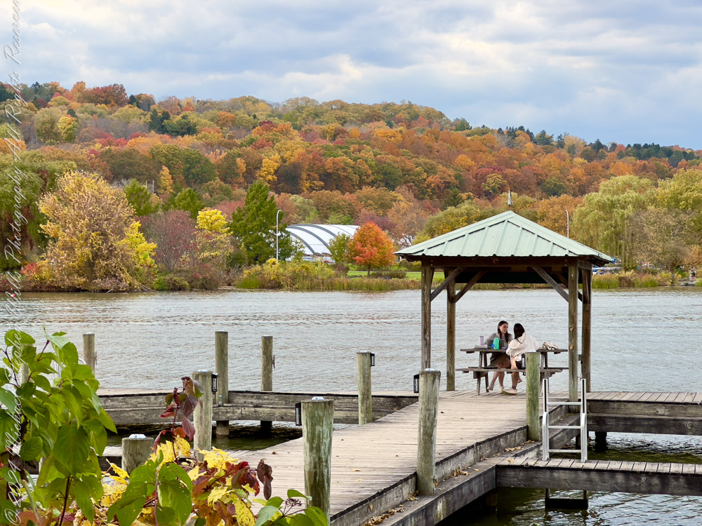
Steamboat Landing: A Glimpse of History The wooden docks at Steamboat Landing, now home to the bustling Ithaca Farmer’s Market, speak of bygone eras when steamboats ferried goods and people across Cayuga Lake. Today, as golden foliage cloaks the hills in the distance, this spot remains an anchor for community and connection.
A meeting place for friends and conversation
Foregrounded in the photos are plants like Grape Vine (Vitis spp.), with their sprawling, hardy stems turning yellow as temperatures drop. Grapevines, both wild and cultivated, thrive along the lakeshore and remind us of their agricultural importance in the Finger Lakes.
Also visible are some shrubs of Virginia Creeper (Parthenocissus quinquefolia) turning crimson, their vibrant hues climbing posts and fences as they embrace autumn’s spotlight.
Did You Know? Steamboat Landing was part of Ithaca’s rich lake commerce history during the 19th and early 20th centuries, connecting travelers to destinations far and wide.
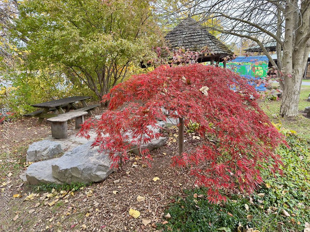
The Crimson Canopy: Japanese Maple This photo highlights a stunning Japanese Maple (Acer palmatum), its feathery, scarlet foliage cascading delicately in front of the pavilion. Native to East Asia, Japanese Maples have found a beloved place in landscapes across the world for their graceful form and brilliant seasonal displays.
Alongside its boughs, weathered benches and stone pathways invite rest and reflection — a beautiful marriage of human craftsmanship and nature’s artistry.
Fun Fact: Japanese Maples are often pruned meticulously in Japanese gardens to emphasize their architectural shape, turning them into living sculptures.
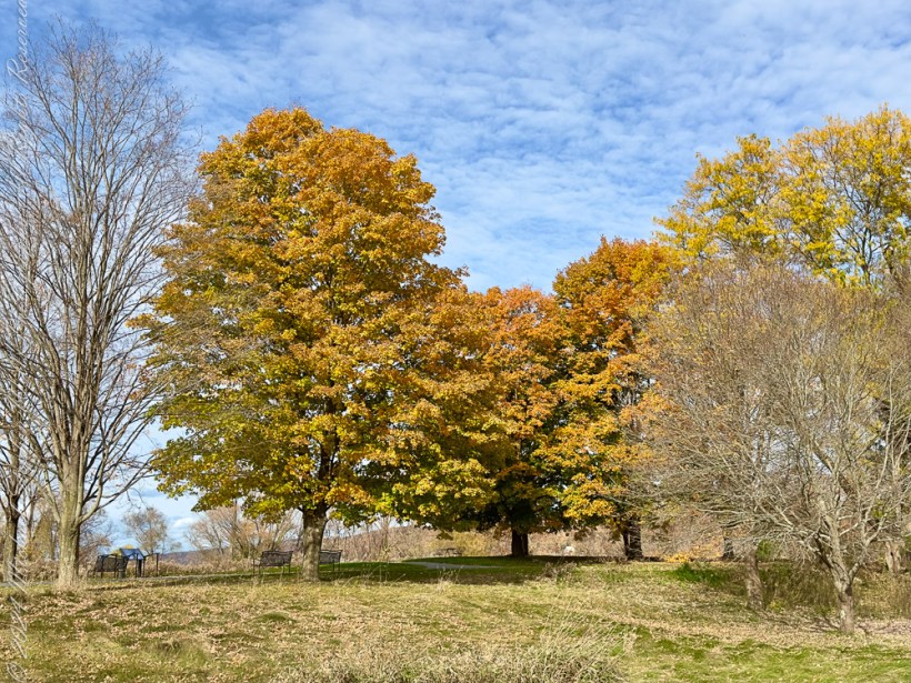
The Treman Park Lake Loop: Autumn’s Golden Finale Our journey concludes with this sweeping landscape from the Treman Park Lake Loop. The towering Sugar Maples (Acer saccharum) dominate the view, their crowns now a rich, golden orange — a signature of northeastern forests. Known as the tree that gives us maple syrup, Sugar Maples are quintessential symbols of autumn in the Finger Lakes.
To the right, bare branches of earlier-shedding trees stand in contrast, whispering the arrival of winter. The sky above, painted with soft clouds, completes the scene of a serene seasonal transition.
Interesting Note: Sugar Maples can live for over 300 years, their wood prized for furniture and instruments, and their sap a sweet gift of the forest.
Closing Thoughts From the quiet confluence of Fall Creek and Cayuga Lake to the historic docks of Steamboat Landing and the golden maples of Treman Park, autumn on the Cayuga Waterfront Trail is a symphony of color, history, and ecological wonder. Whether you’re strolling, photographing, or simply pausing to take it all in, these moments capture both the grandeur and subtlety of the season.
Enter your email to receive notification of future postings. I will not sell or share your email address.
Copyright 2024 All Rights Reserved Michael Stephen Wills
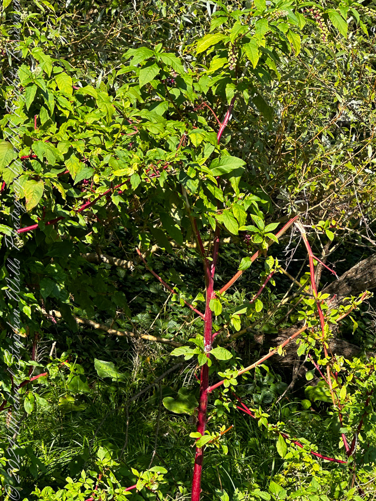
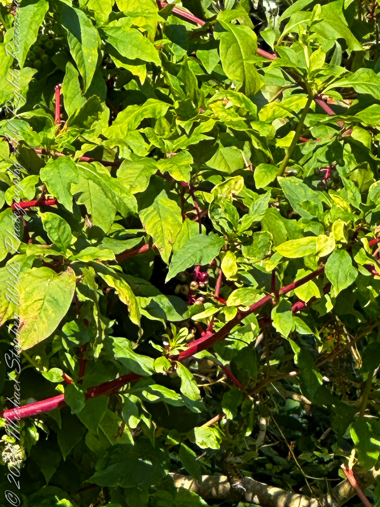
Our explorations along Ithaca’s Cayuga Waterfront Trail begins with the striking Pokeweed (Phytolacca americana), its ruby-red stems rising like sentinels against a sea of green leaves. At a glance, it’s bold, almost tropical, yet this native plant is a quintessential autumn feature in the Northeast. Those drooping clusters of berries (not yet ripe here) are food for birds like robins and mourning doves — though toxic to us, pokeweed adds a bit of danger to its beauty.
Nature’s Note: While visually stunning, pokeweed’s ripe purple berries were historically used as dye. Early settlers and Native Americans knew its power, though caution is always the rule here!
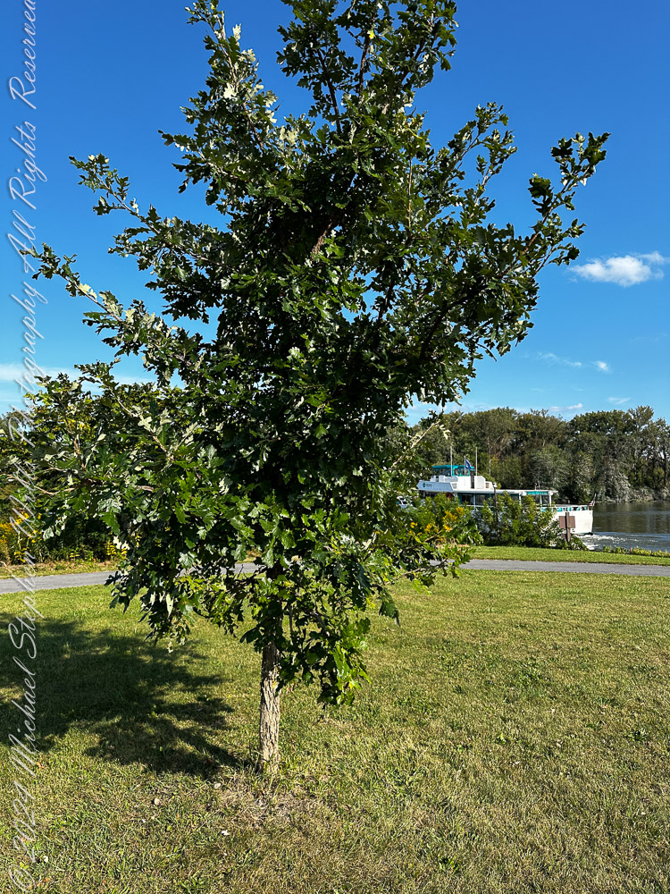
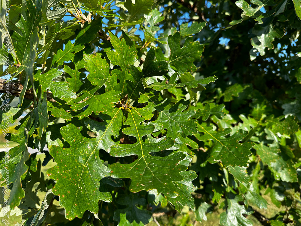
The Mighty Oak: Sentinel of the Trail
Next, we imnagine the cool shade of an oak tree, its lobed leaves silhouetted like green lacework against the clear blue sky. The photogenic Oaks are ecosystem powerhouses. Supporting hundreds of species of moths, butterflies, and birds, oaks quietly hold the fabric of nature together.
In autumn, these leaves will transform, dropping gently to create warm beds for overwintering insects. Stand beneath its branches long enough, and you’ll swear it whispers stories of the seasons gone by.
Quick Fact: Oaks produce acorns that are a favorite food of squirrels. Ever notice a squirrel “planting” them? That’s nature’s accidental reforestation plan in action.
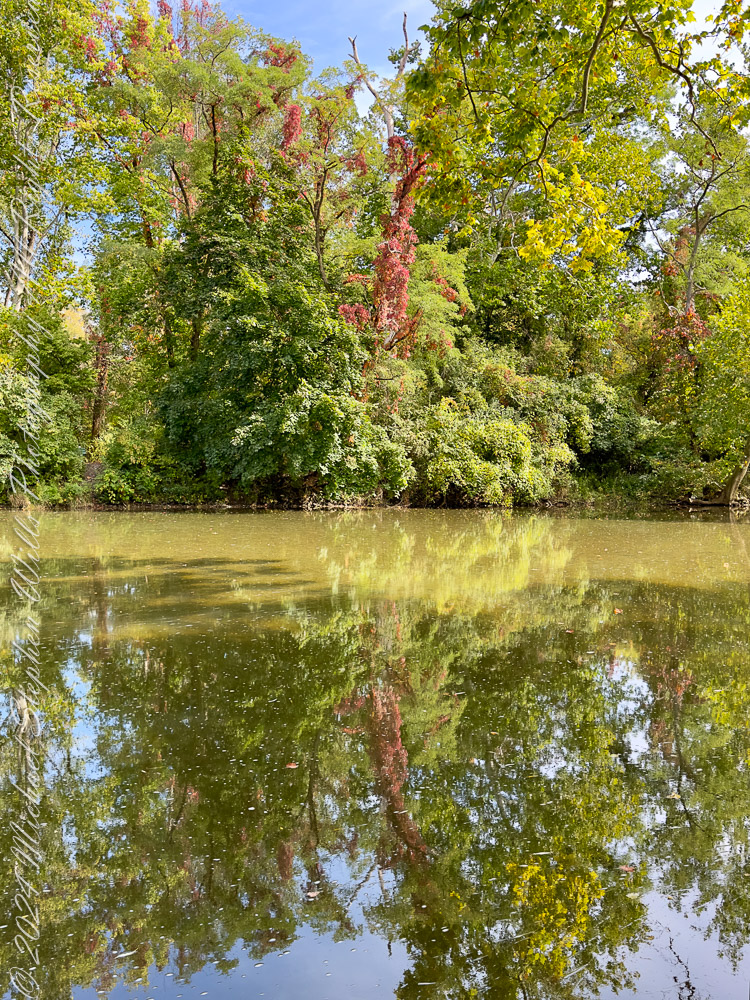
Reflections of Autumn’s Palette
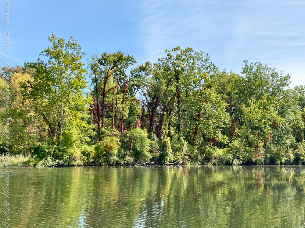
We reach the water’s edge, where the serene surface where Fall Creek joins Cayuga Lake mirrors the fiery splashes of red Virginia Creeper (Parthenocissus quinquefolia) winding through the trees. This climbing vine, with its scarlet fall foliage, is like nature’s ribbon tying the forest together.
The reflection — a perfect painting — blurs the boundary between land and water. Here, quiet reigns, save for the soft ripple of a fish or the rustle of leaves overhead.
Curious Note: Virginia Creeper is often mistaken for poison ivy. The secret? Virginia Creeper has five leaflets, while poison ivy wears three — nature’s rhyme: “Leaves of three, let it be.”
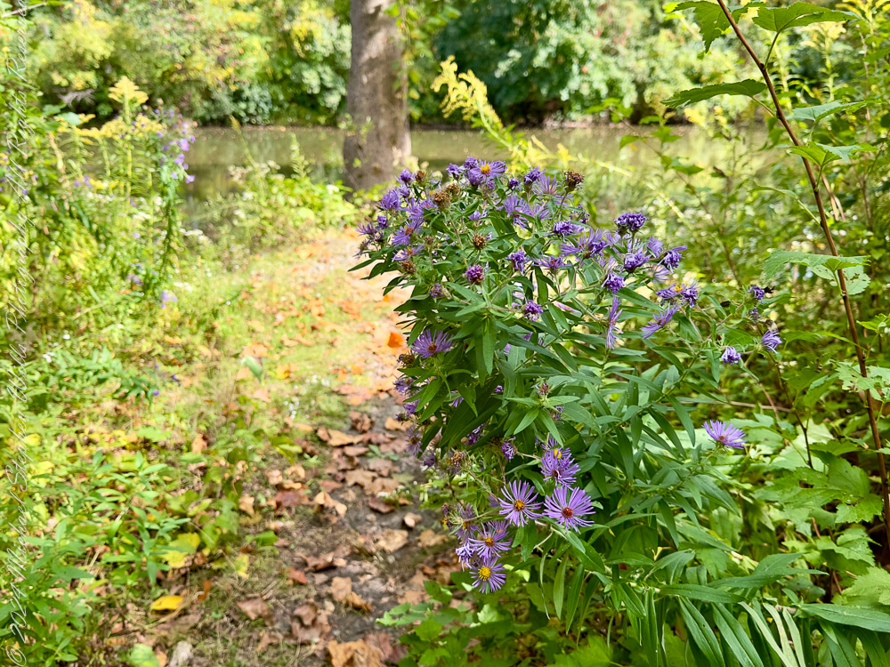
Aster Alley: A Burst of Purple Beauty
On the trail’s side, a cheerful gathering of New England Asters (Symphyotrichum novae-angliae) steals the spotlight. These vibrant purple flowers, with their golden centers, are late-season treasures. As most blooms fade, asters feed pollinators like bees and butterflies in their final push before winter.
Walk by slowly, and you might catch a bumblebee lazily humming its thanks — a last sip of nectar before the chill sets in.
Did You Know? Asters get their name from the Greek word for star. Fitting, don’t you think?
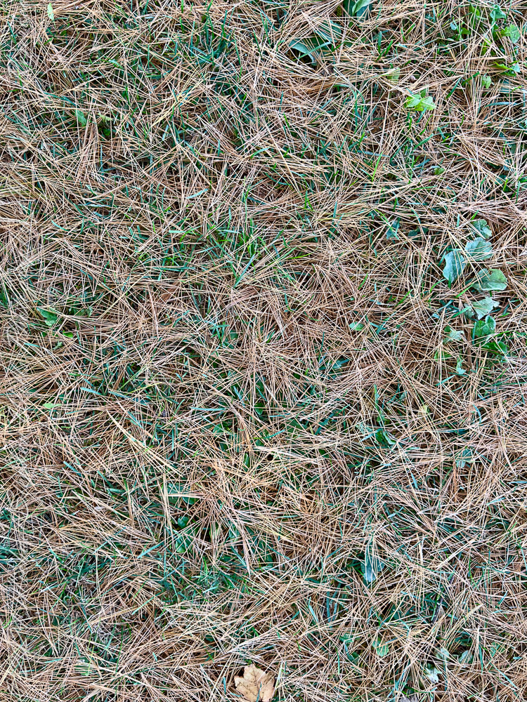
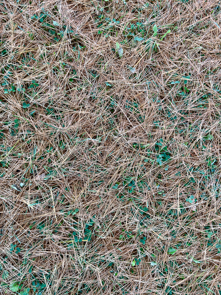
Nature’s Quilt: Pine Needle Carpet
Finally, we tread across a textured carpet of pine needles, blanketing the ground in warm, earthy hues. Beneath this seemingly simple scene lies a story of renewal. As pines shed their needles, they enrich the soil with organic matter, providing a soft bed for new life to sprout in the spring.
The crunch underfoot feels both nostalgic and meditative — a gentle reminder that every fallen needle is part of nature’s endless cycle.
Fun Observation: Pine needles, often called “nature’s mulch,” are slightly acidic, which helps pine trees thrive while keeping competition at bay.
Closing Thoughts
From the bold reds of pokeweed to the mirrored waters adorned with Virginia Creeper, and the twinkle of asters amid the foliage, autumn along the Cayuga Waterfront Trail is a celebration of nature’s resilience and beauty. It’s a quiet reminder that even as the seasons shift, the world remains vibrant — a living, breathing tapestry stitched together by trees, plants, and reflections.
So, walk slowly, listen closely, and let the stories of leaves, stems, and waters guide your journey.
Enter your email to receive notification of future postings. I will not sell or share your email address.
Copyright 2024 All Rights Reserved Michael Stephen Wills