
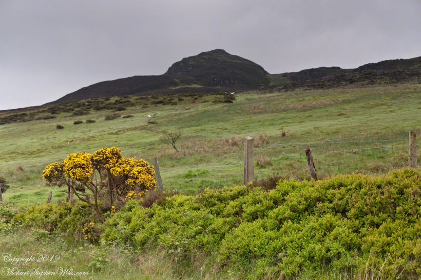
On the slopes of Slievenaglogh
One white horse
One white horse

Looking east
This the fifth and final of a series of landscape photographs taken from this position.

The peak is named, in the English language, Slievenaglogh. It is so strange as it’s not English, being instead a transliteration of the Irish name “Sliabh na gCloch.” This is “Rock Mountain” translated literally. Slievenaglogh is carried to the townland, a long thin swath of land being the peak and associated ridge-line.
The rocks up there are called “gabbro,” a type of magma slowly cooled under ground. Slievenaglog, Slieve Foy across the valley, and the Morne mountains all formed within volcano magma chamber(s) of the Paleocene, 66 million years ago, a time associated with extensive volcanism and the Cretaceous–Paleogene extinction event that gave rise to the current age.
Our younger cousin has been up there, optimistically we left it for a later trip.


A photographer and his audience
One May early morning two white horses come down from a sloping pasture on Slievenaglogh to view an interloper taking photographs. Slievenaglogh Townland, County Louth, Ireland.
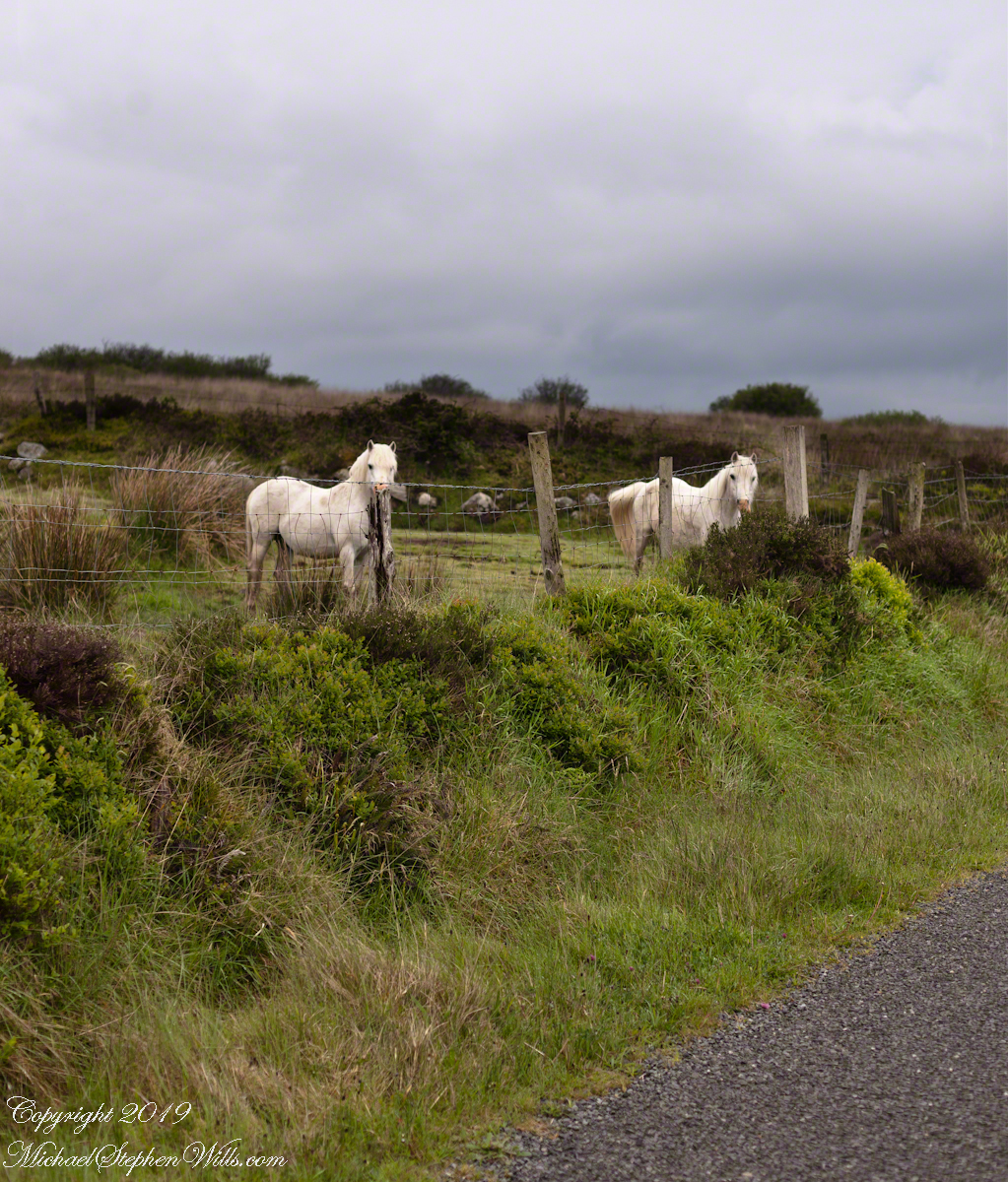
Slievenaglogh Townland, County Louth, Ireland.
This I used the Canon EF 50mm f/1.4 USM lens. It is two shots, the first in horizontal, the second in vertical mode.
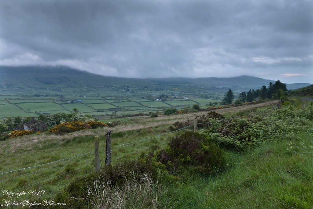
A Cooley Peninsula Valley on a May Morning
On the northeast slope of Slievenaglogh peak (Irish: Sliabh na gCloch) on the road from Mullaghattin Townland to Riverstown. This day I swapped lenses and took in the same general direction for each. This is the first and last of a series using the Canon EF 50mm f/1.4 USM lens and I pulled in the shots from the Canon 24mm f1.4 L II USM lens, published in previous posts.

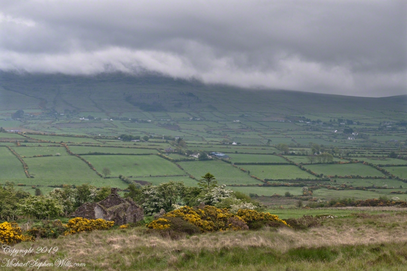
Here we look northeast from the Slievenaglogh Townland over the valley between Slievenaglogh and Slieve Foy peaks. Slieve Foy is the far ridge lost in clouds.
This is the first and last of a series using the Canon EF 50mm f/1.4 USM lens.


The view includes Little River, Castletown River, Ballycoly and Glenmore Townlands. Adjacent is a sheep pasture with a farm ruin behind the yellow flowered gorse (Whin bush, scientific name Ulex).
Early morning, late May 2014.
