Among the Trees: Encountering Treman State Park’s Enfield Falls in Autumn

For years, I admired a distant waterfall on Enfield Creek. This autumn, a newly discovered path revealed its hidden beauty, cascading waters, and remarkable geological character.

From a distance, the waterfall is a glimmer among the trees. Across a broad stretch of grasses and low shrubs, Enfield Creek folds into a wooded hollow, where water tumbled over a series of rock ledges. In autumn, the surrounding trees offered glimpses of orange and gold, while the darker evergreens stood behind them. The falls were there, unmistakable once I knew where to look, but the distance concealed much of their character.
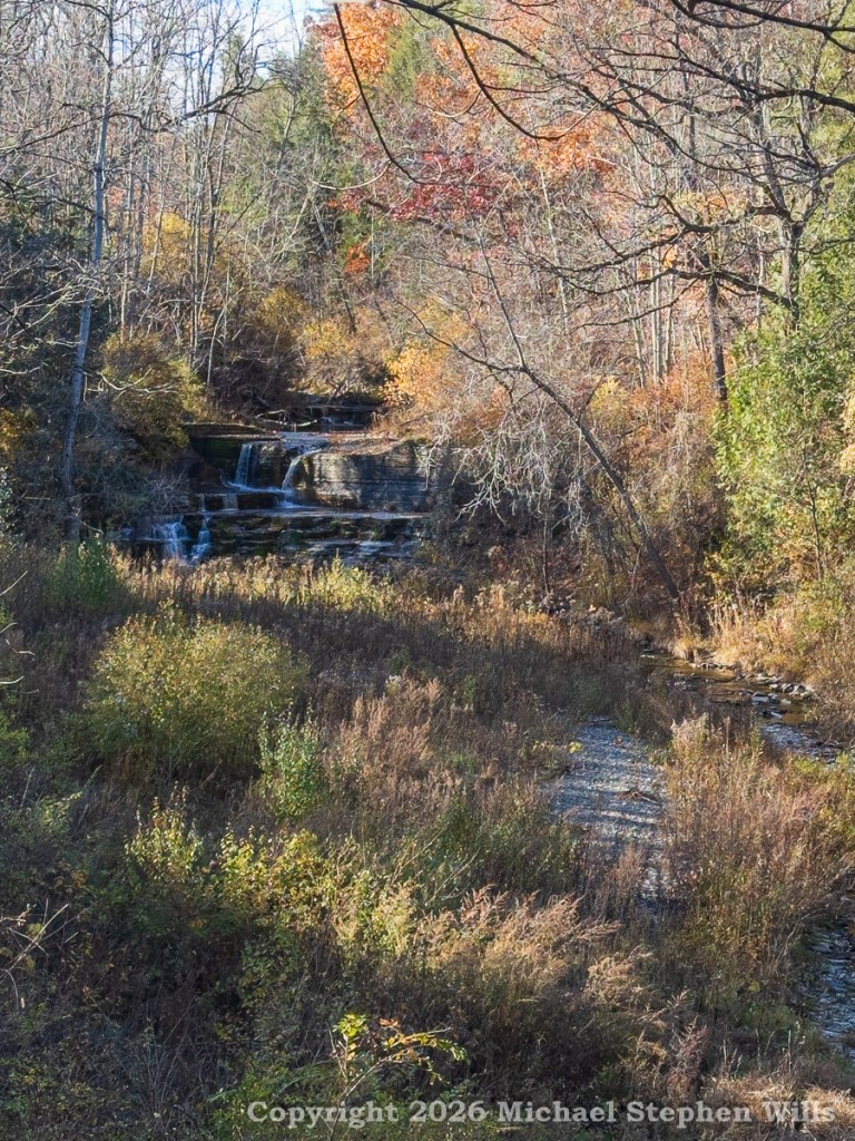
Small waterfall flowing through an autumn forest surrounded by colorful foliage and tall grasses

For years, I stopped to admire this scene in Robert H. Treman State Park, above the place where Enfield Creek and Fish Creek meet. Sometimes I photographed it, hoping to capture the waterfall through the tangle of branches. The view changed with the seasons. Summer foliage nearly swallowed the creek. Autumn opened the scene, revealing the pale ribbons of falling water. Even then, the falls remained frustratingly remote, unmarked, unnamed on all the maps.

I wondered what they looked like up close. From my usual vantage point, I could make out several drops, but not their arrangement. Nor could I see much of the rock formations that shaped them. I had explored other parts of Treman Park many times, yet this particular stretch of Enfield Creek remained unfamiliar.

That changed this autumn of 2026 when I noticed what appeared to be a path leading toward the creek. I had overlooked it on previous walks, perhaps because it was tucked out of the way, vegetation had obscured the opening. On that autumn afternoon curiosity won out. I followed the path, making my way toward the sound of water.

I followed little more than a deer trail, untended, and found the familiar distant view gave way to something entirely different. The stream became louder, and through the trees I began to distinguish the individual cascades. What had appeared from afar as a modest waterfall was a much more elaborate arrangement of ledges, pools, and falling water.

I had finally reached the place I had been photographing for years.

After several weeks of low rainfall the falls divided into two separate streams. On the left, water spread across the lip of a broad rock shelf before dropping in a nearly vertical curtain. To the right, a narrower, more concentrated flow swept over another edge, its smooth white column standing out against the dark, moss-covered stone.
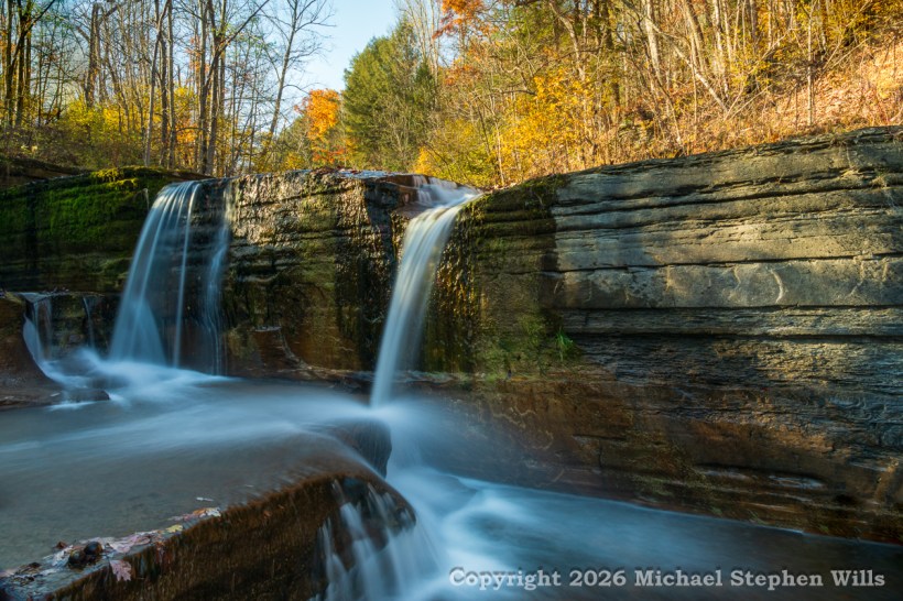
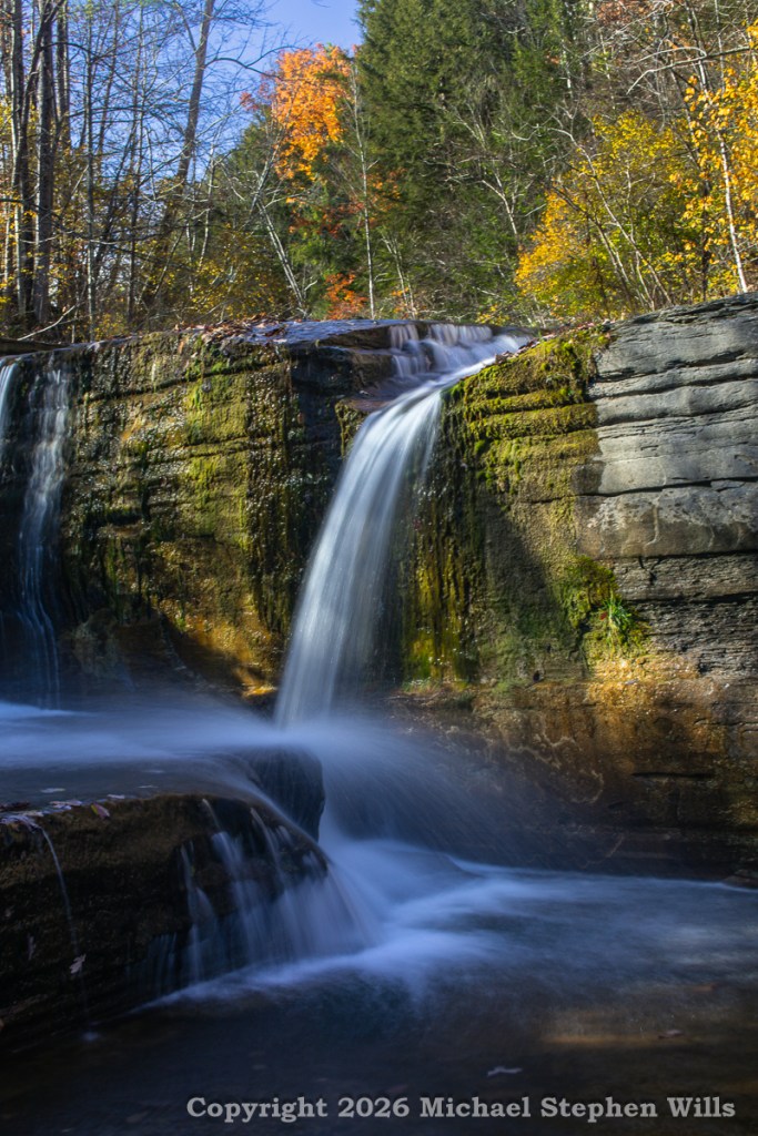
Twin waterfalls flowing over layered rock ledges in an autumn forest
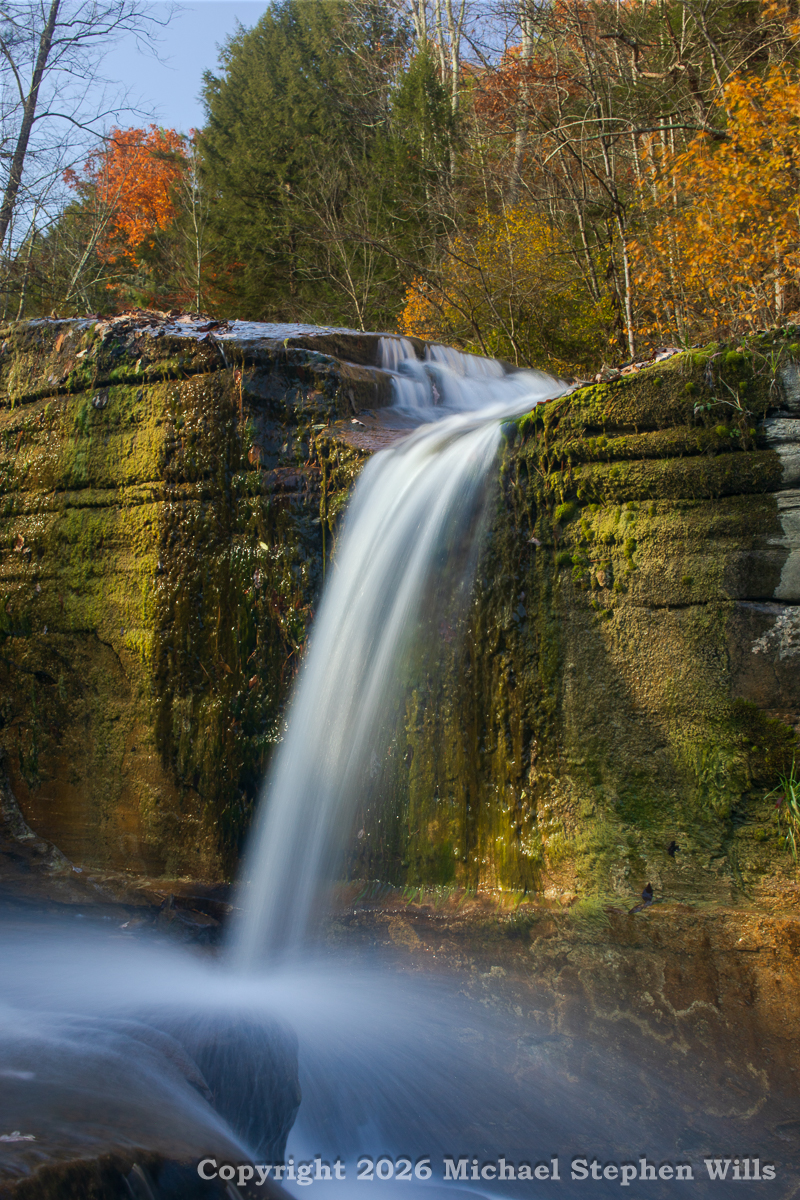
Waterfall cascading over moss-covered rock ledges in an autumn forest

Below, the two streams entered a shallow pool before spilling over yet another ledge. Water moved through this little basin in several directions, finding channels along the irregular rock surfaces. Standing nearby, I could appreciate something the distant view had never revealed: the falls were not a single event, but a succession of them.
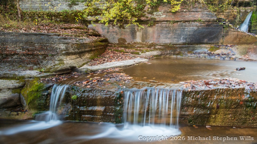
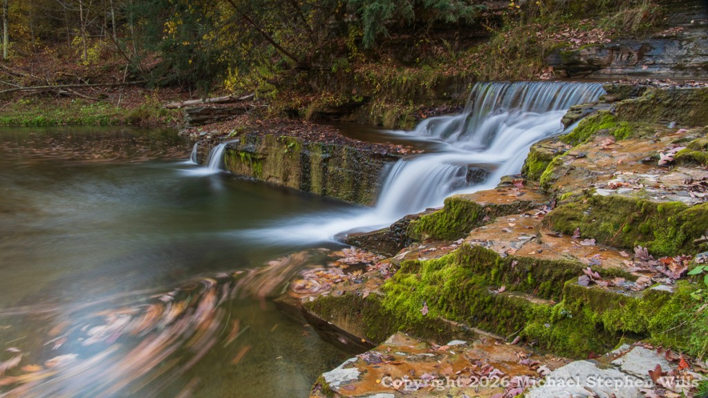
The rock itself deserved attention. Horizontal layers, exposed by the cutting action of Enfield Creek, formed a substantial wall beside the falls. Some surfaces were dark with moisture; others caught the afternoon sunlight. Moss occupied the wetter sections, especially where water seeped down the stone. A few small plants had established themselves in narrow crevices.
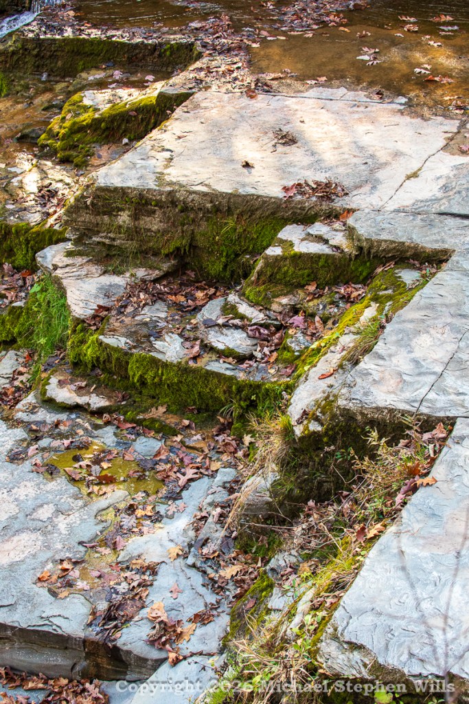
Ancient, horizontally layered sedimentary rock, intersected by angular joints formed under tectonic stress.

Above the falls, the trees were well into their autumn transformation. Golden leaves brightened the upper slopes, while a few brilliant orange crowns stood against the deep green of the conifers. Many branches were already bare. Sunlight reached through them to illuminate portions of the rock face, leaving the lower pool in shadow.

I settled into photographing the falls, trying different compositions and lenses. The long exposures transformed the rushing water into flowing white veils. In one frame, I concentrated on the right-hand cascade. In another, I included both upper falls and the lower spillway, allowing the water to lead the eye through the picture. The vertical compositions emphasized the succession of drops, while the wider view revealed the broad, layered rock wall.
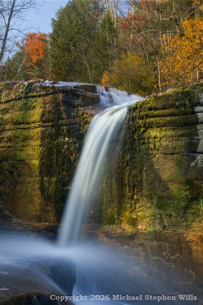
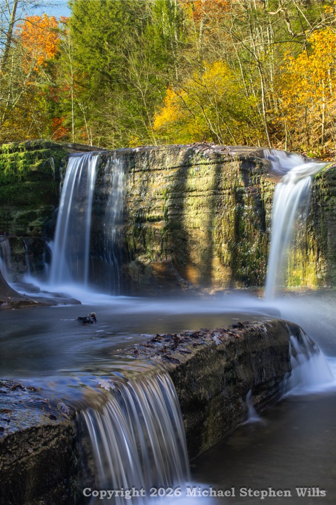
Long-exposure waterfall cascading over moss-covered rocks in an autumn forest
Multi-tiered waterfall flowing over moss-covered rock ledges in an autumn forest

There was also human history close at hand. During the nineteenth century, this part of the park belonged to the thriving hamlet of Enfield Falls. Mills, houses, a hotel, and other businesses once occupied the surrounding landscape. Cornell archaeologists have excavated nearby sites, uncovering foundations and household artifacts that preserve details of that vanished community.
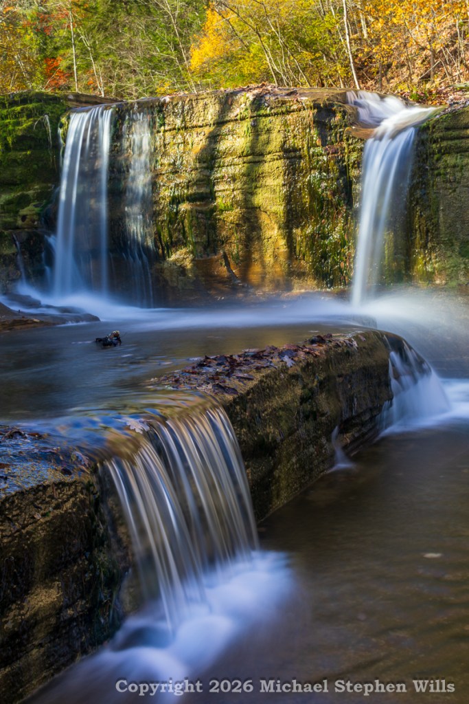
Long-exposure view of cascading waterfalls over moss-covered rock ledges in an autumn forest

I thought about those earlier residents, whose daily lives unfolded beside these same creeks. They depended upon the water for work, while visitors came to admire the scenery. The wooded landscape I know today was once more settled place, these falls echoed in their homes. Possibly the hamlet, Enfield Falls, was named after these; now unnamed, unremarked
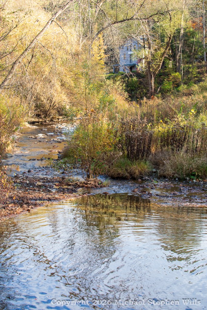
Eventually, I returned along the path, pleased to have discovered a new perspective on a familiar landscape. The waterfall had not changed, of course. It had been flowing over those ledges throughout all the years I stood at a distance, wondering what lay beyond the trees.
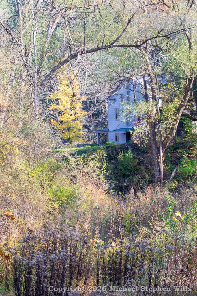
What had changed was my experience of it. I still appreciate that distant view, with the falls tucked into the autumn woods. Now, however, I know the details hidden within it: the twin curtains of water, the moss-covered ledges, the shallow pool, and the final cascade spilling toward the creek below.

After so many years of looking, it was a pleasure simply to have found my way there.
Click me to visit Michael Stephen Wills Online Finger Lakes Photography

Enter your email to receive notification of future postings. I will not sell or share your email address.

Drombeg Fulacht Fiadh: A Journey Through History

Join Mike and Pam at Drombeg Stone Circle to explore stone hut remains and a mysterious hearth beside the Fulacht Fiadh in Ireland’s green landscape.

A narrow path, a handful of low stone walls, and small white flowers scattered through the grass: the photographs of our exploration at Drombeg preserve details that invite a closer look. Beside the Fulacht Fiadh, two adjoining huts survive as outlines in the ground. Exploring this part of the site with my wife, Pam, gives me a way to think about the people behind the stones, even when so much of their story remains beyond our reach.

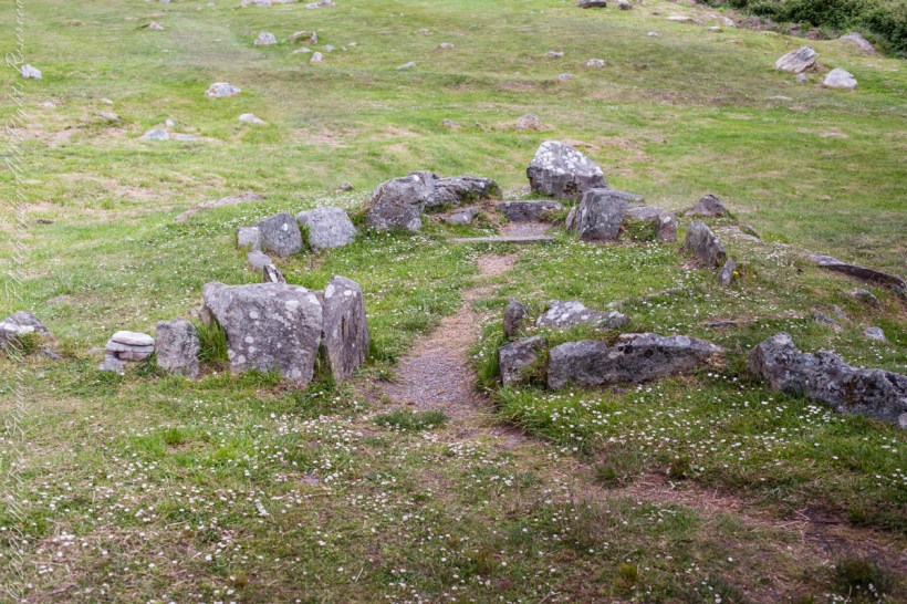
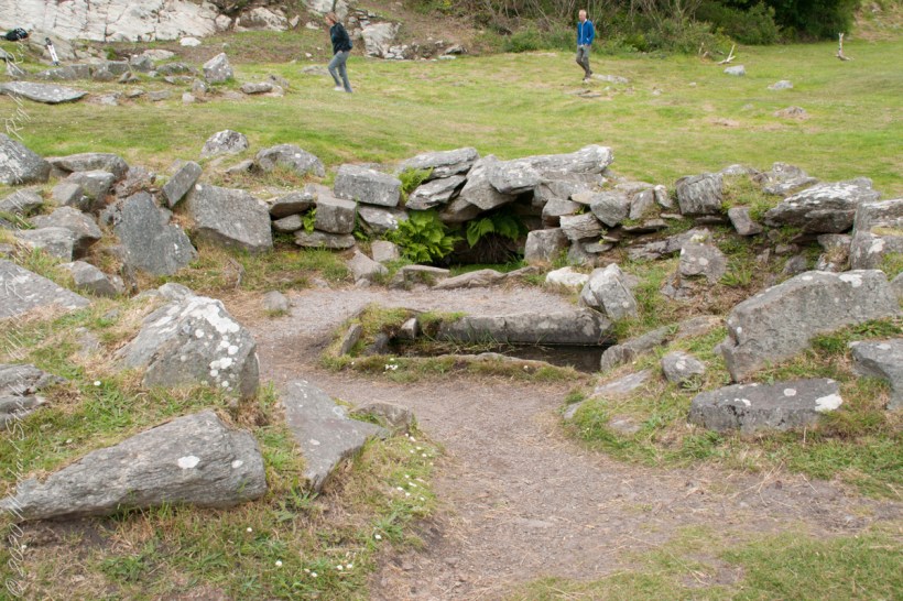
Approach to Hut A

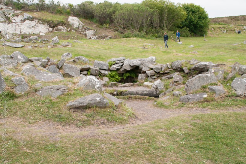
The first photograph, one of the huts, draws the eye along a worn strip of earth toward an opening between upright stones. Beyond it, the hut’s curved boundary gathers a patch of grass into something recognizable as a space. Some stones stand prominently; others barely rise above the turf. Pale lichen marks their faces. Small flowers grow around their bases, softening the edges without quite concealing the arrangement.

Looking at that opening, I imagine the simple act of entering. It is an ordinary movement, one Pam and I have made through countless doorways together. Here, the surviving stones give that familiar action an unfamiliar setting. What would it have meant to cross this threshold when the hut was in use? The photograph cannot answer, but it makes the question feel close enough to linger over.

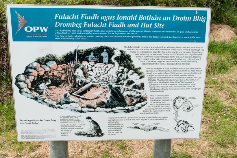
Drombeg Fulacht Fiadh and Hut Site The fulacht fiadh, which is an ancient cooking place and adjacent hut sites probably date to the Bronze Age and may have been in use at the same time as the nearby stone circle.
The fulacht fiadh consists of a trough with an adjoining hearth and well, which are all enclosed by a low stone bank with an entrance to the south. Water in the trough was heated by rolling stones heated by fire in the hearth, into the water. Experiments conducted during excavation of the site in 1957 showed that 70 gallons (318 litres) of cold water could be brought to the boil in 18 minutes. Meat was then cooked in the water which remained sufficiently hot for almost 3 hours. Alternative suggested uses for fulachta fiadha are bathing, industrial activities such as dyeing and even brewing!
One of the conjoined huts contains a stone-lined feature interpreted as a roasting oven which suggests that the huts may have had a food processing function similar to that of the nearby fulacht fiadh. A pathway links both.
A stone saddle quern – used for grinding grain – was found over a drain in the cooking place but probably originated from one of the huts.
Drombeg—from An Drom Beag
(the Small Ridge)

The accompanying OPW placard give us a few firm details. Drombeg has two huts adjoining the Fulacht Fiadh, with a connecting path. Hut B incorporates a rock-lined hearth that possibly served as an oven. Those few words change the way I read the scene. The low remains become places with a relationship to one another, and the path becomes a useful thread to follow through the scattered stone.

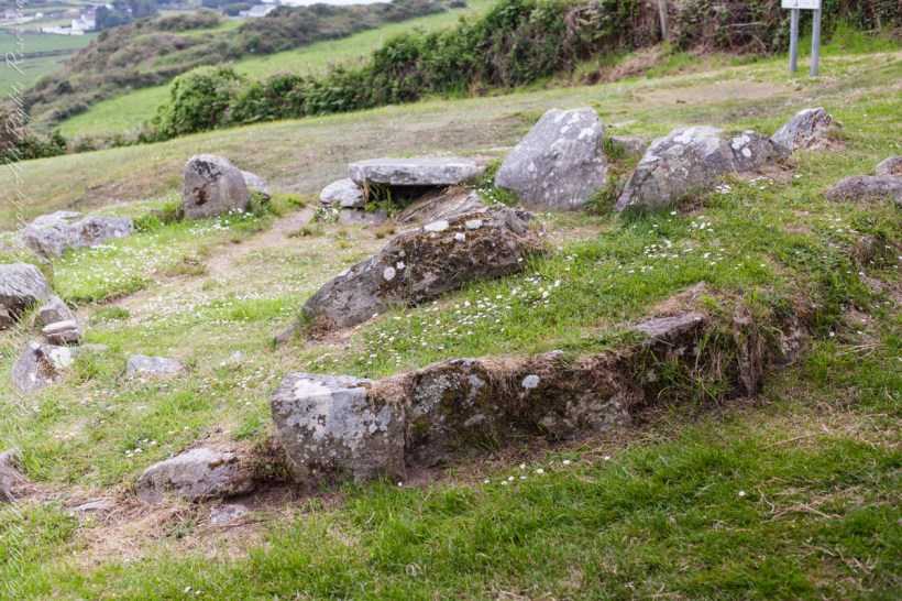
Hut B with a view of the landscape.

In the wider view, the ground slopes away toward hedges, green fields, and distant buildings. Closer to the camera, irregular stones trace the hut through grass and patches of bare earth. A broad, flat slab rests above a dark recess. Nothing in the photograph announces itself with grandeur. Its interest lies in how closely we look, and in the small connections we begin to make.

The hearth is a detail that holds my attention. The OPW placard notes are careful: it possibly served as an oven. I want to keep that uncertainty intact. It leaves room for curiosity without turning a suggestion into a fact. Even with that restraint, the possibility of cooking brings a human scale to the ruins. An oven suggests work to be done, something to prepare, someone waiting.

Can this be anything but a comfortable perch to take in the view? No, the OPW placard suggests its use as a hearth.

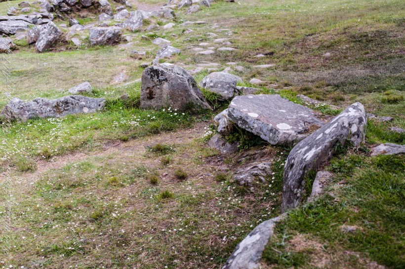
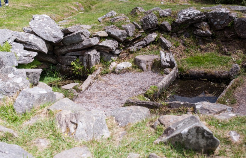
The closest photograph brings the hearth into sharper focus. White patches of lichen spread across the the irregular rock wall. Plants fill small gaps beneath it. The stones lean at different angles, and the trough leads the eye onward. The view holds the intimate detail and the larger setting together, allowing us to consider how these neighboring spaces might have related.

I imagine a person tending heat there, watching carefully, occupied with a task that mattered in the moment. That is an imagined scene, not something these photographs establish. Yet it helps me approach the stones with a different kind of attention. Whoever used this place had practical concerns that we can wonder about, even when their names, words, and particular circumstances are lost to us.

Approaching the Fulacht Fiadh…

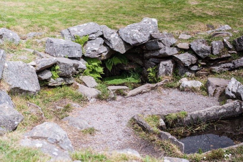
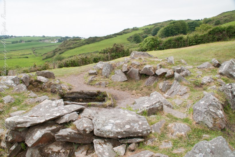
The Fulacht Fiadh site contains a hearth as well.

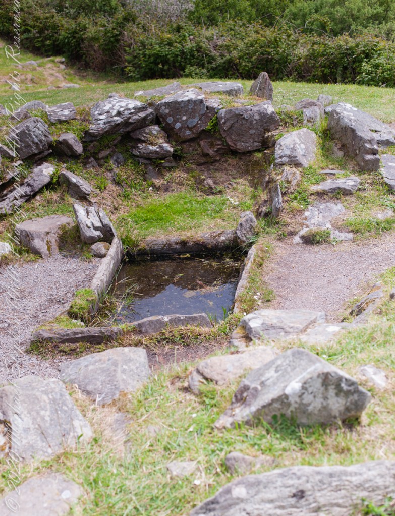
The hearth is to the right of the rock-lined trough, a spring above.
In Fulacht Fiadh investigated there is a link to preparation activity involving heat and moisture. Found throughout Ireland, Great Britan and the Isle of Man where the sites are called “Burnt Mounds”.
In the center of the Fulacht Fiadh is a trough, a water filled pit, which at Drombeg is lined with rock. A water source, a spring to the left (not visible in this photograph), a hearth above.
The water source, a spring.

For me, sharing an exploration like this with Pam offers its own pleasure: having someone beside whom to consider what remains. I cannot supply a remembered conversation from these pictures. I can, however, imagine the questions we might carry away. How much can a surviving outline tell us? At what point does looking become imagining? How do we appreciate a place while leaving its unanswered questions open?

Here we stand behind the sping for a broad view of the landscape. The hearth is to the right of the trough.

These photographs bring back to mind a low doorway, a path, and the hearth. Together, they offer a modest but absorbing way into Drombeg. The flowers are small enough to overlook; so are some of the stones. Giving them attention becomes part of the experience. In this telling of our visit, that is what I would keep: Pam and me exploring the surviving shapes of a place, following what we can see, and letting a few careful questions accompany us.

Click me to visit Michael Stephen Wills Online Finger Lakes Gallery.

Enter your email to receive notification of future postings. I will not sell or share your email address.