Saguaro Sky
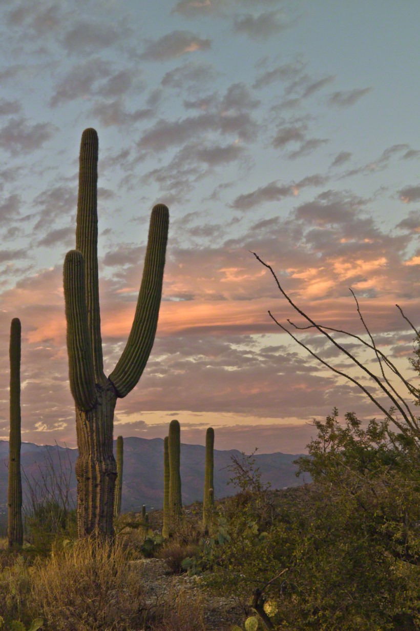
Embrace with me the unique splendor of southern Arizona’s deserts in November. Join me atop the Tanque Verde Ridge as we capture the last light accentuating the saguaros against an evolving sky.
Embrace with me the unique splendor of southern Arizona’s deserts in November. Join me atop the Tanque Verde Ridge as we capture the last light accentuating the saguaros against an evolving sky.

Happy Thanksgiving
The Catskill Mountains are not mountains. The Catskills started as a high plateau. Over eons, before the first humans, water, the sun, and wind carved high steep peaks: rounded, forested and teeming with life.
October 2008, on a return trip from family on Long Island, we traveled the winding road called “Route 17”, through the high autumn hillsides.
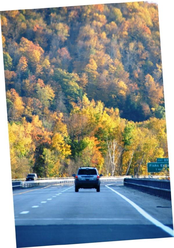
As the sun passed over the western hills we stopped to explore a place called “Fishs Eddy”, a town on the banks of the Delaware River.
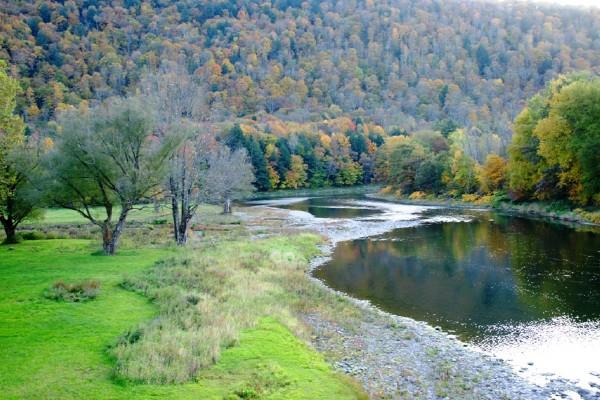
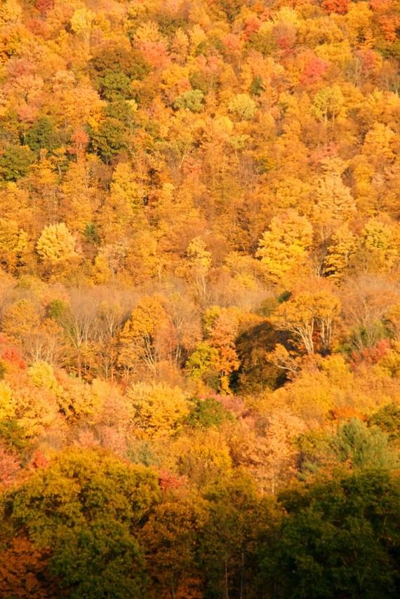
On the east side, facing sunset is a formation that would be a cliff if it was not for the hardwood trees growing from every available nook, crevice. Everywhere a root could be sunk, roots fed trees that, one late October afternoon, made a hill bright with autumn.
Turkeys live in this type of habitat. We took a trail, barely a road that climbed past failed farms and hunting shacks.
Click me for more Autumn Magic from my Online Gallery
On a level place, in front of a ruined home, we came upon a Tom (male) turkey and his four hens. The hens fled at the sight of us.
With barely time to raise the camera I caught Tom and the last hen as she fled into the bushes.
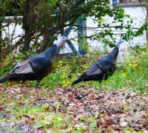
I say she, because Tom stayed behind. He stood erect, all three feet of him, defiant and strutting in a direction opposite from the hens.
This is the bird Benjamin Franklin proposed as the national emblem of the new United State of America (the bald eagle won that competition).
Hunted into almost oblivion, across the United States the wild turkey is making a dramatic comeback in many places, including the forests and farmland of rural New York State
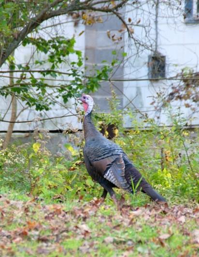
This fellow made no noise. His strutting posture and head bobbing said it all.
We left Tom Turkey in peace to his domain and hens.
dramatic skies from Saguaro National Park
November is a special time for the ranges and basins of southern Arizona deserts. Climb a bajada of foothills, face west and wait for the sunset. That is what I did this day, November 3, 2005. East of Tucson the Saguaro National Monument at the foot of the Rincon Mountain Wilderness is where I parked, unpacked the photo gear and climbed the side of the Tanque Verde Ridge for a favorable view. Weather was pushing high level moisture from the west, clouds were developing.
You see here a shot from that session. In the distance, looking across Tanque Verde, are the Santa Catalina mountains. Months since the last rainfall, the giant Saguaros are using internal moisture reserves drawn up from a shallow root system, the flesh is less plump, the supporting structure of the ribs, always evident, are more pronounced. The last light catches these ribs in relief against a dramatic sky.

On the Tain Way
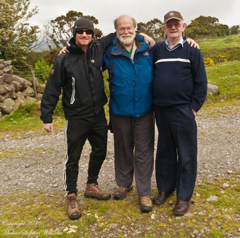
On Monday, June 9, 2014, cousin John Mills dropped his son, Sean Mills, myself and Pam Wills off at the foot of the western slopes of Slieve Foy on the Tain Way. Sean, Pam and I walked the way over the mountain and into Carlingford in the footsteps of epic Irish heroes.

amazing resolution with the Canon 24 mm lens
The resolution of the Canon EF 24mm f/1.4L II USM makes this lens a favorite of mine for landscape work. Let me show you why.
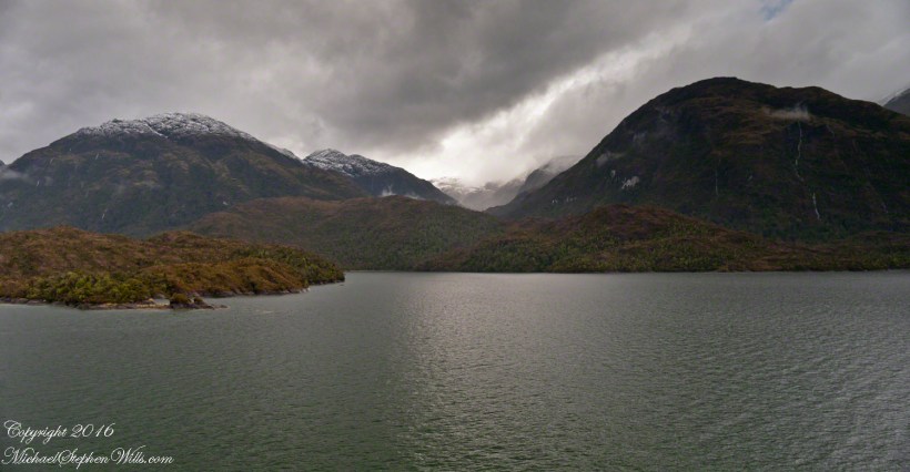
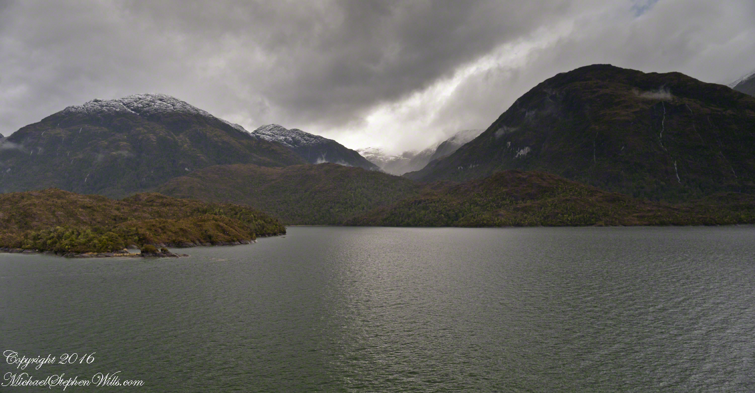
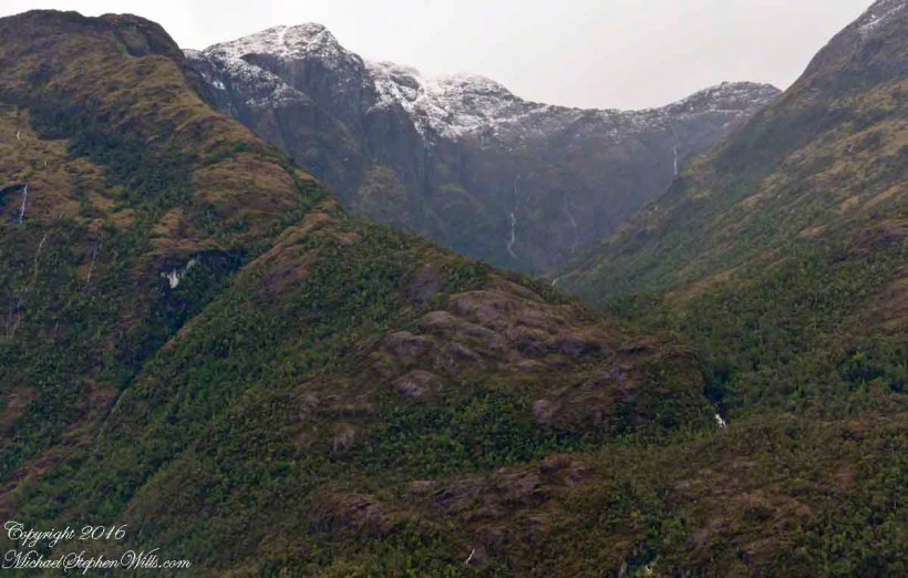
The valley today’s posting lies behind the tree. It is a broad valley shaped by ancient glaciers.
Here is the Google Earth view, from an elevation of 9,400 feet, with the ship position marked. Northwest is a pushpin titled, “Hanging Valley and Waterfall.”
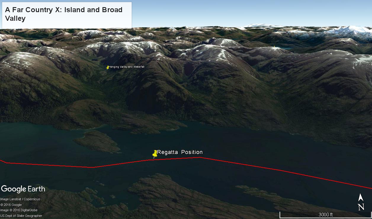
The waterfall marking the hanging valley is visible in the following photograph. All photographs in this posting are from a Canon EOS-1Ds MarkIII, 24 mm lens (see above for complete name), on a Manfrotto travel tripod. ISO 500, f5.6 or f6.3.
With a point of view about 50 feet above the water the valley bottom is hidden behind an 800 foot hill and the water fall is just above the hill. See it? …..I didn’t think so.
There is the island with the tree, to the left. The following image is the same photograph, with the central section enlarged.
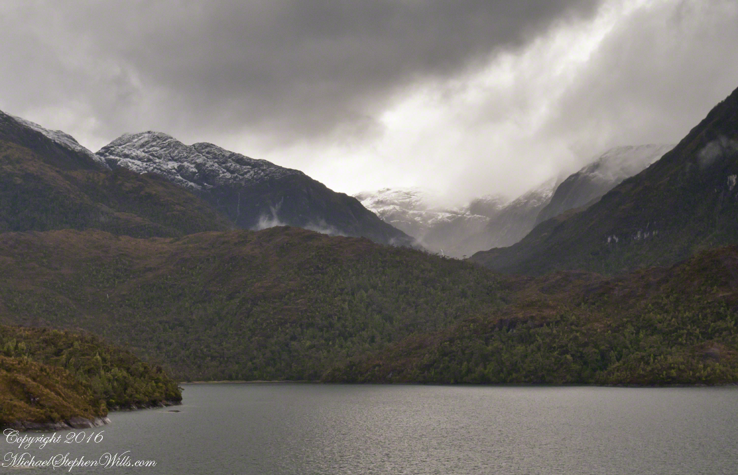
The enlargement brings out the play of light, the low clouds, deep in the valley. To provide scale, know those are full sized pines on the hillside, foreground. The waterfall is just about visible. I will enlarge the image one more time.
There it is!! I stepped up contrast, as well.
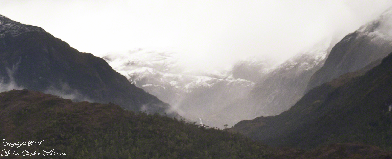
Here is another version of the original view. That patch of sky had opened up seconds after the first shot and, as a result, the 3,000 door mountain and waterfalls, on right, are better lit. Notice the bare rock face on the mountain slope, marking a landslide.
Click this image for a high resolution version, in your browser.
A different landslide Scar is featured in two previous blogs,
A Far Country VI: View of Tempanos Fjord
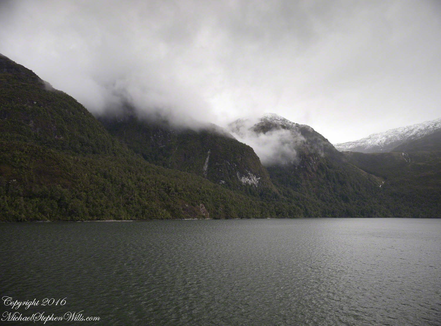
The Regatta’s course brought us closer for the two following shots.
The lovely sky is still visible…..

….one minute later the clouds gather and relative darkness returns.

amazing resolution with the Canon 24 mm lens
The resolution of the Canon EF 24mm f/1.4L II USM makes this lens a favorite of mine for landscape work. Let me show you why.
The valley today’s posting lies behind the tree. It is a broad valley shaped by ancient glaciers.
Here is the Google Earth view, from an elevation of 9,400 feet, with the ship position marked. Northwest is a pushpin titled, “Hanging Valley and Waterfall.”
The waterfall marking the hanging valley is visible in the following photograph. All photographs in this posting are from a Canon EOS-1Ds MarkIII, 24 mm lens (see above for complete name), on a Manfrotto travel tripod. ISO 500, f5.6 or f6.3.
With a point of view about 50 feet above the water the valley bottom is hidden behind an 800 foot hill and the water fall is just above the hill. See it? …..I didn’t think so.
There is the island with the tree, to the left. The following image is the same photograph, with the central section enlarged.
The enlargement brings out the play of light, the low clouds, deep in the valley. To provide scale, know those are full sized pines on the hillside, foreground. The waterfall is just about visible. I will enlarge the image one more time.
There it is!! I stepped up contrast, as well.
Here is another version of the original view. That patch of sky had opened up seconds after the first shot and, as a result, the 3,000 door mountain and waterfalls, on right, are better lit. Notice the bare rock face on the mountain slope, marking a landslide.
Click this image for a high resolution version, in your browser.
The Regatta’s course brought us closer for the two following shots.
The lovely sky is still visible…..
….one minute later the clouds gather and relative darkness returns.
Compelling Plant Shapes
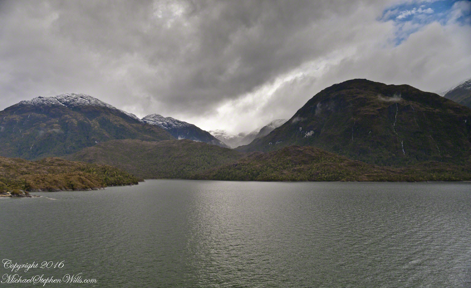
Here is a Google Earth view of Tempanos Fjord from 9,400 feet, looking north, northwest over a point on the fjord 6.5 miles from Iceberg Glacier, at 4 pm local time on February 17, 2016. This view is interesting for the insignificant island, .75 mile long, and broad mountain valley to the north fringed with waterfalls.
Marked is the location of a tree, “bonsai”, a feature of the fjord cliffs, “Landslide Scar” and a neighboring Fjord, “Farquhar Fjord.”
This blog features the tree.
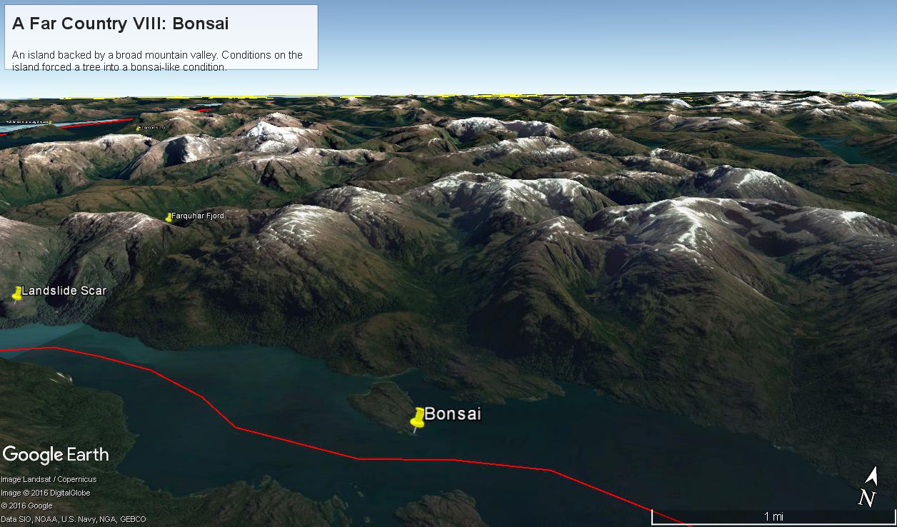
The Farquhar Fjord entrance opens onto the entrance of Tempanos Fjord and is the last photograph.
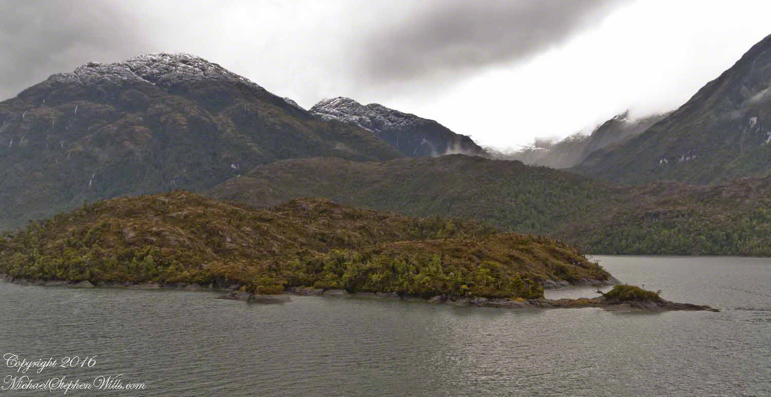
A photograph from our port side stateroom deck includes both the island and broad valley. The misshapen tree, the “bonsai”, is on an islet to the right and in front of the island. It is the small stump backlit by water reflection. The stump is more interesting than can be seen in this image from a handheld camera, at 24 mm. I used the variable lens for a closer look.
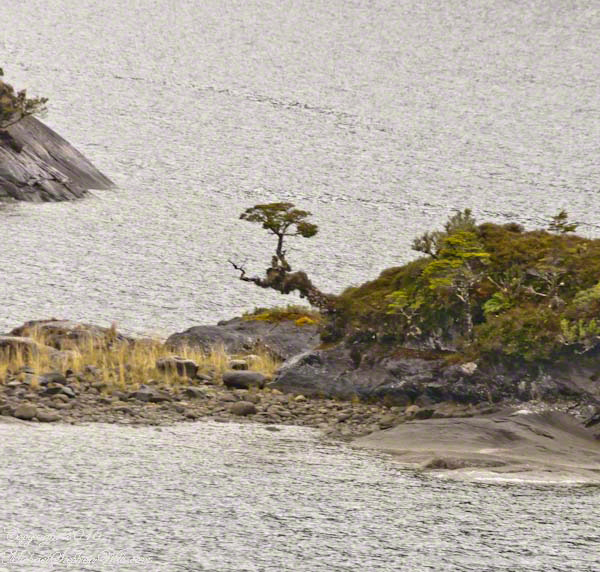
From this 133 mm, f8.0, 1/250 sec and ISO 800, still handheld, interesting details come into view. The islet is a rock on which clings a bed of moss. Several ferns, a sapling (on the far side) and a stump, on the right, are surviving. The stump presumably supported a small tree of which a “bonsai-like” twig remains.
Bonsai are fascinating, created through the art and skill of emulating pleasing natural forms. Here the moss encrusted twists and miniature tree crown were formed from a difficult environment. Bonsai of Japan originated from an ancient Chinese tradition of penjing (“tray plant”). The inspiration for this are, at origin and now, must be, in part, from admiration of the tenacity and beauty of these plants.
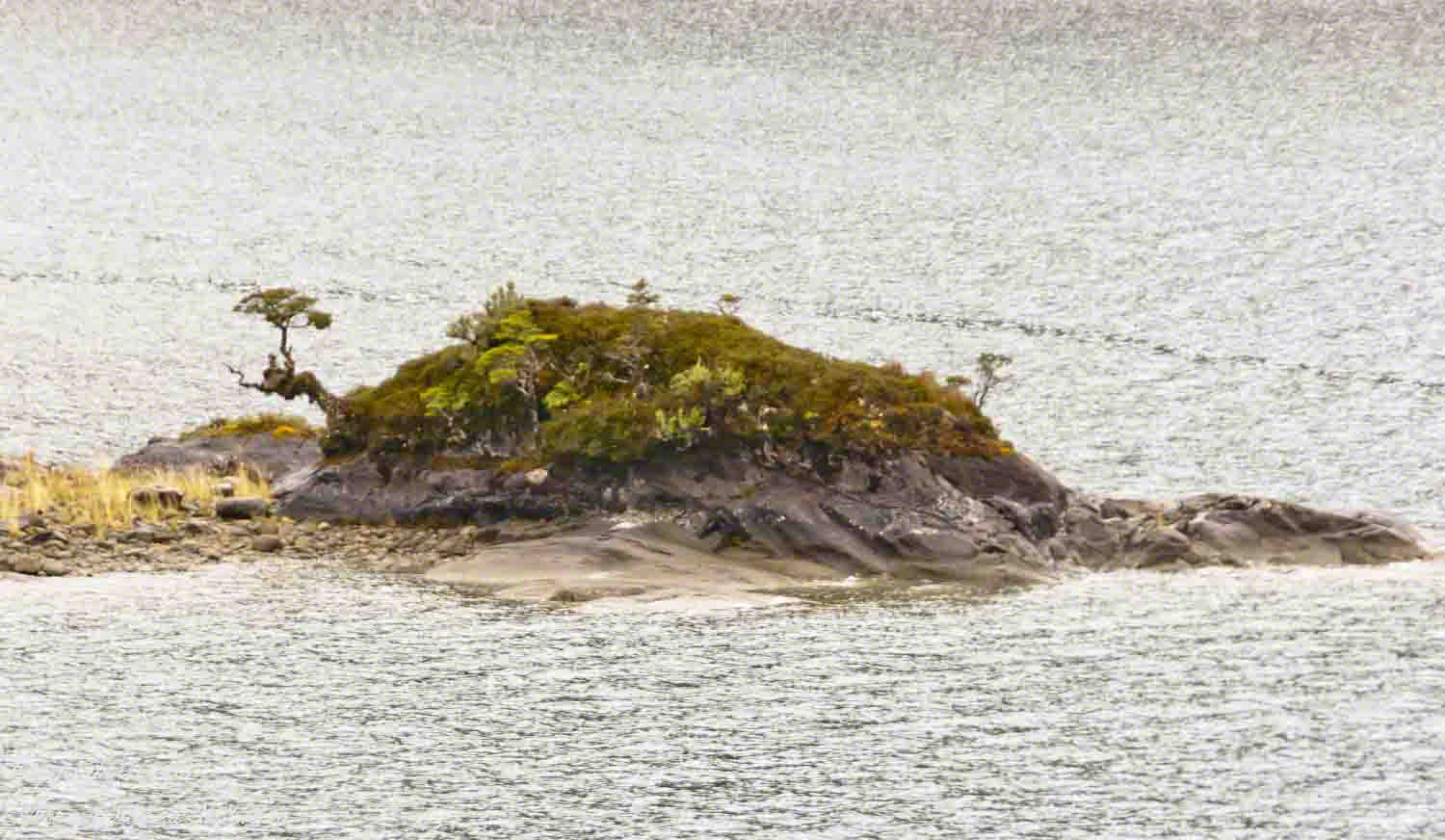
At the 200 mm maximum my Sony Alpha 770 (1/400, f9, ISO 800) image is a little fuzzy, still with great details.
From my interest in bonsai I am on the lookout for shapes such as this. Travelling the challenging environment of the Chilean Fjords I found examples here and there.

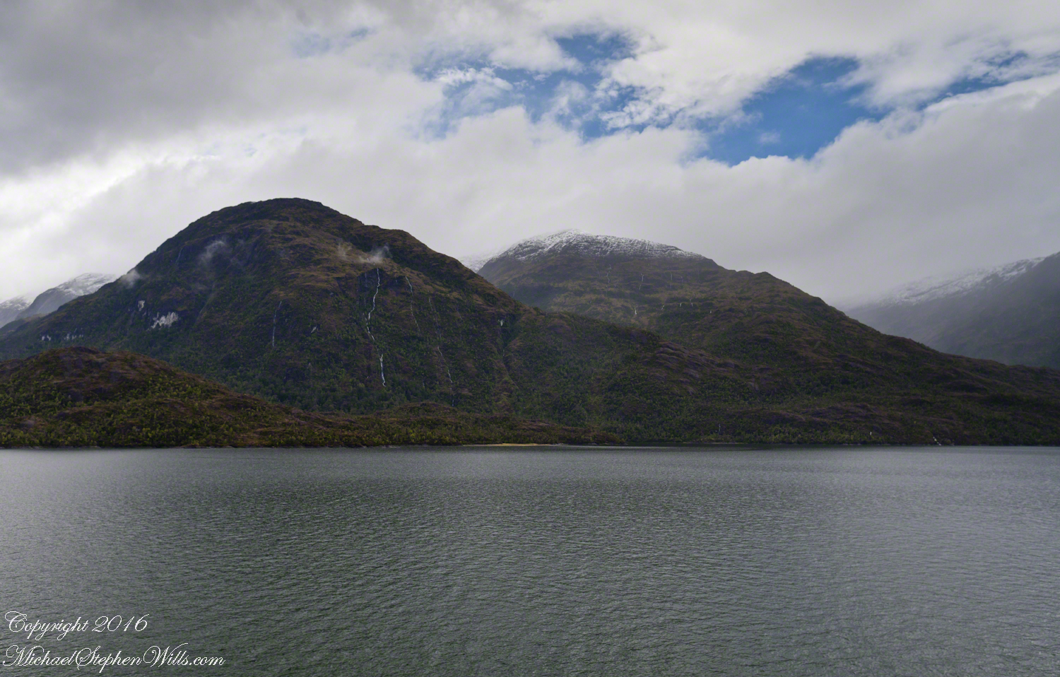
A mountain and waterfall ringed bowl.
(Click any photograph to visit my online gallery)
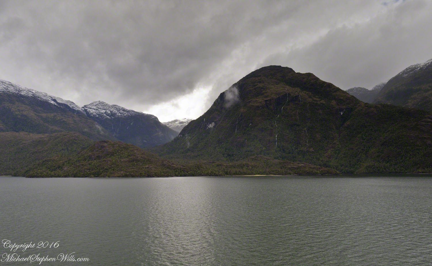
4:00 pm local time the Oceania was approximately 5 miles from the Iceberg Glacier, moving forward at a slow rate of speed, 4.6 knots. Here are more views of the mountain-ringed bowl behind a 1,000 foot cliff.
Both photographs are handheld using my Sony Alpha700, ISO 800, variable lens set to 45mm, 1/250 f13. At the same time I shot from a tripod mounted Cannon, 24 mm wide angle fixed focus lens.
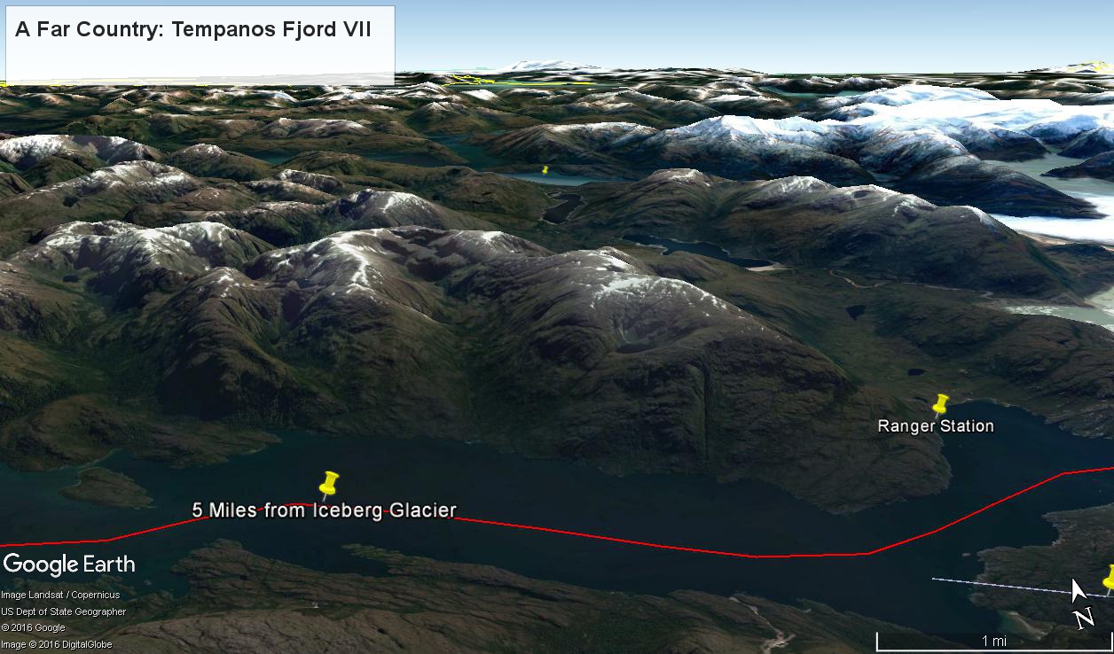
The following capture from Google Earth is the view from 12,200 feet. Regatta’s position is the “5 miles from Iceberg Glacier” pushpin. The formation is almost due north. We were surprised to see a ranger station in this uninhabited area, not yet in view. The white line, lower right, is the border between the Aisen (north) and Magellanic (south) Chilean regions.
Fjord View
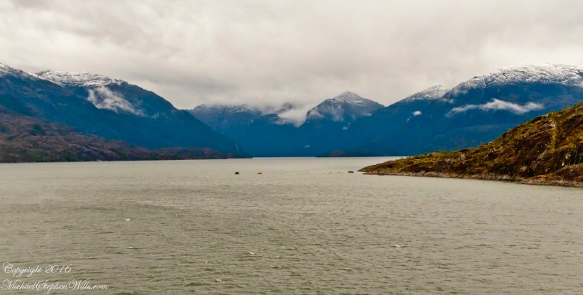
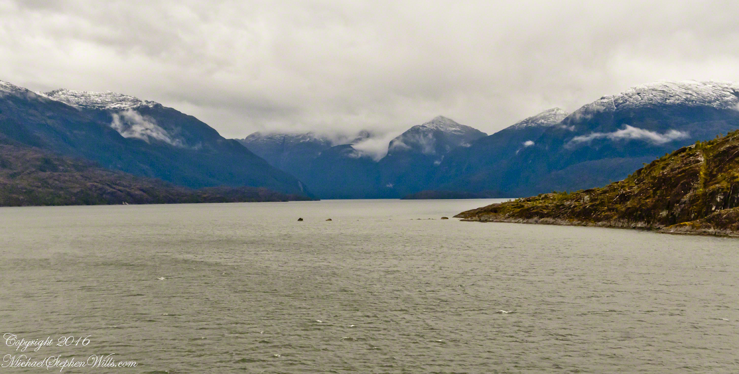
By 3:20 pm local time the Oceania was approximately 1.75 miles from the Iceberg Glacier and the captain positioned the ship for a starboard side glacier view. From our port side stateroom terrace Pam and I had this sweeping view of the way we had come.
Tempanos Fjord is a mile across here and we have a clear view of the landslide scar feature in my last blog. It is 7.75 miles distant, a small white patch on the fjord wall. The landscape scar marks where the fjord bends, changing north, northeast course to an east, southeast direction. Before the bend, the Iceberg glacier is not visible. Turn the bend and the glacier is plainly visible in the distance if the viewer is looking over the ship bow.
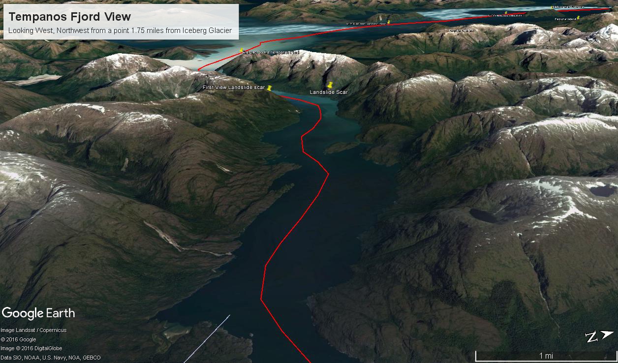
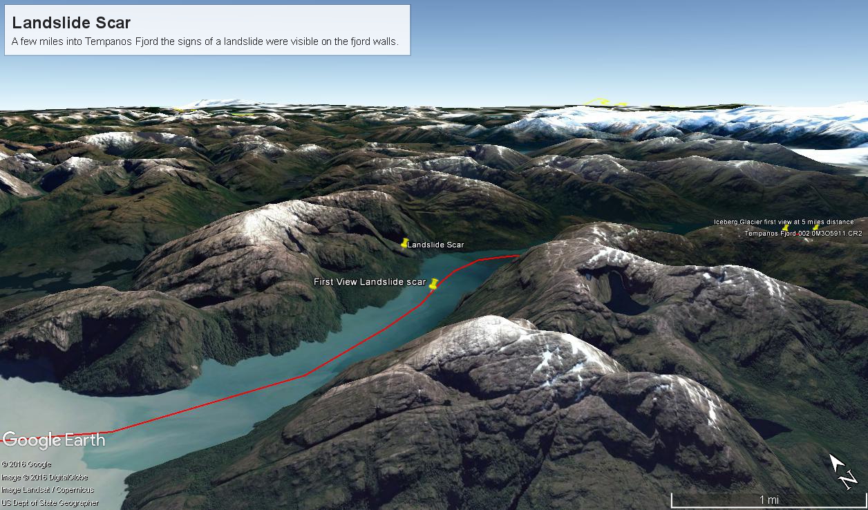
The following capture from Google Earth is the view from 14,000 feet. Marked are the locations of the landslide scar and the ship position were I first photographed the scar on our way into Tempanos Fjord. The red lined ship’s course may be followed out of the fjord back to the Messier Channel. The fjord follows a course among mountain peaks and deep valleys. A great pleasure of sailing Tempanos Fjord is the many vistas opening one to another.
All is Larger than it First Appears
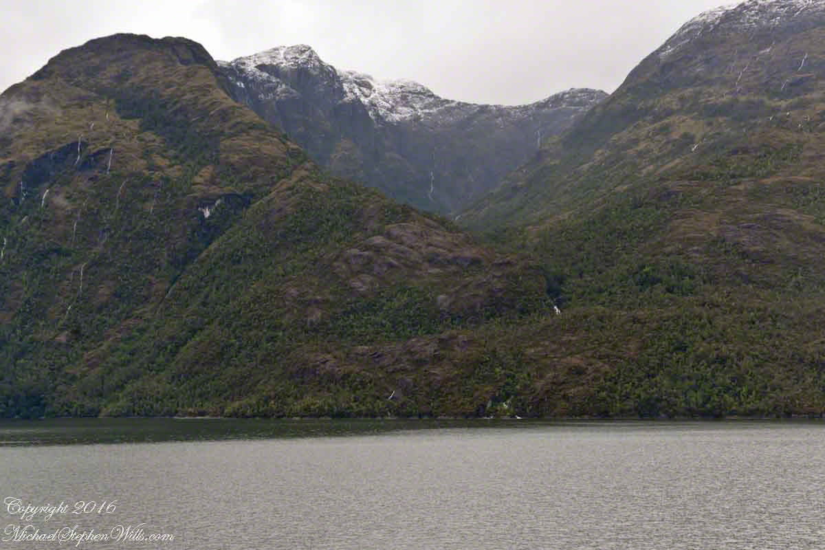
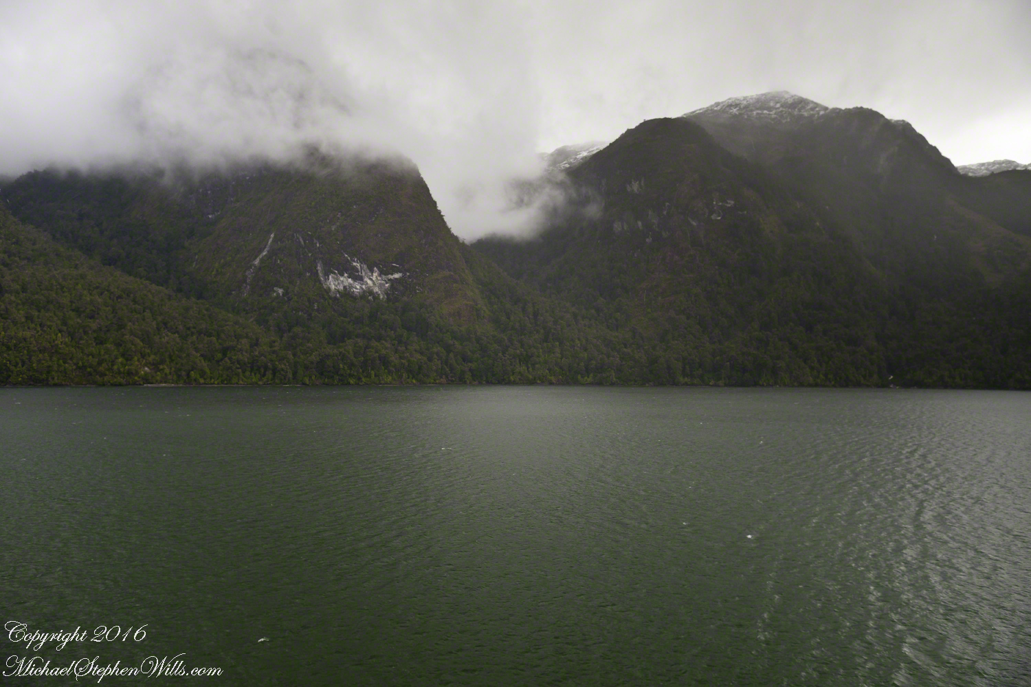
By 2:45 pm local time the Oceania was almost 4 miles into Tempanos Fjord, 10.5 miles from the Iceberg Glacier, when this telling gash on a mountain buttress forming the side of one of many glacial valleys.
Here is the Google Earth overview of our course that day through Tempanos Fjord, as the red line. Visible is the Farquhar Fjord, to the north. Marked is the position of the scar and the approximate position where I took the first view. Where the fjord bends to the southeast the glacier is not yet visible.
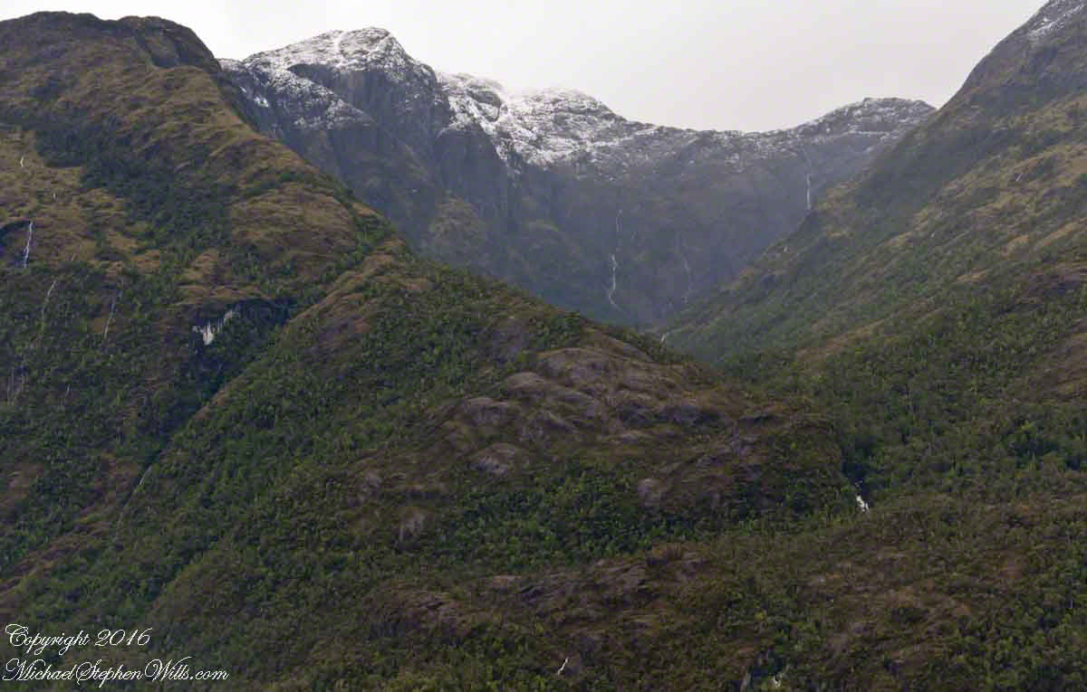
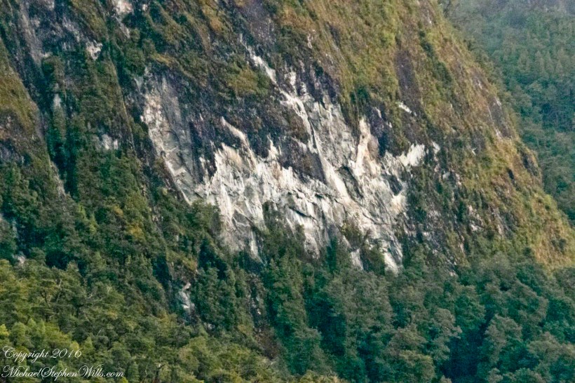
The scar, for all the rawness of the stone, is not recent. There was time for a forest to cover the destruction. The Oceania steamed past, making steady progress. The gash appeared ahead, unremarked. I wonder what the effect was after the cracks, slowly widened over decades by the ice, forced friction to give way to gravity, the mountainside sliding, perhaps, into the fjord. Hard to tell. There is no remnants of the slide visible.
All is larger than it first appears. Those are full size pines below the scar. It is the steepness of the cliff face that holds off the vegetation, the whiteness of the rock the source of the apparent freshness of the gash.
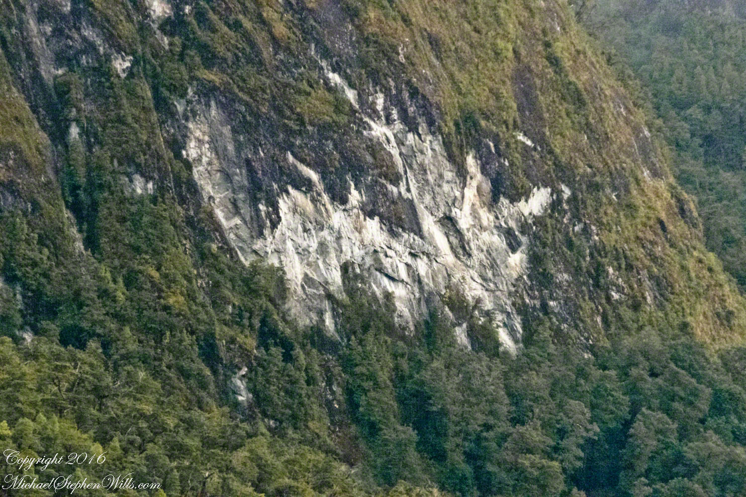
The mountainsides are threaded with waterfalls. Look closely to the left of the gash for a very thin line ending in a spray.
