(Click any photograph to visit my online gallery)
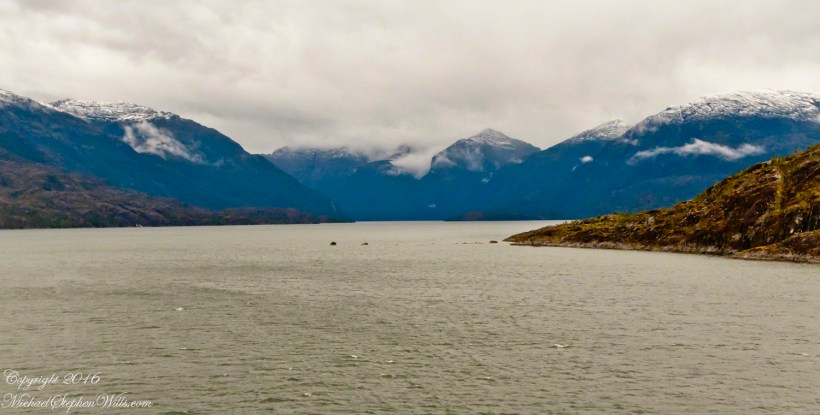
By 3:20 pm local time the Oceania was approximately 1.75 miles from the Iceberg Glacier and the captain positioned the ship for a starboard side glacier view. From our port side stateroom terrace Pam and I had this sweeping view of the way we had come.
Tempanos Fjord is a mile across here and we have a clear view of the landslide scar feature in my last blog. It is 7.75 miles distant, a small white patch on the fjord wall. The landscape scar marks where the fjord bends, changing north, northeast course to an east, southeast direction. Before the bend, the Iceberg glacier is not visible. Turn the bend and the glacier is plainly visible in the distance if the viewer is looking over the ship bow.
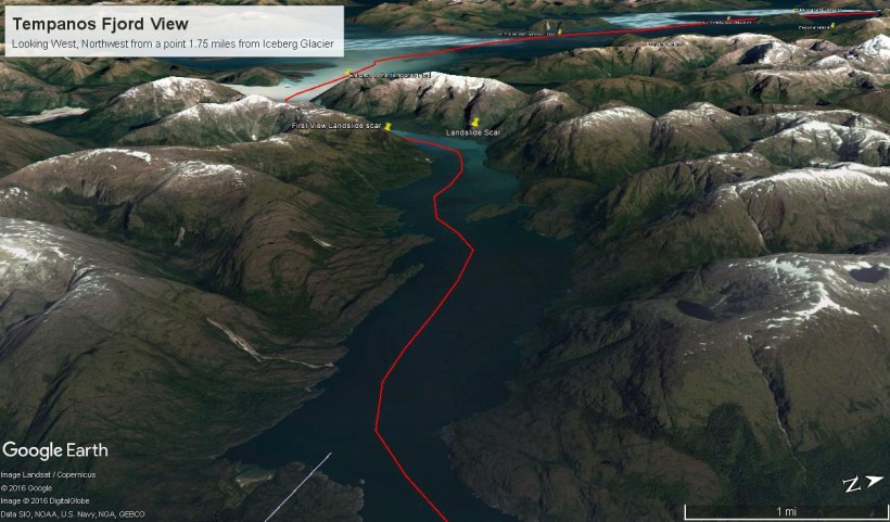
The following capture from Google Earth is the view from 14,000 feet. Marked are the locations of the landslide scar and the ship position were I first photographed the scar on our way into Tempanos Fjord. The red lined ship’s course may be followed out of the fjord back to the Messier Channel. The fjord follows a course among mountain peaks and deep valleys. A great pleasure of sailing Tempanos Fjord is the many vistas opening one to another.

Great photography! Have to come back to view you gallery! Thank you for liking my Cee’s photo. You got my follow!! See you again.
LikeLiked by 1 person
Thank You for this kind comment, Miriam. I look forward to your future blogs.
LikeLiked by 2 people
You’re welcome. Do you live in England? I should Good map your photo locations. It’s neat to get Google Earth view. One time, we went to London. I have a childhood friend living there. I used Google earth, could see her house! I live in Orange county, CA, close to the ocean.
LikeLiked by 1 person
I took some iceberg photos in Alaska. Where did you take yours?
LikeLiked by 1 person
So nice, what an experience.
LikeLiked by 2 people
“Once in a lifetime” Thank You
LikeLiked by 1 person
Spettacolo! E sempre complimenti per i tuoi scatti fotografici.
LikeLiked by 2 people