Join me in the mesmerizing world of photography as we capture the ethereal beauty of a frosty January morning, where history meets nature’s artistry. Explore more on our blog.
The Catskill Mountains are not mountains. The Catskills started as a high plateau. Over eons, before the first humans, water, the sun, and wind carved high steep peaks: rounded, forested and teeming with life.
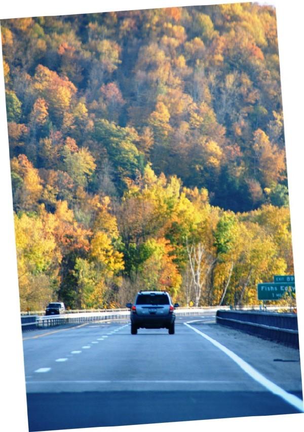
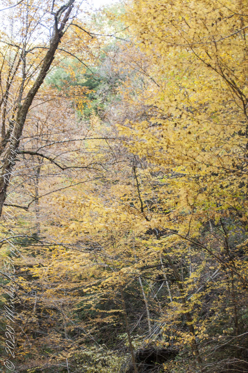
October 2008, on a return trip from family on Long Island, we traveled the winding road called “Route 17”, through the high autumn hillsides.
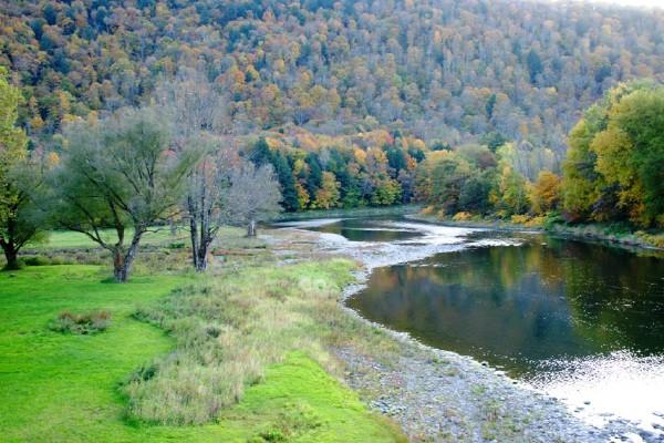
As the sun passed over the western hills we stopped to explore a place called “Fishs Eddy”, a town on the banks of the Delaware River.
Delaware River view at Fishes Eddy
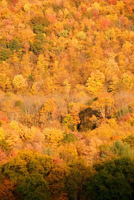
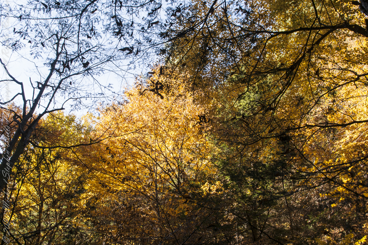
On the east side, facing sunset is a formation that would be a cliff if it was not for the hardwood trees growing from every available nook, crevice. Everywhere a root could be sunk, roots fed trees that, one late October afternoon, made a hill bright with autumn.
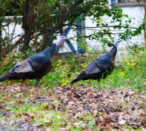
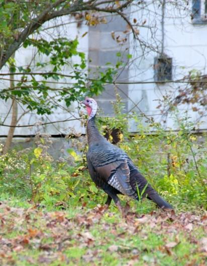
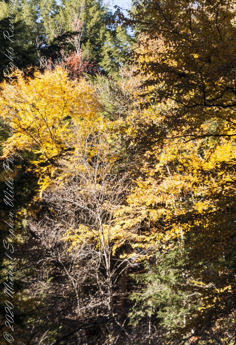
Turkey Habitat
Turkeys live in this type of habitat. We took a trail, barely a road that climbed past failed farms and hunting shacks.
On a level place, in front of a ruined home, we came upon a Tom (male) turkey and his four hens. The hens fled at the sight of us. With barely time to raise the camera I caught Tom and the last hen as she fled into the bushes.
Tom Turkey Defiant
I say she, because Tom stayed behind. He stood erect, all three feet of him, defiant and strutting in a direction opposite from the hens.
This is the bird Benjamin Franklin proposed as the national emblem of the new United State of America (the bald eagle won that competition).
Hunted into almost oblivion, across the United States the wild turkey is making a dramatic comeback in many places, including the forests and farmland of rural New York State
This fellow made no noise. His strutting posture and head bobbing said it all.
We left Tom Turkey in peace to his domain and hens.
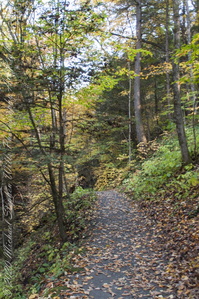
My Sony Alpha was in use during our October 16 drive to Fillmore Glen. As we traversed landscapes, autumn glory of Tompkins and Cayuga Counties was captured. Thank You, Pam, for driving.
Heading today’s post is a windshield shot, I’m loving the effect of a golden road.
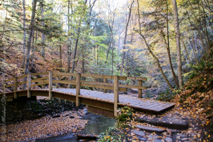
During our walk, I used the Sony Alpha for a parallel series of shots to compliment the tripod mounted Canon. Here are some of those results.
Step up and over
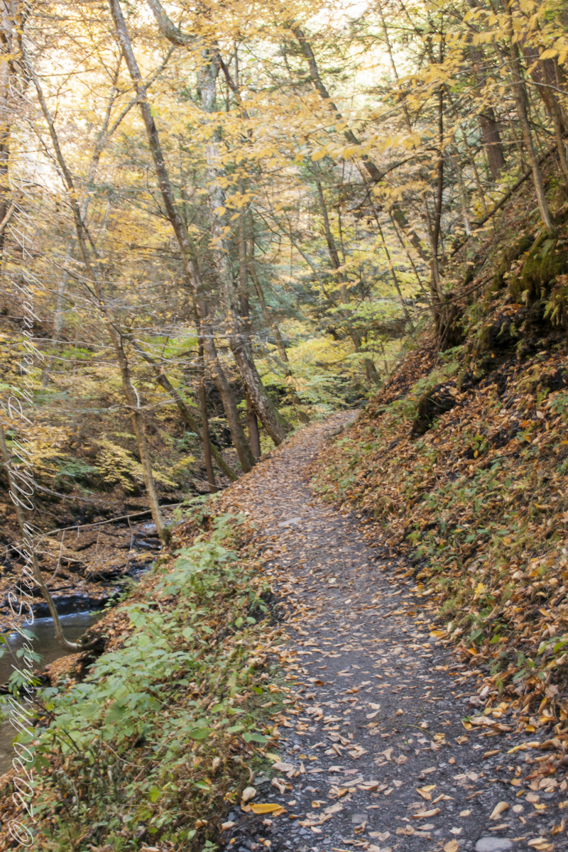
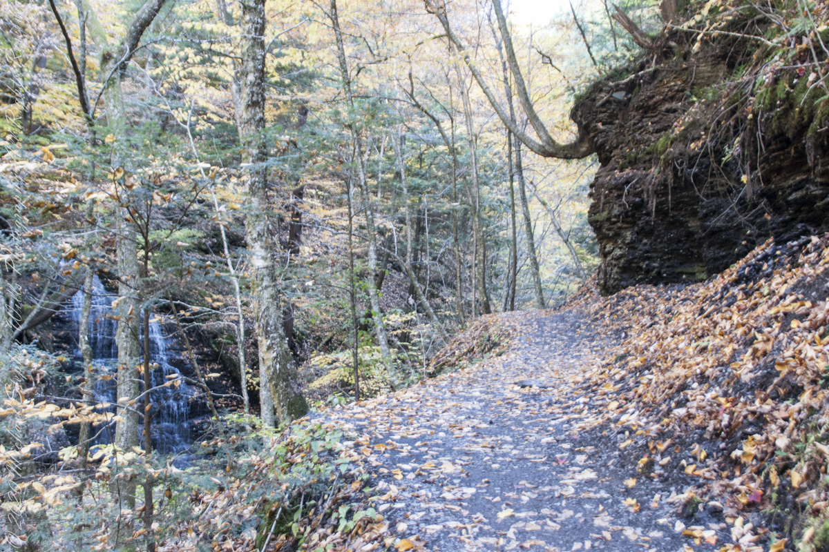
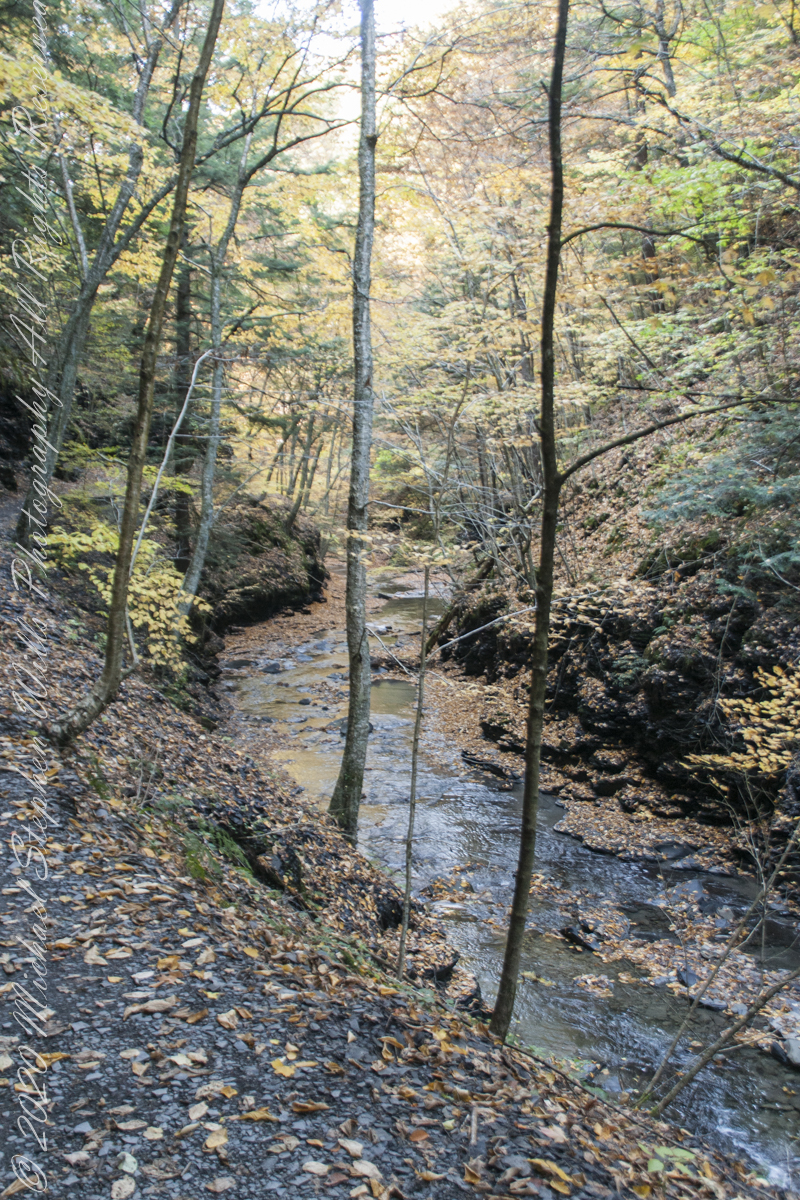
Enjoy this collection of Fillmore Glen pathways
AA
Fillmore Glen, New York State Park, Cayuga County, Moravia, New York
Copyright 2022 All Right Reserved Michael Stephen Wills
” I ventured up the gorge from bottom to this point where, blocked by an enormous shining emerald-colored ice wedge accumulated from the water pouring over the path in warmer months, I turned around”
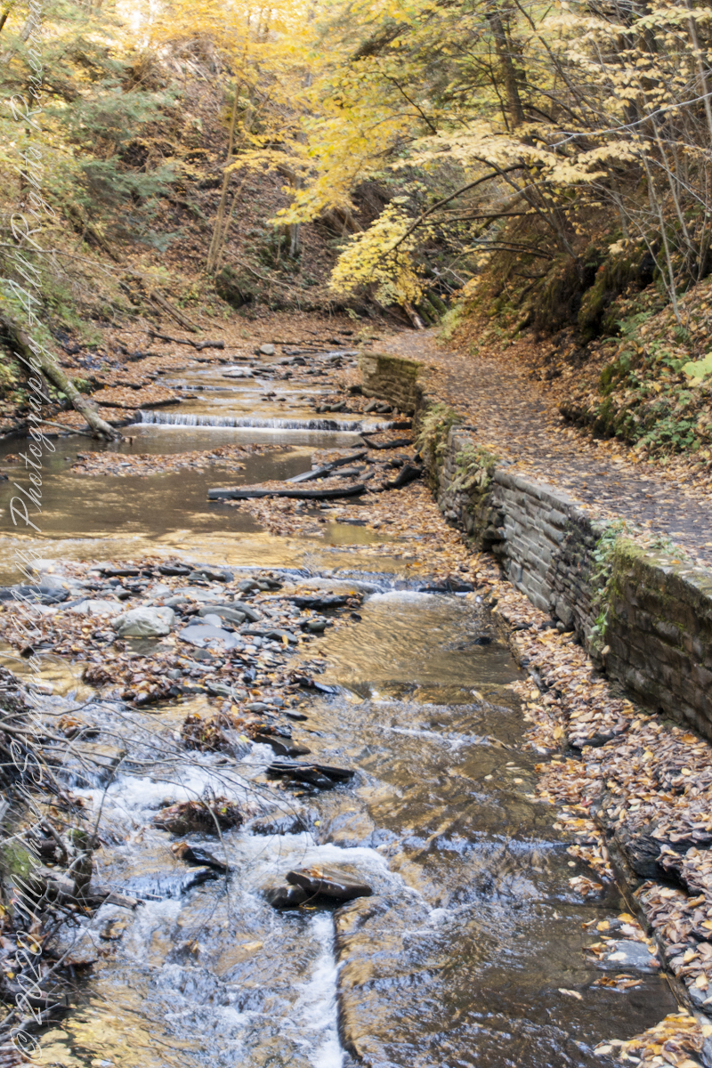
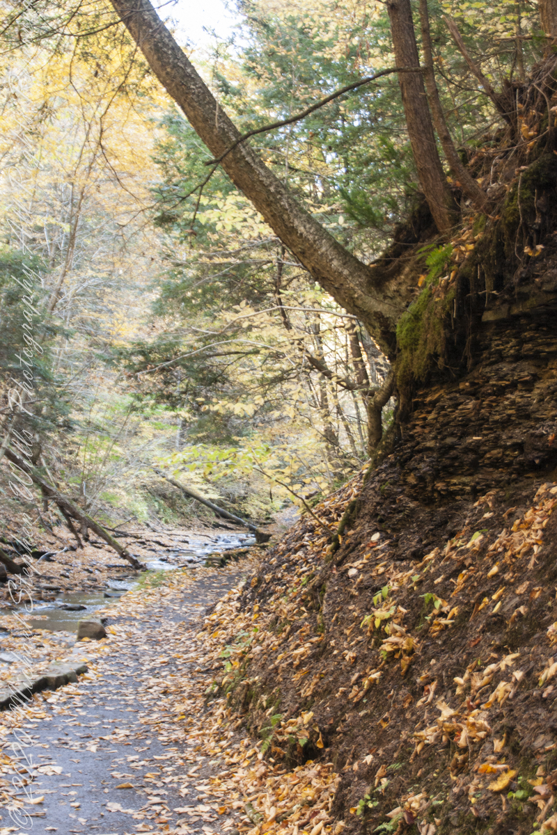
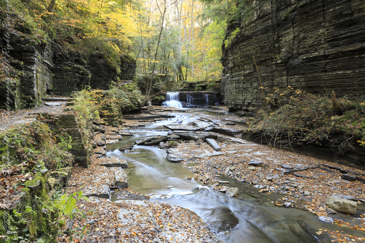
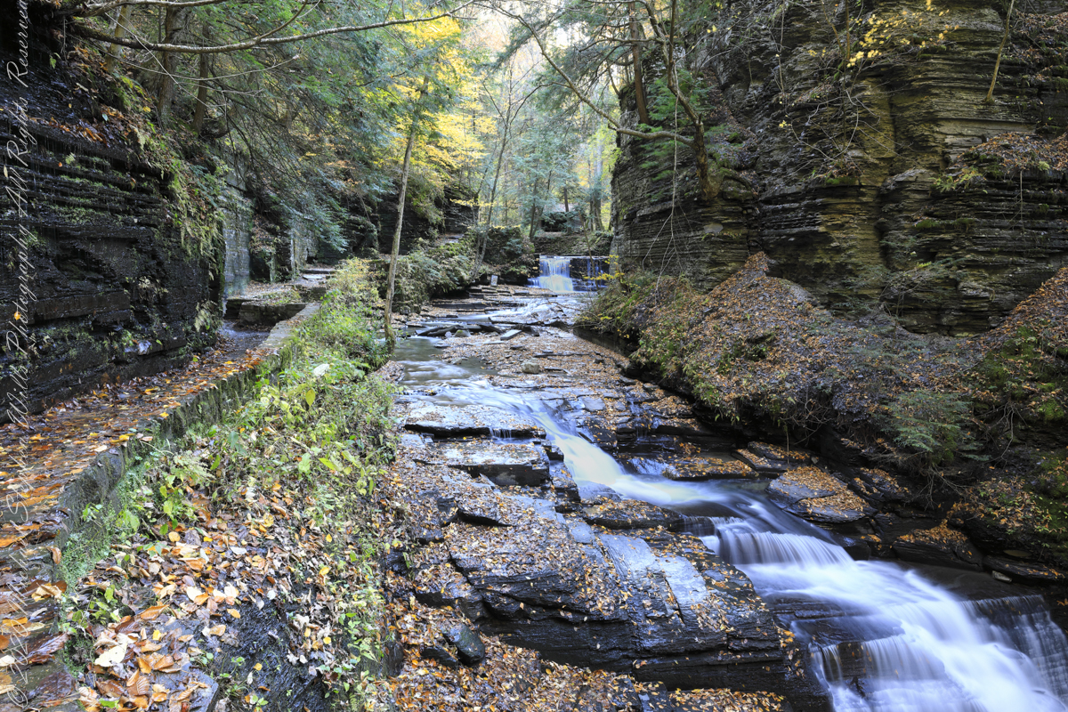
Between the metal walkway (see previous post) and the last numbered bridge, eight (8), the gorge narrows with sedimentary rock cliffs on either side, remnants of the forces that formed this rock in the form of water pouring from the porous stone flowing over the trail.
One February morning, equipped with climbing boots, crampons, gaiters, I ventured up the gorge from bottom to this point where, blocked by an enormous shining emerald-colored ice wedge accumulated from the water pouring over the path in warmer months, I turned around.
I call it a Waterfall Gallery for these walls bracing this wonderful collection of cascades in these photographs.
Waterfall gallery between bridges seven (7) and eight (8). Fillmore Glen, New York State Park, Moravia, Cayuga County, New York
A warm and cool versions of this spot.
Warm
Cool
Watch Your Step!!
Fillmore Glen, New York State Park, Cayuga County, Moravia, New York
Copyright 2022 All Right Reserved Michael Stephen Wills
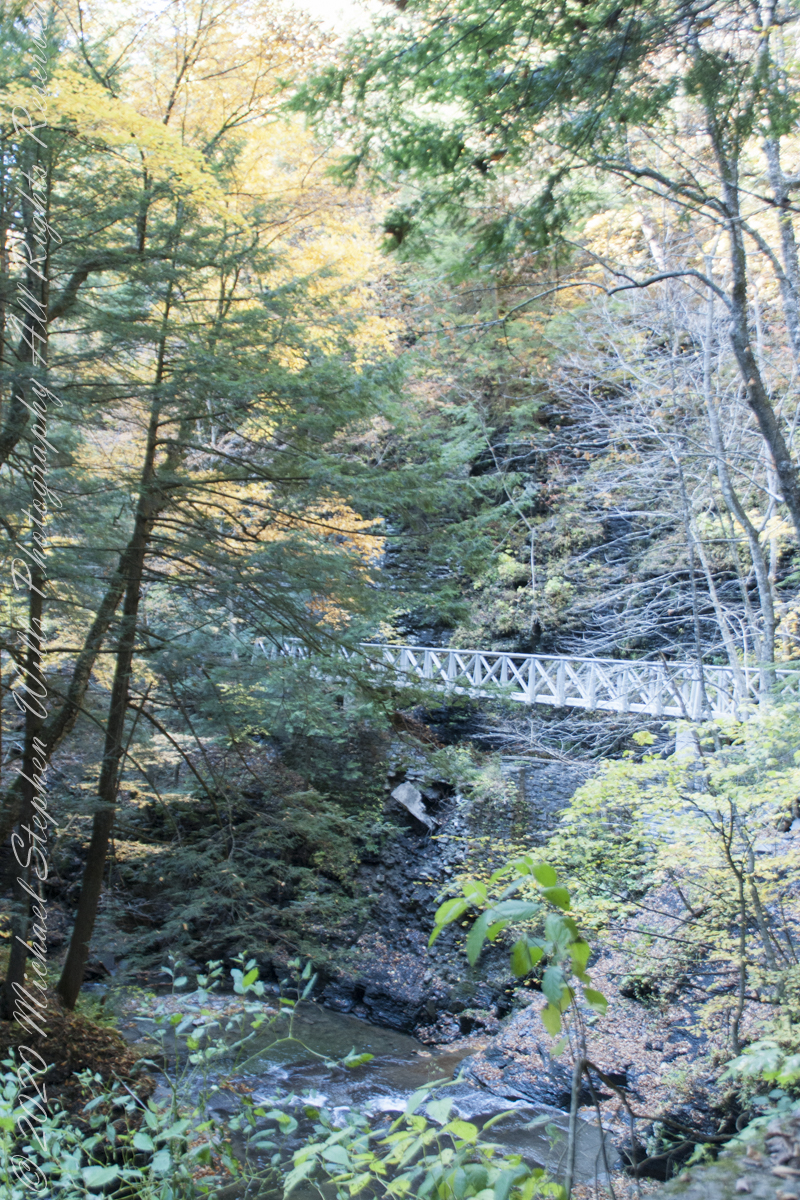
Crossing bridge seven (7), “Lovers’ Bridge, we encounter this passage, from the earliest work of the Civilian Conservation Corps of the 1930’s. Stairs carved into the Cambrian cliff. These images are a combination of handheld Sony Alpha dslr and tripod mounted Canon captures. Can you tell the difference (please comment on your insights).
View from the new walkway
Looking back to the walkway installed this year. This span does not cross Dry Creek, is not included in the bridge count.
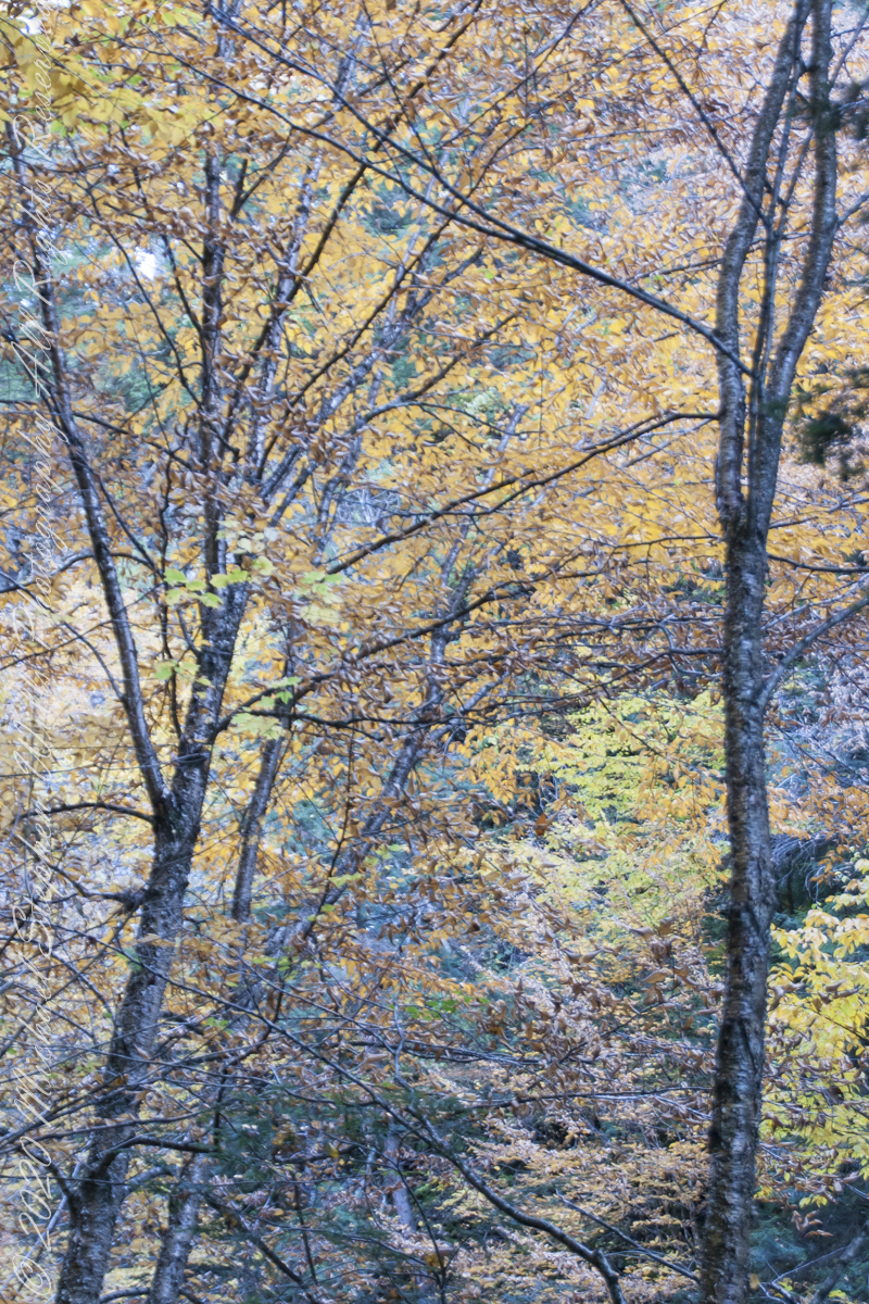
Overhead, the glorious autumn canopy
Fillmore Glen, New York State Park, Cayuga County, Moravia, New York
Copyright 2022 All Right Reserved Michael Stephen Wills
Ancient legends speak of the River Lethe, crossed by departing souls. The waters of the Lethe wash away memory, allowing for spiritual rebirth, reincarnation, a return to the world in new form.
This memory implant represents a bridge over the Lethe.
For those chosen to cross over to the new land in return for
their treasure, lives and selves.
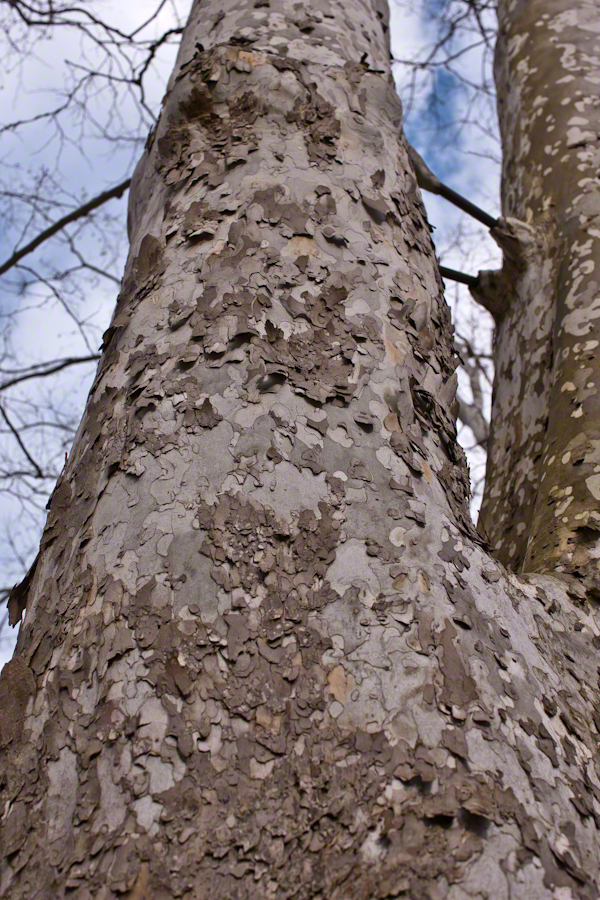
Description
This virtual monoculture glade from the long time of forests,
a place of happy gatherings, of families, plentiful food and water.
These sycamores grew over centuries, through thousands of days, wider than 10 people,
white with age as the outer covering, called bark, falls away.
forked, trunks
climbing to the sky.
Copyright 2022 Michael Stephen Wills All Rights Reserved
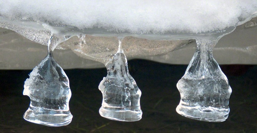
These icicles were formed along Fall Creek during the coldest months of February in the Finger Lakes Region of New York State.
The transient nature of these forms is suggested by the thinness of the pedicle joining each bell to the ice lobe of the ledge. Note the golden crystals in the ice lobe.
A visualization of the symbolic power of the numeral three, reflected on itself. Question: what do “threes” mean to you?
Captured with the Sony DSLR-A700, DT 16-105mm F3.5-5.6 lens, hoya circular polarizing filter, mounted on the Manfrotto tripod with ball head.
Click the photograph for my online gallery Ice Bells listing.
Copyright 2021 Michael Stephen Wills All Rights Reserved
Here is a repost for those who missed the video. Please click on video, below and share your responses via comments. Thank You
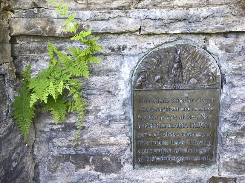
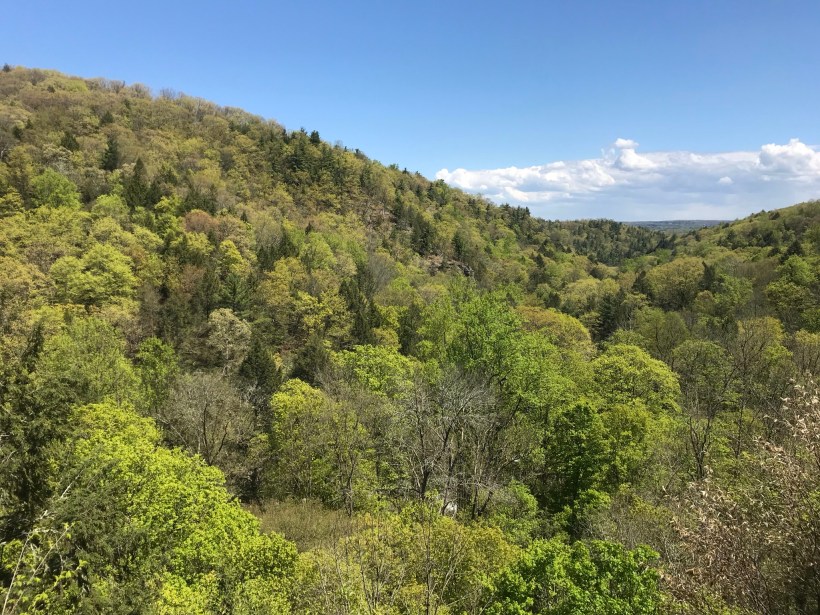
The Finger Lakes Trail joins Robert H. Treman New York State Park, running along the south rim along the park border.
Today, I started from the stairs next to the Mill of the upper park, walking along Fish Kill Creek, a brief visit to the CCC plaque, over the new footbridge and a steep climb up to the ridge to a marvelous view over the way we just walked. That is a millipede resting on a wooden trail stake.
A word on the creek name. The Dutch word for creek is “Kill”, the anglicisation of the original name retained the Dutch making it, in effect, “Fish Creek Creek,” not a memorization of fish massacre.
There’s one shot of the damage done to tree leaves by hoards of caterpillars…I found chewed-up leaves at my feet throughout the hike.
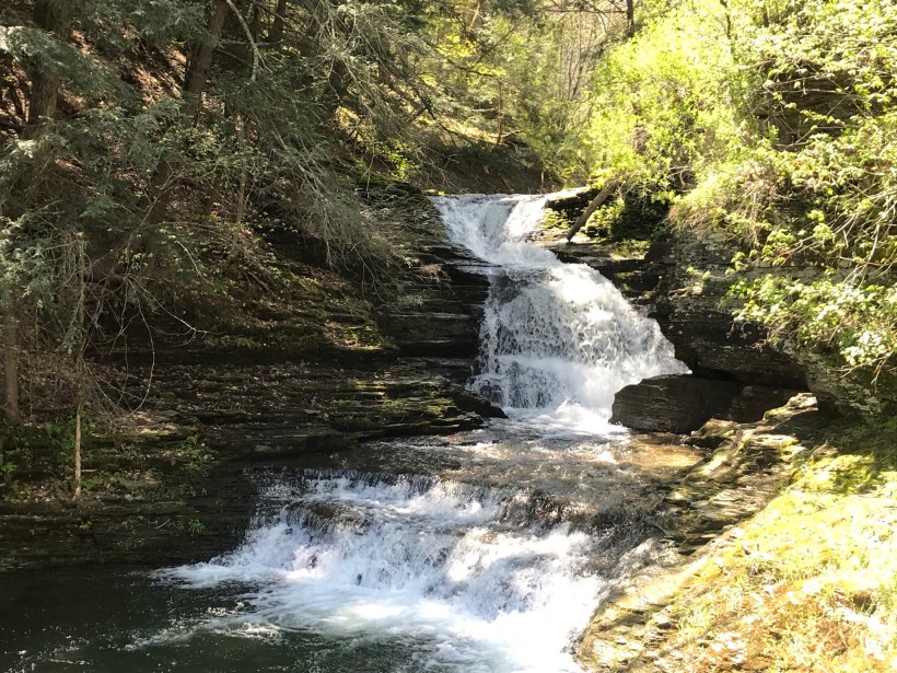
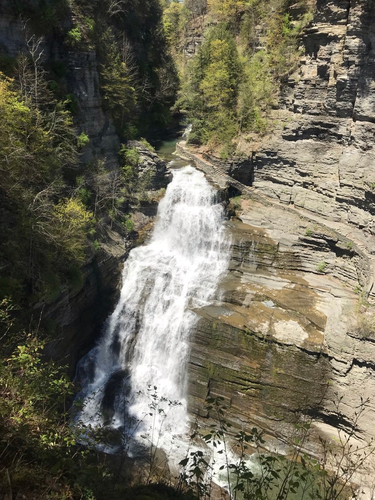
Then, I re-join the State Park South Rim trail, down the Cliff Staircase to wander the gorge floor below Lucifer Falls.
Up the Gorge Trail with many shots of these wonders including Lucifer Falls, Devil’s Kitchen Waterfall, and the Gallery.
Close with a shot of early Tiger Lily blooms on the south facing bank of Enfield Creek.
I used a new format with this post, with all media in one You Tube video. Enjoy!!
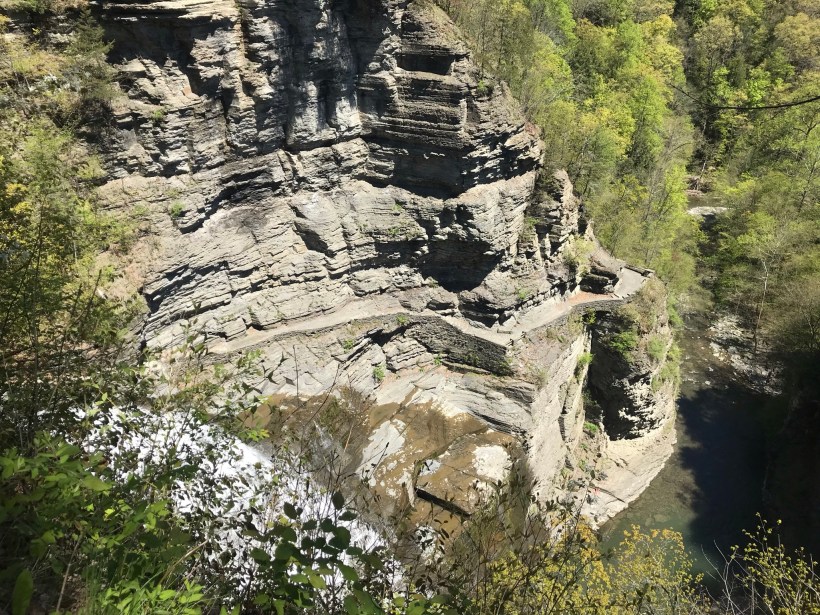
Pam and I headed out to Treman Park for a walk to the Lucifer Falls overlook. The Gorge Trail is not yet open due to the danger of rock falling from the gorge walls — the park maintenance staff needs to survey winter damage and knock down material in danger of falling.
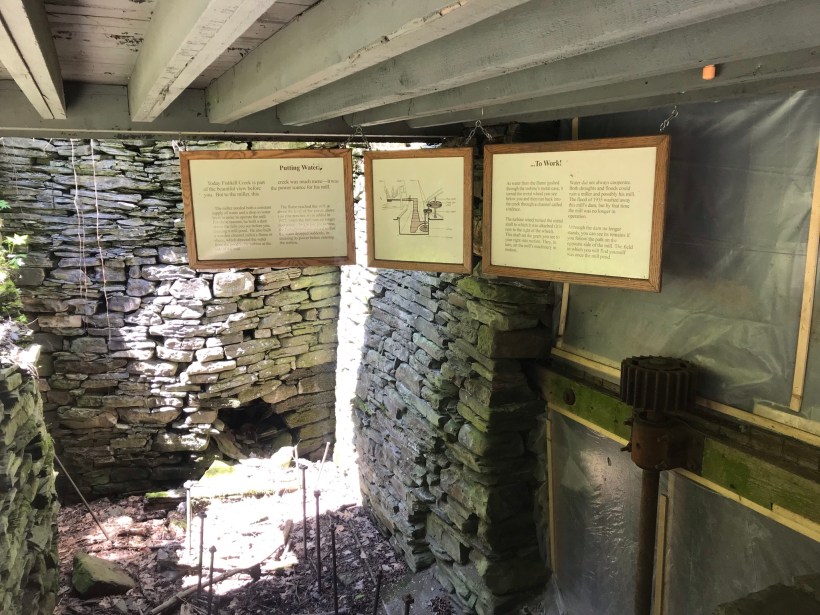
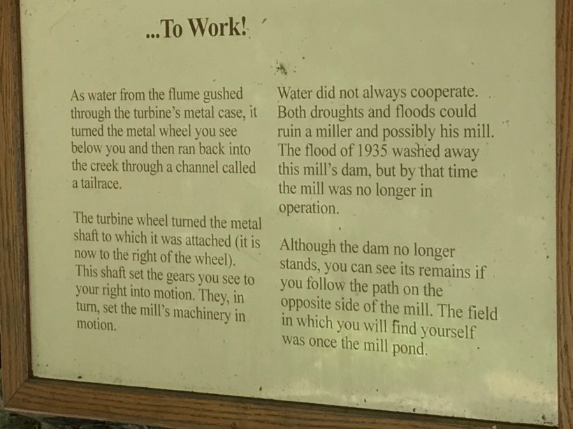
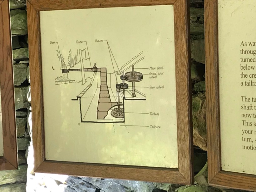
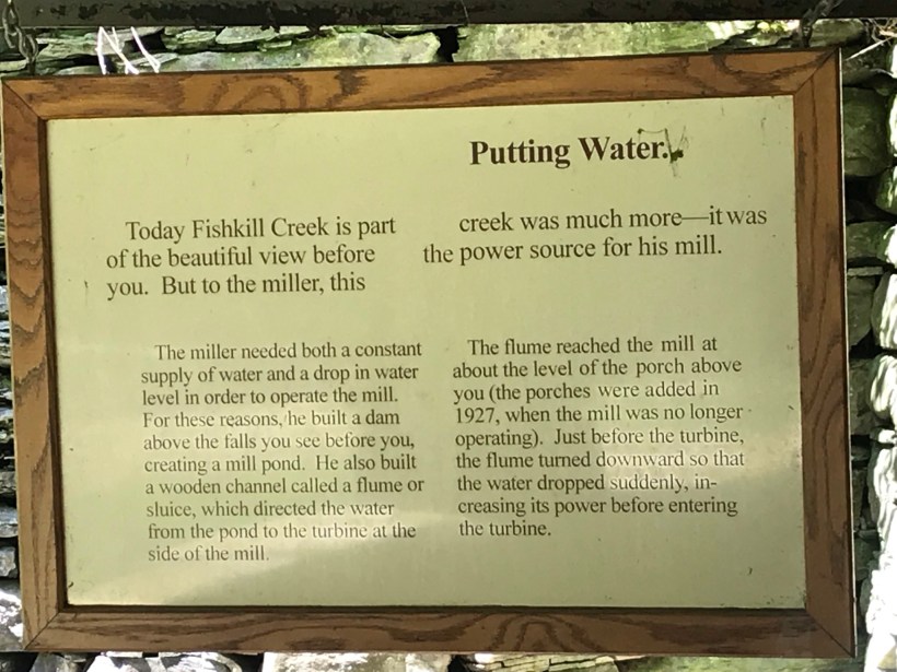
Our first stop was the mill waterfall. This was was directed to the mill stream to power the mill where grain was ground to order.
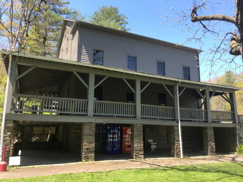
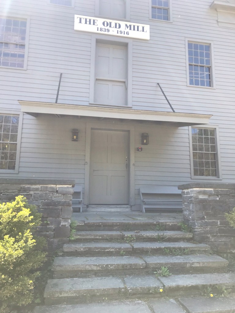
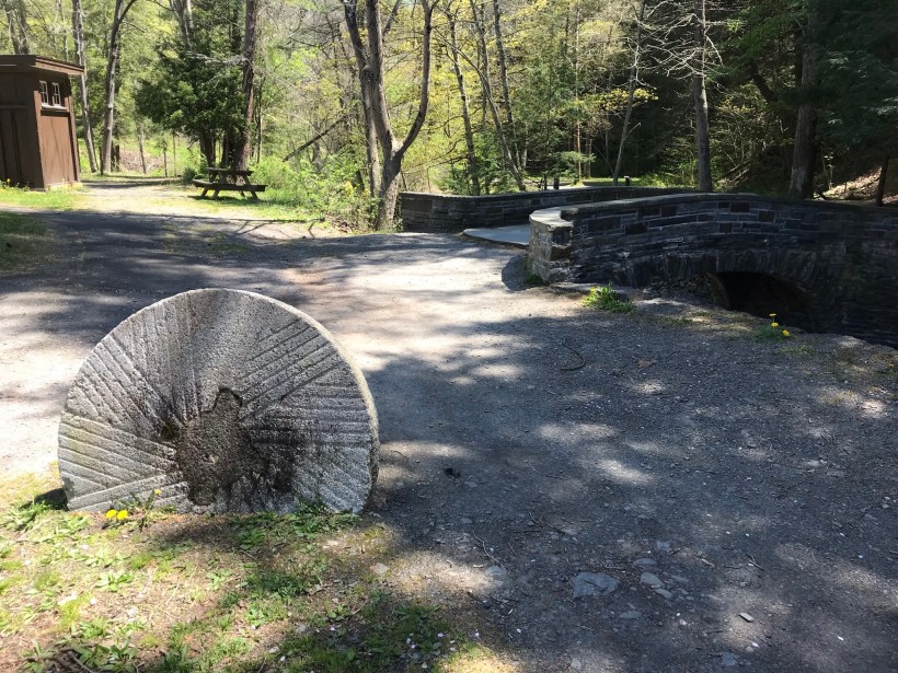
Here is an overview of the Mill, now a museum not yet opened post-Covid. The millstone stands at the start of the foot trails. All media on this post is from my IPhone 7, lightweight equipment for this hike. The automatic upload to ICloud is convenient.
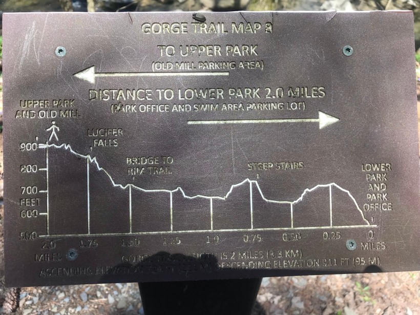
Round trip is four-plus miles, with several hundred feet elevation change. Pam and I discussed a car caravan for our next visit, to support a one-way downhill hike (still plenty of uphill hiking). We need to work up to the round trip after our winter inactivity.
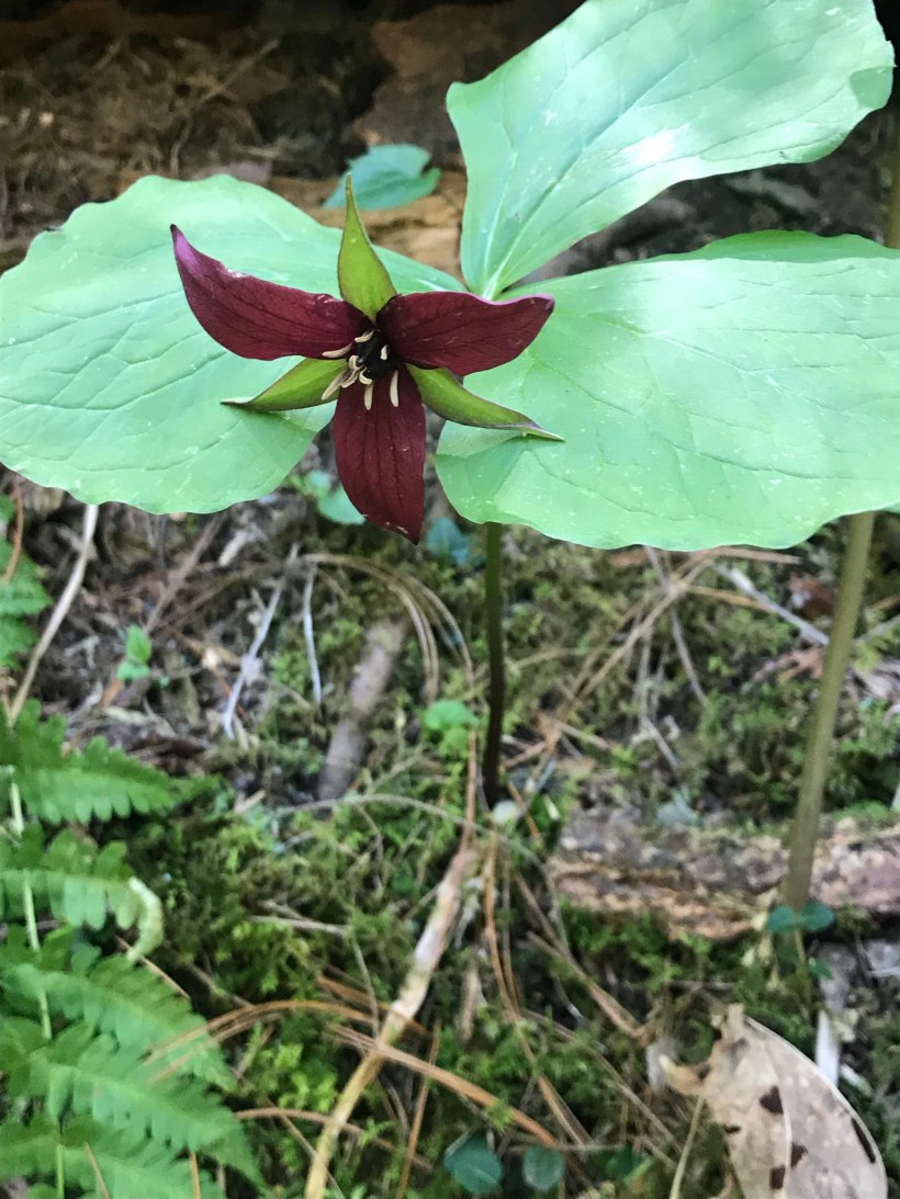
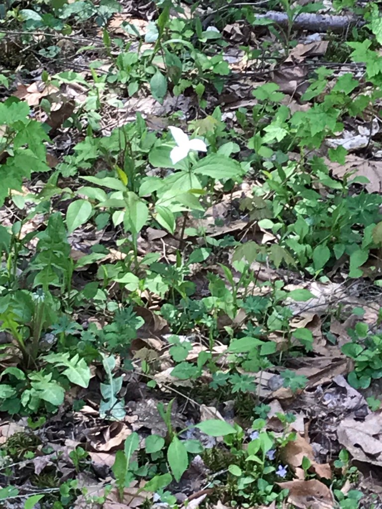
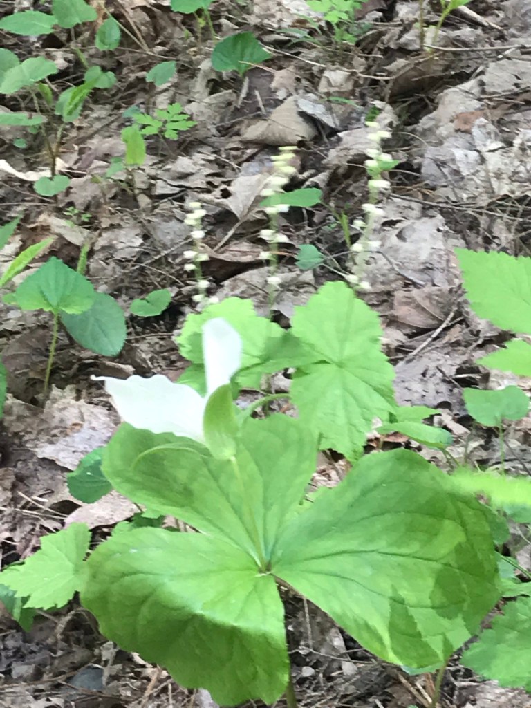
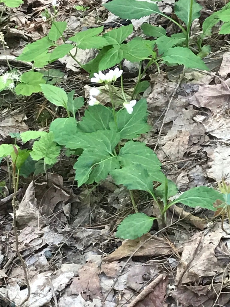
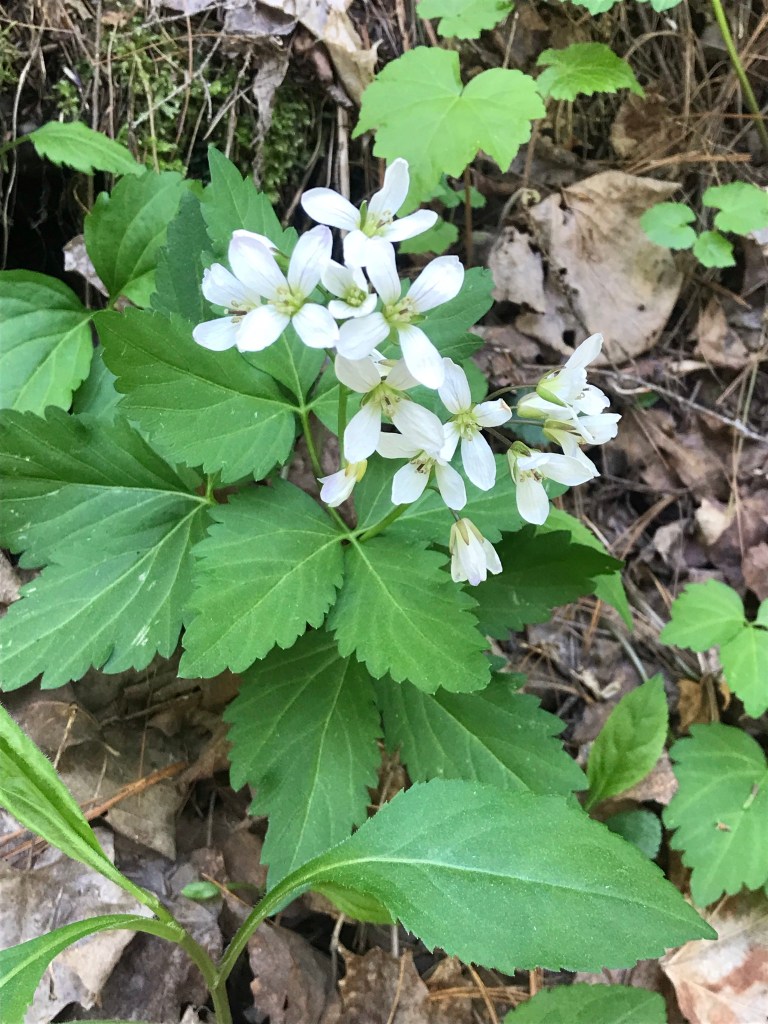
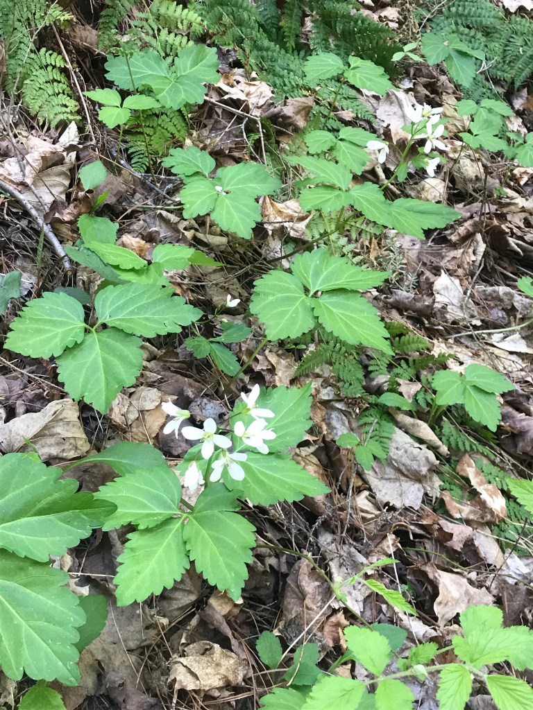
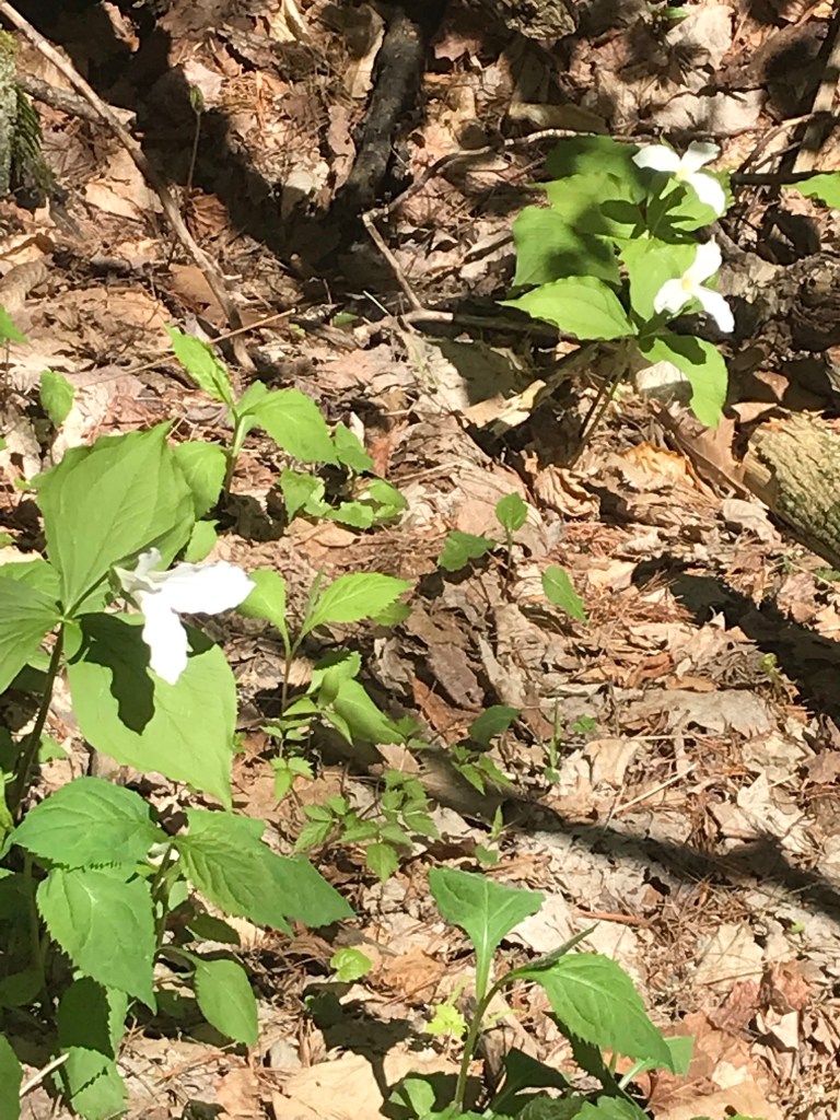
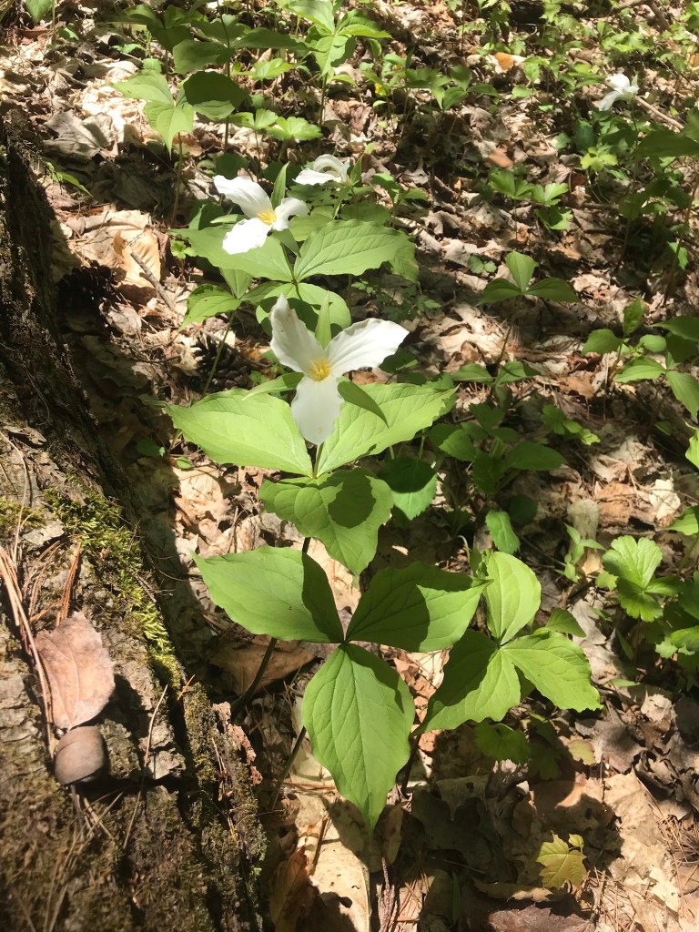
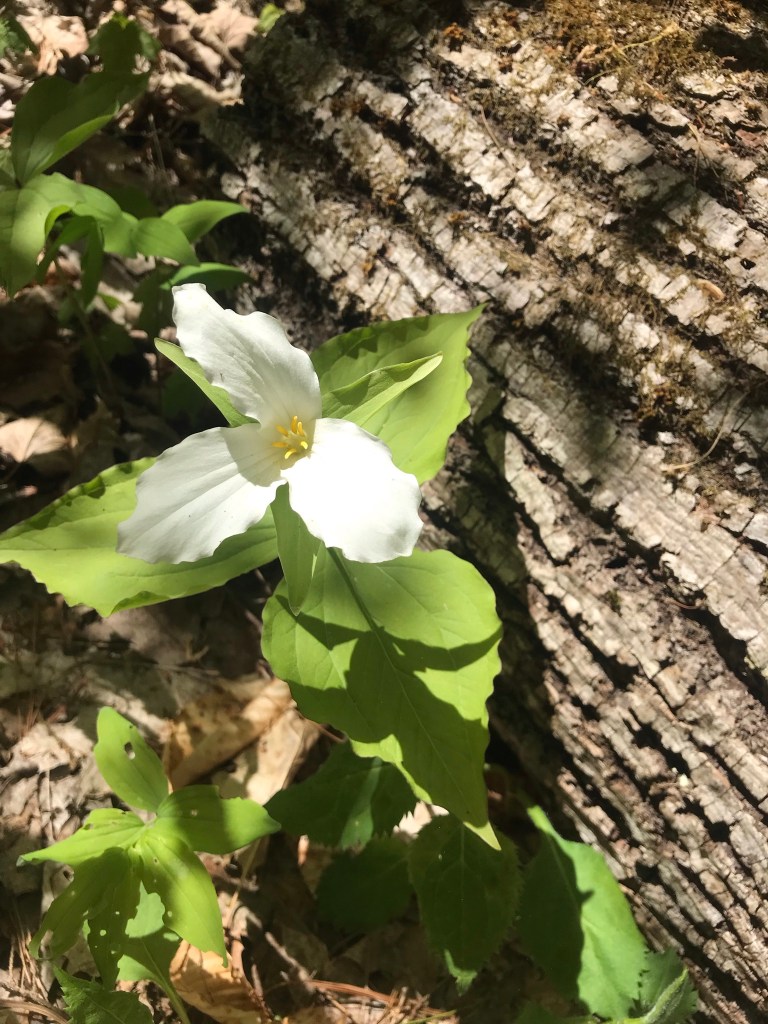
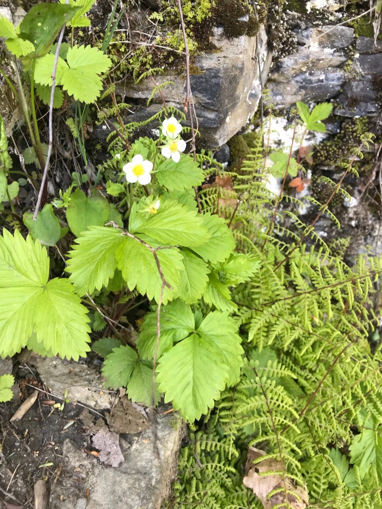
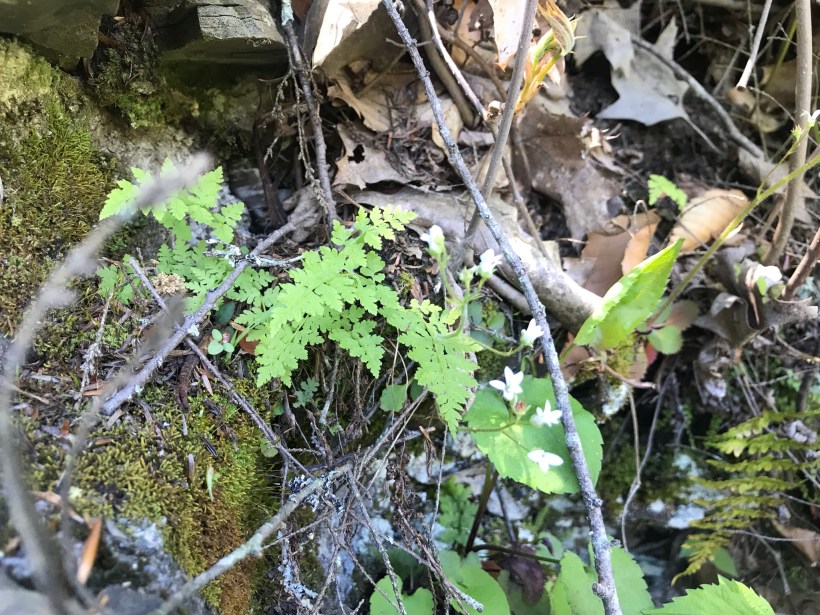
Trillium are in bloom!!
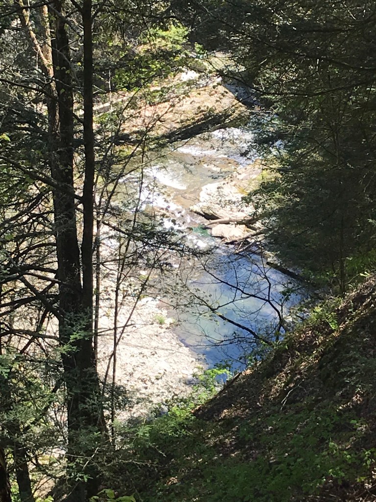
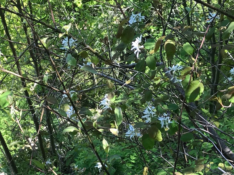
Multiple overlooks into the gorge grace this trail.
More trillium before we reached the overlook. Lucifer falls and the incredible path etched into the cliff by the Civilian Conservation Corps (Roosevelt’s Tree Army during the Depression).
After the Lucifer Falls overlook is this stupendous view from the top of the Cliff Stairs, 224 steps continue to link to the Gorge and South Rim trails.
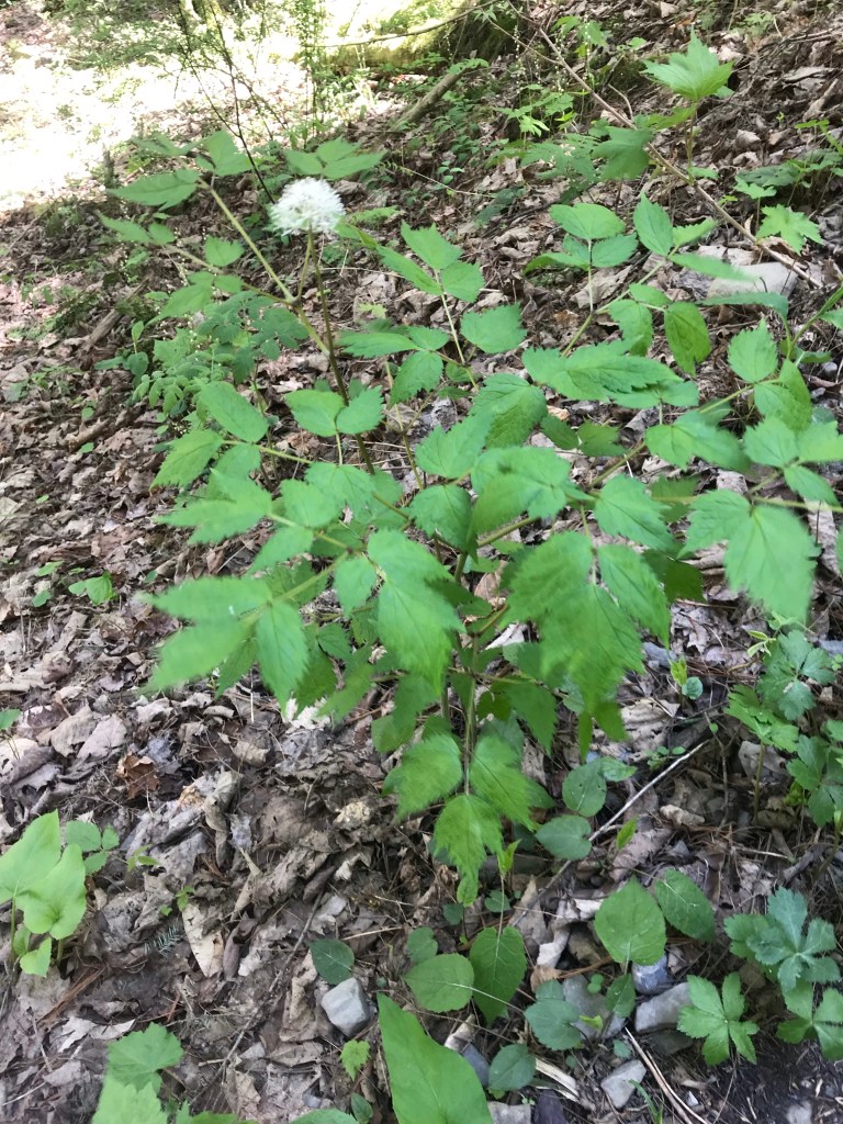
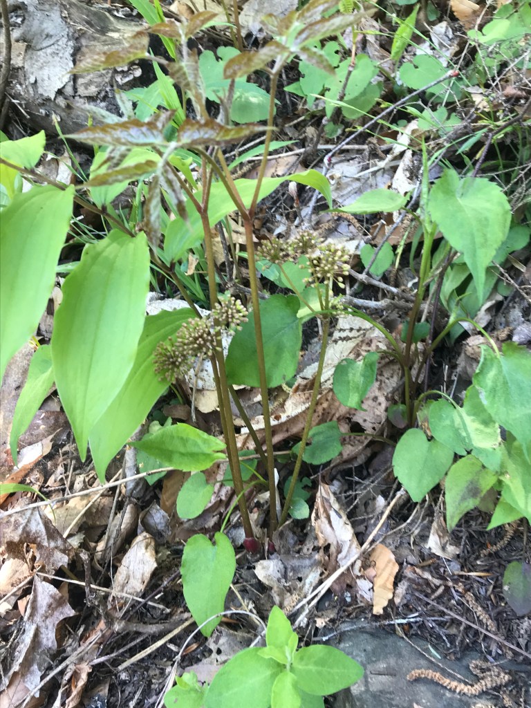
As we lingered on the top steps the flowering plants slowly revealed themselves.
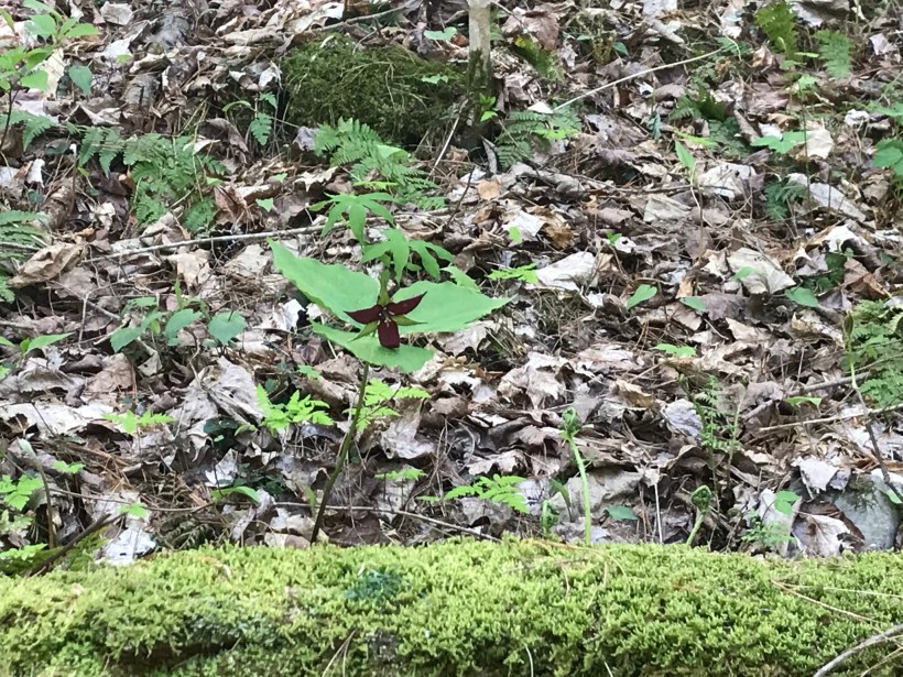
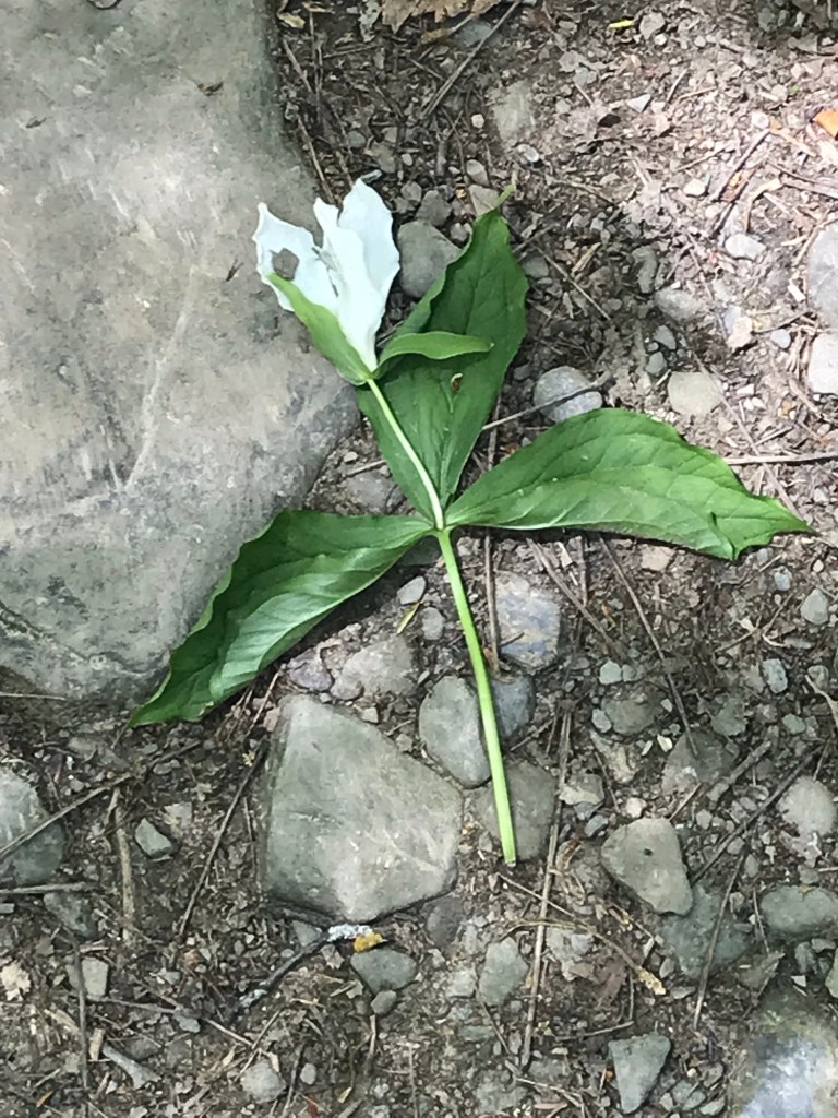
I captured this tragic image on the return trip….a trillium discarded on the trail. Stiff fines await anyone caught doing this.
Copyright 2021 Michael Stephen Wills All Rights Reserved
Summertime, reckless souls jump from the stone stairway into a cool water carved pool at the foot of these falls, one of my memories of the Treman Gorge Trail.


 For those chosen to cross over to the new land in return for