Join me in the mesmerizing world of photography as we capture the ethereal beauty of a frosty January morning, where history meets nature’s artistry. Explore more on our blog.
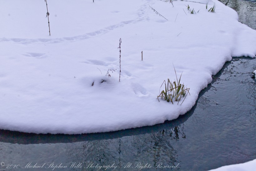
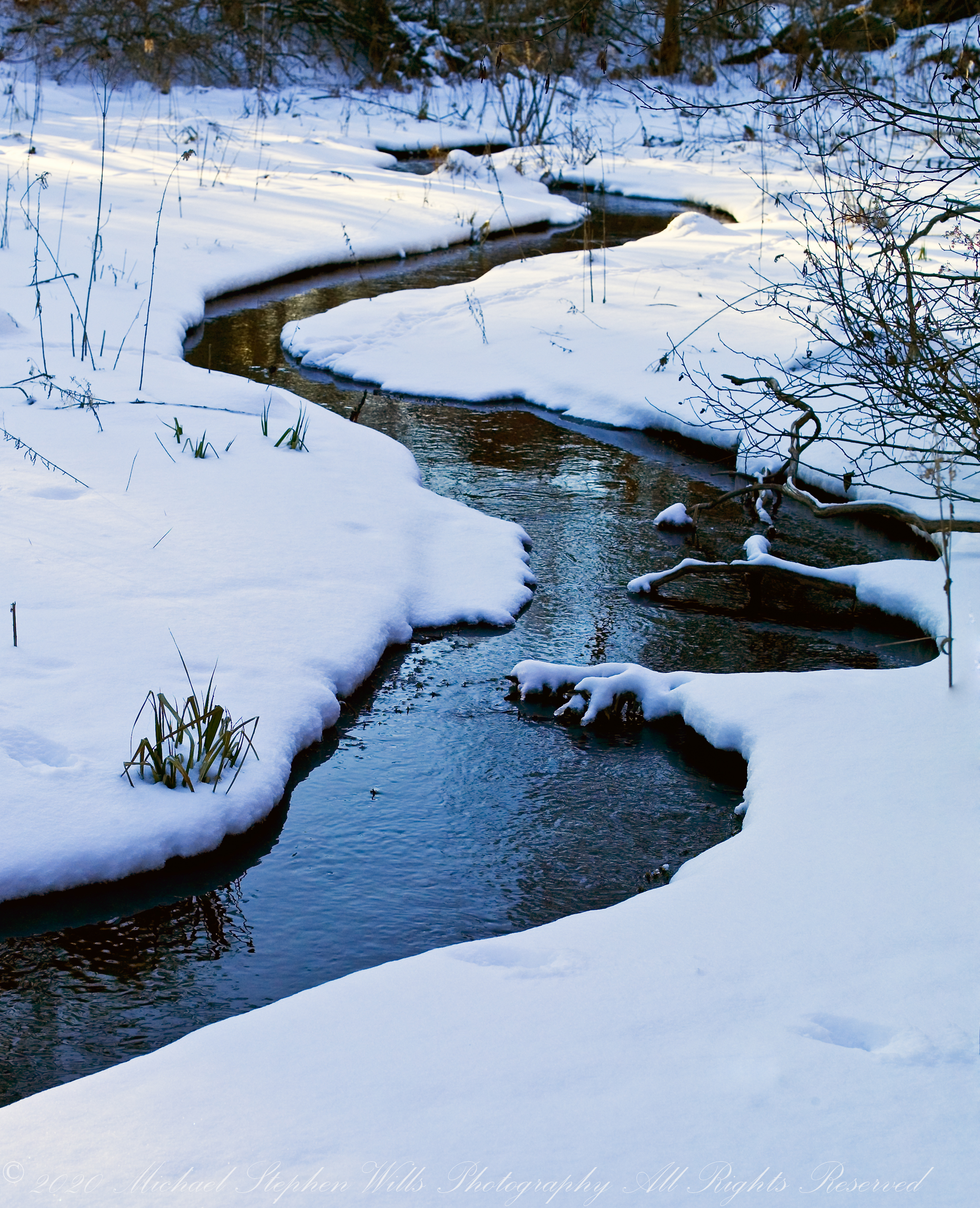
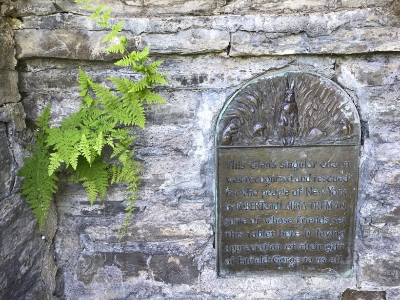
The glacial marls through which this water flows to emerge here clear and pure were under threat from development in the 1980’s and 1990. Thanks to the efforts of the landowner, the uniqueness of this environment was preserved.
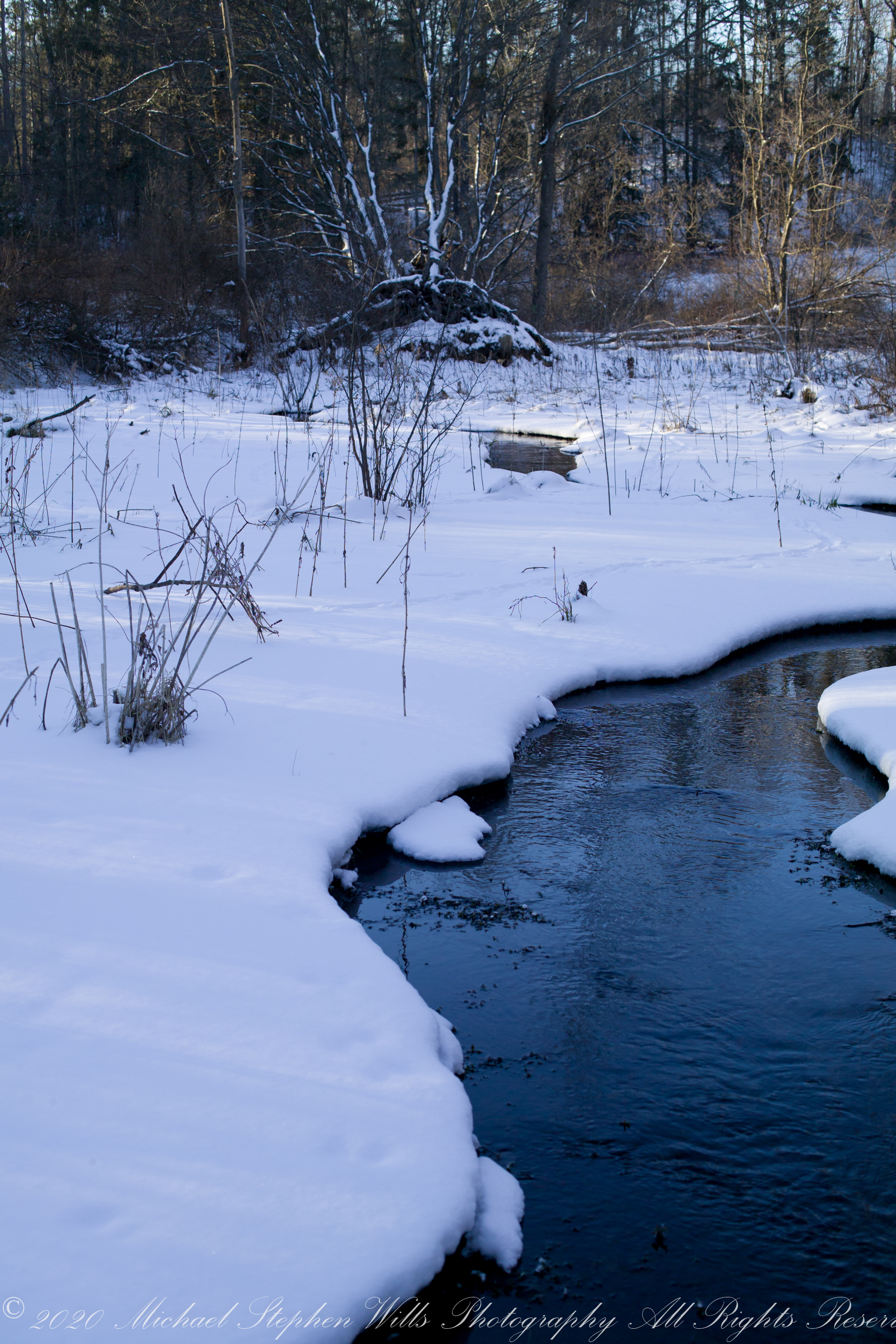
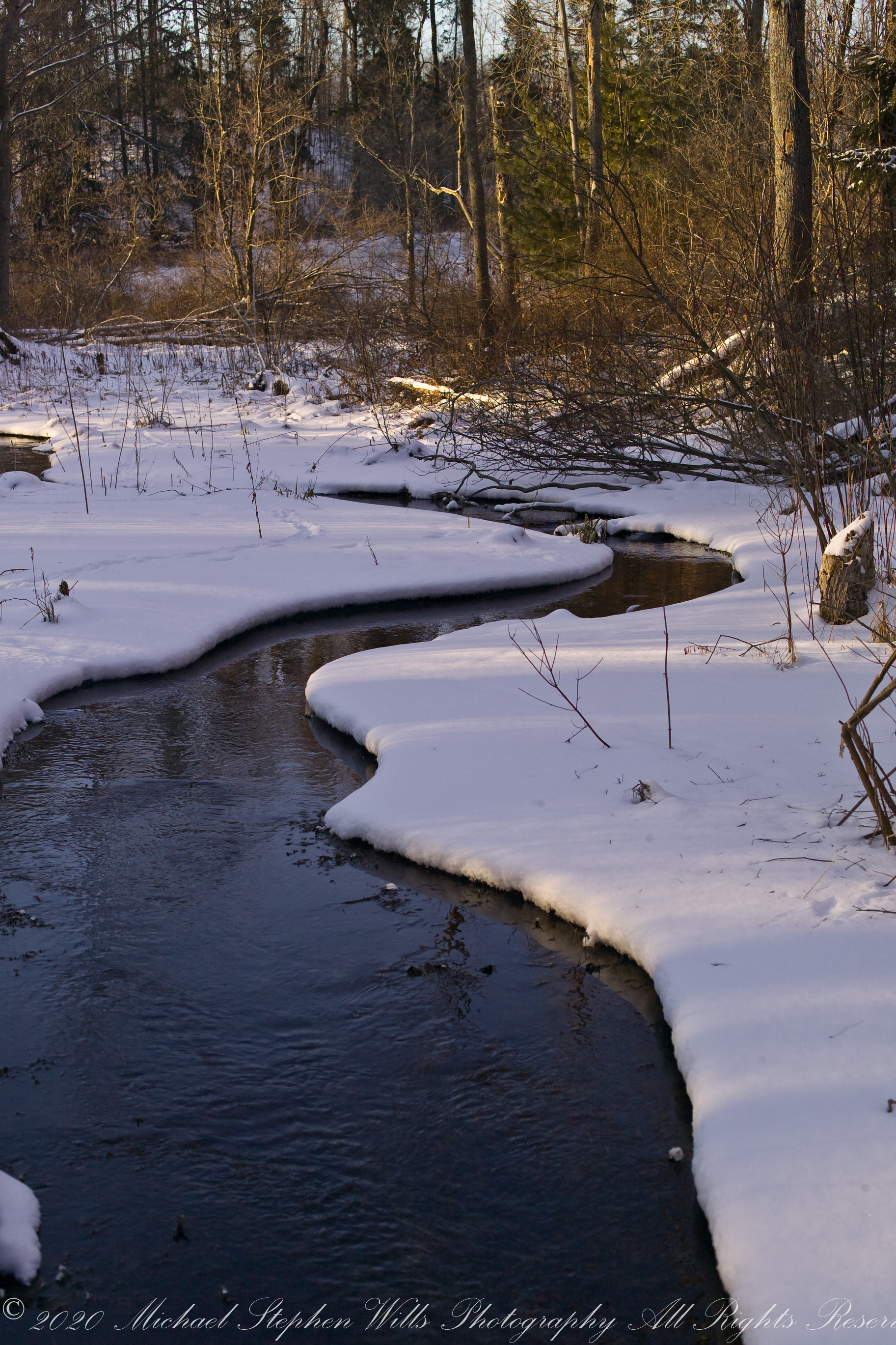
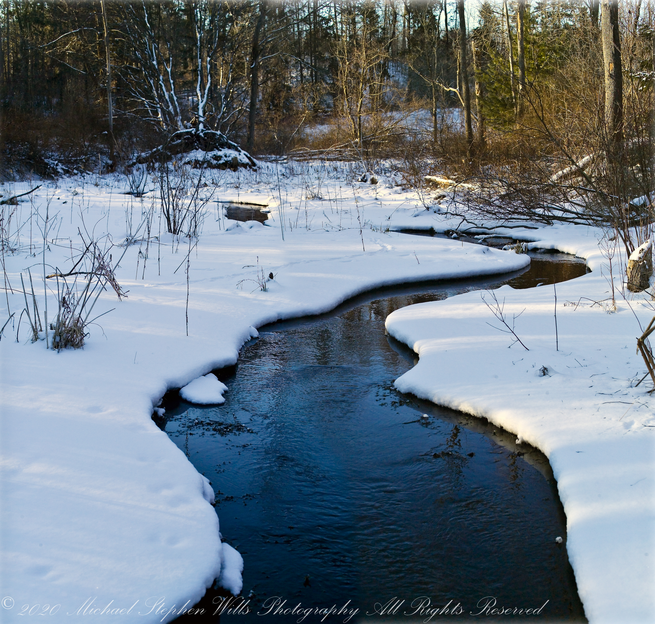
The first two photographs are combined and enhanced in photoshop to yield the third, combination, photograph.
Winter ShadowsWinter Shadows
All were from a tripod mounted Kodak DSC pro SLR-C with the Canon lens EF 50mm f/1.4 USM
Winter Shadows
Copyright 2023 All Rights Reserved Michael Stephen Wills
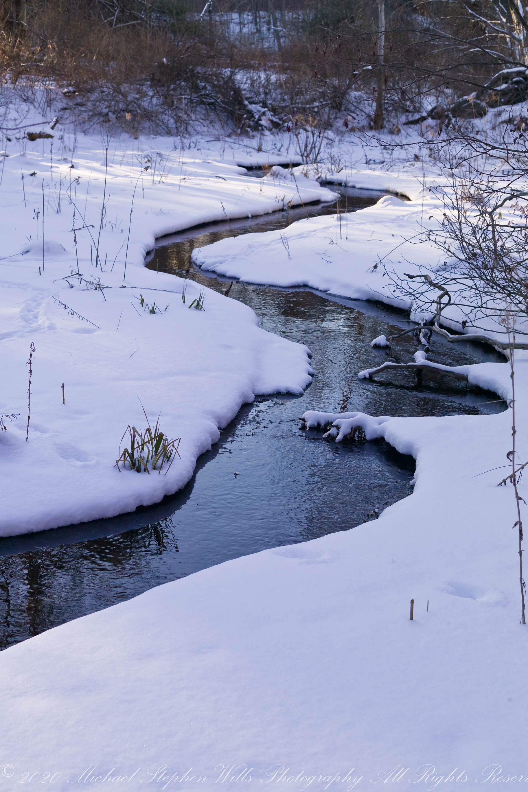
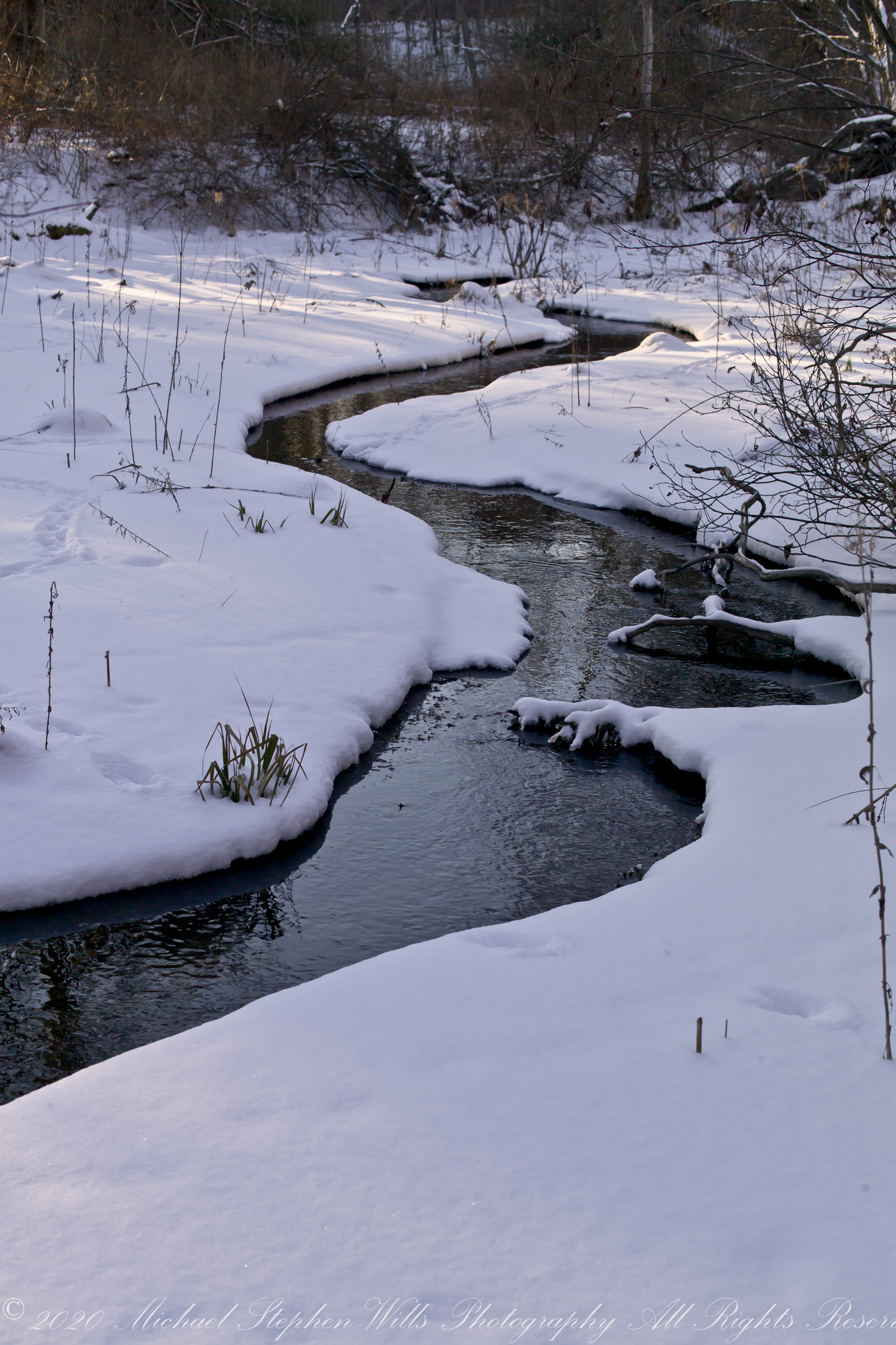
This water emerges from glacial marls, pure and clear, before flowing into a kettle pond. Here we see it on a winter afternoon meandering across a meadow before joining the Fall Creek of the previous postings of this week.
The first two are the same photograph. One has been enhanced in Photoshop. The other was perfected in Lightroom. The third is a different photograph taken about the same time, also peracted in Lightroom.
Winter ShadowsWinter Shadows
All were from a tripod mounted Kodak DSC pro SLR-C with the Canon lens EF 50mm f/1.4 USM
Winter Shadows
Copyright 2023 All Rights Reserved Michael Stephen Wills
In the nature of fame, today Watkins Glen is the best known of the Finger Lakes State Parks. The International Speedway of that name enhanced and amplified name recognition during the post war years. Founded in 1948, the course used public roads of the town until the inevitable happened, an accident and the death of a seven year old child in a group of sidewalk spectators when a racer lost control.
The glen predates the race by 12,000+ years formed at that time from glaciation using materials from distant eons . Watkins Glen was known as a tourist attraction from the 19th century for the resort hotel on the south gorge rim, acquired and developed by New York State in the first years of the 20th century.
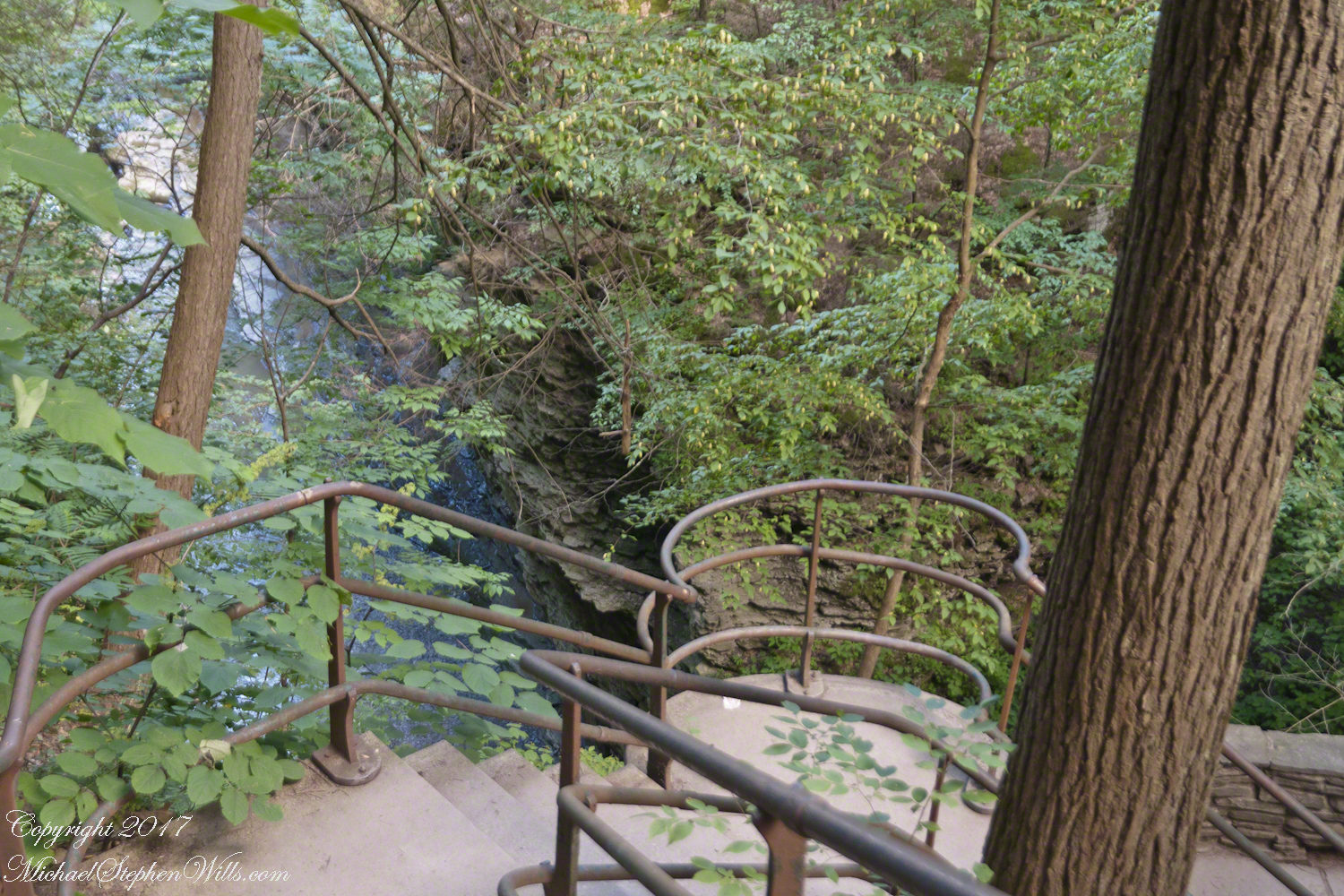
From a gate off “Lovers Lane” a sturdy flight of concrete steps with custom made handrails lead to an observation platform over the gorge. This feature will be known to many future generations……
…….the fine grained concrete is worthy of a Roman wall, the heavy iron handrails were built to specification as flowing curves unlike what is done today: built as modules and accommodated on site.
In the 20th century the fame of Watkins Glen attracted the road race, the popularity of racing enhanced park attendance. Today, the gorge trail of crowded summer weekends. On Tuesday, August 1, 2017 Pam packed a picnic lunch and we made a late start for a weekday visit. The upper entrance is enhanced by mature trees, oak, elm, hemlocks. We had our picnic under these on a moldy picnic table enhanced with a green striped table cloth and fresh coffee.
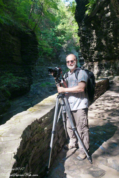
Pam is my personal photographer. Here is an example of her work.
To give me my due, I did the driving and carried the 30+ pound pack into the gorge.
Pam captured me in position downstream from Rainbow Falls with a Manfrotto tripod with hydrostatic ball head on which is mounted a Canon EOS 1Ds Mark III and Canon EF 24mm f1.4 II USM lens, Tiffen nd 0.9 filter.
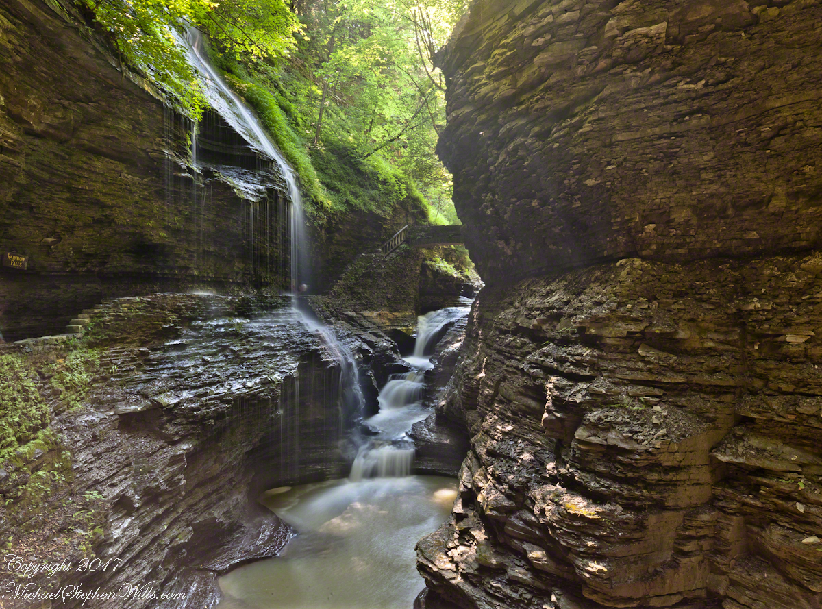
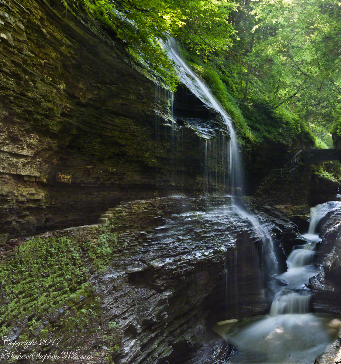
It was coming up to 4 pm eastern daylight savings time, the sun still high overhead. I needed to carefully choose a position for a frame in the wide angle lens without hot spots. Here are two results.
The sun was just of the gorge rim, to the right. Rainbow Falls forms from the tributary to Glen Creek cascading over the gorge walls.
Visitors walk under the falls where falling water eroded the soft, underlying stone to form an overhang.
Copyright 2021 Michael Stephen Wills All Rights Reserved
Here is a repost for those who missed the video. Please click on video, below and share your responses via comments. Thank You
The Finger Lakes Trail joins Robert H. Treman New York State Park, running along the south rim along the park border.
Today, I started from the stairs next to the Mill of the upper park, walking along Fish Kill Creek, a brief visit to the CCC plaque, over the new footbridge and a steep climb up to the ridge to a marvelous view over the way we just walked. That is a millipede resting on a wooden trail stake.
A word on the creek name. The Dutch word for creek is “Kill”, the anglicisation of the original name retained the Dutch making it, in effect, “Fish Creek Creek,” not a memorization of fish massacre.
There’s one shot of the damage done to tree leaves by hoards of caterpillars…I found chewed-up leaves at my feet throughout the hike.
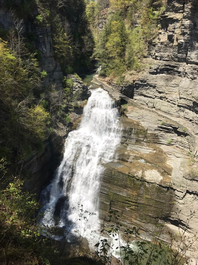
Then, I re-join the State Park South Rim trail, down the Cliff Staircase to wander the gorge floor below Lucifer Falls.
Up the Gorge Trail with many shots of these wonders including Lucifer Falls, Devil’s Kitchen Waterfall, and the Gallery.
Close with a shot of early Tiger Lily blooms on the south facing bank of Enfield Creek.
I used a new format with this post, with all media in one You Tube video. Enjoy!!
Pam and I headed out to Treman Park for a walk to the Lucifer Falls overlook. The Gorge Trail is not yet open due to the danger of rock falling from the gorge walls — the park maintenance staff needs to survey winter damage and knock down material in danger of falling.
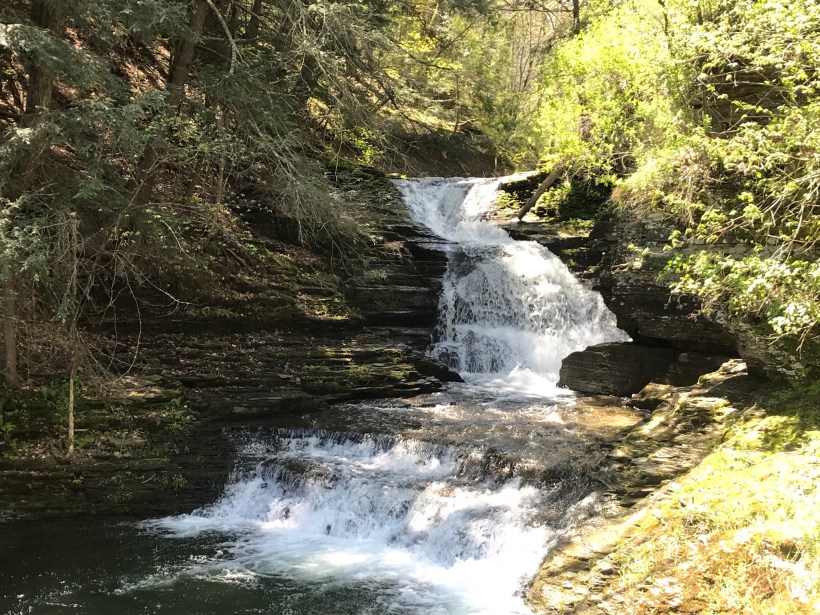
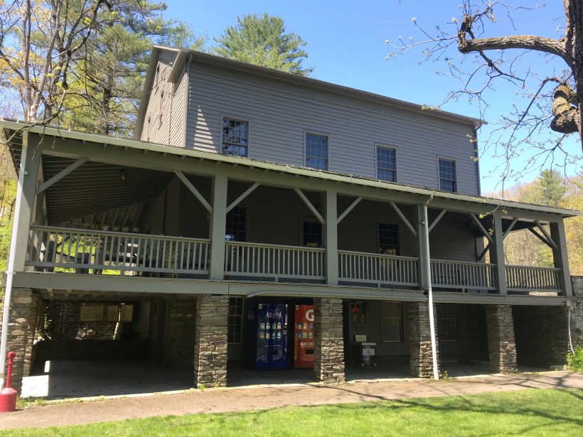
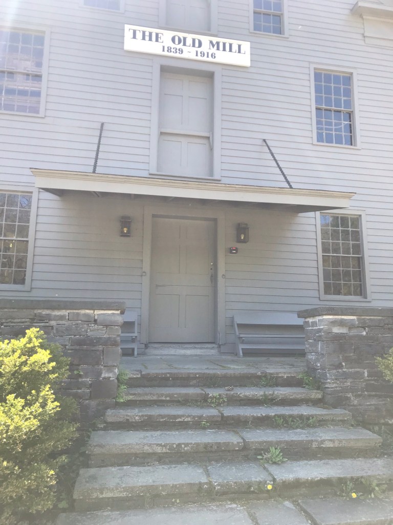
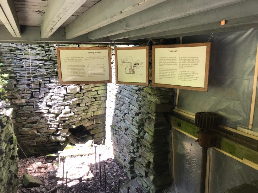
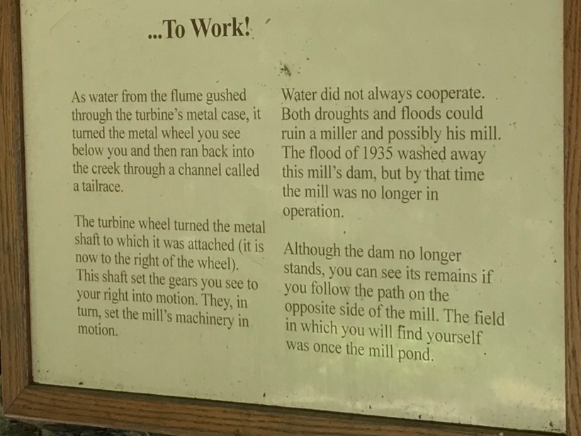
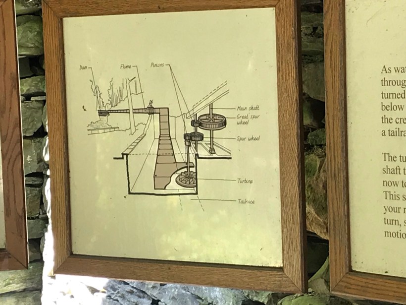
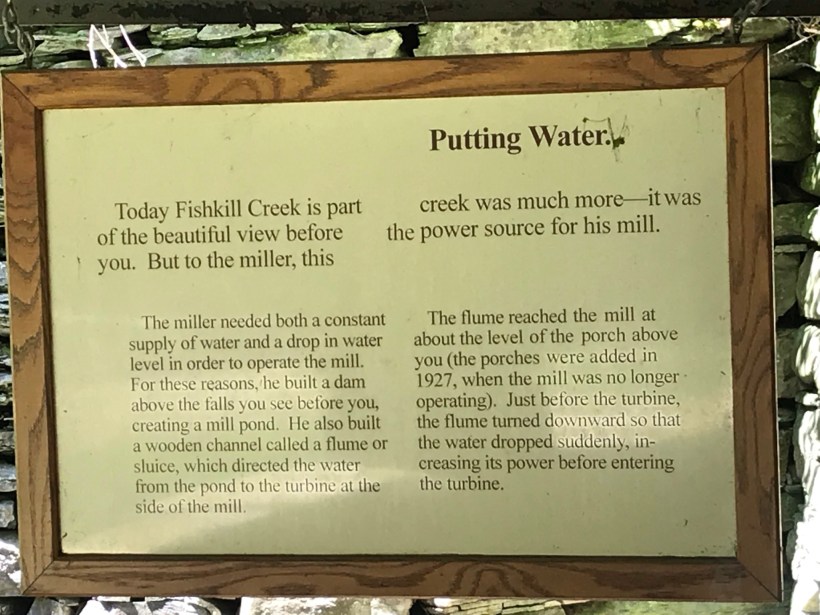
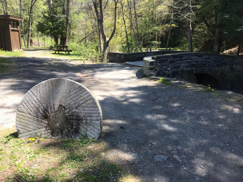
Our first stop was the mill waterfall. This was was directed to the mill stream to power the mill where grain was ground to order.
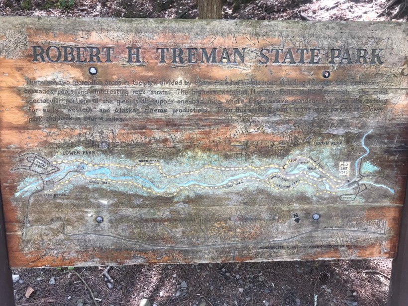
Here is an overview of the Mill, now a museum not yet opened post-Covid. The millstone stands at the start of the foot trails. All media on this post is from my IPhone 7, lightweight equipment for this hike. The automatic upload to ICloud is convenient.
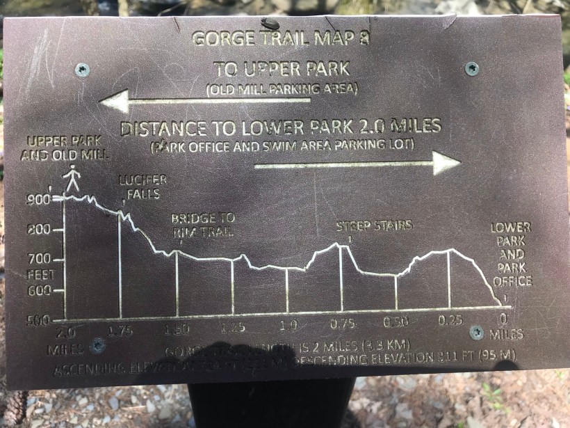
Round trip is four-plus miles, with several hundred feet elevation change. Pam and I discussed a car caravan for our next visit, to support a one-way downhill hike (still plenty of uphill hiking). We need to work up to the round trip after our winter inactivity.
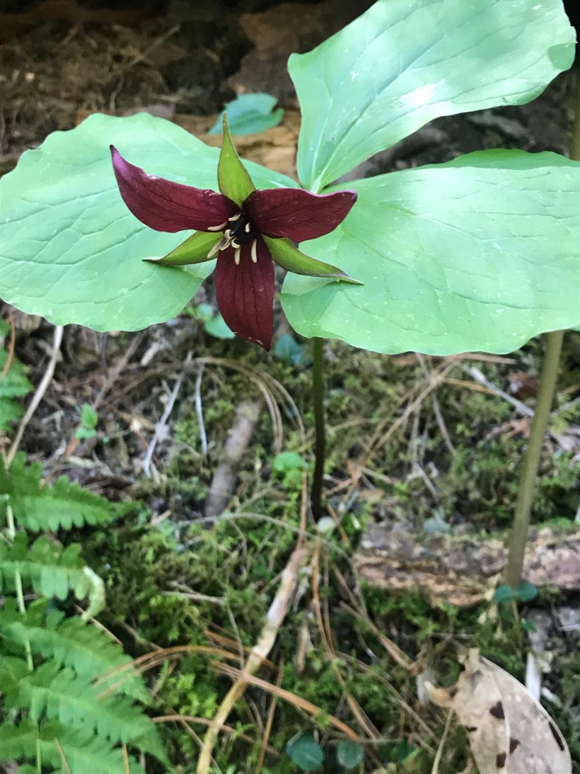
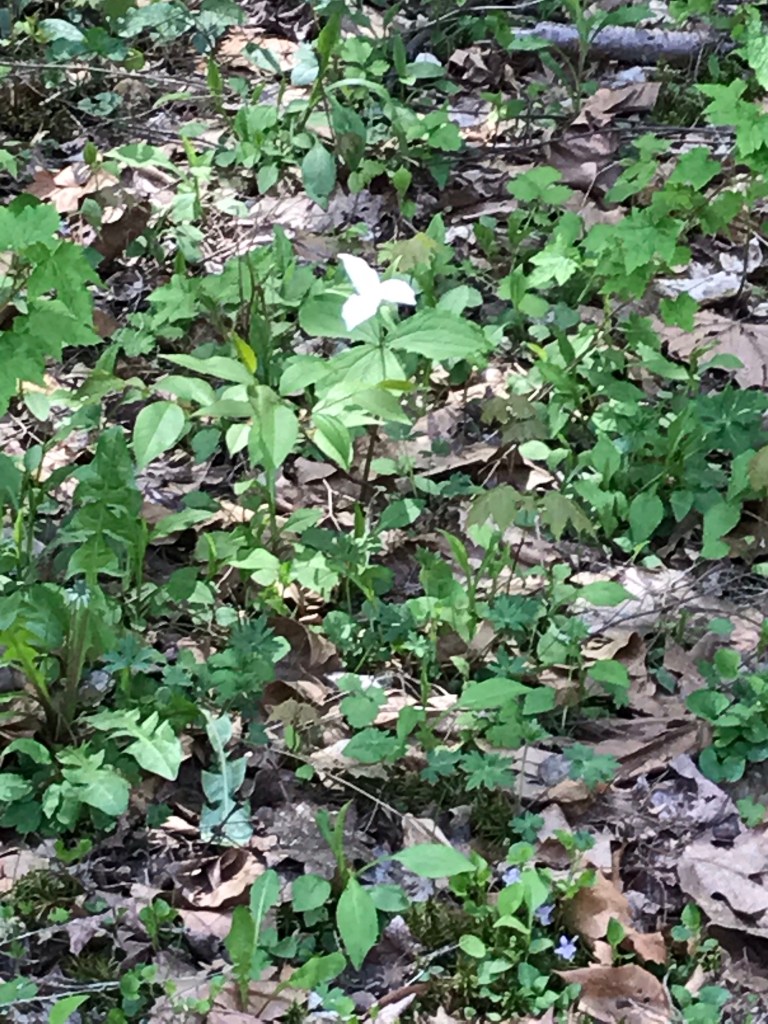
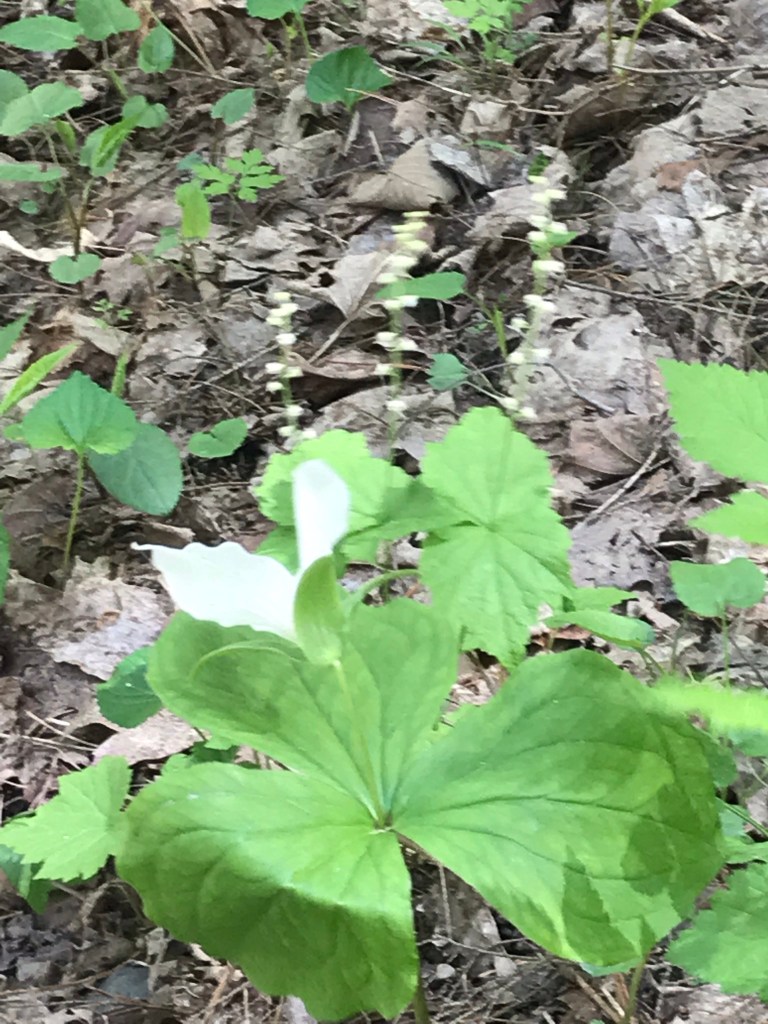
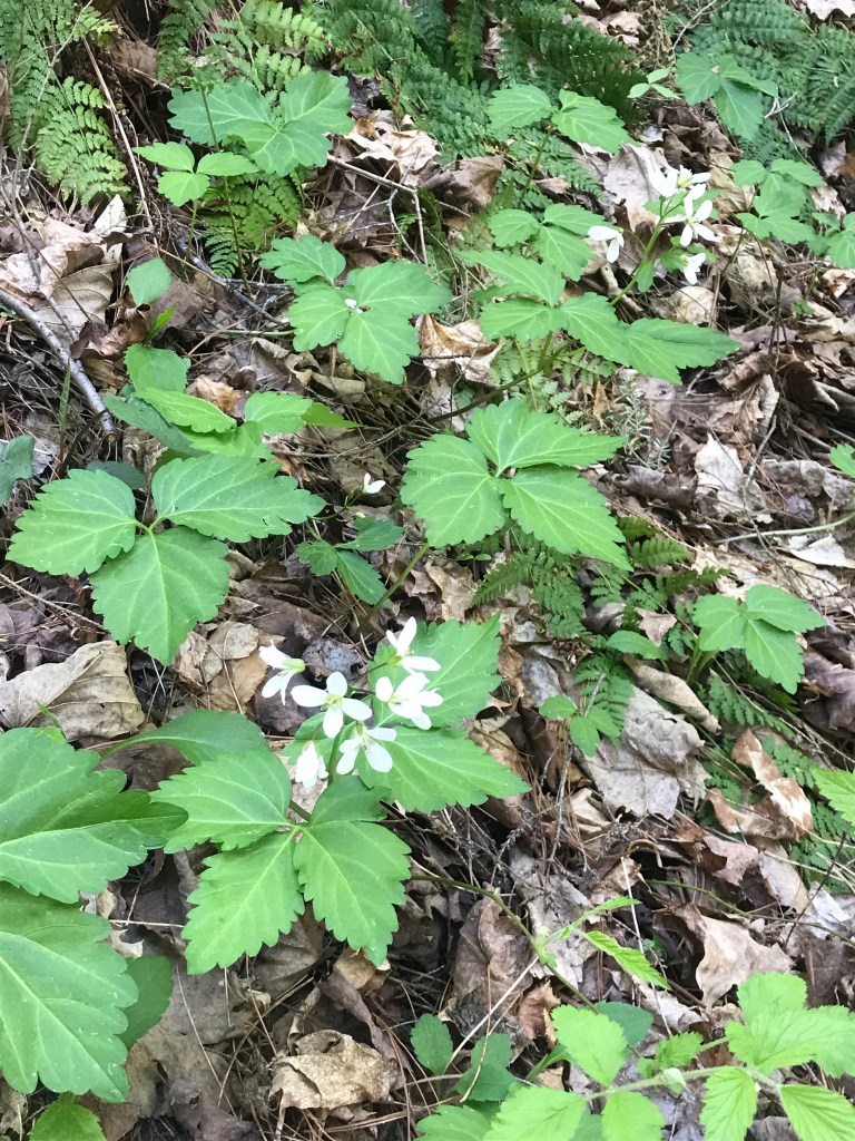
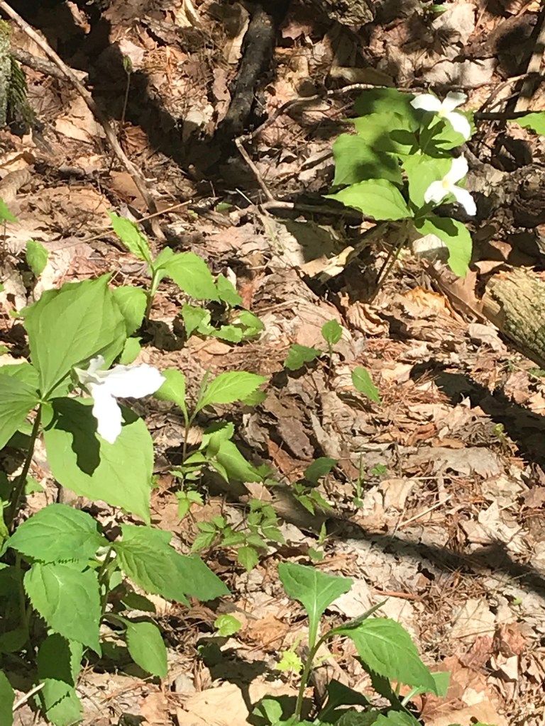
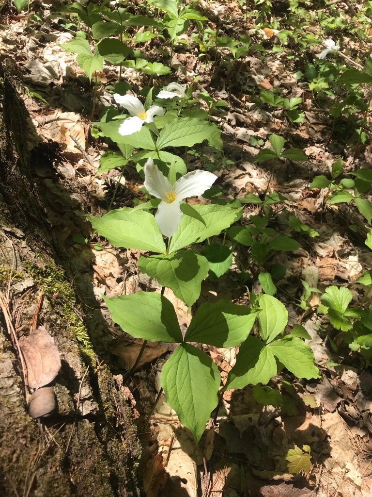
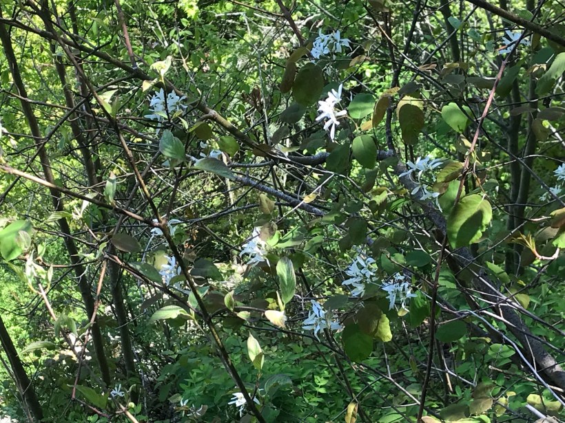
Trillium are in bloom!!
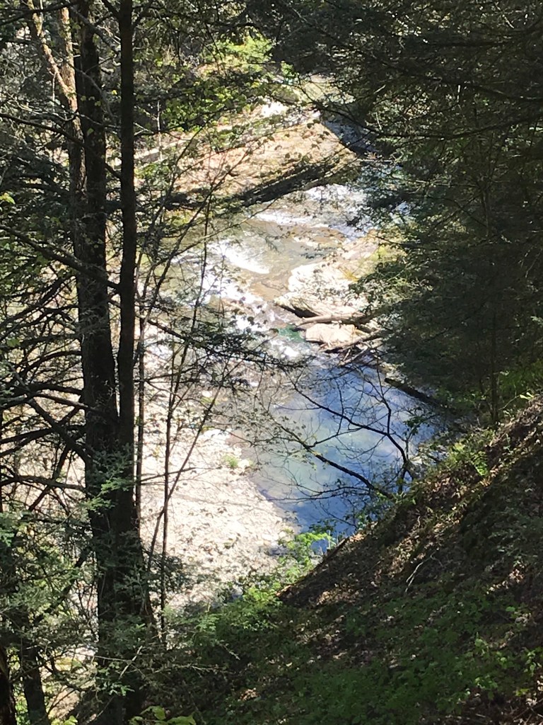
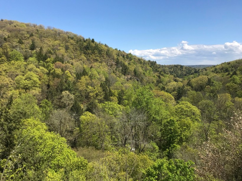
Multiple overlooks into the gorge grace this trail.
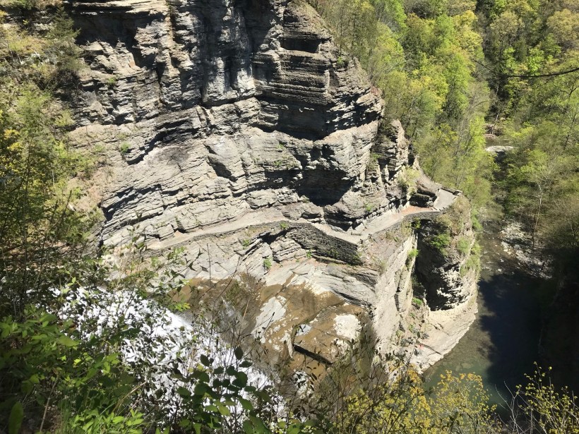
More trillium before we reached the overlook. Lucifer falls and the incredible path etched into the cliff by the Civilian Conservation Corps (Roosevelt’s Tree Army during the Depression).
After the Lucifer Falls overlook is this stupendous view from the top of the Cliff Stairs, 224 steps continue to link to the Gorge and South Rim trails.
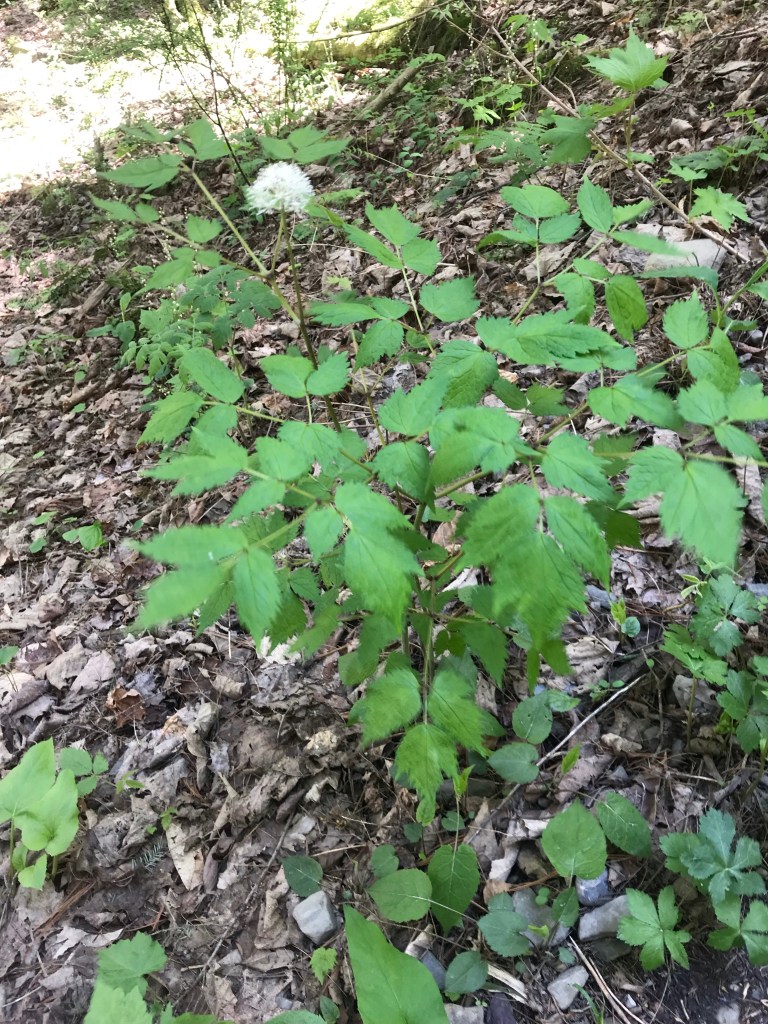
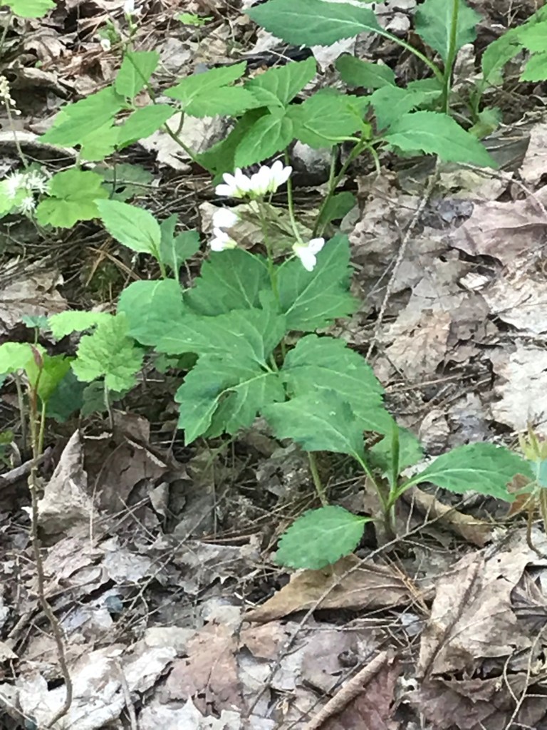
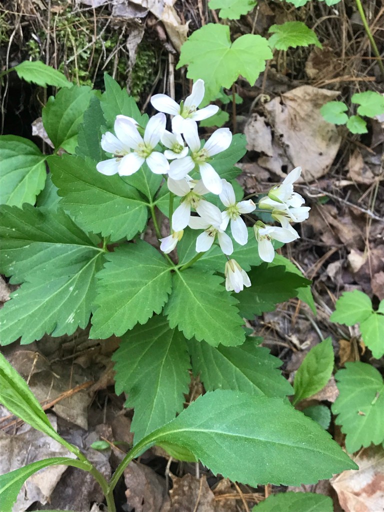
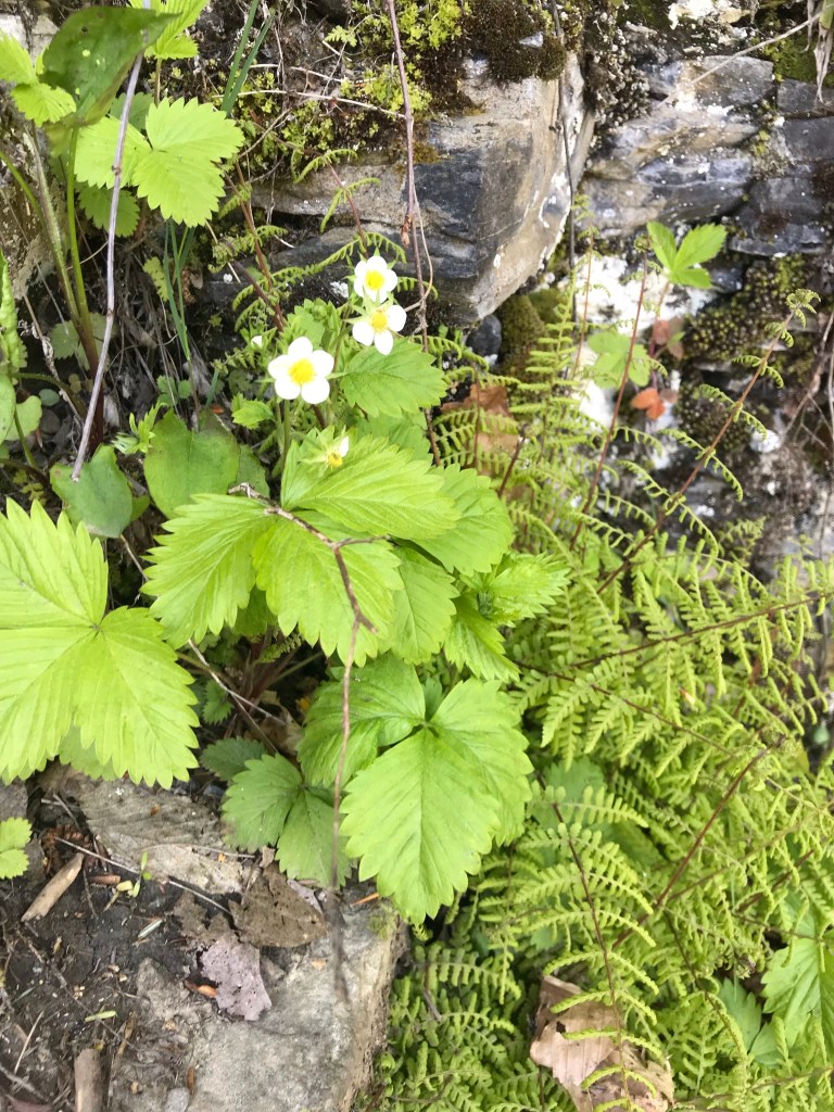
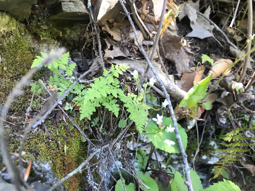
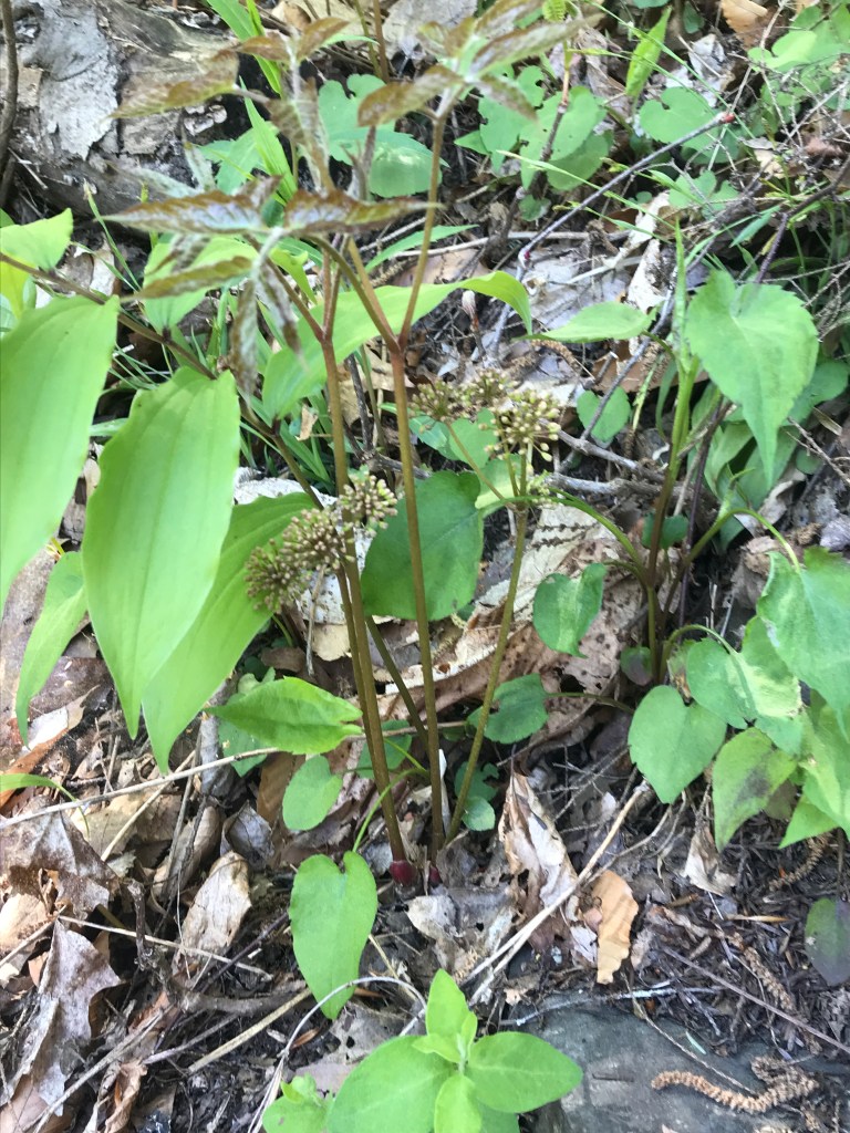
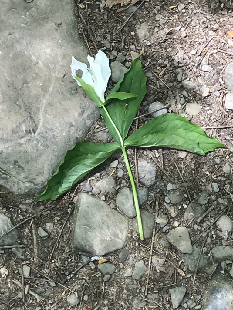
As we lingered on the top steps the flowering plants slowly revealed themselves.
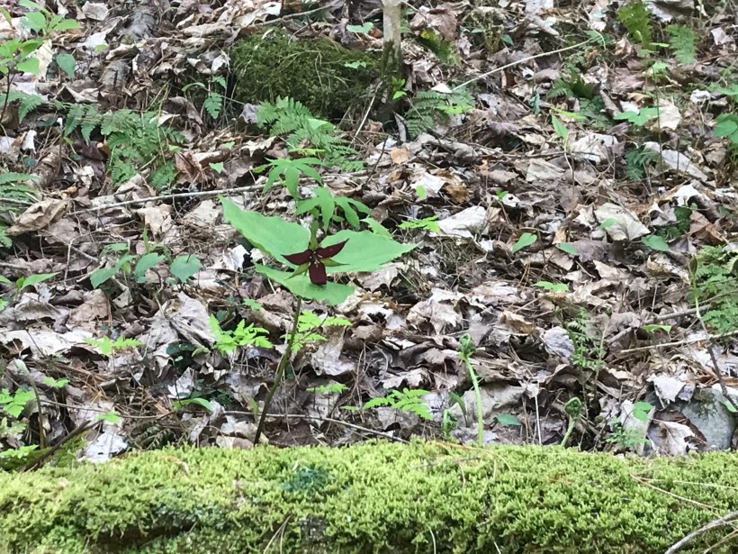
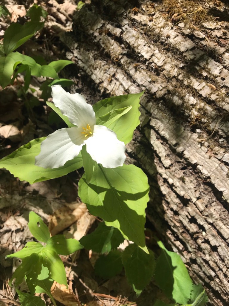
I captured this tragic image on the return trip….a trillium discarded on the trail. Stiff fines await anyone caught doing this.
Copyright 2021 Michael Stephen Wills All Rights Reserved
Summertime, reckless souls jump from the stone stairway into a cool water carved pool at the foot of these falls, one of my memories of the Treman Gorge Trail.