Stopped Sun
For the “Dead of Winter”
For the “Dead of Winter”
Step into the ancient world of Neolithic monuments and discover the astounding astronomical knowledge of our ancestors. Explore the Newgrange Lightbox in Ireland and similar marvels across Europe, revealing a deep connection between ancient peoples and the cosmos. Join me in unveiling these architectural wonders.
Fuertes Bird Sanctuary / Renwick Wood
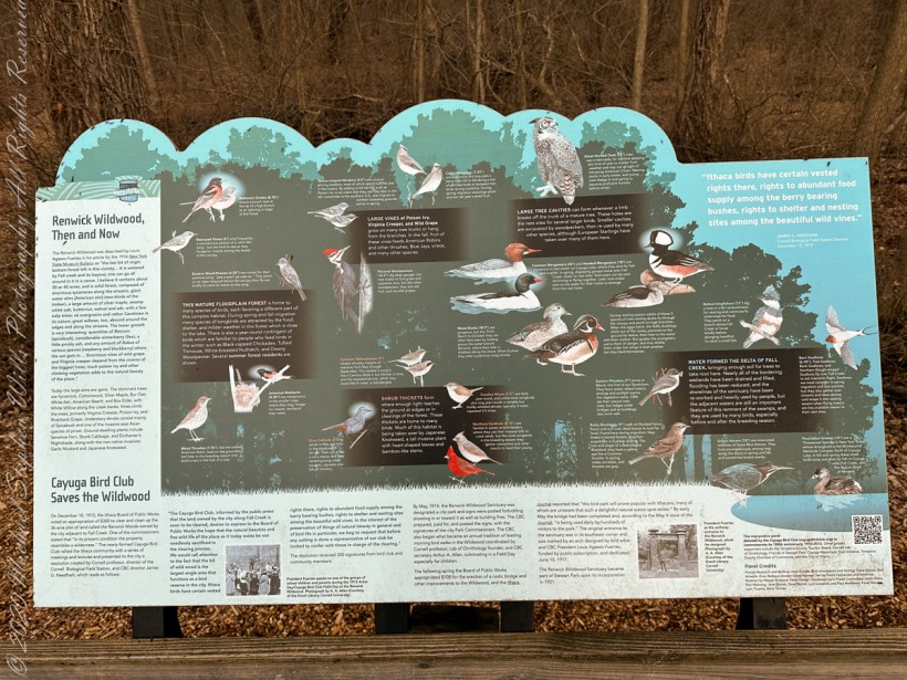
This large sign found along the Cayuga Waterfront Trial at the entrance to Renwick Woods. It provides the origin story (floodplain, delta of Fall Creek), how it came to be conserved and the importance of the place to birds.
The original entrance to the Fuertes Bird Sanctuary, now called Renwick Wood, was marked by this arch, designed by Louis Agassiz Fuertes, dedicated June 10, 1917.
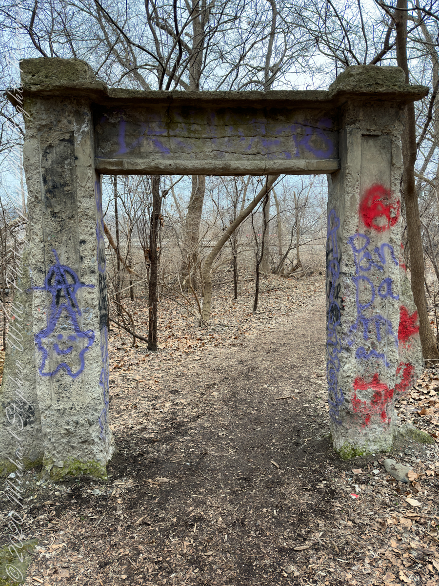
The professor was born February 7, 1874, at Ithaca, the son of Prof. Estevan Antonio and Mary Stone (Perry) Fuertes. He was graduated by Cornell with the degree of A.B., in 1897, and married Margaret F. Sumner of Ithaca, in 1904. Since 1898 he had been a painter of birds.
Professor Fuentes illustrated such volumes as “Birding on a Broncho,” “Citizen Bird,” Song Birds and “Water Fowls.” His permanent work included habitat groups in the American Museum of Natural History; 25 decorative panels for F.M. Brewster, at New Haven, Conn., birds of New York at the State Museum, Albany; murals in the Flamingo Hotel, at Miami, Fla., paintings for the New York Zoological Society, Bronx. (Source: Find a Grave)

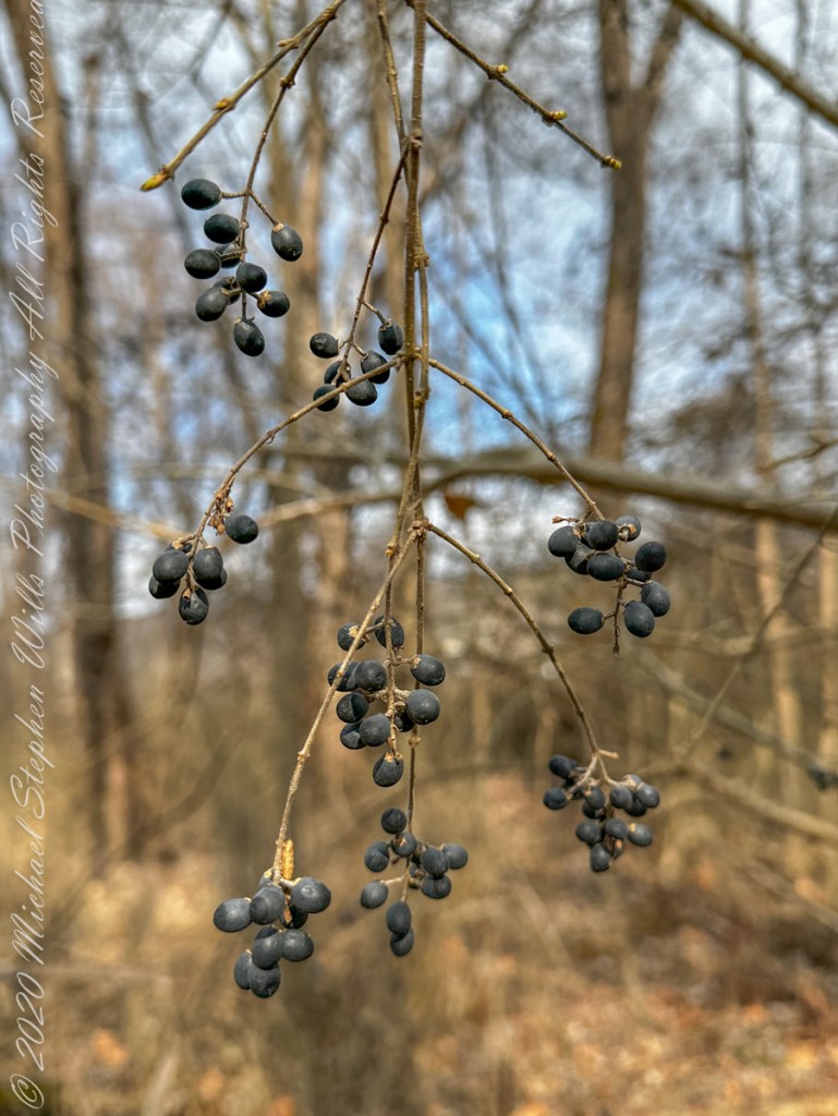
The flowers of this small shrub identify it as a member of the Rose family. The berries I captured in the following photograph are edible (non-poisonous), though astringent. Autumn time, the leaves turn red. It is native to eastern North America. I found these berrys along the Renwick Wood trail.
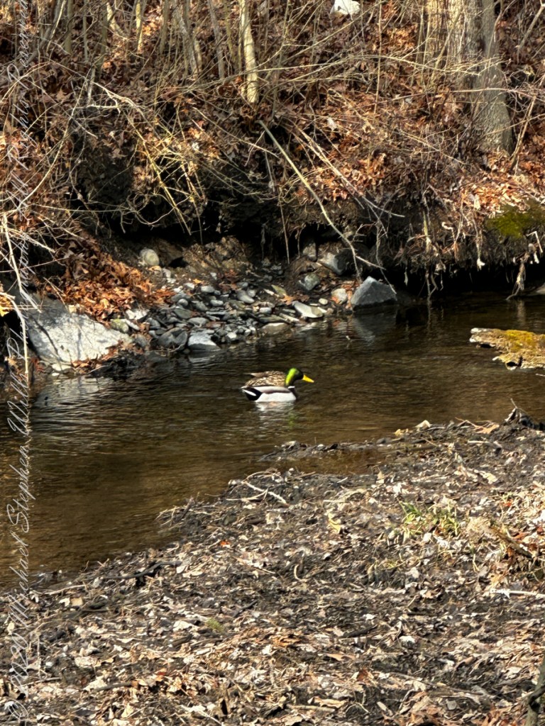
A pair of Mallard ducks foraging along a Fall Creek bayou on the edge of Renwick Woods where Stewart Park begins.
Ithaca Fire Department was training at their facility on Pier Road, next to Newman Golf Course, and across Fall Creek from Renwick Woods.
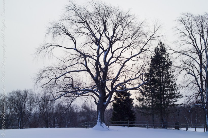
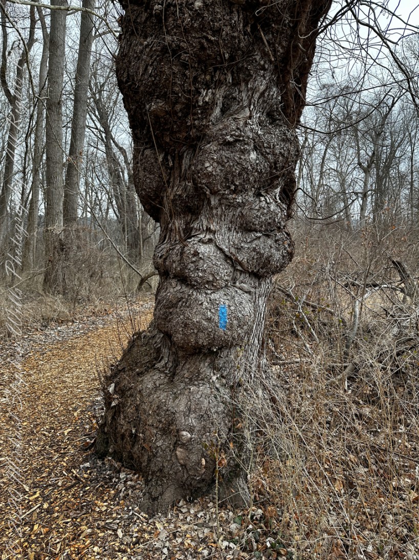
Hoary Elm in HDR
Late Winter, on the cusp of Spring, I arrived at the Cornell Experimental farm before sunrise.
There I set up a Kodak DSC Pro SLR/c with a Canon EF 50 mm f/1.4 USM lens all mounted on a very stable Manfrotto Studio Aluminum Tripod Model 475 and Hydrostatic Ball Head. From this 15 exposures were obtained. Photoshop CS6 HDR combined the 15 into this perfected image. Cornell Thompson Experimental Farm, Town of Dryden, Tompkins County, New York
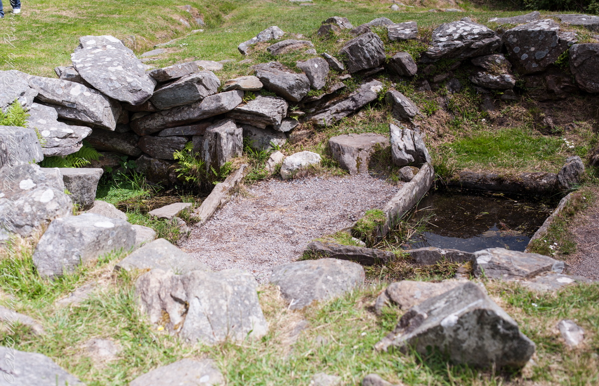
Two Huts and a Hearth
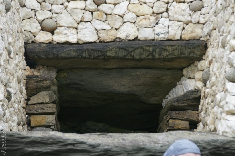
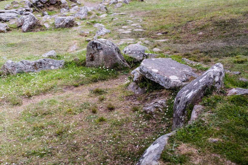
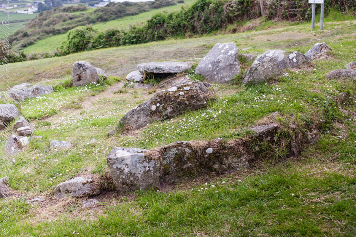
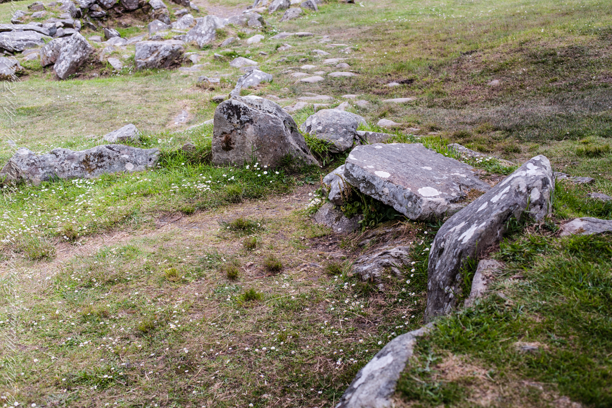
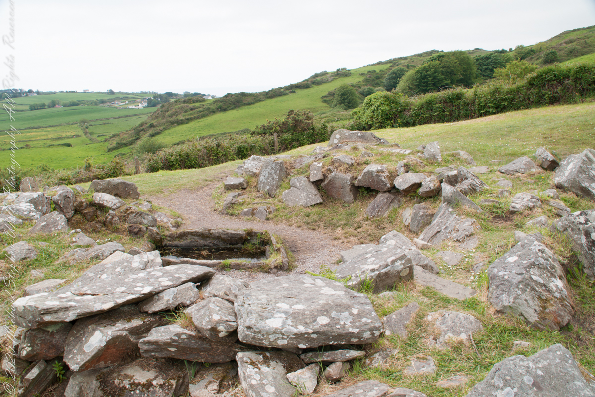
Drombeg has two huts adjoining the Fulacht Fiadh with a connecting path.
Hut B incorporates a rock lined hearth that possibly served as an oven.

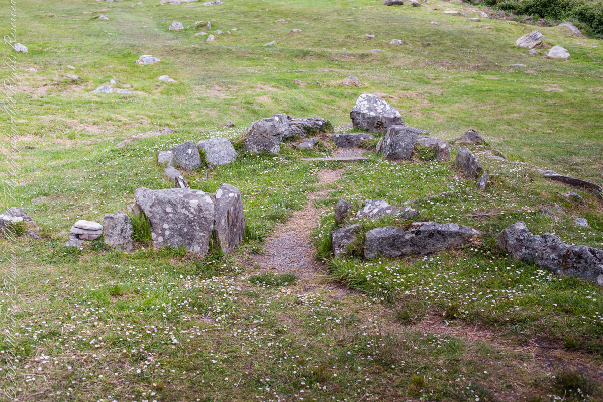
Survey of elements
The previous post was an overview the Fulacht Fiadh associated with the Drombeg Stone Ring of County Cork, Republic of Ireland.
In this post, we explore the elements of these fascinating remnants from the late Bronze Age, over 3,000 years ago.
It is amazing the rock wall survived human need for the valuable wall stones. Portions were stolen, though for the most part we can see enough to understand.
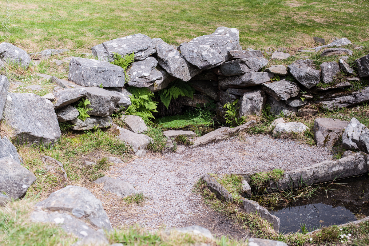

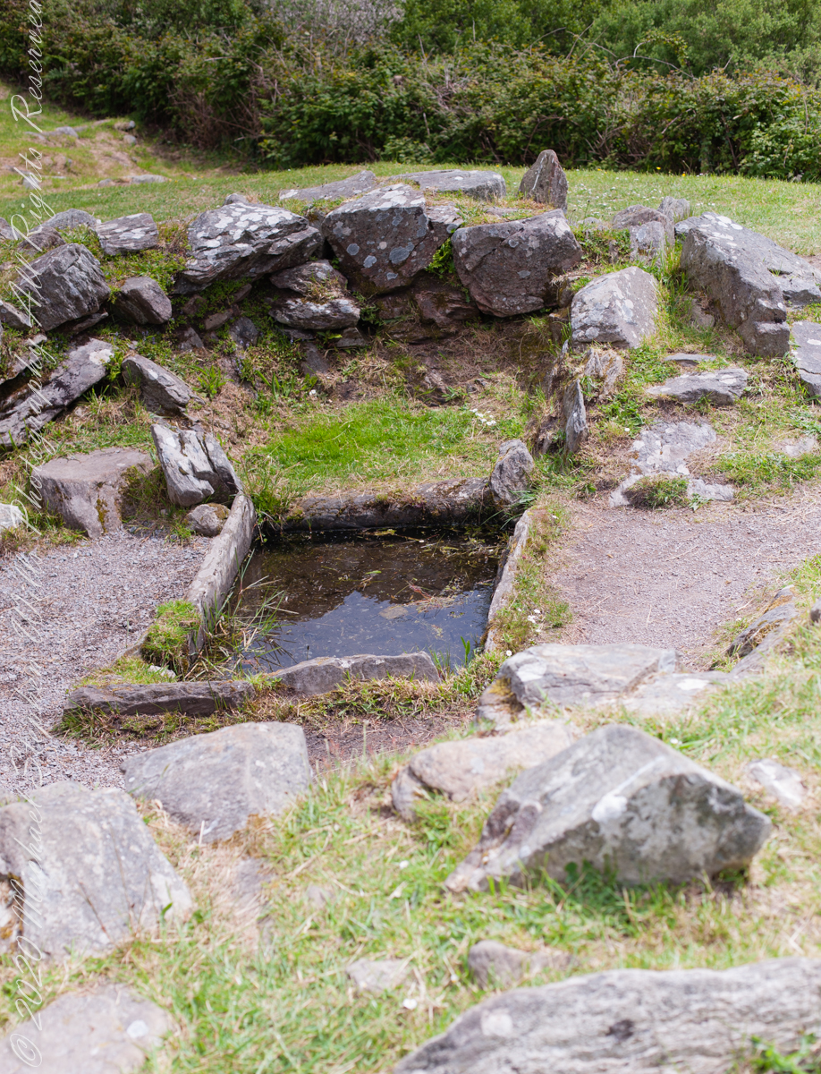
Drombeg’s Fulacht Fiadh, a Bronze Age cooking site, used heated stones to boil water for cooking, dyeing, and brewing.
Notice the groupings of visitors in the middle distance of Pam’s photograph, gathered around remains of late Bronze age elements.

There is a sign to explain…
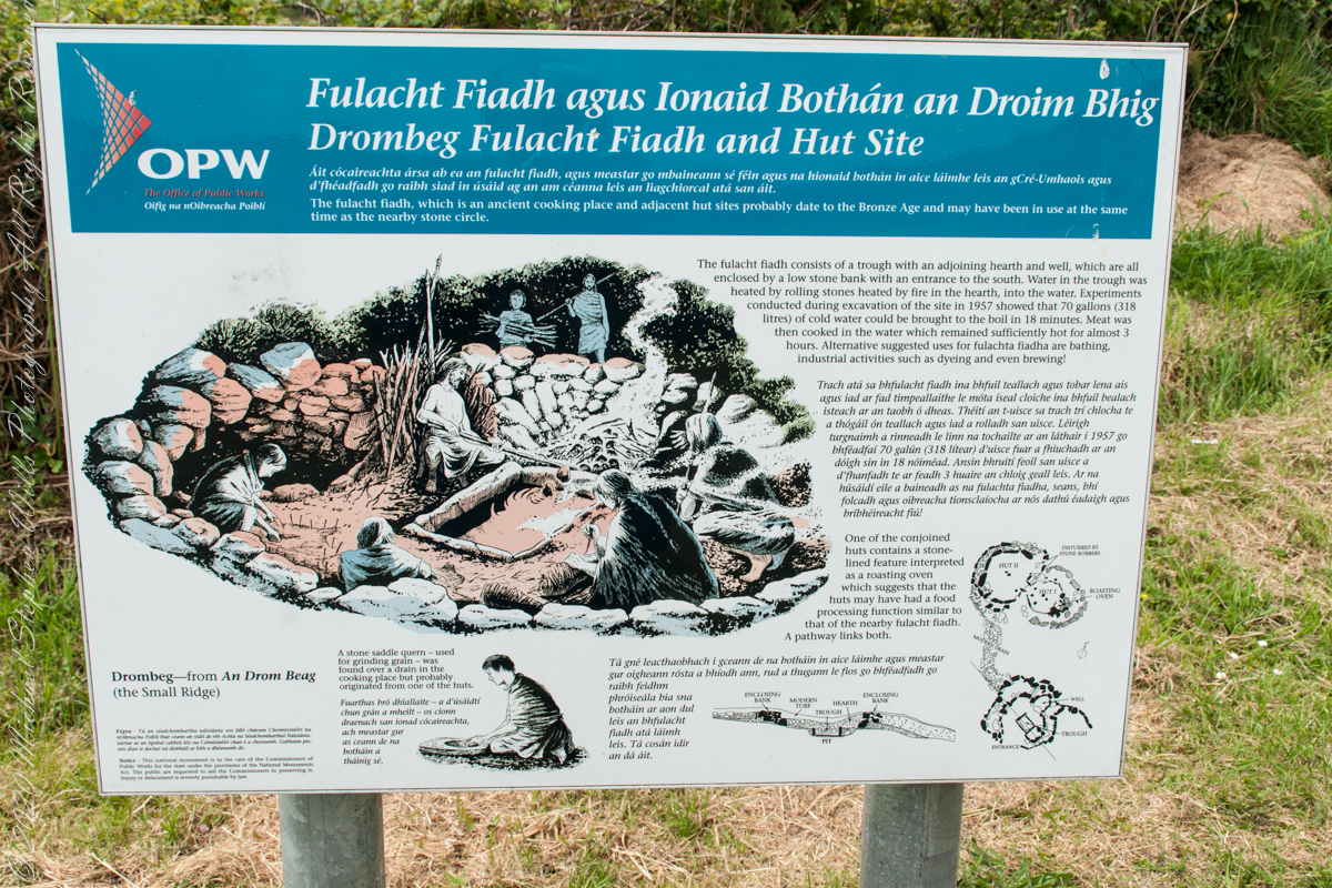
In modern Ireland the word fulacht means barbeque and the archeological sites with characteristics in common, such as a water source, health and pit, are named “Fulacht fiadh,” derived from Old Irish sources. In all cases the link is to some kind of preparation activity involving heat and moisture. Found throughout Ireland, Great Britan and the Isle of Man where the sites are called burnt mounds. The Drombeg Fulacht fiadh exemplifies all characterists. There is a horseshoe shaped rock walled/banked, now a remnant, enclosure, entrance to the south. In the middle is a pit, at Drombeg lined with rock, a spring on one side, a hearth on the other. A stone saddle quern, used for grinding grain, was nearby Adjacent huts, rock walls with post holes, do not suggest a settlement, but rather a temporary use.

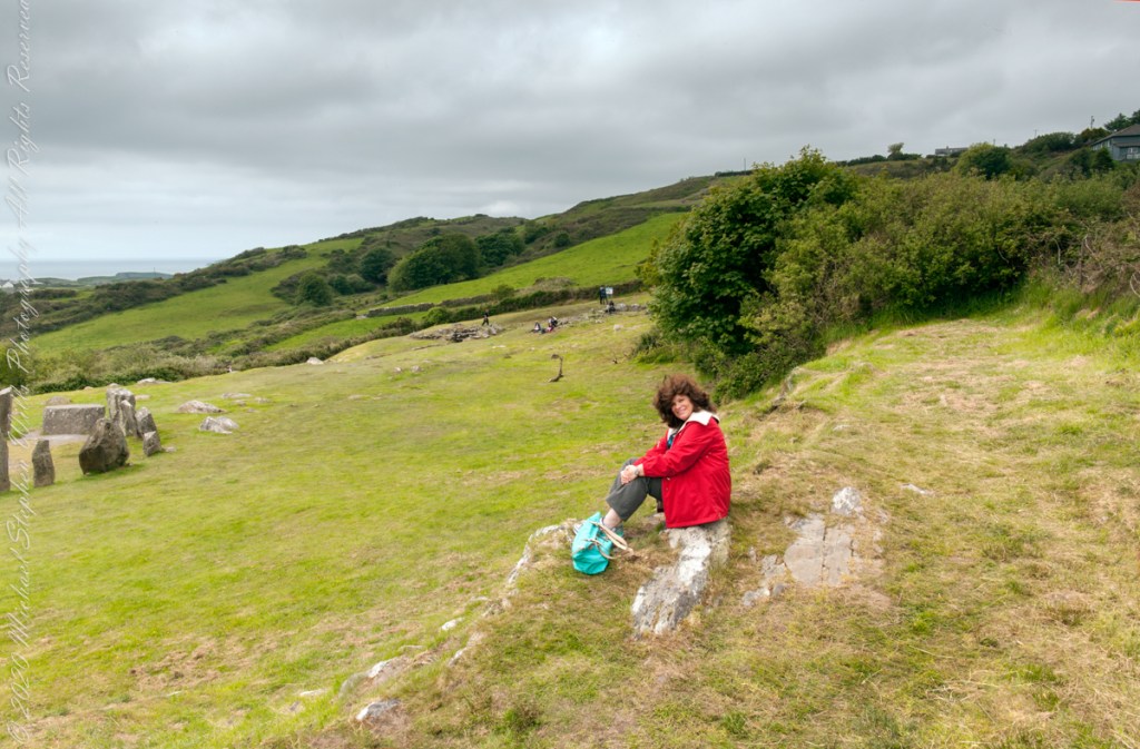
Seventeen Stones
Pam posing with wind blown hair on the rock outcrop I used to achieve site overviews. In medium distance, other visitors gather around another site feature.
Click pic for a larger view, in a new tab. When using WordPress Reader, you need to open the post first.
Seventeen Stones
The photograph shared the last Drombeg posting needed hours of reworking before it was ready for submission to Stock Photography services. Ireland photography is my “money maker”, so the effort is work this.
Today, I share the image as it existed in camera, to the final product. The most detailed work was removing the human figures in the upper right corner. The camera sensor was problematic, with an light accumulation of dust. Below are the two images, each alone and as slideshow for flipping back and forth.
What differences can you observe? (comments, please)
Click any pic for a larger view, in a new tab, or a slide show. When using WordPress Reader, you need to open the post first.
llllll
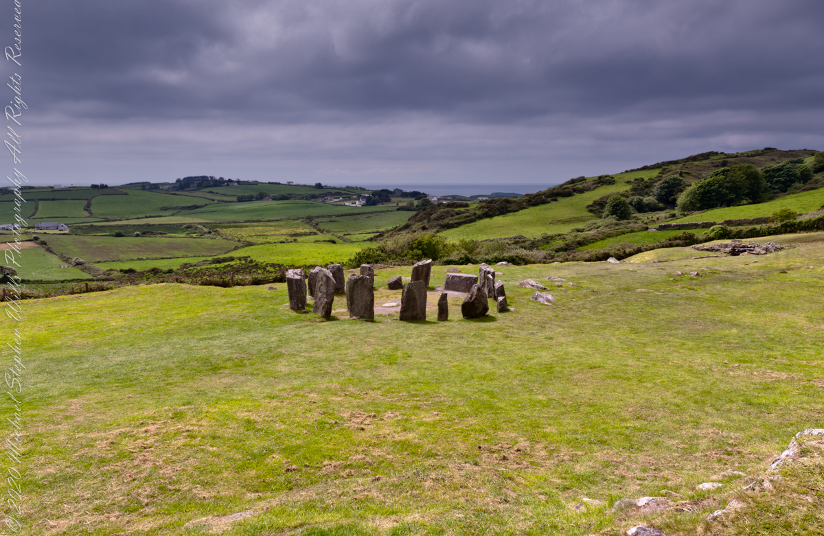

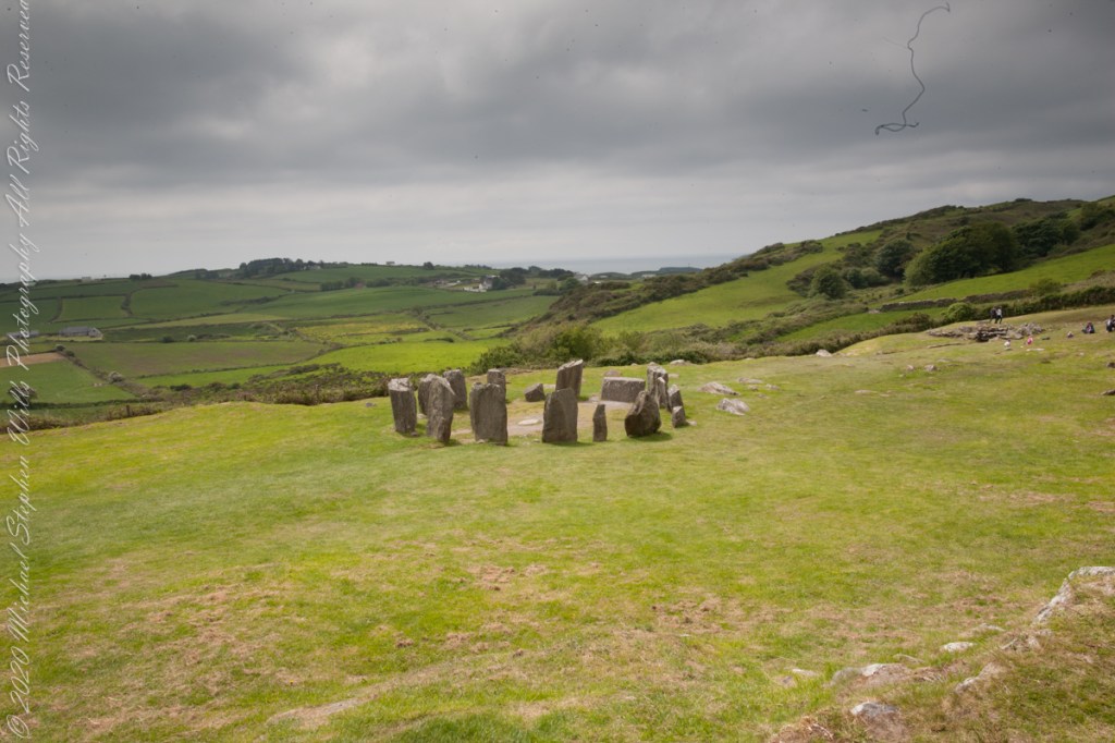
Seventeen Stones
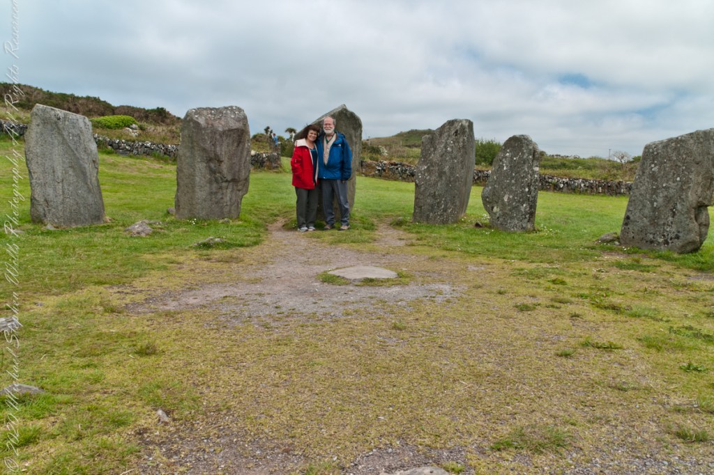
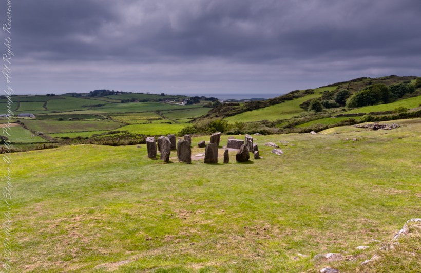
Here is one of my finest photographs from that morning. The ocean view is a reason Drombeg is one of the most popular neolithic sites.
The Celtic Sea is close to this site, unoccupied since 800 BC, may be as old as 1100 BC according to radiocarbon dating from 1957 excavations. Thirteen of the original seventeen stones form a circle 31 feet across. Two portal stones face a recumbent stone, together forming a axis pointing to the sun position at sunrise on the winter solstice. One of the most visited Neolithic sites in Ireland, it required some patience to achieve an image without human figures.
Click any pic for a larger view, in a new tab, or a slide show. When using WordPress Reader, you need to open the post first.
The camera is set on a tripod positioned in front of the recumbent.