A span of 10,000 years spreads between now and the first possibility of settlement on the island of Eire, then swept clean to bare rock by the weight of ice. Current scholarship of the Dún Aonghasa ruins, Inishmore, County Galway, the Irish Republic place a settlement within the inner of the four dry stone rings after 6,500 years (1,500 BC or 3,500 years ago). By way of scale, the first settlement took about 30 times the duration of the U.S. Constitution ratification through 2025: the last state, Rhode Island, ratified the Constitution 1789.
By 700 BC, 2,700 years ago, a series of upright, closely placed stones, were erected between the second and third rings called a cheval de fries field (“Frisian horses” in English) today, this defensive structure evokes the enormous scale of the struggles around this place of defense.
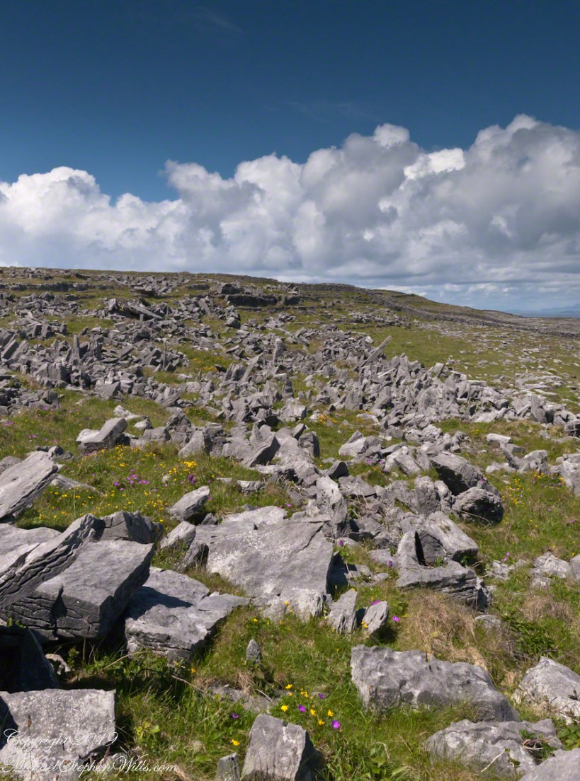
This is a portion of that field, I believe, taken as Pam and I approach the inner ring entrance, walking a wide path cleared of barriers. Click the photograph for a larger image with caption.
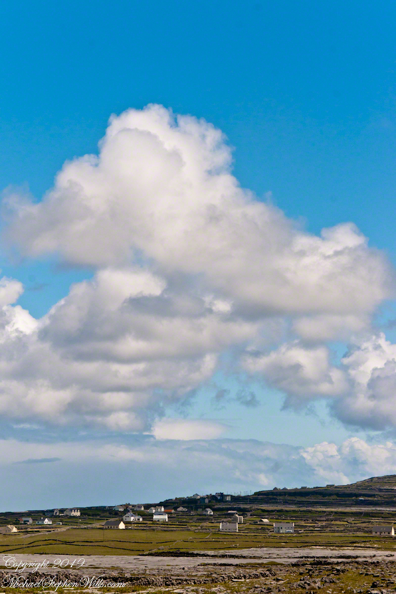
From the commanding location of Dún Aonghasa, looking northeast across Inishmore, the logic of the ancients becomes clear. No better vantage could be found—land unfurling like a hand toward Galway Bay, cottages nestled in green folds, clouds billowing above like sails caught mid-journey. A place of presence. A place of permanence.
Perched high on the cliff’s edge, the fort behind, the Atlantic at the back, the wind carried stories—unwritten, unspoken, but felt in the bones. Below, stone walls divided the island into patterns of memory. Fields outlined in rock, laid long ago by hands familiar with hardship and patience. The sea’s pulse echoed faintly in the distance, as steady and unfathomable as time itself.
No words were needed in that moment. Just the hush of sky and stone. Cottages, bleached bright by limewash—kalsomine, the old name still whispered by some—stood resilient against the elements, each one a witness to generations. Each one seemed to carry a personal reverence, a tenderness carved into the landscape.
Paths led gently inland, where wind slowed and voices from distant homes rose faintly through the open air. Along those paths, the rhythm of island life could be read in hoof prints, scattered wool, and the sharp, clean edges of hand-cut stone. There, among the hedges of limestone and wild grass, the living and the lost felt close.
The cloud cover shifted constantly. Shadows passed like thoughts across the land. Toward the shore, the sky opened wide. A silence filled the lungs, as bracing and deep as the Atlantic itself. Time seemed to slow, the mind slipping into the rhythm of the land.
Limestone pavement, rough beneath the boots, told its own tale of erosion and survival. That the earth here could sustain even the most modest farming seemed improbable. Yet here it was: a testament to stubborn hope and quiet ingenuity. In that quiet, ancient energy rose—something older than the fort, older than language. A pulse shared with the rock and wind.
The fort eventually came back into view—perched as if grown from the cliff itself, curved walls enclosing nothing but air and sky. I perceived no defensive bluster, only presence. And what a view it commanded. On days like this, the clouds formed towering cathedrals overhead, white and gold in the sun. Below, the cottages and fields seemed miniature, perfect, enduring.
The wind played echoes of prayer, lullaby, and laughter mingled with the call of seabirds. The thought came that nothing here was ever truly lost—only layered. Generation upon generation, each leaving some trace: a stone placed just so, a wall mended one final time, a cottage roof patched for another winter.
Here, even the air speaks. It moves gently but insistently, brushing the cheeks and stirring something ancient within the chest. Beneath it, the island breathes: not loudly, not urgently, but with the slow, deep rhythm of the tides.
As the sun dipped slightly westward, light changed across the fields, cottages glowing warm against darkening green. The wind softened. The clouds drifted, still massive but no longer looming. Time to return. A glance back offered one last communion with sky, stone, and silence.
Inishmore, on that day had been absorbed. Understood not with the mind, but with something quieter. Something that listens without need for words.
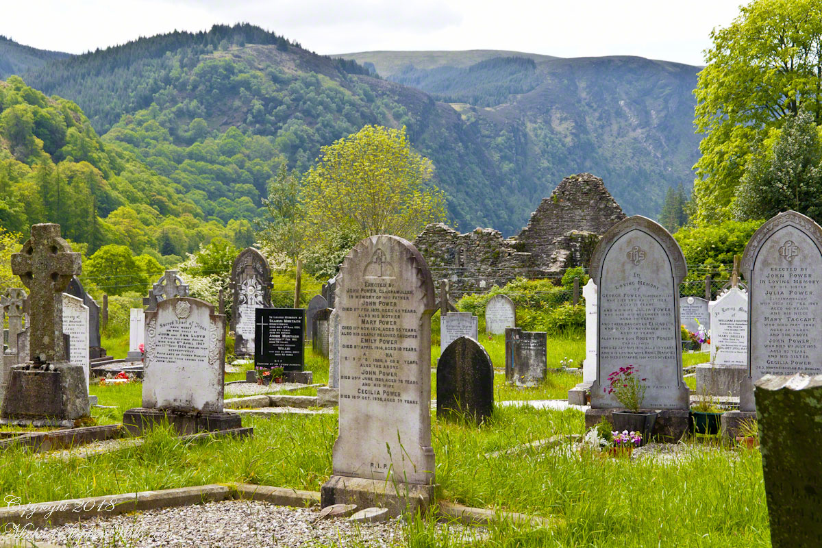
Find here a serene visit to Glendalough, highlighting the ancient beauty of its landscape, monastic history, and the deep sense of peace felt among the gravestones.
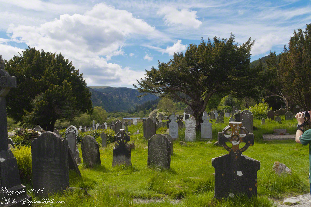
We arrived in Glendalough on a bright spring morning, a gentle breeze carrying the scent of grass and distant water. Even before stepping out of the car, I sensed something ancient in the air, as though the centuries themselves lay waiting among the stones. The peaks of the Wicklow Mountains rose around me, their slopes draped in verdant forests that whispered of forgotten tales. In the distance, shimmering like a secret, the Upper Lake beckoned under the watchful hush of rugged hillsides. I took a deep breath and started my wander.
One of the lakes for which the valley is named, above the headstones in the mid-distance
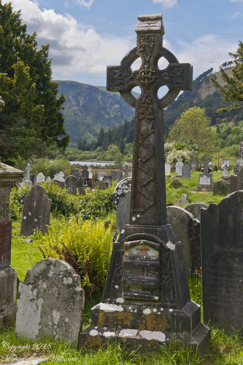
Walking through the monastic settlement, I felt enveloped by a hush both reverential and oddly comforting. The path led me to a cluster of gravestones leaning gently askew, each marked by Celtic crosses standing guard over the memory of those buried below. One cross, carved from sturdy stone, immediately drew my attention with its intricate knotwork etched deep into the surface. The front of it bore swirling designs reminiscent of interwoven vines—symbols of eternity, continuity, and faith. I found myself imagining centuries of pilgrims, each pausing here, hands gently resting on the weathered carvings, offering up their prayers and hopes.
Memorial from a mother to her 6 year old son and husband
A bit farther on, I came upon a small grouping of headstones bowed in silent unity. Ferns and moss carpeted the ground in bright greens, creating a natural tapestry that wove together life and memory. The slightly overgrown grass softened the entire landscape, allowing each stone to stand quietly yet firmly in the earth. From behind these markers, I caught my first glimpse of the shimmering lake, framed perfectly by the slopes of the valley. The water’s surface reflected the sky’s azure brilliance and accentuated the gentle hush that fell upon the graveyard like a comforting quilt.
As I paused to take a few photographs, I felt a hint of magic floating through the air—an indefinable sense that beyond what my eyes perceived, an age-old spirit thrived. The Celtic symbols on the headstones seemed alive, their swirling knots hinting at the cycle of life and death, the oneness of the world, and the bridging of earthly existence with the mystic realm. I found myself recalling old Irish legends: stories of saints who could converse with animals, of spirits dwelling in hidden glades, of holy wells that healed weary travelers. It felt as though those tales were all around me, wrapped in the tapestry of this timeless valley.
Looking out toward the remains of the stone church—its walls crumbled yet proud—my imagination conjured the chanting of monks, their voices echoing off the surrounding hills. The same forest that sheltered me now would have encircled them all those centuries ago, shifting from season to season. It was easy to picture them gathering by the lake’s edge, cups of cold, clear water cupped in their hands, or moving reverently among the graves of those who had come before them. Here, time seemed an illusion. The line between past and present faded as I stood among these enduring stones.
Winding paths of grass guided me to another section of the cemetery, where weathered inscriptions told the stories of families, lineages, and deep connections to the land. Some headstones were so old that the lettering had nearly eroded, but others still proudly bore legible names and dates. Names like Power, Byrne, and Keane were etched in memory, followed by poignant words of affection and devotion. The place felt both solemn and comforting at once—a harmonious interplay of remembrance, reverence, and the gentle pulse of nature.
Valley walls are dramatic and steep
A sudden breeze rippled through the trees, setting the leaves to dance and carrying the lilt of birdsong across the valley. I turned to admire the view once more, and there, between towering yew trees, the lake glowed like a polished mirror. Soft clouds glided overhead in a pale blue sky. The entire scene seemed woven from a single, unbroken strand—mountain, forest, gravestone, lake, and sky merging in a spellbinding harmony. It was the kind of moment that invited awe, a moment in which to lose oneself and yet feel more fully found.
I left the cemetery with a deeper sense of peace than I had known in some time. The photographs I took may capture the beauty of Glendalough’s ancient crosses and serene landscape, but it’s the intangible hush of centuries and the gentle brush of magic that remain with me. With every step back toward the car, I felt the warmth of timelessness, and as the day’s golden light enveloped the stone monuments behind me, I carried away a tiny spark of the valley’s enchantment—a reminder that some places are truly touched by the divine.Look closely at the carved scroll at the foot of the cross.
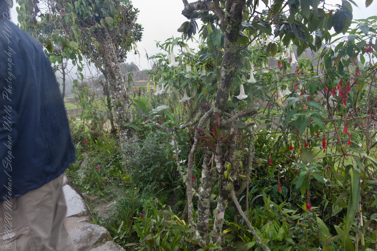
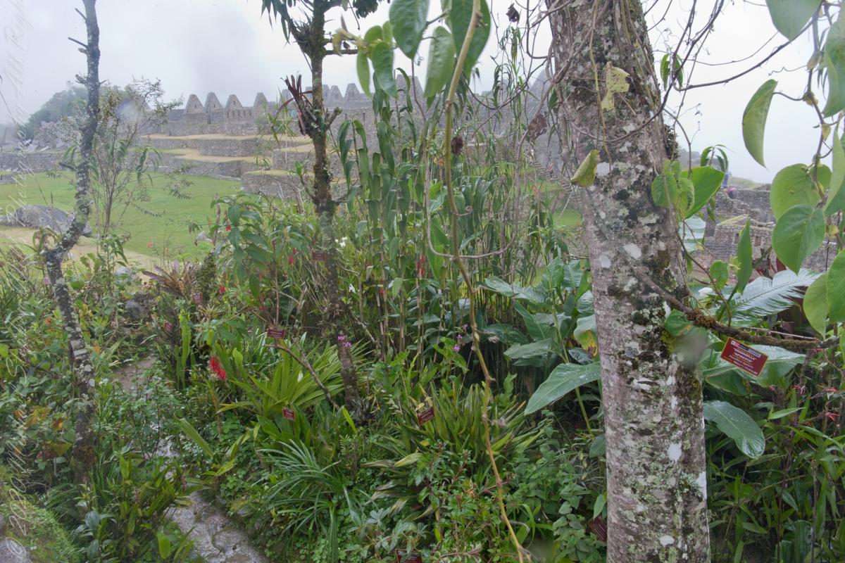
I set up a Manfrotto BeFree tripod with the Canon EOS 1DS Mark III mounted with the Canon EF 70-300 f/4-5.6 L IS USM lens to capture our experience while entering Machu Picchu.
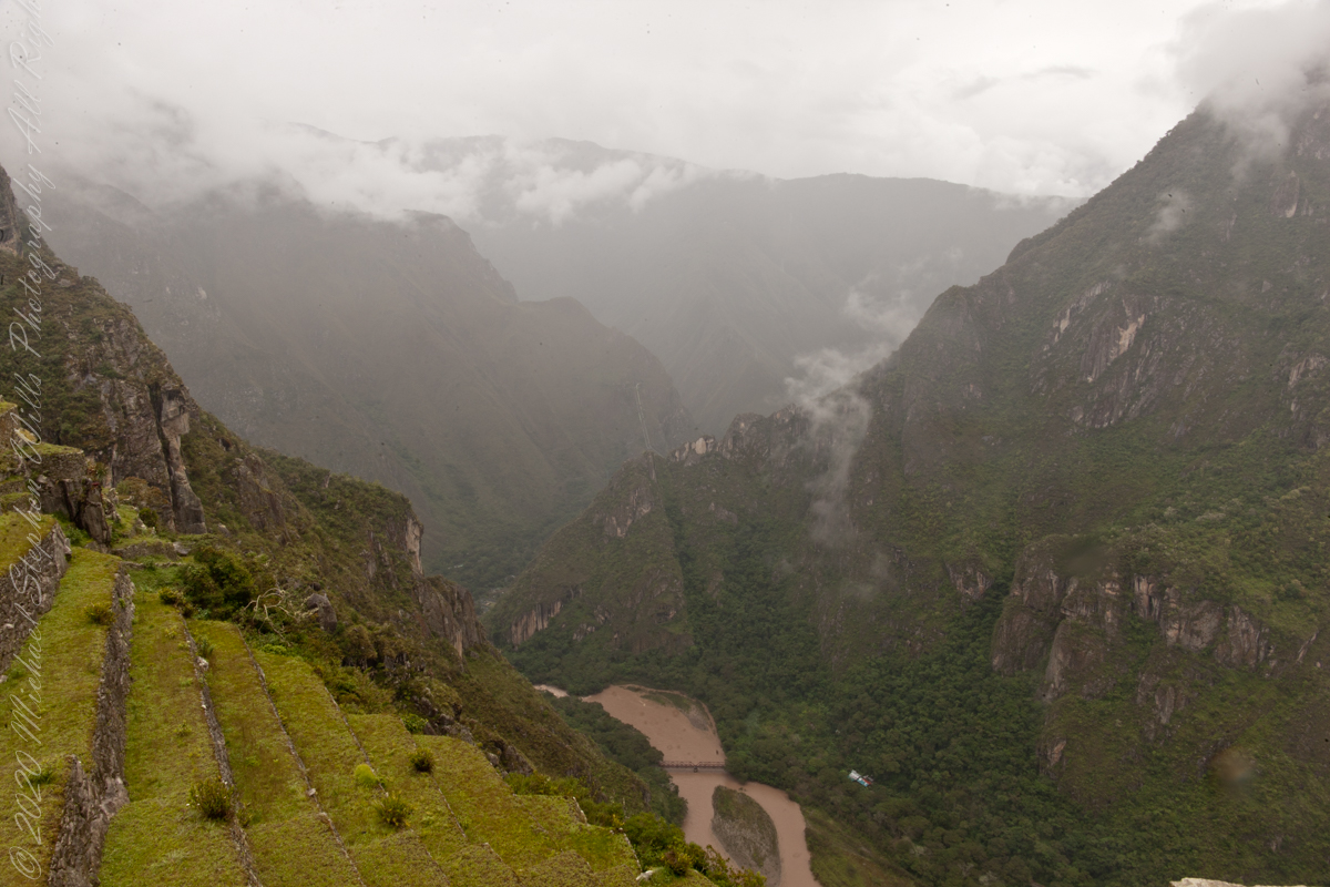
The eastern shoulder of Huayna Picchu is left and the Urubamba river curves around it. Leading the eye to the distance is an uninhabited andean valley covered in rain forest.
Copyright 2023 Michael Stephen Wills All Rights Reserved
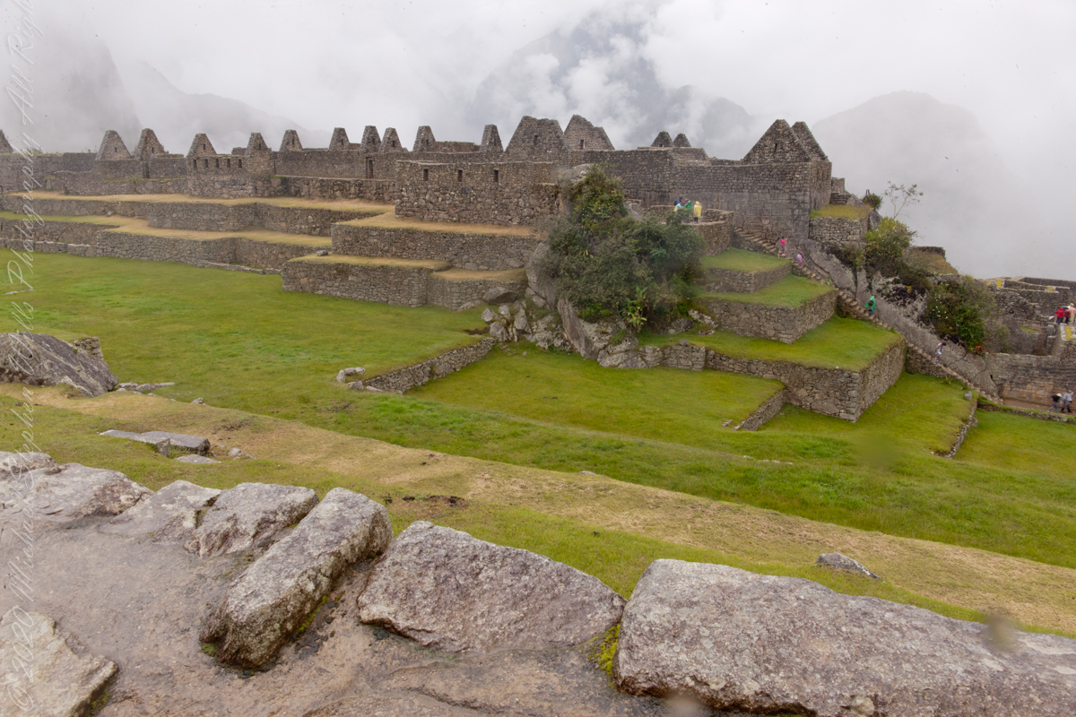
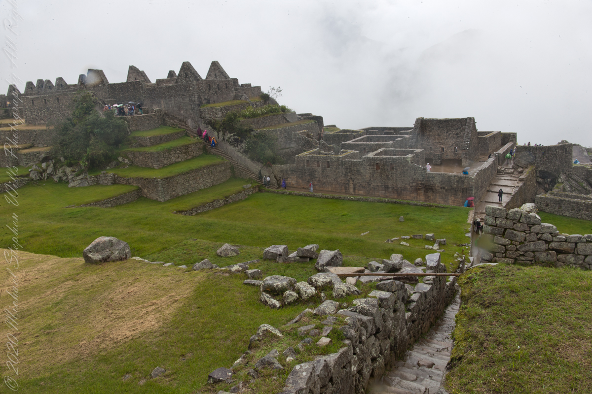
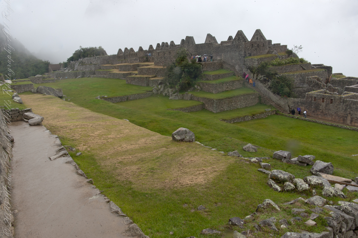
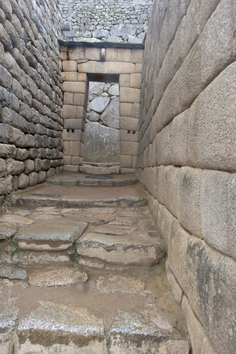
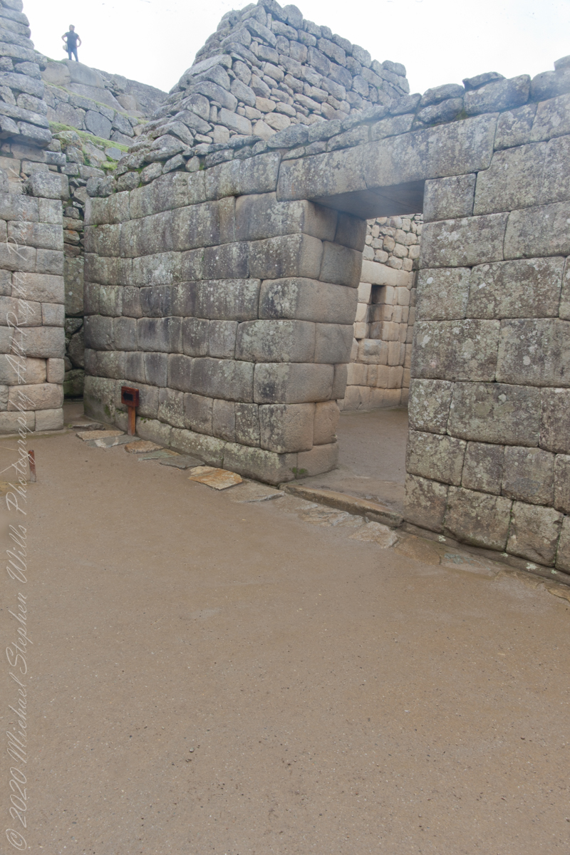
“The central buildings of the Machu Picchu Sanctuary use the classical Inca architectural style of polished dry-stone walls of regular shape. The Incas were masters of this technique, called ashlar, in which blocks of stone are cut to fit together tightly without mortar.”
The site itself may have been intentionally built on fault lines to afford better drainage and a ready supply of fractured stone. ‘Machu Picchu clearly shows us that the Incan civilization was an empire of fractured rocks’.
Inca quarried the rock for Machu Picchu from the mountain ridge itself.
“The section of the mountain where Machu Picchu was built provided various challenges that the Incas solved with local materials. One issue was the seismic activity due to two fault lines. It made mortar and similar building methods nearly useless. Instead, the Inca mined stones from the quarry at the site, lined them up and shaped them to fit together perfectly, stabilizing the structures. Inca walls have many stabilizing features: doors and windows are trapezoidal, narrowing from bottom to top; corners usually are rounded; inside corners often incline slightly into the rooms, and outside corners were often tied together by “L”-shaped blocks; walls are offset slightly from row to row rather than rising straight from bottom to top.”
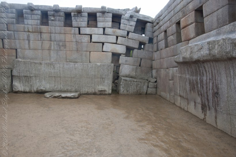
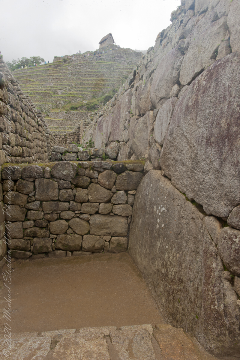
Main Temple survived multiple earthquakes
“Heavy rainfall required terraces and stone chips to drain rainwater and prevent mudslides, landslides, erosion, and flooding. Terraces were layered with stone chips, sand, dirt, and topsoil, to absorb water and prevent it from running down the mountain. Similar layering protected the large city center from flooding. Multiple canals and reserves throughout the city provided water that could be supplied to the terraces for irrigation and to prevent erosion and flooding.”
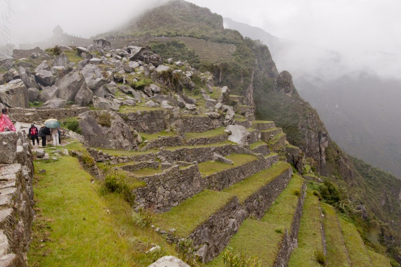
Agricultural Terraces
“The Incas never used wheels in a practical way, although their use in toys shows that they knew the principle. The use of wheels in engineering may have been limited due to the lack of strong draft animals, combined with steep terrain and dense vegetation. The approach to moving and placing the enormous stones remains uncertain, probably involving hundreds of men to push the stones up inclines. A few stones have knobs that could have been used to lever them into position; the knobs were generally sanded away, with a few overlooked.”
Reference: text in italics and quotes is from the Wikipedia “Machu Picchu”, web page.
Copyright 2023 Michael Stephen Wills All Rights Reserved
“For the Inca civilization, and especially during the time that the city of Machu Picchu was the most important place as Sanctuary of the Inca aristocratic class, the Congregation of its inhabitants in the numerous events, mostly rituals and celebrations worshipping sacred Inca gods, as it had a very important and momentous significance for the Incan society. All these celebrations ramifications in centers planned for the host to hundreds of citizens who saw the cult of their deities as well made. Also, this civilization granted a special attention details, to organization and structure of both class, of the city itself, so that the expert anthropologist community has been able to prove the existence of a straight relationship between the main square and the structuring of the Incan society.“
“Among the several locations which have shaped the division of the Citadel of Machu Picchu in their different urban areas and consequently in their different social classes, the Central Square or Main Plaza of Machu Picchu is the symbol of one of the most important for hosting the more far-reaching sacred celebrations of the Inca religion, due to its vast size are the ideal location to accommodate this type of mass religious and social ceremonies. The Central Square shows how the Incan society followed a strict, but at the same time, well-structured organization of the city in their different social classes; the anthropologist community states that this vast space was created to establish the spaces of the city limited the inhabitants depending on its status quo within Inca society.”
“After several studies by experts of the world community of anthropology, it has come to understand that the Main Plaza has played a very important role in the Inca society and the segregation of its social classes. This explains the reason for the existence of a physical axis to do distinction of several Inca social classes, which were separated one from the other not only different privileges of every social class, but also by the existence of the sub urban areas which host different individuals of the society. The main square makes this Division structural member of the urban section of the city of Machu Picchu differentiating the two sub urban sectors known as Hanan or high sector, which is home to buildings with greater religious significance for the city, and Hurin or low sector.”
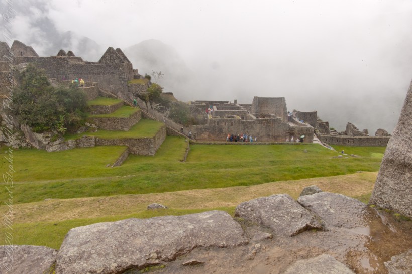
“The areas around the Central Plaza of Machu Picchu are surrounded by a rocky structure that accommodates a series of terraces from where you can appreciate a great view of Huayna Picchu. Here is where is located the construction of three covers, which gives way to the Central or main square, complex of buildings typical of the Inca civilization called “kanchas”, which all have a symmetrical distribution in their facades and are in turn communicated with the other, which favored the life of society in the city to offer a space that housed both spaces end residential for labor purposes through different plugs and local. The massive yet refined architecture of Machu Picchu blends exceptionally well with the stunning natural environment, with which it is intricately linked. Numerous subsidiary centers, an extensive road and trail system, irrigation canals and agricultural terraces bear witness to longstanding, often on-going human use.”
“The rugged topography making some areas difficult to access has resulted in a mosaic of used areas and diverse natural habitats. The Eastern slopes of the tropical Andes with its enormous gradient from high altitude “Puna” grasslands and Polylepis thickets to montane cloud forests all the way down towards the tropical lowland forests are known to harbor a rich biodiversity and high endemism of global significance. Despite its small size the property contributes to conserving a very rich habitat and species diversity with remarkable endemic and relict flora and fauna.“
Reference: text in italics and quotes is from the UNESCO World Heritage and Google Earth, Machu Picchu, web pages.
Copyright 2023 Michael Stephen Wills All Rights Reserved
“The Temple of the 3 Windows is one of the most surprising constructions in Machu Picchu. The carving of its walls is perfect. There are several hypotheses as to why they built three huge windows there with incredible views of the mountain range. It is presumed that the purpose was to worship the Inca gods, especially those who guard the tripartite world of the Incas: the heavenly world (Hanan pacha), the earthly world (Kay pacha) and the underworld (Uku pacha). The temple is an immense trapezoidal wall, 10 meters long and 4 meters wide, built with huge stones carved and assembled to perfection.”
“All three windows are also trapezoidal. On both sides there are two additional closed windows (like niches) where the Incas left ceremonial objects of gold and silver.”
“The temple served a religious function. The white granite stone with which it was built has a different carving from the rest of the constructions at Machu Picchu. The fineness of its walls indicates that it was one of the most important buildings in the citadel.”
“A few steps from this temple there are other buildings with religious purposes of great importance: the Main Temple, the Temple of the Sun and the Intihuatana.“
“There are many hypotheses about the religious rituals that were performed in the Temple of the 3 Windows. It is believed that the Inca worldview of the world divided into three worlds was worshiped: the heavenly world (Hanan pacha), the earthly world (Kay pacha) and the underworld (Uku pacha).”
“For the Incas, the Hanan pacha was the world of the gods, of the celestial beings (the sun, the moon, the stars). The Kay pacha was the earthly world, of men and animals. Finally, the Uku pacha was the world of the dead, of beings that wait to reincarnate to return to the earthly world.”
“The tripartite world of the Incas was represented by three animals: the condor (kuntur), the puma (puma) and the snake (amaru). The ‘three’ is present in many of the Inca constructions such as the ‘chakana’ (also called the Andean cross) present in the Temple of the Sun in Ollantaytambo.”
Reference: text in italics and quotes paraphrased from the web page “imachupicchu.com.”
Copyright 2023 Michael Stephen Wills All Rights Reserved
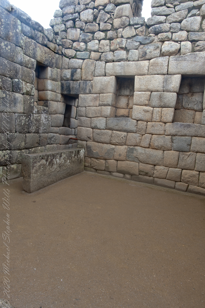
“The Main, or Principle, Temple situated on the Sacred Plaza of the Urban Sector of Machu Picchi, is an impressive rectangular shaped building consisting of two lateral and one rear wall. The base of the temple are large lithic stones supporting more regular sized and precisely carved stones. The temple features seventeen trapezoidal shaped niches most likely used for ceremonial offerings. Six stone pegs of the rear walls might have been used to hang decorations or aid rituals.“
Main Temple Left Corner
“Tradition states during Inca times the temple was adorned with colorful mantles, emblems and mummies of important Inca leaders and an effigy of P’unchao, a divine sacred symbol made of solid gold representing the Inca god Wiraqocha. When the Incas abandoned Machu Picchu at the time of the Spanish Conquest, they removed the most important artefacts leaving behind just the stone structure.”
“Earthquakes over the years have undermined the Main Temple structure, notably the rear right hand corner of the building, where the stones have separated and moved downwards.”
Reference: text in italics and quotes paraphrased from the web page “The Only Peru Guide.”
Copyright 2023 Michael Stephen Wills All Rights Reserved
“For the Inca civilization, and especially during the time that the city of Machu Picchu was the most important place as Sanctuary of the Inca aristocratic class, the Congregation of its inhabitants in the numerous events, mostly rituals and celebrations worshipping sacred Inca gods, as it had a very important and momentous significance for the Incan society. All these celebrations ramifications in centers planned for the host to hundreds of citizens who saw the cult of their deities as well made. Also, this civilization granted a special attention details, to organization and structure of both class, of the city itself, so that the expert anthropologist community has been able to prove the existence of a straight relationship between the main square and the structuring of the Incan society.“
“Among the several locations which have shaped the division of the Citadel of Machu Picchu in their different urban areas and consequently in their different social classes, the Central Square or Main Plaza of Machu Picchu is the symbol of one of the most important for hosting the more far-reaching sacred celebrations of the Inca religion, due to its vast size are the ideal location to accommodate this type of mass religious and social ceremonies. The Central Square shows how the Incan society followed a strict, but at the same time, well-structured organization of the city in their different social classes; the anthropologist community states that this vast space was created to establish the spaces of the city limited the inhabitants depending on its status quo within Inca society.”
“After several studies by experts of the world community of anthropology, it has come to understand that the Main Plaza has played a very important role in the Inca society and the segregation of its social classes. This explains the reason for the existence of a physical axis to do distinction of several Inca social classes, which were separated one from the other not only different privileges of every social class, but also by the existence of the sub urban areas which host different individuals of the society. The main square makes this Division structural member of the urban section of the city of Machu Picchu differentiating the two sub urban sectors known as Hanan or high sector, which is home to buildings with greater religious significance for the city, and Hurin or low sector.”
“The areas around the Central Plaza of Machu Picchu are surrounded by a rocky structure that accommodates a series of terraces from where you can appreciate a great view of Huayna Picchu. Here is where is located the construction of three covers, which gives way to the Central or main square, complex of buildings typical of the Inca civilization called “kanchas”, which all have a symmetrical distribution in their facades and are in turn communicated with the other, which favored the life of society in the city to offer a space that housed both spaces end residential for labor purposes through different plugs and local. The massive yet refined architecture of Machu Picchu blends exceptionally well with the stunning natural environment, with which it is intricately linked. Numerous subsidiary centers, an extensive road and trail system, irrigation canals and agricultural terraces bear witness to longstanding, often on-going human use.”
“The rugged topography making some areas difficult to access has resulted in a mosaic of used areas and diverse natural habitats. The Eastern slopes of the tropical Andes with its enormous gradient from high altitude “Puna” grasslands and Polylepis thickets to montane cloud forests all the way down towards the tropical lowland forests are known to harbor a rich biodiversity and high endemism of global significance. Despite its small size the property contributes to conserving a very rich habitat and species diversity with remarkable endemic and relict flora and fauna.“
Reference: text in italics and quotes is from the UNESCO World Heritage and Google Earth, Machu Picchu, web pages.
Copyright 2023 Michael Stephen Wills All Rights Reserved
“The central buildings use the classical Inca architectural style of polished dry-stone walls of regular shape. The Incas were masters of this technique, called ashlar, in which blocks of stone are cut to fit together tightly without mortar.“
You can tell we are climbing from the angle of the guardhouse.
“The site itself may have been intentionally built on fault lines to afford better drainage and a ready supply of fractured stone. ‘Machu Picchu clearly shows us that the Incan civilization was an empire of fractured rocks‘”.
“The section of the mountain where Machu Picchu was built provided various challenges that the Incas solved with local materials. One issue was the seismic activity due to two fault lines. It made mortar and similar building methods nearly useless. Instead, the Inca mined stones from the quarry at the site, lined them up and shaped them to fit together perfectly, stabilizing the structures. Inca walls have many stabilizing features: doors and windows are trapezoidal, narrowing from bottom to top; corners usually are rounded; inside corners often incline slightly into the rooms, and outside corners were often tied together by “L”-shaped blocks; walls are offset slightly from row to row rather than rising straight from bottom to top.“
“I See You”
“Heavy rainfall required terraces and stone chips to drain rainwater and prevent mudslides, landslides, erosion, and flooding. Terraces were layered with stone chips, sand, dirt, and topsoil, to absorb water and prevent it from running down the mountain. Similar layering protected the large city center from flooding.[106] Multiple canals and reserves throughout the city provided water that could be supplied to the terraces for irrigation and to prevent erosion and flooding.”
“The Incas never used wheels in a practical way, although their use in toys shows that they knew the principle. The use of wheels in engineering may have been limited due to the lack of strong draft animals, combined with steep terrain and dense vegetation. The approach to moving and placing the enormous stones remains uncertain, probably involving hundreds of men to push the stones up inclines. A few stones have knobs that could have been used to lever them into position; the knobs were generally sanded away, with a few overlooked.”