Cerro Dragón is a geographical and urban landmark made up of a large dune that is located in the coastal area of Norte Grande, Chile, within the city of Iquique.
Click any photograph for a larger view and use Ctrl-x to zoom in closer.
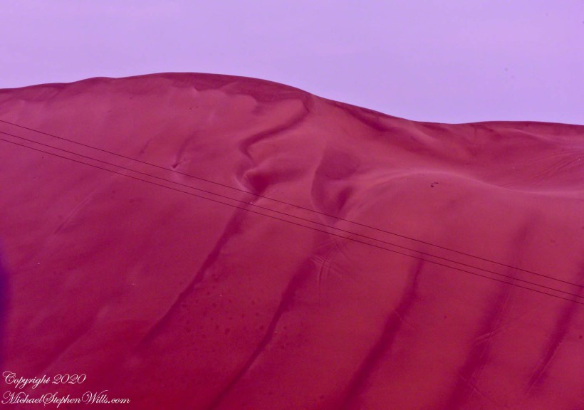
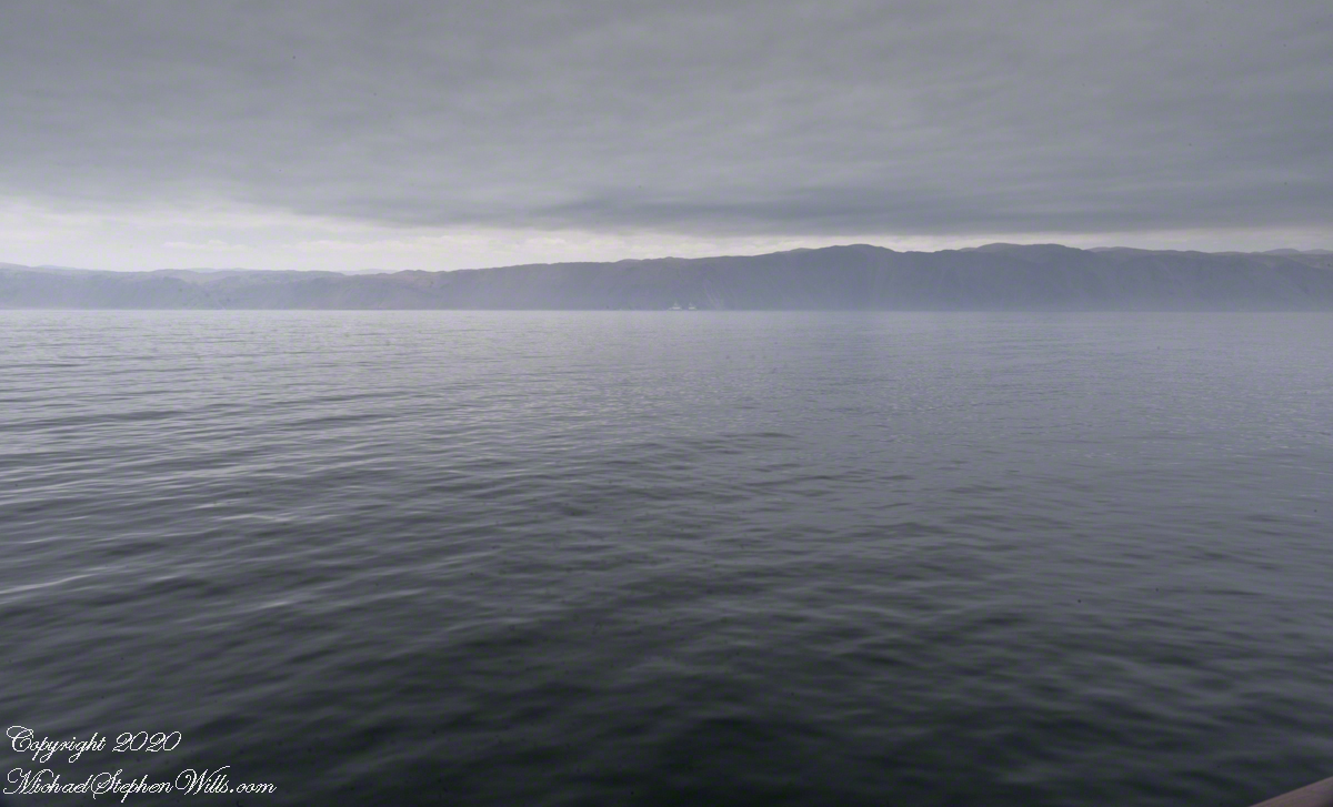
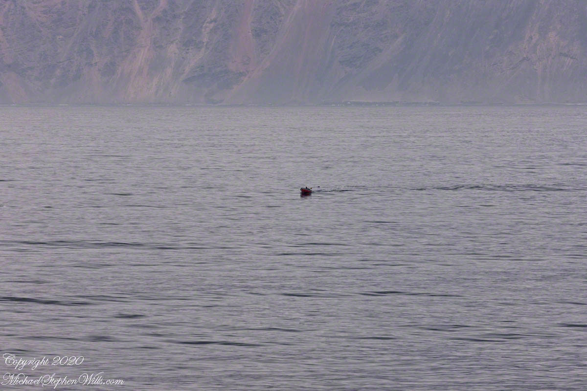
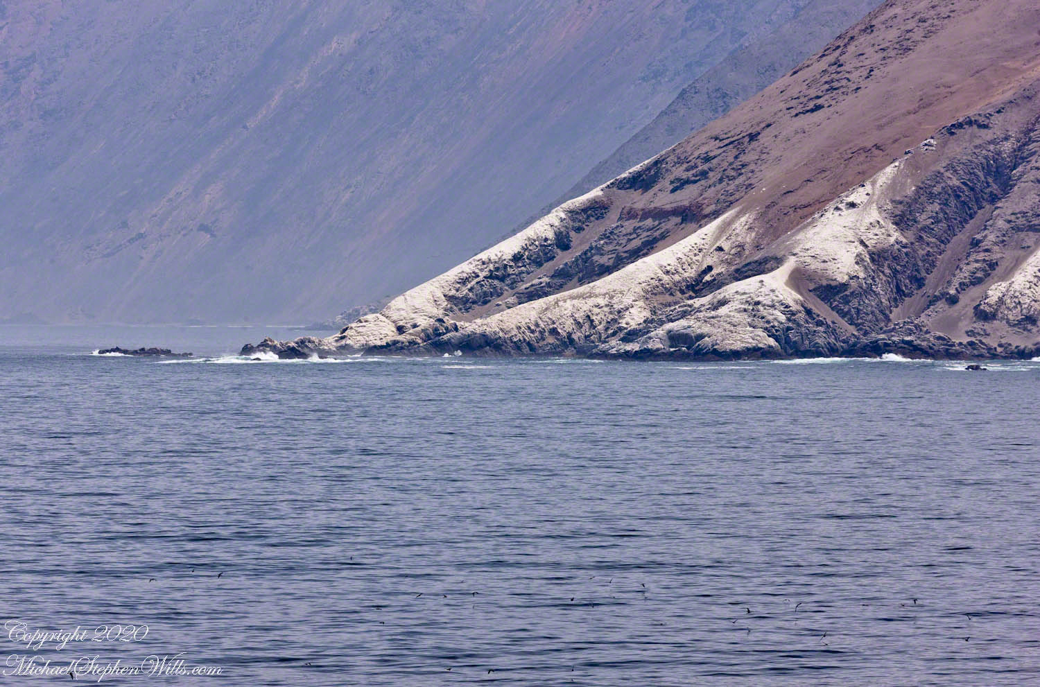
Dragon Hill from the Atacama desert escarpment above Iquique
April 18, 2005 it was declared a National Monument Nature Sanctuary. Approximately 4 kilometers long, 834.06 acres. Its location between the urban settlement of Iquique in the lower marine terrace and the growing urbanization of Alto Hospicio in the pampa, as well as its characteristics of open, imposing and original landscape, give the city of Iquique a unique identity.
By virtue of its peculiar characteristics, Cerro Dragón became a symbol for the Iquique community, which has internalized it in its collective imagination as a fundamental part of its territorial identity.
Click any photograph for a larger view and use Ctrl-x to zoom in closer.
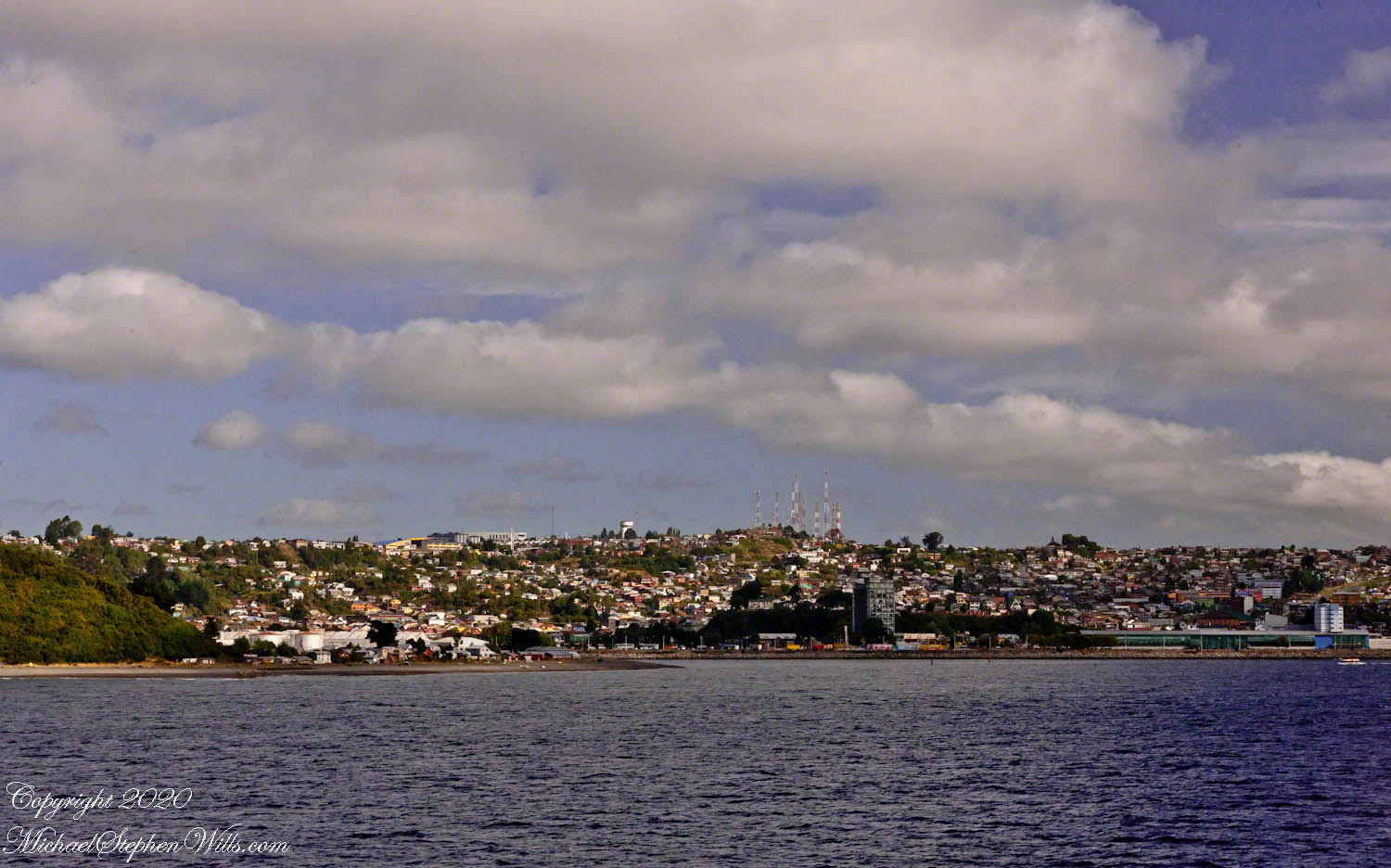
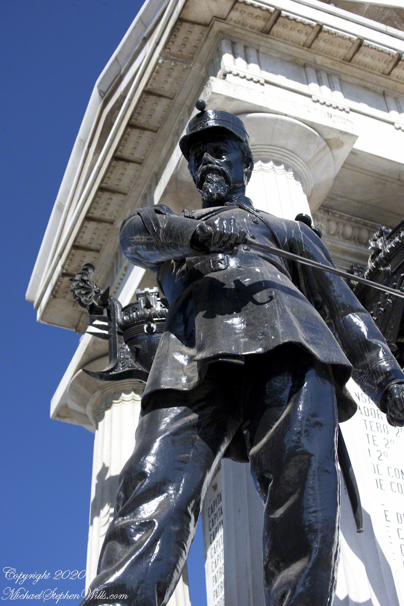
Puerto Montt
The connection is father-son. Puerto Montt, founded by German immigrants and named for the president at the time, Manuel Montt, who invited German farmers suffering from a famine with the goal of populating the region. Montt was successful in this goal. In 1907 his son, Pedro’s first official act as newly elected president was, with Saltpeter production at a halt, to send the army to Iquique to suppress striking workers.
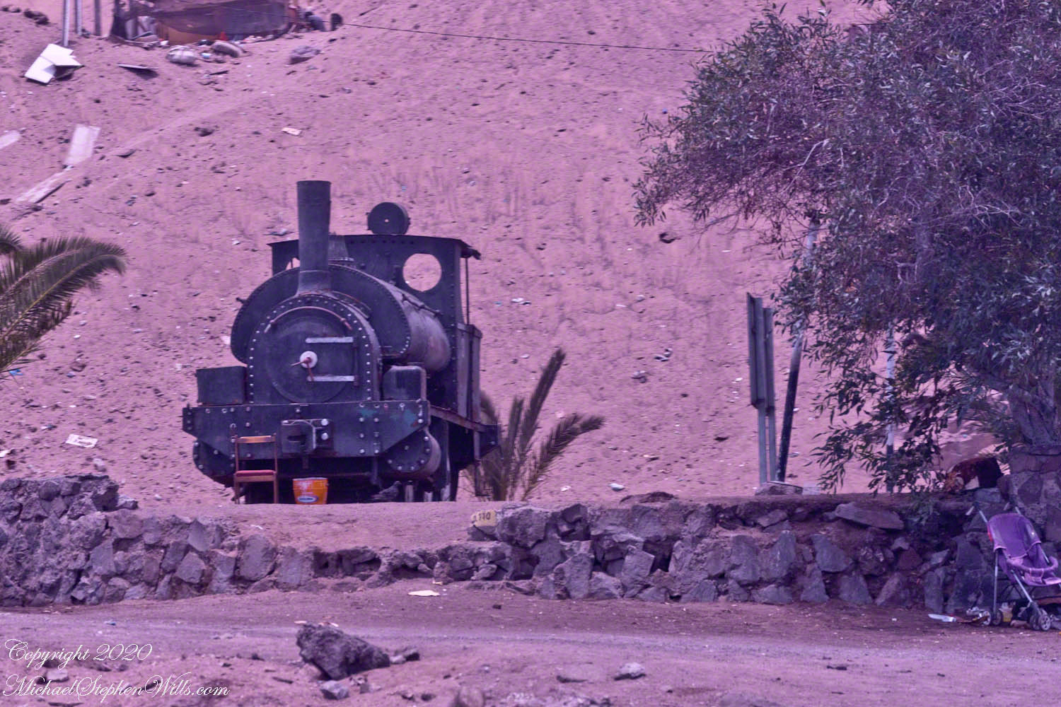
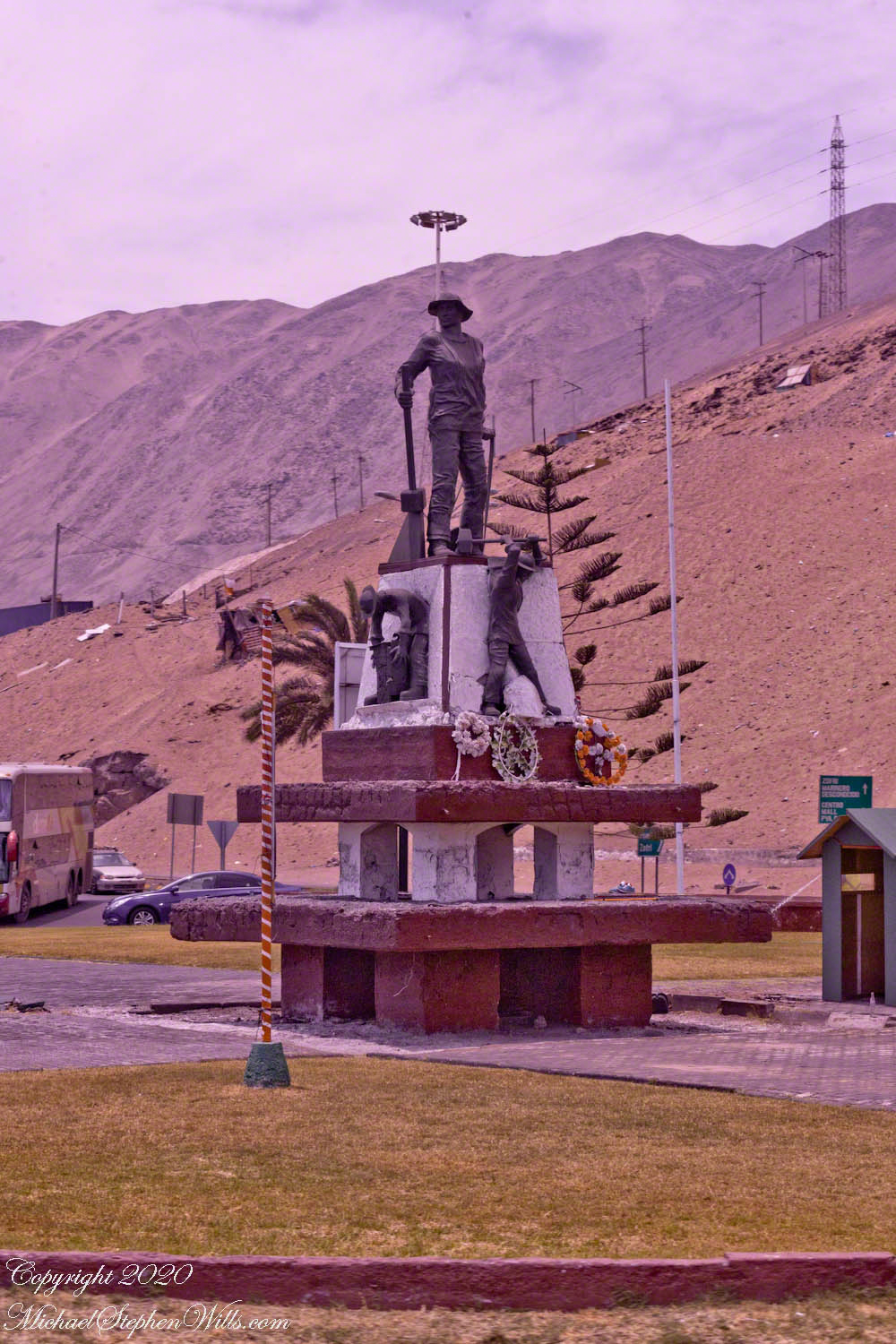
A steam locomotive stands apart from the monument,
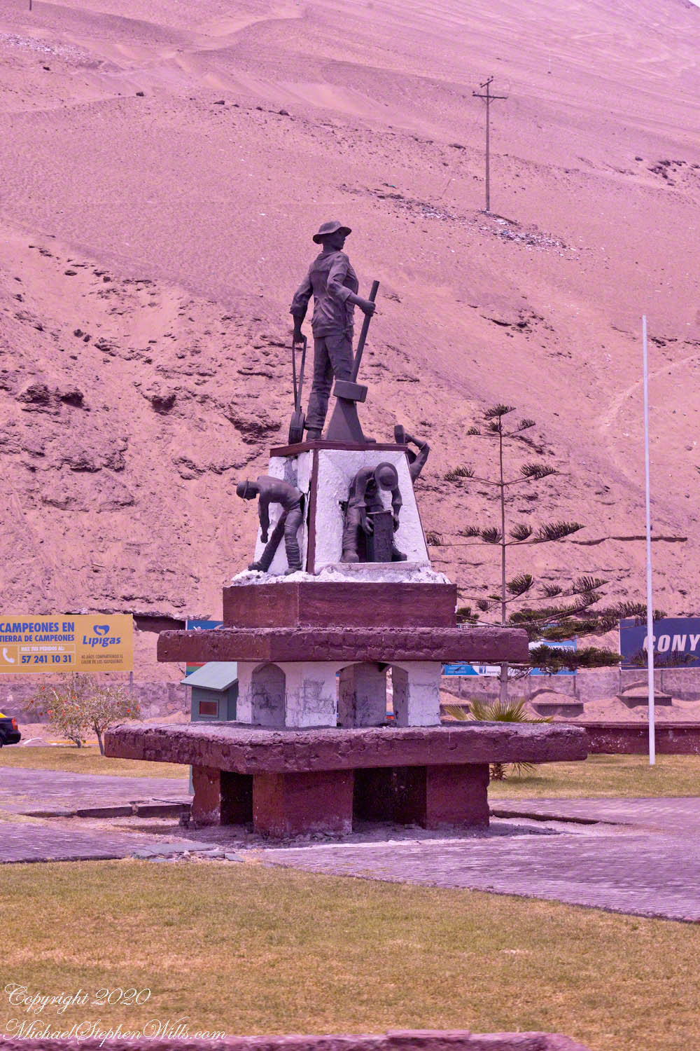
Now, there is a monument to these workers, “Monumento al pampino salitrero,” above the city plain. Set apart and poorly maintained, trash strewn, is a nod to the importance of railroads for the transportation of the mined product. A few hundred feet away….
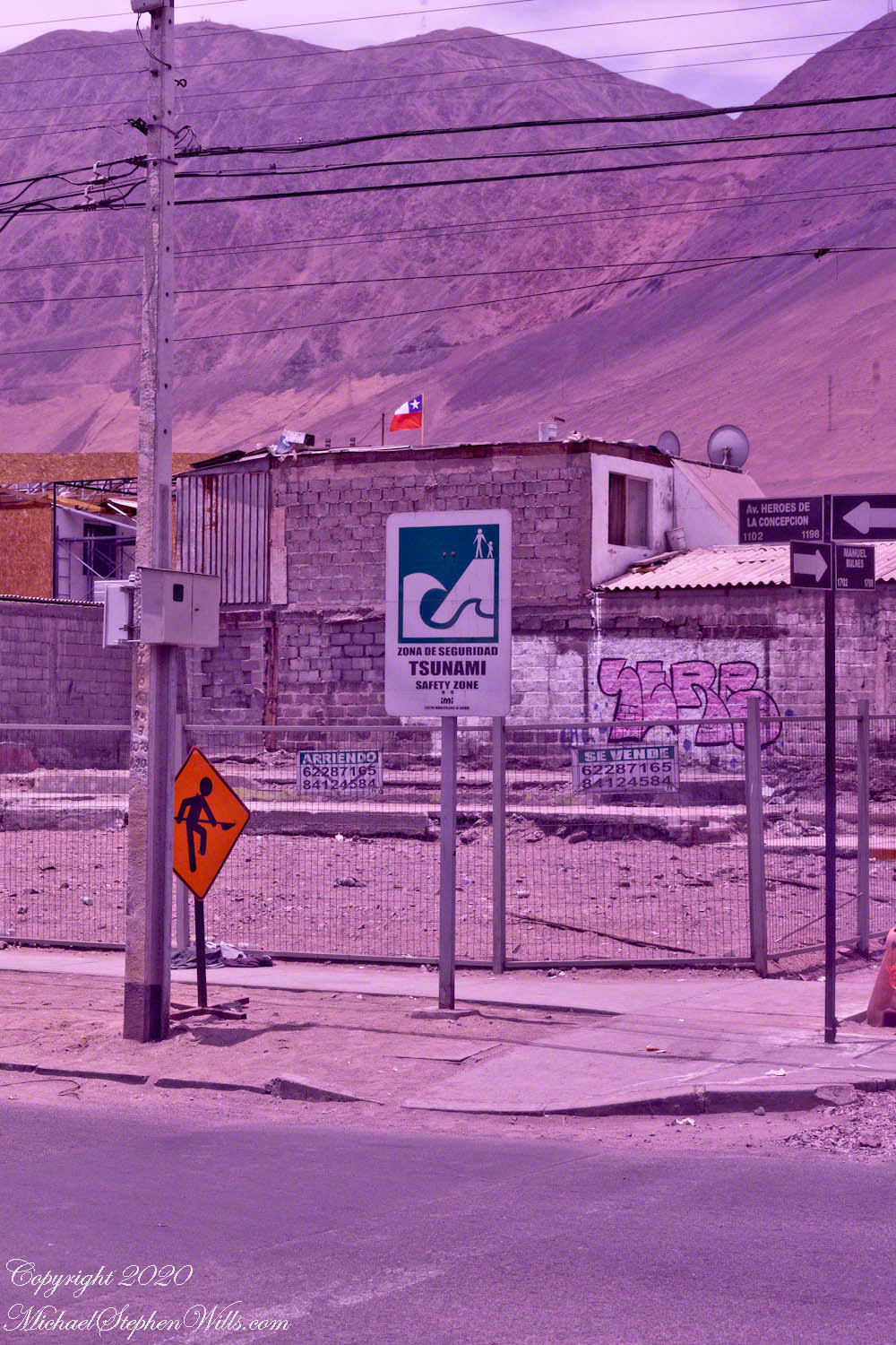
Iquique is a native word for “pleasant place.” It has no (NO!!) rainfall, though almost always cloudy with fogs. On the Pacific rim, sudden, unexpected inundation by water is a fact of life. At this point, the corner of Manuel Bulnes and Avenue of the Heroes of the Conception, the land is sloping up toward the escarpment, 125 feet above sea level, one mile from the ocean. Here we are “officially safe,” an oxymoron.
Twenty months prior Iquique was struck by an offshore earthquake, 8.2 magnitude, followed by a seven foot tsunami. Here, Matarani, Coquimbo, Valparaiso I was happy when we passed these signs (with English translations for us tourists). Traffic congestion would doom us if an earthquake/tsunami struck during the port/downtown transit.
Click any photograph for a larger view and use Ctrl-x to zoom in closer.
“We are now safe”
On this lot is a dwelling, haphazardly constructed of concrete blocks, evidence of desperate poverty. The fence signs (“Se Vende” — for sale) presage the leveling of this corner. Just this year, the street has seen riots…….
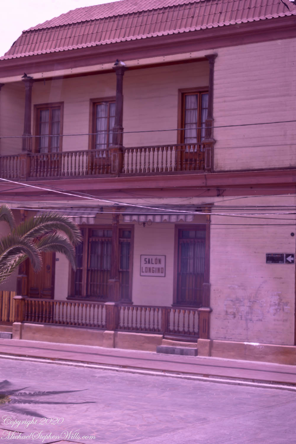
Baquedano crosses Manuel Bulnes and forms the east side of Arturo Prat plaza. It is a long avenue in the old quarter of Iquique, a popular tourist attraction and is a “typical zone,” a status that preserves its historical and architectural heritage. It is characterized by late 19th- and early 20th-century wooden houses. Baquedano Street was transformed by city government into an attractive pedestrian boulevard. The architecture that Baquedano Street exemplifies accommodates Iquique’s prevailing climatic conditions.
Click any photograph for a larger view and use Ctrl-x to zoom in closer.
The buildings on Baquedano Street and, in general, all those that follow the city’s traditional architecture, were built as stores or houses by immigrants who amassed fortunes through the nitrate works. The buildings typically show a continuous facade,a verticality and lightness. They are typically organized around a central nucleus and feature vestibules, verandas, skylights or lanterns, watchtowers, and a serial or “shady” roof over the terrace roof.
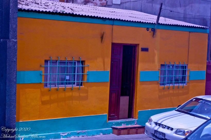
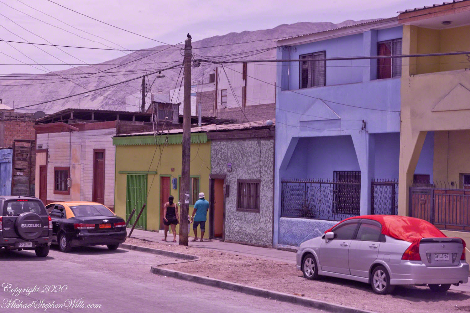
Above, a mixed series of homes. At left, a rundown, one-story timber structure with a “shady” roof intended to cool the interior. The bright blue and beige, at right, are cinder block, as is the following with the front door blocked open to let in the air, a very hot tin roof. Windows and first floor porches are heavily barred or fenced for security.
Northeast corner of Manuel Bulnes and Oscar Bonilla
A common theme here and in Lima, Peru: additional living space above an existing structure thrown together of cheap materials, half done (ran out of funds), no insulation.
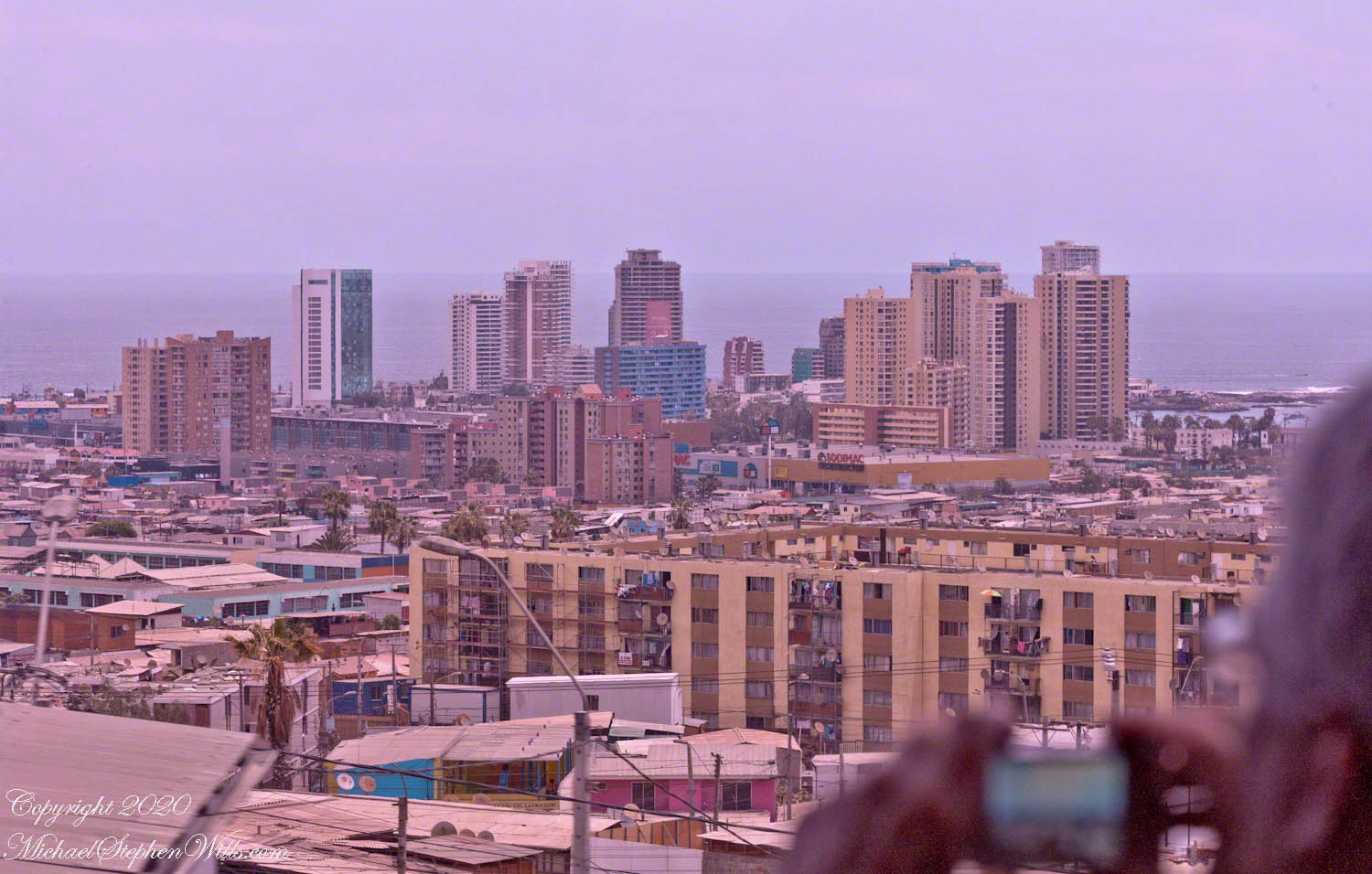
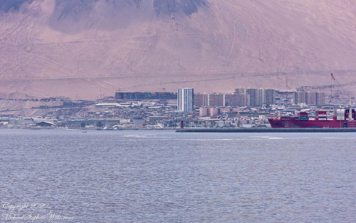
Views of the city open up as we climb the escarpment to the desert plateau. In the foreground a tenement, cinder block homes, glittering skyscrapers with ocean views in the distance.
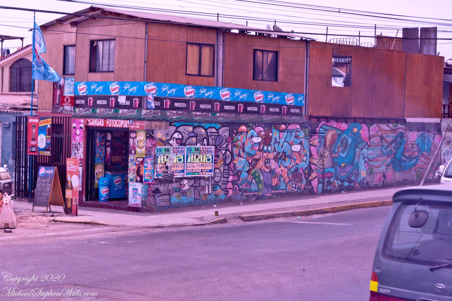
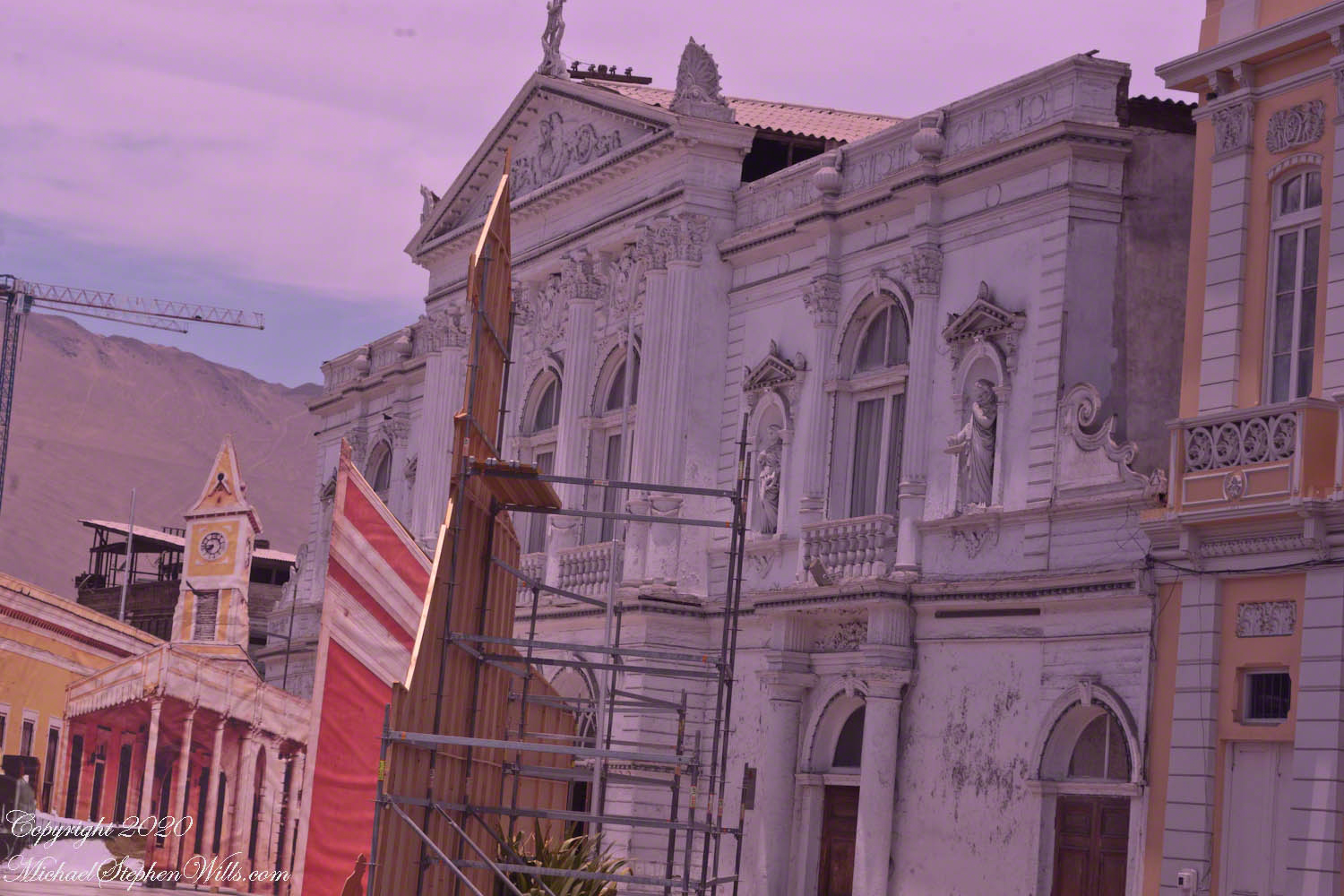
Aníbal Pinto is the street that passes the main square and theater, named for a President of Chile in the 19th Century during a time of crises, notably the War of the Pacific. Logging the Alerce tree was outlawed in 1976, even before then it was a luxury reserved for elite. Most buildings are of these masonry blocks, part of the Hotel Costa Norte, under construction at the corner of Manuel Bulnes. Mural art lined both corner surfaces. Some was apolitical, such as this colorful mandala surrounded by flowers, butterflies, bees on the east side of Aníbal Pinto.
Click any photograph for a larger view and use Ctrl-x to zoom in closer.
Simple Beauty with car for sale
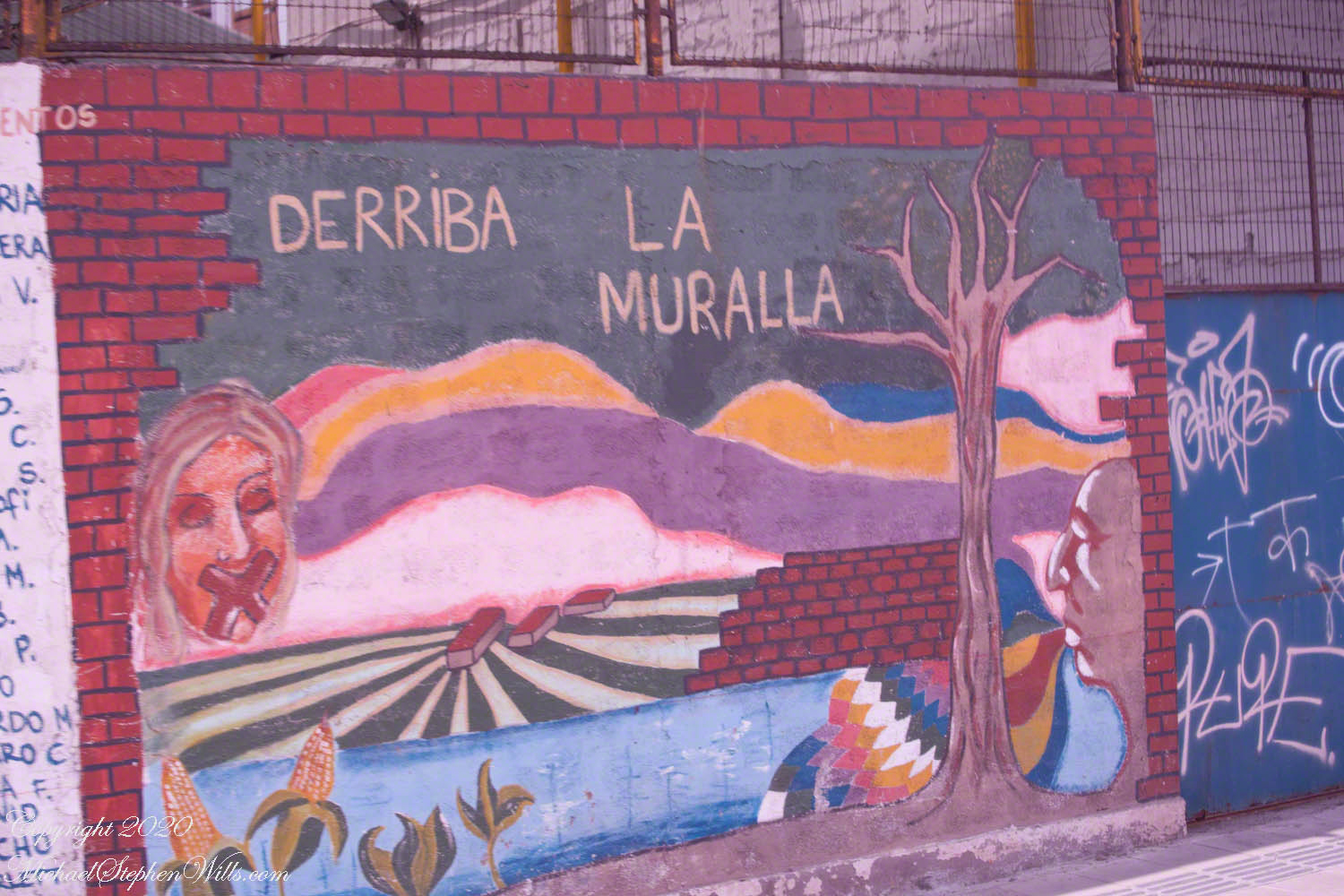
Turning east onto Manuel Bulnes (a street name) the Atacama desert escarpment comes into view above low concrete block structures (no highrises in sight). Outside the bus window is this political statement. The red brick painted, “DERRIBA” is Spanish “knock it down.” The red brick fallen away reveals suppressed speech, on left. The profile of the Chilean poet and statesman Pablo Neruda, his stylized speech transforming the dead landscape.
Knock Down the Wall, Let Poetry Flow
Manuel Bulnes, another 19th century Chilean president, was also a military officer who fought for Chilean independence from the Spanish.
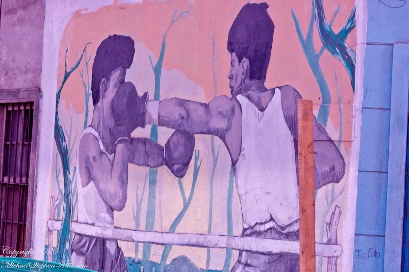
A mural of unidentified pugilists, a solid left jab on a small street named for Oscar Bonilla, one of the main conspirators in the military coup against Salvador Allende. As Defense Minister, Bonilla went against Pinochet. Shortly after was killed in a mysterious helicopter crash.
Northeast corner of Manuel Bulnes and Oscar Bonilla
On a happier note…Santa Claus entering a chimney strung with lights.
Fitzroya cupressoides is a tall, long lived evergreen tree. Also called Alerce, the forests covered large areas of the Chilean Andes. Alerce wood was the principle source of Colonial commerce between Chile and Peru and was heavily logged in the 19th and 20th Centuries. Alerce lumber was used to build, in 1889, the Municipal Theater on Auturo Prat plaza. Today the theater offers performances and hosts a School of Ballet.
Click any photograph for a larger view and use Ctrl-x to zoom in closer.
The legend of the theater includes the actress Sarah Bernhardt. After Iquique booked her performance Barnhardt’s uncharitable comments about the low quality of the venue (“It was a shed”) embarrassed the powers that be, who released their wealth to fund this late 19th century building from the height of saltpeter prosperity.
Another building of the theater complex with a great selection of dining choices
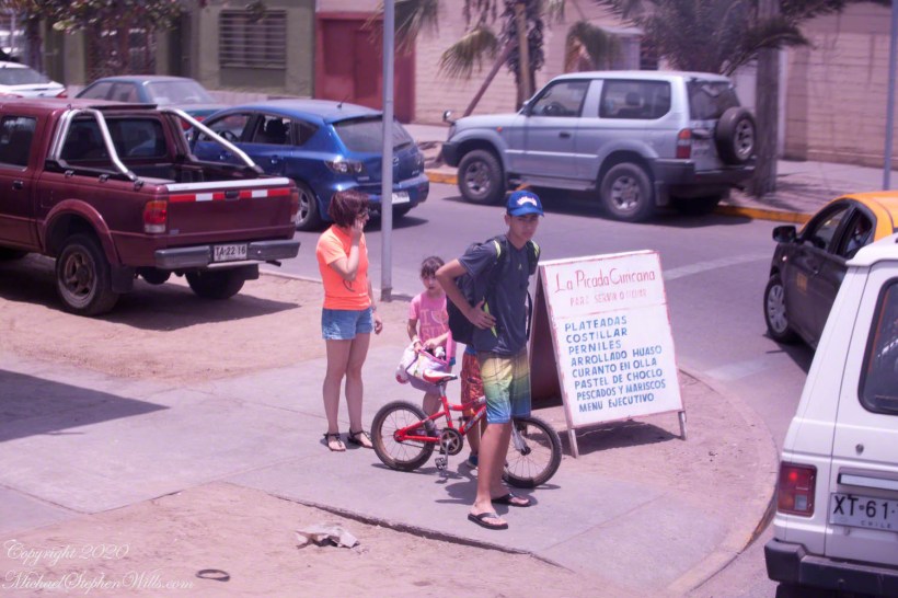
We turn east here, toward the desert escarpment. Here is a young family out for a bike ride. Interesting sign of local cuisine.
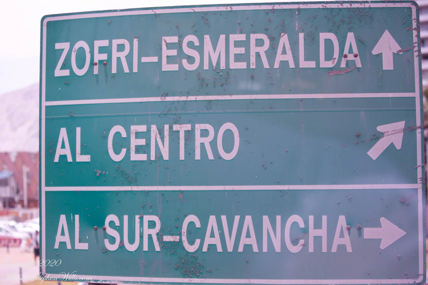
Shortly after the Maritime Government plaza is a crossroads with this interesting sign. The first line references two attractions. “ZOFRI” is the local abbreviation for the designation of Iquique as a port with tax advantages. The destination of this sign is a shopping mall. “Esmeralda” is the living museum I photographed from the tender. Our route to the Atacama desert took us through “Centro” with views of “Sur-Cavancha” on our ascension of the escarpment.
Click any photograph for a larger view and use Ctrl-x to zoom in closer.
Interesting destinations.
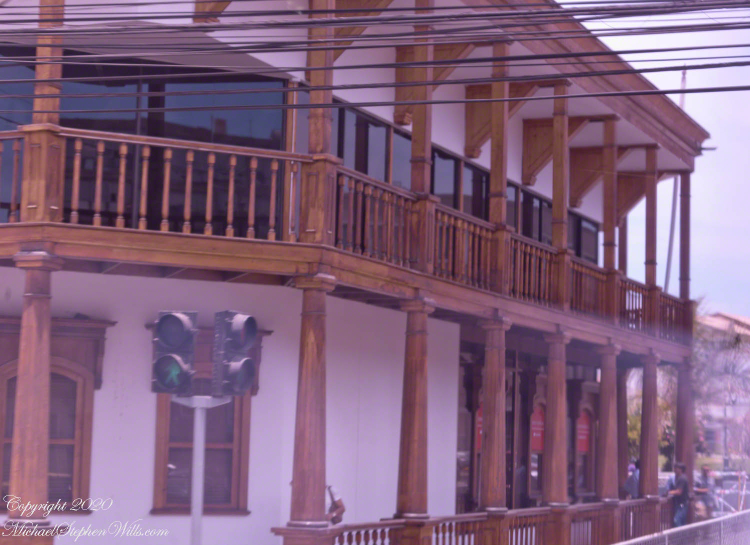
As we approach the central square, this local wonder is on the corner. Any wood must be acquired over long distances as little (close to nothing) grows locally.
A display of great wealth — a wood veranda.
Declared a National Historic Landmark on July 13, 1987 this Clock Tower, together with the buildings surrounding it in the plaza (the Municipal Theater of Iquique, the building of the Workers Welfare Society of Tarapacá, the Casino Español and the Club Croata) is one of the most representative urban expressions of the “Saltpeter Period”, a time which saw much foreign investment. Built 1878 when Iquique was Peru territory, the partition walls of Oregon pine wood, a clock mechanism from England. Saltpeter, a nitrogen rich deposit on the Atacama desert surface, brought thousands of poor workers to exploit the natural resource and to, in turn, be exploited.
I decided against straightening the tower, too much was lost in the process.
A pair of linear fountains run parallel to the road, framing the clock tower or theater depending on the point of view.
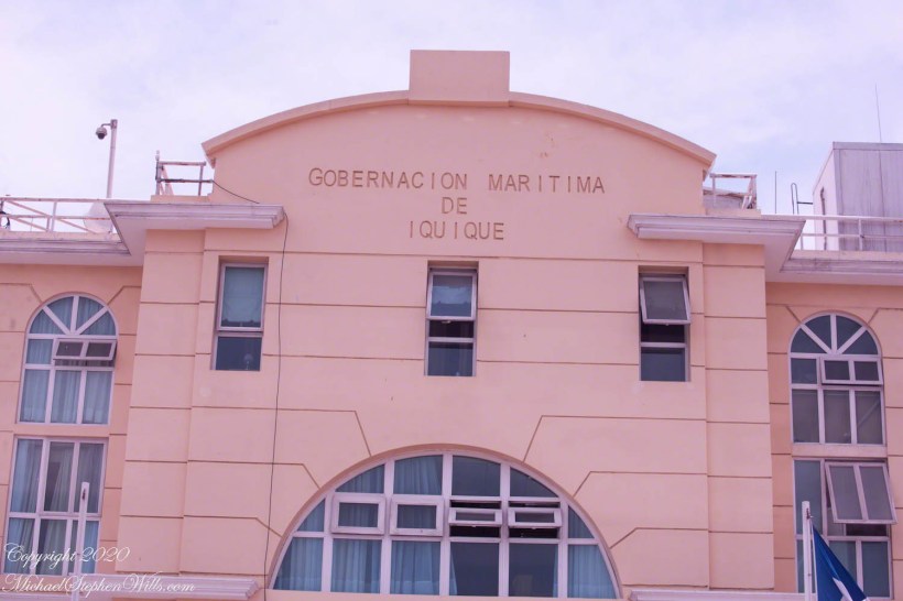
At the foot of the port island a Maritime Government building for the Iquique region. This and the other photographs of Iquique city were taken from the tour bus using a Canon dslr and the Canon EF 70 – 300 variable “zoom” lens.
Click any photograph for a larger view and use Ctrl-x to zoom in closer.
“Red, White and Blue” Note the brass ship’s bell on the left entrance column.
Shaped as it is, Chile needs an agency devoted to the coast. Littoral, the geographic term applied to this area of control. By definition of Chile it’s littoral begins “80 meters inland from the line of beach” to 200 miles from the point of low tide, a broad definition that works without too much conflict as, to the west, is the enormous Pacific Ocean. As with all countries there are interesting disagreements over maritime borders and rights at the borders. Chile and Argentina’s complex border in the far south among the islands and channels of Tierra del Fuego are legend.
“Flag of Chile” with two men on the steps clutching smart phones. Port security is apparent in the identification cards on lanyards.
Iquique is one of thirteen (13) Maritime Governorates. From north to south we can mention those of Arica, Iquique, Antofagasta, Coquimbo, Valparaíso, San Antonio, Talcahuano, Valdivia, Puerto Montt, Castro, Aysén, Punta Arenas and Navarino with the Chilean Antarctic Territory. Our cruise touches up, or passes through, all of them.
Facade
Larger than life busts of two Chilean heroes flank the entrance. We learned about Prat in an earlier post. While Captain Prat lost his life during the Battle of Iquique, Carlos Arnaldo Condell De La Haza, Captain of the schooner Virgen de Covadonga, escaped a larger and heavier gunned Peruvian ship, the armored frigate Independencia, sailing south.
Captain Condell, through tactics and seamanship, pinned the Independenia on a reef. The Covadonga blasted away until driven off by the monitor Huáscar. Condell went on to other naval successes and succumbed to illness at the young age of fourth four (44) years.
Our tour tickets and bus designation ( “number 2” ) firmly in hand, Pam and I walked the gangplank from the tender (see yesterday’s post), into the Iquique International Cruise terminal, then out to the sunshine to find out bus, following the crowd.
Click any photograph for a larger view and use Ctrl-x to zoom in closer.
Downtown High rises soar above downtown
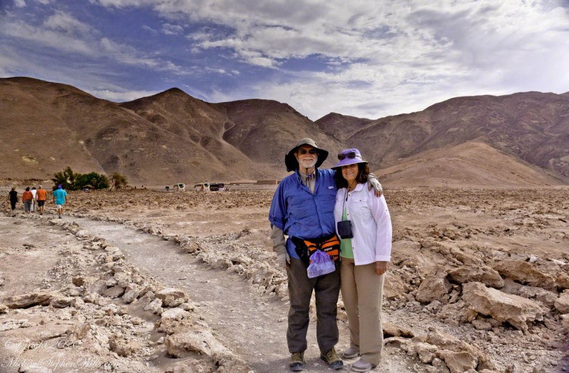
Touring this way can feel link a rodent maze, it was not our feeling at all. The groups maxed at 15, the guides friendly and knowledgeable, the tour buses luxurious. We enjoyed ourselves immensely. Here we are, later that day, dressed for adventure.
Mike and Pam Wills on tour at the Pintados Geoglyphs, Tarapacá, Chile within the Atacama desert.
Our itinerary for the day is to navigate through the city, across the desert to visit a World Heritage Site, Humberstone, and ancient geoglyph sites, touching on local ecology.
Another view of the Cathedral of the Immaculate Conception among the downtown high-rises of Iquique.
Here is our tour, time to hop on the bus, get going.
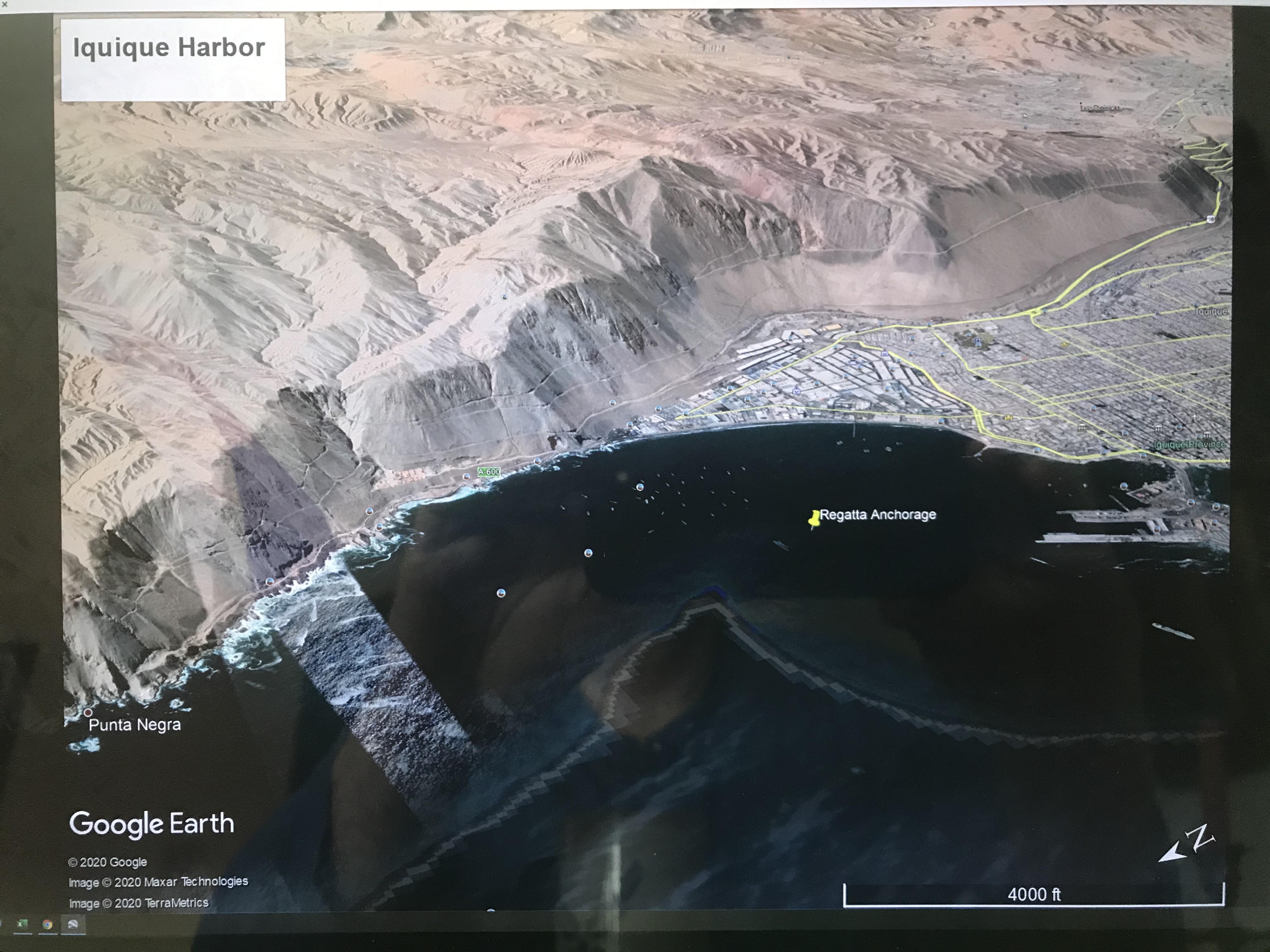
Ninety minutes after docking our assigned tender pulled away from the Regatta for a twenty minute trip to Iquique. A tender is a boat with an enclosed seating area designed to transport about twenty persons in quiet waters from an anchorage to port. I recall the morning announcement from the ship Captain advising use the winds were high (or the waves), and he negotiated a mooring with the port, instead of the planned docking, in order to save our visit to Iquique.
Click any photograph for a larger view and use Ctrl-x to zoom in closer.
The approximate anchorage of the Regatta marked with a pushpin. The tender transported use from the Regatta to the base of the island port.
Above is a screen capture from Google Earth, the entire Iquique harbor is pictured from Punta Negra (see photo from yesterday) to the base of the island port connected to the mainland with a road. The tender port is at this base, on the shore side. If you wish, download the following PDF document with a clearer image. You will need a PDF viewer.
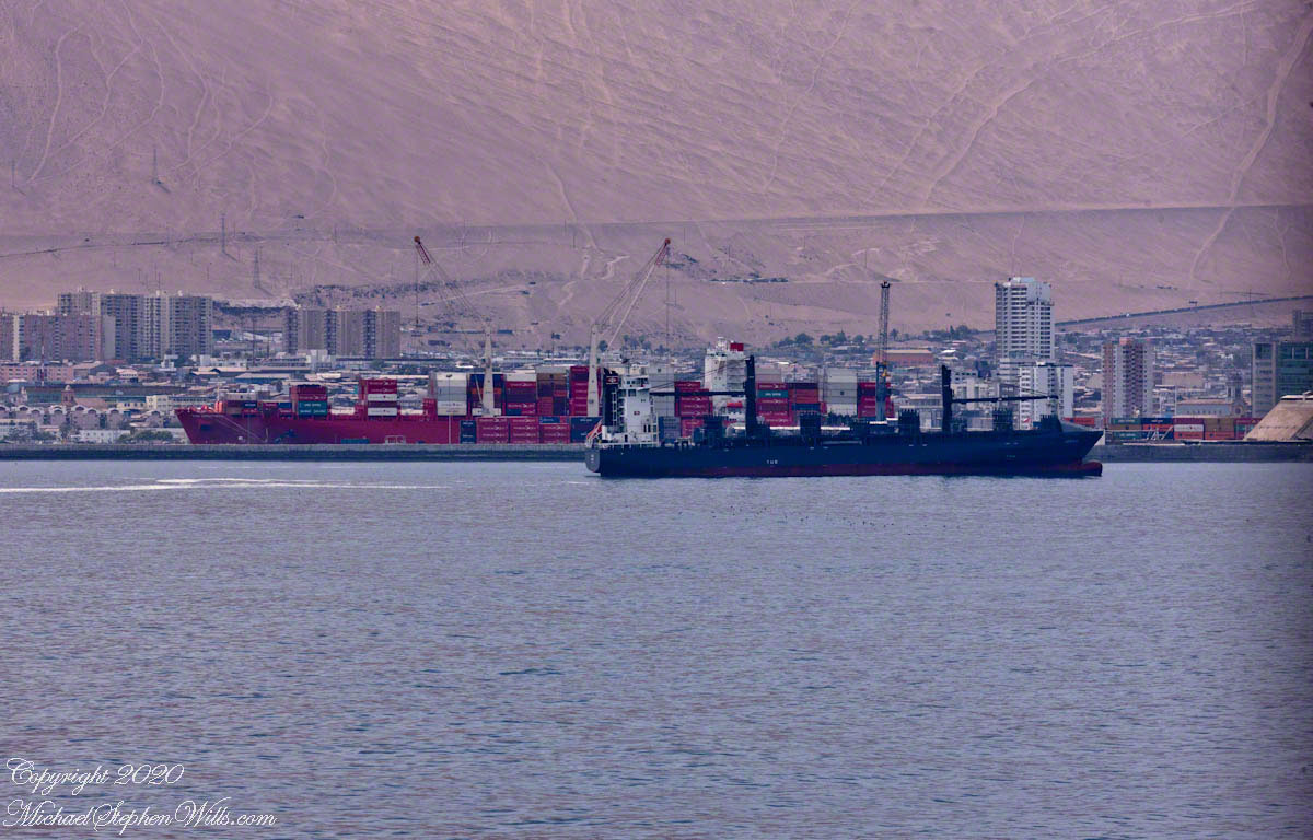
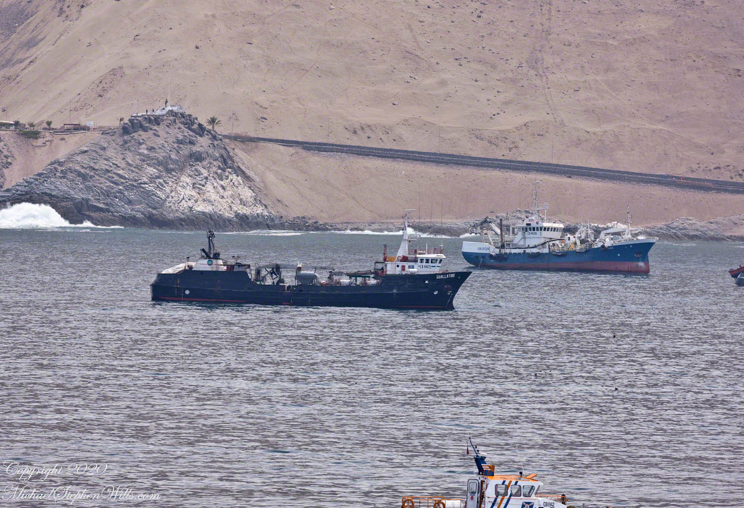
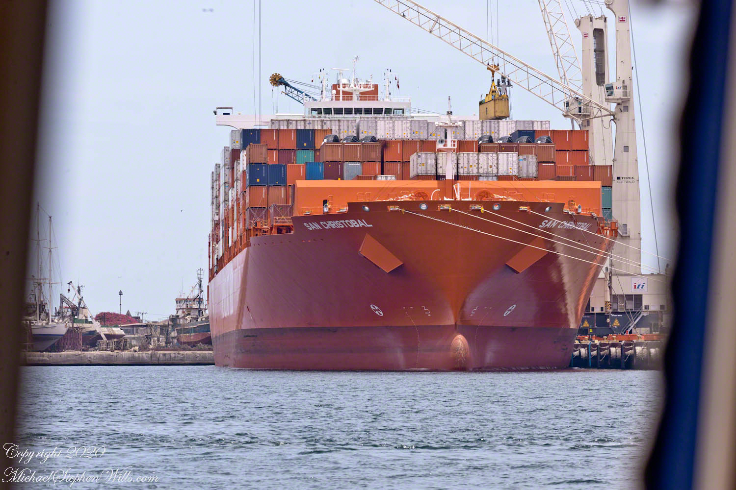
Shipping containers being unloaded from the container ship San Christobal.
Here are some of the sights visible from the tender. I recall sitting next to the large rear window. Above is the large red container ship. From earlier posts, the San Christobal is docked at the outer berth. The ship is being unloaded, you can see a yellow shipping container on the crane.
Today, aneconomic reason for Iquque’s prosperity is the status as a duty free zone the government dubbed “ZOFRI.” Another is tourists flocking to this “Miami of South America” for duty free shopping (there is a mall), the shore lined with tall hotels and condominiums. Adventure-seekers love the surfing and hang gliding from the escarpment.
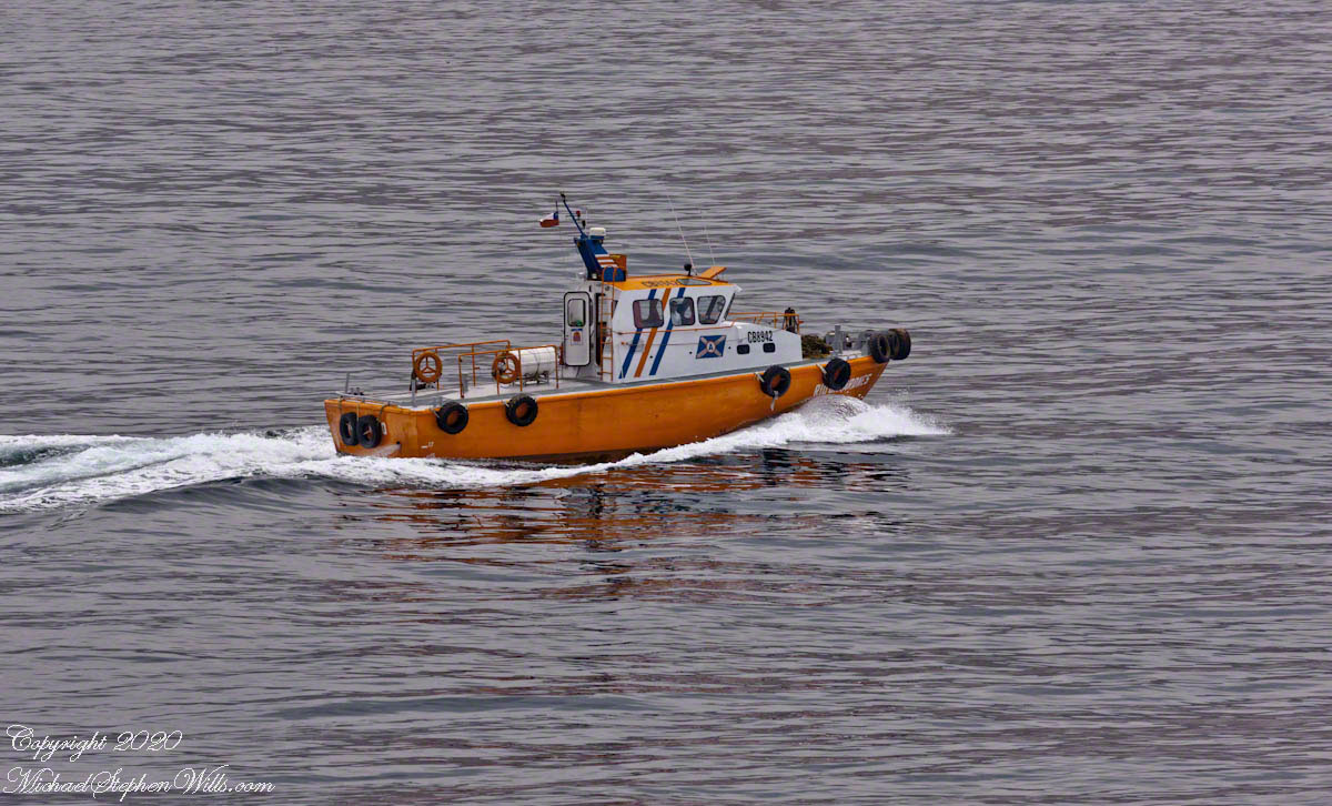
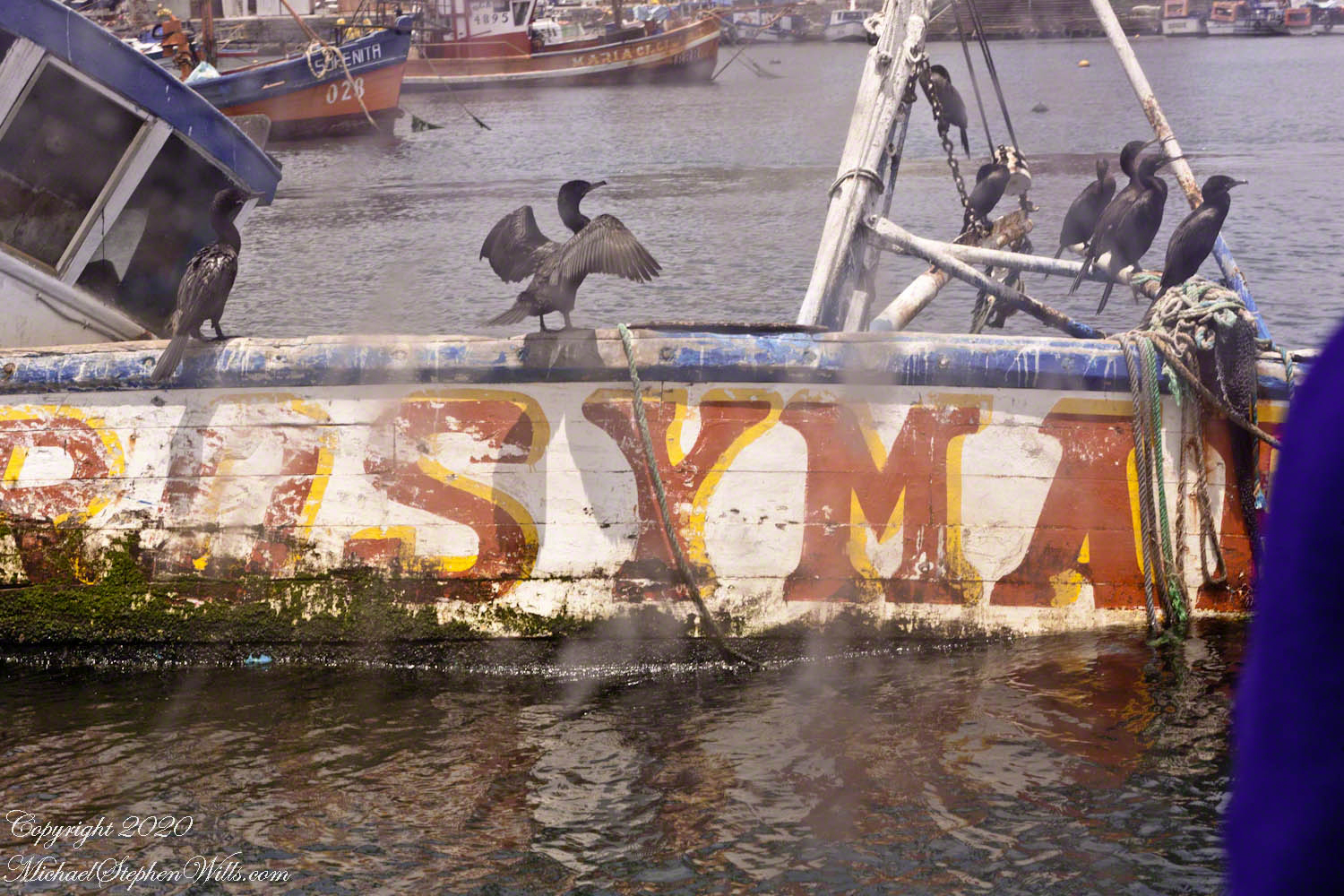
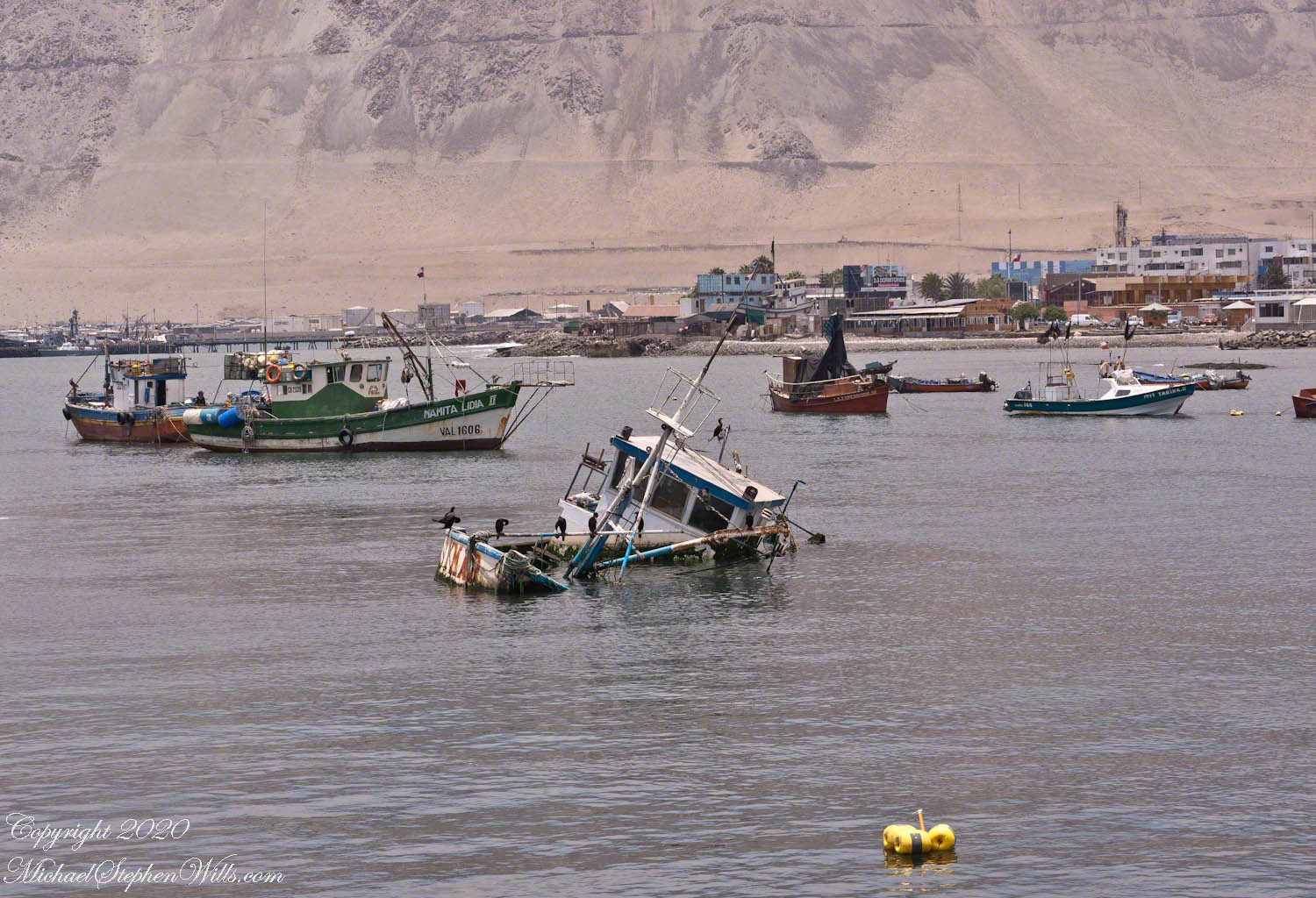
Notice the fishing nets in the stern with yellow floats
This is the scene close to the tender port, past mooring for smaller fishing and other boats.
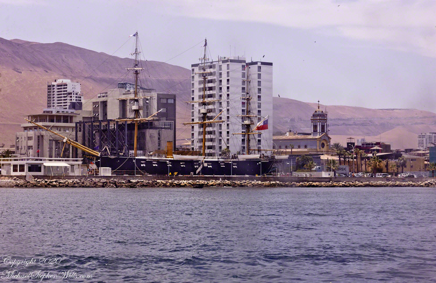
Replica of the Chilean navy ship Esmeralda sunk during the Battle of Iquique. It is a nautical “living museum.” From the website: “The museum script of the Museum ‘Emerald Corvette’ is represented by thirteen museum scenes that inspire the guided tour, where it was recreated what life was like on board on May 20, 1879, the day before the historic Pacific War day.” The Cathedral of the Immaculate Conception is to the right of the ship stern. Here is a previous post with more about the Esmeralda in historical context.
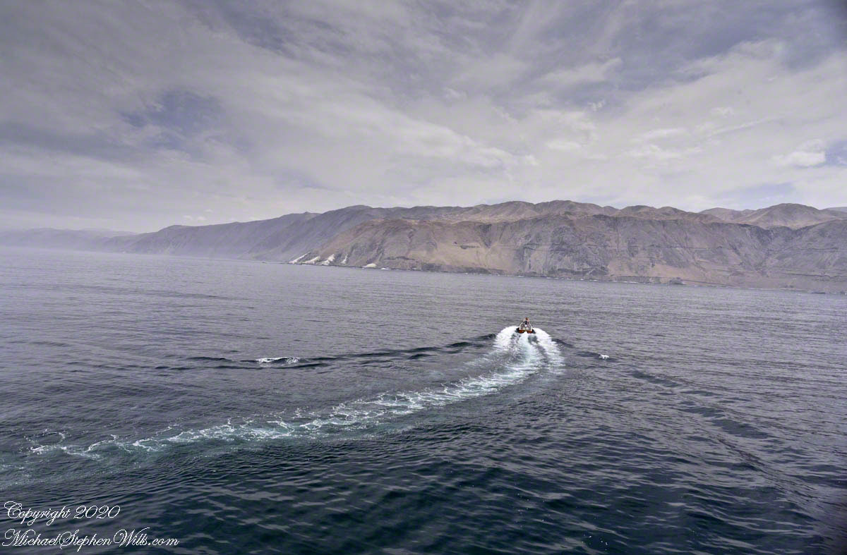
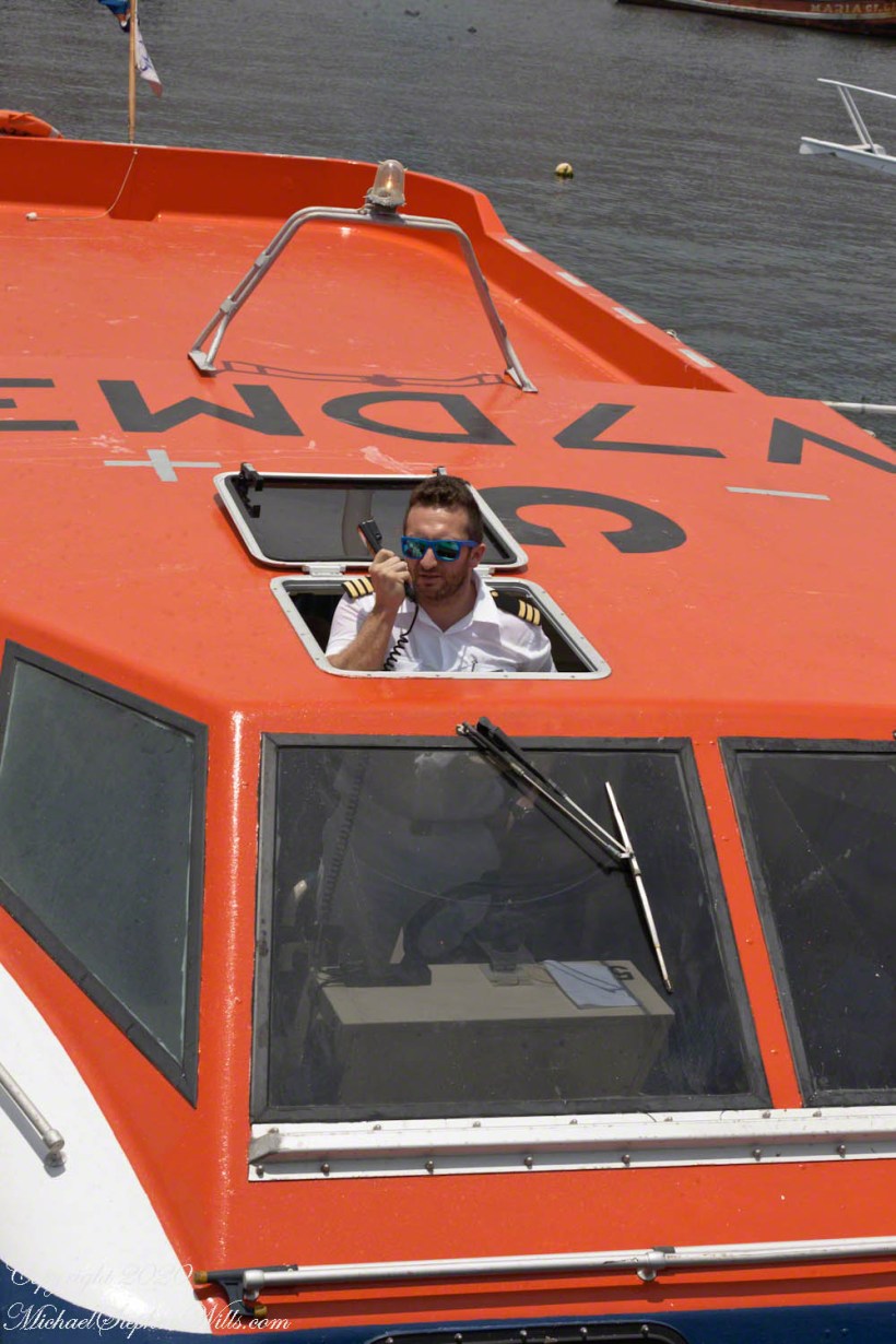
After disembarkation, I looked back for this shot of our tender pilot.