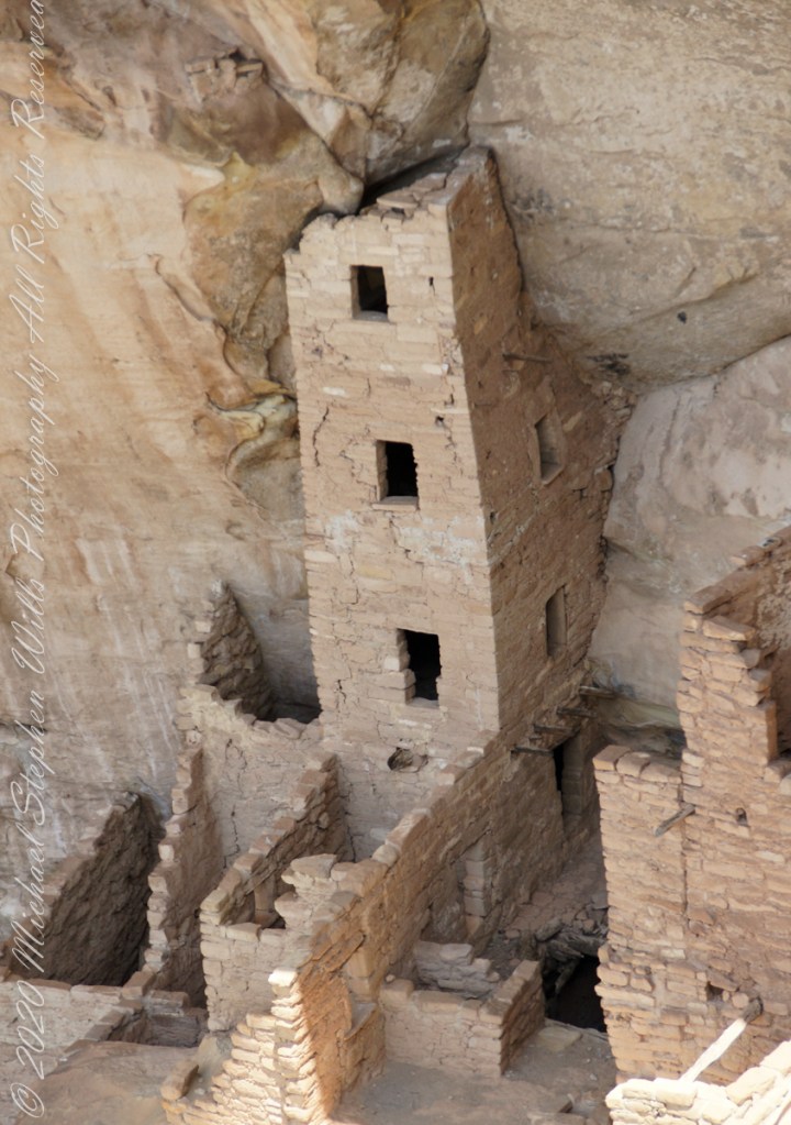
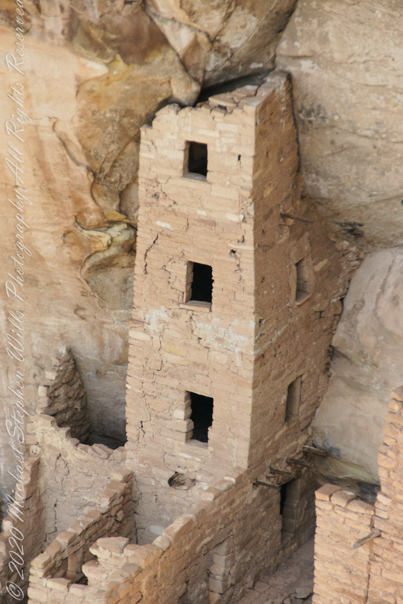
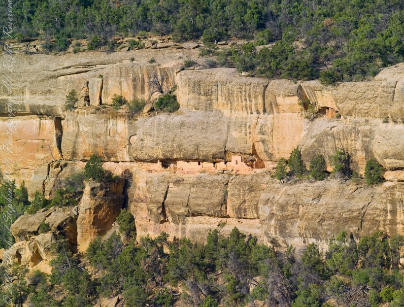
Featuring the tallest standing structure in the park, an intact kiva roof, original plaster and paint, and plentiful rock art, Square Tower House is one of Mesa Verde’s most impressive cliff dwellings.
Located off the Mesa Top Loop, at the head of Navajo Canyon, this cliff dwelling is only accessible on a ranger guided tour, for a fee. Tickets for the tour are limited, so get them before your arrive. There is a viewing point just off the loop road. Mesa Verde National Park, Montezuma County, near Cortez, Colorado.
The two rooms here are what seems to be a round wall, possibly a kiva ruin, on the left and a single story building, on the right, being the single wall with an opening for access. They probably blocked the opening in cold weather to conserve heat. It is possible this site had a special use and was occupied for a limited period of time each season/year.
Copyright 2023 Michael Stephen Wills All Rights Reserved
Pam and I arrived at Mesa Verde early one summer morning in July and spent time understanding the landscape of the ruin sites and the lighting. I made a mental visit plan and decided to arrive at the cliff palace mid-afternoon and it turned out, of the tour times available, this was the best. It is possible to make special arrangements for access, to take photographs, and maybe I will give this a try in my next life.
This four-story square tower, located at the south end of the alcove, at one time reached the ceiling. Access to the upper rooms was provided by hatchways in the lower room roofs.
What about that T-shaped door?
On the fourth floor, a T-shaped doorway suggests a balcony because that type of opening in the wall, designed to minimize the area, was used as a doorway.
Bend over Backwards
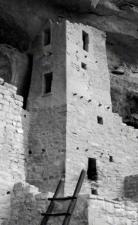
Inside the tower are well preserved wall paintings. To view them, you side in that lower opening, facing outwards and, bending backwards, look up into the tower. You need to hold onto the wall to do this and its the only time we were allowed to touch the ruin.
The Kiva
The modern wooden ladder rises from a kiva platform. Notice the level of wear on the top of the ladder posts. There are three kivas visible from the tower and at a later time I might post about these.
Copyright 2023 Michael Stephen Wills All Rights Reserved
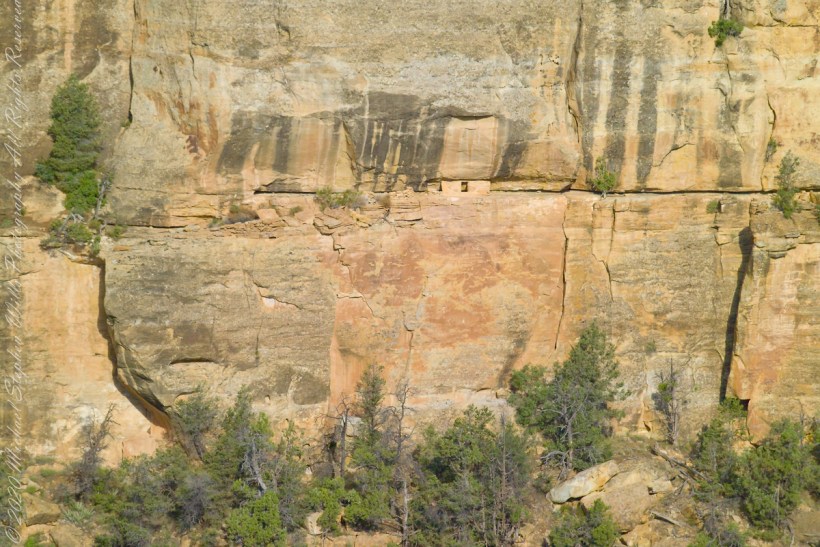
The Anasazi (“ancient ones”) constructed 15 rooms on a 10 foot deep cliff alcove and used a toe-trail (literally a series of depressions in the rock used to gain traction) to climb to the mesa top (shown in this photograph) and the canyon.
A toe-trail security feature is the necessity to start using the correct hand/foot combination, otherwise there will be a point from which it is impossible to proceed. There are 15 rooms here: a kiva, on the far left, a multi-story building, on the right, with 4 upper rooms and 10 ground floor spaces. They probably blocked the openings in cold weather to conserve heat.
The Anasazi had gardens on the mesa top or the canyon, plus they hunted and gathered wild foods. In the gardens, they planted corn, bean, squash and watermelon in the rich soil. They also gathered wild plants and herbs such as bee-weed, ground cherry, milkweed, cattail, wolf berry and sedge grass Cliff dwelling alcoves include a seep spring, a seam in the rock through which a small amount of water flowed. Imagine the difficulty of hauling water every day if there was not a water source in the alcove.
Can you find the unnamed ruin also in this canyon, we call it “Cliff Canyon”? These ruins are outside the national park boundary, inside the Ute Mountain Ute Indian Reservation.
House of Many Windows
The “window” of this cliff dwelling (ruin) was actually a door!! The Anasazi (“ancient ones”) constructed two rooms in this narrow cliff alcove.
The two rooms here are what seems to be a round wall, possibly a kiva ruin, on the left and a single story building, on the right, being the single wall with an opening for access. They probably blocked the opening in cold weather to conserve heat. It is possible this site had a special use and was occupied for a limited period of time each season/year.
Cliff dwelling alcoves include a seep spring, a seam in the rock through which a small amount of water flowed. Imagine the difficulty of hauling water every day if there was not a water source in the alcove. The large juniper to the left attests to a water source, since it grows from a shared crevice.
The protective alcove was deeper in the past. The desert varnish (the dark marking) above the alcove marks a place where water seeps from the cliff and, in cold weather, expands under the overlying rock, causing it to fall. Can you see where the cliff face has fallen above the ruin? The lack of desert varnish shows the rock fall was relatively recent.
Copyright 2023 Michael Stephen Wills All Rights Reserved
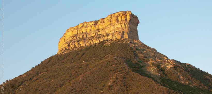
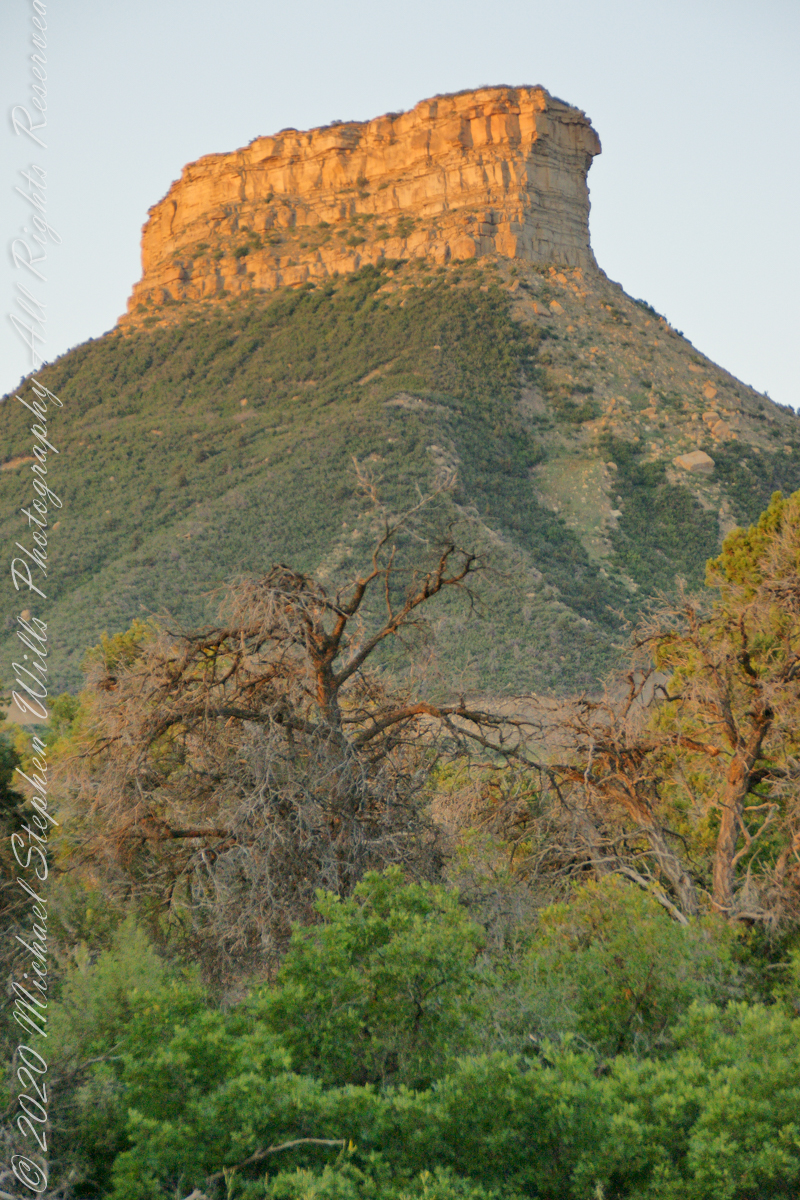
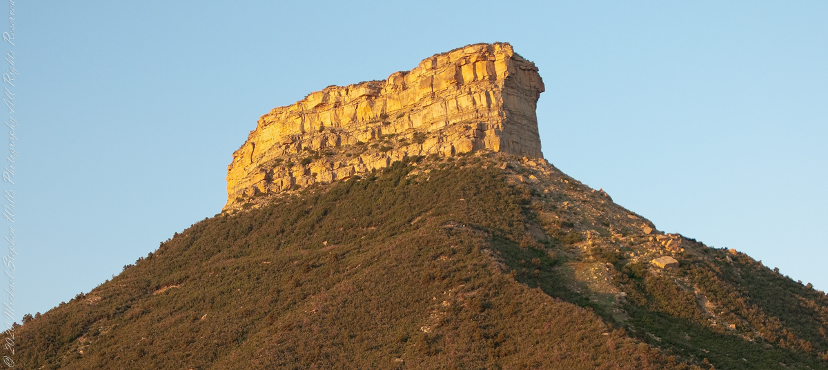
This dramatic butte at the entrance to Mesa Verde National Park, golden in the first light of a July morning. My wife, Pam, and I were on this road in the pre-dawn hours. Our delight with this surprise view was worth it.
In this Point Lookout area, near the park’s entrance, the Mancos Shale is about 2,000 ft thick, and this is what this butte is composed of. Mancos Shale is the lowest formation of the park and is a thick sequence of gray to black marine shale containing minor tan siltstone and fine sandstone beds. On steep slopes, such as those near the northern and eastern boundaries of the park, this formation is prone to landslides and debris flows. This is the base of the butte. The lovely golden rock is Point Lookout Sandstone of the Mesaverde Group, a predominantly yellowish-gray or pale-orange, fine- to medium-grained marine sandstone, approximately 300-400 ft thick. The Point Lookout Sandstone forms much of the cap rock in the northern park area.
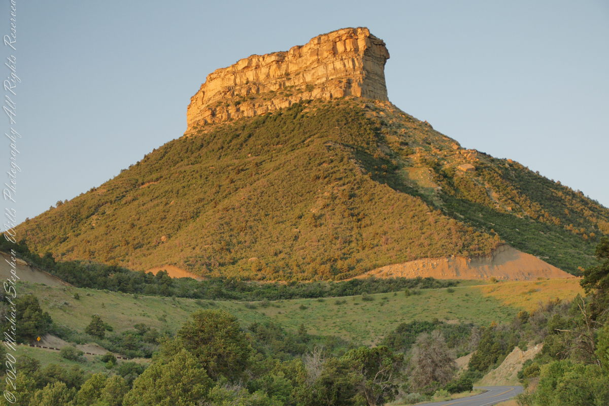
I reworked the above image into this Fine Art image of Point Lookout.