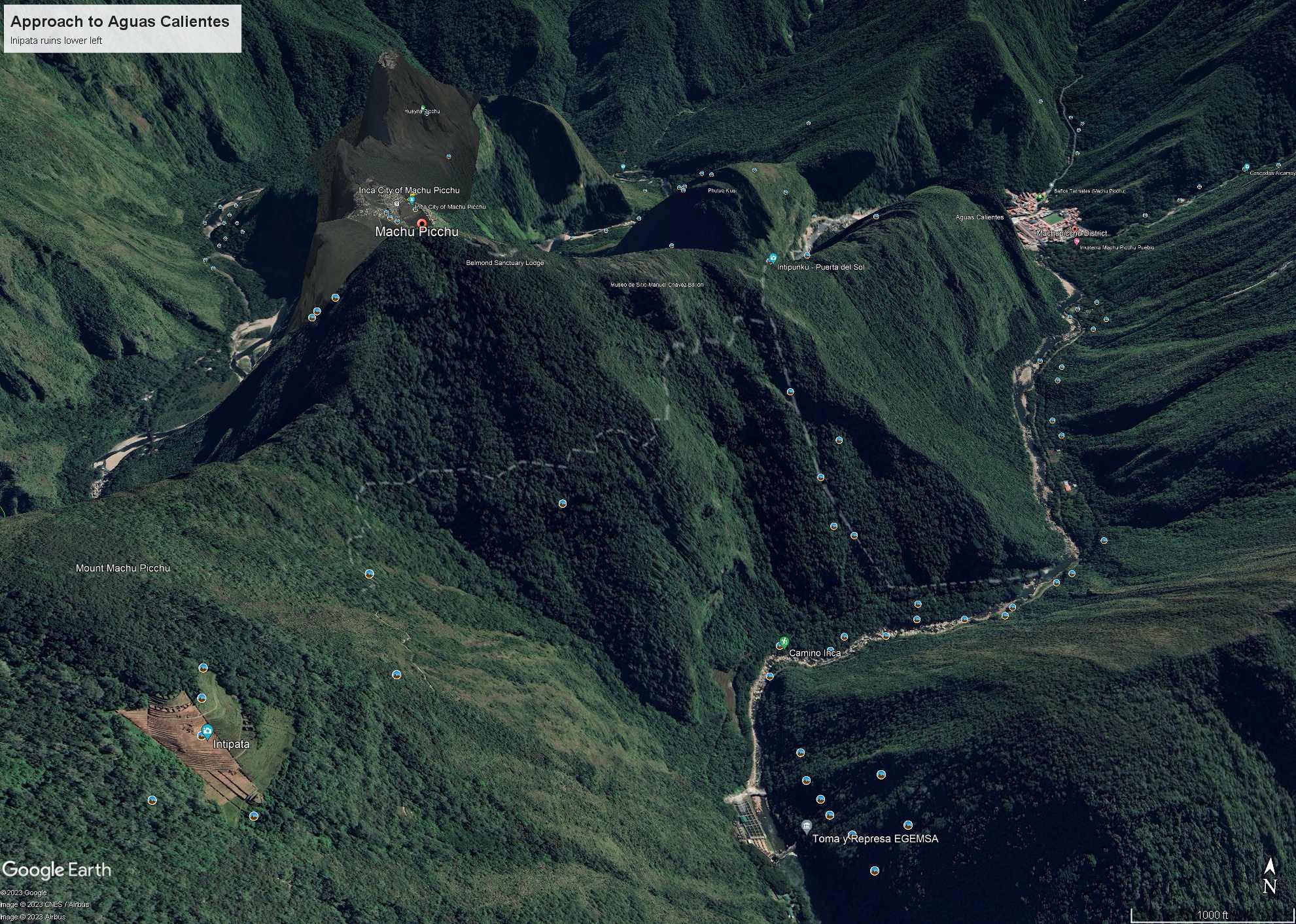
Click Me for my Online Gallery
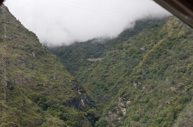
In 1911 American historian and explorer Hiram Bingham traveled the region looking for the old Inca capital. On July 24, 1911 Bingham, led to Machu Picchu by a villager, Melchor Arteaga, crossed the Urubamba river on a rickety wood bridge. Bingham found the name Agustín Lizárraga and the date 1902 written in charcoal on one of the walls. Though Bingham was not the first to visit the ruins, he was considered the scientific discoverer who brought Machu Picchu to international attention.
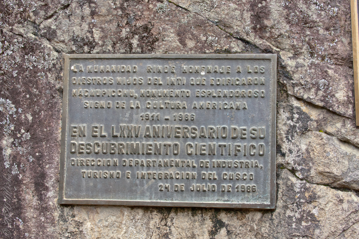
“Humanidad Rinde Homenaje a diestros hijos del inti que edificaron MachuPicchu, monumento esplendoroso sign o de la cultura americacana 1911 – 1986 En el LXXV Aniversario Descubrimiento Cientifico Direccion Departmental de Industria, turismo e integracion del Cusco 24 de Julio de 1986” Translation “Humanity pays tribute to skilled sons of the Inca who built Machu Picchu, splendid monument sign or of American culture 1911 – 1986 In the LXXV Anniversary Scientific Discovery Departmental Directorate of Industry, Tourism and Integration of Cusco July 24, 1986”
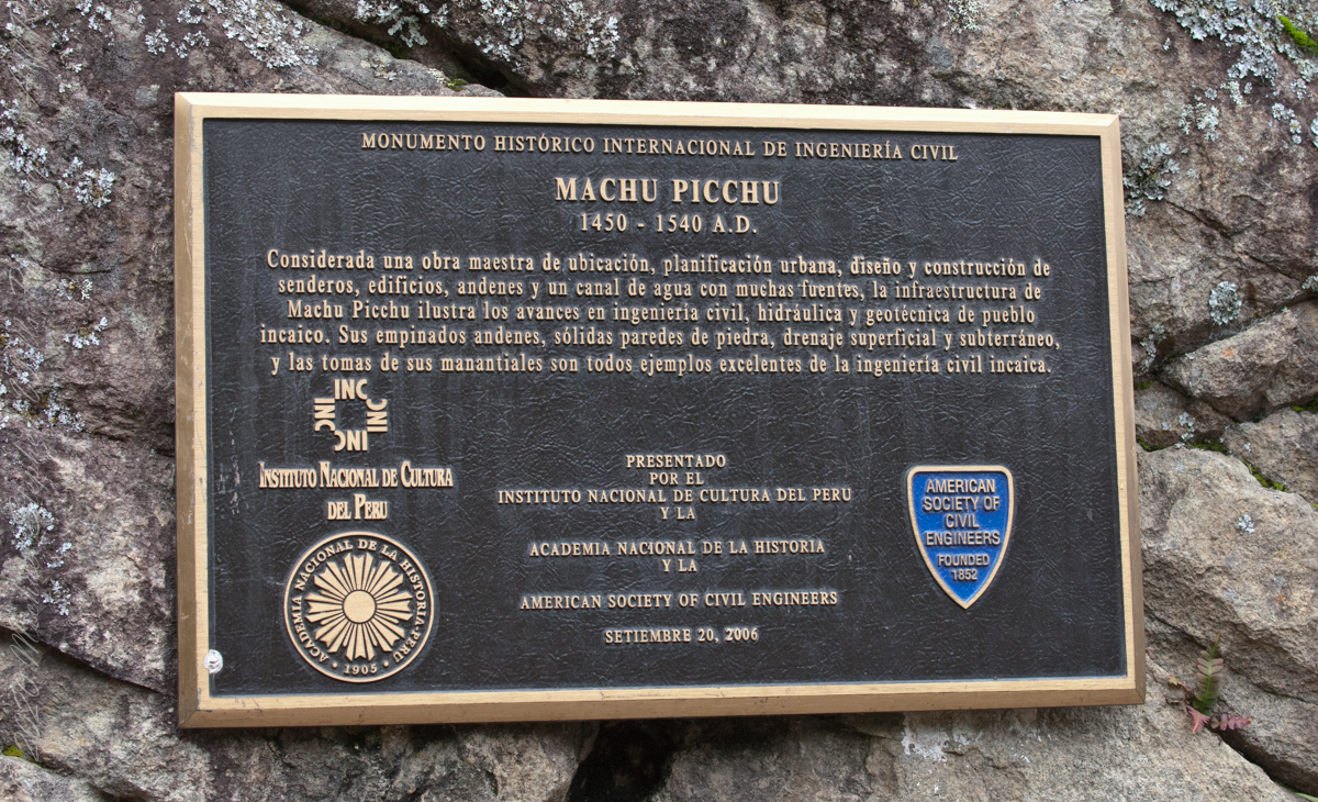
“Considerada una obra maestra de ubicacion, planificacion urbana, diseno y construccion de senderos, edificios, andenes y un canal de agua con muchas fuentes, la infraestructura de Machu Picchu ilustra las avances en ingenieria civil, hidraulica y geotecnica de pueble incaico. Sus empinados andenes, solidas paredes de piedra, drenaje superficial y subterraneo, y las tomas de sus manantiales son todos ejemplos excelentes de la ingenieria civil incaica.” Translation “Considered a masterpiece of location, urban planning, design and construction of trails, buildings, platforms and a water channel with many fountains, the infrastructure of Machu Picchu illustrates the advances in civil, hydraulic and geotechnical engineering of Inca village. Its steep platforms, solid stone walls, surface and underground drainage, and intakes of its springs are all excellent examples of Inca civil engineering. September 20, 2006.”
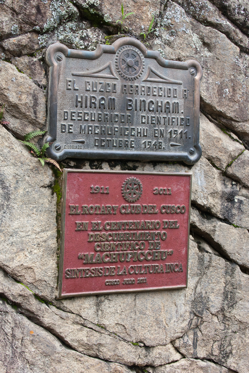
Top: El Cuzco Agradecido a Hiram Bingham Descubridor Cientifico de MachuPicchu en 1911. October 1948 (made by C Ubquizo) Translation (The City of ) Cuzco (is) Grateful to Hiram Bingham Scientific Discoverer of Machu Picchu in 1911. October 1948 Bottom: 1911 2011 El Rotary Club del Cusco En el Centenario del Descubrimiento Cientifico co “AMachuPicchu” Sintesis de la Culture Inca Cusco Julio 2011 Translation: The Rotary Club of Cusco In the Centenary of the Scientific Discovery of “MachuPicchu” Synthesis of the Inca Culture Cusco July 2011.

Credits:
“Machu Picchu” Wikipedia
Translations Spanish are from Google Translate (with my editing).