The Rincons are one of 42 Sky Mountain islands isolated from each other by the gradual warming and drying climate changes since the last ice age, 10,000 years ago. While this marvelous environment of oak and pine forests only accessible with much effort on foot, it is literally visible from every point of the Tucson valley and million human inhabitants.
Rincon is Spanish for corner, the mountains are called that from their shape enclosing a space on the west, northwest until recently used for ranching and is now falling into use for tract housing. The mountains themselves are reserved as wilderness, parts in the Saguaro National Park and the Coronado National Forest.
In the past 44 years I was lucky enough to visit the Rincon Wilderness interior three times, shouldering different style backpacks onto the mountain, walking different boots. The first, during college the 1970’s, a party of six left from the end of Speedway, up the Douglas Springs trail. The climb was an exercise in desert survival that several friendships did not survive, replace by new friends met on Mica Mountain. I have no photographs from that experience, only memories and the backpack.
Reconnecting with Arizona in 2004, thirty one years after that first experience, I took no chances. My first attempt on Rincon Peak was a success. Risk and effort were reduced, not eliminated by hiring a guide for the four day trip. We made it to Rincon Peak via the Turkey Creek Trail out of Happy Valley, climbing a mountain buttress, views ever widening and lengthening.
These are some photographs from that experience and a landscape photograph of the peak at sunset, taken the following year.
Click this link or the photographs for my Online Gallery
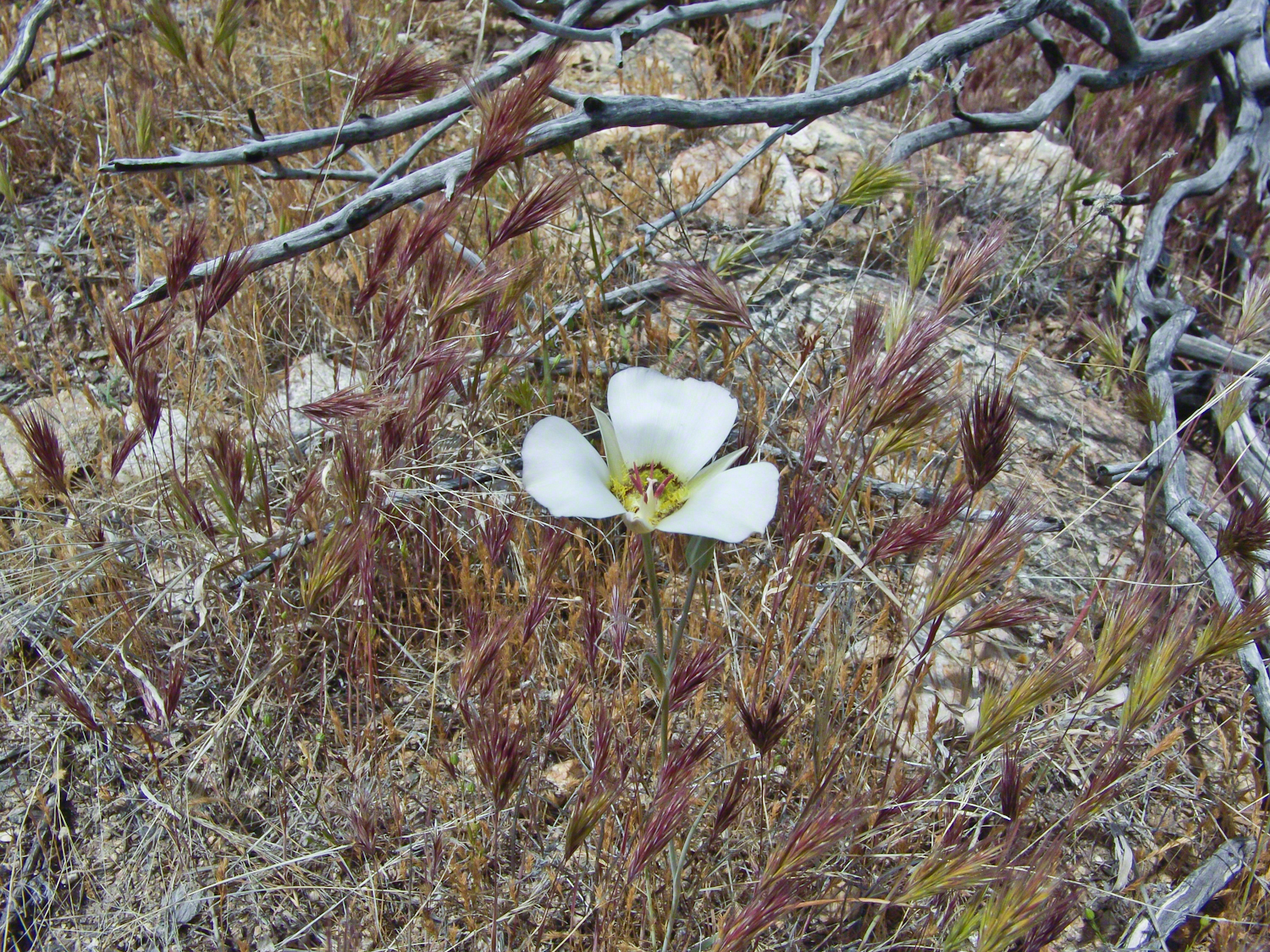
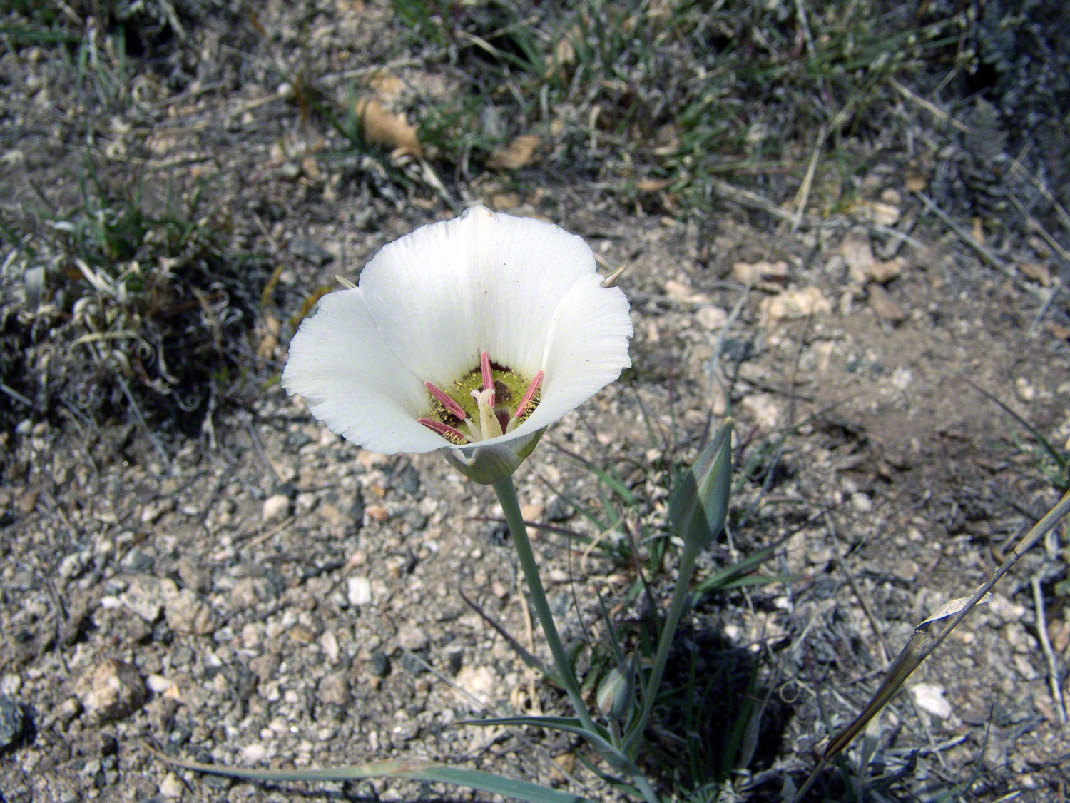
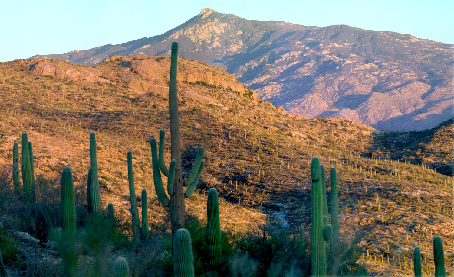
Sego Lilies bloom among a stricken oak and drying grasses on the Turkey Creek trail. This is an overview of the environment, it is the winter rains that trigger the bloom.
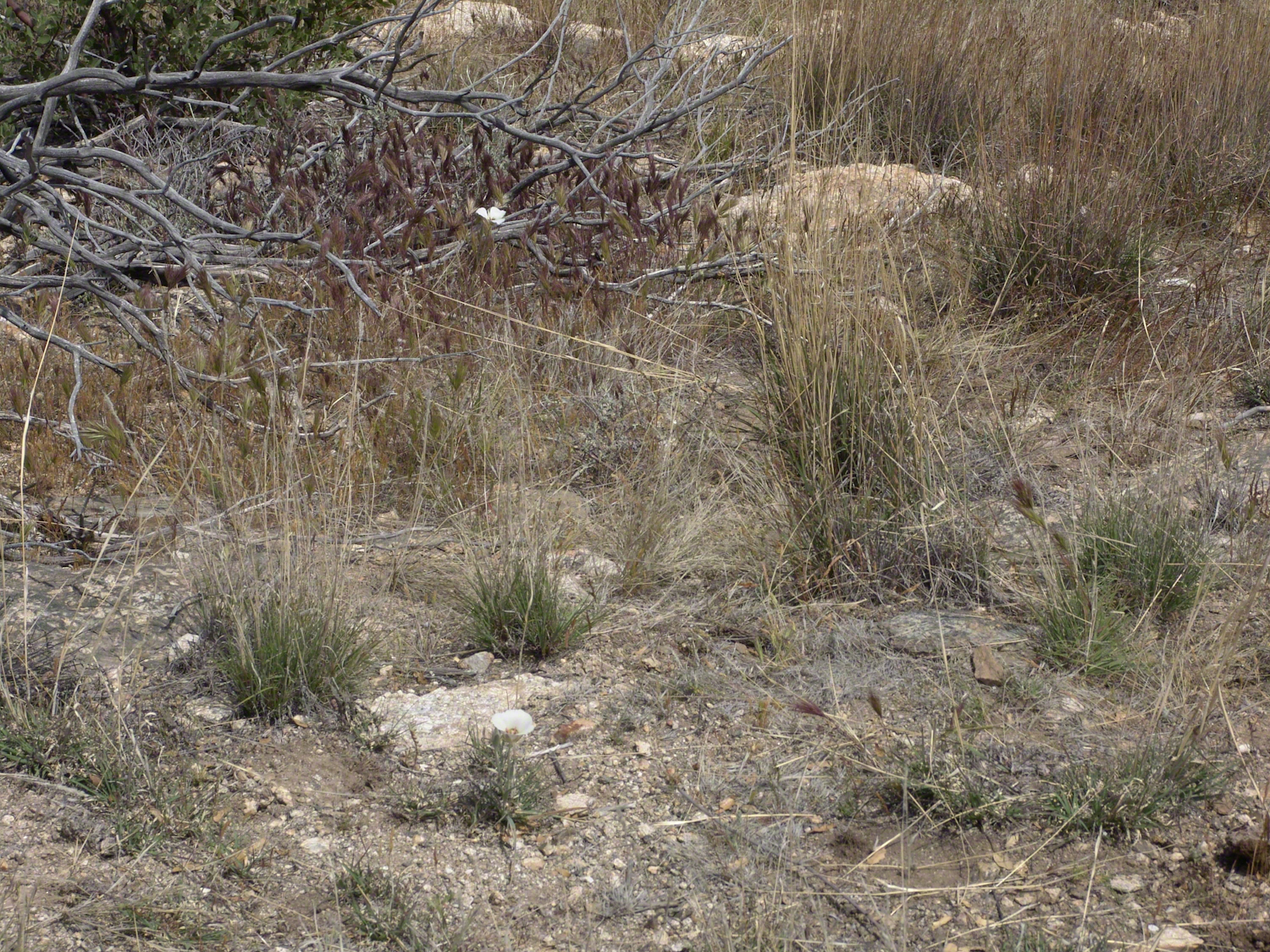
We paused while I unpacked my gear to capture Sego Lilies growing along the Turkey Creek Trail.
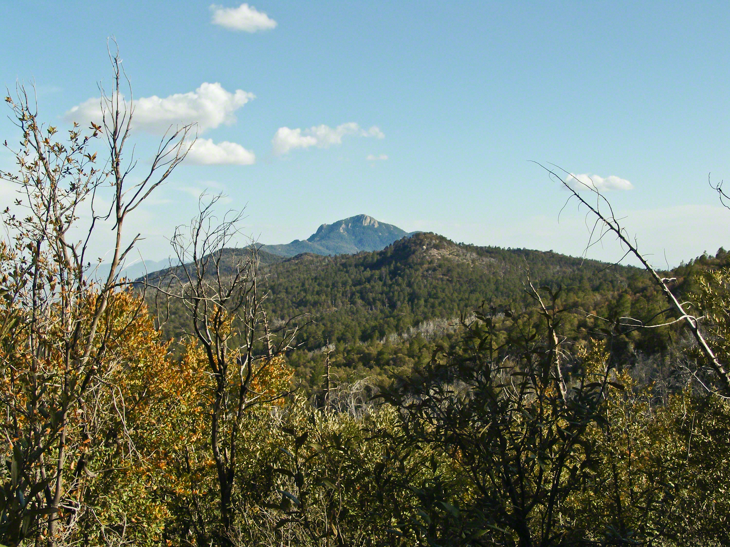
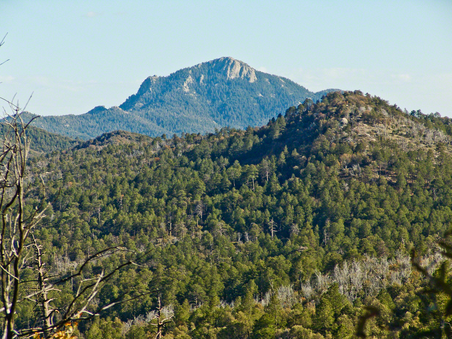
Deer Head Spring, at the top of Turkey Creek Trail was a moist spot with no accessible water when we reached it April 27, 2004. With the remains of a gallon of water each we needed to press ahead to Heartbreak Ridge and climb into Happy Valley Saddle were, thankfully, the creek was low and full of algae but usable. Here are my first views of Rincon Peak, looking across the aptly named Heartbreak Ridge and Happy Valley Saddle.
The view to south from Rincon Peak. The white rocks at lower right forms a Valley of the Moon wall. San Pedro River valley at the root, Mae West Peaks at left margin, Dragoon Mountains with Cochise Stronghold center. Taken around 12:30 on April 28, 2004 as a thunderstorm approached.
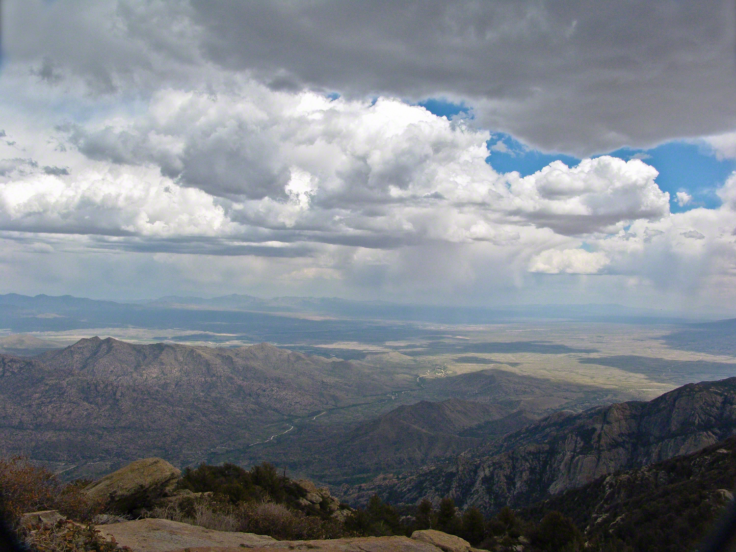
The Rincon Peak view looking south, southwest over the Valley of the Moon to the eastern Tucson Valley and the Sky Islands the Whetstone Mountains (Apache Peak), behind are the Santa Ritas. The works of man are overpowered by sky, rock, distance.
We made a hasty departure in front of the thunderstorm. It was a touch and go decision to attempt the peak that day, we made it with moments to spare.
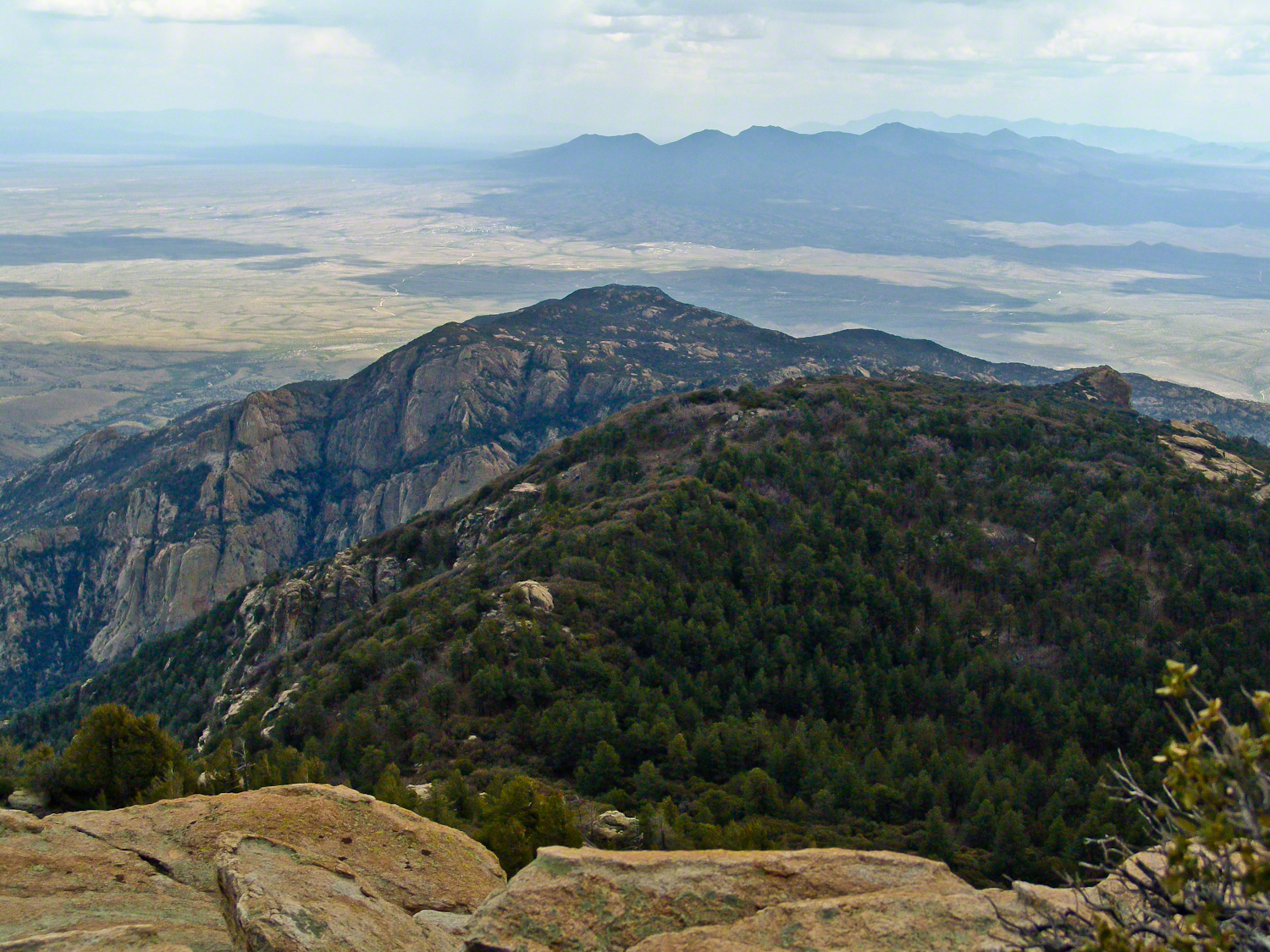
April 29, 2004 the morning after reaching Rincon Peak I set up the tripod near our Happy Valley Saddle camp to capture Rincon Peak in early morning sunlight.
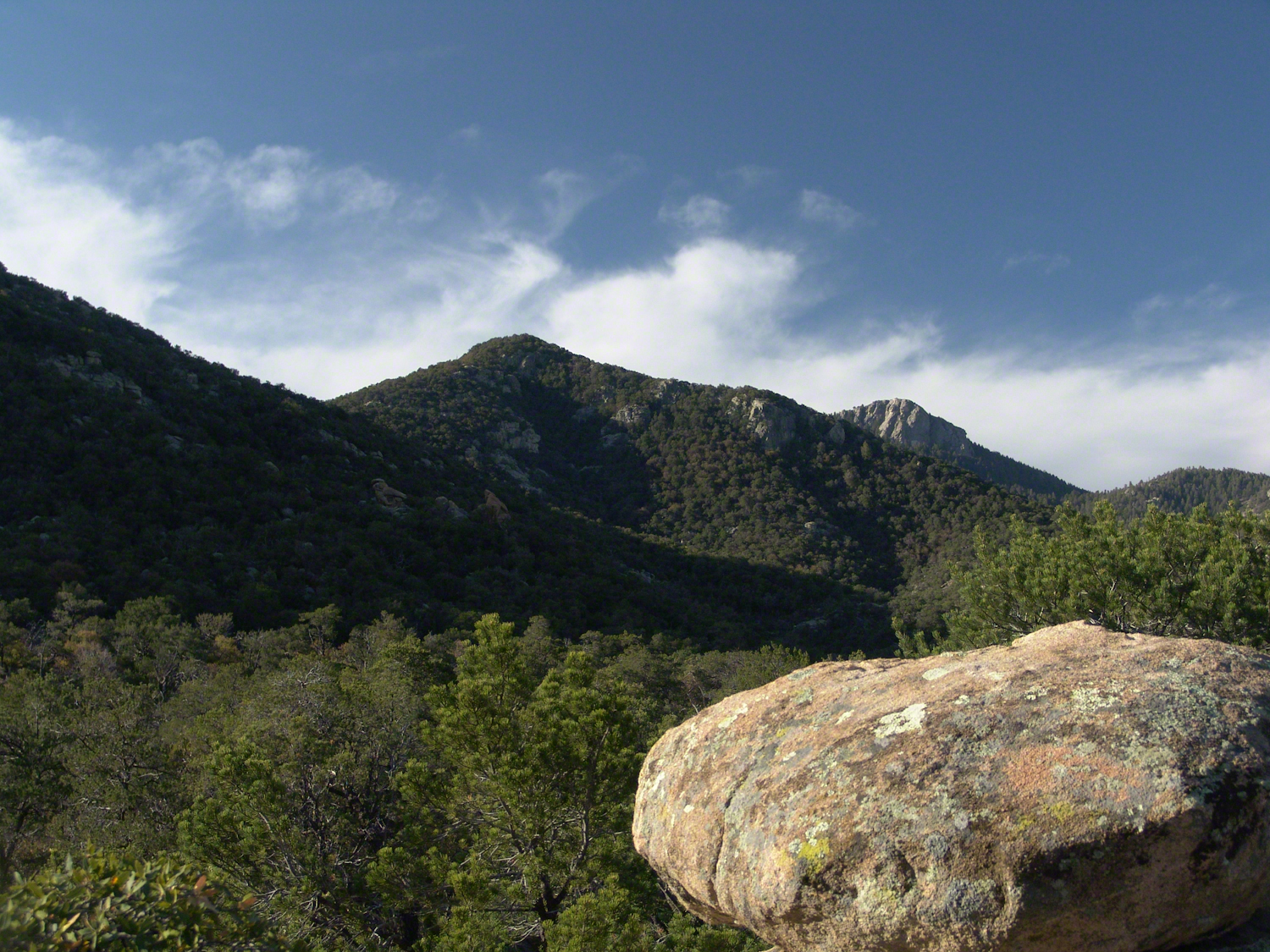
The day we descended to the X9 Ranch via the Rincon Creek trail. My guide’s grandfather had a homestead at the X9 and his access to the trailhead through private lands opened this route for us. This is a photograph of sunset on Rincon Peak from the X9 ranch. I am looking east from the Rincon (Spanish for corner) made by the massifs Rincon Peak, Mica Mountain and Tanque Verde ridge.
The evening of November 2, 2006 I climbed the Saguaro National Park, East, Tanque Verde trail for about 30 minutes to reach this view of Rincon Peak and waited until just before the sun set behind the Tucson Mountains for this shot. Then hiked back to the car in twilight. In my hurry, I tripped on a stepped turn and dove headfirst into a large prickly pear. It was a very painful experience and I regretted damaging the cactus and the loss of and good hiking shirt. There were large spines in my face and tiny, pesky spines covered my chest and back. The large spines are not barbed and come right out. I needed to visit a physician to remove them.

Ouch! That encounter with a prickly pear sounds bad. Did you not have a flashlight?
LikeLiked by 1 person
I have a headlamp, it was not dark enough to use it. I was simply walking too fast. I learned my lesson with much pain and suffering — now am slow and careful always. Thanks for reading….
LikeLiked by 1 person
Also, that area is known for puma sightings. The trail is empty at that time, so I tend to look around quite a bit on the alert. Another reason for going slow. Thanks so much for your questions and observation, Neihtn
LikeLike
The photos are breath taking and welcome aboard 😁.
LikeLiked by 1 person
Thanks for the compliment….and likewise.
LikeLike
Your always welcome.
LikeLiked by 1 person
I had the same reaction as neihtn2012, above. Ouch; that must have been so very painful. The prickly pear was introduced in Australia during the 19th century. In the early 1900s eradication began! Such an invasive plant, and, as I understand it, extremely painful when its barbs are injected. We do have a number of farms producing fruiting prickly pear; however, time and effort is spent ensuring they do not go ‘out of bounds’.
I’ve never been a lover of hiking, Michael (my interest/exercise/love of movement is via dance) though, I really am enjoying your hiking tales and the images you’ve captured. I do love the header you’ve chosen for this one, too. You certainly do look quite a happy chappie. Courtesy of the wife?
LikeLiked by 1 person
Hi Carolyn,
I enjoy Prickly Pear facts, thanks. They are second in personality to Saquaros and beat out Jumpping Chollas with by blooming, in my opinion. Prickly Pear are used for fencing in many parts of the world and are very effective for that and for the fruit that are a dependable source of food. Don’t care for the fruit myself. Pam and I are very happy here in the Finger Lakes. Doing well. Thanks for visiting!!
LikeLiked by 1 person
I occasionally see the fruit in our supermarkets, but I’ve never thought to try them. I have touched them though and felt their sharp little spikes. I believe I’ll leave that delicacy to others! As for the Jumping Chollas; what a very strange looking cacti it is ~ I had to google that one!
LikeLiked by 1 person
It just seems to jump as the tiniest brush is enough to attach it, and the rest of the spines grab. A true horror show when growing in a grove and you need to get to the other size….better to take the long way round.
LikeLiked by 1 person
Beautiful shots of what looks like amazing countryside!
LikeLiked by 1 person
Oh yes, Sue, I saw what I was missing while attending the University of Arizona, delayed pleasure for a good result. Thanks for the compliment.
LikeLiked by 1 person
Michael this is beautiful. ❤ Thank you for sharing this beauty through your photography. It's a gift, almost like I'm there too. Your blog has such a lovely feel to it. Thanks Michael! Have a good weekend. Blessings, Debbie
LikeLiked by 1 person
Debbie,
Your supportive words are greatly appreciated. Wishes for a happy and safe Labor Day weekend. Mike
LikeLiked by 1 person
And to you, Mike. ❤ Thank you. ~Blessings, Debbie
LikeLiked by 1 person
Yikes. You’e fortunate you didn’t injure your eyes.
LikeLiked by 1 person
very fortunate — I had turned my head away while falling. Needle-less to say I am much more careful on trails, regardless of the urgency for speed.
LikeLike
Michael, your description and photography attest to the harsh environment of this area. I made a special note when you said a natural source of drinkable water can be a problem.
LikeLiked by 1 person
that added greatly to pack weight for anything beyond a day trip
LikeLiked by 1 person
Good point! Water can be a heavy element to carry, and you have to use it wisely.
LikeLiked by 1 person