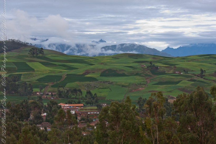
A few minutes past Chinchero the Avenue Mariscal Castilla bends dramatically to reveal this first view of the Sacred Valley of the Incas. The bend is the first of 14 switchbacks down to the river. The Andean peak Chicón is hidden in the clouds, at 18,140 feet is the 214th of the Andes.
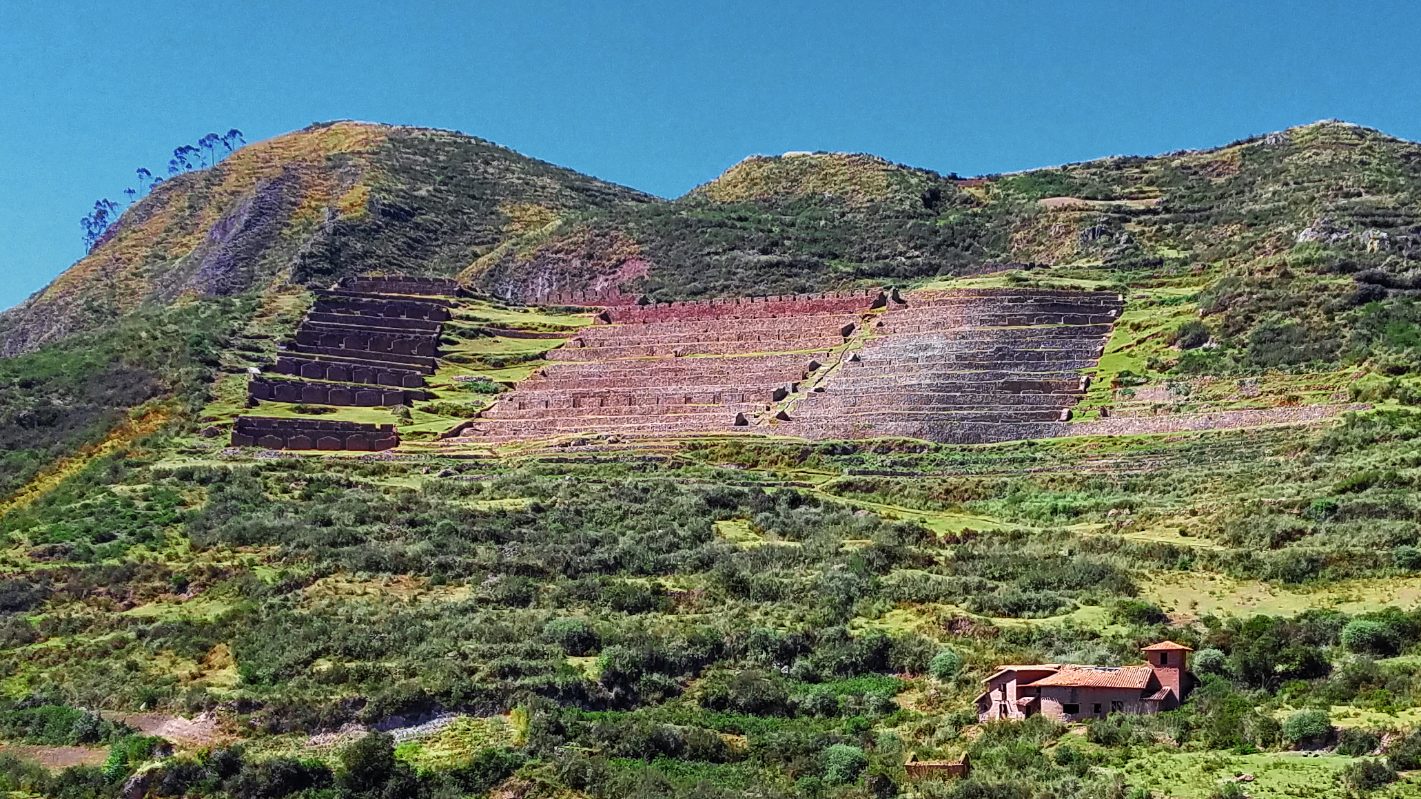
The Incas chose this location to build Machu Colca, Machuqolqa or Machu Qollqa (from Quechua machu old, old person, qullqa, qulqa deposit, storehouse). Today it is an archaeological site situated at 12,631 feet elevation, above the left bank of the Urubamba River and composed of 14 terraces and partial buildings.
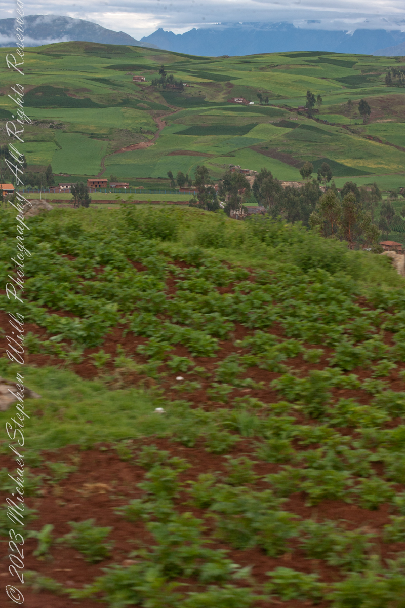
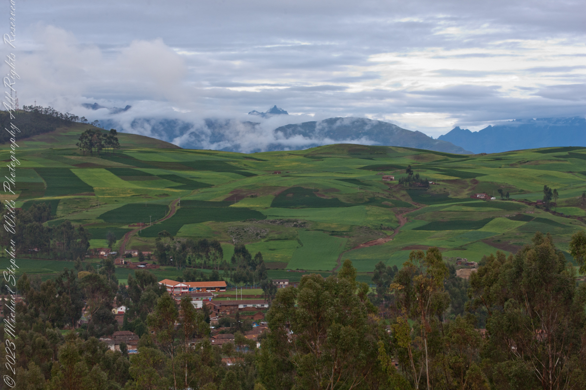
We overlook Raqch’i village and rich farmland to the distant Andean peaks, down below, out of view, is the Urubamba River that created the valley. The prominent, sharp distant peak is Pumahuanca of the Urubamba Mountain Range, at 17,448 feet (3.3 miles) altitude it is “only” the 179th highest of the Andes. Cusco Region, Urubamba Province, Huayllabamba District.
Copyright 2023 Michael Stephen Wills All Rights Reserved
On our travel to Urubamba we traversed Chinchero District is one of seven districts of the Urubamba Province in Peru of which this eponymous town is the largest. It is the location for the proposed Chinchero International Airport, which would serve travelers to the Cusco Region. The people that live in the district are mainly indigenous citizens of Quechua descent. Quechua is the language which the majority of the population (81.49%) learnt to speak in childhood, 17.95% of the residents started speaking using the Spanish language (2007 Peru Census). One of the highest peaks of the district is Hatun Luychu at approximately 4,400 m (14,400 ft). Other mountains in this district include: Ichhu Kancha, Kunka Kunka, K’usi Qaqa, Pata Kancha, Quri Qucha Punta, Quri Qucha Qaqa, Sinqa, Wallata Wachana, Wanakawri (Anta-Urubamba), Yuthu Pukyu.
Now and then I shot out the front window to capture road signs as orientation.
Puray comes from an ancient legend narrated by the settlers, where, the Sun god asked Manco Capac that his twin sons accompany him in his sunset and when the time came, they discovered that the son who walked farther had become the Huaypo (Huaypo) Lagoon (9 miles west) and the daughter in the Piuray (Puray) Lagoon.
In this photograph, distant cattle graze against backdrop of the lagoon and andean foothills.
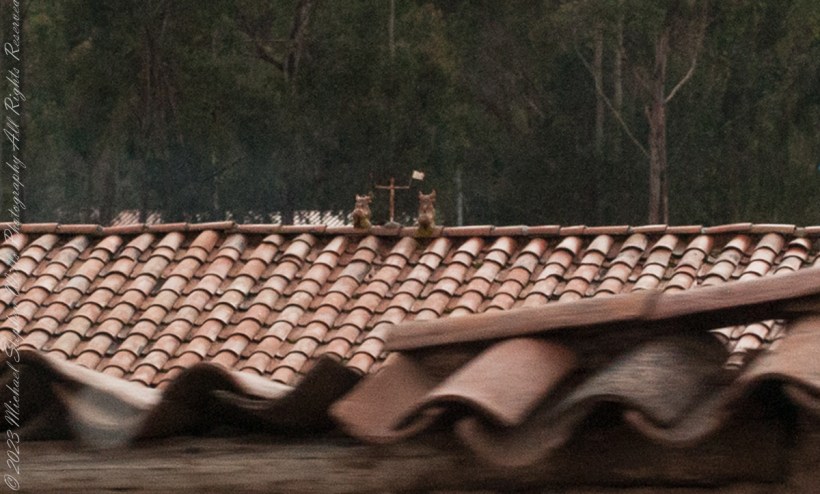
You can just make out the Bulls and Cross in the center of this photograph. A detail is provided, below. The words on the facade is a political statement – a presidential election was then underway.
A couple of ceramic Bulls stand on the middle of most rooftops in Cuzco where they stand as if on a hilltop looking out on the rolling, downward-sloping pastures of orange tiles. This powerful image is one of good fortune and protection for the house and the families that inhabit it.
This tradition comes from the time of the Incas. They relied on images of alpacas that they called illas. These alpacas had a hole in their loin where one could put alpaca fat and then bury them in the Earth to obtain protection for their agriculture as well as a good harvest. They also used illas to protect their flocks of alpacas and llamas, as well as to guarantee their reproduction. Illas in the form of houses were also used to protect buildings so that they would be safe and last.
Illas have been found Cusco. We can see them in the Cusco Museo Inca, the Inca Museum, of the National University of San Antonio Abad.
With the coming of the Spanish, the people of Cuzco made a change in the form of the illas. They added to the three mentioned above the bulls of Pucará. The name Pucará comes from the place where the bulls were first raised, on the broad grasslands of the altiplano, the high plateau, of Puno, as it approaches the pass of La Raya from which a highway drops to Cuzco. The area of Pucará is famous for its herds of cattle, sheep, and especially the native llamas and alpacas.
The high grasslands have always had symbolic importance for the people of Cuzco because from them came the herders of camelids (llamas and alpacas) as well as many of the freeze dried potatoes, the chuño and moraya, that were important food stocks.
From the also came, according to one of the two versions of the origin story of the Incas, the founding couple Manco Capac and Mama Ocllo. The story relates how they journeyed from Lake Titicaca which is in the center of those grasslands, and which was also the center of one of the most important Pre-Inca civilizations, that of Tiwanaku.
Pucará was an important site where the northern form of the Tiwanaku civilization developed. This may also play a role in the value people give to the toritos, or bulls, from Pucará.
This grassland and lake area is also important for a Pre-Inca set of stories about the hero Thunupa, who is also related to the lightning and is assimilated sometimes to the great god Viracocha and sometimes to Illapa the god of thunder and lightning. Pucará became an important center for the making of pottery which was widely distributed. Intriguingly a center of pottery making closer to Cuzco, Raqchi, is also associated with Thunupa, Viracocha, and Illapa. It was the site of the great temple to Viracocha built by the Incas.
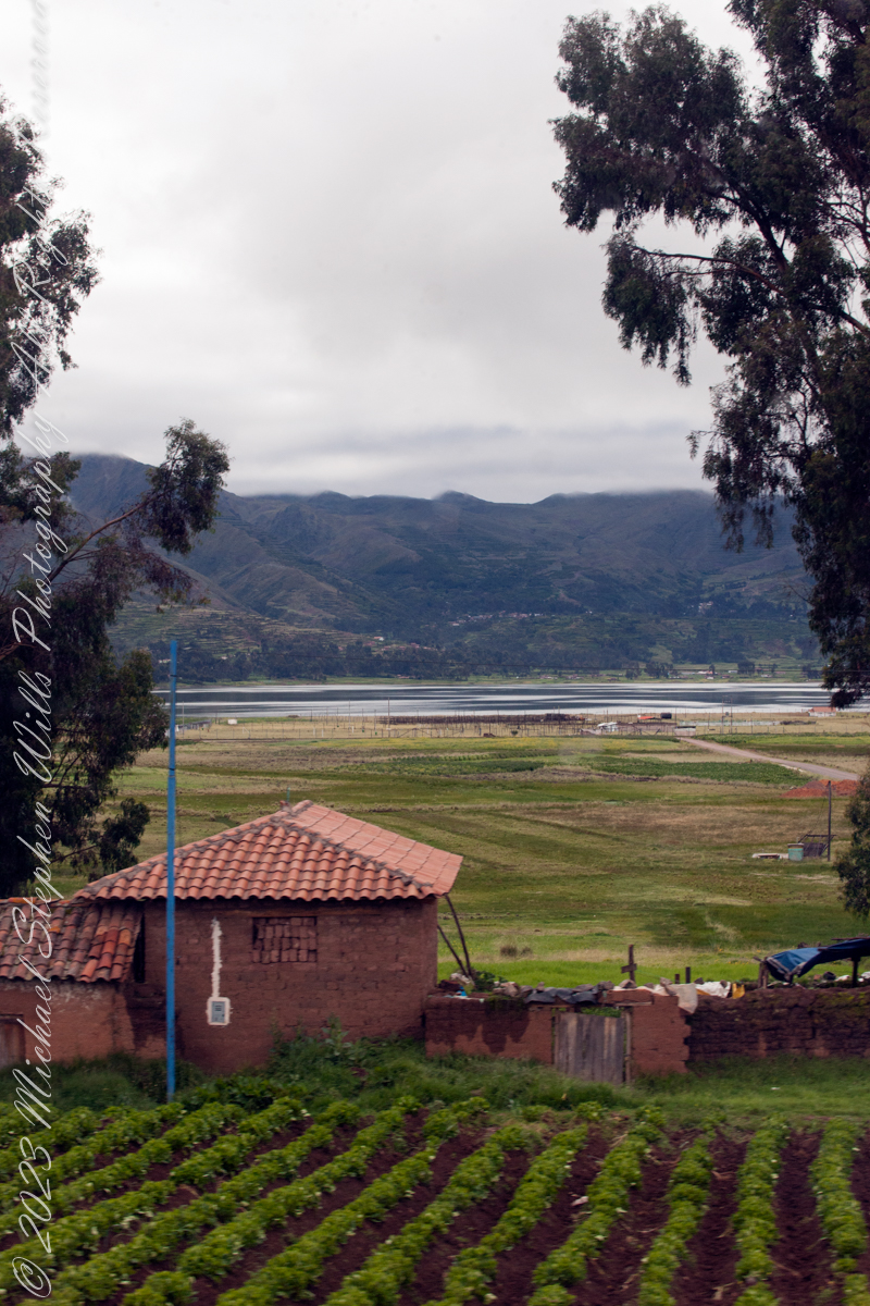
As seen from Avenue del EjércitoIts near Chinchero, Peru. Lagoon waters lap the distant, terraced andean foothills, look closely to see fish drying racks on the near shore, 11,270 feet altitude. Here, water boils at 191 degrees Fahrenheit, not 212.
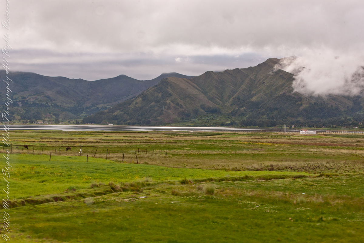
Puray comes from an ancient legend narrated by the settlers, where, the Sun god asked Manco Capac that his twin sons accompany him in his sunset and when the time came, they discovered that the son who walked farther had become the Huaypo (Huaypo) Lagoon (9 miles west) and the daughter in the Piuray (Puray) Lagoon.
In this photograph, distant cattle graze against backdrop of the lagoon and andean foothills.
Puray lagoon is located in the upper part of the Sacred Valley of the Incas, southeast of Chinchero and 19 miles northwest of Cusco. The Piuray (Puray) Lagoon is a source of water of surface origin. It is one of the most important sources of the city of Cusco, as it supplies 42% of drinking water in the city as well as the Sacred Valley of the Incas and other provinces of the region. It was the Incas who carried Piuray (Puray) Lagoon water to the imperial city (Cusco) through underground aqueducts. Quechua natural region, Peru
Copyright 2023 Michael Stephen Wills All Rights Reserved