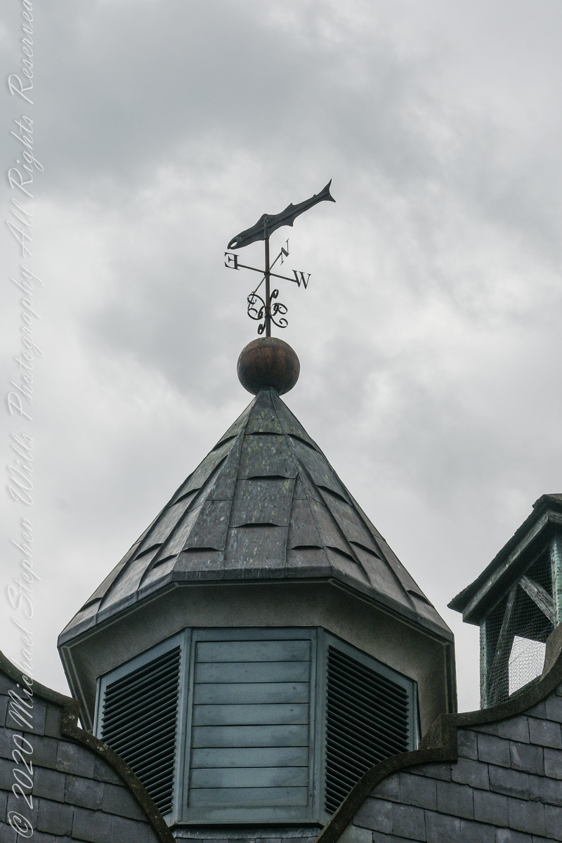
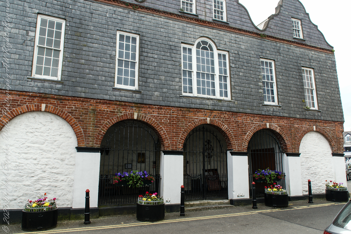
A stone’s throw from the antique mooring of post 4 is this former Courthouse building, Market Square. Built around about 1600, with additions in 1706 which included the frontage with the loggia on the ground floor. Offices and a jury room were provided on the first floor, and part of the original building was converted into a paneled courtroom.
It was in this building that the Kinsale Town Corporation and its sovereign conducted their affairs and the Courthouse was also used for ceremonial occasions in the 18th century. This courthouse was the location for the inquest on the victims of the Lusitania, sunk off the Old Head of Kinsale in 1915 and is now home to the Regional Museum.
The Museum in the Courthouse includes a display on the famous Kinsale Giant. He was Patrick Cotter O’Brien. He died in 1806 and is believed to have been over 8 foot tall.
T
The Museum houses the largest collection of maritime artefacts in Ireland.
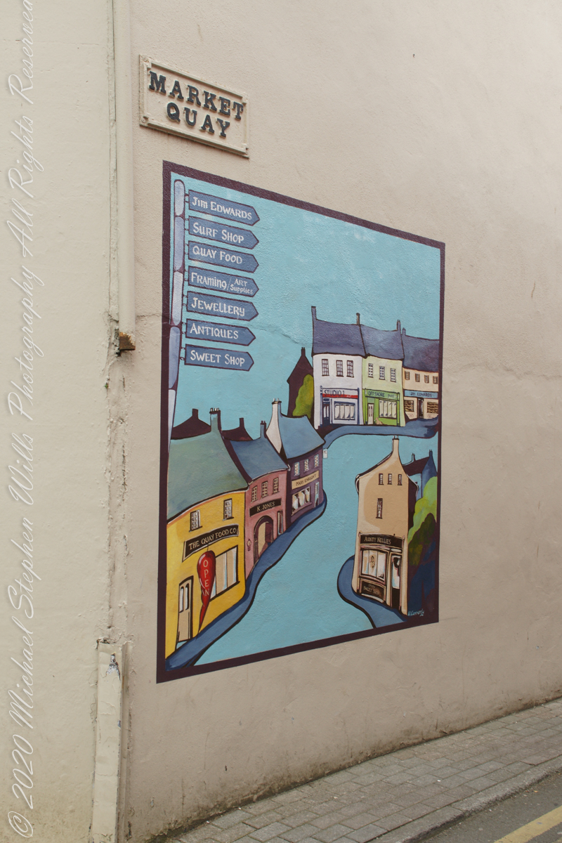
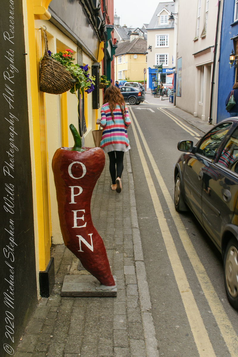
This mural on the corner wall where Market Quay meets the Market Square. I puzzled over the following photograph until I recognized the Chili Pepper from the mural.
A colorful mural on Market Quay.The Quay Food Company, Kinsale, County Cork, Ireland
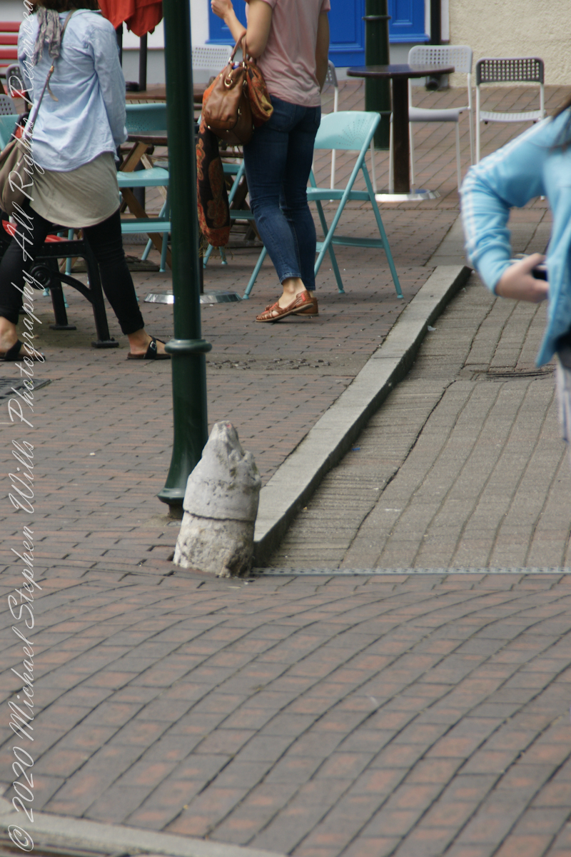
Without Dermot Ryan’s storytelling I’d never have guessed this stub of a post was a bollard to which ships’ mooring lines were fastened. It follows the memorial bollard is close to the lane named “Market Quay.”
Across from the Kinsale Museum in Market Square is a post formerly used as a ship’s bollard in the harbor. Ships were unloaded here.
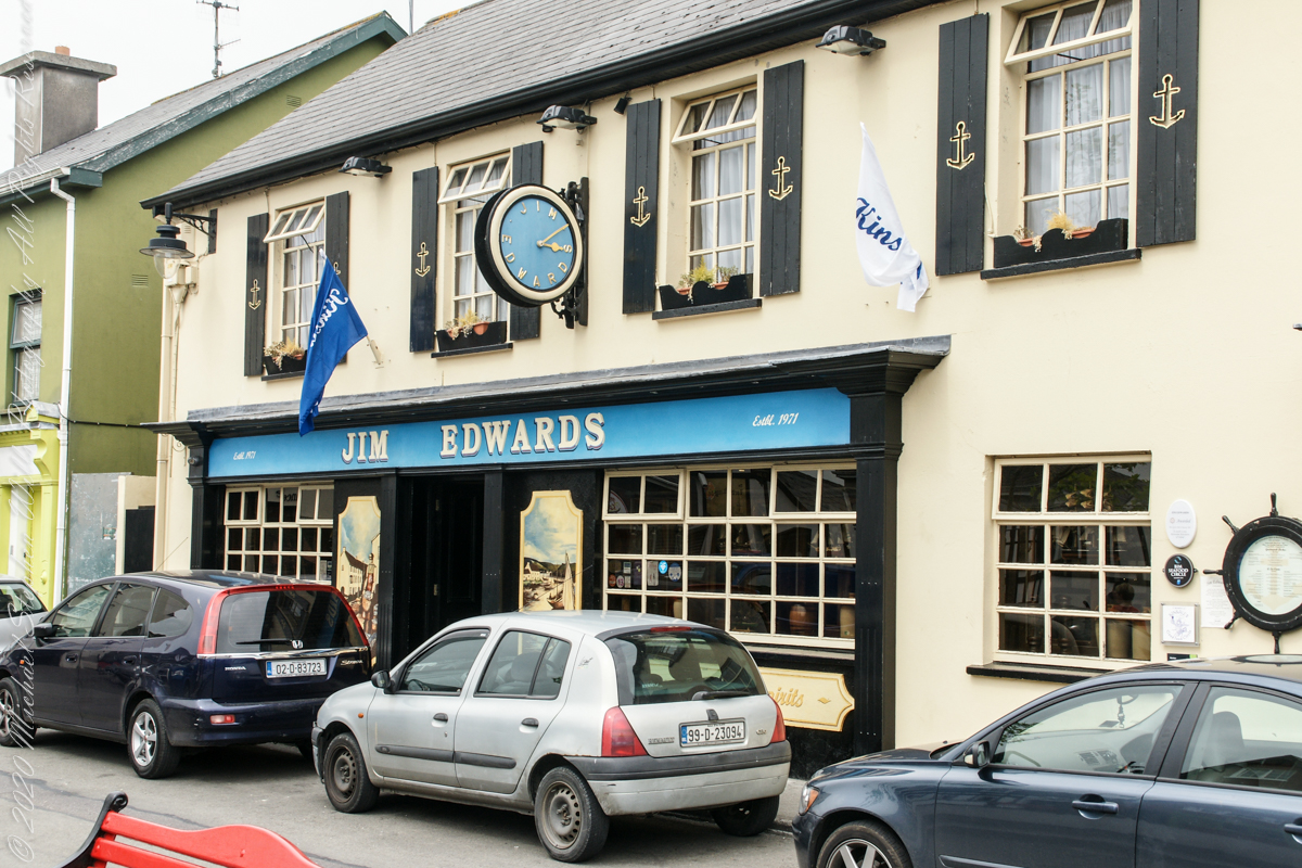
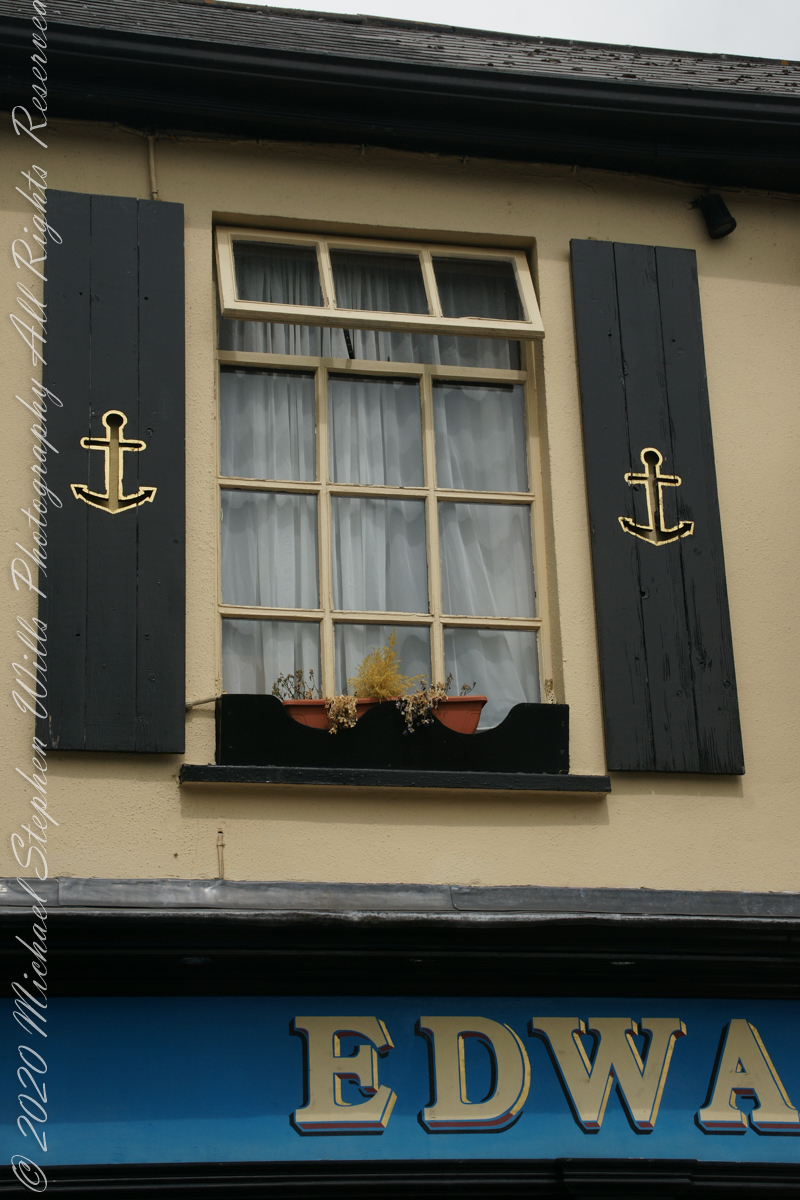
The Jim Edwards hotel and restaurant façade is a colorful and elegant element of Market Quay.
The facade and entrance on Market Quary for Jim Edwards hotel and restraunt.Nautical theme shutters and sparce window box
Dermot told a tale about spies, looking from windows above the square, reporting on shortcomings of citizens.
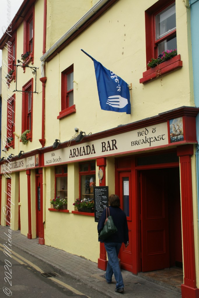
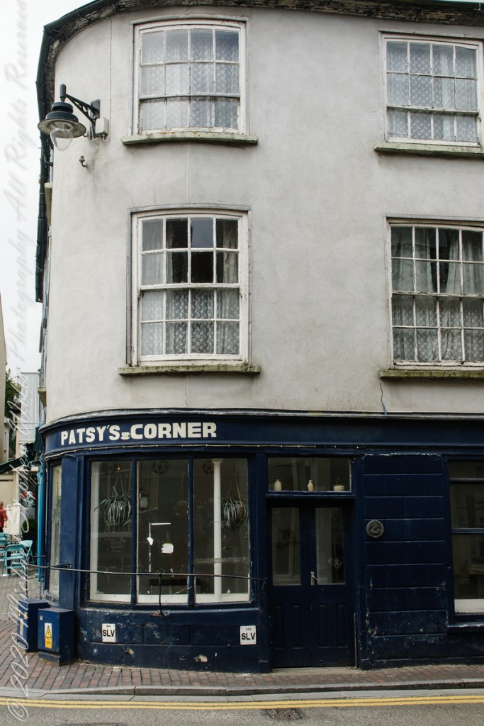
SONY DSCLooking up the hill from Market Square, Kinsale, County Cork, Republic of Ireland.The Armada bar on Market Street Kinsale, County Cork named in memory of the scraps of the Spanish fleet driven to Ireland by storms, mostly to the west coast.Kinsale, County Cork, Ireland This is a chain of stores in tourist spots throughout Ireland. This location is permanently closed, post COVID.Patsy’s Corner (coffee shop), closed. Kinsale, County Cork, Ireland
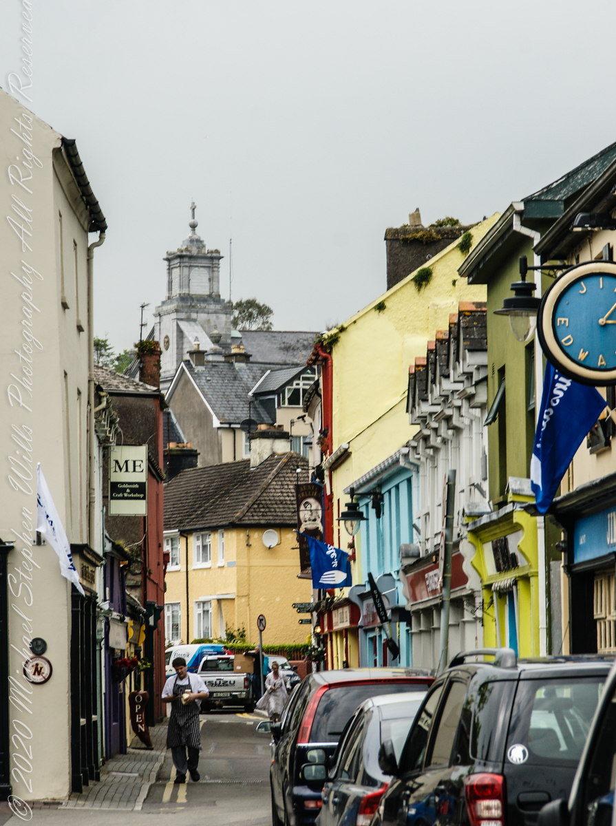
Looking northwest along Market Quay toward Saint John the Baptist Roman Catholic Church seen rising above the rest. The Jim Edwards hotel on the right. This, and the next, photographs are an interesting, or not, slice of life on Market Quay this May day: a man in a striped apron carries packaged food, ostensibly a delivery, and it probably is.
Looking northwest along Market Quay toward Saint John the Baptist Roman Catholic Church.. the Jim Edwards hotel on the right.
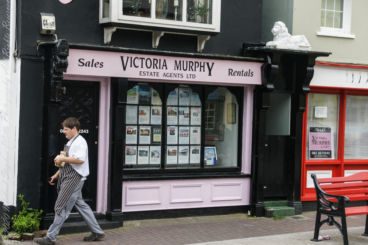
A man in striped apron carrying a delivery (…or a story plot line….) walks in front of Victoria Murphy and Daughter, Real Estate Agent, storefront on Market Quay, Kinsale, County Cork, Republic of Ireland. Notice the store to left is vacant and handled by Victoria Murphy. That store front has high turnover: was occupied 2017, vacant again 2019 (as per Google Maps).
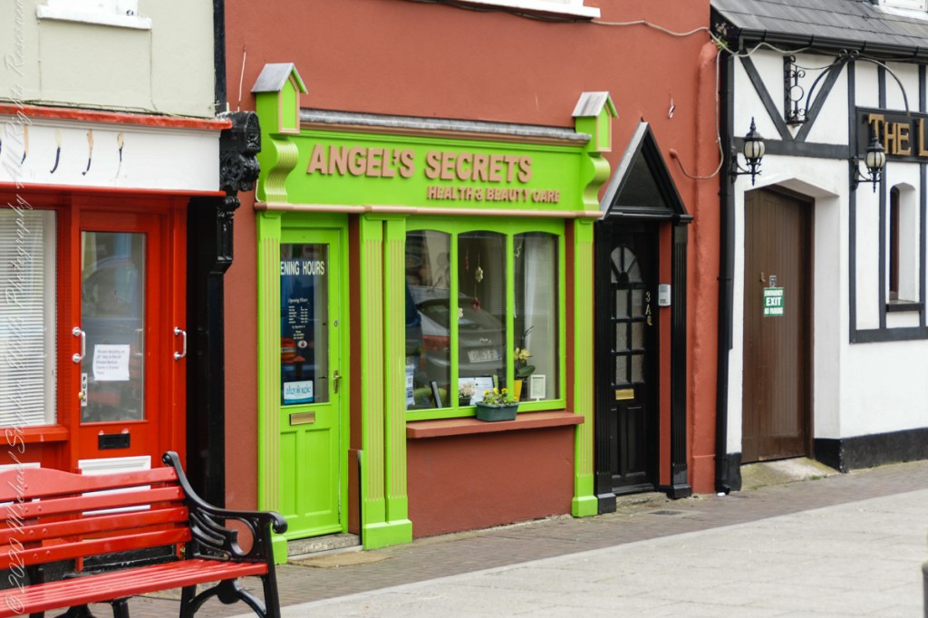
“Angle’s Secrets” storefront on Market Quay, Kins ale, County Cork, Republic of Ireland. I believe this building is owned by Victoria Murphy and Daughter Realty, the storefront second to the right. Don’t ask me how I know this as, no, I do not know it in the usual sense.
The second of a series of idiosyncratic posts from a walking tour of Kinsale. My Sony Alpha 700 captured the events back in May 2014.
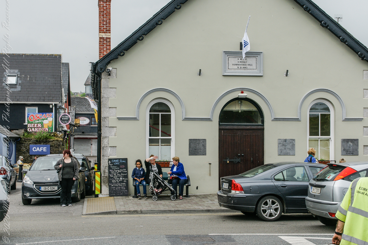
Text from the current Facebook page: The Temperance Hall is Kinsale’s example of Victorian architecture, constructed in 1885. It provides a space to facilitate those within the community and is used on a regular basis by all walks of life. Temperance Hall is space that can be rented by the community through Finishing Services which is located in the heart of Kinsale or can be contacted on 021 477 3571. The hall is run by a voluntary community committee who oversee the day to day running and maintenance of the hall. This Space is used by many groups in the town some of which are: Youth Café, Set Dancing, Bowling, Drumming Circle, Kuk Sool One, Active Retirement Tae Kwan Do, Craft Fairs, Self Defence Class, Dance, Art Exhibitions, Kinsale District Court Service, and Many Fundraising Events. This space can be used for many events on a non-commercial basis for €10 per hour and all enquirers can by made to Finishing Services on 021 4773571.
.
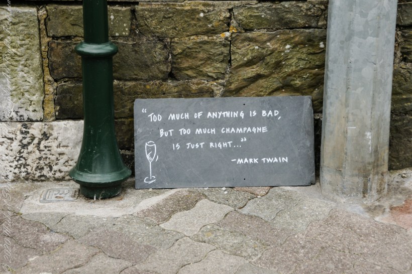
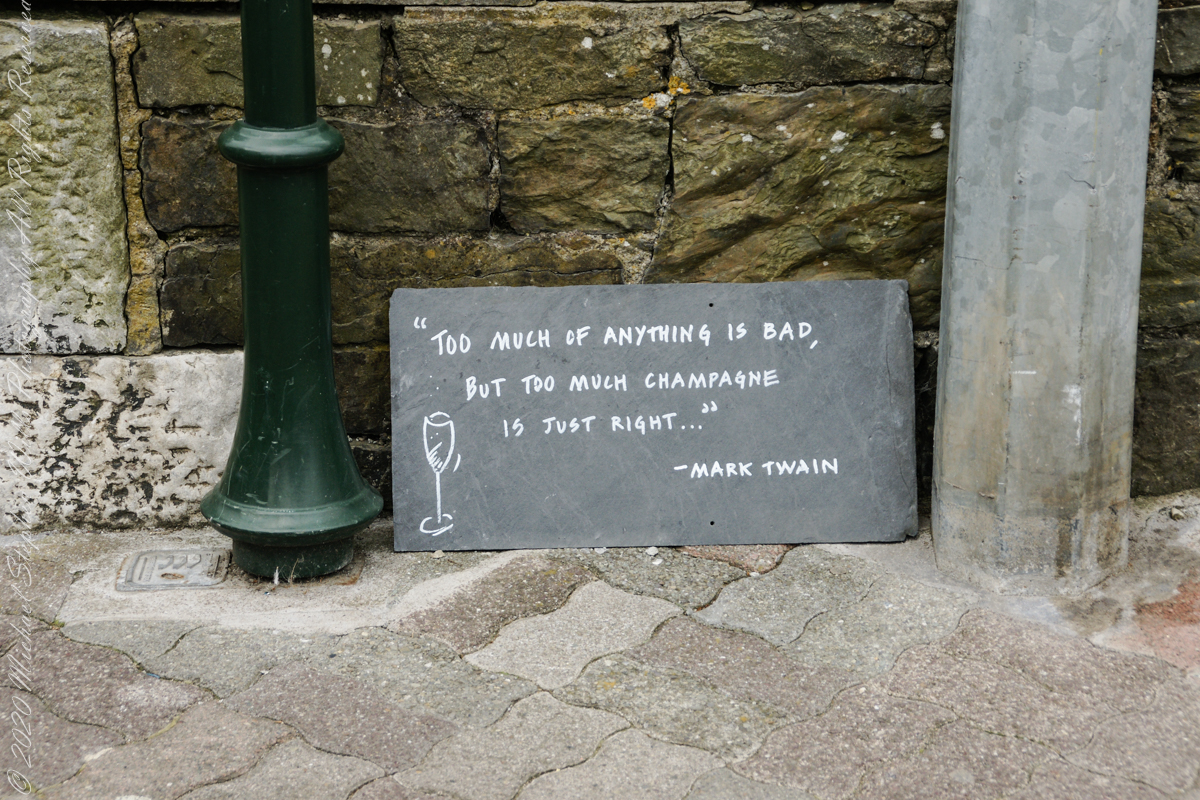
In “Dubliners,” Joyce uses sensory disconnect in evoke Gabriel’s epiphany, and effect the writing of this sign, quoting another writer, an American no less, near (next to…on?? Don’t recall) the Kinsale Temperance Hall.
“Too much of anything is bad, but too much champagne is just right….” –Mark Twain
All this is happening on Market Quay. A quay is a dock, historically ships were offloaded here.
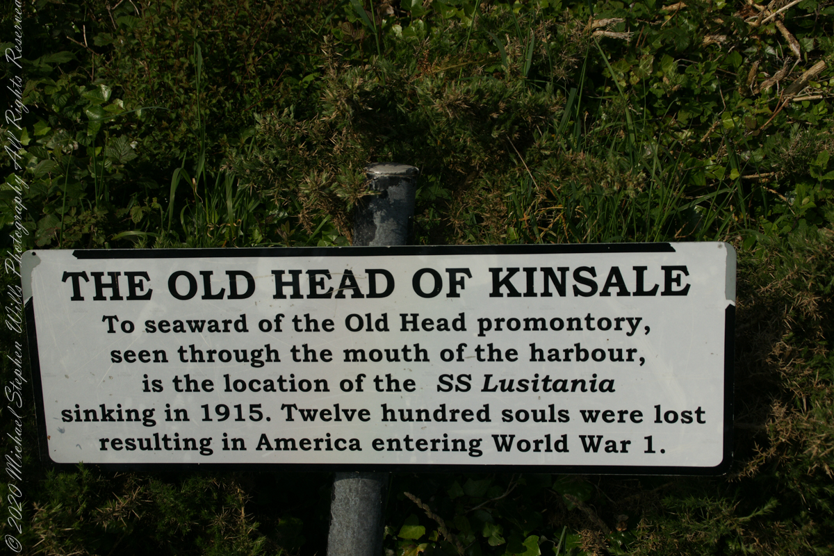
The view referred to by placard is to the right. The Old Head of Kinsale is the distant landform, looking right to left, is the portion that drops off to the ocean.
Click any pic for a larger view, in a new tab, or a slide show. When using WordPress Reader, you need to open the post first.
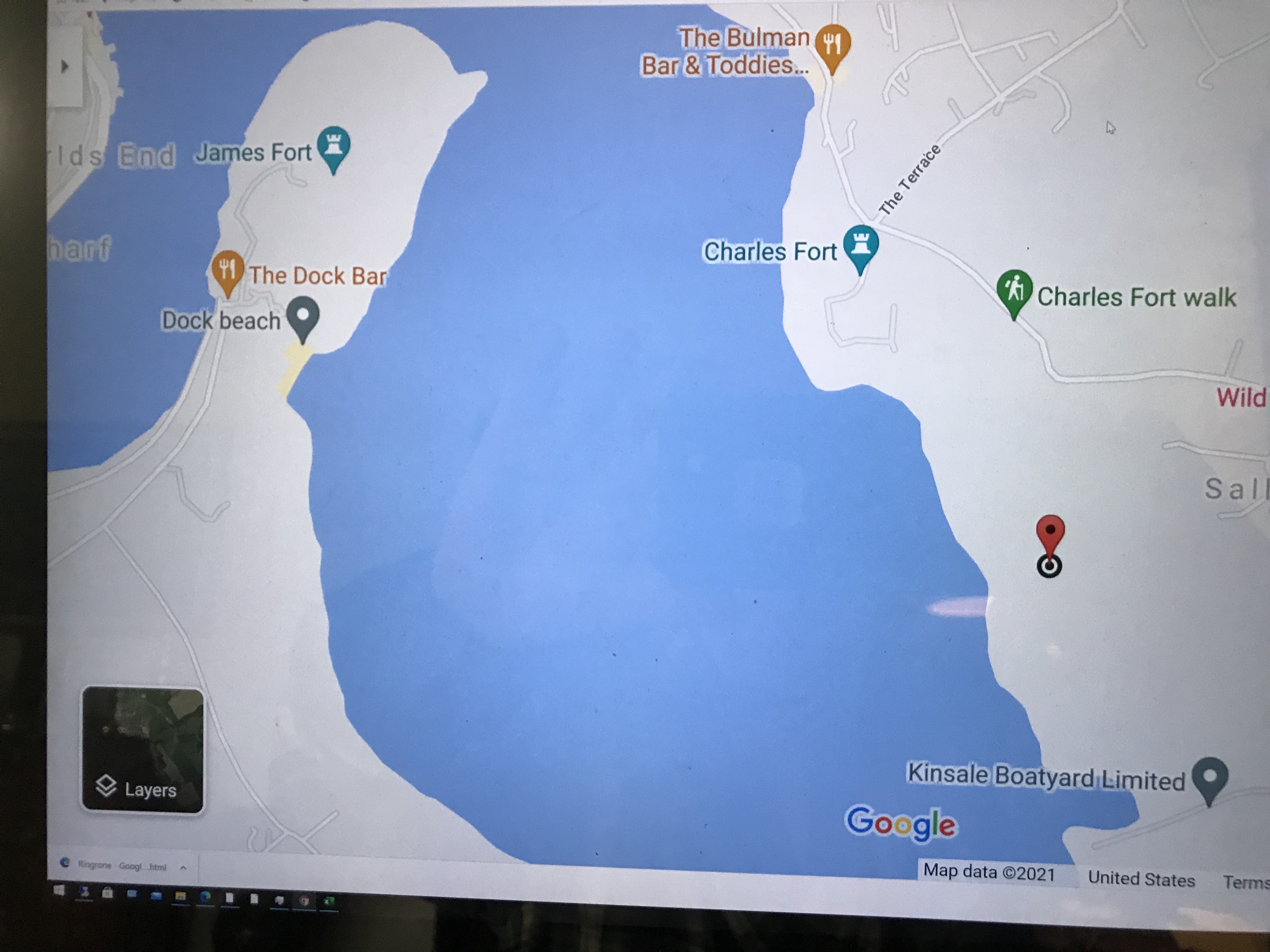
Here is a Google Maps screen capture showing the relationship of our position (the unnamed red drop-pin) on the right, and the Old Head of Kinsale landform, seen below the lable “Ballylane.”
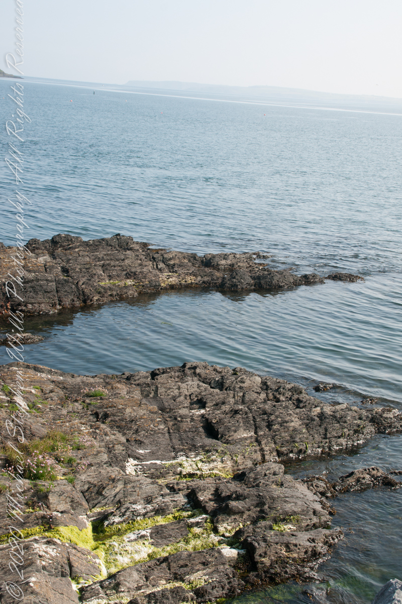
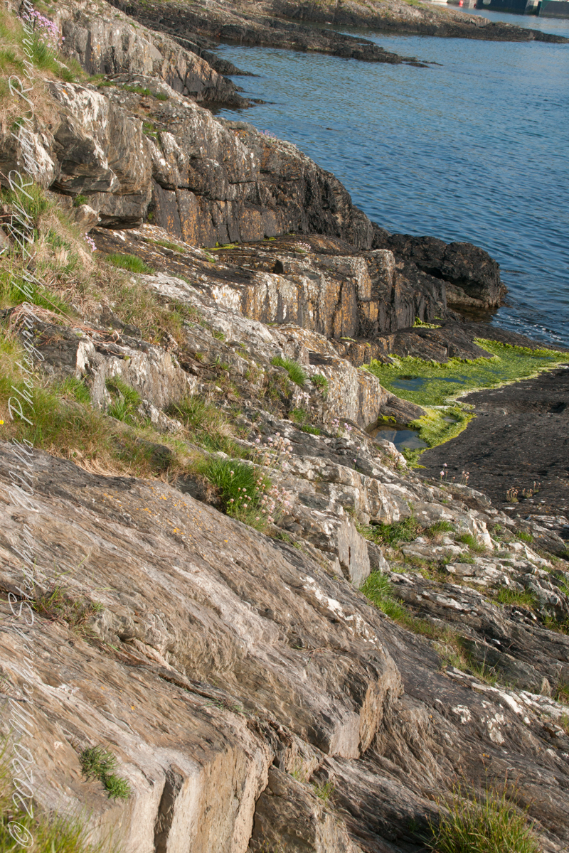
Here are the views looking toward the Celtic Sea, the Old Head of Kinsale and the cliffs at our feet.
Looking back toward Charles Fort
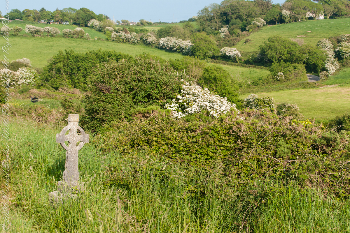
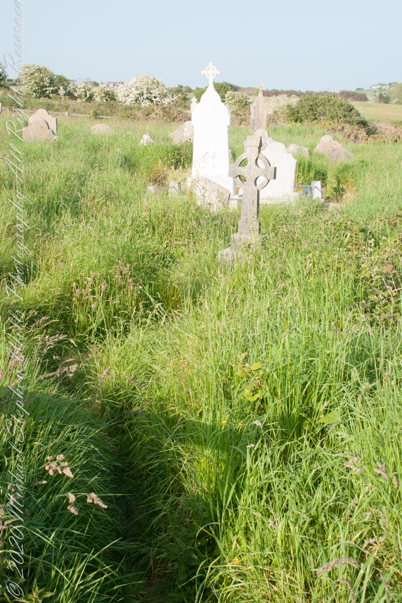
This cemetery is unmarked on the maps I use.
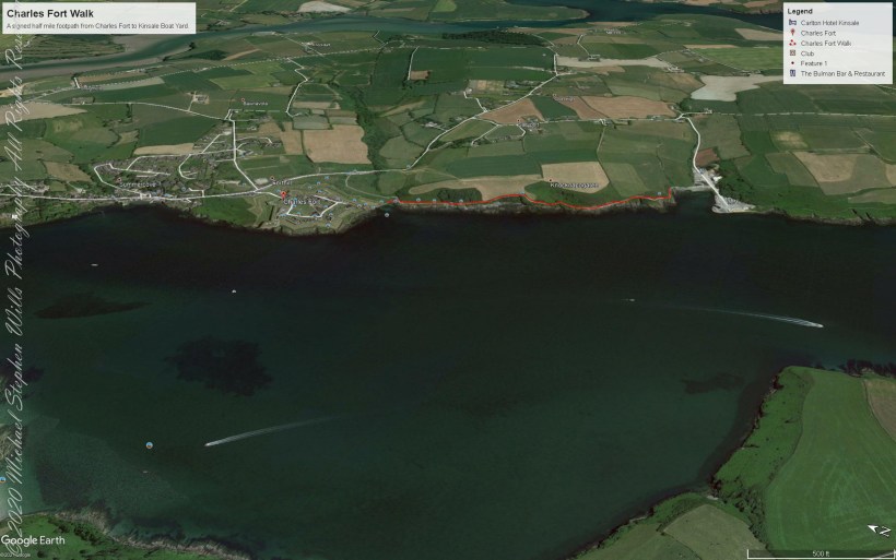
Here is a Google Earth view of our walk, the red line. The view is looking east from above the former “de Courcy family parkland.”
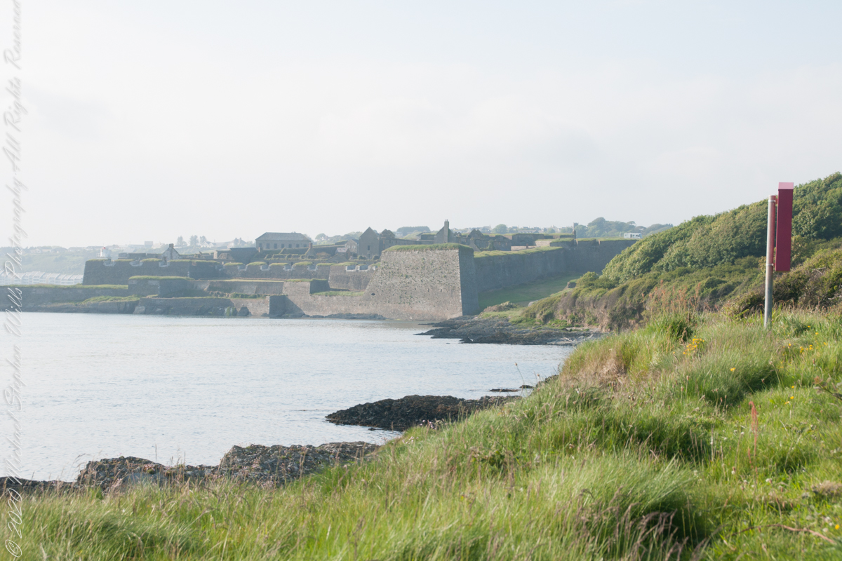
A half mile footpath, marked in red, leads from Charles fort along the shoreline cliffs, surmounted by working farmland.
Copyright 2021 Michael Stephen Wills All Rights Reserved
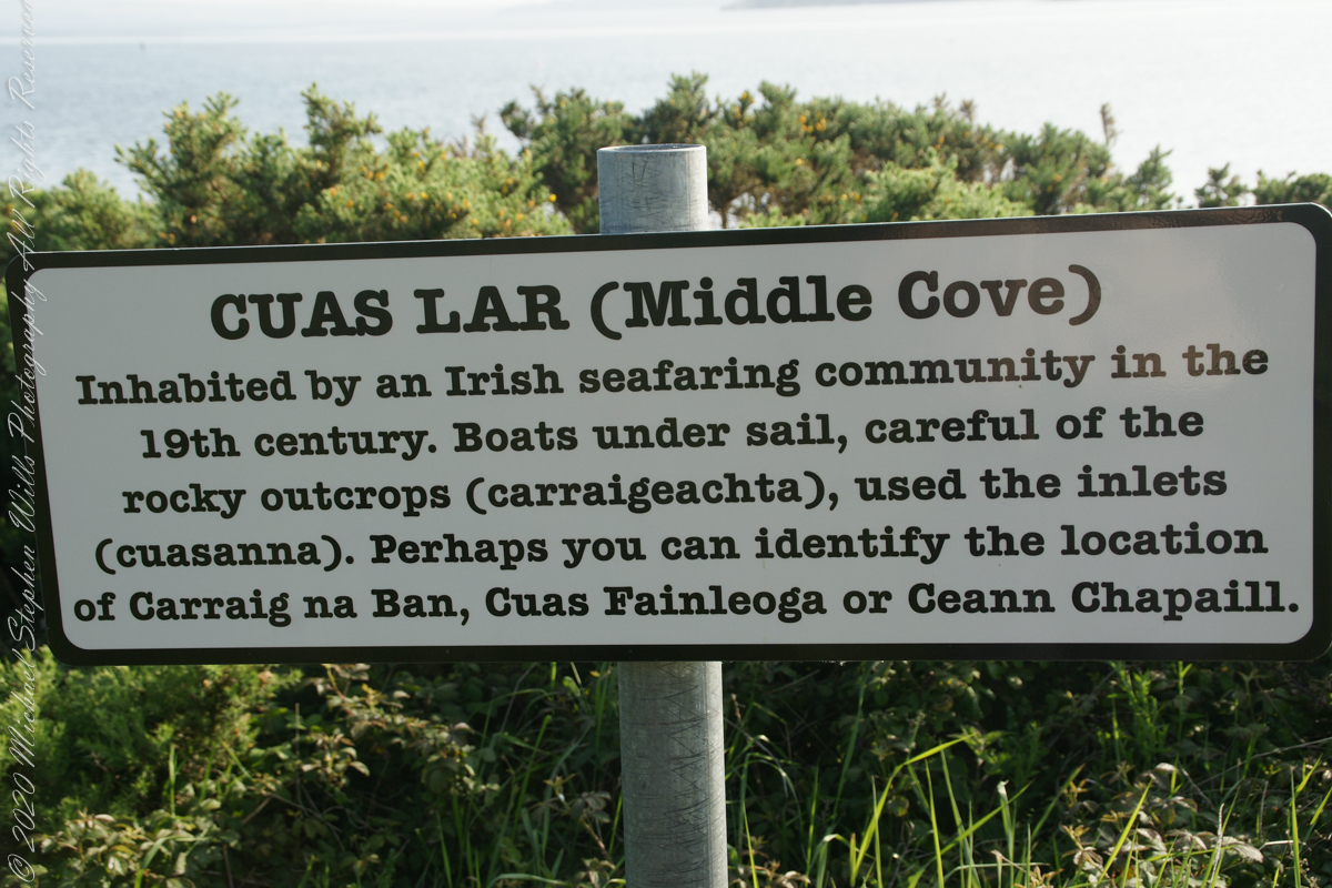
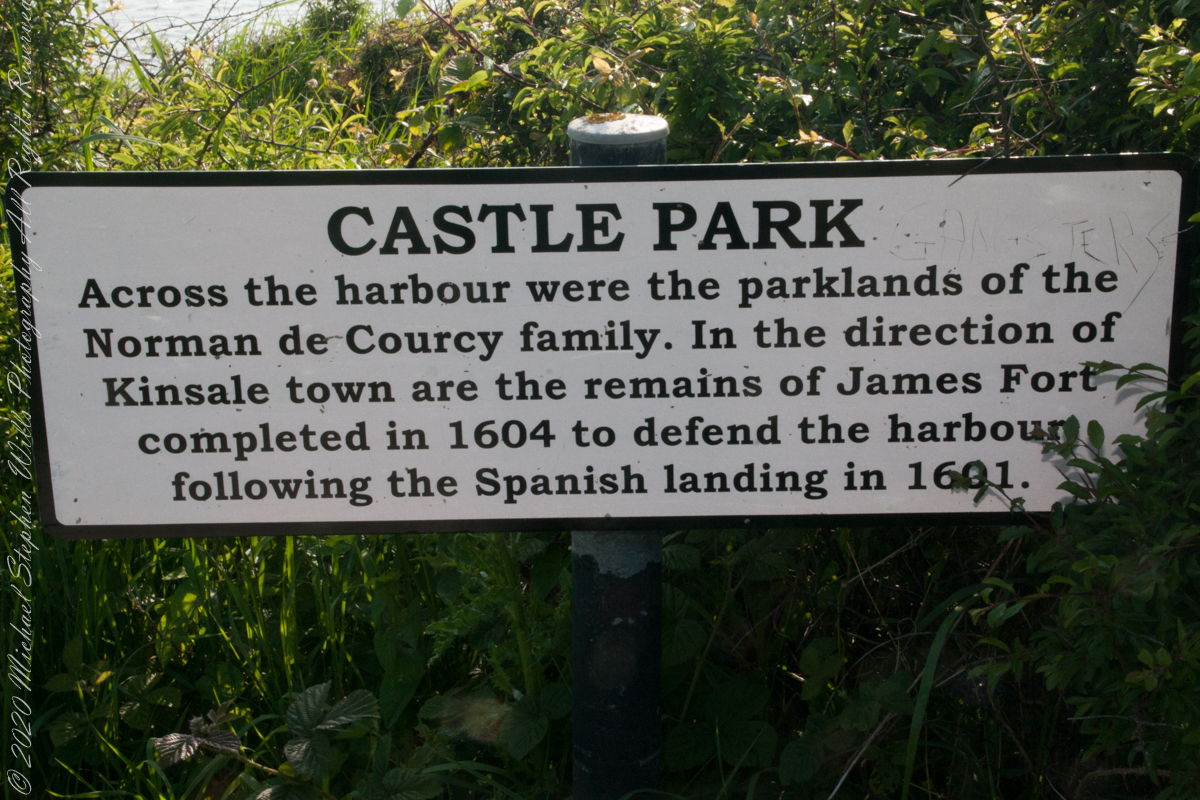
As Pam and I past the scenes of bucolic reverie this sign drew us back to the past. The reference to de Courcy is as a family of invading Normans. John de Courcy, without the King’s permission, launched an 1176 AD invasion of northeastern Ireland, what is now County Down, as an ultimately failed land grab. The history is murky, though apparently John de Courcy’s son Miles acquired the land referred to in the placard through the English King Henry II, awarded to Miles’ thieving, murderous Norman father-in-law Milo de Cogan in the 13th Century. Much later, the old (James) and new (Charles) Forts were constructed to defend Kinsale harbor.
Click any pic for a larger view, in a new tab, or a slide show. When using WordPress Reader, you need to open the post first.
Here is a Google Maps screen capture showing the relationship of our position (the unnamed red drop-pin) on the right, Charles and James Forts and the de Courcy family parklands, the large blank area below the pin named “Dock beach.”
Here are the views looking toward the Celtic Sea, the Old Head of Kinsale and the cliffs at our feet.
Looking toward the Old Head of Kinsale in the far distance
Rocky Cliffs at our feet
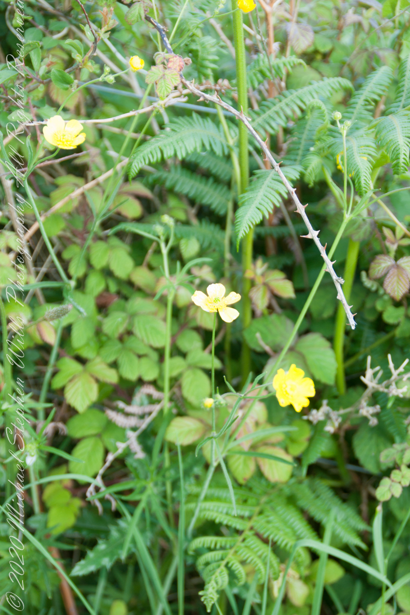
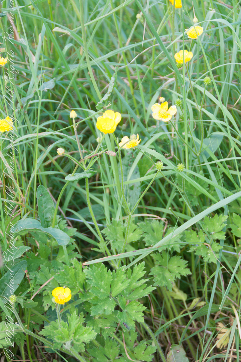
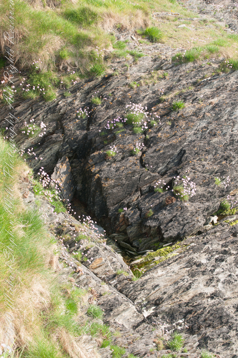
Cliff and Sea Pink
More Sea Pink decorating the rocks.
Here is a Google Earth view of our walk, the red line. The view is looking east from above the former “de Courcy family parkland.”
A half mile footpath, marked in red, leads from Charles fort along the shoreline cliffs, surmounted by working farmland.
Copyright 2021 Michael Stephen Wills All Rights Reserved
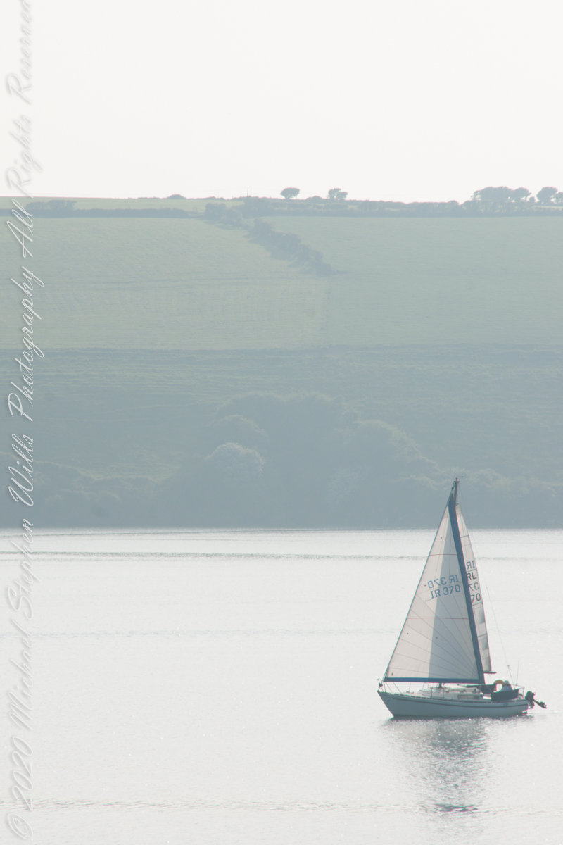
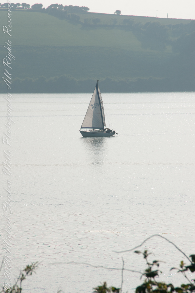
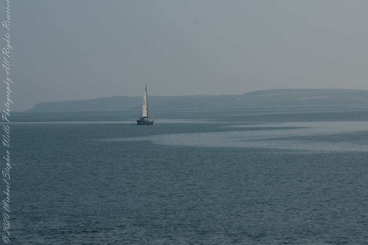
As Pam and I continued down the half mile “Sallyport” footpath, marked in red on the Google Earth view provided at the end of this post, we enjoyed the view across the Celtic Sea toward the distant Old Head of Kinsale and this sailboat headed to port.
Click any pic for a larger view, in a new tab, or a slide show. When using WordPress Reader, you need to open the post first.
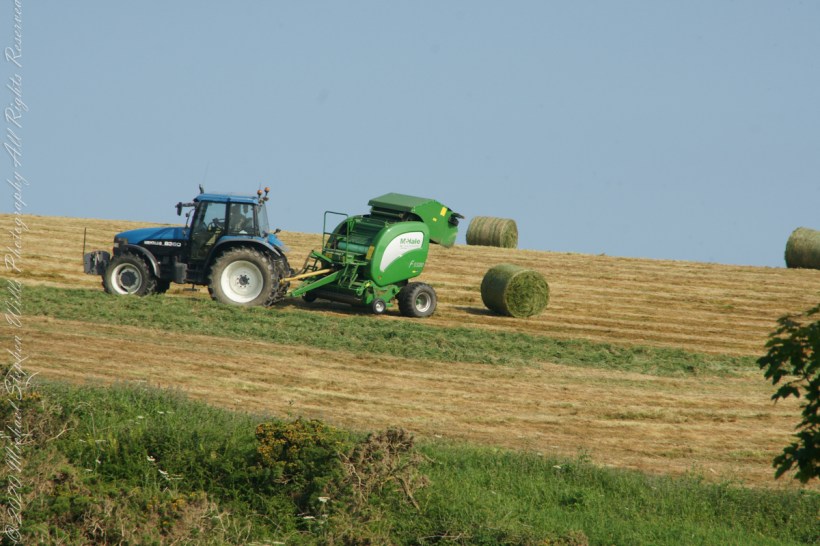
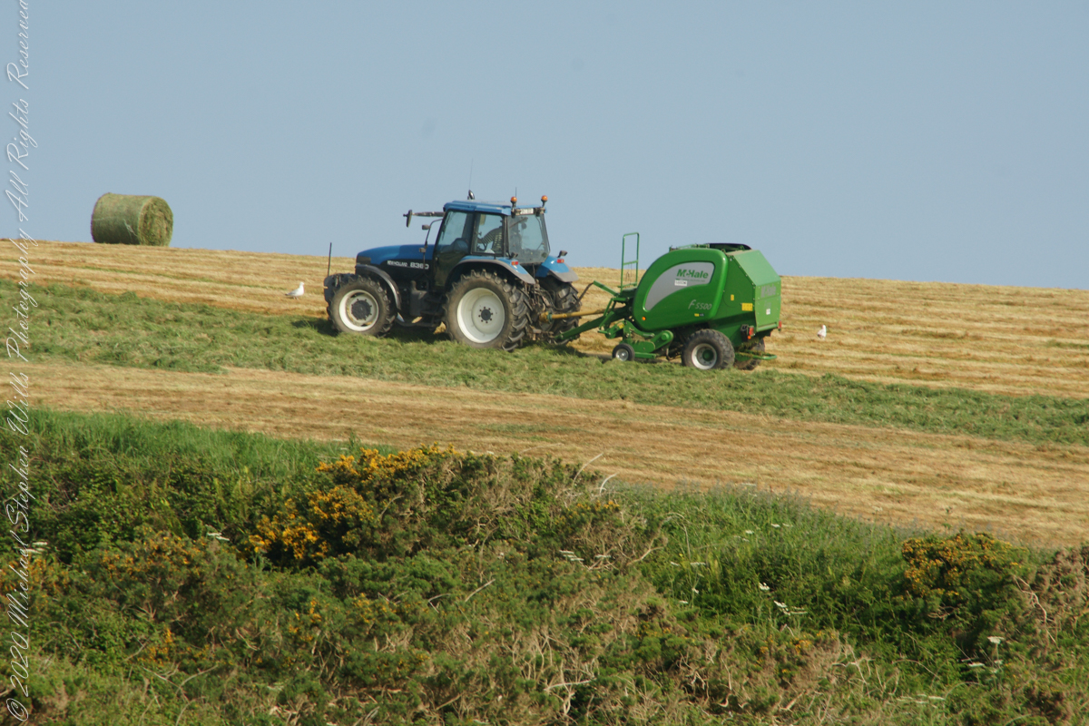
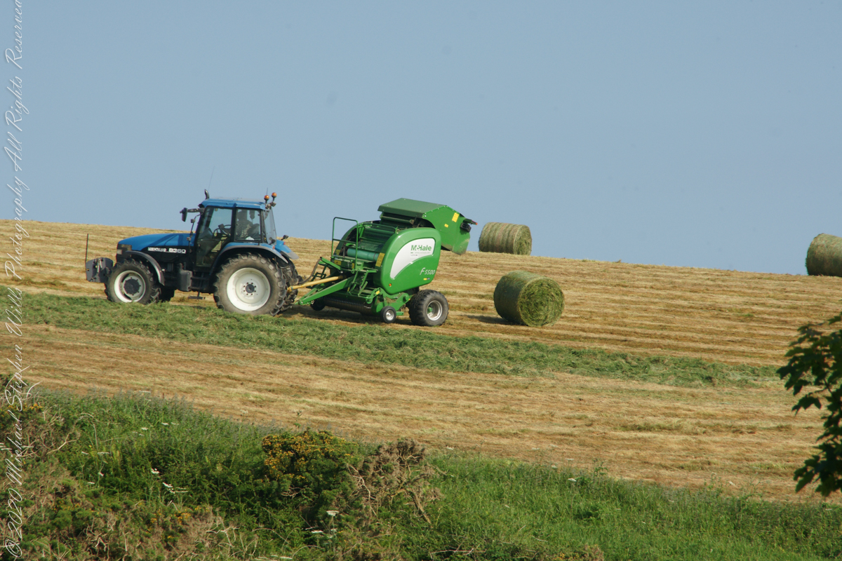
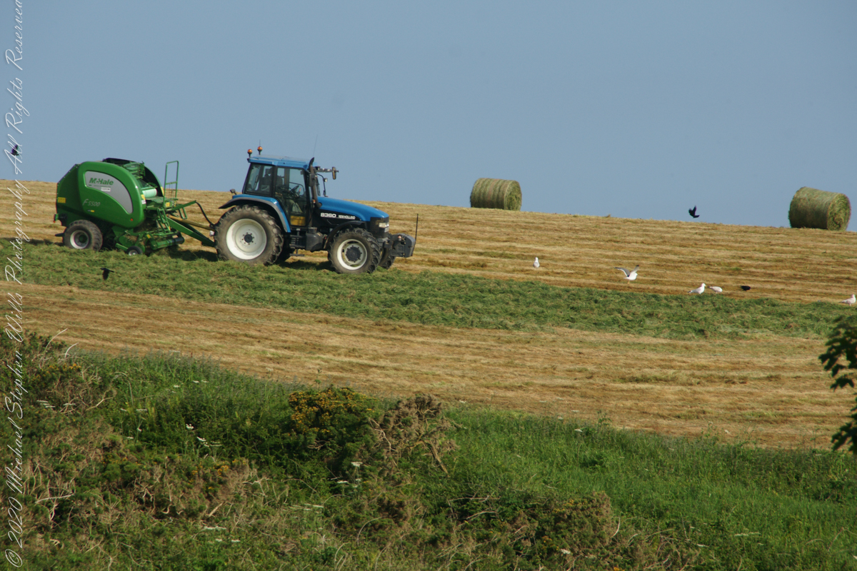
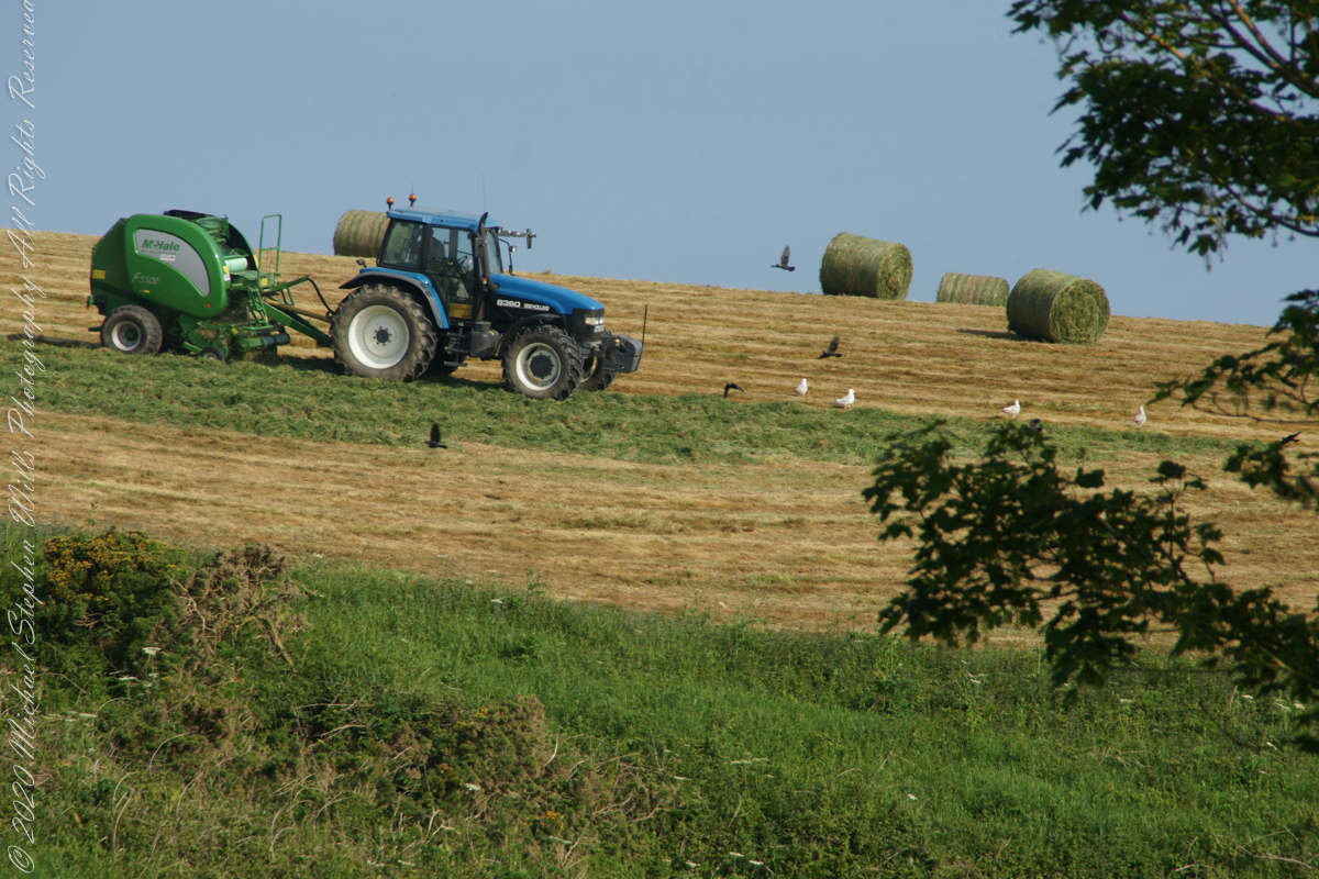
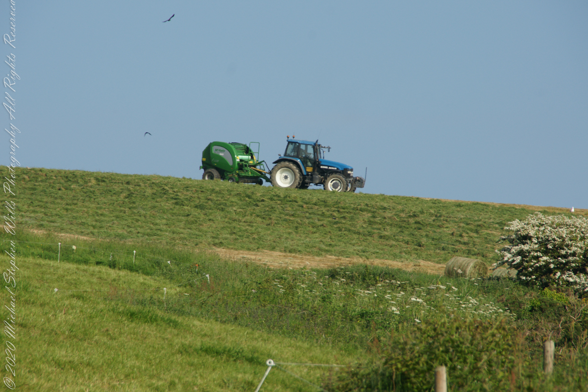
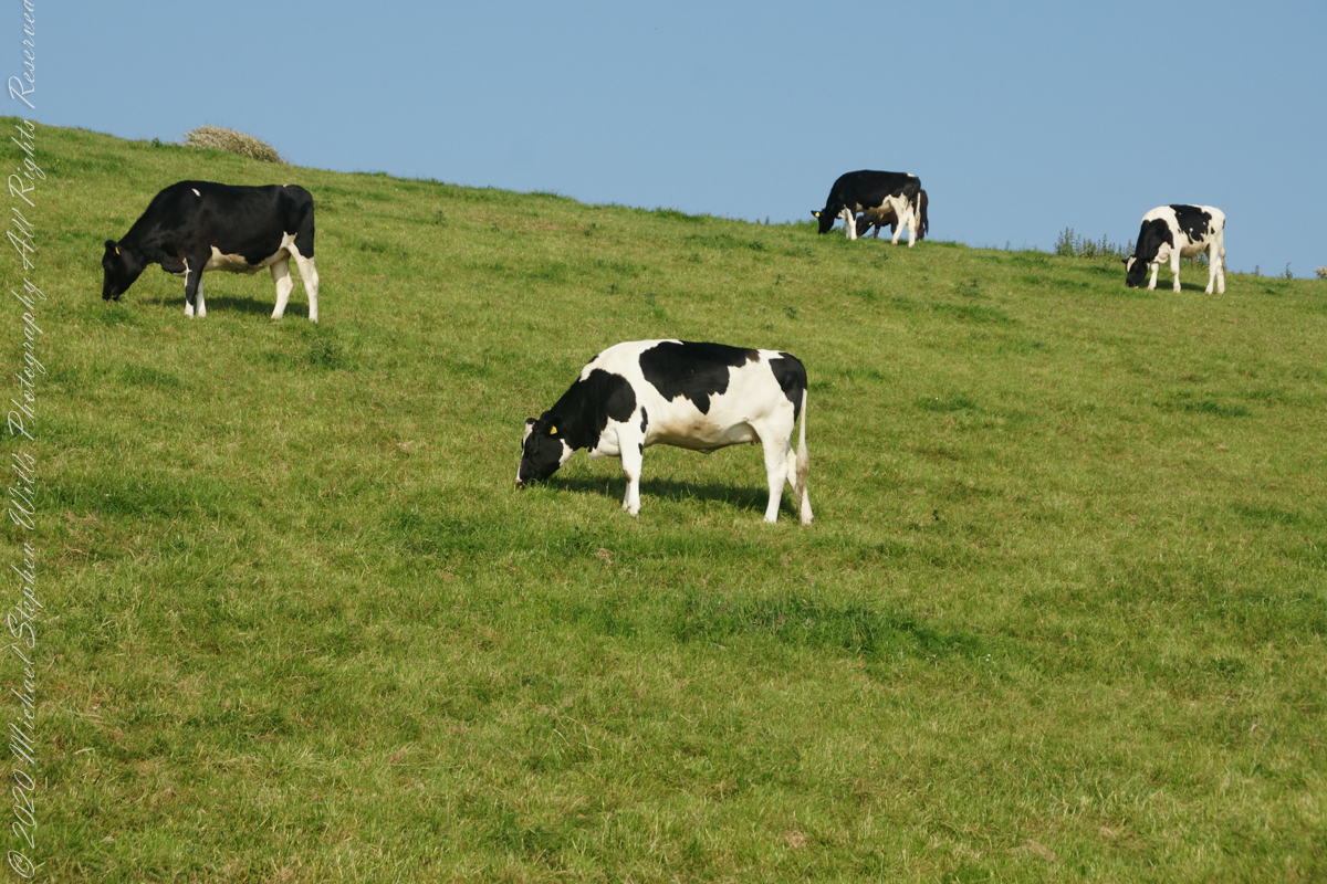
Landward, we enjoyed watching the progress of a farmer rolling hay bales while cows munched fresh green grass.
A half mile footpath, marked in red, leads from Charles fort along the shoreline cliffs, surmounted by working farmland.
Copyright 2021 Michael Stephen Wills All Rights Reserved
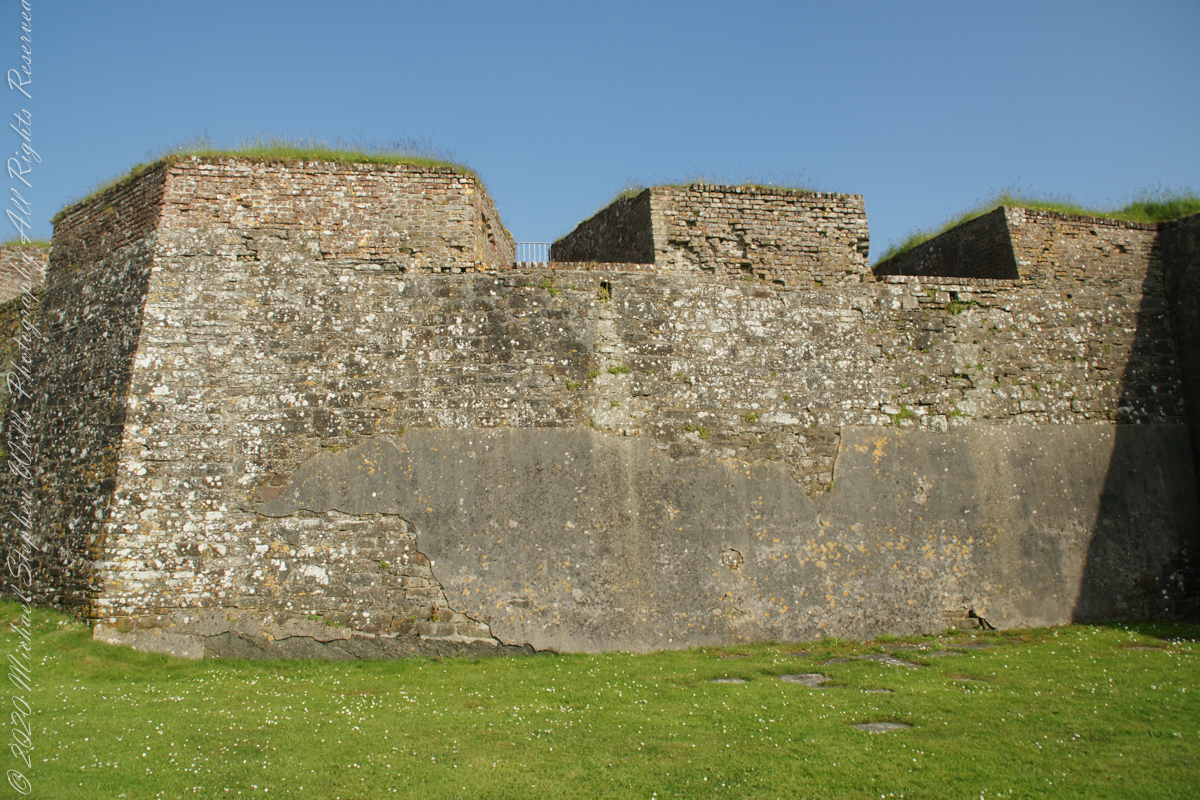
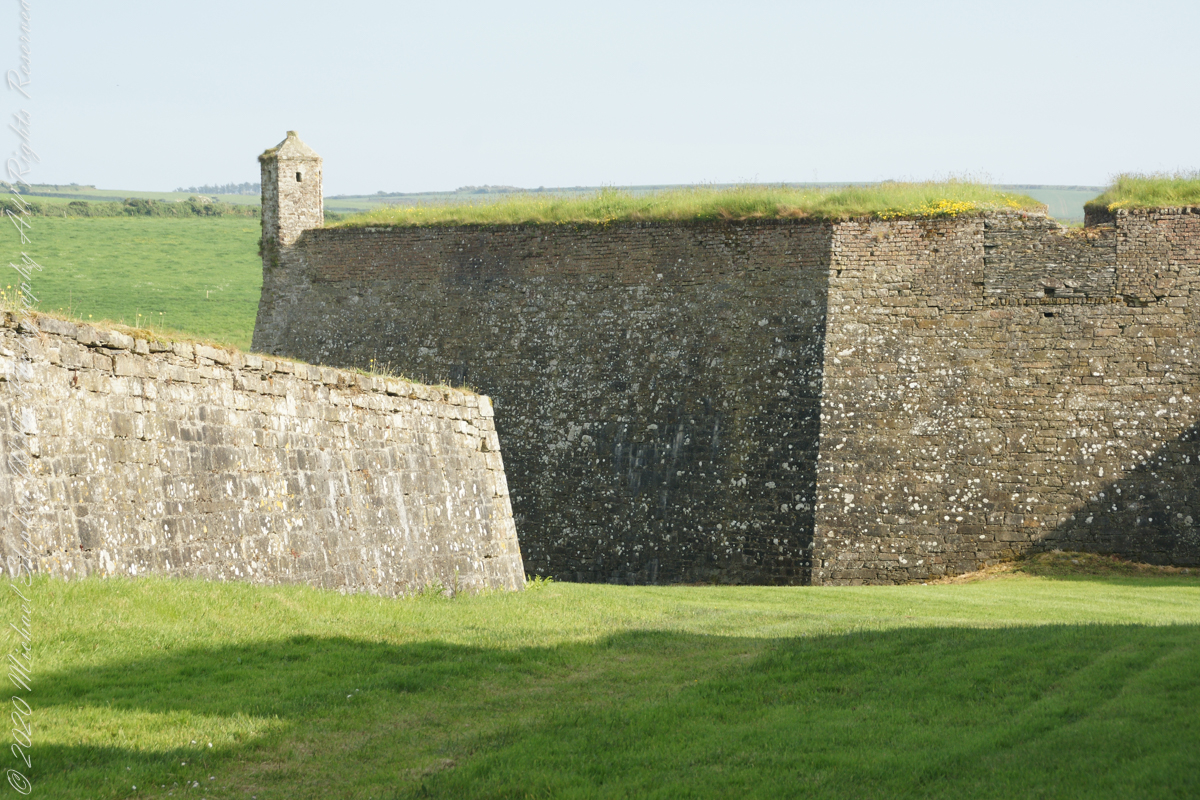
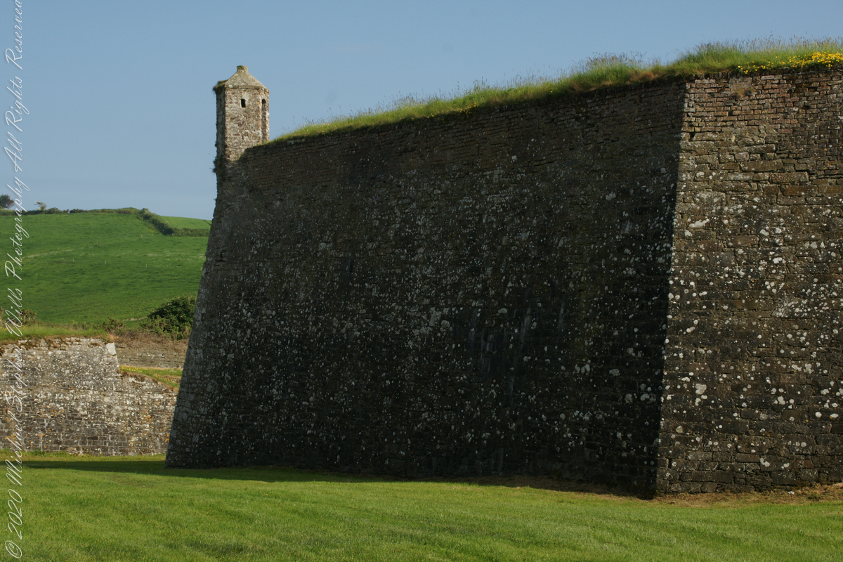
A “dun” is a larger fortification, few and far between on the island of Ireland. We saw one on the Arran Islands, from the Iron Age, Dun Angus, Charles Fort, or Dún Chathail in Irish, is from historical ages.
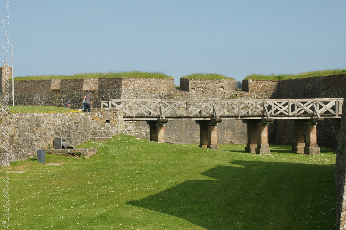
A cannot tell from my slide show, but the walls are star shaped with many salients, giving more positions to defend the walls.
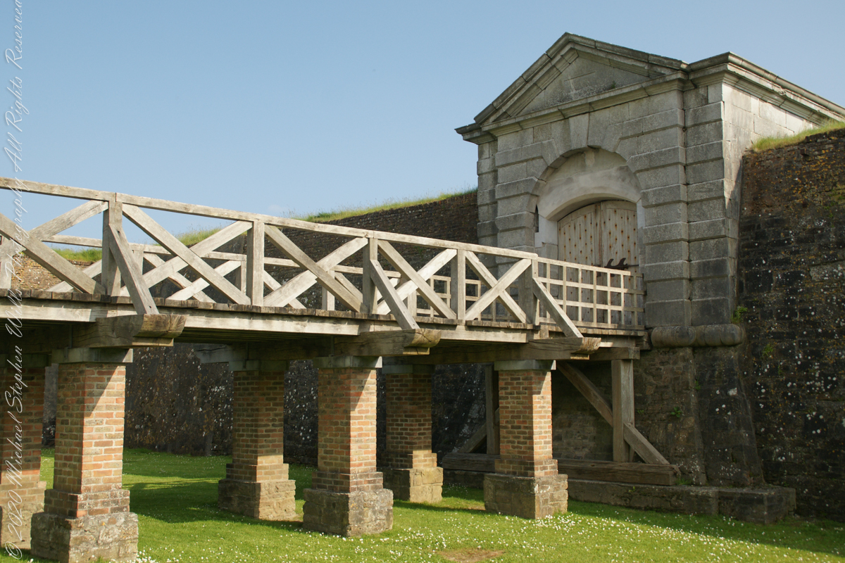
Steps to bridge across defensive ditch
Bridge and gate to fort enclosure, closed this late in day
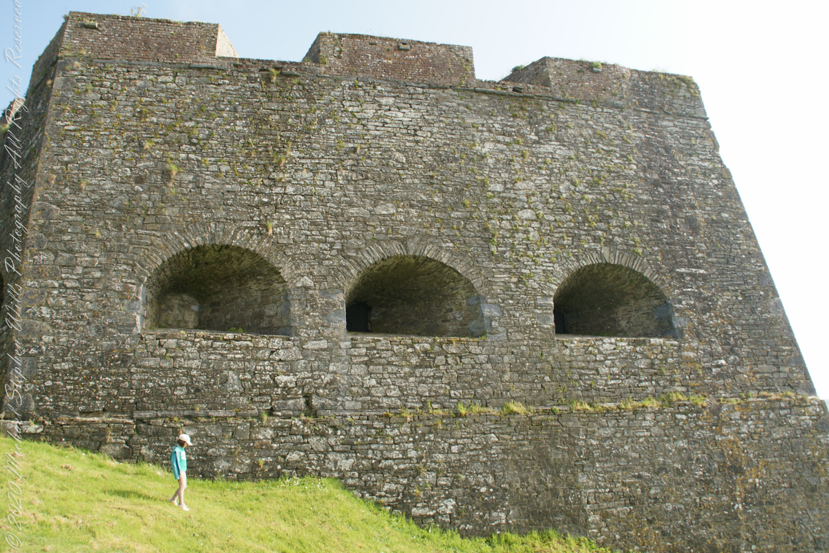
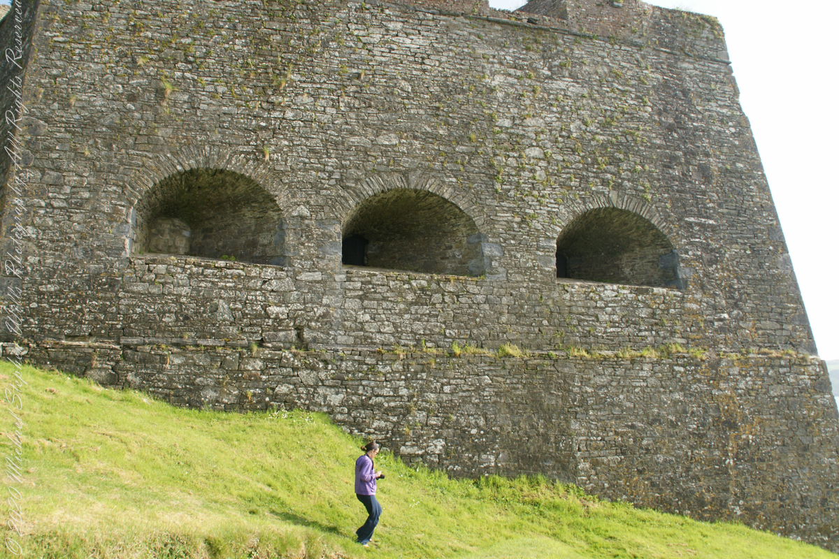
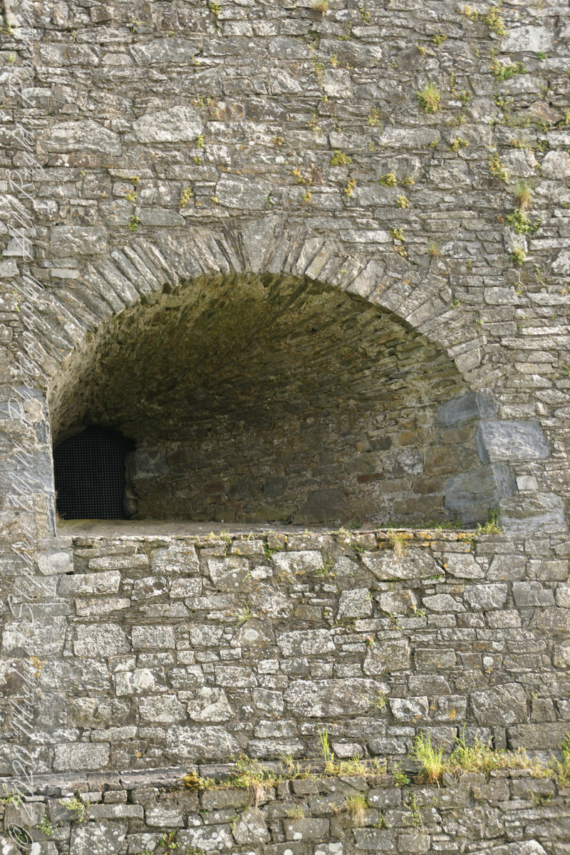
Embrasures
An opening in the fort walls which cannons can be fired. They were often flared outward to enlarge the field of fire.
Close-up of gun port
Crenellations
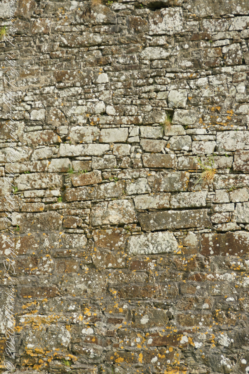
Tightly joined masonry
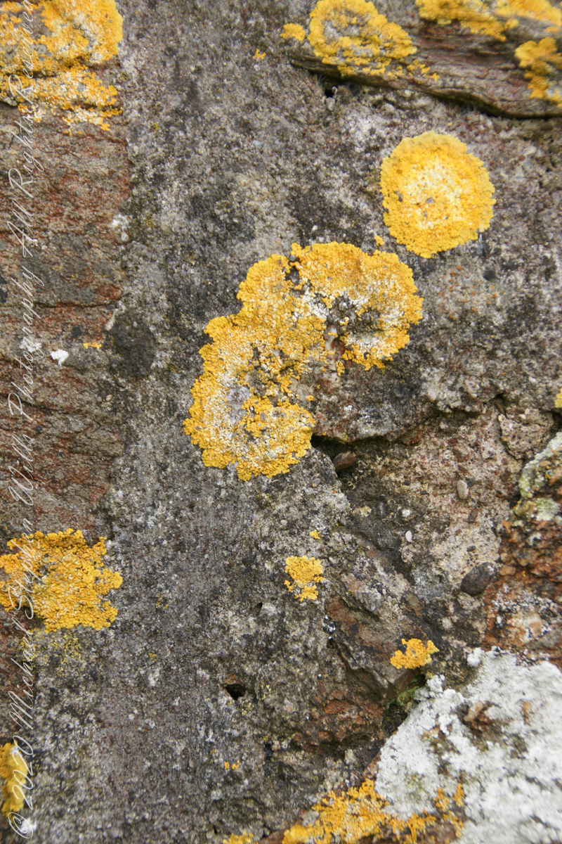
lichen
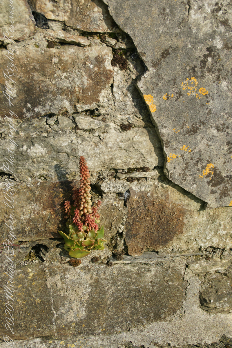
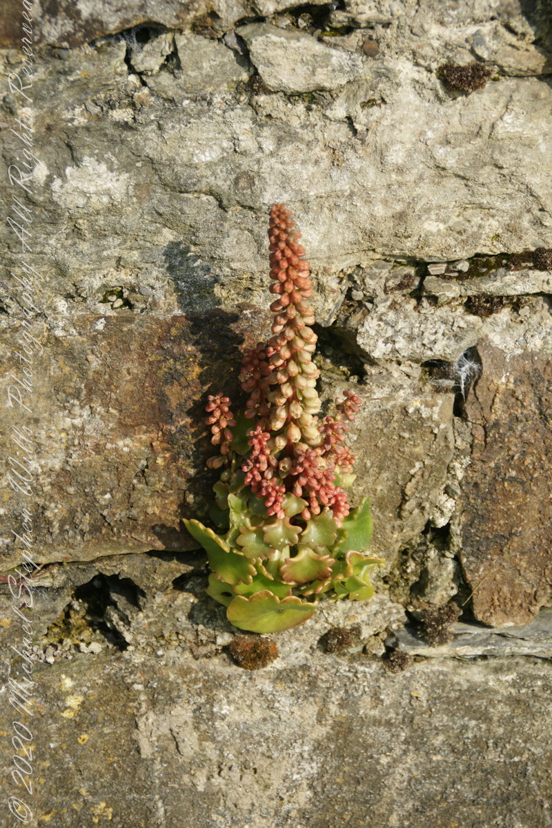
life has its way
seems to be a succulent
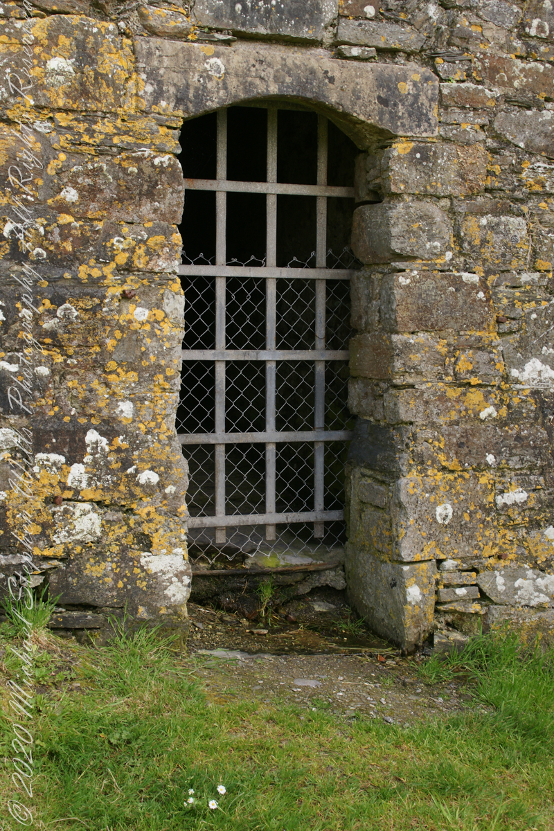
a doorway here seems a bad idea, but what do I know?
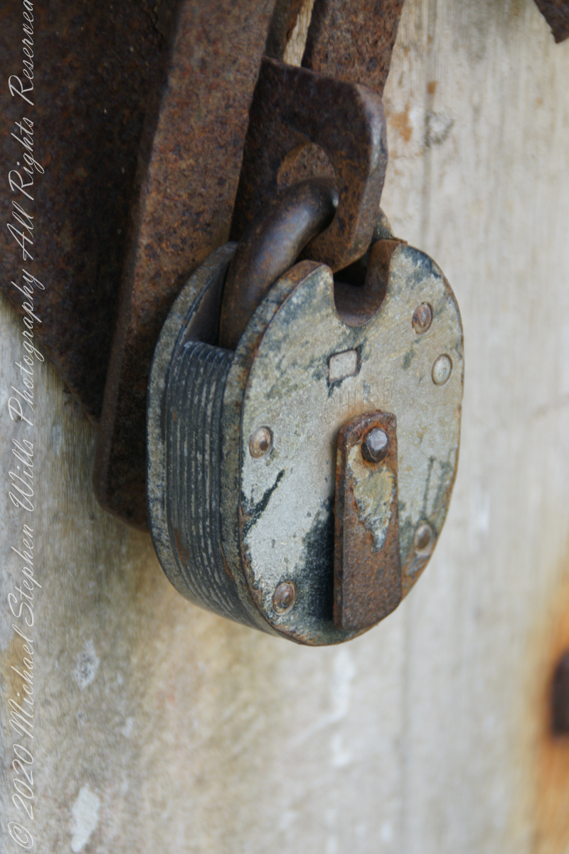
A pulley at first glance, look again and it is a lock
beneath the walls
Down to the Sallyport and the next post
References
“Charles Fort” – wikipedia
Copyright 2021 All Rights Reserved Michael Stephen Wills
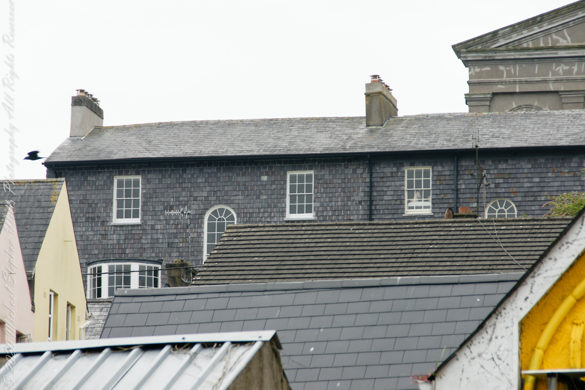
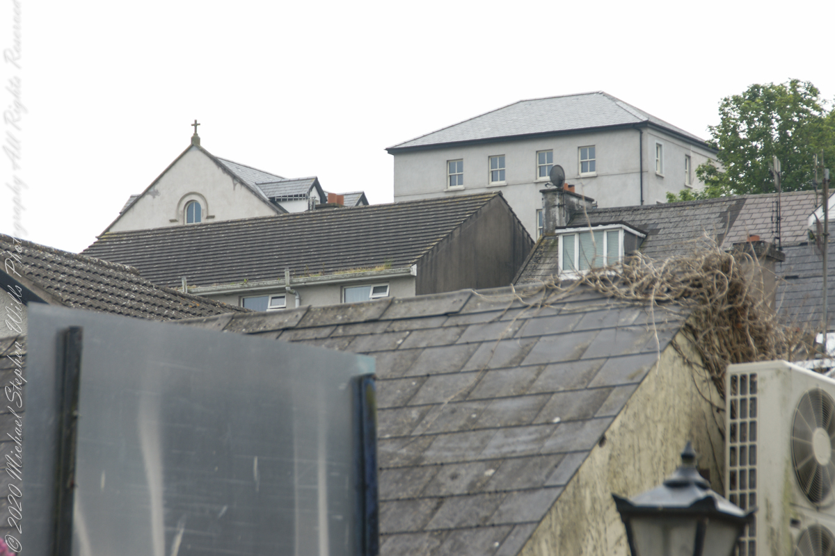
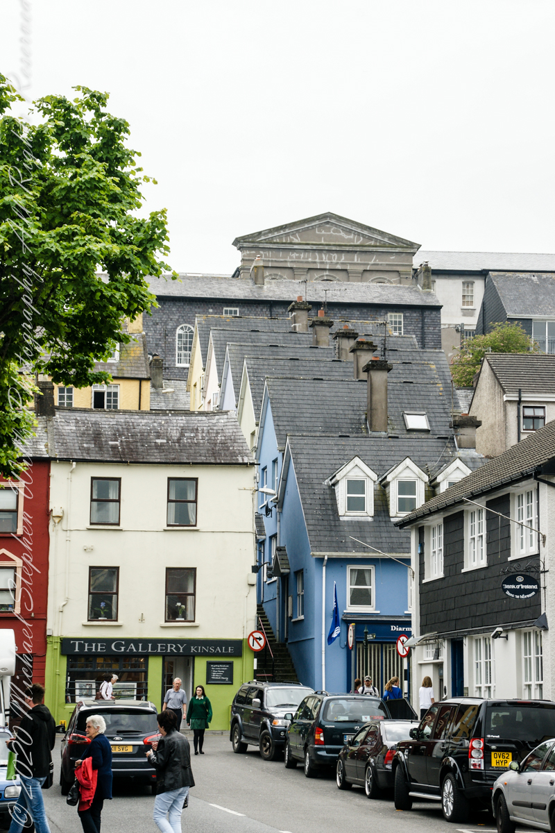
Kinsale, a historic seaport in County Cork, showcases unique architecture and geography, with its streets and houses built on steep inclines near the river Bandon.
The first of a series of idiosyncratic posts from a 2014 walking tour of Kinsale.
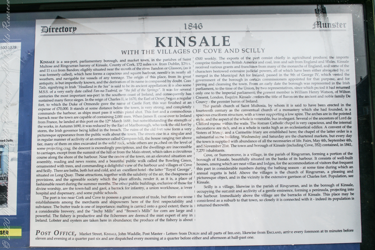
Text from an poster behind glass accessible to all and sundry. Directory 1846 Munster, Kinsale with the villages of Cove and Scilly. Kinsale is a seaport, parliamentary borough and market town in the parishes of Saint Multose and Ringcurran barony of Kinsale, County of Cork, 172 miles s.w. from Dublin, 121/2 s and 11 e.s.e. from Bandon; eligibly situated near the mouth of the river Bandon or Glasson, (as it was formerly called), which here forms a capacious and square harbor, accessible in nearly all weathers, and navigable for vessels of any tonnage. the origin of this place, from its great antiquity, is but imperfectly known, and the derivation of its name is compassed by doubt. Cean Taile (Cionn tSáile), signifying in Irish “Headland in the Sea” is said to be its ancient appellation. (see more in the photograph).
An informative poster behind glass accessible to all and sundry. Text: Directory 1846 Munster, Kinsale with the villiages of Cove and Scilly. Kindale is a sea-0ort, parlimentary borough and market town i the parishes of Saint Multose and Ringcurran barony of Kinsale, County of Cork, 172 miles s.w. from Dublin, 121/2 s and 11 e.s.e. from Bandon; elibibly situated near the mouth of the river Bandon or Glasson, (as it was formerly called), which here forms a capacious and square harbour, accessible in nearly all weathers, and navigable for vessels of any tonnage. the originn of this place, from its great antiquity, is but imperfectly known, and the derivaltion of its name is compassed by doubt. Cean Taile, signifying in Irish “Headland in the Sea” is said to be its anceient appellation. (see more in the photograph)./
Here we are on Emmet Place. There is a row of houses built along a steep alley named “The Stoney Steps.” At top is the aptly named Higher O’Connell Street.
The Gallery Kinsale
13 Main Street
Kinsale
West Cork
Ireland. From an informative poster…The streets rise in a singular and in regular manner of acclivity of an eminence called Compass Hill, the house ranging tier above tier, many of them on sites excavated in the solid rock, while other are perched on the level of some projecting crag: the descent is exceedingly precipitous, and the dwelling are inaccessible to carriages, except from the summit of the hill or from Main street, which takes a circuitous course along the shore of the harbor.
From the informative poster…The streets rise in a singular and in regular manner of acclivity of an eminence called Compass Hill, the house ranging tier above tier, many of them on sites excavated in the solid rock, while other are perched on the level of some projecting crag: the descent is exceedingly precipitous, and the dwelling are inaccessible to carriages, except from the summit of the hill or from Main street, which takes a circuitous course along the shore of the harbor.