Pam and Mike pose at the overlook, February 2016. “We were there!!”
The plateau on which the city was built was also the place where the construction materials were extracted. The rock quarry – this can still be found in the city of Machu Picchu. So, the Incas had no major difficulties in constructing the stone blocks.
The majority of construction bricks, rocks are rather small, unlike in the case of Ollantaytambo and Sacsayhuamán.
About 5.000 people must have worked to build Machu Picchu – specialists say. But it could only accommodate 750 – 1.000 inhabitants. Strangely there were only about 200 – 250 skeletons found.
About 140 buildings were erected. Most of these are houses, some are temples. There also are depots and even a guard house at the edge of the city.
The Incas used dry stone technique to build the city. No mortar was used, the stone bricks were simply put together without any material to stick them together.
All rocks used were split perfectly and the bricks were put together like a huge puzzle. Some of the bricks are so tightly put together that one cannot even put a knife between them. The rocks were probably cut with the so-called wooden wedge technique: holes were drilled into the rocks and wet wooden wedges were inserted into them. After that the constructors waited until the wet wooden wedges froze.
Copyright 2023 Michael Stephen Wills All Rights Reserved
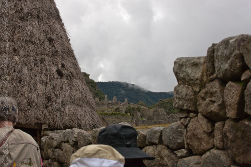
I set up a Manfrotto BeFree tripod with the Canon EOS 1DS Mark III mounted with the Canon EF 70-300 f/4-5.6 L IS USM lens to capture our experience while entering Machu Picchu.
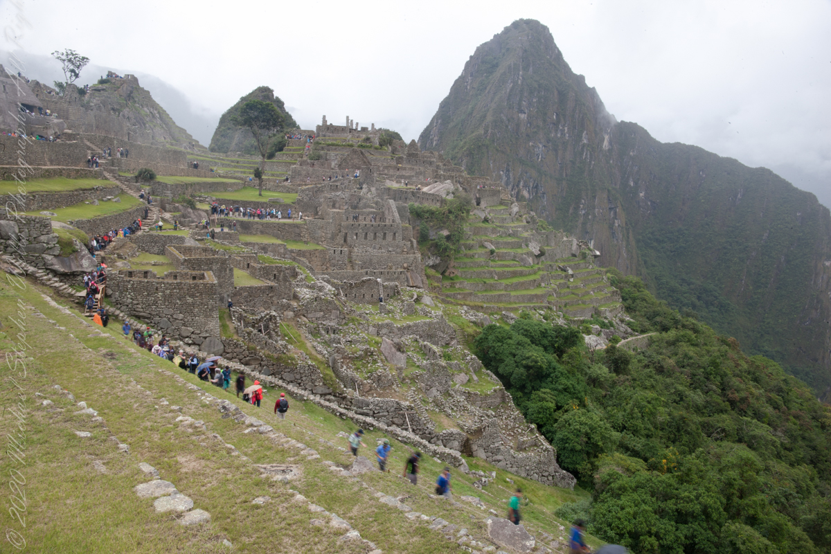
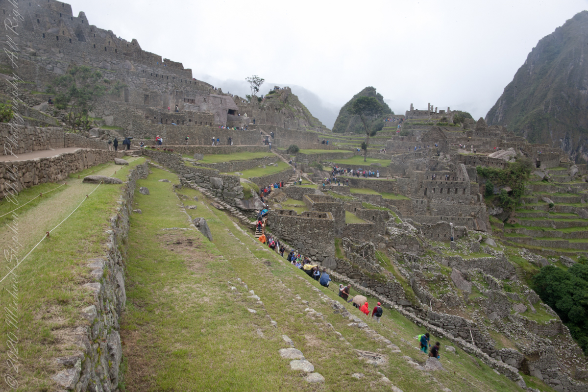
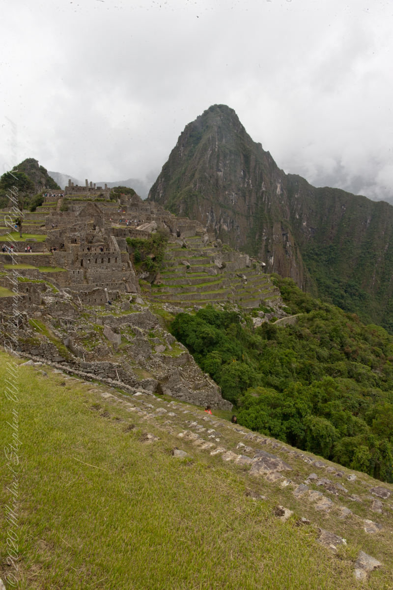
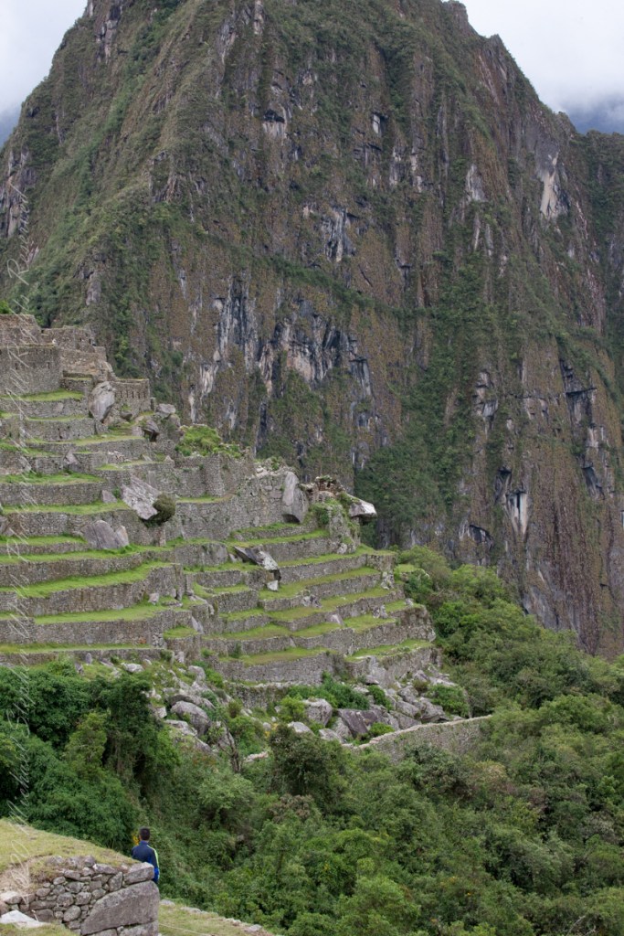
Huayna Picchu and the eastern portion of Machu Picchu from the agricultural terraces along with tourists proceed to the ancient city.
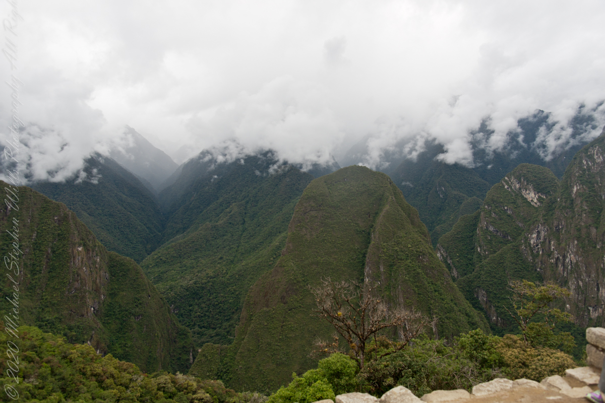
The eastern shoulder of Huayna Picchu is left and the Urubamba river curves around it. Leading the eye to the distance is an uninhabited andean valley covered in rain forest.
Copyright 2023 Michael Stephen Wills All Rights Reserved
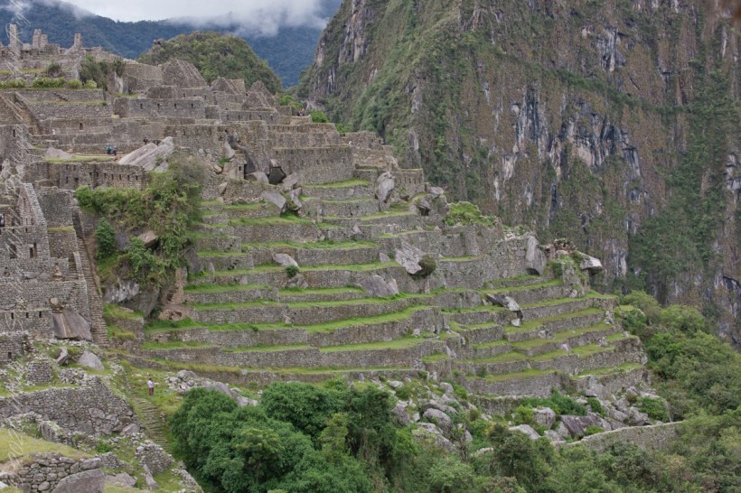
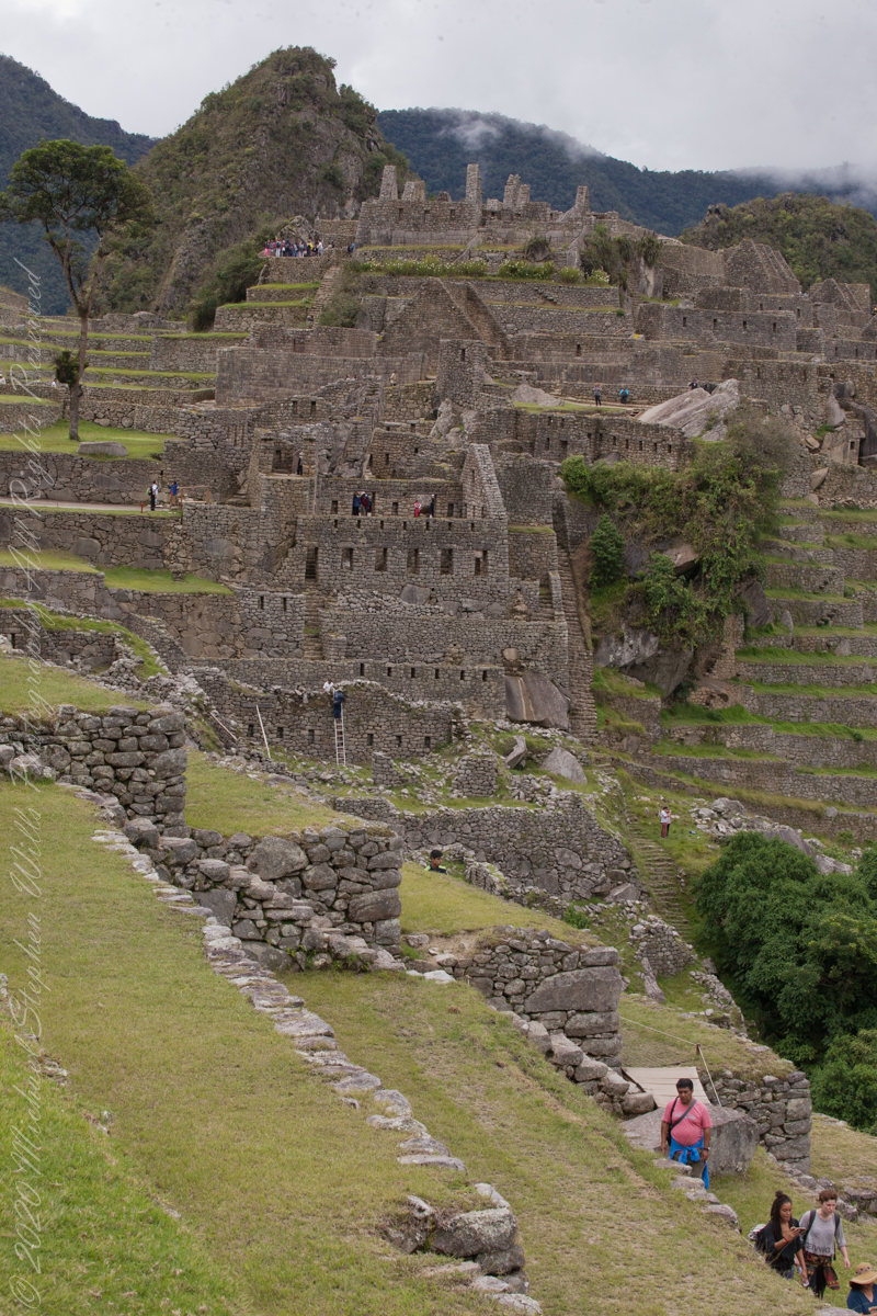
These agricultural terraces, built in the 15th century, were still in limited use by local farmers when Bingham arrived in the early 20th century.
These terraces were a work of considerable engineering, built to ensure good drainage and soil fertility while also protecting the mountain itself from erosion and landslides. Modern soil studies reveal the major crops were corn and potatoes. These terraces are below the districts named “Industrial Zone” and “Factory Houses.” A cliff of Huayna Picchu is in the background.
This photograph demonstrates either repair of or adaptation to landslides.
Copyright 2023 Michael Stephen Wills All Rights Reserved
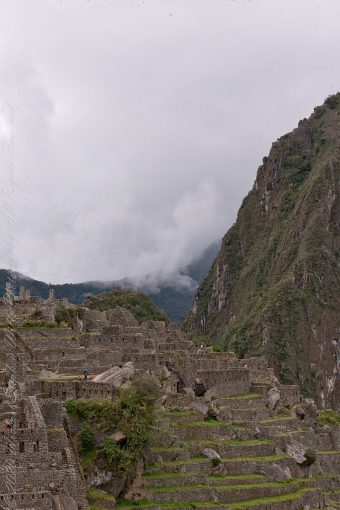
I set up a Manfrotto BeFree tripod with the Canon EOS 1DS Mark III mounted with the Canon EF 70-300 f/4-5.6 L IS USM lens. The lens is fast enough for the clear images from the train. Here, stabilized on a tripod, we can see tourists climbing and gathering on the peak as well as the terraces and ruins on top.
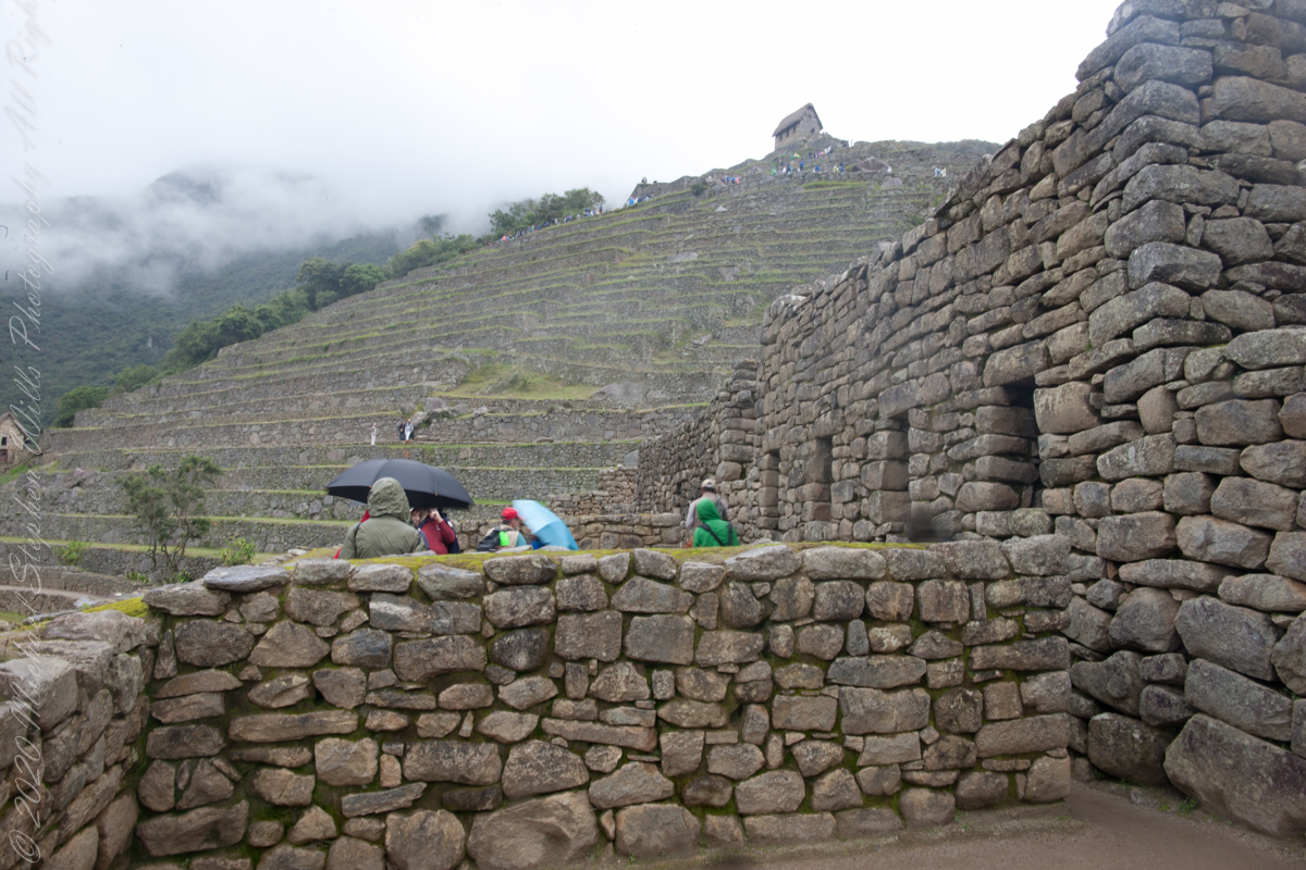
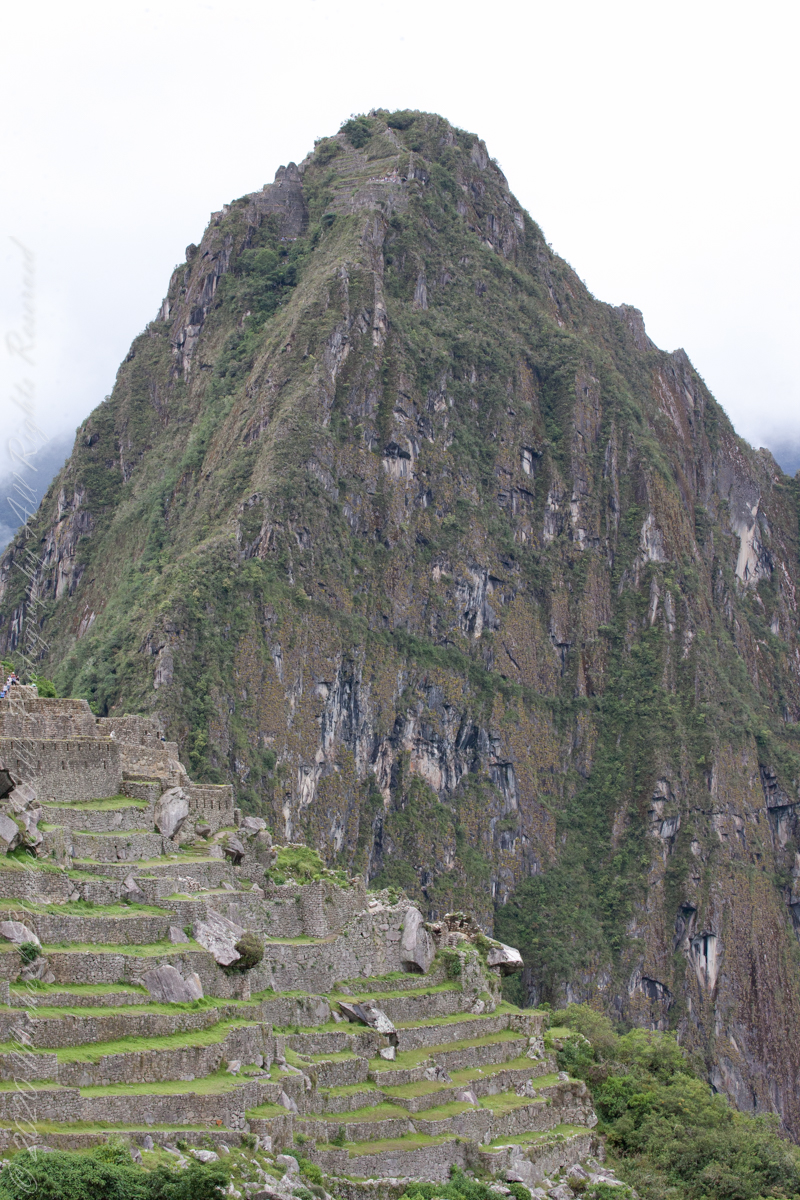
“Huayna Picchu, Quechua: Wayna Pikchu, is a mountain in Peru around which the Urubamba River bends. It is located in the Cusco Region, Urubamba Province, Machupicchu District. It rises over Machu Picchu, the so-called lost city of the Incas. The Incas built a trail up the side of the Huayna Picchu and built temples and terraces on its top. The peak of Huayna Picchu is 2,693 meters (8,835 ft) above sea level, or about 260 meters (850 ft) higher than Machu Picchu.”
“According to local guides, the top of the mountain was the residence for the high priest and the local virgins. Every morning before sunrise, the high priest with a small group would walk to Machu Picchu to signal the coming of the new day. The Temple of the Moon, one of the three major temples in the Machu Picchu area, is nestled on the side of the mountain and is situated at an elevation lower than Machu Picchu. Adjacent to the Temple of the Moon is the Great Cavern, another sacred temple with fine masonry. The other major local temples in Machu Picchu are the Temple of the Condor, Temple of Three Windows, Principal Temple, “Unfinished Temple”, and the Temple of the Sun, also called the Torreon.“
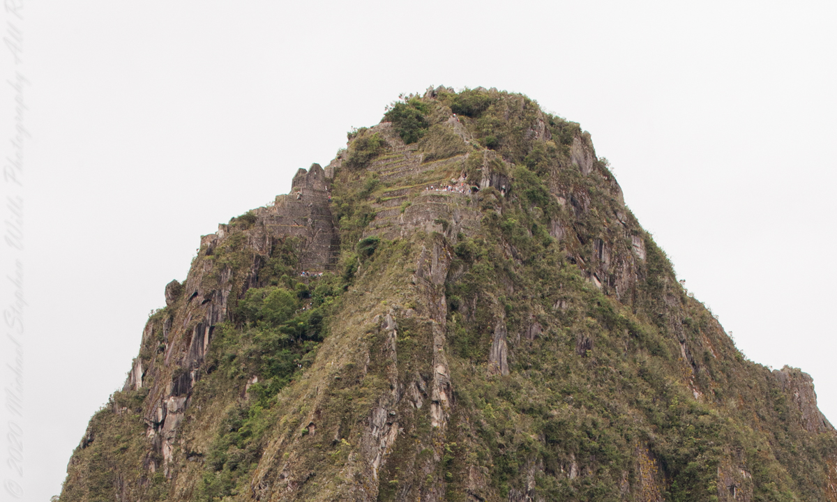
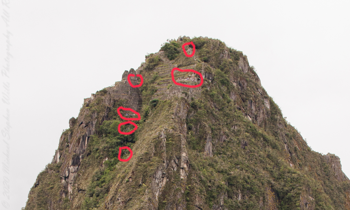
Terraces are salient, to left of peak is a roofless, gabled ruin. Look carefully to find climbing tourists and groups on terraces. Huayna Picchu
“Its name is Hispanicized, possibly from the Quechua, alternative spelling Wayna Pikchu; wayna young, young man, pikchu pyramid, mountain or prominence with a broad base which ends in sharp peaks, “young peak”. The current Quechua orthography used by the Ministerio de Cultura is Waynapicchu and Machupicchu.”
Terraces are salient, to left of peak is a roofless, gabled ruin. Look carefully to find climbing tourists and groups on terraces. Huayna Picchu.
Reference: Wikipedia “Huayna Picchu.”
Copyright 2023 Michael Stephen Wills All Rights Reserved
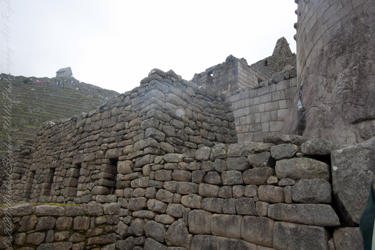
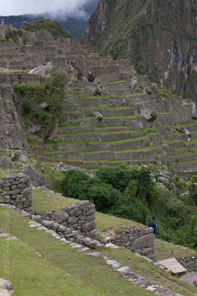
The wall with six rectangular windows is part of the “Prison Group”, a labyrinthine complex of cells, niches and passageways, positioned both under and above the ground. A portion of agricultural terraces is to the right and foreground. Look closely to see a group of tourists in the “Industrial Zone” district.
Copyright 2023 Michael Stephen Wills All Rights Reserved
These agricultural terraces, built in the 15th century, were still in limited use by local farmers when Bingham arrived in the early 20th century. These terraces were a work of considerable engineering, built to ensure good drainage and soil fertility while also protecting the mountain itself from erosion and landslides. Modern soil studies reveal the major crops were corn and potatoes. These terraces are below the districts named “Industrial Zone” and “Factory Houses.” A cliff of Huayna Picchu is in the background.
Copyright 2023 Michael Stephen Wills All Rights Reserved
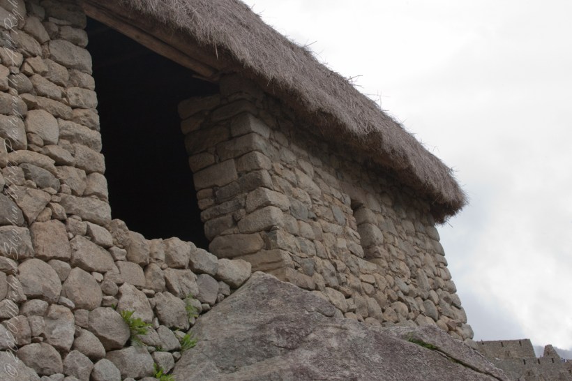
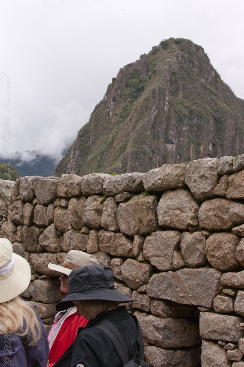
On our way to the Urban Sector of Machu Picchu I capture the peak of Huayna Picchu above a rough stone wall. “Huayna Picchu, Quechua: Wayna Pikchu, is a mountain in Peru around which the Urubamba River bends. It is located in the Cusco Region, Urubamba Province, Machupicchu District. It rises over Machu Picchu, the so-called lost city of the Incas. The Incas built a trail up the side of the Huayna Picchu and built temples and terraces on its top. The peak of Huayna Picchu is 2,693 meters (8,835 ft) above sea level, or about 260 meters (850 ft) higher than Machu Picchu.”
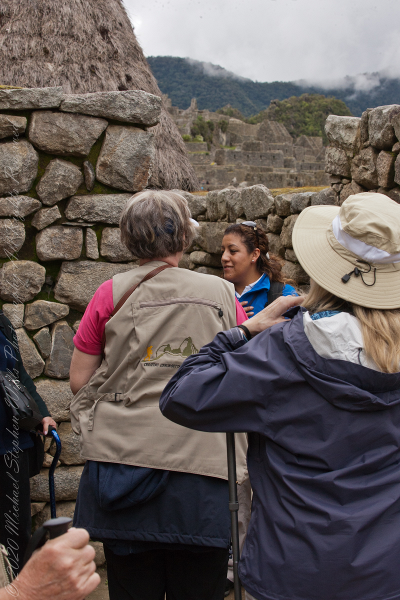
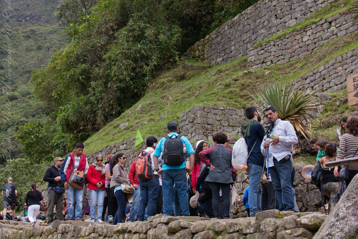
A fellow group of tourists wait for entry to the citadel
“According to local guides, the top of the mountain was the residence for the high priest and the local virgins. Every morning before sunrise, the high priest with a small group would walk to Machu Picchu to signal the coming of the new day. The Temple of the Moon, one of the three major temples in the Machu Picchu area, is nestled on the side of the mountain and is situated at an elevation lower than Machu Picchu. Adjacent to the Temple of the Moon is the Great Cavern, another sacred temple with fine masonry. The other major local temples in Machu Picchu are the Temple of the Condor, Temple of Three Windows, Principal Temple, “Unfinished Temple”, and the Temple of the Sun, also called the Torreon.“
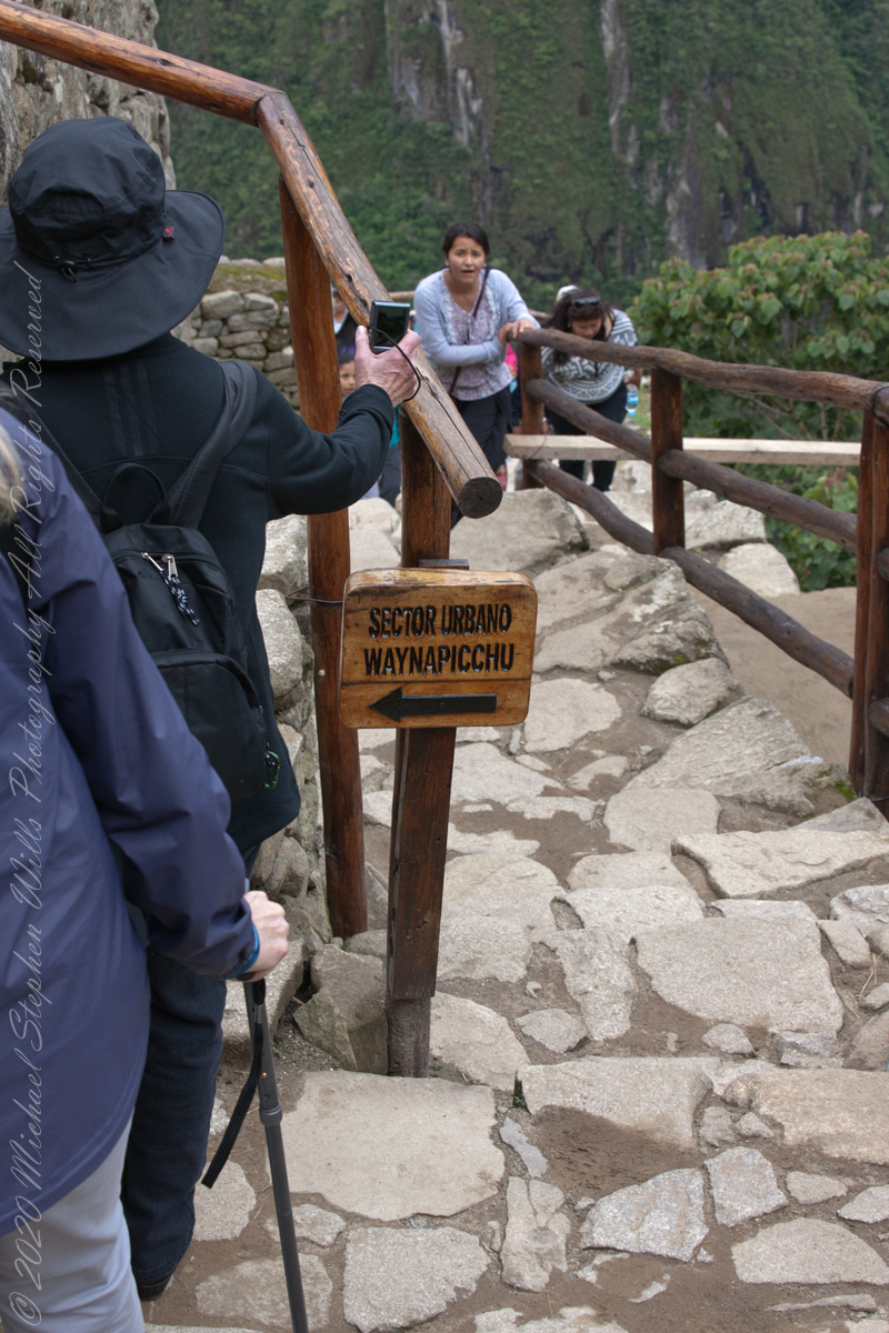
The end of a long climb
“Its name is Hispanicized, possibly from the Quechua, alternative spelling Wayna Pikchu; wayna young, young man, pikchu pyramid, mountain or prominence with a broad base which ends in sharp peaks, “young peak”. The current Quechua orthography used by the Ministerio de Cultura is Waynapicchu and Machupicchu.”
“Young Peak” rises above the “Lost City of the Incas.”
Reference: Wikipedia “Huayna Picchu.”
Copyright 2023 Michael Stephen Wills All Rights Reserved
In 1911 American historian and explorer Hiram Bingham traveled the region looking for the old Inca capital. On July 24, 1911 Bingham, led to Machu Picchu by a villager, Melchor Arteaga, crossed the Urubamba river on a rickety wood bridge. Bingham found the name Agustín Lizárraga and the date 1902 written in charcoal on one of the walls. Though Bingham was not the first to visit the ruins, he was considered the scientific discoverer who brought Machu Picchu to international attention.
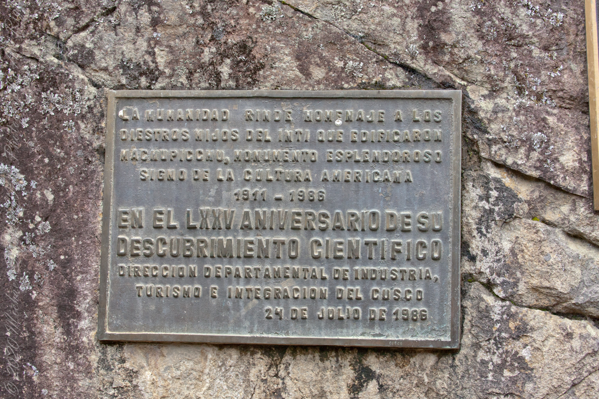
“Humanidad Rinde Homenaje a diestros hijos del inti que edificaron MachuPicchu, monumento esplendoroso sign o de la cultura americacana 1911 – 1986 En el LXXV Aniversario Descubrimiento Cientifico Direccion Departmental de Industria, turismo e integracion del Cusco 24 de Julio de 1986” Translation “Humanity pays tribute to skilled sons of the Inca who built Machu Picchu, splendid monument sign or of American culture 1911 – 1986 In the LXXV Anniversary Scientific Discovery Departmental Directorate of Industry, Tourism and Integration of Cusco July 24, 1986”
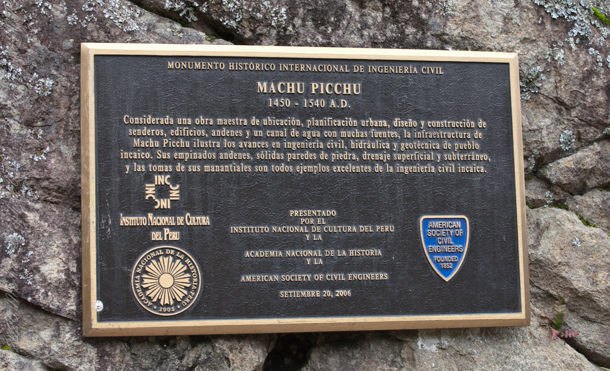
“Considerada una obra maestra de ubicacion, planificacion urbana, diseno y construccion de senderos, edificios, andenes y un canal de agua con muchas fuentes, la infraestructura de Machu Picchu ilustra las avances en ingenieria civil, hidraulica y geotecnica de pueble incaico. Sus empinados andenes, solidas paredes de piedra, drenaje superficial y subterraneo, y las tomas de sus manantiales son todos ejemplos excelentes de la ingenieria civil incaica.” Translation “Considered a masterpiece of location, urban planning, design and construction of trails, buildings, platforms and a water channel with many fountains, the infrastructure of Machu Picchu illustrates the advances in civil, hydraulic and geotechnical engineering of Inca village. Its steep platforms, solid stone walls, surface and underground drainage, and intakes of its springs are all excellent examples of Inca civil engineering. September 20, 2006.”
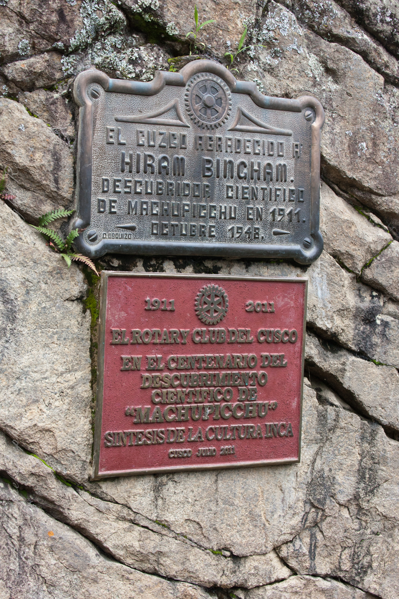
Top: El Cuzco Agradecido a Hiram Bingham Descubridor Cientifico de MachuPicchu en 1911. October 1948 (made by C Ubquizo) Translation (The City of ) Cuzco (is) Grateful to Hiram Bingham Scientific Discoverer of Machu Picchu in 1911. October 1948 Bottom: 1911 2011 El Rotary Club del Cusco En el Centenario del Descubrimiento Cientifico co “AMachuPicchu” Sintesis de la Culture Inca Cusco Julio 2011 Translation: The Rotary Club of Cusco In the Centenary of the Scientific Discovery of “MachuPicchu” Synthesis of the Inca Culture Cusco July 2011.
Credits:
“Machu Picchu” Wikipedia
Translations Spanish are from Google Translate (with my editing).
Copyright 2023 Michael Stephen Wills All Rights Reserved
“Falcon Heavy is a partially reusable super heavy-lift launch vehicle[a] that can carry cargo into Earth orbit, and beyond. It is designed, manufactured and launched by American aerospace company SpaceX.“
“The rocket consists of a center core on which two Falcon 9 boosters are attached, and a second stage on top of the center core. Falcon Heavy has the second highest payload capacity of any currently operational launch vehicle behind NASA’s Space Launch System, and the fourth-highest capacity of any rocket to reach orbit, trailing behind the SLS, Energia and the Saturn V.“
“SpaceX conducted Falcon Heavy’s maiden launch on 6 February 2018, at 20:45 UTC. As a dummy payload, the rocket carried a Tesla Roadster belonging to SpaceX founder Elon Musk, with a mannequin dubbed “Starman” in the driver’s seat. The second Falcon Heavy launch occurred on 11 April 2019, and all three booster rockets successfully returned to Earth. The third Falcon Heavy launch successfully occurred on 25 June 2019. Since then, Falcon Heavy has been certified for the National Security Space Launch (NSSL) program.“
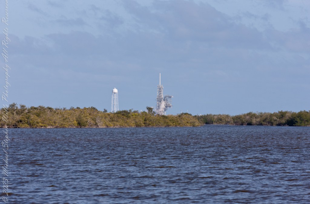
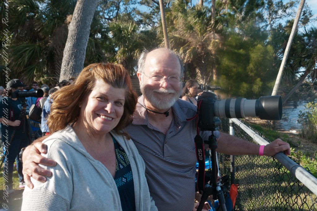
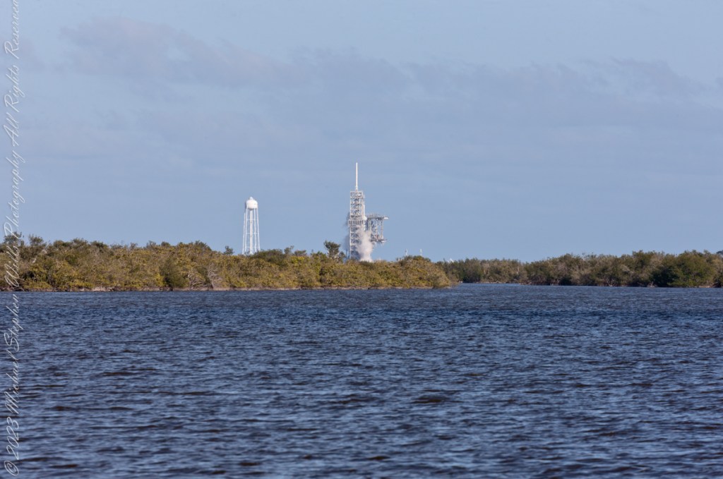
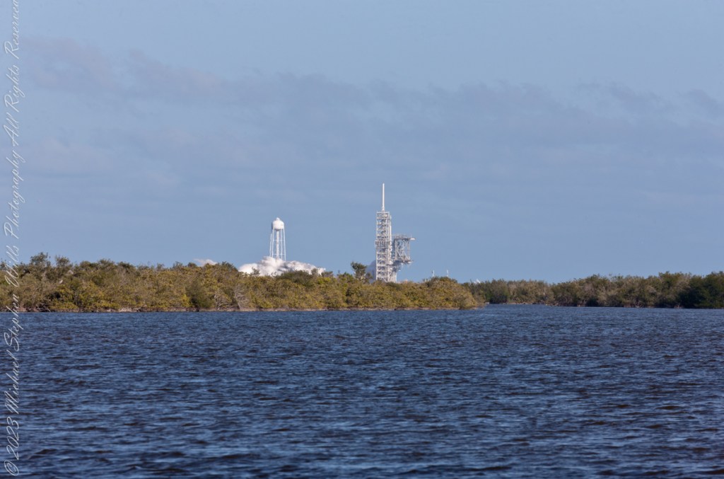
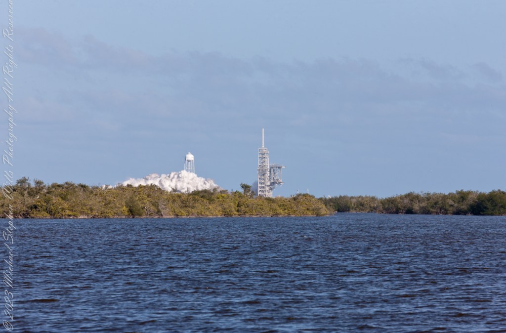
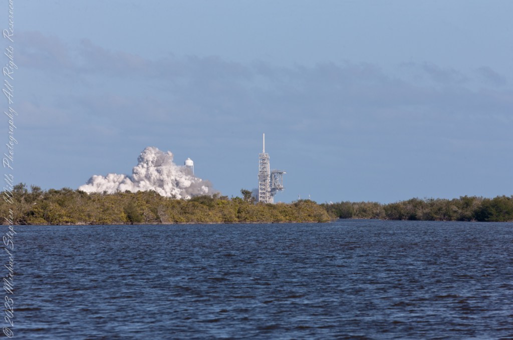
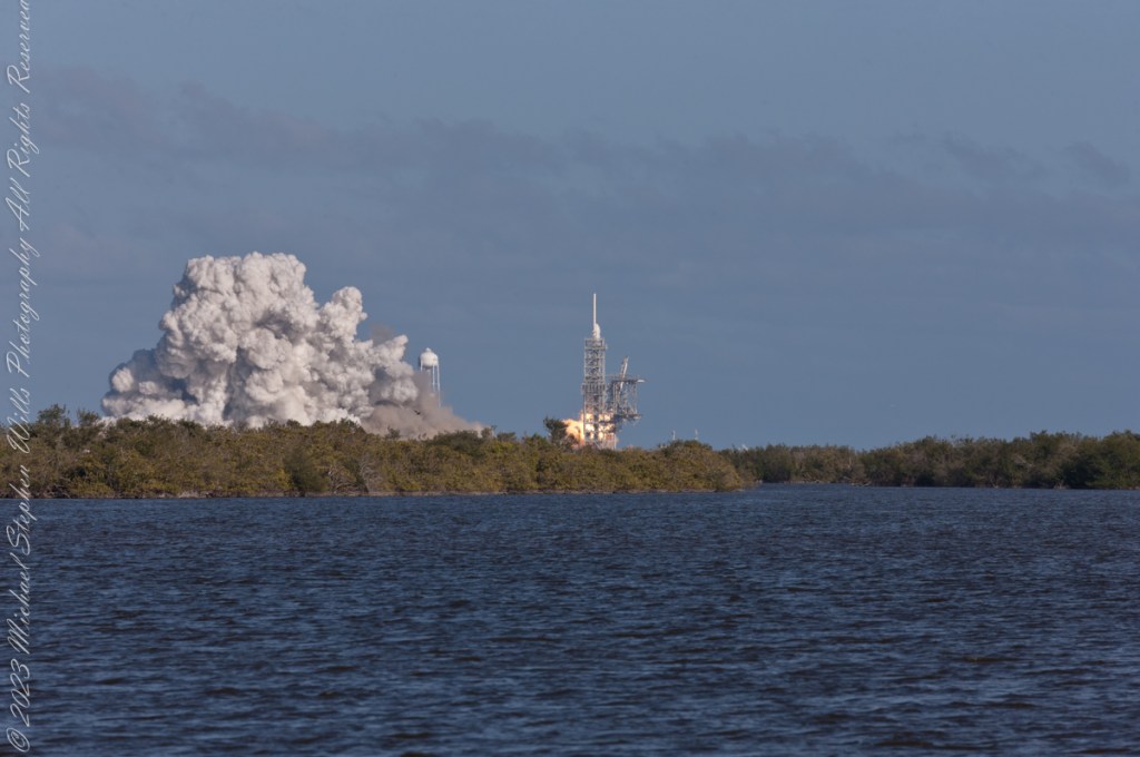
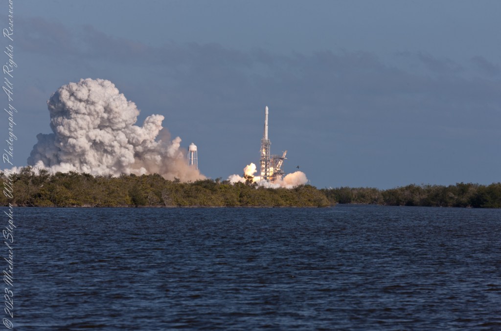
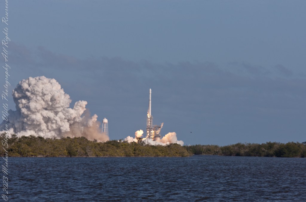
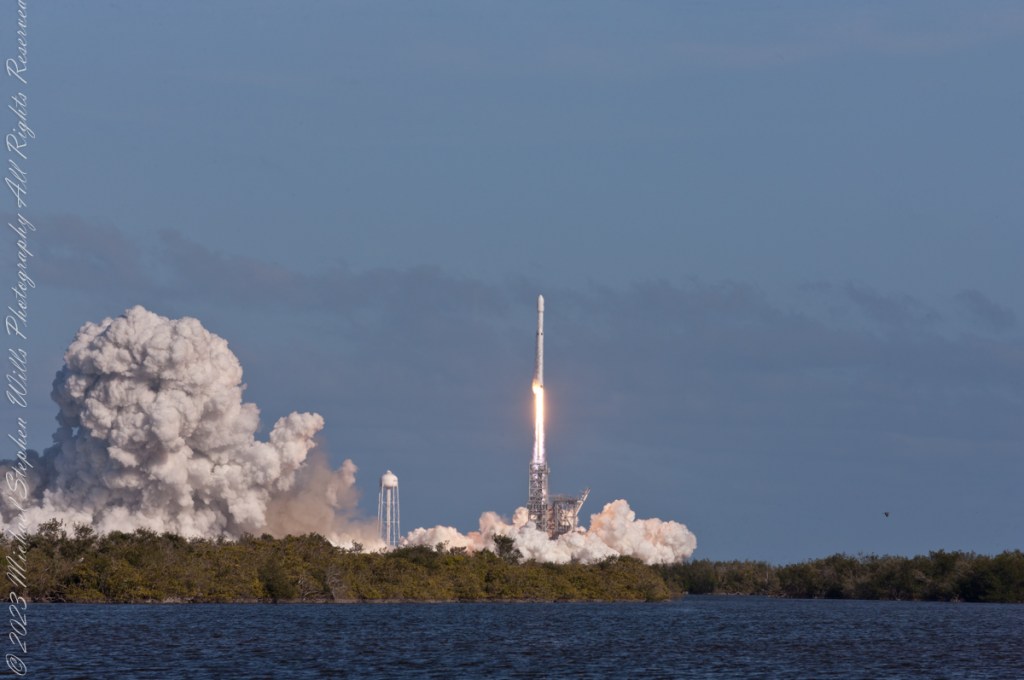
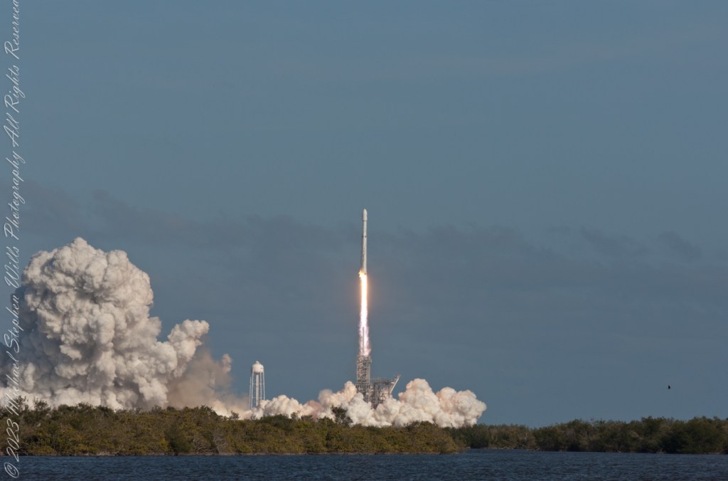
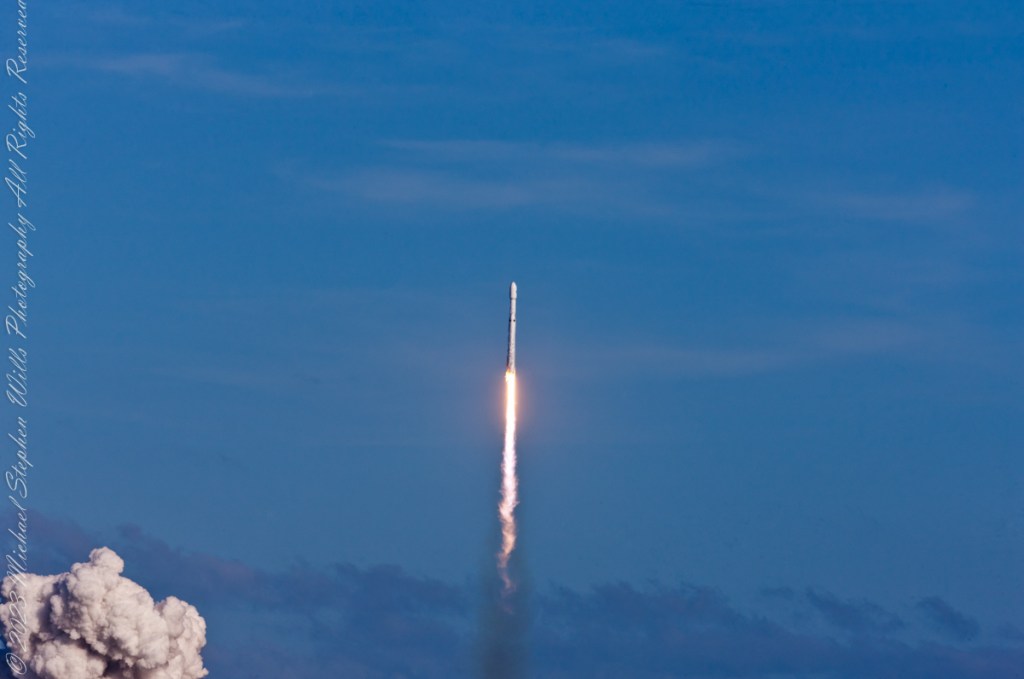
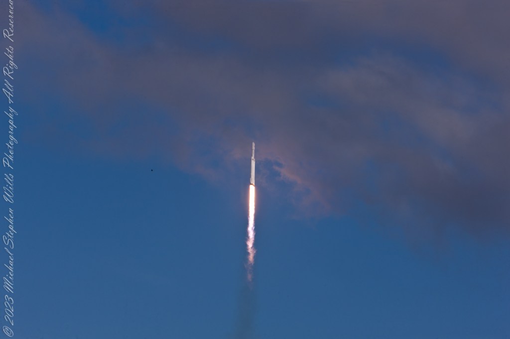
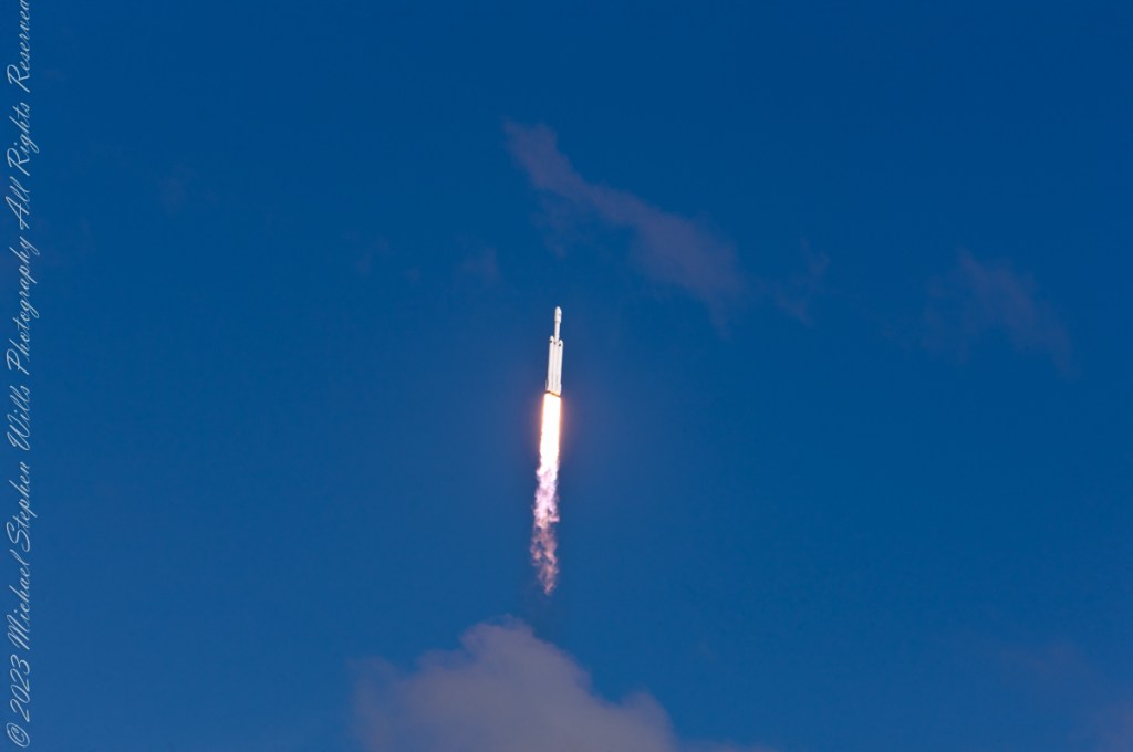
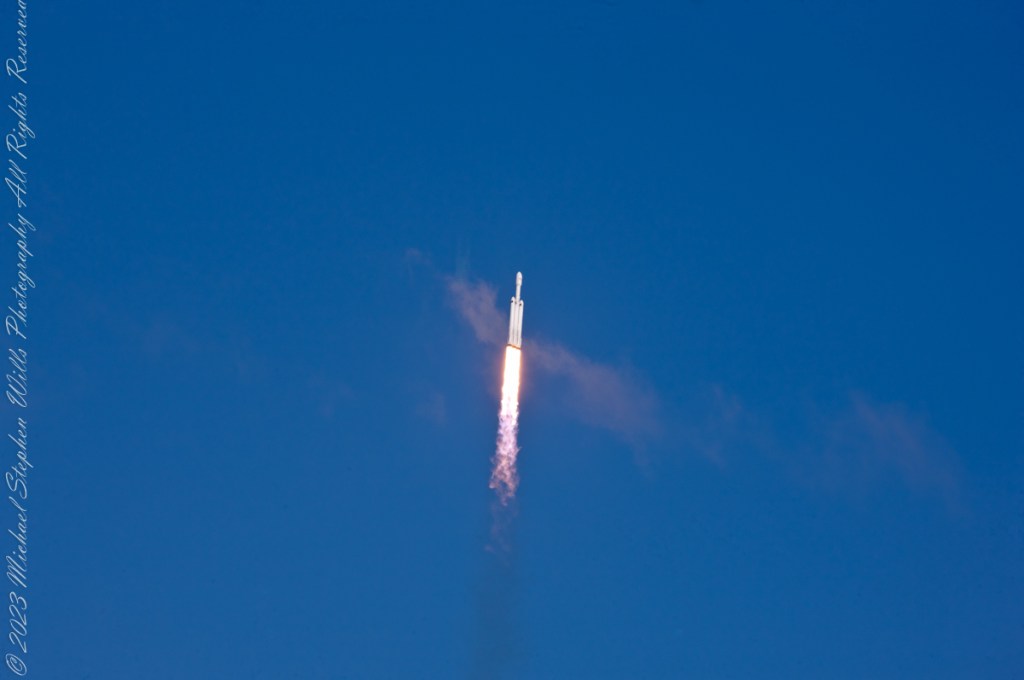
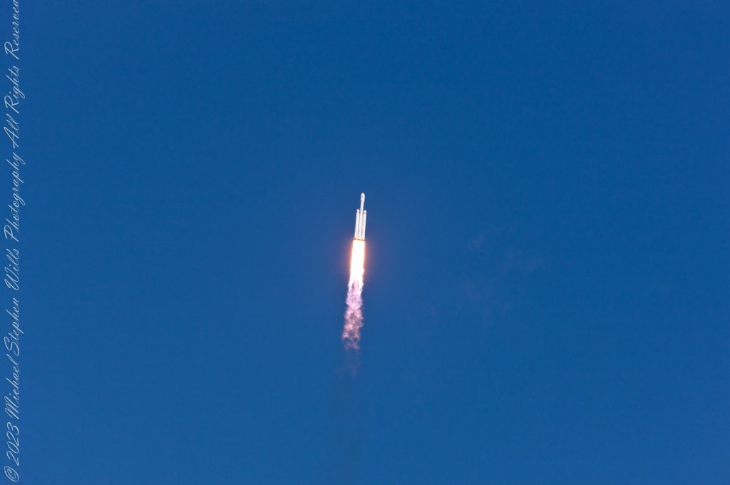
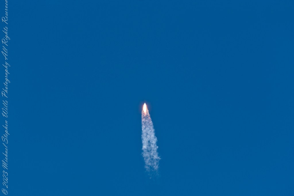
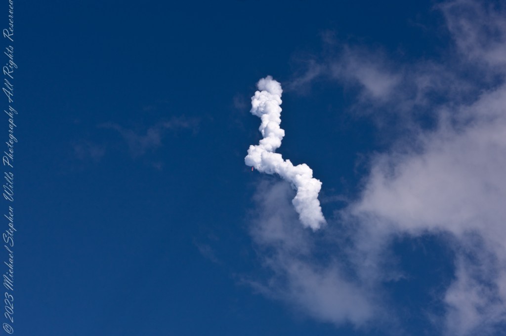
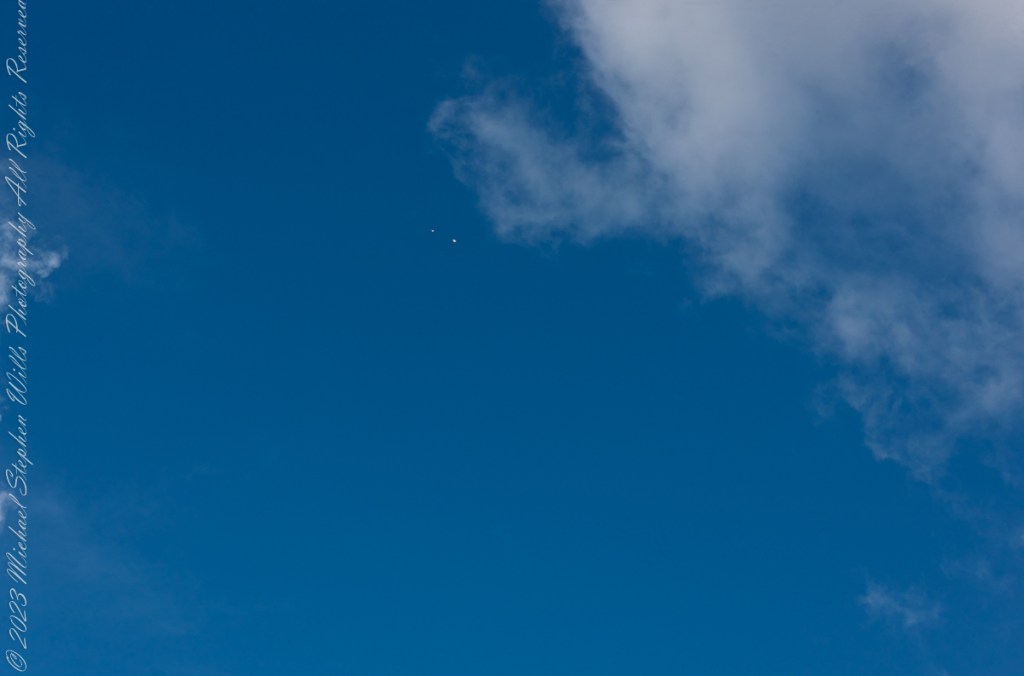
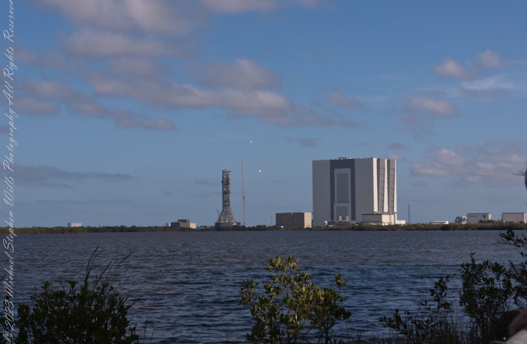
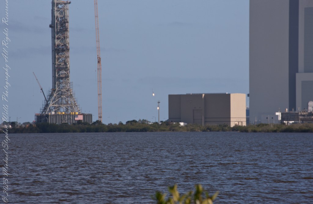
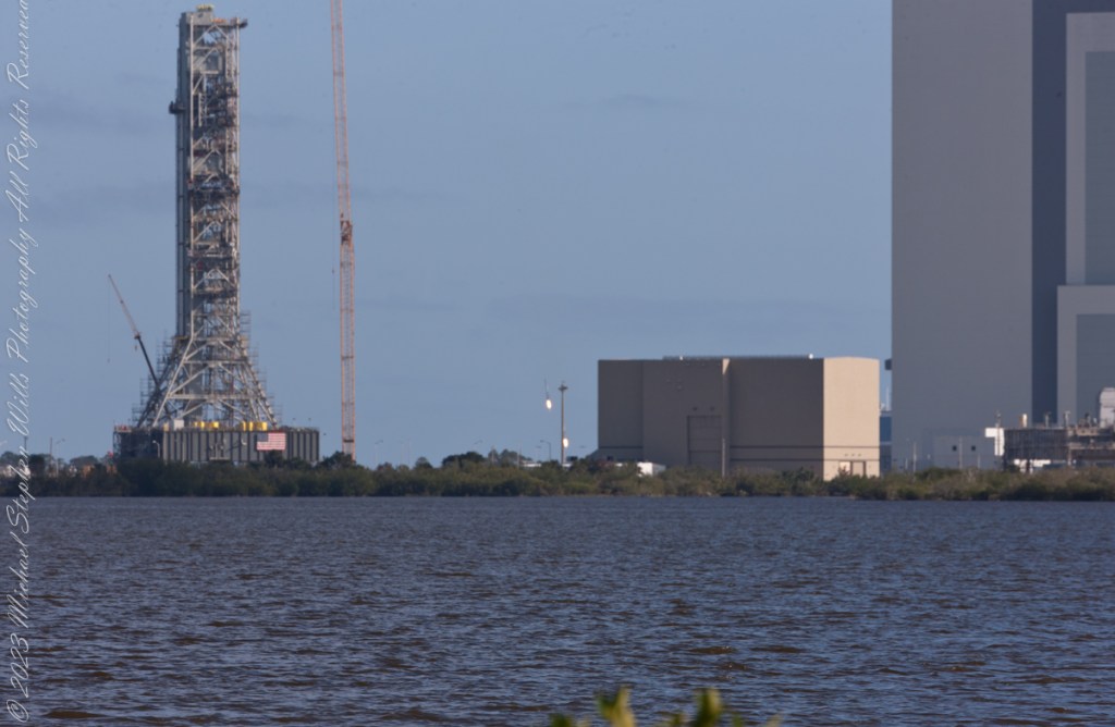
February 6, 2018 fuel venting during fueling of the Space X Falcon Heavy 19 minutes 25 seconds prior to launch. The rocket hidden by the launch tower. Taken from Kennedy Space Center Apollo-Saturn V Center looking across the Banana River to Launch Complex 39A, 3.9 miles away.Pam and Mike Wills in place at a prime spot for the SpaceX Falcon Heavy Launch. Kennedy Space Center, Apollo-Saturn V Center. February 6, 2018. 00:10:49 before launch.February 6, 2018 fuel venting, fueling complete 1 minute 20 seconds prior to launch. The rocket hidden by the launch tower. Taken from Kennedy Space Center Apollo-Saturn V Center looking across the Banana River to Launch Complex 39A, 3.9 miles away.February 6, 2018 Space X Falcon Heavy, 3 seconds prior to launch. The rocket hidden by the launch tower. The cloud is water released into the launch platform under pressure from the water tower. Taken from Kennedy Space Center Apollo-Saturn V Center looking across the Banana River to Launch Complex 39A, 3.9 miles away.February 6, 2018 Space X Falcon Heavy, launch 2 seconds prior to launch. The rocket hidden by the launch tower. The cloud is water released into the launch platform under pressure from the water tower. Taken from Kennedy Space Center Apollo-Saturn V Center loking across the Banana River to Launch Complex 39A, 3.9 miles away.February 6, 2018 Space X Falcon Heavy engine ignition. The moment of engine ignition, the rocket hidden by the launch tower. Taken from Kennedy Space Center Apollo-Saturn V Center loking across the Banana River to Launch Complex 39A, 3.9 miles away.February 6, 2018 Space X Falcon Heavy, launch plus 1 second. Ignition visible, tower connections falling away. Rocket nose visible to right of tower lightening rod. Taken from Kennedy Space Center Apollo-Saturn V Center loking across the Banana River to Launch Complex 39A, 3.9 miles away.February 6, 2018 Space X Falcon Heavy, launch plus 2 seconds. Rocket lift-off fully underway. Taken from Kennedy Space Center Apollo-Saturn V Center looking across the Banana River to Launch Complex 39A, 3.9 miles away.February 6, 2018 Space X Falcon Heavy, launch plus 4 seconds. Rocket not yet clear of launch tower. Taken from Kennedy Space Center Apollo-Saturn V Center looking across the Banana River to Launch Complex 39A, 3.9 miles away.February 6, 2018 Space X Falcon Heavy, launch plus 5 seconds. A heron flies to the right of launch tower. Taken from Kennedy Space Center Apollo-Saturn V Center looking across the Banana River to Launch Complex 39A, 3.9 miles away.February 6, 2018 Space X Falcon Heavy, launch plus 6 seconds. Rocket is just clear of launch tower. At 230 feet in 6 seconds it is travelling at 26.1 miles per hour. A heron flies to right of launch tower. Taken from Kennedy Space Center Apollo-Saturn V Center looking across the Banana River to Launch Complex 39A, 3.9 miles away.February 6, 2018 Space X Falcon Heavy, launch plus 7 seconds. Rocket is clear of the launch tower. Taken from Kennedy Space Center Apollo-Saturn V Center looking across the Banana River to Launch Complex 39A, 3.9 miles away.February 6, 2018 Space X Falcon Heavy, launch plus 7 seconds. Taken from Kennedy Space Center Apollo-Saturn V Center looking across the Banana River to Launch Complex 39A, 3.9 miles away.February 6, 2018 Space X Falcon Heavy, launch plus 8 seconds. Taken from Kennedy Space Center Apollo-Saturn V Center looking across the Banana River to Launch Complex 39A, 3.9 miles away.February 6, 2018 Space X Falcon Heavy, launch plus 9 seconds. Taken from Kennedy Space Center Apollo-Saturn V Center looking across the Banana River to Launch Complex 39A, 3.9 miles away.February 6, 2018 Space X Falcon Heavy, launch plus 12 seconds. Taken from Kennedy Space Center Apollo-Saturn V Center.February 6, 2018 Space X Falcon Heavy, launch plus 20 seconds. The rocket has rolled a few degrees, all boosters are visible. The Taken from Kennedy Space Center Apollo-Saturn V Center.February 6, 2018 Space X Falcon Heavy, launch plus 25 seconds. All boosters are visible. Taken from Kennedy Space Center Apollo-Saturn V Center.February 6, 2018 Space X Falcon Heavy, launch plus 26 seconds. All boosters are visible. Taken from Kennedy Space Center Apollo-Saturn V Center.February 6, 2018 Space X Falcon Heavy, launch plus 32 seconds. A boosters are visible. Taken from Kennedy Space Center Apollo-Saturn V Center.February 6, 2018 Space X Falcon Heavy, launch plus 1 minute 11 seconds. The boosters have throttled back. Taken from Kennedy Space Center Apollo-Saturn V Center.February 6, 2018 Space X Falcon Heavy, launch plus 1 minute 57 seconds. The cloud was formed from the throttled back boosters. The rocket is visible near center of frame. Taken from Kennedy Space Center Apollo-Saturn V Center.February 6, 2018 Space X Falcon Heavy, launch plus 6 minutes 37 seconds. Firing thrusterrs of the two returning boosters are visible a bit above the center of frame. Taken from Kennedy Space Center Apollo-Saturn V Center.February 6, 2018 Space X Falcon Heavy, launch plus 7 minutes 50 seconds. Both boosters visible firing thrusters between the SLS Launch Tower and NASA Vehicle Assembly Building. Taken from Kennedy Space Center Apollo-Saturn V Center loking across the Banana River.February 6, 2018 Space X Falcon Heavy, launch plus 8 minutes 2 seconds. Both boosters visible firing thrusters between the SLS Launch Tower and NASA Vehicle Assembly Building. Taken from Kennedy Space Center Apollo-Saturn V Center loking across the Banana River.February 6, 2018 Space X Falcon Heavy, launch plus 8 minutes 3 seconds. Both boosters visible firing thrusters between the SLS Launch Tower and NASA Vehicle Assembly Building. Taken from Kennedy Space Center Apollo-Saturn V Center loking across the Banana River.
“Falcon Heavy was designed to be able to carry humans into space beyond low Earth orbit, although as of February 2018, SpaceX does not intend to transport people on Falcon Heavy, nor pursue the human-rating certification process to transport NASA astronauts. Both Falcon Heavy and Falcon 9 are expected to eventually be superseded by the Starship launch system, currently being developed.“
“On 6 February 2018, after a delay of over two hours due to high winds, Falcon Heavy lifted off at 20:45 UTC. Its side boosters landed safely on Landing Zones 1 and 2 a few minutes later. However, only one of the three engines on the center booster that were intended to restart ignited during descent, causing the booster to be destroyed upon impacting the ocean at a speed of over 480 km/h (300 mph).“
“Initially, Elon Musk tweeted that the Roadster had overshot its planned heliocentric orbit, and would reach the asteroid belt. Later, observations by telescopes showed that the Roadster would only slightly exceed the orbit of Mars at aphelion.“