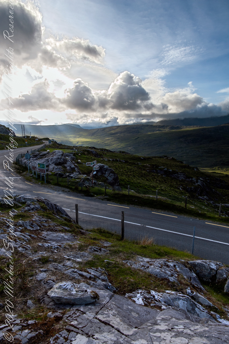
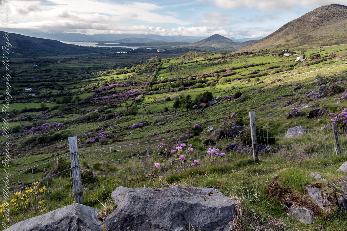
Here we are still standing in Moll’s Gap, looking a bit farther northwest into Black Valley than for View Two. Across the far mountains is Black Valley, a place so remote it was among the last, on the island itself (“mainland”) to be electrified or connected to telephone networks. Today Black Valley is a southerly route to the Gap of Dunloe well known to certain hikers and cyclists.
I am struggling here to deal with the vast range of light intensity from the glow of a westering sun, to the shadows cast by surrounding heights.
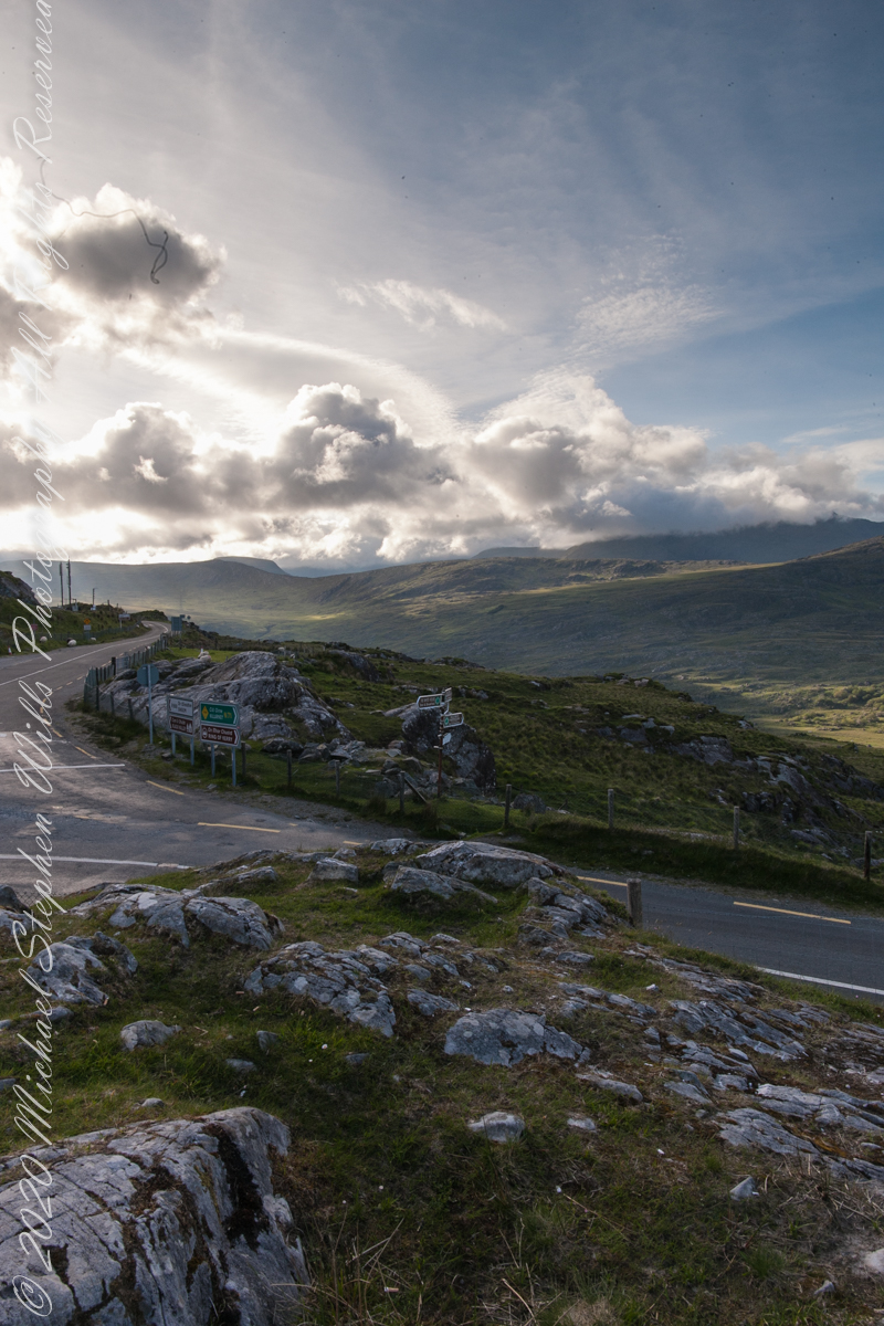
Beneath our feet are the slopes of Derrygarriff (in Irish Doire Gharbh) of the Mangerton range. Across the way is Crossderry peak of the Dunkerron mountains, the townland is named for the peak (or vice versa).
Click pic for larger view in a new browser tab. If you are in WordPress Reader, open the post to use this feature.
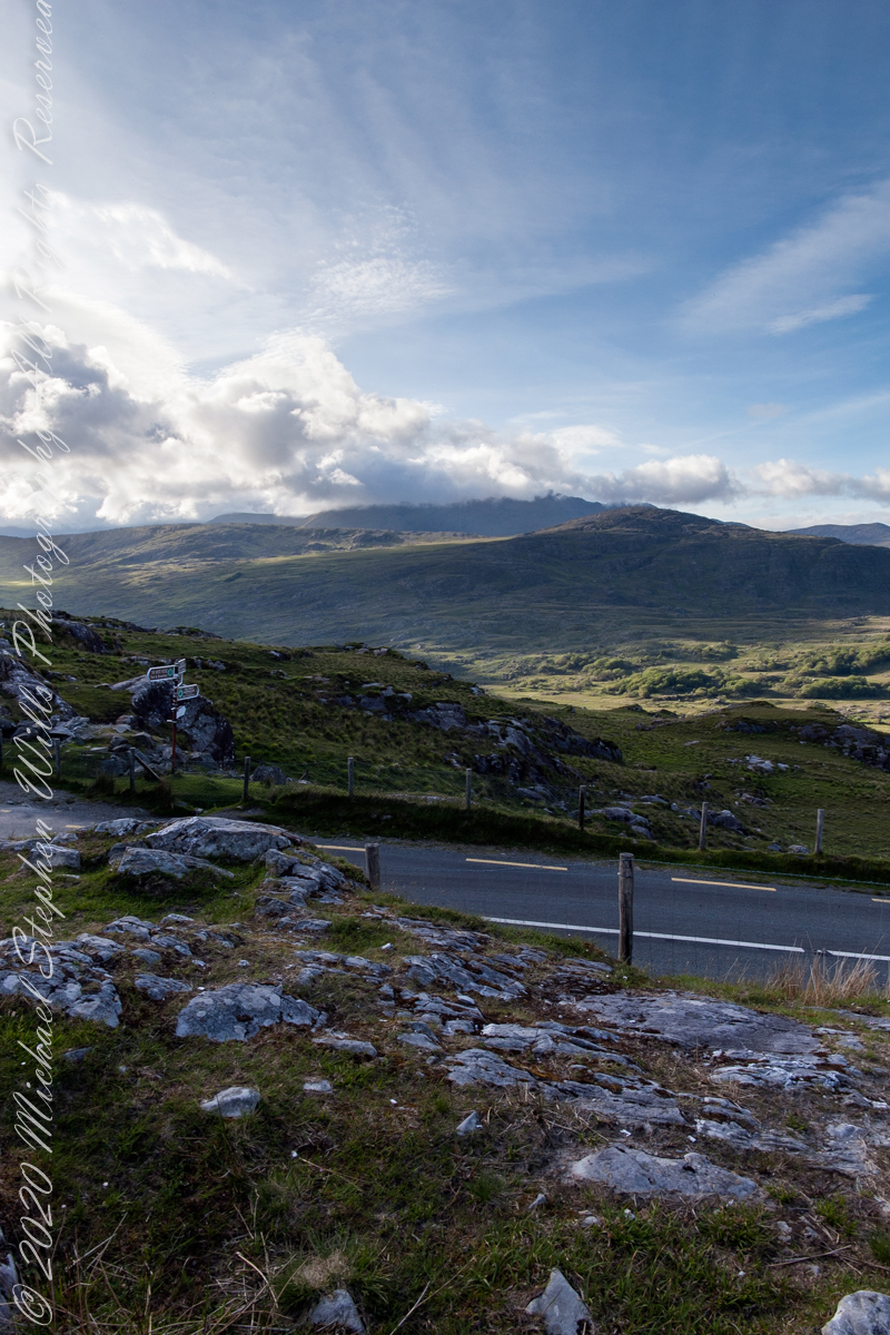
Here is a second try, a bit more successful as the clouds opened to shine on distant land. I did work in Photoshop to manage the brightest clouds.
Here are all three versions of the Black Valley view from Moll’s Gap. Enjoy
Copyright 2021 Michael Stephen Wills All Rights Reserved
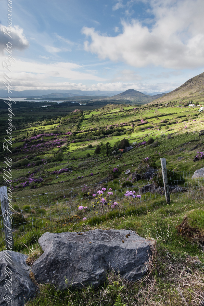
Here we are standing in Moll’s Gap, looking northwest into Black Valley, a place so remote it was among the last, on the island itself (“mainland”) to be electrified or connected to telephone networks.
Beneath our feet are the slopes of Derrygarriff (in Irish Doire Gharbh) of the Mangerton range. Across the way is Crossderry peak of the Dunkerron mountains, the townland is named for the peak. Black Valley, now a southerly route to the Gap of Dunloe well known to certain hikers and cyclists, is beyond the far mountains.
Click pic for larger view in a new browser tab. If you are in WordPress Reader, open the post to use this feature.
Copyright 2021 Michael Stephen Wills All Rights Reserved
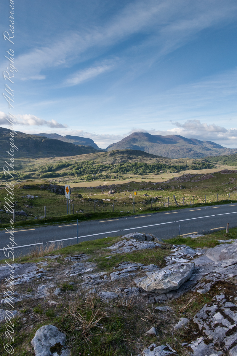
Here we are, on the road from Kenmare to Killarney, N71, part of the Ring of Kerry around the Iveragh Peninsula. The spot is the mountain pass Moll’s Gap, also known in the Irish language as Céim an Daimh (meaning, Gap of the Ox). In the Nineteenth Century a woman named Moll Kissane ran a public house here, operating illegally.
The mountain of this townland, named Eirk (also known as Adhard) , is composed of a fine grained sandstone found in a wide swath from North America’s northeastern coast, Greenland, Ireland, Great Britain — lands formerly part of the same ancient continent.
Click pic for larger view in a new browser tab. If you are in WordPress Reader, open the post to use this feature.
Iveragh Peninsula, Eirk townland, County Kerry, Republic of Ireland.
Copyright 2021 Michael Stephen Wills All Rights Reserved
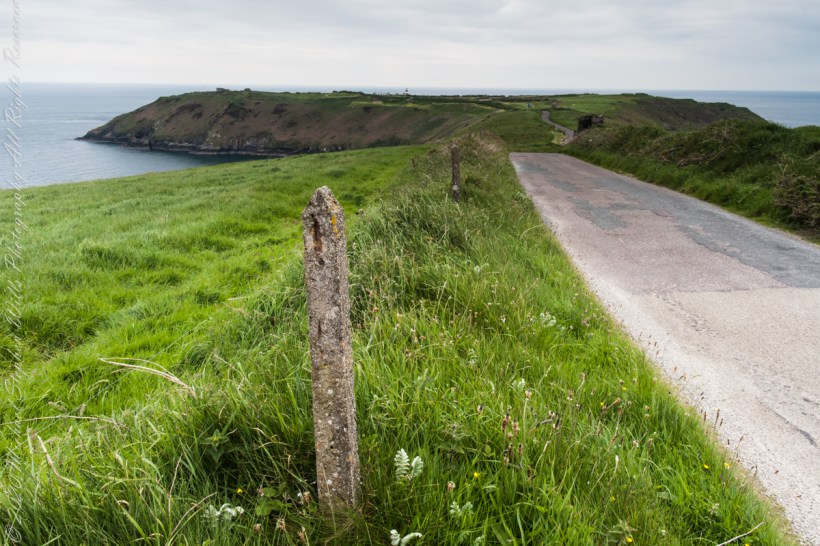
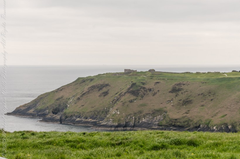
Our day of touring Kinsale and environs, the last day of May 2014, continues with our morning visit to the “Old Head of Kinsale.” Head is short for headland, a narrow strip of land projecting into the sea.
Road to the Old Head of Kinsale
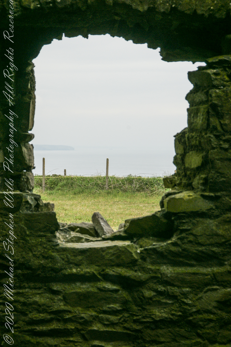
Old Head of Kinsale
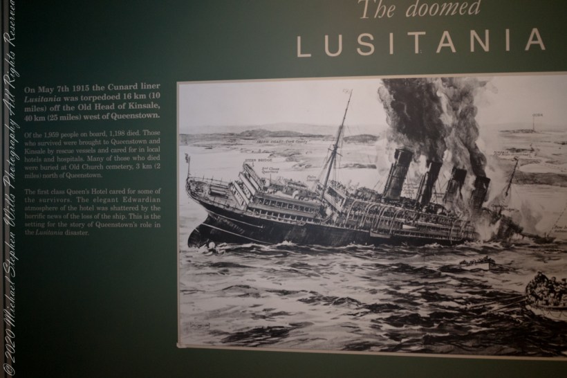
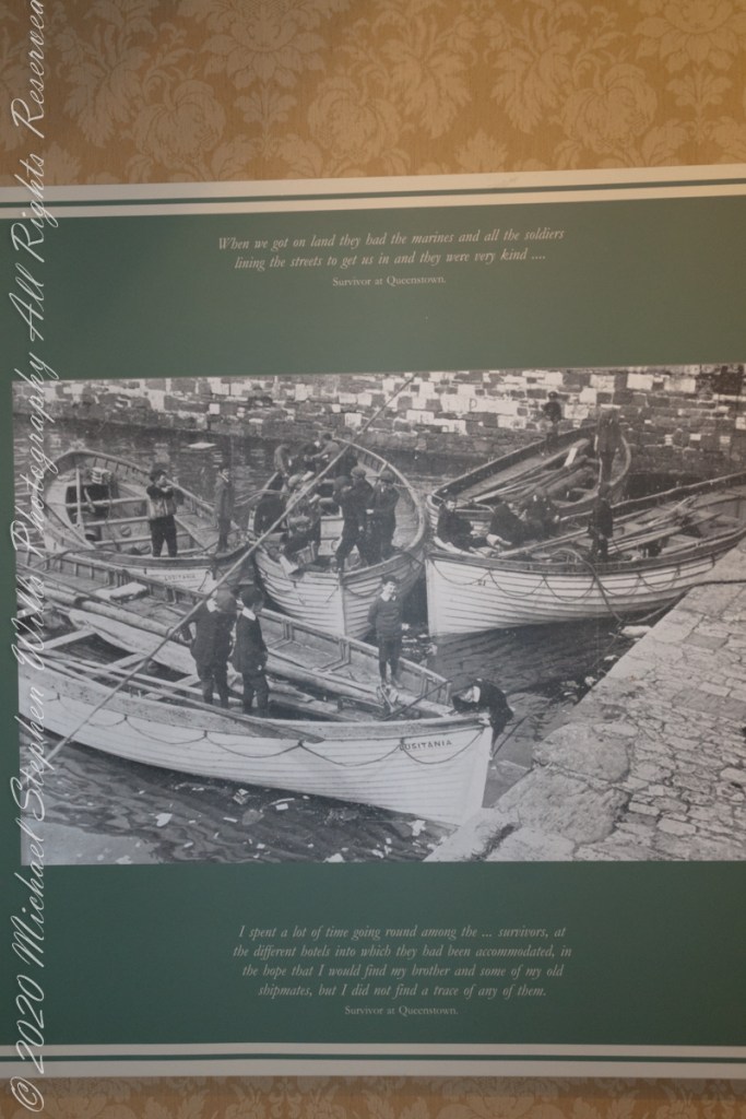
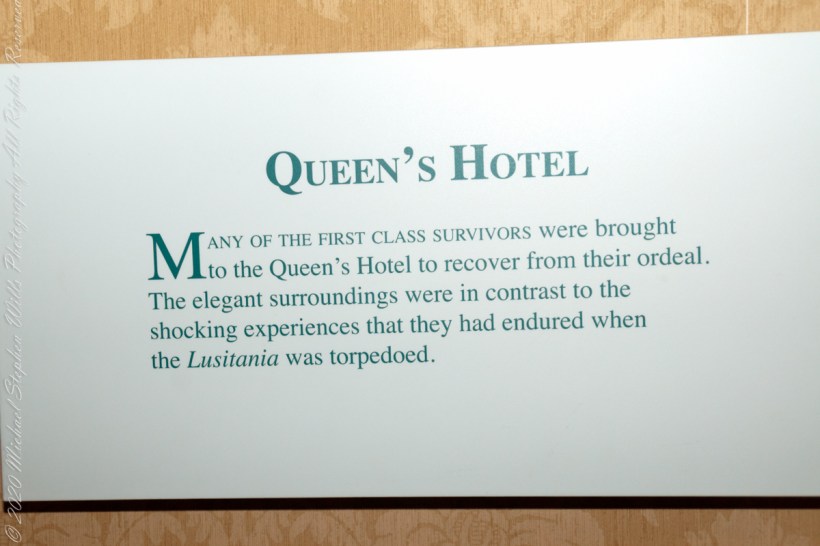
On May 7th, 1915 the Cunard liner Lusitania was torpedoed 16 km (10 miles) off the Old Head of Kinsale, 40 km (25 miles) west of Queenstown. Of the 1,959 people on board, 1,198 died. Those who survived were brought to Queenstown and Kinsale by rescue vessels and cared for in local hotels and hospitals. Many of those who died were buried at Old Church cemetery, 3 km (2 miles) north of Queenstown. The first class Queen’s Hotel cared for some of the survivors. The elegant Edwardian atmosphere of the hotel was shattered by the horrific news of the loss of the ship. This is the setting for the story of Queenstown’s role in the Lusitania disaster. –text from Cobh Heritage Center poster, see image below.
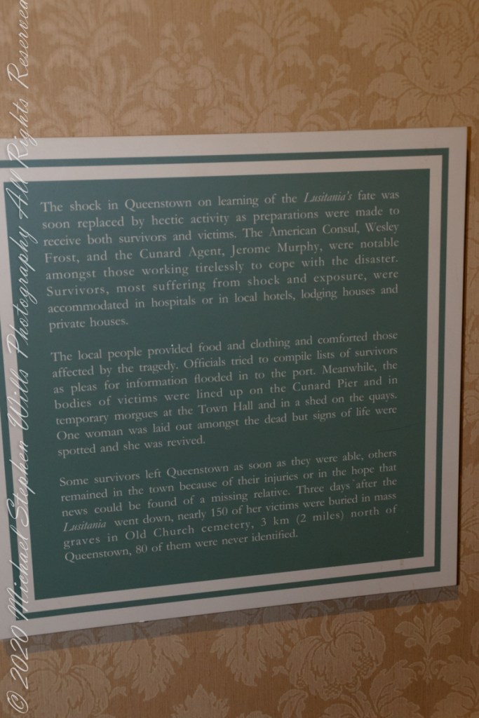
The Old Head is notable, in the contest of the Lusitania attack, for being the land closest to the incident. Cobh, then named “Queenstown”, was the focus of rescue operations. See text below, from a display of the Cobh Heritage Museum.
from Cobh Heritage Museum.
The Kinsale tower is just over nine meters high, with walls up to 80 cm thick. Records show a signal crew was in place in 1804 and the tower finished the following year, though severely affected by dampness. When Napoleon was defeated by Wellingtons forces at Waterloo, 1815. With the diminished threat these expensive installations were neglected. The 1899 Ordnance Survey map lists the site as being in ruins. During our 2014 visit the local community was renovating the tower and the work appears complete sometime before 2021.
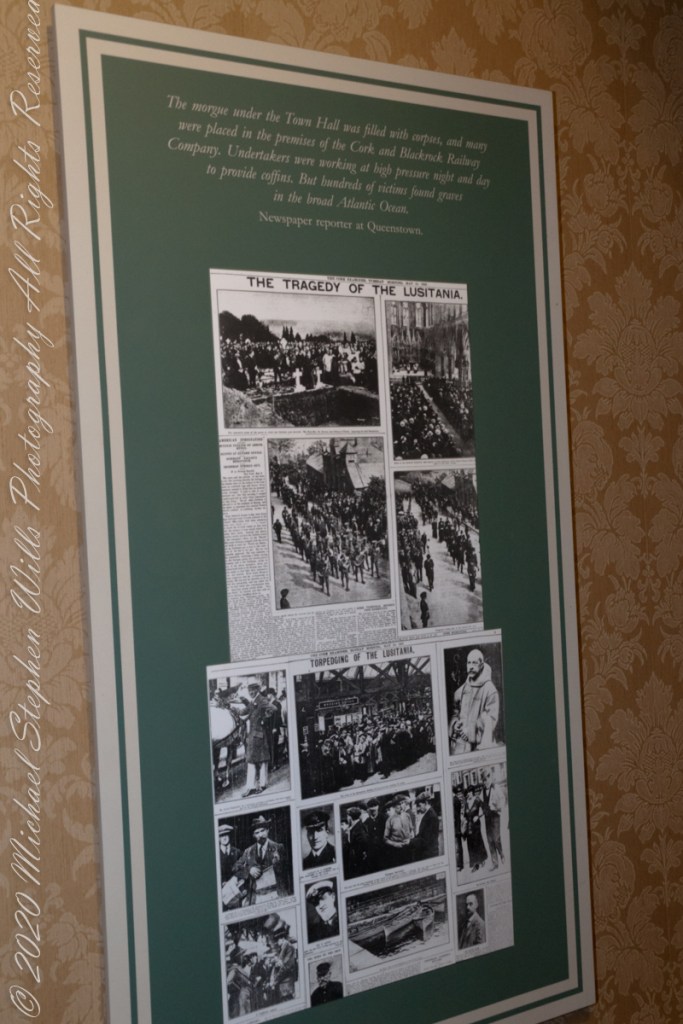
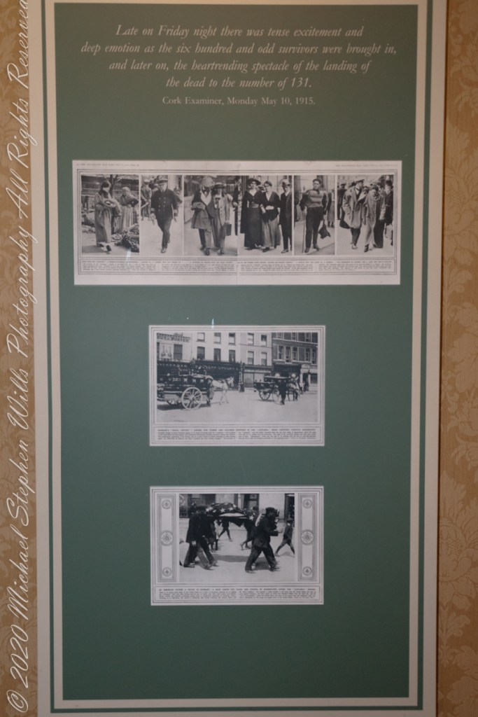
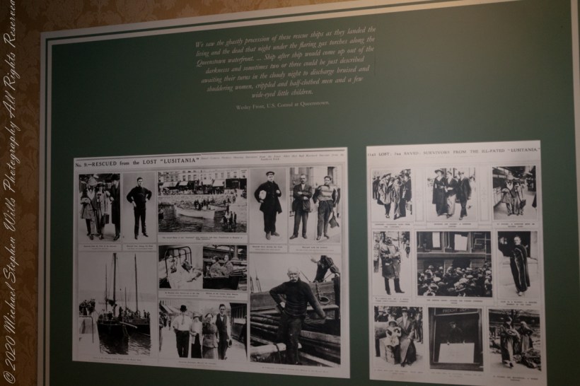
The morgue under the Town Hall was filled with corpses, and many were placed in the premises of the Cork and Blackstock Railway Company. Undertakers were working at high pressure night and day to provide coffins. But hundreds of victims found graves in the broad Atlantic Ocean. –Newspaper reporter at Queenstown. See images in the above gallery for more.
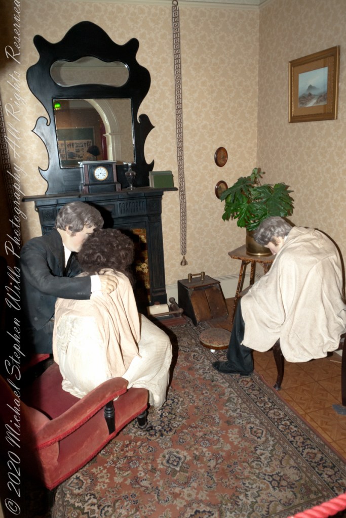
Cobh Heritage Center exhibit of survivor recovery, Queen’s Hotel
I did not see and/or recall much emphasis in the museum for pillorying Germany, after all a German U-boat was responsible. Curious, I did a Wikipedia search and found this text. The topic of Ireland, Germany and World War I is complicated.
On the afternoon of 7 May, a German U-boat torpedoed Lusitania 11 miles (18 km) off the southern coast of Ireland inside the declared war zone. A second internal explosion sank her in 18 minutes, killing 1,198 passengers and crew. The German government justified treating Lusitania as a naval vessel because she was carrying 173 tons of war munitions and ammunition, making her a legitimate military target, and they argued that British merchant ships had violated the cruiser rules from the very beginning of the war. The internationally recognized cruiser rules were obsolete by 1915; it had become more dangerous for submarines to surface and give warning with the introduction of Q-ships in 1915 by the Royal Navy, which were armed with concealed deck guns. The Germans argued that Lusitania was regularly transporting “war munitions”; she operated under the control of the Admiralty; she could be converted into an armed auxiliary cruiser to join the war; her identity had been disguised; and she flew no flags. They claimed that she was a non-neutral vessel in a declared war zone, with orders to evade capture and ram challenging submarines.
However, the ship was not armed for battle and was carrying thousands of civilian passengers, and the British government accused the Germans of breaching the cruiser rules. The sinking caused a storm of protest in the United States because 128 American citizens were among the dead. The sinking shifted public opinion in the United States against Germany and was one of the factors in the declaration of war nearly two years later. After the First World War, successive British governments maintained that there were no munitions on board Lusitania, and the Germans were not justified in treating the ship as a naval vessel. In 1982, the head of the Foreign Office’s American department finally admitted that, although no weapons were shipped, there is a large amount of ammunition in the wreck, some of which is highly dangerous and poses a safety risk to salvage teams.
T
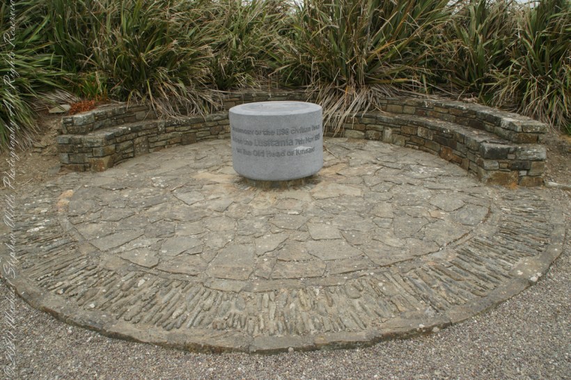
The original memorial to the Lusitania was unveiled on the 80th anniversary of the May 7th, 1915 sinking (May 7, 1995), Old Head of Kinsale, County Cork Ireland. The imemorial nscription reads “In memory of the 1198 civilian lives lost on the Lusitania 7th May 1915 off the Old Head of Kinsale.”
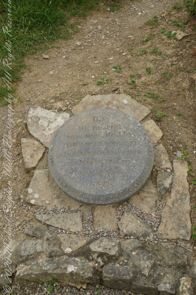
The inscription of the commemoration plaque accompanying the memorial reads, “This memorial was unveiled by Hugh Coveney D Minister of Defense and The Marine on 7 May 1995.” Around the edge of the medallion reads, “Brian Little Sculptor” “This (cannot read) donated by Lan and Mary Buckley”
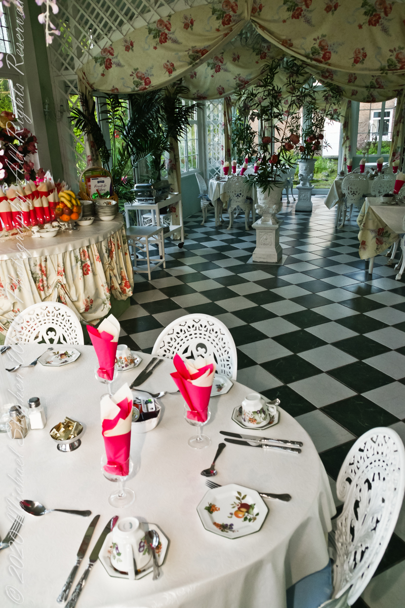
Our day of touring Kinsale and environs, the last day of May 2014, began with this elegant breakfast by Marantha House near Blarney, our base for County Cork.
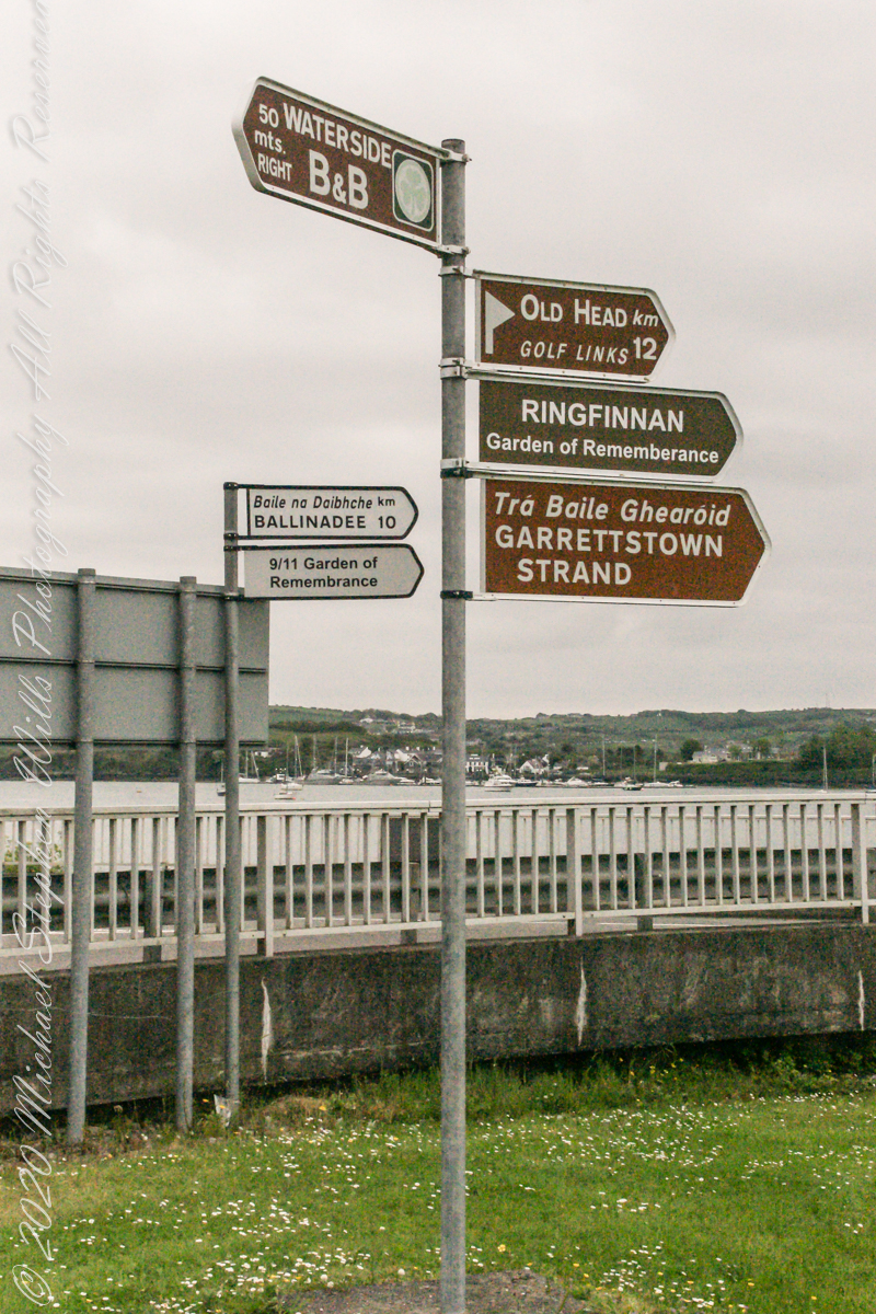
On the way to the Old Head of Kinsale. Located in Knocknacurra on the Kinsale side of Bridge Kinsale on R600. Looking toward the peninsula of Castle Park Village and James Fort. Coordinates 51°41’40.1″N 8°31’42.0″W
This tower, at the apex of the Old Head ring route, has extensive views. The next station at Seven Heads, to the southwest, is visible against the skyline on a clear day. These are two of the 81 stations planned for this signaling system implemented in the first years of the 19th century when a French naval invasion was a possibility.
The Kinsale tower is just over nine meters high, with walls up to 80 cm thick. Records show a signal crew was in place in 1804 and the tower finished the following year, though severely affected by dampness. When Napoleon was defeated by Wellingtons forces at Waterloo, 1815. With the diminished threat these expensive installations were neglected. The 1899 Ordnance Survey map lists the site as being in ruins. During our 2014 visit the local community was renovating the tower and the work appears complete sometime before 2021.
Number six of six from the Kerry County side on the descent Healy Pass, R574. Here we move away from, say goodbye (hopefully, for now) to these marvelous views, our first sight of County Kerry.
Two more strange, conical hills come into view, repeating those in the distance. These have a long story.
Beara Peninsula, Coolcreen townland, County Kerry, Republic of Ireland.
You can easily view a higher resolution versions by clicking on the photograph to open a browser tab.
Click photograph for a larger version.
Copyright 2021 Michael Stephen Wills All Rights Reserved
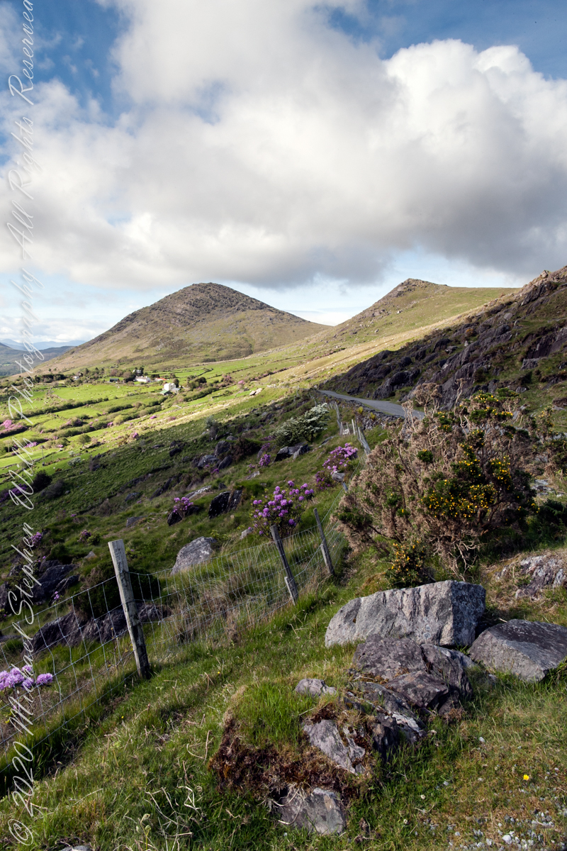
Number three of six from the Kerry County side on the descent Healy Pass, R574. I enhanced view three to level the horizon. A side by side comparison is provided, below.
Beara Peninsula, Coolcreen townland, County Kerry, Republic of Ireland.
You can easily view a higher resolution versions by clicking on the photograph to open a browser tab.
Click photograph for a larger version.
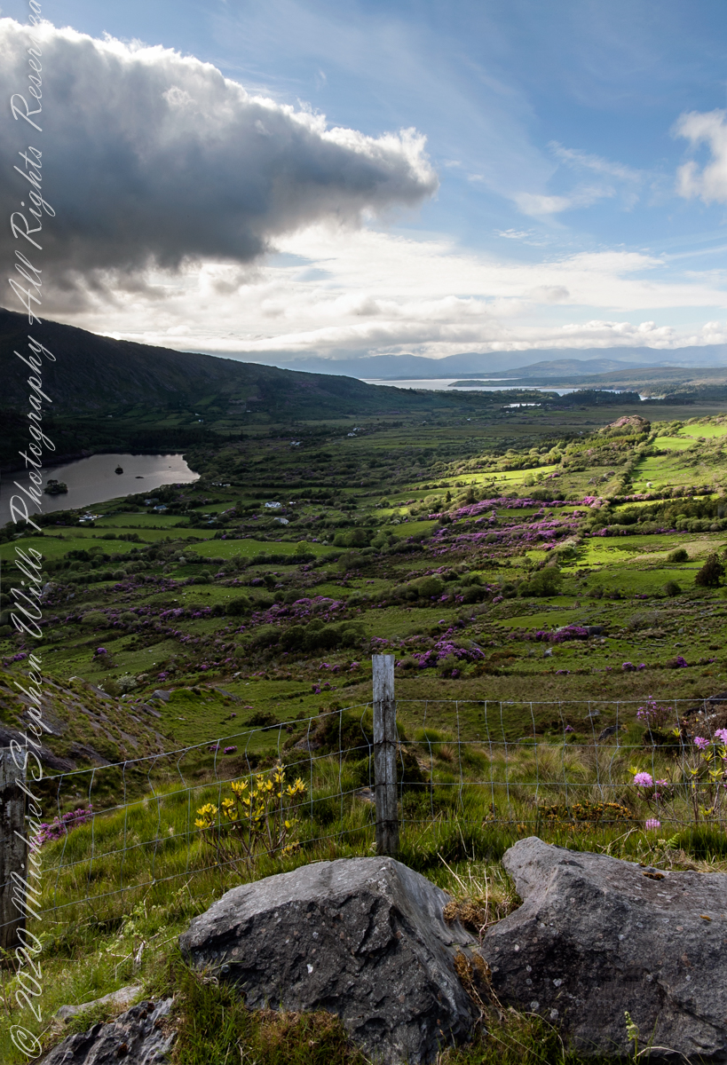
Visible from this point on R574, Healy Pass, is Glenmore Lake, the Rivers Drunminboy, Glanstrasna flowing into a sheltered inlet of the Atlantic Ocean. In 1911, the Irish National Census lists nineteen (19) persons of five (5) families listed with the names O’Sullivan, Sullivan and Shea. From this view this is a puzzle until the map is examined. The land transitions from this rock to a steep, then leveling slope down to Glanmere Lake and a stream running from the heights with plenty of reasonably level, fertile acreage. There is a glimpse of a lake. Like many of the Irish place names, Glenmore Lake has a connection to the Irish Language name, Loch an Ghleanna Mhóir. Roughly translated the name means Large Lake of the Glen. The names in use today, in English, are derived from the sounds of the Irish. It happens the Irish Ghleanna sounds link Glen (or in another version, Glan, roughly the same). Beara Peninsula, Coolcreen townland, County Kerry, Republic of Ireland.
Copyright 2021 Michael Stephen Wills All Rights Reserved
Number four of six from the Kerry County side on the descent Healy Pass, R574. Here I turn the camera on the Manfrotto studio tripod with hydrostatic ball head to the original view, a little less lit with a better leveling of the horizon.
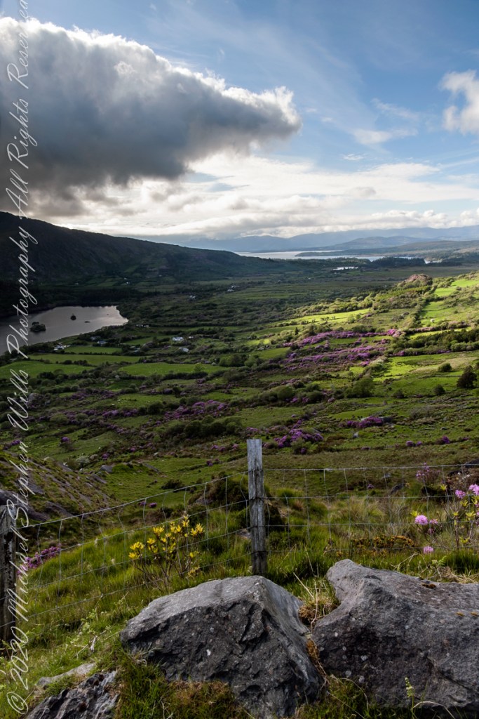
Number three of six from the Kerry County side on the descent Healy Pass, R574. I turned the camera a few more degrees into the gathering darkness, under the cloud, for an almost complete view of Glanmore Lake.