Click Me for the complete story
Today I spiffed up the Google Maps entry for this spot. Click the link, above, for more of this story.
Copyright 2023 Michael Stephen Wills All Rights Reserved
Great Uncle Charles Wills (repost)
Today I spiffed up the Google Maps entry for this spot. Click the link, above, for more of this story.
Copyright 2023 Michael Stephen Wills All Rights Reserved

Finding Grandfather’s Final Resting Place
When I was a young adult Mom told me Grandfather Wills was buried in the Bronx. James Edward Wills died when my father was very young and they were poor, living in tenements on the upper West Side of Manhattan April 1916.. Looking through Dad’s papers after both he and Mom were gone, I found the grave receipt: “Saint Raymond’s Cemetery, Westchester, New York.” James Wills, born April 1877, the youngest of six children of George Wills and Margaret McCambridge, who were 43 and 38, their place of residence two years later cited in the 1880 Federal Census as Shamong, New Jersey. Today, Shamong Township is part of New Jersey Pinelands National Reserve. Atsion, the Iron Furnace town where James’ Grandmother Ann McCambridge (nee Milley) worked as a cook, is in Shamong Township.
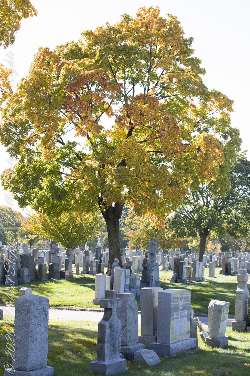
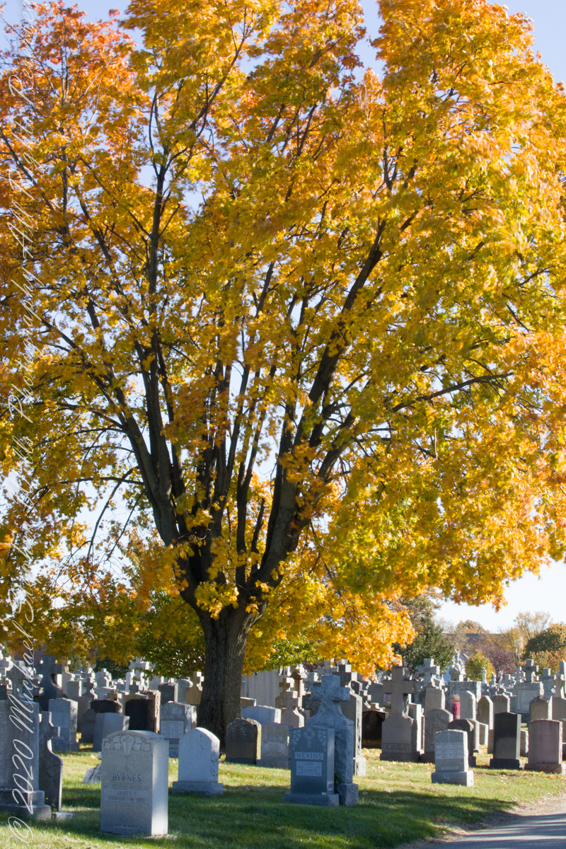
Finding and researching the grave receipt is what began my adventures in genealogy. What was, in 1916, Westchester is now the Schuylerville section of Bronx county, a borough of New York City. Saint Raymond’s Parish, still going strong, acquired more consecrated land for burials with now an “Old” and “New” cemetery separated by the confluence of interstates 95, 295, 678 including the approaches to the Whitestone and Throgs Neck Bridges, the superstructures of which are visible from the “Old” cemetery.
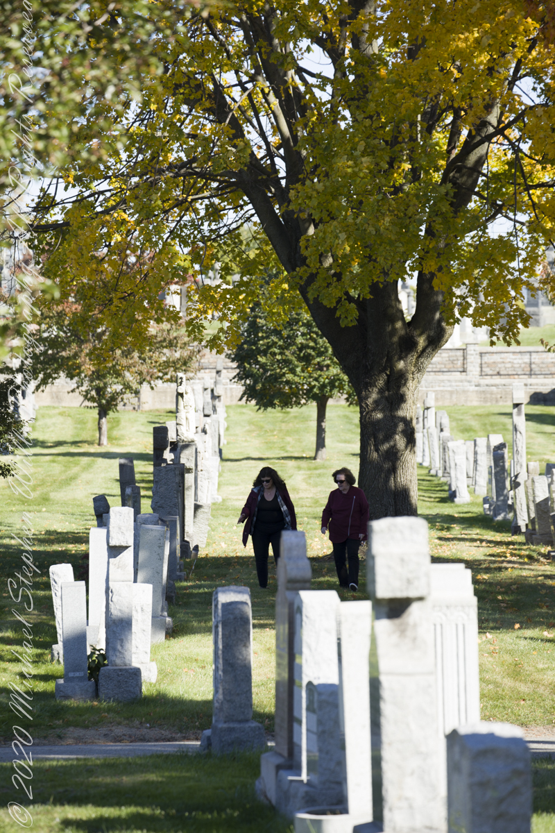
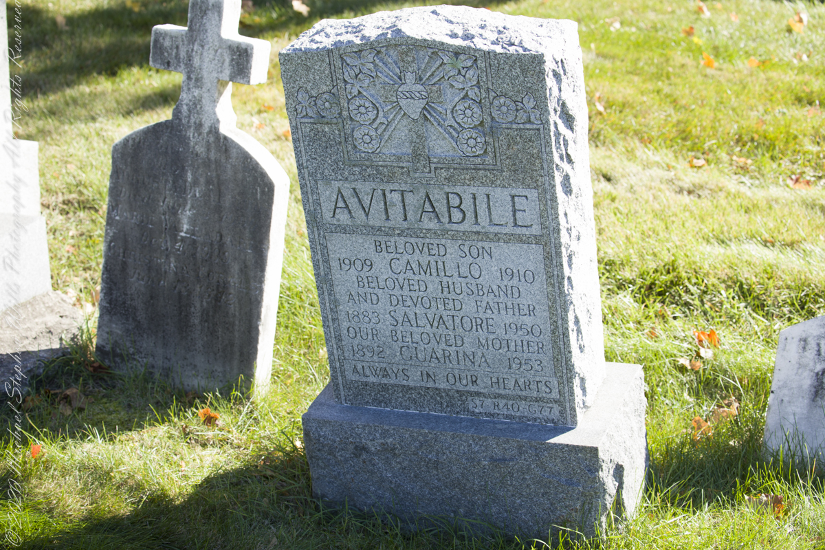
Having sorted out these details, I approach my cousin Mary at the October 2021 engagement party of my niece where we made arrangements to find Grandfather Wills’ final resting place the following month. On Wednesday, November 10th, Mary’s husband Peter drove us over the George Washington Bridge, through the incredible traffic of the Cross Bronx Expressway (a funny name for this moving parking lot, bumper to bumper trucks), to Schuylerville. We navigated to the “Google Maps” push pin I placed next to Section 7. Google Maps even has street views of the cemetery, in retrospect the view of Section 7, Ranges 35 – 51, includes grandfather’s grave.
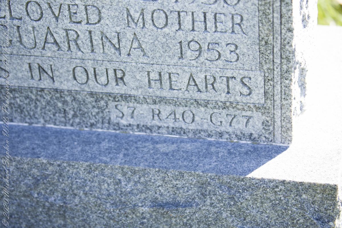
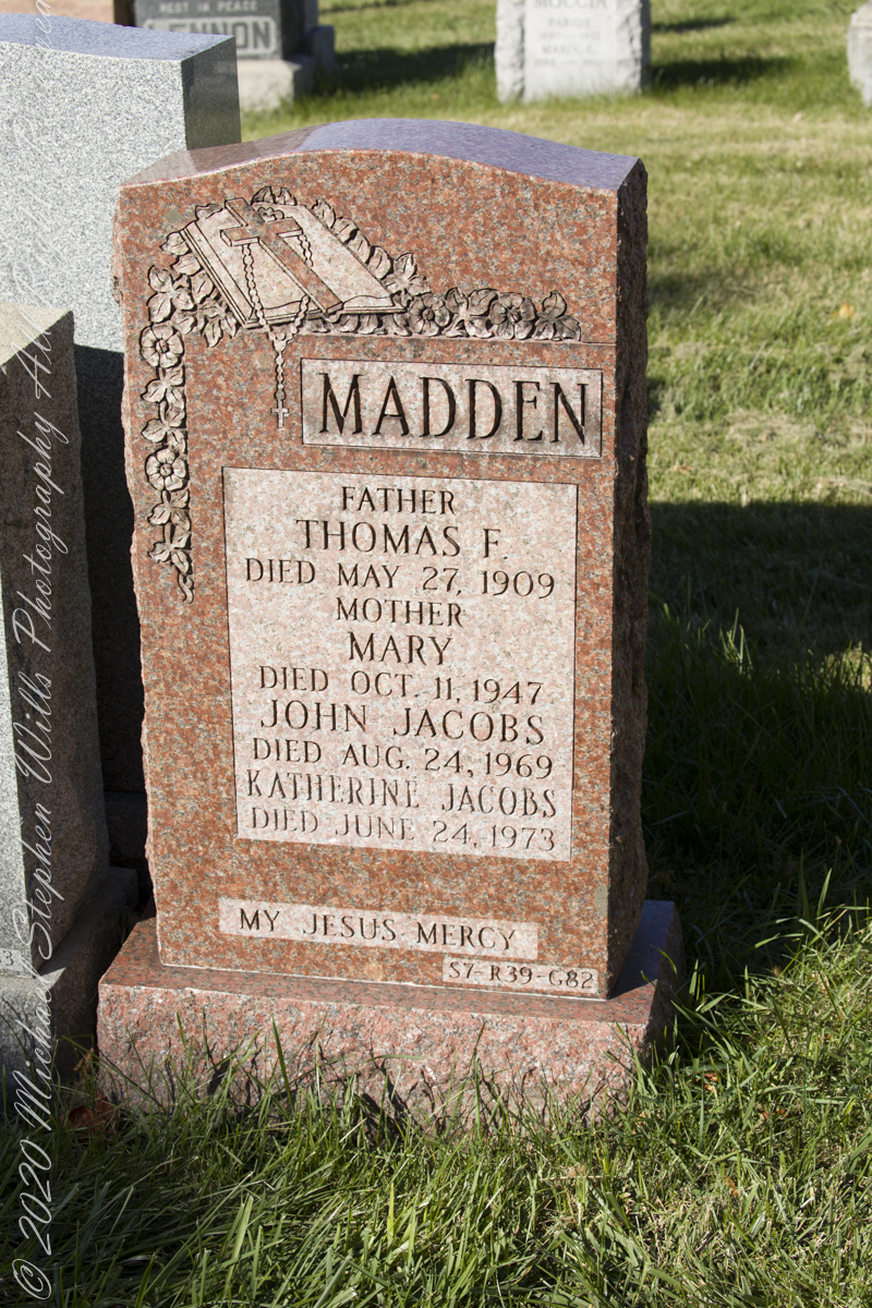
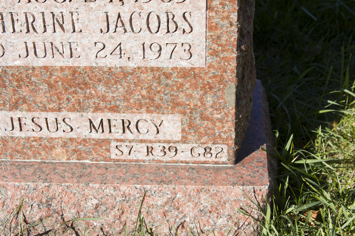
We worked together, walking the rows, reading headstone inscriptions, on the expectation of finding Grandfather’s name without success. Peter and I took to counting the rows to find number 41, with success. With less success counting the headstones and spaces (unmarked graves) to find number 82. At the same time, Pam and Mary searched. I used the “Find A Grave” website to look up headstones in section 7, row 41 and found the only location provided was “Section 7.” I also called the cemetery office where they were most helpful. There is NO record of James Wills.
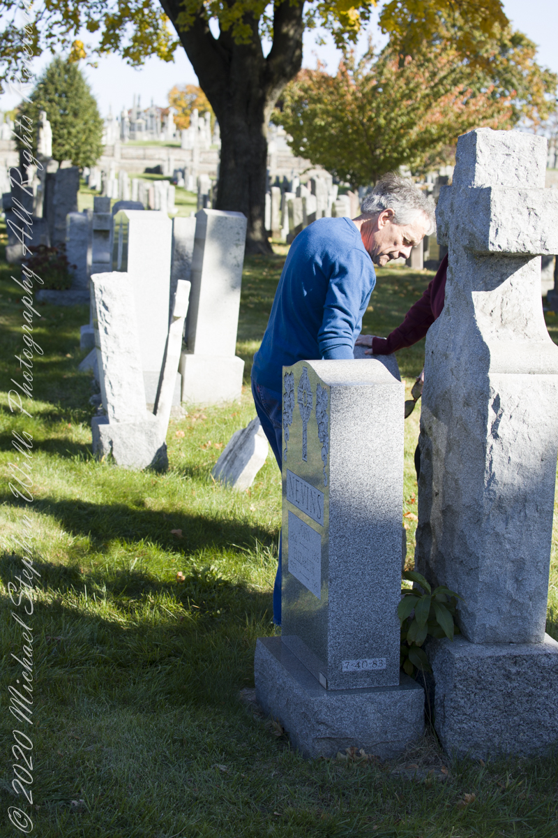
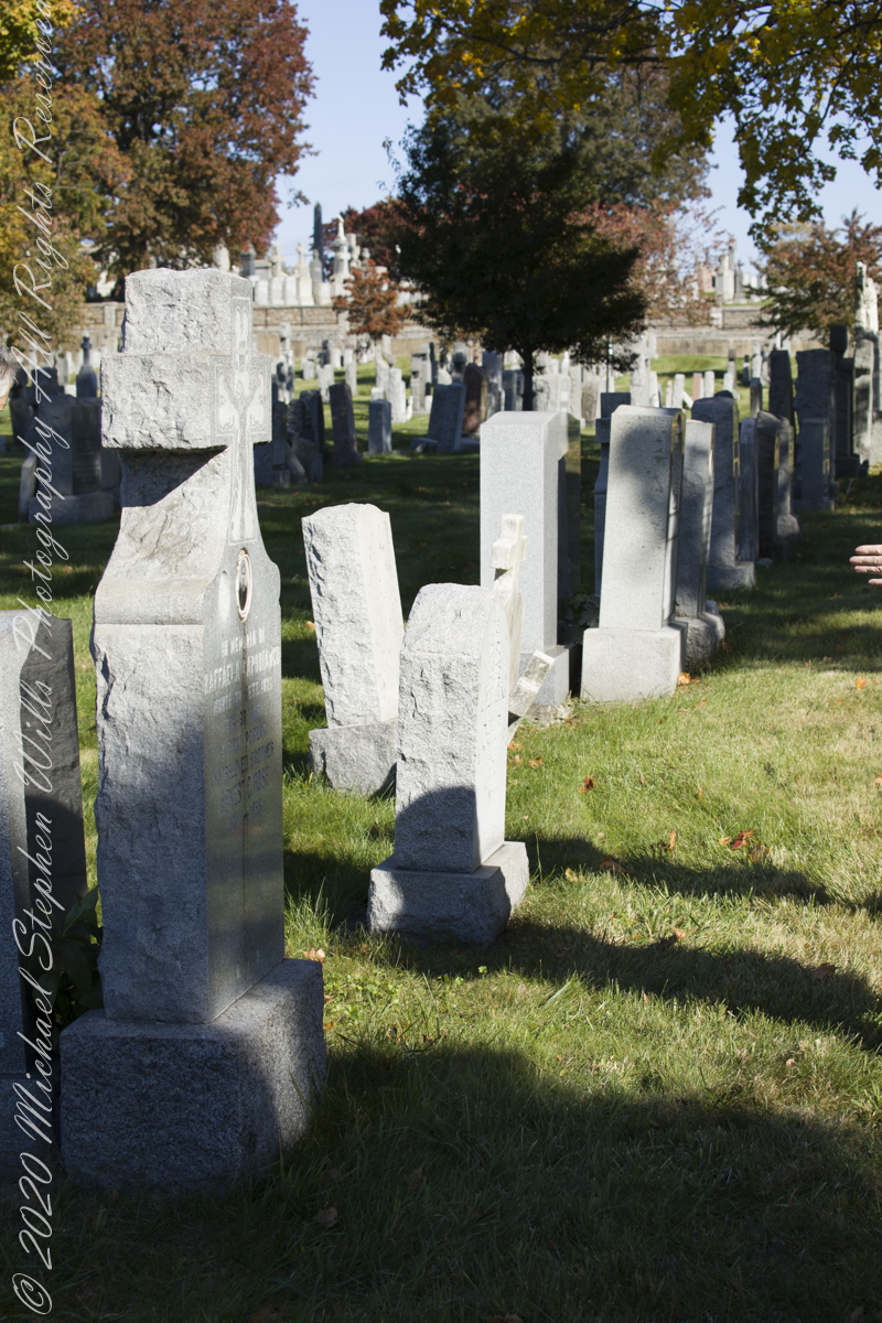
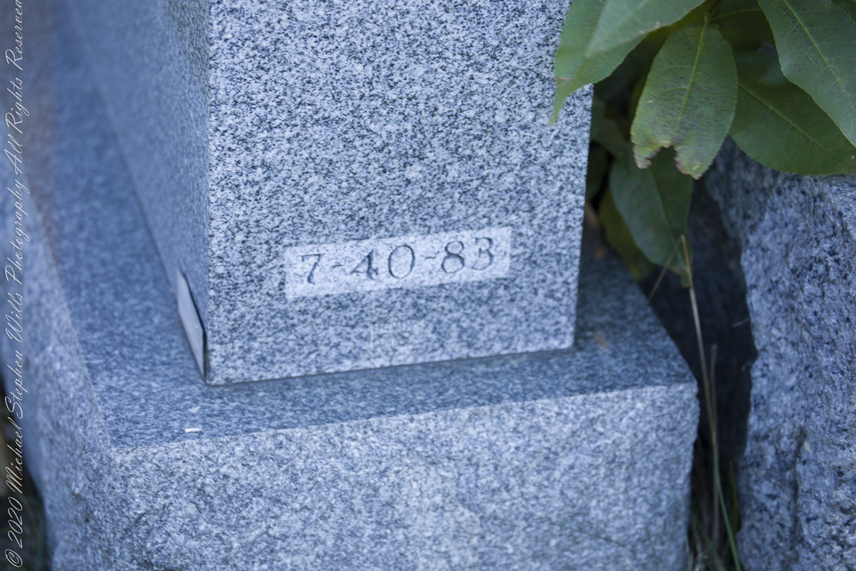
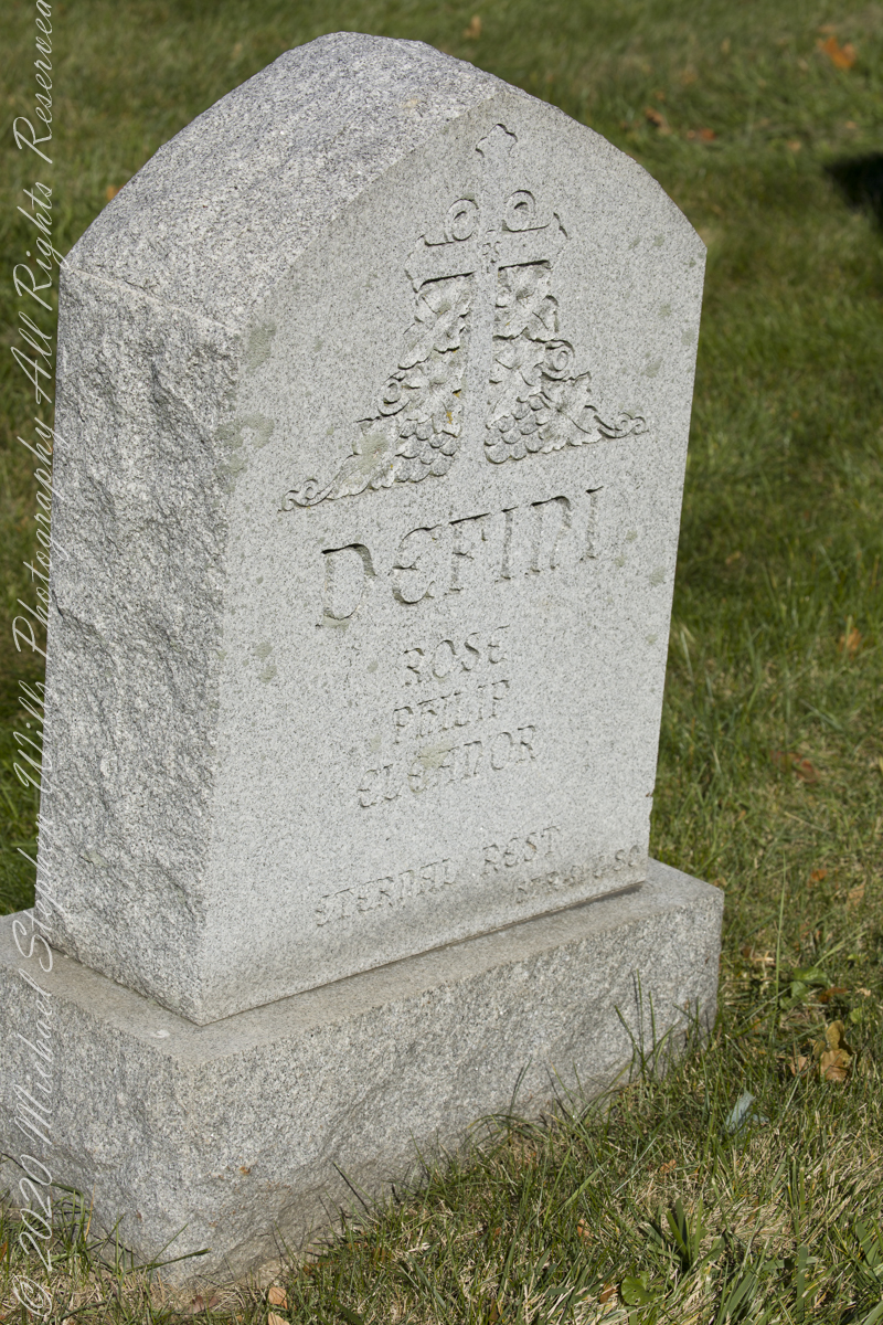
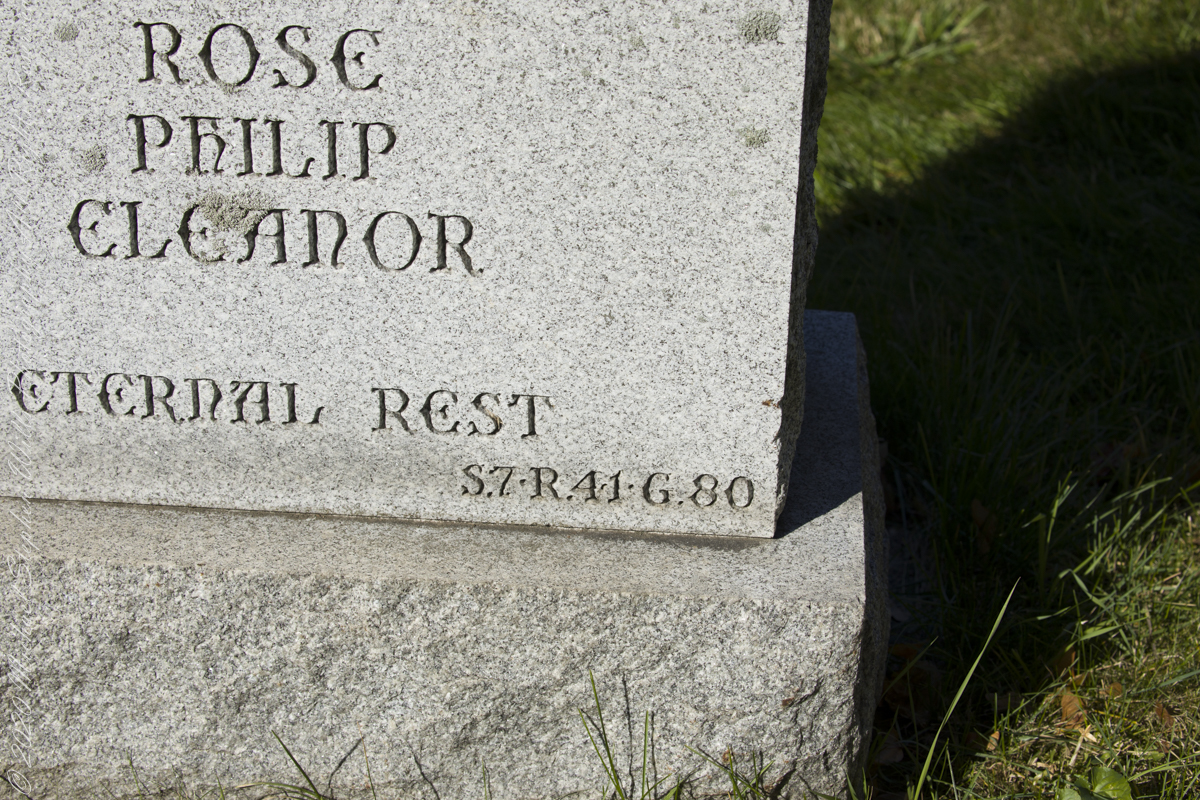
Then, Pam noticed some headstones inscribed with the exact location, Section, Range (Row) and Grave. This was the key. Here are the headstone references that pinpointed Grandfather Wills’ final, unmarked, resting place.
In the following photograph I am on the right with wife Pam. Cousin Mary next to her husband Peter on the right, Mary is standing on grave 82.
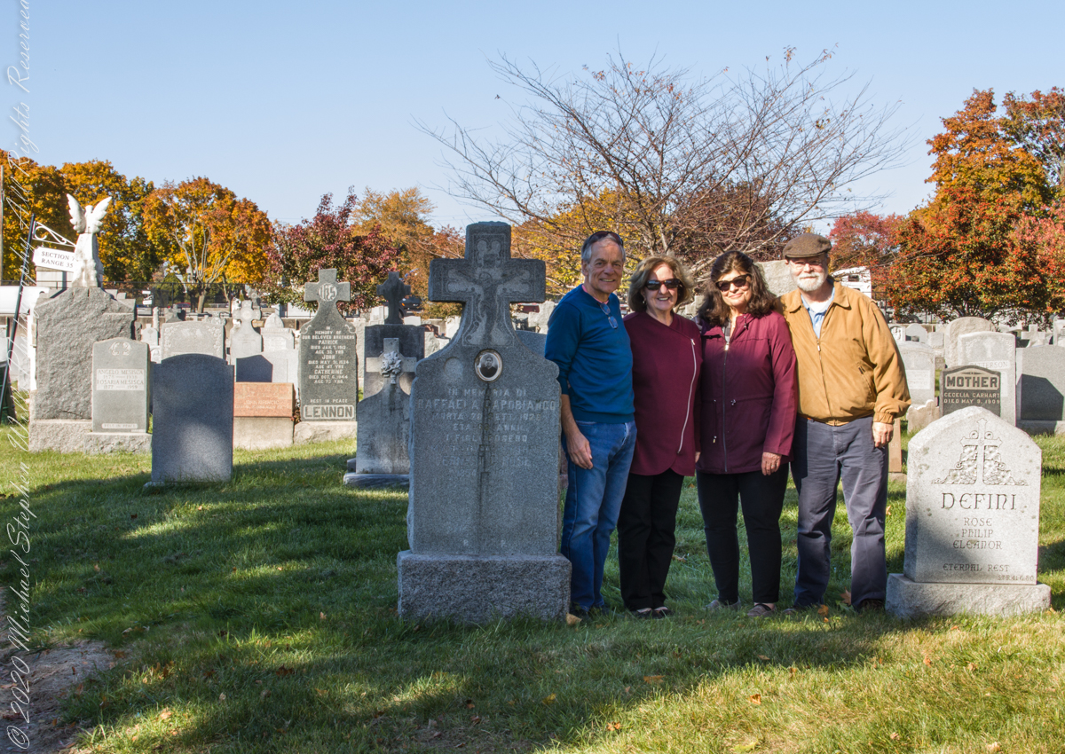
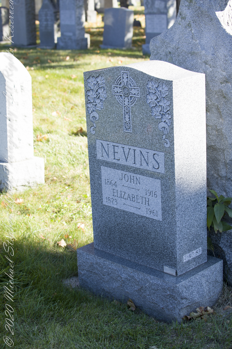
James Edward Wills unmarked grave, Section 7, Range (Row) 41, Grave 82, Old Saint Raymond’s Cemetery, Balcom Avenue, Schuylerville, Bronx, New York. Wednesday, November 10, 2021. Here we are facing south / southeast into Section 7, James Wills’ unmarked grave is to the left and just behind Nevins headstone (Row 40, Grave 83).

What is a Collier?
Here my exploration of Wharton State Forest, Pitch Pine Forest III, branches to the genealogical exploration of this landscape as my sister, Theresa and I, proceed along the humped, pitted sand road Goodwater through the wilderness to emerge in Batsto Village, a recreation of lives that touched my great great grandparents, James and Ann McCambridge among them. Ann saved money earned as a cook for Atsion furnace, the historical site at the start of the road to Quaker Bridge. Her husband James worked as a collier, supplying fuel for the iron furnaces at Atsion and Batsto, among other enterprises. During our Batsto Village visit we found these reproductions of charcoal clamps.
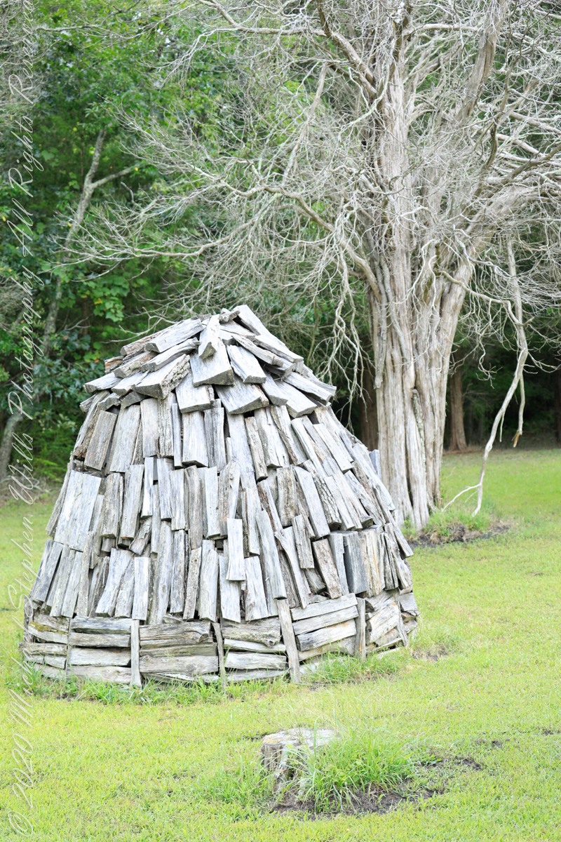
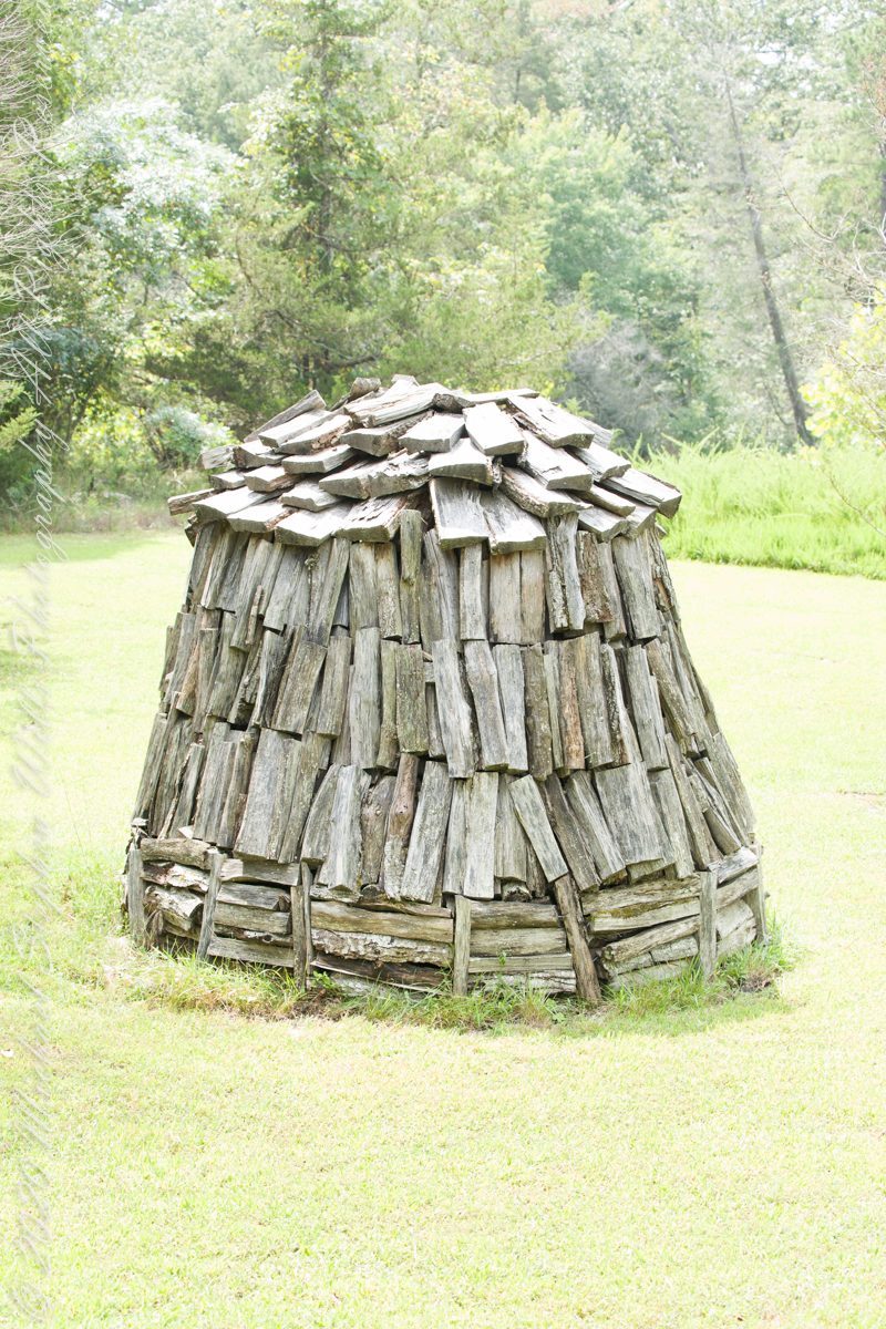
Since earliest times charcoal was used for cooking and heating. It was the best heat source for metal furnaces. Entire deforested regions are attributed to the demand for charcoal. Thomas Jefferson experimented with charcoal clamp designs, modifying air flow from the base.
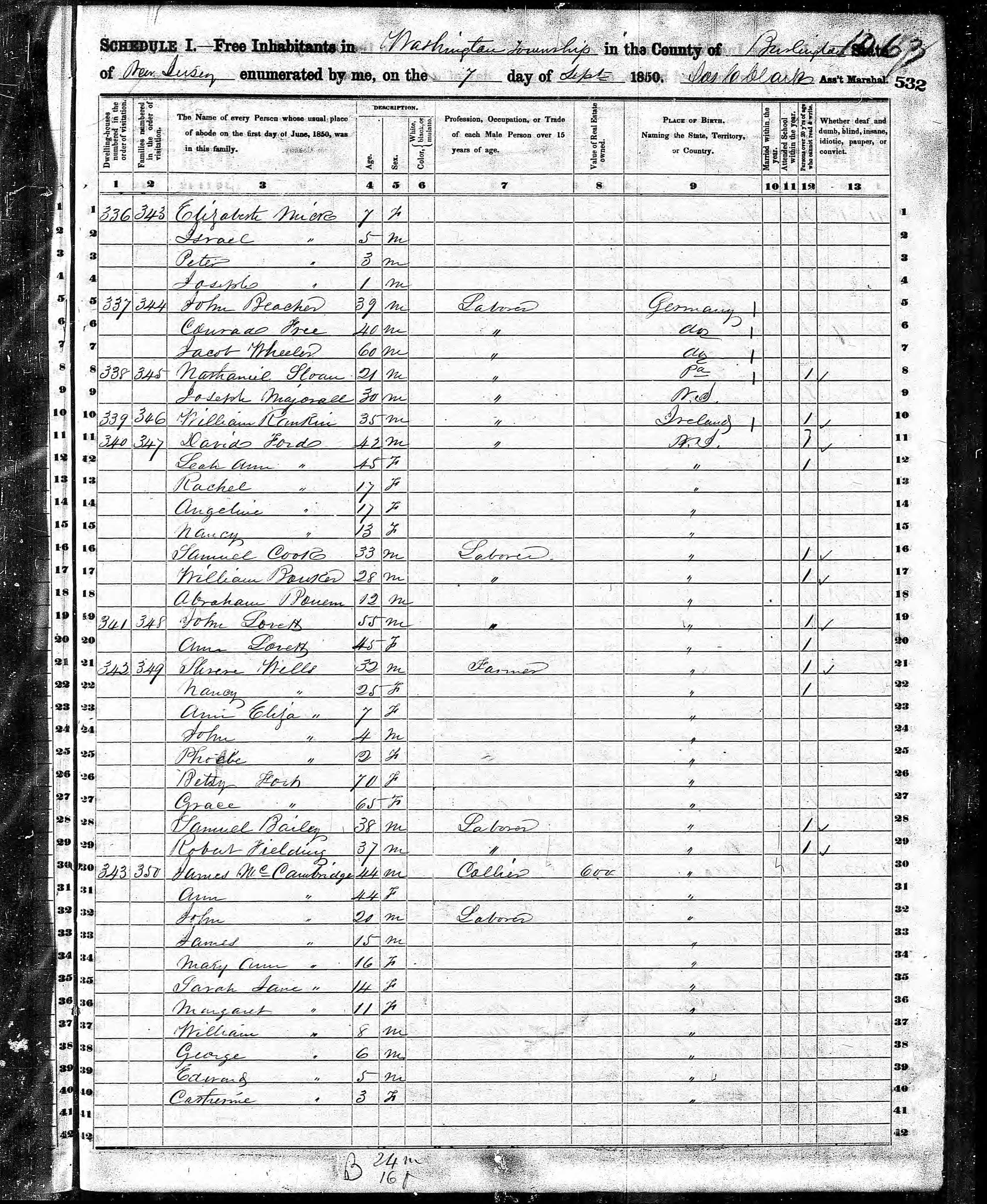
James and Ann lived on the land that provided a livelihood, enough to support themselves and nine (9) children. From September 7, 1850 is the US Census for this family of my second great grandparents. Great Grandmother Margaret was 11 years. James is listed as a Collier, the value of Real Estate owned was 6,000 (a fortune for the time).
Like his wife Ann, James had a savings account…..
Copyright 2021 Michael Stephen Wills All Rights Reserved
Road to Batsto
Leaving the jeep on the west side of Quaker Bridge, I walked over to inspect the structure and poke around the other side, carrying a Canon 5d Mark IV (camera body) / EF 70 – 300 mm f/4-5.6 L IMS (lens), shooting as I walked. My sister Theresa and Maxie, a little white dog, lagged behind taking in the surroundings. Here they are, in shadow, on the west side.

My work on the east side was shared in previous posts, “Pinelands Connections VIII,” I and II “Around Quaker Bridge,” and I and II “Pitch Pine Forest,” work interrupted by the sound of an approaching engine, a Humvee came into view. I waved my arm up and down, a sign to slow down, pulling alongside the driver looked up with dead eyes, no element of recognition of a fellow human, as I explained my sister was on the bridge. A stink of unfamiliar hydrocarbons, diesel fuel?, rose through the heat as they pulled forward with no acknowledgement of my request. Thankfully they slowed down as Theresa, Max in her arms, said, “hi.”
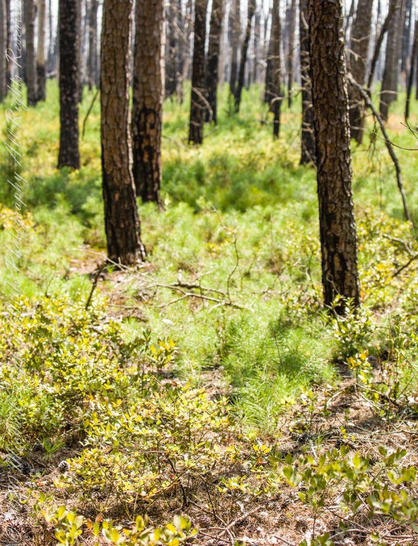
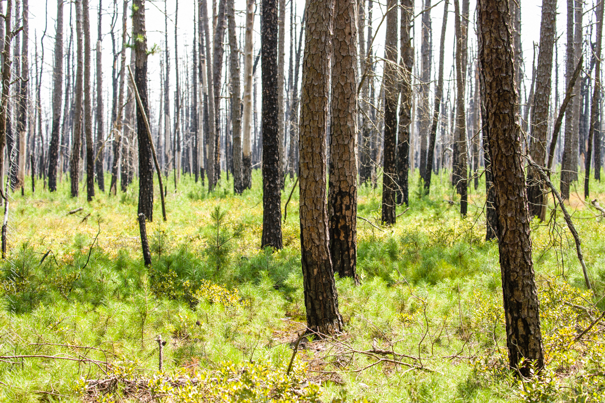
Multiple roads converge from all directions on Quaker Bridge, using GoogleMaps (surprising these unimproved, “jeep” sand roads were listed) I chose Goodwater Road as a route to Batsto Village, on the southern side of Wharton State Forest. The 6.1 mile road follows the east bank of Mullica River at a distance, a very rough passage through ancient Pitch Pine forest. Here are photographs of the enormous capacity of the pines to regrow after fire. Note a thick seeding growth among the mature pine trunks, lower portions fire blackened.
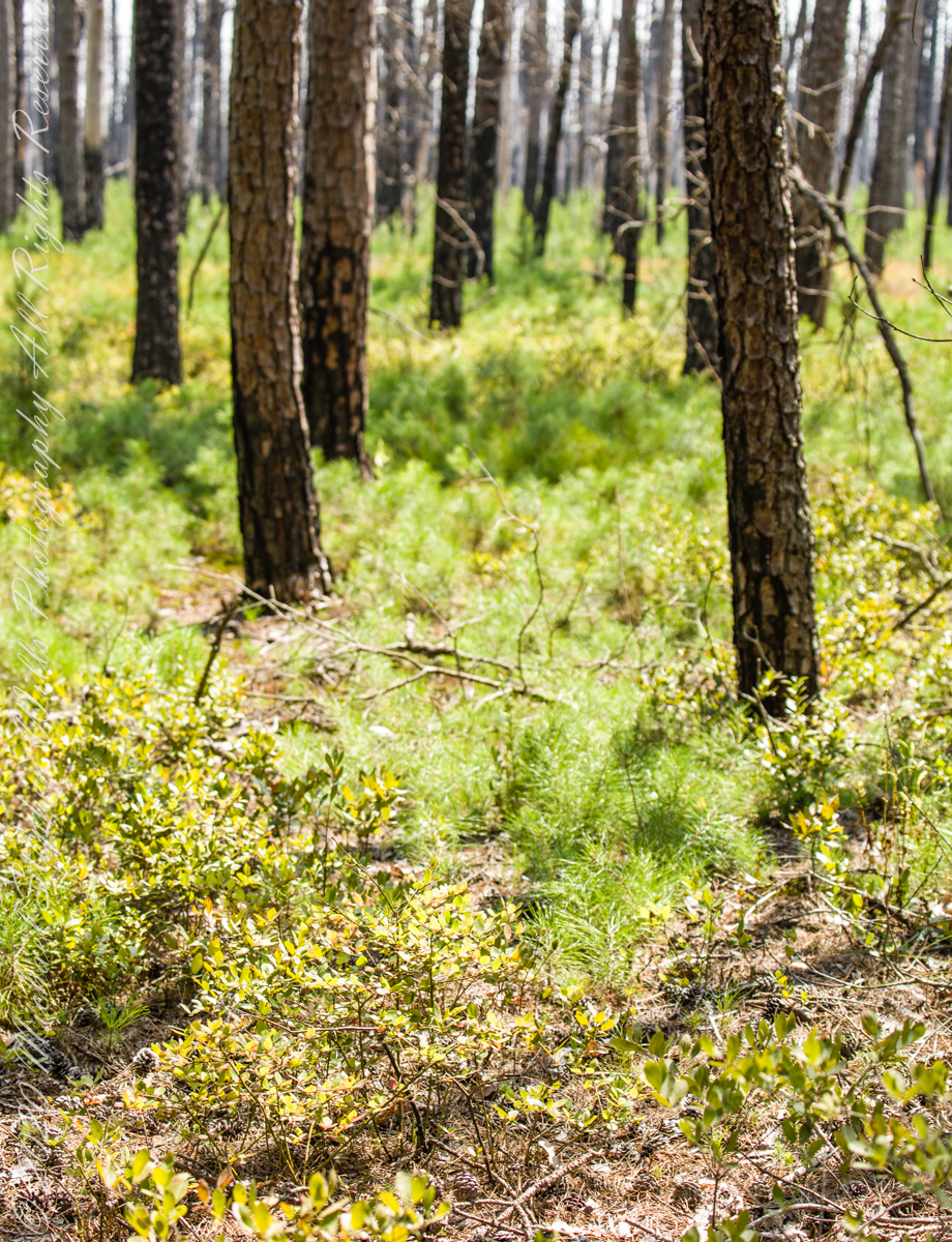
Copyright 2021 Michael Stephen Wills All Rights Reserved

A presence today
“Driving along a sand road between the vanished town of Calico and the vanished town of Munion Field, we passed a house that was so many miles from any other house that Fred said, with evident admiration, “He got well in away from everybody, didn’t he?” Fred made a similar remark every time we passed a house or cabin that was particularly deep and alone in the weeds. Getting — or staying — way from everybody is a criterion that apparently continues to mean as much to many of the people in the pines as it did to some of their forebears who first settled there. Tories, for example, fled into the pines during the American Revolution. People with names like Britton and Brower, loyal to the King, and sometimes covered with feather and tar, left their homes in colonial cities and took refuge in the Pine Barrens. Also, during the eighteenth century, when the farmlands of western New Jersey were heavily populated with Quakers, the Pine Barrens served as a catch basin for Quakers who could not live up to the standards of the Quaker code….” From The New Yorker magazine, November 26, 1967, “Profiles, The Pine Barrens I” creative non-fiction by John McPhee.
……continued from “Pinelands Connections II.
Vanished like the towns of Washington, Calico, Munion Field are the reasons that led to the union of the Quaker George Wills and Mary Dellett, daughter of James, emigrant from Northern Ireland. It is reasonable to surmise George, separated from the Quakers, sought refuge in the pines as a young man.
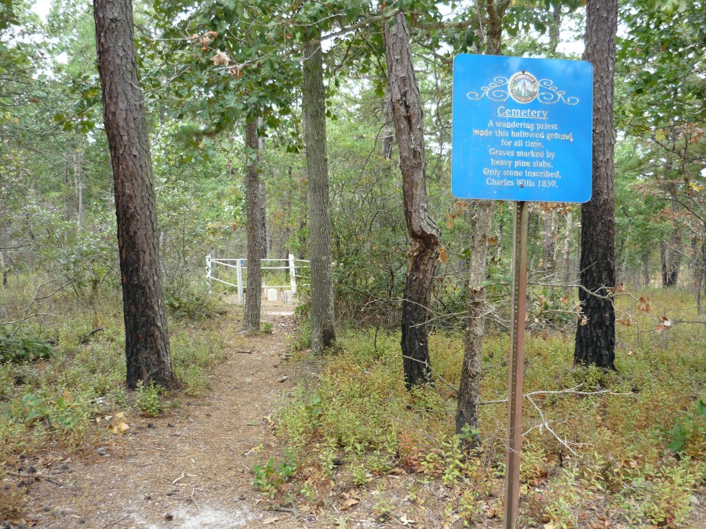
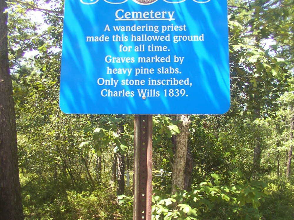
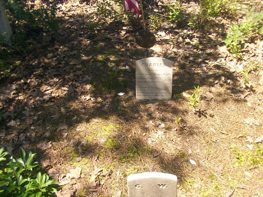
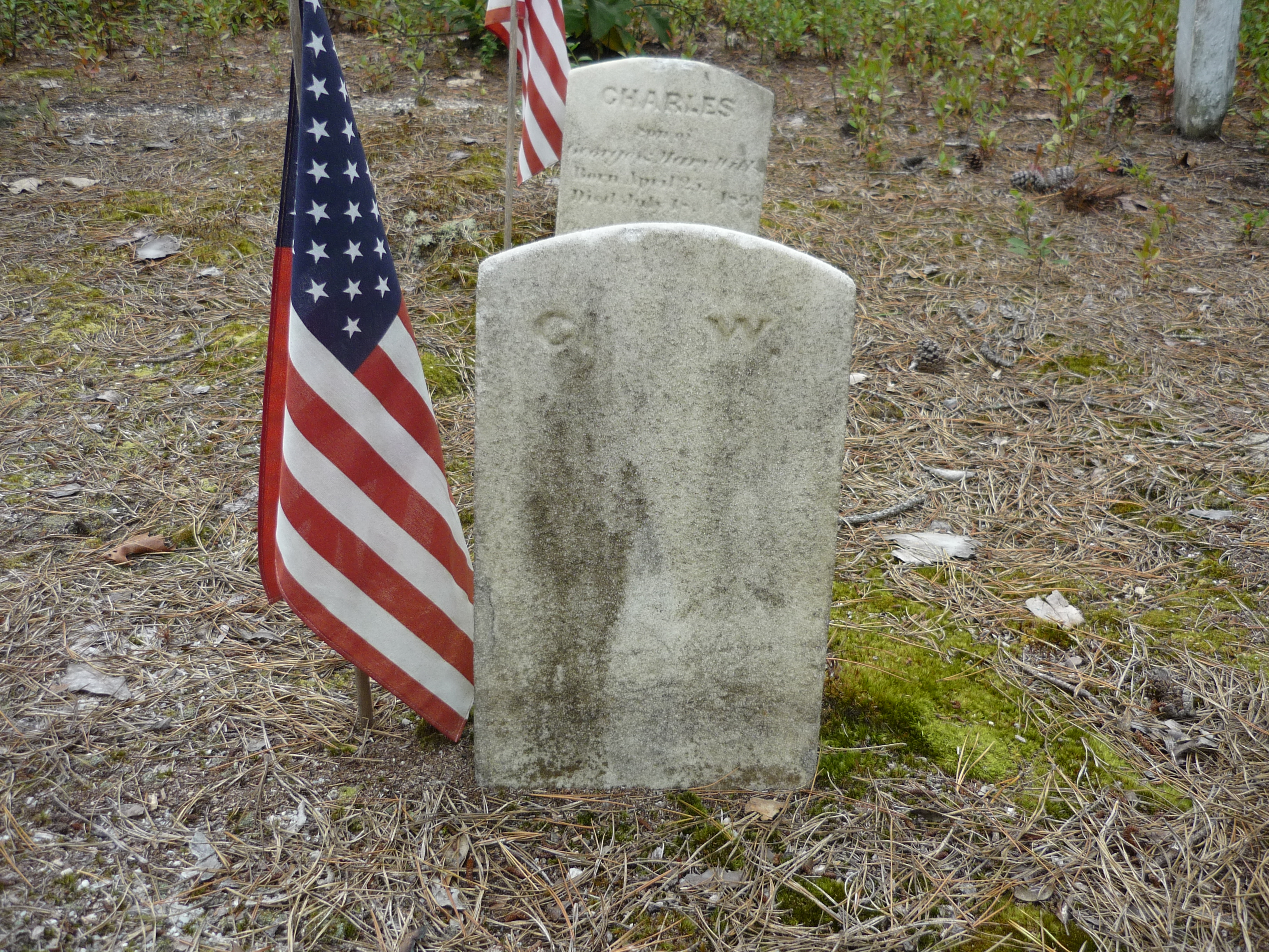
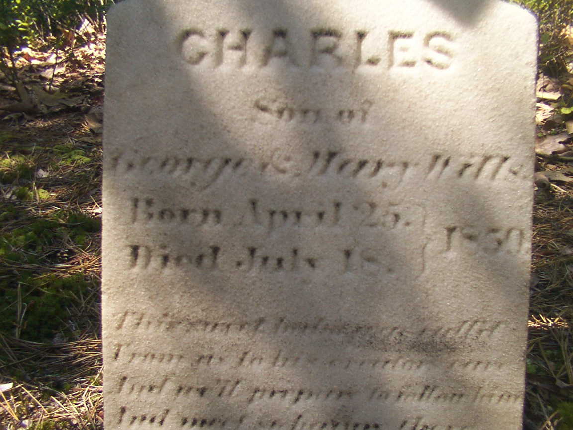
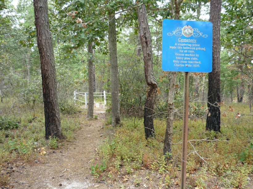
We can tease grief and loss from the records and landscape, When Joseph C. Clark visited George and Mary on August 24, 1850 to record the persons living there, if the U.S. Constitution prescribed the recording of the grief he experienced, the record would show Charles missing from the list. Follow the sand path, “Eagle Road” three miles north where he lays in the ground of the family cemetery, having passed just days before the 1850 census was taken.
The loss of a cherished presence can be inferred from the use of precious marble to mark his resting place. The heavy pine slabs of his companions long since vanished.
As with the Wills Hotel, the Wills Family Cemetery is best found through global coordinates: 39°45’49.7″N 74°34’01.4″W
Copyright 2021 Michael Stephen Wills All Rights Reserved
