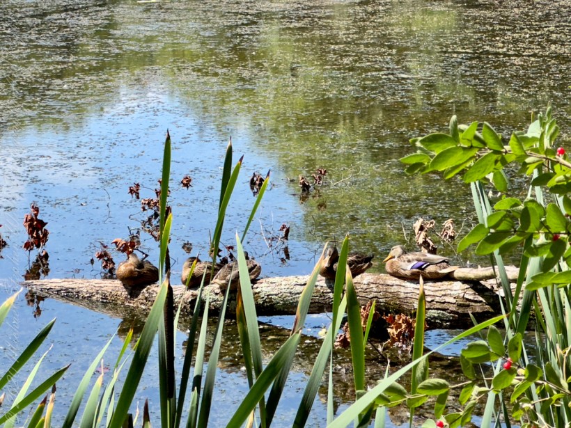
Two species of wild ducks rest on a fallen tree trunk.
That is a female Wood Duck (Aix sponsa) on right.
Wood Ducks mainly eat berries, acorns, and seeds, but also insects, making them omnivores. They are able to crush acorns after swallowing them within their gizzard.
August 2023, Buttermilk Falls New York State Park, Ithaca, Tompkins County, New York.
Copyright 2023 Michael Stephen Wills All Rights Reserved
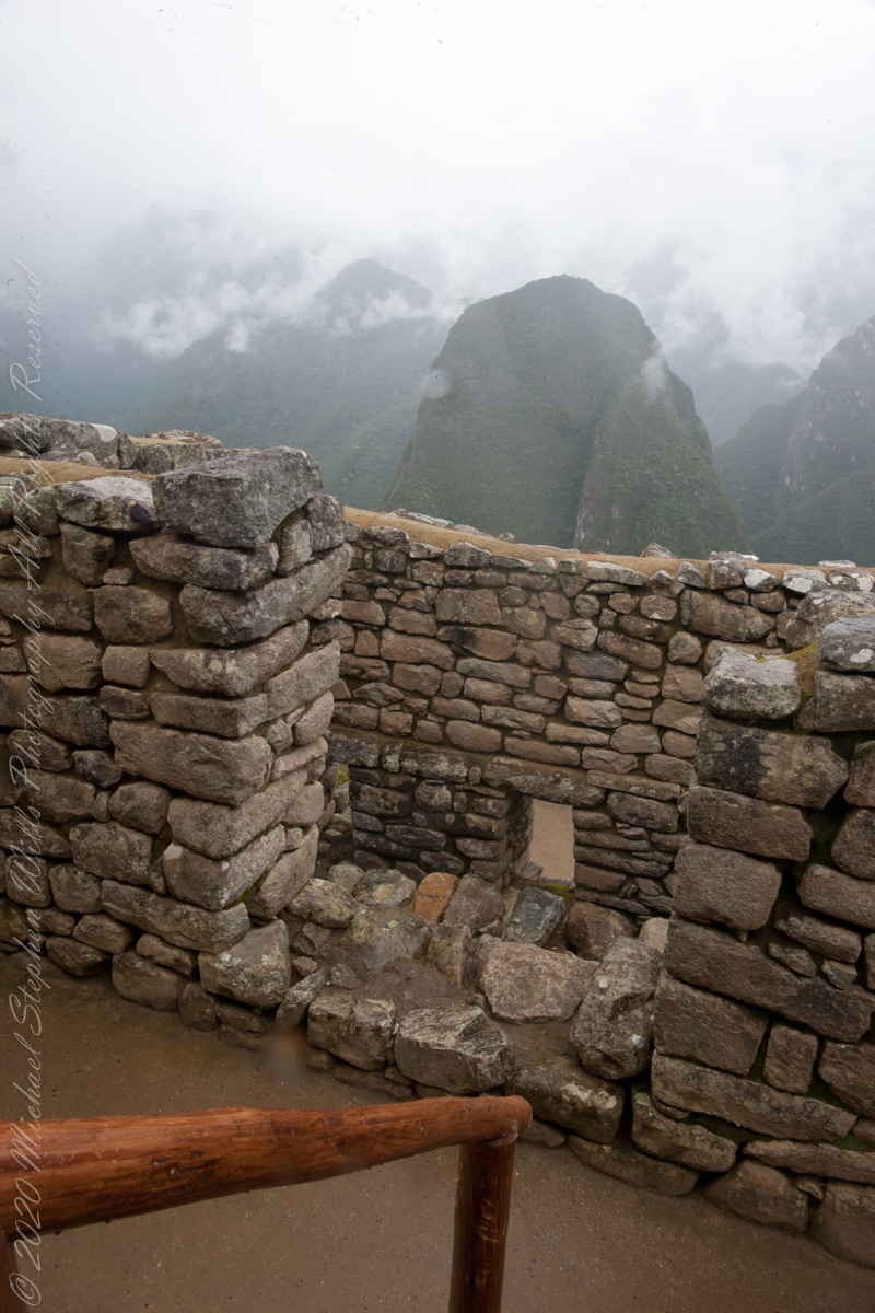
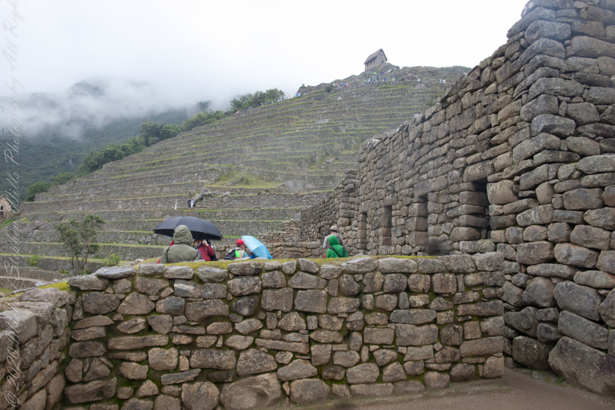
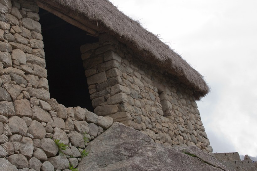
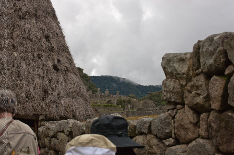
It was from reviewing this photograph, and others, I realized the photo of the woman being evacuated did not include the guardhouse. That is the guardhouse high above us.
This photo taken from the rock wall foreground in previous photo.
“Embedded within a dramatic landscape at the meeting point between the Peruvian Andes and the Amazon Basin, the Historic Sanctuary of Machu Picchu is among the greatest artistic, architectural and land use achievements anywhere and the most significant tangible legacy of the Inca civilization. Recognized for outstanding cultural and natural values, the mixed World Heritage property covers 32,592 hectares of mountain slopes, peaks and valleys surrounding its heart, the spectacular archaeological monument of “La Ciudadela” (the Citadel) at more than 2,400 meters above sea level. Built in the fifteenth century Machu Picchu was abandoned when the Inca Empire was conquered by the Spaniards in the sixteenth century. It was not until 1911 that the archaeological complex was made known to the outside world.“
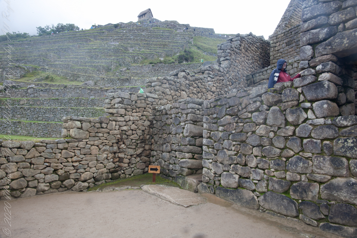
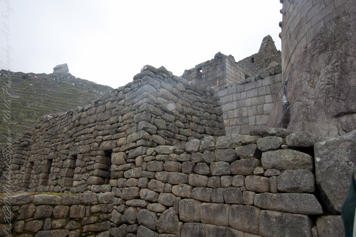
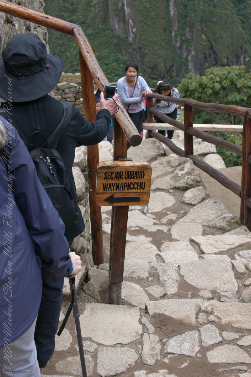
Pam waiting her turn to ascend stairs. Notice the closely joined dry wall stones above her and to the left. Compare with the rougher work to right.
“The approximately 200 structures making up this outstanding religious, ceremonial, astronomical and agricultural center are set on a steep ridge, crisscrossed by stone terraces. Following a rigorous plan the city is divided into a lower and upper part, separating the farming from residential areas, with a large square between the two. To this day, many of Machu Picchu’s mysteries remain unresolved, including the exact role it may have played in the Incas’ sophisticated understanding of astronomy and domestication of wild plant species.“
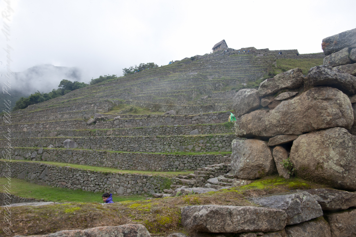
View from the stairs
“The massive yet refined architecture of Machu Picchu blends exceptionally well with the stunning natural environment, with which it is intricately linked. Numerous subsidiary centers, an extensive road and trail system, irrigation canals and agricultural terraces bear witness to longstanding, often on-going human use. The rugged topography making some areas difficult to access has resulted in a mosaic of used areas and diverse natural habitats. The Eastern slopes of the tropical Andes with its enormous gradient from high altitude “Puna” grasslands and Polylepis thickets to montane cloud forests all the way down towards the tropical lowland forests are known to harbour a rich biodiversity and high endemism of global significance. Despite its small size the property contributes to conserving a very rich habitat and species diversity with remarkable endemic and relict flora and fauna.“
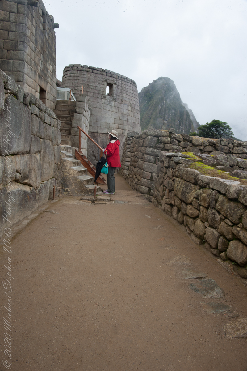
Pam and Mike pose at the overlook, February 2016. “We were there!!”
The plateau on which the city was built was also the place where the construction materials were extracted. The rock quarry – this can still be found in the city of Machu Picchu. So, the Incas had no major difficulties in constructing the stone blocks.
The majority of construction bricks, rocks are rather small, unlike in the case of Ollantaytambo and Sacsayhuamán.
About 5.000 people must have worked to build Machu Picchu – specialists say. But it could only accommodate 750 – 1.000 inhabitants. Strangely there were only about 200 – 250 skeletons found.
About 140 buildings were erected. Most of these are houses, some are temples. There also are depots and even a guard house at the edge of the city.
The Incas used dry stone technique to build the city. No mortar was used, the stone bricks were simply put together without any material to stick them together.
All rocks used were split perfectly and the bricks were put together like a huge puzzle. Some of the bricks are so tightly put together that one cannot even put a knife between them. The rocks were probably cut with the so-called wooden wedge technique: holes were drilled into the rocks and wet wooden wedges were inserted into them. After that the constructors waited until the wet wooden wedges froze.
Copyright 2023 Michael Stephen Wills All Rights Reserved
I set up a Manfrotto BeFree tripod with the Canon EOS 1DS Mark III mounted with the Canon EF 70-300 f/4-5.6 L IS USM lens to capture our experience while entering Machu Picchu.
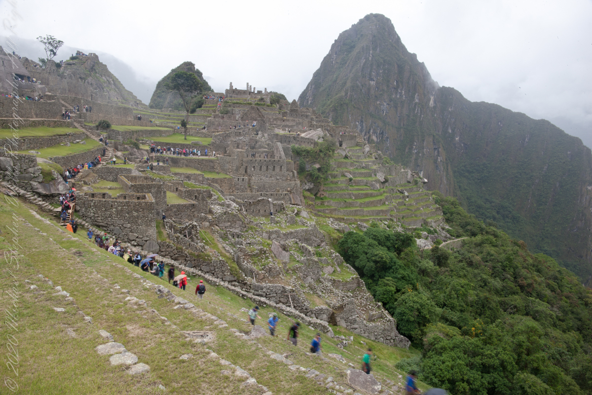
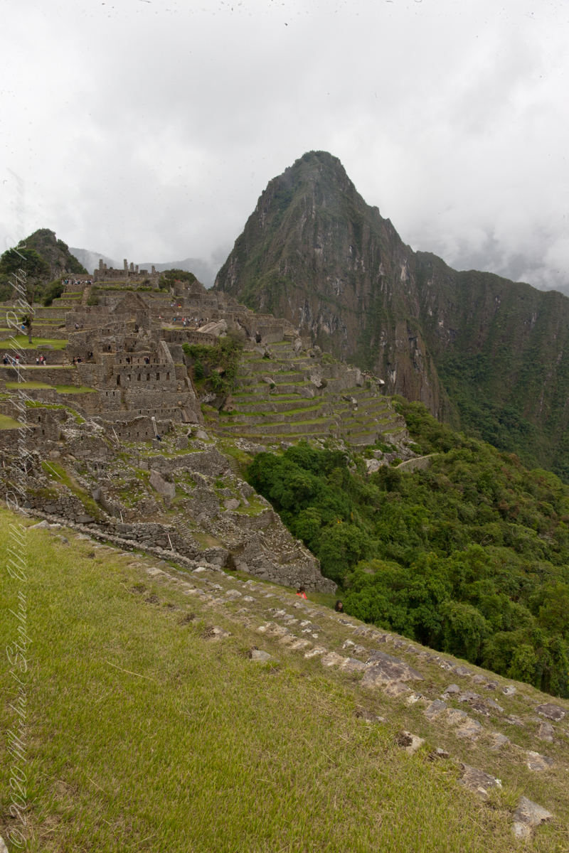
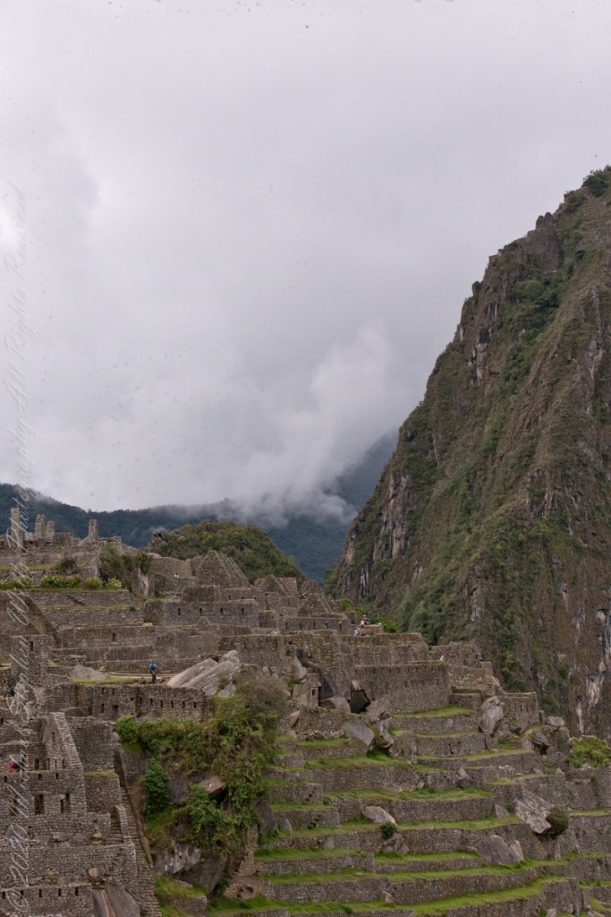
Huayna Picchu and the eastern portion of Machu Picchu from the agricultural terraces along with tourists proceed to the ancient city.
The eastern shoulder of Huayna Picchu is left and the Urubamba river curves around it. Leading the eye to the distance is an uninhabited andean valley covered in rain forest.
Copyright 2023 Michael Stephen Wills All Rights Reserved
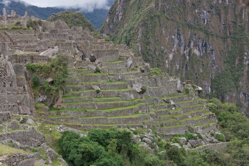
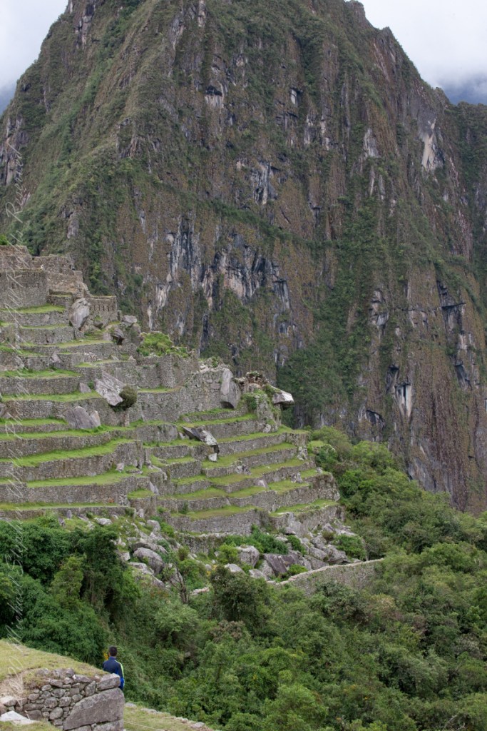
These agricultural terraces, built in the 15th century, were still in limited use by local farmers when Bingham arrived in the early 20th century.
These terraces were a work of considerable engineering, built to ensure good drainage and soil fertility while also protecting the mountain itself from erosion and landslides. Modern soil studies reveal the major crops were corn and potatoes. These terraces are below the districts named “Industrial Zone” and “Factory Houses.” A cliff of Huayna Picchu is in the background.
This photograph demonstrates either repair of or adaptation to landslides.
Copyright 2023 Michael Stephen Wills All Rights Reserved
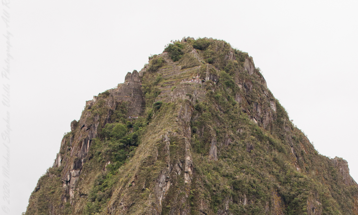
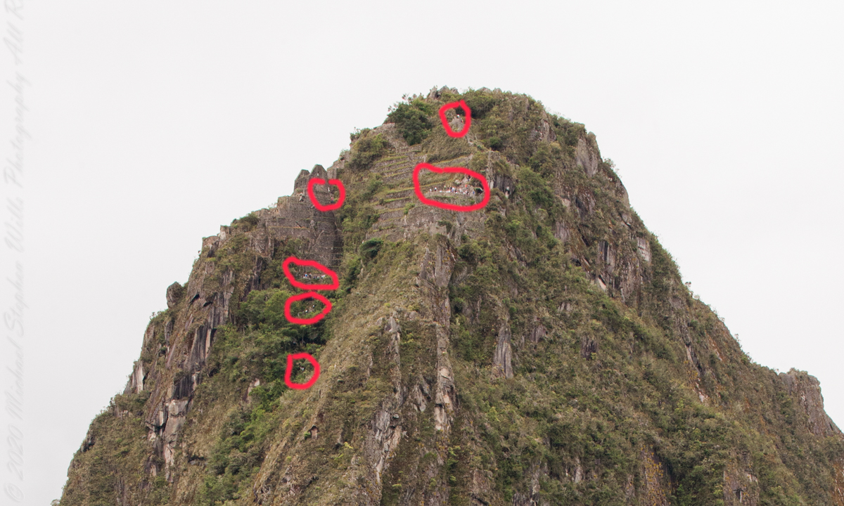
I set up a Manfrotto BeFree tripod with the Canon EOS 1DS Mark III mounted with the Canon EF 70-300 f/4-5.6 L IS USM lens. The lens is fast enough for the clear images from the train. Here, stabilized on a tripod, we can see tourists climbing and gathering on the peak as well as the terraces and ruins on top.
“Huayna Picchu, Quechua: Wayna Pikchu, is a mountain in Peru around which the Urubamba River bends. It is located in the Cusco Region, Urubamba Province, Machupicchu District. It rises over Machu Picchu, the so-called lost city of the Incas. The Incas built a trail up the side of the Huayna Picchu and built temples and terraces on its top. The peak of Huayna Picchu is 2,693 meters (8,835 ft) above sea level, or about 260 meters (850 ft) higher than Machu Picchu.”
“According to local guides, the top of the mountain was the residence for the high priest and the local virgins. Every morning before sunrise, the high priest with a small group would walk to Machu Picchu to signal the coming of the new day. The Temple of the Moon, one of the three major temples in the Machu Picchu area, is nestled on the side of the mountain and is situated at an elevation lower than Machu Picchu. Adjacent to the Temple of the Moon is the Great Cavern, another sacred temple with fine masonry. The other major local temples in Machu Picchu are the Temple of the Condor, Temple of Three Windows, Principal Temple, “Unfinished Temple”, and the Temple of the Sun, also called the Torreon.“
Terraces are salient, to left of peak is a roofless, gabled ruin. Look carefully to find climbing tourists and groups on terraces. Huayna Picchu
“Its name is Hispanicized, possibly from the Quechua, alternative spelling Wayna Pikchu; wayna young, young man, pikchu pyramid, mountain or prominence with a broad base which ends in sharp peaks, “young peak”. The current Quechua orthography used by the Ministerio de Cultura is Waynapicchu and Machupicchu.”
Terraces are salient, to left of peak is a roofless, gabled ruin. Look carefully to find climbing tourists and groups on terraces. Huayna Picchu.
Reference: Wikipedia “Huayna Picchu.”
Copyright 2023 Michael Stephen Wills All Rights Reserved
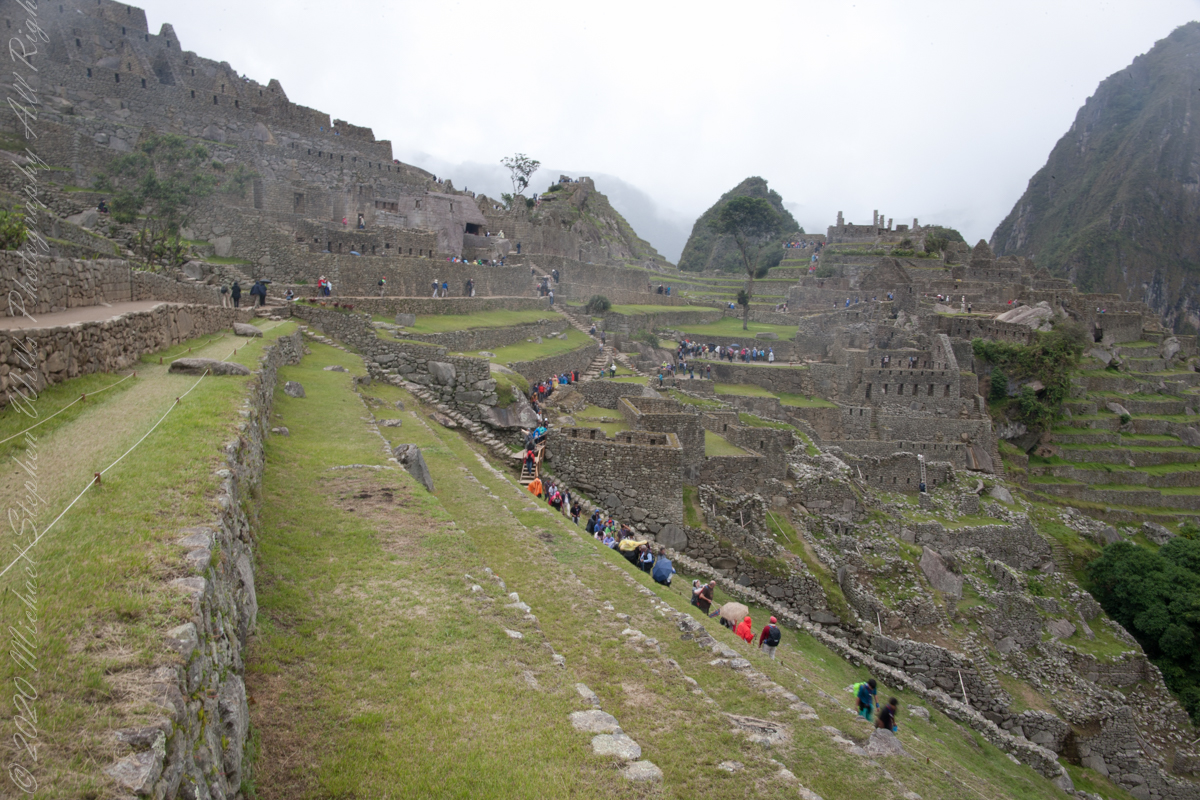
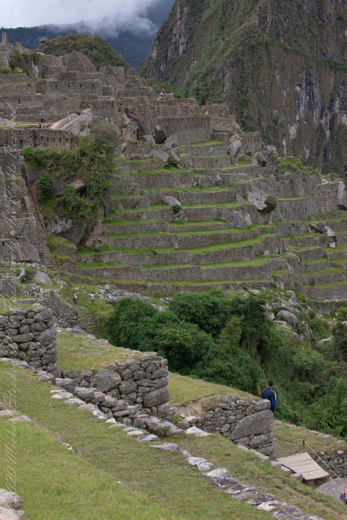
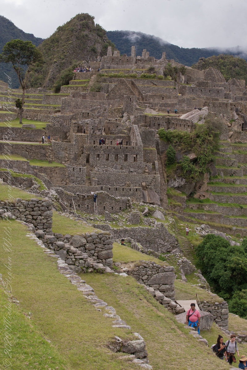
The wall with six rectangular windows is part of the “Prison Group”, a labyrinthine complex of cells, niches and passageways, positioned both under and above the ground. A portion of agricultural terraces is to the right and foreground. Look closely to see a group of tourists in the “Industrial Zone” district.
Copyright 2023 Michael Stephen Wills All Rights Reserved
These agricultural terraces, built in the 15th century, were still in limited use by local farmers when Bingham arrived in the early 20th century. These terraces were a work of considerable engineering, built to ensure good drainage and soil fertility while also protecting the mountain itself from erosion and landslides. Modern soil studies reveal the major crops were corn and potatoes. These terraces are below the districts named “Industrial Zone” and “Factory Houses.” A cliff of Huayna Picchu is in the background.
Copyright 2023 Michael Stephen Wills All Rights Reserved
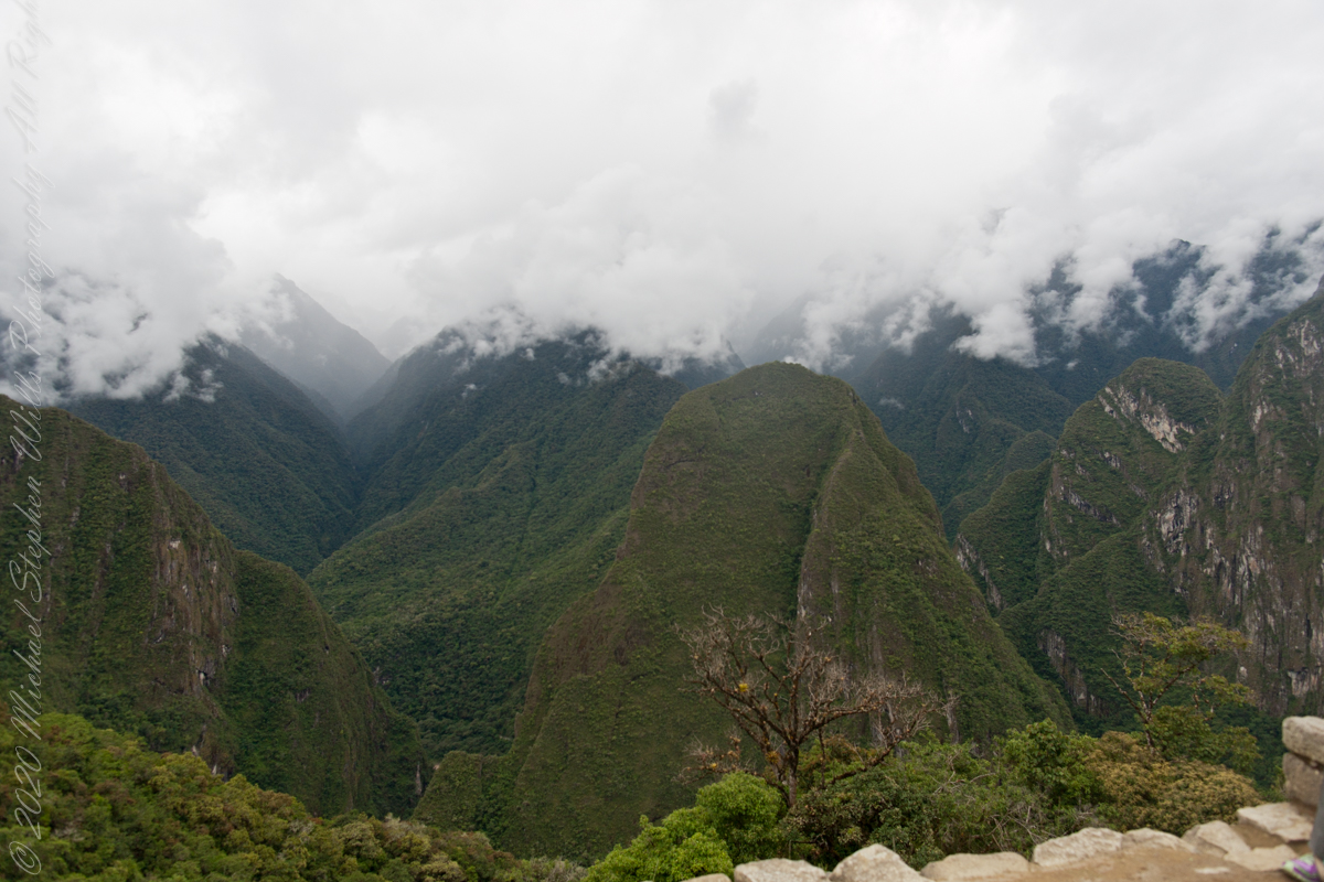
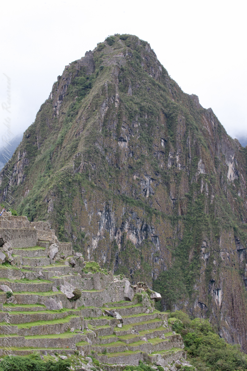
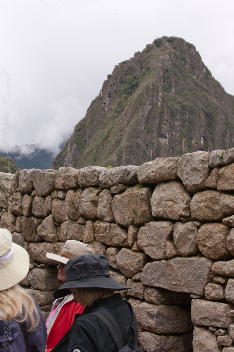
On our way to the Urban Sector of Machu Picchu I capture the peak of Huayna Picchu above a rough stone wall. “Huayna Picchu, Quechua: Wayna Pikchu, is a mountain in Peru around which the Urubamba River bends. It is located in the Cusco Region, Urubamba Province, Machupicchu District. It rises over Machu Picchu, the so-called lost city of the Incas. The Incas built a trail up the side of the Huayna Picchu and built temples and terraces on its top. The peak of Huayna Picchu is 2,693 meters (8,835 ft) above sea level, or about 260 meters (850 ft) higher than Machu Picchu.”
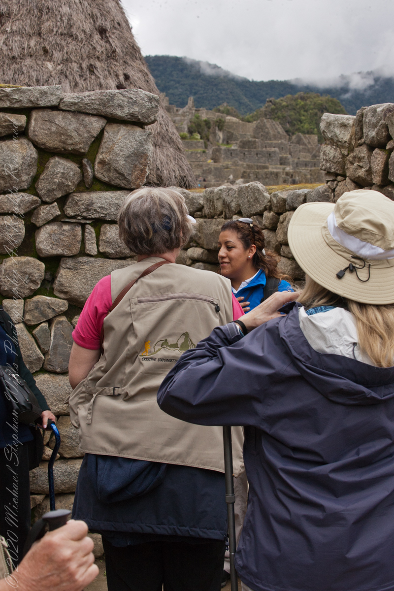
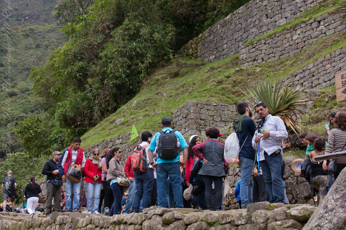
A fellow group of tourists wait for entry to the citadel
“According to local guides, the top of the mountain was the residence for the high priest and the local virgins. Every morning before sunrise, the high priest with a small group would walk to Machu Picchu to signal the coming of the new day. The Temple of the Moon, one of the three major temples in the Machu Picchu area, is nestled on the side of the mountain and is situated at an elevation lower than Machu Picchu. Adjacent to the Temple of the Moon is the Great Cavern, another sacred temple with fine masonry. The other major local temples in Machu Picchu are the Temple of the Condor, Temple of Three Windows, Principal Temple, “Unfinished Temple”, and the Temple of the Sun, also called the Torreon.“
The end of a long climb
“Its name is Hispanicized, possibly from the Quechua, alternative spelling Wayna Pikchu; wayna young, young man, pikchu pyramid, mountain or prominence with a broad base which ends in sharp peaks, “young peak”. The current Quechua orthography used by the Ministerio de Cultura is Waynapicchu and Machupicchu.”
“Young Peak” rises above the “Lost City of the Incas.”
Reference: Wikipedia “Huayna Picchu.”
Copyright 2023 Michael Stephen Wills All Rights Reserved