Guardians of the Plateau: Brigham’s Tomb, the Stagecoach, and the King on His Throne

Here is a journey to Brigham’s Tomb in Monument Valley, reflecting on the land’s timelessness, silent presence, and the profound connection between the observer and natural formations.

He did not come seeking answers, nor was he lost. The road had summoned him—as it had summoned others before him—and he followed its arc with the steadiness of one who does not hurry time. The sun was descending behind him, slow and inevitable, casting long golden blades across the plateau. That was how it wanted to be seen, and he did not interfere.

He had come this way before in dreams, further south where the great stone mittens reached into the sky. There, the land had risen in clarity, each formation distinct in its declaration. But now the evening had deepened, and the land changed its tongue. It spoke more slowly. With greater weight. And he listened.

The air was thin with silence. Even the wind moved differently here—more cautious, more reverent. And then the shapes came into view. Not suddenly, but as if they had always been there and were only now permitting themselves to be noticed.

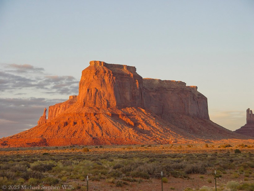
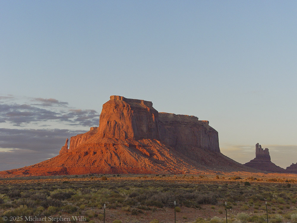
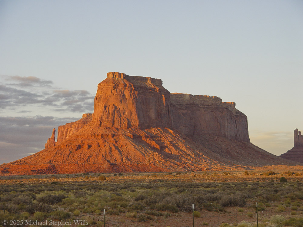
Here stood Brigham’s Tomb.

On the way to Monument Valley Tribal Park as the sunset for this view on Sullivan Road (Route 163). Navajo County, Arizona. Brigham’s Tomb. On the way to Monument Valley Tribal Park as the sunset for this view on Sullivan Road (Route 163). Navajo County, Arizona. Brighams Tomb is situated six miles (9.7 km) northeast of Oljato–Monument Valley, Utah, on Navajo Nation land. It is an iconic landform of Monument Valley and can be seen from Highway 163. Precipitation runoff from this landform’s slopes drains into the San Juan River drainage basin. Topographic relief is significant as the summit rises 1,000 feet (305 meters) above the surrounding terrain in 0.25 mile (0.4 km). The mountain’s name refers to Brigham Young, the first governor of the Utah Territory. This landform’s toponym was officially adopted/revised in 1988 by the United States Board on Geographic Names after having been officially named “Saddleback” from 1964 through 1987. Some older maps will still show the Saddleback name. Geology Brighams Tomb is composed of three principal strata. The bottom layer is slope-forming Organ Rock Shale, the next stratum is cliff-forming De Chelly Sandstone, and the upper layer is Moenkopi Formation capped by Shinarump Conglomerate. The rock ranges in age from Permian at the bottom to Late Triassic at the top. The buttes and mesas of Monument Valley are the result of the Organ Rock Shale being more easily eroded than the overlaying sandstone..

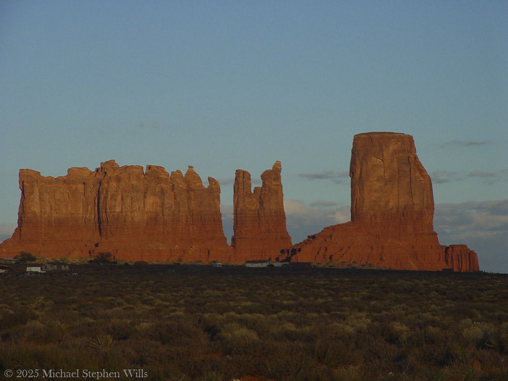
It rose alone, square and solemn, its flanks pressed by the last warmth of the day. The light traced every fracture, every line of sediment like the spine of something ancient and vast. It had no vanity. Its strength was in endurance, in the simplicity of mass. The world had spun uncounted times around this throne of stone, and still it stood—unmoved, unwitnessed except by sky and the slow-growing desert at its feet.

He paused there—not because he was uncertain, but because the monument required it. Some things must be received in silence.

Their topographic relief is significant: Stagecoach rises 900 feet (274 meters) above the surrounding terrain in 0.35 mile (0.56 km), while King-on-his-Throne rises 565 feet (172 meters) in 0.2 mile (0.32 km). Each butte’s toponym has been officially adopted by the United States Board on Geographic Names—Stagecoach is named for its resemblance to a stagecoach, and King-on-his-Throne is said to resemble a monarch surveying his domain. Stagecoach’s first summit ascent was made in 1995 by John Middendorf, Carl Tobin, and Dan Langmade; King-on-his-Throne’s first was in 1967 by Fred Beckey, Marlene Dalluge, Joe Brown, and Don Liska.

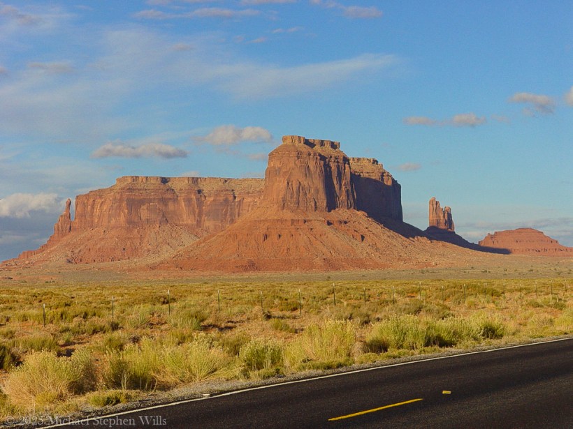
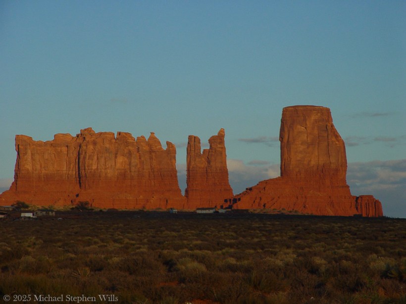
To the southeast, past a stretch of ochre earth and sagebrush, rose two more forms. The King on His Throne, upright and proud, shaped as if he had emerged from the stone itself to bear witness. An artifact of erosion, also a sovereign presence—crowned in shadow and wind. There was no question of who he was. His seat was eternal, and no rider passed without first meeting his gaze.

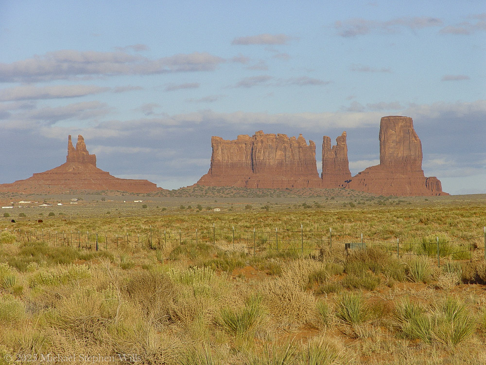
Beside him stood The Stagecoach. Its resemblance to the name was almost too perfect, as if the form had stepped from the myth fully formed. But he knew better. It had not become a stagecoach. The coach had become it. The names were backwards, as names often are. The land had come first. All else was echo.

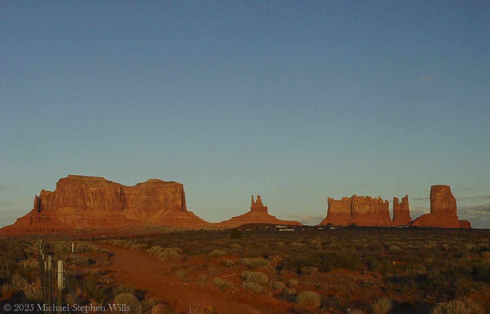
The giants stood together across the basin, their red-gold skin kindled in the last light. Their arrangement was no accident. One rose alone. Two more aside, bound by rhythm but not repetition. Together they formed a sequence—pause, proclamation, passage.

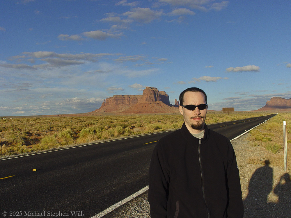
He walked the trail slowly, camera at his side but silent for a long while. There were things beyond framing. This was not a scene to be taken. It was a truth to be approached.

At the edge of the frame—a photograph not yet taken, but inevitable—the fence stretched taut across the scrub. Old wood. Rusted wire. Man’s line scratched against the land’s permanence. It held nothing. It said nothing. But it was there, and so he acknowledged it, as one acknowledges a child’s drawing pinned beside a mural.

Overhead, the sky was deepening into steel. But the earth still burned, even gently. The buttes and mesas were not dimmed by dusk. They only leaned inward, as if the heat of the day had carried them toward some great remembering.

He had seen many monuments in his life, but these were not monuments in the human sense. These were not built. They were born. They had no need for marble or inscription. Their gospel was in their silence, their liturgy the erosion of time itself.

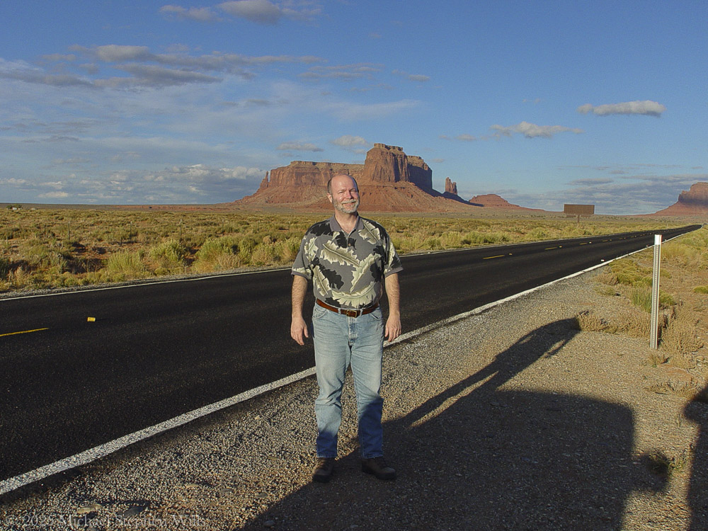
He stood long, unmoving.

Not lost. Not searching. Just witnessing.

As the light slipped and the forms began to release their edges to shadow, he turned once—not away, but forward. The road still called. And the giants behind him did not diminish. They merely remained, as they always had, and always would.

Waiting.

Enter your email to receive notification of future postings. I will not sell or share your email address.

The Mesa Light Captured Them

A father and son journey to Eagle Mesa, experiencing its beauty and silence, reflecting on its history and significance within Navajo culture as the day fades.

They came north out of Chinle with the day already leaning west and the sun fallen low into the drag of horizon dust and the road ran flat and empty past rust hills and mesquite country until, turning into the sun at Mexican Water, after a long hour, at last they pulled into Kayenta where the streets lay quiet under the heavy sun and the windows of the store fronts cast their amber light out across the sand drifting across sidewalks and the wind stirred only faintly and then was still.

They left their bags in the room and turned north again without speaking. The son drove. A man, his father, sat quiet beside him and the sun slid low through the windshield and the sky was pale and cloudless and wide beyond reckoning.

The land began to rise and the road bent and climbed and fell again and then it came into view. Not slowly. Not like a curtain rising. It was simply there.

A shape in the far desert.

Like a ship that had grounded in a sea long vanished. A sheer mesa the color of blood and ochre and fire where the last of the day spilled westward and caught the rock face and made it burn.

He told the son to pull off. They stopped the car and got out and the sound of the engine fell away, the desert made no sound at all.

The man stood in the road and turned slowly. Eagle Mesa lay before him and the land stretched off in every direction and the fenceposts ran on into silence and the sky seemed to rest upon the buttes as if tired.

There were names for these places. Old names. Navajo names that spoke of eagles roosting and trees once there and water that came and went and did not come again. The mesa they called Wide Rock. The place where spirits go. He did not know the words but he knew the feeling.

On the way to Monument Valley Tribal Park as the sunset for this view on Sullivan Road (Route 163). Navajo County, Arizona. Eagle Mesa is situated 4.5 miles (7.2 km) northeast of Oljato–Monument Valley, Utah, on Navajo Nation land. It is an iconic landform of Monument Valley and can be seen from Highway 163.Precipitation runoff from this mesa’s slopes drains to Mitchell Butte Wash and Train Rock Wash which are both part of the San Juan River drainage basin. Topographic relief is significant as the summit rises 1,100 feet (335 meters) above surrounding terrain in 0.6 mile (1 km). The nearest higher neighbor is Brighams Tomb, 2.05 miles (3.30 km) to the east. This landform’s toponym has been officially adopted by the United States Board on Geographic Names. Navajo names for the mesa are “Wide Rock”, “Where the Eagles Roost”, “Water Basket Sits”, and “Trees Hanging from Surrounding Belt” because there were once numerous trees here. In Navajo mythology, Eagle Mesa is a place where spirits of the deceased may go. Eagle Rock Spire is a 300-ft tower on the northern tip of the mesa which requires class 5.9 climbing skill to reach the summit.Navajo names for this spire which resembles a perched eagle include “Eagle Alongside Mesa”, “Big Finger is Pointed”, and Tsé Łichii Dahazkani (Elevated Red Rock Sitting Up). The first ascent of the spire was made on April 23, 1970, by Fred Beckey and Eric Bjornstad. Geology Eagle Mesa is a mesa composed of three principal strata. The bottom layer is Organ Rock Shale, the next stratum is cliff-forming De Chelly Sandstone, and the upper layer is Moenkopi Formation capped by Shinarump Conglomerate. The rock ranges in age from Permian at the bottom to Late Triassic at the top. The buttes and mesas of Monument Valley are the result of the Organ Rock Shale being more easily eroded than the overlaying sandstone.

The son came and stood beside him and did not speak. The man lifted the camera and took a photograph and then another. The road behind them shimmered with the last heat of day. He took another picture his son, dressed in black, his arms at rest and the red mesa rising behind him and the shadows of their bodies cast long across the gravel and the shoulder of the road.

On the way to Monument Valley Tribal Park as the sunset for this view on Sullivan Road (Route 163). Behind Sean are the landforms Eagle Mesa and behind it Setting Hen, Bringham’s Tomb, to the right. Navajo County, Arizona

They took turns with the camera. The son caught him midstride and smiling lit by sunlight, the land stretching out all around. A man small in a world not made for men.

There was no sound but the click of the shutter and the dry whisper of wind among the sage.

On the way to Monument Valley Tribal Park as the sunset for this view on Sullivan Road (Route 163). Behind Mike are the landforms Eagle Mesa and behind it Setting Hen, Bringham’s Tomb to the right. Navajo County, Arizona

Later he would read that the rock was born of Organ Shale and De Chelly Sandstone and Moenkopi topped with Shinarump. He would know the spire they saw was first climbed by men named Beckey and Bjornstad and that it was called Tsé Łichii Dahazkani by those who’d named it before it ever had another name. He would know the mesa rose eleven hundred feet in less than a mile and that its runoff fed washes that fed rivers that fed nothing now.

But then he only stood and watched and knew it for what it was.

Not a monument to anything but time.

A stillness like prayer. A place that waits.

They lingered until the sun went and the sky turned iron blue and the shadows of the rock reached out across the valley floor and touched them where they stood. Then they climbed back in the car and drove south again and the road unwound behind them black and a single star above and the silence of the place held on inside them long after the valley was gone.

Enter your email to receive notification of future postings. I will not sell or share your email address.