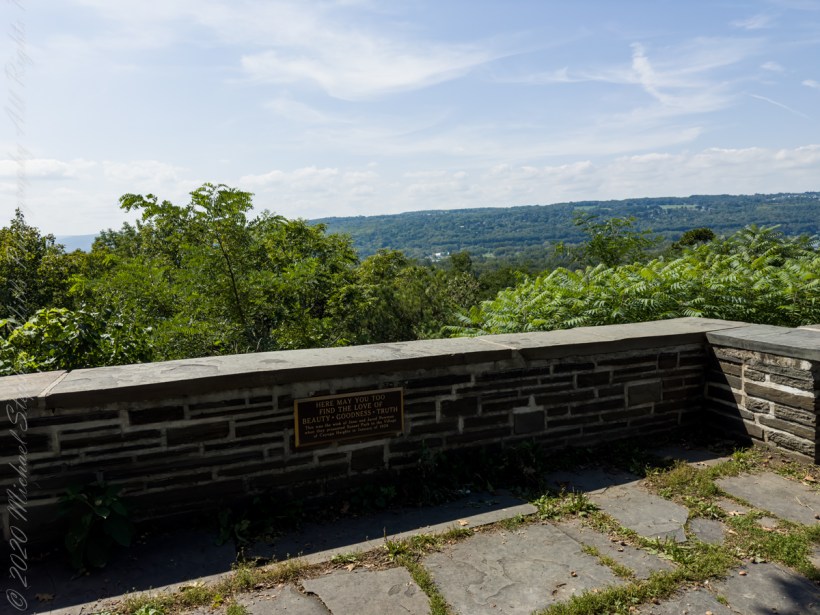
After living here since 1986 I discovered this Cayuga Heights park on a warm early September day, 2023.
Looking across Cayuga Lake, not visible in the valley, to West Hill.
Plaque inscription: “Here may you too find the love of beauty, goodness, truth. This was the wish of Jane and Jared Newman when they presented Sunset Park to the village of Cayuga Heights in January of 1938.”
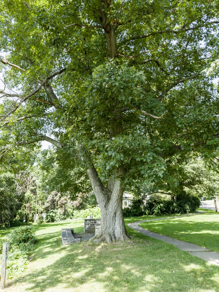
Rest on a limestone bench beneath a mature oak tree.
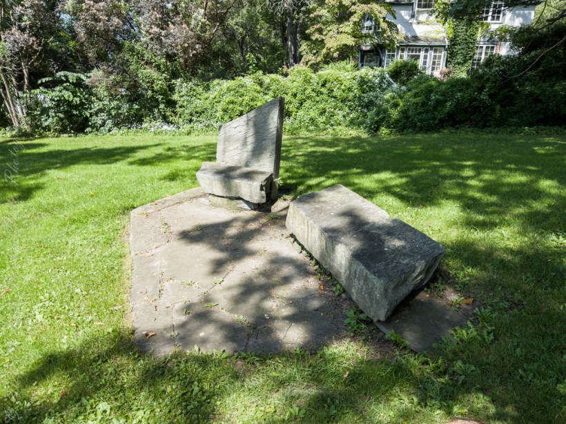
Limestone benches
View across Ithaca towards West Hill and, in the far distance, Connecticut Hill.
Copyright 2023 Michael Stephen Wills All Rights Reserved
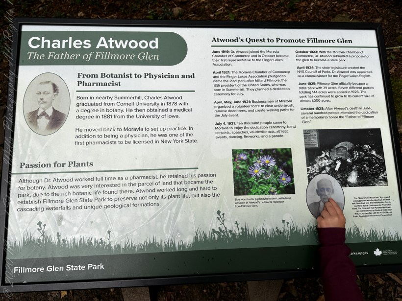
This year, 2023, an informational sign was installed next to the Charles Atwood memorial at the foot of the stone stairs leading to the Gorge Trail.
Charles Atwood The Father of Fillmore Glen
“From Botanist to Physician and Pharmacist: born in Summerhill, Cayuga Coun ty, New York State, Charles Atwood graduated from Cornell University in 1878 with a degree in Botany. He then obtained a medical degree in 1881 from the University of Iowa. He moved to Moravia, Cayuga County, to set up practice. In addition to being a physician, he was one of the first pharmacists to be licensed in New York State. A Passion for Plants. Although Dr. Atwood worked full time as a pharmacist, he retained his passion for botany. Atwood was very interested in the parcel of land that became Fillmore Glen Park, due to the rich botanic life found there. Atwood worked long and hard to establish Fillmore Glen State Park to preserve not only its plant life, but also the cascading waterfalls and unique geological formations.”
“Atwood’s Quest to Promote Fillmore Glen. June 1919: Dr. Atwood jointed the Moravia Chamber of Commerce and in October became the first representative to the Finger Lakes Association. April 1921: the Moravia Chanbmer of Commerce and the Finger Lakes Association pledged to name the local park after Millard Fillmore, the 13th president of the United States, who was born in Summerhill. They planned a dedication ceremony for July. April, May, June 1921: Businessmen of Moravia organized a volunteer force to clear underbrush, remove dead trees and create walking paths for the July event. July 4, 1921: Ten thousand people came to Moravia to enjoy the dedication ceremony, band concerts, speeches, vaudeville acts, athletic events, dancing, fireworks and a parade. October 1923: With the Moravia Chamber of Commerce, Dr. Atwood submitted a proposal for the glen to become a state park. April 1924: The state legislature created the New York State Council of Parks. Dr. Atwood was appointed a commissioner for the Finger Lakes Region. June 1925: Fillmore Glen officially became a state park with 39 acres. Seven different parcels totaling 144 acres were added in 1926. The park has continued to grow to its current size of almost 1,000 acres. October 1928: After Dr. Atwood’s death in June, several hundred people attended the dedication of a memorial to honor the ‘Father of Fillmore Glen.'”
Reference: text in italics and quotes is from the new Charles Atwood Sign.
Copyright 2023 Michael Stephen Wills All Rights Reserved
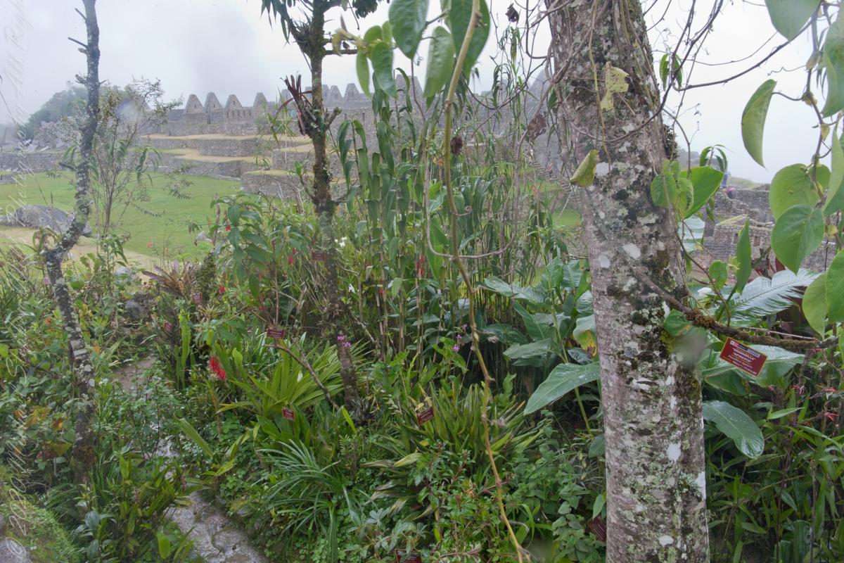
I set up a Manfrotto BeFree tripod with the Canon EOS 1DS Mark III mounted with the Canon EF 70-300 f/4-5.6 L IS USM lens to capture our experience while entering Machu Picchu.
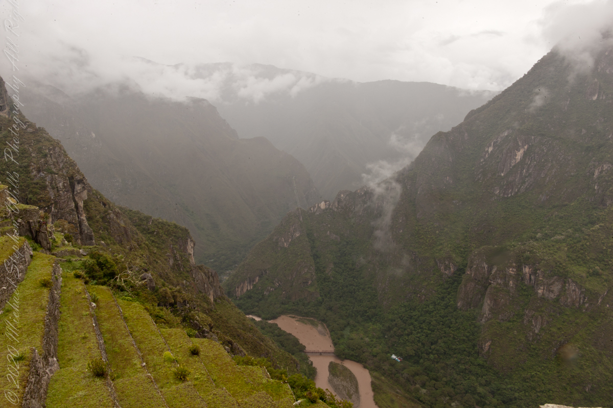
The eastern shoulder of Huayna Picchu is left and the Urubamba river curves around it. Leading the eye to the distance is an uninhabited andean valley covered in rain forest.
Copyright 2023 Michael Stephen Wills All Rights Reserved
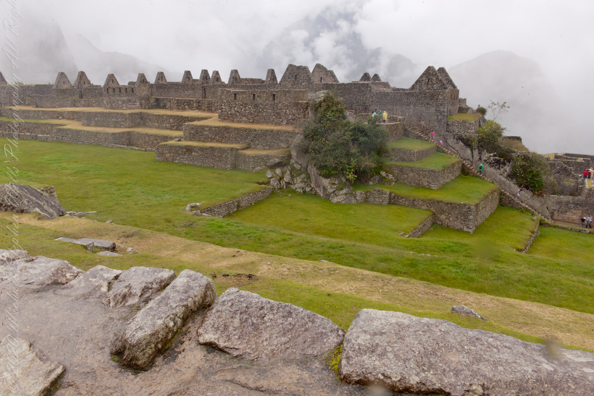
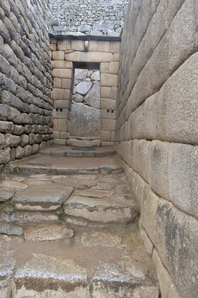
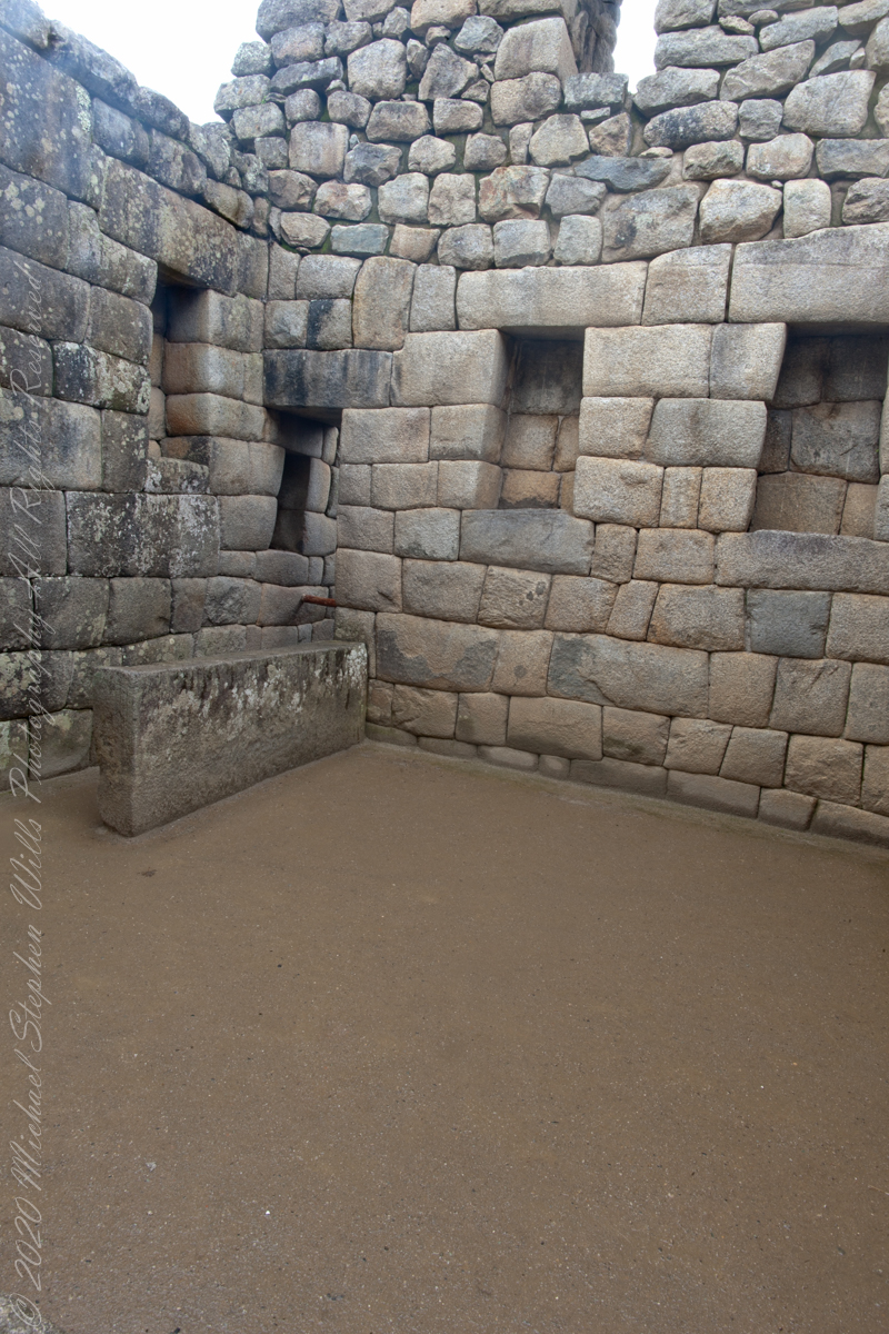
“The central buildings of the Machu Picchu Sanctuary use the classical Inca architectural style of polished dry-stone walls of regular shape. The Incas were masters of this technique, called ashlar, in which blocks of stone are cut to fit together tightly without mortar.”
The site itself may have been intentionally built on fault lines to afford better drainage and a ready supply of fractured stone. ‘Machu Picchu clearly shows us that the Incan civilization was an empire of fractured rocks’.
Inca quarried the rock for Machu Picchu from the mountain ridge itself.
“The section of the mountain where Machu Picchu was built provided various challenges that the Incas solved with local materials. One issue was the seismic activity due to two fault lines. It made mortar and similar building methods nearly useless. Instead, the Inca mined stones from the quarry at the site, lined them up and shaped them to fit together perfectly, stabilizing the structures. Inca walls have many stabilizing features: doors and windows are trapezoidal, narrowing from bottom to top; corners usually are rounded; inside corners often incline slightly into the rooms, and outside corners were often tied together by “L”-shaped blocks; walls are offset slightly from row to row rather than rising straight from bottom to top.”
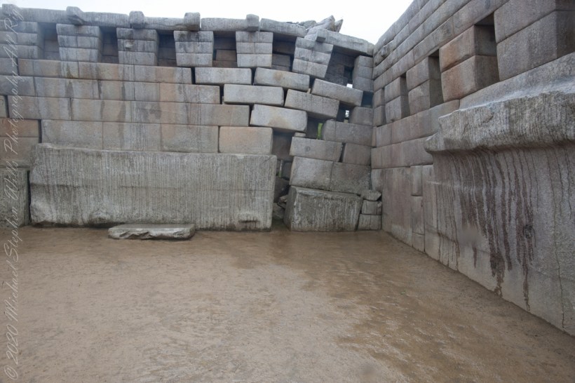
Main Temple survived multiple earthquakes
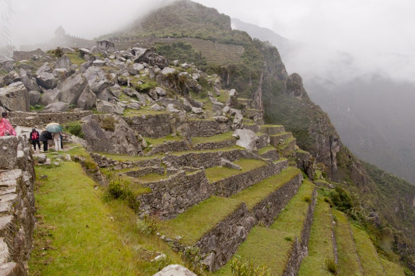
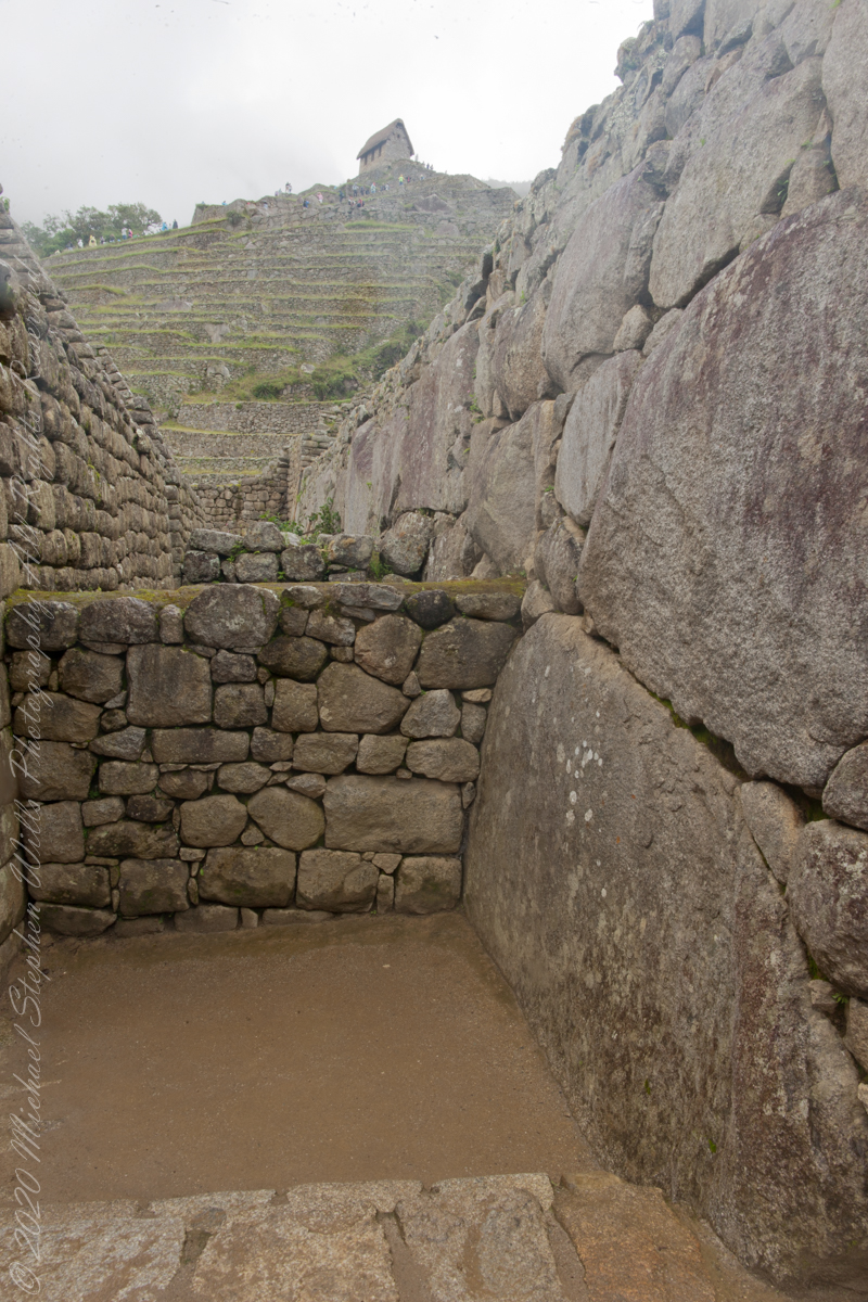
“Heavy rainfall required terraces and stone chips to drain rainwater and prevent mudslides, landslides, erosion, and flooding. Terraces were layered with stone chips, sand, dirt, and topsoil, to absorb water and prevent it from running down the mountain. Similar layering protected the large city center from flooding. Multiple canals and reserves throughout the city provided water that could be supplied to the terraces for irrigation and to prevent erosion and flooding.”
Agricultural Terraces
“The Incas never used wheels in a practical way, although their use in toys shows that they knew the principle. The use of wheels in engineering may have been limited due to the lack of strong draft animals, combined with steep terrain and dense vegetation. The approach to moving and placing the enormous stones remains uncertain, probably involving hundreds of men to push the stones up inclines. A few stones have knobs that could have been used to lever them into position; the knobs were generally sanded away, with a few overlooked.”
Reference: text in italics and quotes is from the Wikipedia “Machu Picchu”, web page.
Copyright 2023 Michael Stephen Wills All Rights Reserved
“For the Inca civilization, and especially during the time that the city of Machu Picchu was the most important place as Sanctuary of the Inca aristocratic class, the Congregation of its inhabitants in the numerous events, mostly rituals and celebrations worshipping sacred Inca gods, as it had a very important and momentous significance for the Incan society. All these celebrations ramifications in centers planned for the host to hundreds of citizens who saw the cult of their deities as well made. Also, this civilization granted a special attention details, to organization and structure of both class, of the city itself, so that the expert anthropologist community has been able to prove the existence of a straight relationship between the main square and the structuring of the Incan society.“
“Among the several locations which have shaped the division of the Citadel of Machu Picchu in their different urban areas and consequently in their different social classes, the Central Square or Main Plaza of Machu Picchu is the symbol of one of the most important for hosting the more far-reaching sacred celebrations of the Inca religion, due to its vast size are the ideal location to accommodate this type of mass religious and social ceremonies. The Central Square shows how the Incan society followed a strict, but at the same time, well-structured organization of the city in their different social classes; the anthropologist community states that this vast space was created to establish the spaces of the city limited the inhabitants depending on its status quo within Inca society.”
“After several studies by experts of the world community of anthropology, it has come to understand that the Main Plaza has played a very important role in the Inca society and the segregation of its social classes. This explains the reason for the existence of a physical axis to do distinction of several Inca social classes, which were separated one from the other not only different privileges of every social class, but also by the existence of the sub urban areas which host different individuals of the society. The main square makes this Division structural member of the urban section of the city of Machu Picchu differentiating the two sub urban sectors known as Hanan or high sector, which is home to buildings with greater religious significance for the city, and Hurin or low sector.”
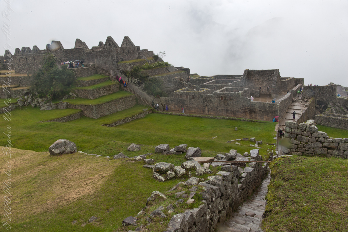
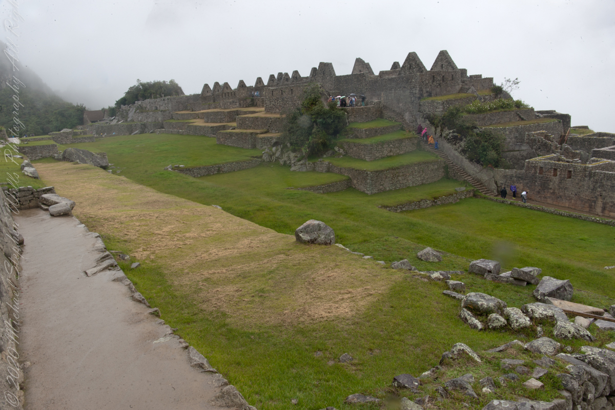
“The areas around the Central Plaza of Machu Picchu are surrounded by a rocky structure that accommodates a series of terraces from where you can appreciate a great view of Huayna Picchu. Here is where is located the construction of three covers, which gives way to the Central or main square, complex of buildings typical of the Inca civilization called “kanchas”, which all have a symmetrical distribution in their facades and are in turn communicated with the other, which favored the life of society in the city to offer a space that housed both spaces end residential for labor purposes through different plugs and local. The massive yet refined architecture of Machu Picchu blends exceptionally well with the stunning natural environment, with which it is intricately linked. Numerous subsidiary centers, an extensive road and trail system, irrigation canals and agricultural terraces bear witness to longstanding, often on-going human use.”
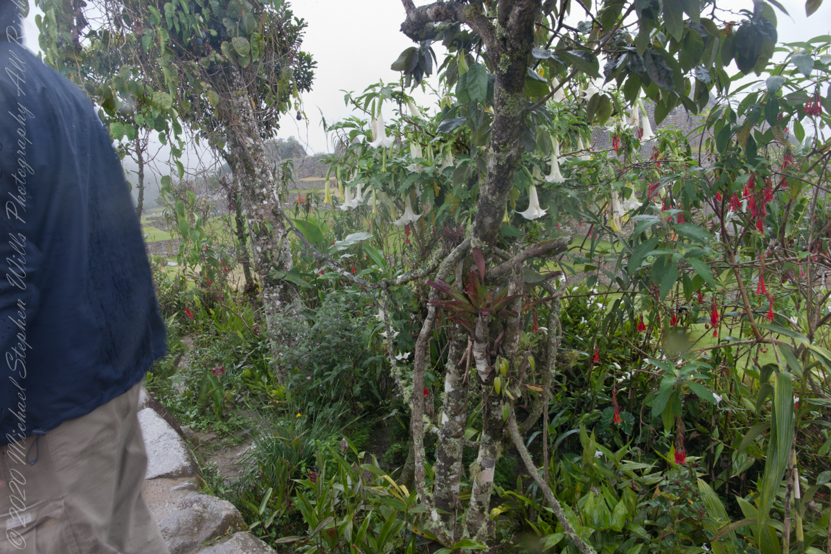
“The rugged topography making some areas difficult to access has resulted in a mosaic of used areas and diverse natural habitats. The Eastern slopes of the tropical Andes with its enormous gradient from high altitude “Puna” grasslands and Polylepis thickets to montane cloud forests all the way down towards the tropical lowland forests are known to harbor a rich biodiversity and high endemism of global significance. Despite its small size the property contributes to conserving a very rich habitat and species diversity with remarkable endemic and relict flora and fauna.“
Reference: text in italics and quotes is from the UNESCO World Heritage and Google Earth, Machu Picchu, web pages.
Copyright 2023 Michael Stephen Wills All Rights Reserved
“The Temple of the 3 Windows is one of the most surprising constructions in Machu Picchu. The carving of its walls is perfect. There are several hypotheses as to why they built three huge windows there with incredible views of the mountain range. It is presumed that the purpose was to worship the Inca gods, especially those who guard the tripartite world of the Incas: the heavenly world (Hanan pacha), the earthly world (Kay pacha) and the underworld (Uku pacha). The temple is an immense trapezoidal wall, 10 meters long and 4 meters wide, built with huge stones carved and assembled to perfection.”
“All three windows are also trapezoidal. On both sides there are two additional closed windows (like niches) where the Incas left ceremonial objects of gold and silver.”
“The temple served a religious function. The white granite stone with which it was built has a different carving from the rest of the constructions at Machu Picchu. The fineness of its walls indicates that it was one of the most important buildings in the citadel.”
“A few steps from this temple there are other buildings with religious purposes of great importance: the Main Temple, the Temple of the Sun and the Intihuatana.“
“There are many hypotheses about the religious rituals that were performed in the Temple of the 3 Windows. It is believed that the Inca worldview of the world divided into three worlds was worshiped: the heavenly world (Hanan pacha), the earthly world (Kay pacha) and the underworld (Uku pacha).”
“For the Incas, the Hanan pacha was the world of the gods, of the celestial beings (the sun, the moon, the stars). The Kay pacha was the earthly world, of men and animals. Finally, the Uku pacha was the world of the dead, of beings that wait to reincarnate to return to the earthly world.”
“The tripartite world of the Incas was represented by three animals: the condor (kuntur), the puma (puma) and the snake (amaru). The ‘three’ is present in many of the Inca constructions such as the ‘chakana’ (also called the Andean cross) present in the Temple of the Sun in Ollantaytambo.”
Reference: text in italics and quotes paraphrased from the web page “imachupicchu.com.”
Copyright 2023 Michael Stephen Wills All Rights Reserved
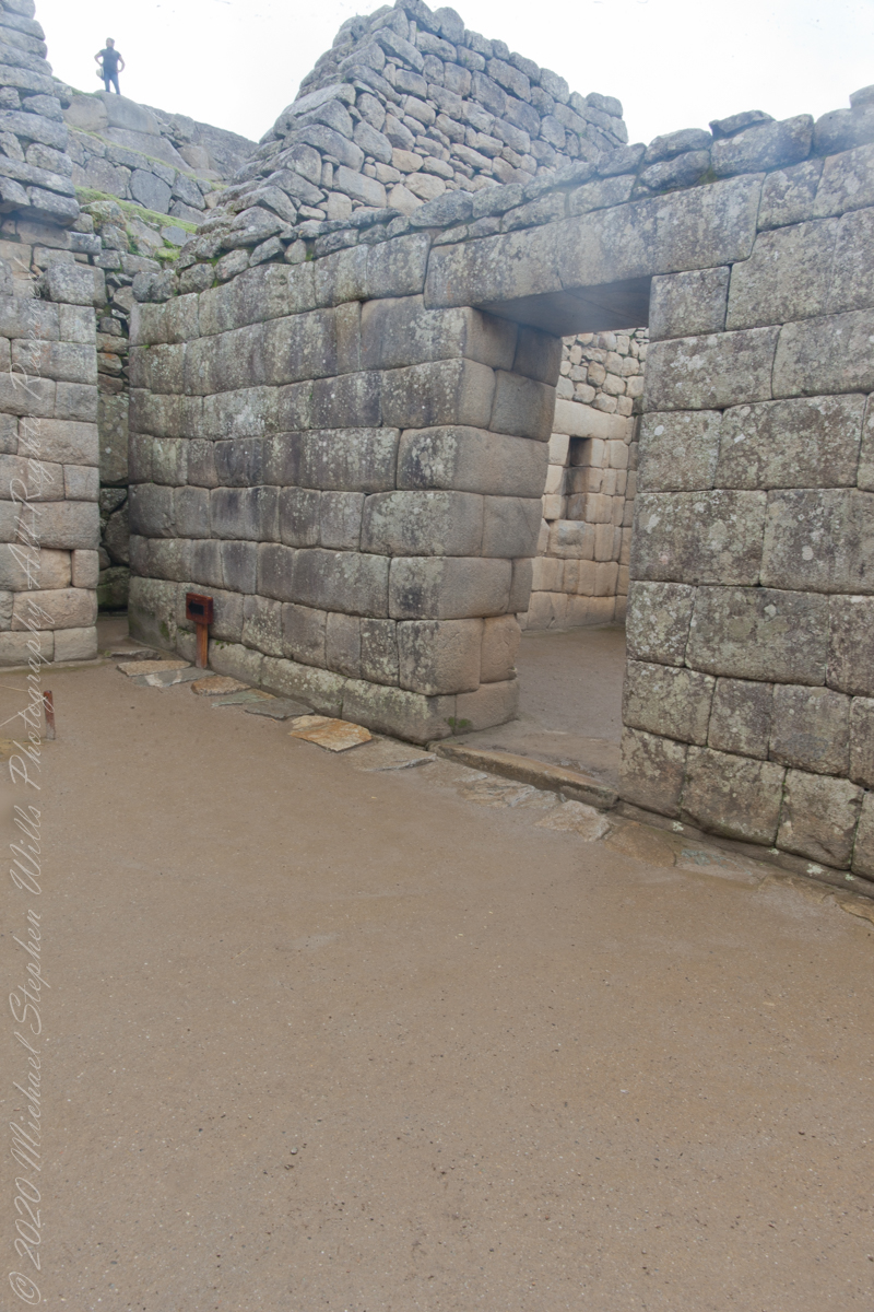
“The Main, or Principle, Temple situated on the Sacred Plaza of the Urban Sector of Machu Picchi, is an impressive rectangular shaped building consisting of two lateral and one rear wall. The base of the temple are large lithic stones supporting more regular sized and precisely carved stones. The temple features seventeen trapezoidal shaped niches most likely used for ceremonial offerings. Six stone pegs of the rear walls might have been used to hang decorations or aid rituals.“
Main Temple Left Corner
“Tradition states during Inca times the temple was adorned with colorful mantles, emblems and mummies of important Inca leaders and an effigy of P’unchao, a divine sacred symbol made of solid gold representing the Inca god Wiraqocha. When the Incas abandoned Machu Picchu at the time of the Spanish Conquest, they removed the most important artefacts leaving behind just the stone structure.”
“Earthquakes over the years have undermined the Main Temple structure, notably the rear right hand corner of the building, where the stones have separated and moved downwards.”
Reference: text in italics and quotes paraphrased from the web page “The Only Peru Guide.”
Copyright 2023 Michael Stephen Wills All Rights Reserved
“For the Inca civilization, and especially during the time that the city of Machu Picchu was the most important place as Sanctuary of the Inca aristocratic class, the Congregation of its inhabitants in the numerous events, mostly rituals and celebrations worshipping sacred Inca gods, as it had a very important and momentous significance for the Incan society. All these celebrations ramifications in centers planned for the host to hundreds of citizens who saw the cult of their deities as well made. Also, this civilization granted a special attention details, to organization and structure of both class, of the city itself, so that the expert anthropologist community has been able to prove the existence of a straight relationship between the main square and the structuring of the Incan society.“
“Among the several locations which have shaped the division of the Citadel of Machu Picchu in their different urban areas and consequently in their different social classes, the Central Square or Main Plaza of Machu Picchu is the symbol of one of the most important for hosting the more far-reaching sacred celebrations of the Inca religion, due to its vast size are the ideal location to accommodate this type of mass religious and social ceremonies. The Central Square shows how the Incan society followed a strict, but at the same time, well-structured organization of the city in their different social classes; the anthropologist community states that this vast space was created to establish the spaces of the city limited the inhabitants depending on its status quo within Inca society.”
“After several studies by experts of the world community of anthropology, it has come to understand that the Main Plaza has played a very important role in the Inca society and the segregation of its social classes. This explains the reason for the existence of a physical axis to do distinction of several Inca social classes, which were separated one from the other not only different privileges of every social class, but also by the existence of the sub urban areas which host different individuals of the society. The main square makes this Division structural member of the urban section of the city of Machu Picchu differentiating the two sub urban sectors known as Hanan or high sector, which is home to buildings with greater religious significance for the city, and Hurin or low sector.”
“The areas around the Central Plaza of Machu Picchu are surrounded by a rocky structure that accommodates a series of terraces from where you can appreciate a great view of Huayna Picchu. Here is where is located the construction of three covers, which gives way to the Central or main square, complex of buildings typical of the Inca civilization called “kanchas”, which all have a symmetrical distribution in their facades and are in turn communicated with the other, which favored the life of society in the city to offer a space that housed both spaces end residential for labor purposes through different plugs and local. The massive yet refined architecture of Machu Picchu blends exceptionally well with the stunning natural environment, with which it is intricately linked. Numerous subsidiary centers, an extensive road and trail system, irrigation canals and agricultural terraces bear witness to longstanding, often on-going human use.”
“The rugged topography making some areas difficult to access has resulted in a mosaic of used areas and diverse natural habitats. The Eastern slopes of the tropical Andes with its enormous gradient from high altitude “Puna” grasslands and Polylepis thickets to montane cloud forests all the way down towards the tropical lowland forests are known to harbor a rich biodiversity and high endemism of global significance. Despite its small size the property contributes to conserving a very rich habitat and species diversity with remarkable endemic and relict flora and fauna.“
Reference: text in italics and quotes is from the UNESCO World Heritage and Google Earth, Machu Picchu, web pages.
Copyright 2023 Michael Stephen Wills All Rights Reserved
“The central buildings use the classical Inca architectural style of polished dry-stone walls of regular shape. The Incas were masters of this technique, called ashlar, in which blocks of stone are cut to fit together tightly without mortar.“
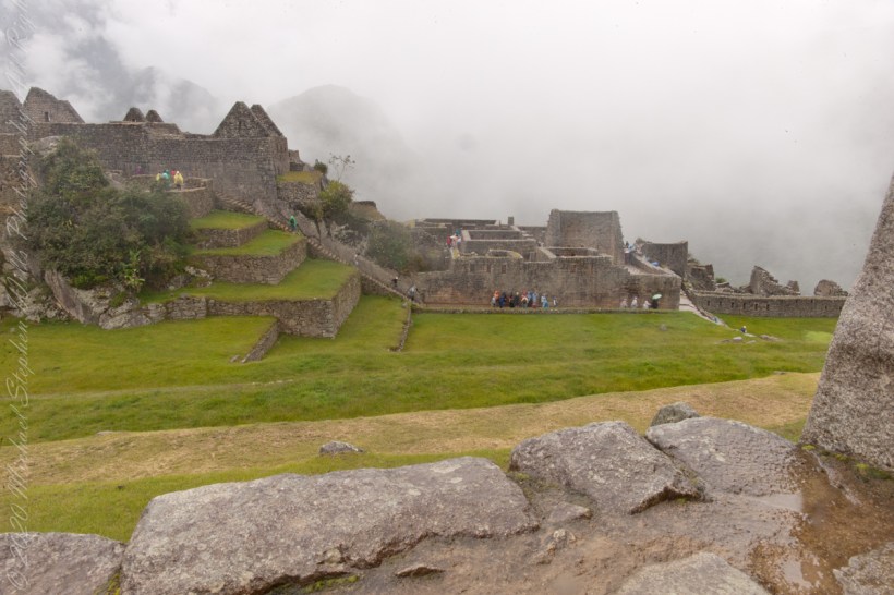
You can tell we are climbing from the angle of the guardhouse.
“The site itself may have been intentionally built on fault lines to afford better drainage and a ready supply of fractured stone. ‘Machu Picchu clearly shows us that the Incan civilization was an empire of fractured rocks‘”.
“The section of the mountain where Machu Picchu was built provided various challenges that the Incas solved with local materials. One issue was the seismic activity due to two fault lines. It made mortar and similar building methods nearly useless. Instead, the Inca mined stones from the quarry at the site, lined them up and shaped them to fit together perfectly, stabilizing the structures. Inca walls have many stabilizing features: doors and windows are trapezoidal, narrowing from bottom to top; corners usually are rounded; inside corners often incline slightly into the rooms, and outside corners were often tied together by “L”-shaped blocks; walls are offset slightly from row to row rather than rising straight from bottom to top.“
“I See You”
“Heavy rainfall required terraces and stone chips to drain rainwater and prevent mudslides, landslides, erosion, and flooding. Terraces were layered with stone chips, sand, dirt, and topsoil, to absorb water and prevent it from running down the mountain. Similar layering protected the large city center from flooding.[106] Multiple canals and reserves throughout the city provided water that could be supplied to the terraces for irrigation and to prevent erosion and flooding.”
“The Incas never used wheels in a practical way, although their use in toys shows that they knew the principle. The use of wheels in engineering may have been limited due to the lack of strong draft animals, combined with steep terrain and dense vegetation. The approach to moving and placing the enormous stones remains uncertain, probably involving hundreds of men to push the stones up inclines. A few stones have knobs that could have been used to lever them into position; the knobs were generally sanded away, with a few overlooked.”
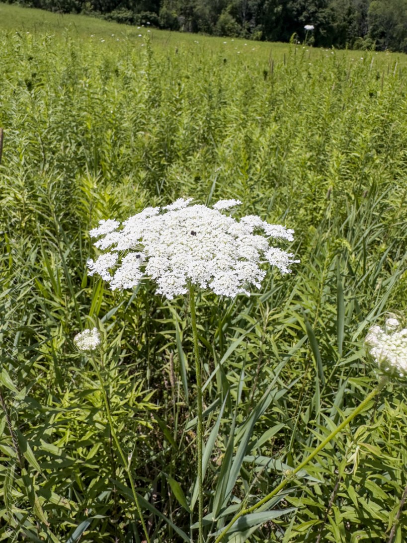
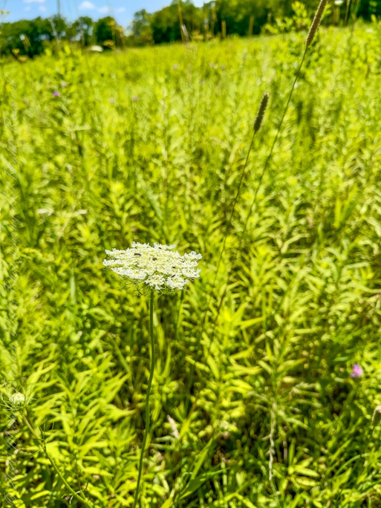
Found in a meadow of the Brock-Harvey Forest Preserve. The function of the central dark florets of D. carota has been subject to debate since Charles Darwin speculated that they are a vestigial trait.
It has been suggested that they have the adaptive function of mimicking insects, thus either discouraging herbivory, or attracting pollinators by indicating the presence of food or opportunities for mating.
One study in Portugal found that the dark florets contributed to visitation by the varied carpet beetle, Anthrenus verbasci, and that higher numbers of dark florets correlated with increased visitation, whereas inflorescences without dark florets had fewer visits. Replacing the dark florets with one or more freeze-killed A. verbasci, who are similar to the florets in size and shape produced similar results to those observations of inflorescences with intact florets..
This specimen was found among many others in a meadow of the Brock-Harvey Forest Preserve