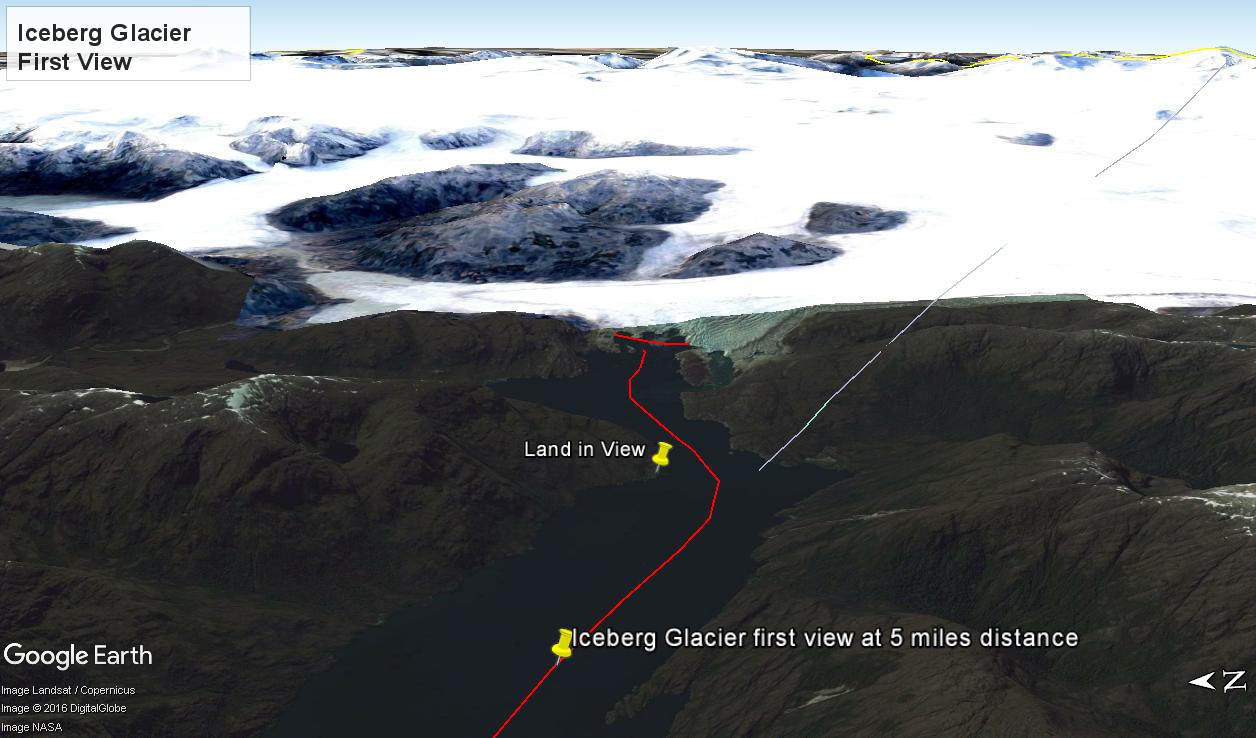
At 5:09 PM (daylight savings time for Chile) the Regatta turned to starboard to navigate around a headland of Farquhar Island. Iceberg Glacier came into view from our port side stateroom terrace. I was set up with the Canon 300 mm variable lens set to 120 mm (1/500 second, F11, ISO500), tripod mounted, to capture the ice from 5 miles distance. The location is marked on the above GoogleEarth view. The red line leading in is our course. On the right, the white line is the boundary between Chilean regions Aisen and Magellan.
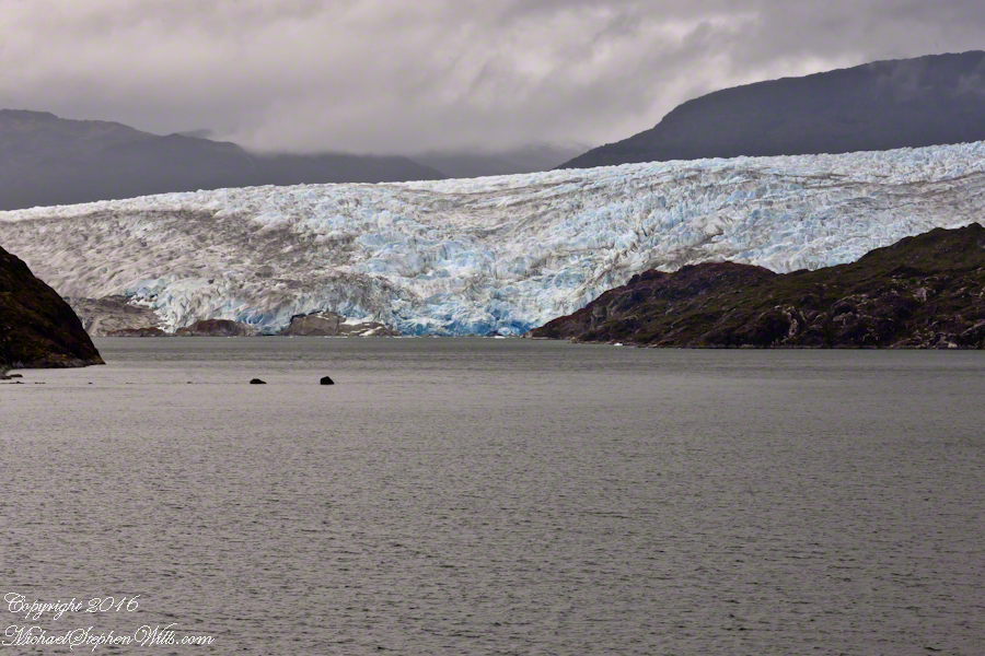
Visible is the .75 glacier front, 500+ feet above the head of Tempanos Fjord. On the GoogleEarth view the front is marked with a red line. Yes, more than 500 feet above the water. In mid-view there are two rocks in the water. Behind them, under the glacier, is a rock face. That rock is 100+ feet tall.
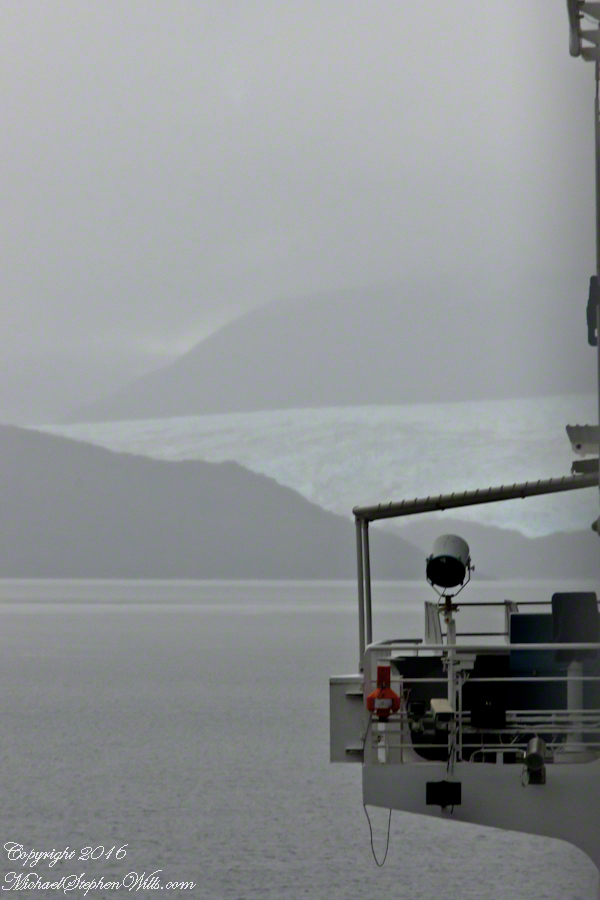
Twenty seven (27) minutes later I used a handheld Sony with variable lens set to 200 mm (1/500 second, F13, ISO800) to capture this image of the ship bridge superimposed on the glacier.
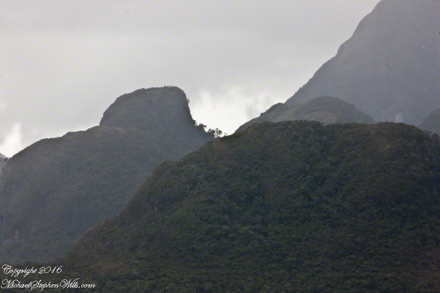
All you see is part of the Bernardo O’Higgins National Park. Named for a founding father of Chile, the country’s first head of state, the park covers 13,614 square miles.
Copyright 2022 Michael Stephen Wills All Rights Reserved
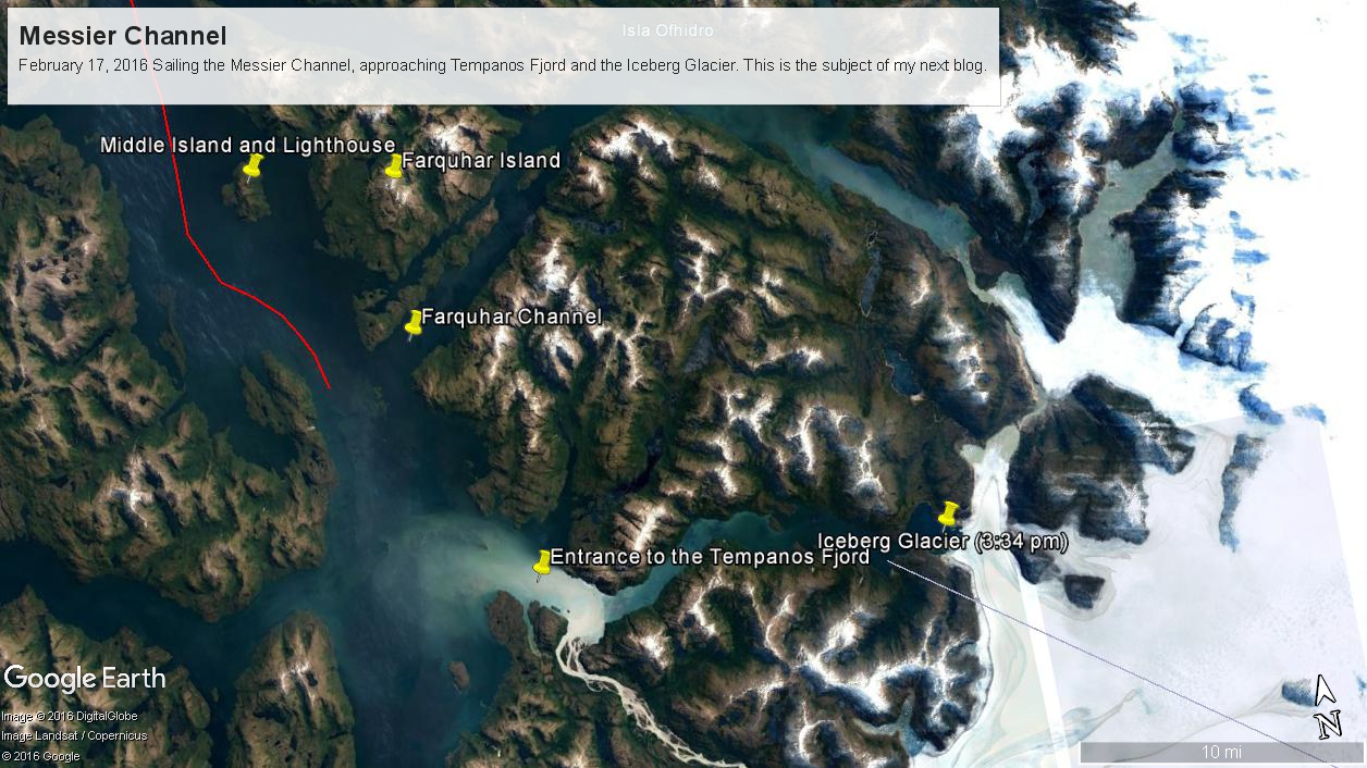
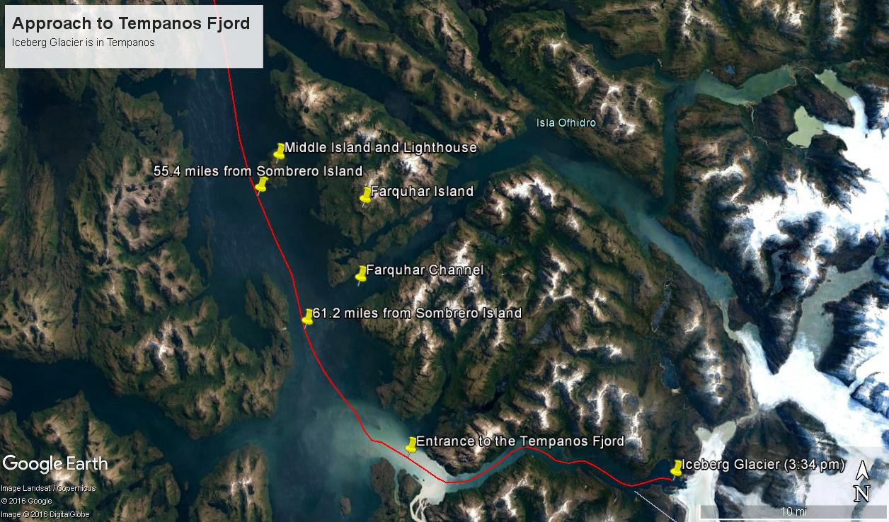
These photographs are most notable for the first sighting of the entrance to Fjord Tempanos and our day’s destination the Iceberg Glacier. At Middle Island Messier Channel is over 5 miles wide though studded with islets and navigational hazards. Here is a Google Earth map of the area with notable locations pinned with names. The red line is a ruler path from Sombrero Island.
In the previous blog, Orientation, Iceberg Glacier, February 17, 2016, you learned about the route the Oceania Regatta followed that day. We left off with photographs of Scout and Orlebar islands, the time was 12:43 pm Chilean Summer Time (daylight savings). The next photograph was time stamped 2:24 pm and, frankly, I had lost track of where we were, so it was necessary to determine the ship’s position.
Here is how to do it. From two known points, Sombrero Island at the northern end of Messier Channel and the Iceberg Glacier, our day’s destination, first a velocity from the total distance, in miles, (Google Earth) divided by the time duration (subtract time stamp of the starting from the final digital photograph and convert to minutes). This gives an average ship velocity in miles Using excel list the photographs with time stamps. For each photograph calculate the time from the starting photo, in minutes, and multiply this by the average velocity.
In this way, I determined the first photographs of this blog were Middle Island and obtained confirmation using Google Earth to view the location from ground level. The process is iterative in that the views showed the first calculated position to be behind the position matching the view.
This, I hypothesized, was because the ship velocity decreased on entering Tempanos Fjord. Noting a time gap between the last photograph of this blog and the next, taken within Tempanos Fjord. So, using Google Earth to establish the last photograph position, I recalculated velocity using that last position as the last time. Then, I recalculated the distances of the photographs and the calculated positions came into better agreement with the viewed positions. After Middle Island the ship slowed significantly in order to enter the fjord.
I still have opened questions because the calculated speed from Sombrero Island to Middle Island is 6 knots higher than the documented top speed of the Regatta.
52.02 miles from Sombrero Island. View NorthEast toward Middle Island, Farquhar Island behind.
The lighthouse of Middle Island is not in view. The channel between the islands is Brazo del Este.
View NorthEast toward the peaks of Farquhar Island Over the shoulder of Middle Island is Riches Bay of the farther island.
View NorthEast toward the peaks of Farquhar Island. Across from us, on Farquhar Island, the George River flow into Connor Cove which opens onto the channel named Brazo del Este. The channel separates the islands.
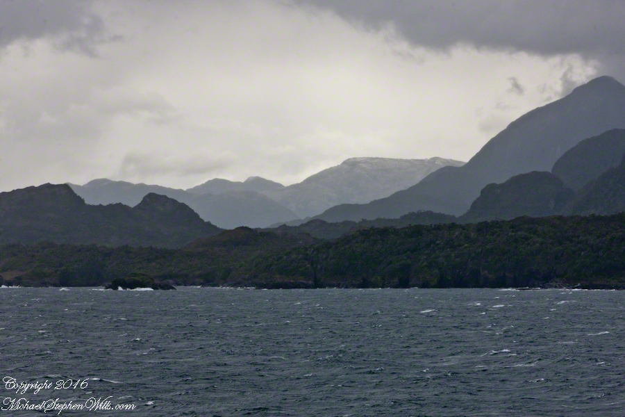
View east the steep cliffs of Farquhar Island rising abruptly from Messier Channel, to 3,200 feet in 2.7 miles.
Peaks of Farquhar Island. View east from Messier Channel using long lens. The island is named for Percival Farquhar, American entrepreneur active in South America, mostly Brazil and railroads, 1905 – 1930.
View north from mid-Messier Channel. Nearest on the right is Middle Island with lighthouse Farquhar Island behind with Palmer and Hens points. In the distance is Van Der Meulen island.
Farquhar Channel. View Northeast with Boxer Island, left foreground,Farquhar Island behind.
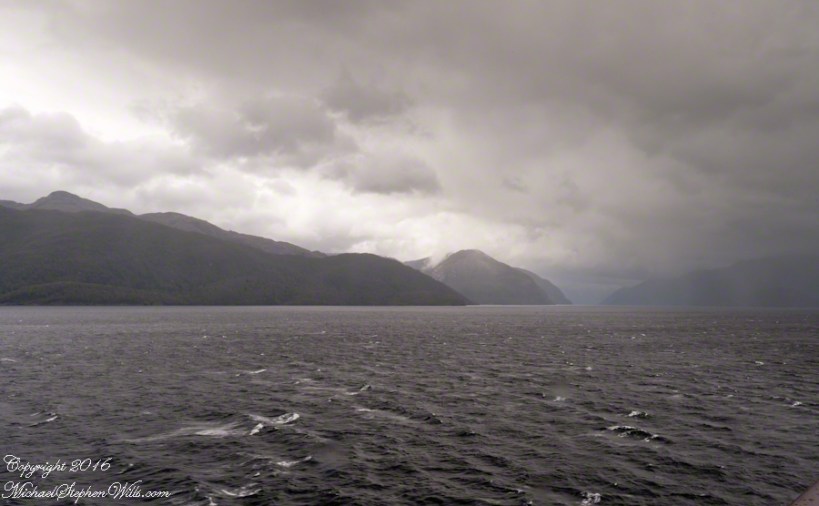
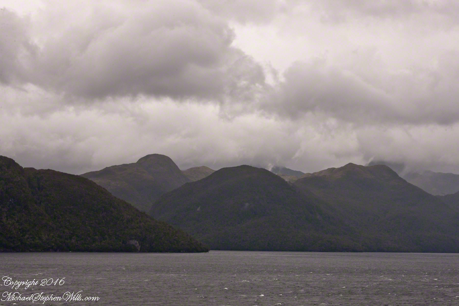
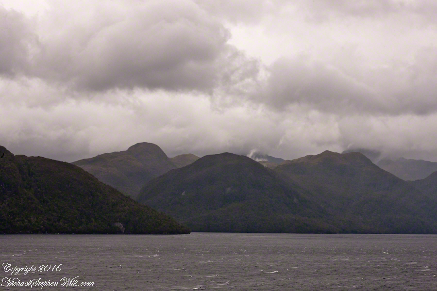
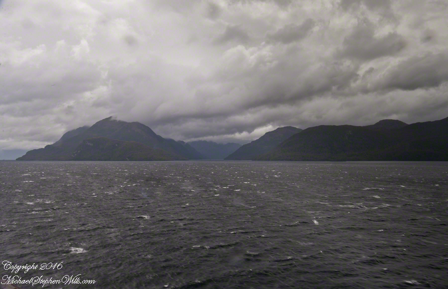
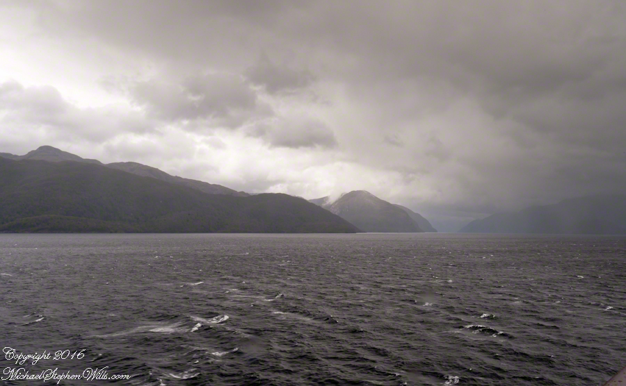
Tempanos Fjord. View Southeast with Estacion Point and Headland to left. Behind the headland is the entrance to Farquhar Fjord, not visible. Tempanos Fjord is framed by land on both sides.
On our way to Fjord Tempanos and the Iceberg Glacier…..
Background: on a ship, facing the bow (front), starboard is right and port is left).
In the 8 miles from Tarn Bay and Sombrero Island lands press closer, higher, islands increase in number. This is a listing of some of the islands we passed. These names reflect the history of Chile, the waves of immigrants touch the land with memories. After some of the names, below, I provide in parentheses the derivation.
On starboard was the northern Wellington Archipelago (English General): Pinochet (the Chilean dictator), Penguin, Juan Stuven (Spanish and German), Chang (the far east), Millar (German).
On port, the names have a military flavor: Zealous, Scout, Scylla (Sea Monster of Greek mythology), Alert, Orlebar (British Officer Augustus Orlebar).
These port side island names reflect what is on the minds of mariners as navigational options narrow with the channel. Innumerable channels, points, mid-channel islets, all looking very much the same, a potentially confusing jumble. Chilean maritime law demands ships have on board, working from the bridge, a certified Chilean maritime pilot to transverse the country’s dangerous channels and fjords. The combination of stopping distance (multiple nautical miles) and the loss of steering when a ship moves slowly make it essential to know, exactly, the route ahead. It was a Chilean maritime pilot who help keep us safe.
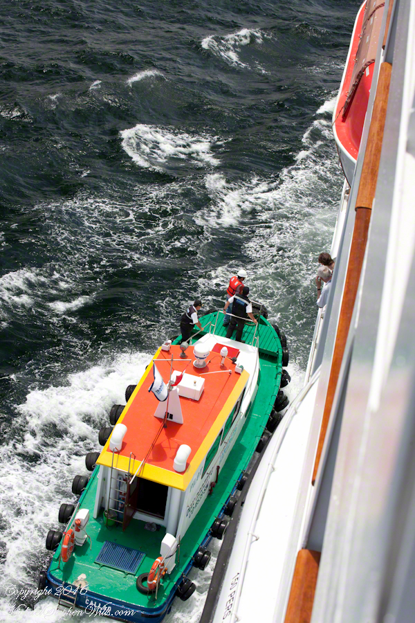
A great personal hazard for pilots is boarding the ship from the pilot boat. From our stateroom terrace we observed fast pilot boats in all seas approach the Regatta miles from port, the pilot on the bow, pull up alongside. Without a harness, the pilot transfers from boat to ship. We observed this several times from our stateroom veranda.
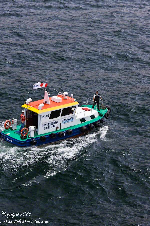
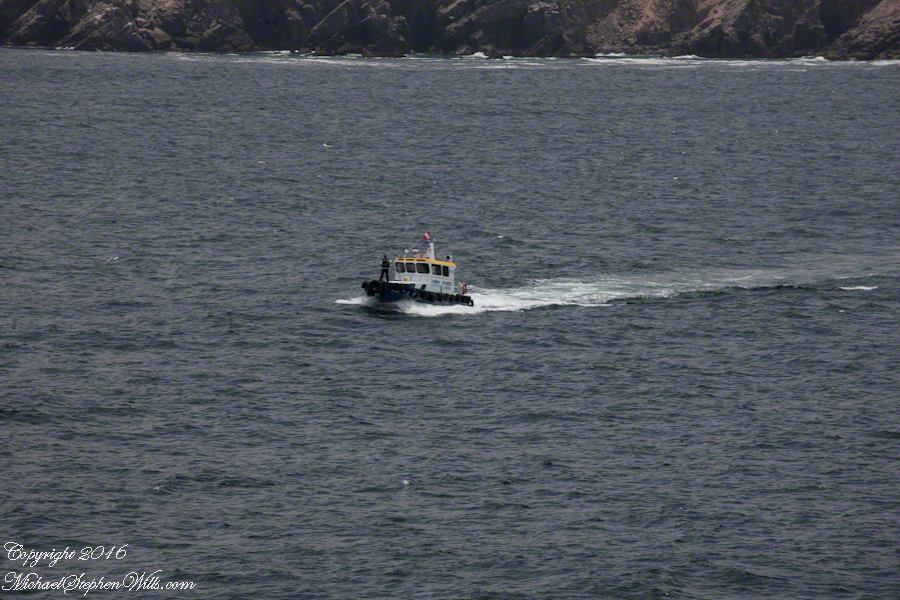
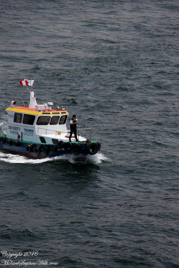
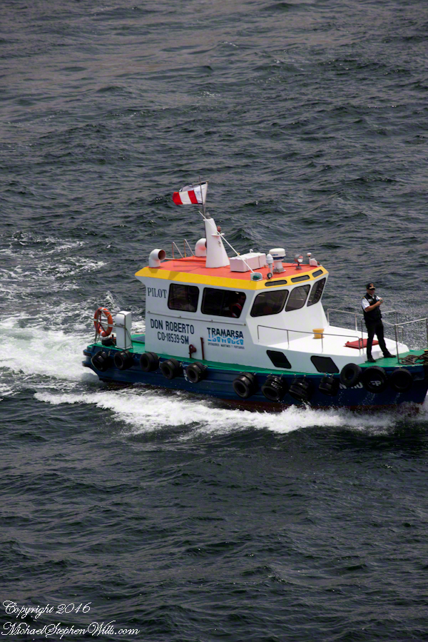
Here are shots of the pilot boat approaching the Regatta off the Peruvian port of Matarani. The boat was mirrored by the colorfully painted houses of Peru.
A fast pilot boat from Matarani approaches the Oceania Regatta. On the bow, the pilot will transfer from boat to ship. On board he will work with the Regatta crew to safely navigate the approach to the Matarani harbor and dock. The whiteness on the land is diatomaceous earth.The whiteness on the land is diatomaceous earth.
A cautious approach. In the third shot the boat turns to slowly approach the Regatta.
Alongside, boat crewmembers joint Don Roberto on the bow to assist in the transfer. I am not sure which of the two blue uniformed persons was “our” pilot.
I did not capture the boarding of the pilot who served the Regatta through the Chilean Fjords. Was is at Puerto Montt? Puerto Chacobuco? I am not sure. I do know a maritime pilot was on board as the channel narrowed to 2 miles, named Scout Channel were we passed Scout Island. I was facing generally east from our port side stateroom veranda while capturing these photographs as the Regatta headed south.
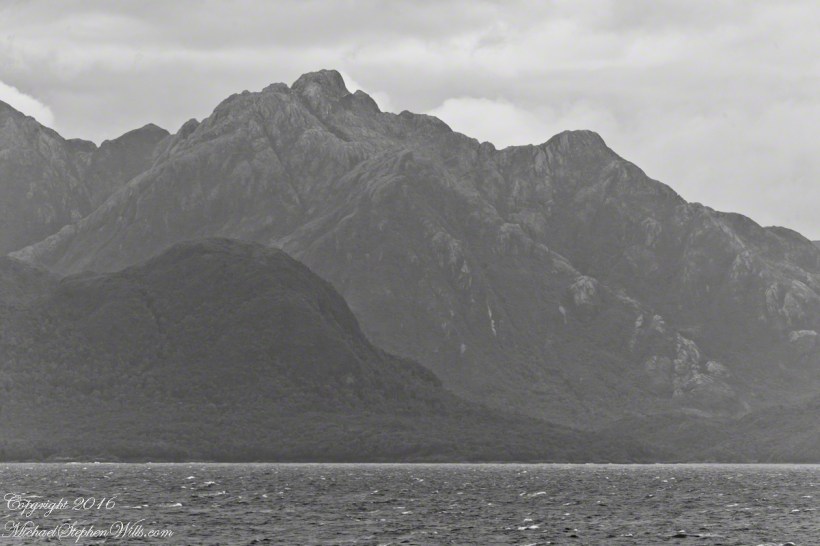
Scout Island. The water is Scout Channel
The peak on Scout Island is about 2,100 feet. The smaller peaks in front are about 1,200 and 1,500 feet. All rise straight up from Scout channel.
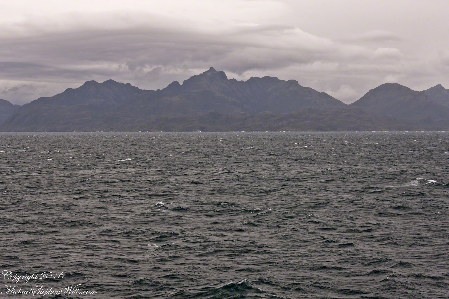
Scout Island lies on the Scout CanalLying just south of Scout Island, Scylla Island is between our ship, in the Scout Canal, and the Kruger Canal. The Kruger is short, between Islands Scout, Orebar, Zealous, Porcia and Tito.Islet Alert is between Canal Scout and Canal Kruger. On the far left there are waves breaking on Pilot Point of Orebar Island, marking the northern end of a small bay, named Hale. You can see the bay behind Islet Alert. On the far left there are waves breaking on Pilot Point
The Gulf of Penas is exposed to the storms of the western pacific. We are here moving from Aisen Region to the Magellan Region of Chile. Also known as Patagonia. This view is the Larenas Peninsula. The Northern Patagonian Ice Fields are on the other side of those mountains, the Southern Andes.
Taken with a Canon EOS 1Ds Mark3, the EF 70-300 f 4-5.6L IS USM lens, tripod mounted on a Manfrotto carbon fiber travel tripod. UV filter 1/160 second at f 6.3 ISO 250.
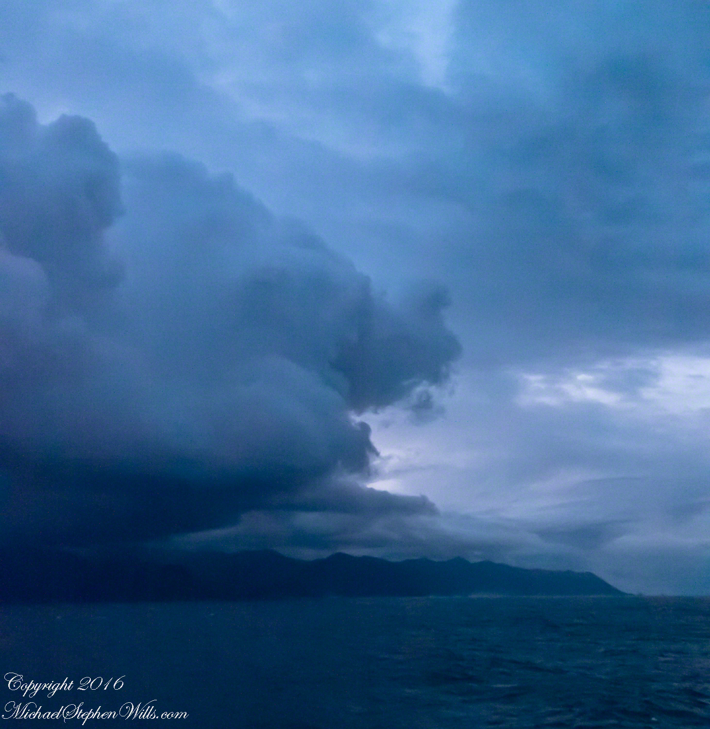
There is a steady wind of about 12 mph driving a few white caps. A line of surf is seen breaking against the cliffs. Shot midmorning from our stateroom terrace as the Regatta cruises south, February 17, 2016. We are headed to an encounter with the Iceberg Glacier of the Southern Ice Fields of Patagonia.
Photography conditions were poor: shooting into the sun from an unstable platform gives poor contrast for the mountain crags. The stabilization of the Canon lens was helpful and I balanced the need for a short exposure with the lowest ISO possible. No time to experiment.
Copyright 2022 Michael Stephen Wills All Rights Reserved
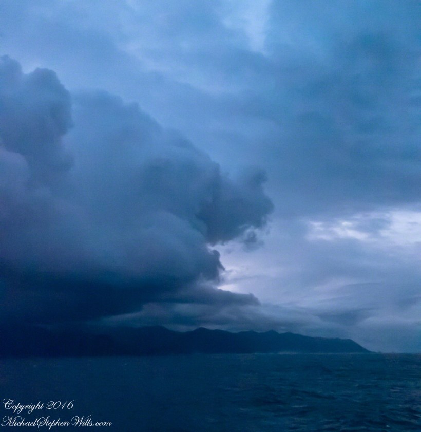
Rounding the Aysen Region headland of the Penas Gulf. Next land will be the Magellian Region extending to Cape Horn. In the Penas Gulf we will enter the Messier Channel and the fjords.
Taken with a tripod mounted Sony DSLR A 700 DT 18-200 variable lens set to 18 mm. 1/40 second at f4.5 ISO 6400. The sun was still low, after sunrise with gathering storm clouds from the terrace of our state room (a moving ship).
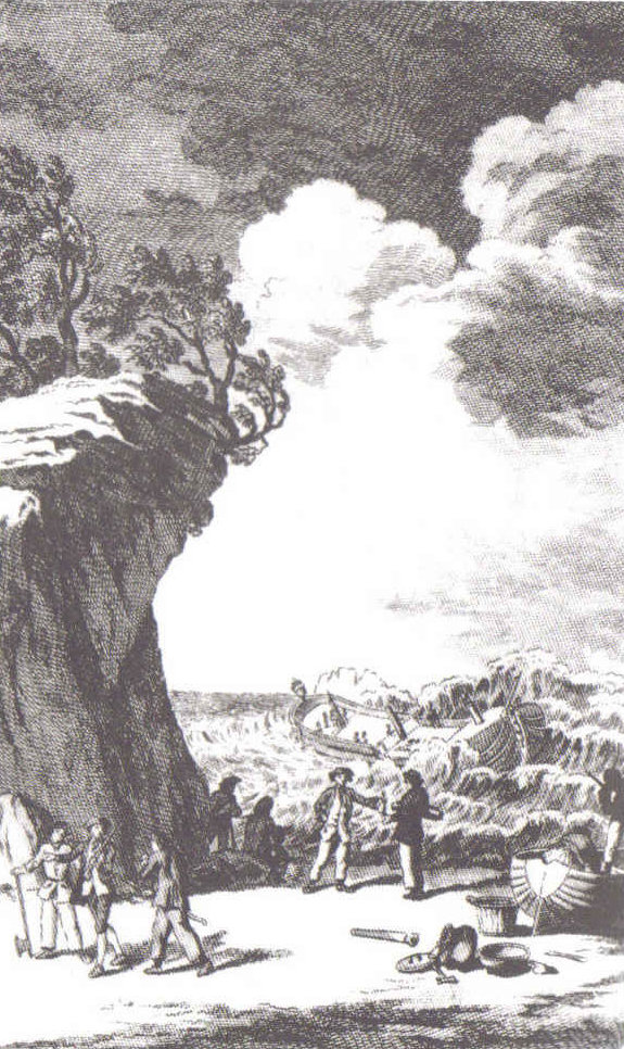
Our early morning traverse of the Penas Gulf was smooth sailing in route for Tarn Bar, entrance to the Messier Channel. We’ll pass Wager Isle where May 14, 1741 the H.M.S. Wager wrecked, stranding the crew. Speaking to the conditions on board, immediately some of the crew broke into the “Spirit Room, got drunk, armed themselves and began looting, dressing up in officers’ clothes and fighting,” many drowning the next day when the Wager flooded and sank.
The original fronts piece to Byron’s Narrative; “Being an Account of the Shipwreck of The Wager and the Subsequent Adventures of Her Crew.”
The remaining 140 officers and crew manned the boat to make for shore in the Patagonian winter. Five years later, midshipman John Byron, grandfather to the poet Lord Byron, made it back to England with the Captain David Cheap. Just west of Wager Isle is the larger Byron Isle, named in his honor.
On this south heading our cabin on the port side faced east. In these early morning hours, I set up on the stateroom balcony, so for better or worse there is no views of either Wager or Byron Isle.
Since 1877 primary education in Uruguay is universal, compulsory and free. These days students receive free education through university, literacy is the highest in South America at 95%, equally for males and females.
These photographs are from a cruise around South American my wife, Pam, and I enjoyed February / March 2016 on the Oceania ship Regatta. This was the evening of February 26, 2016, a Friday, in the city Montevideo, Uruguay.
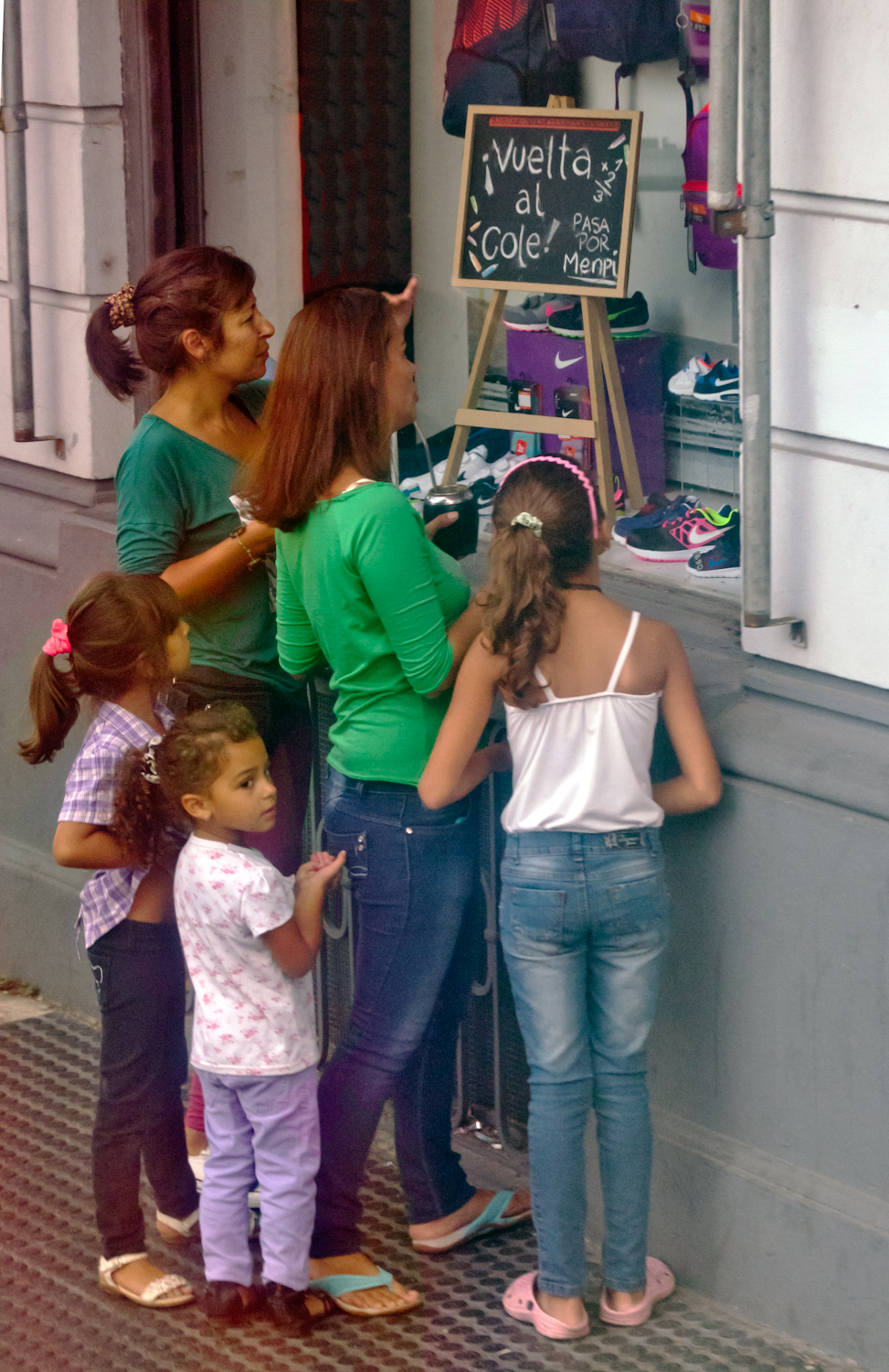
This image is the theme of this blog, “back to school”. On Avenue Gral Eugenio Garzon of the Colon neighborhood of Montevideo a mother and four daughters discuss a shop window featuring “back to school” clothing and necessaries. The children range in age from pre-school to teen. This is evidently a serious discussion about preparing for the school year which starts in March for Uruguay.
A government program launched in 2007 expands Information and Communication technologies in primary schools with these goals:
— To distribute technology,
— To promote knowledge,
— To generate social equity.
Called Ceibal, after a tree native to Uruguay, the program was a success. From 2009 – 2012 450,000 laptops, popularly named “”ceibalitas”, were delivered to children coordinate with teacher training and a monitoring and evaluation model for assessing the impact nationally. Ceibal is the acronym for “Conectividad Educativa de Informática Básica para el Aprendizaje en Línea” (Educational Connectivity/Basic Computing for Online Learning in English).
These photographs build on the theme of the positive influence education has on the lives of Uruguayans, many of whom live in poverty.
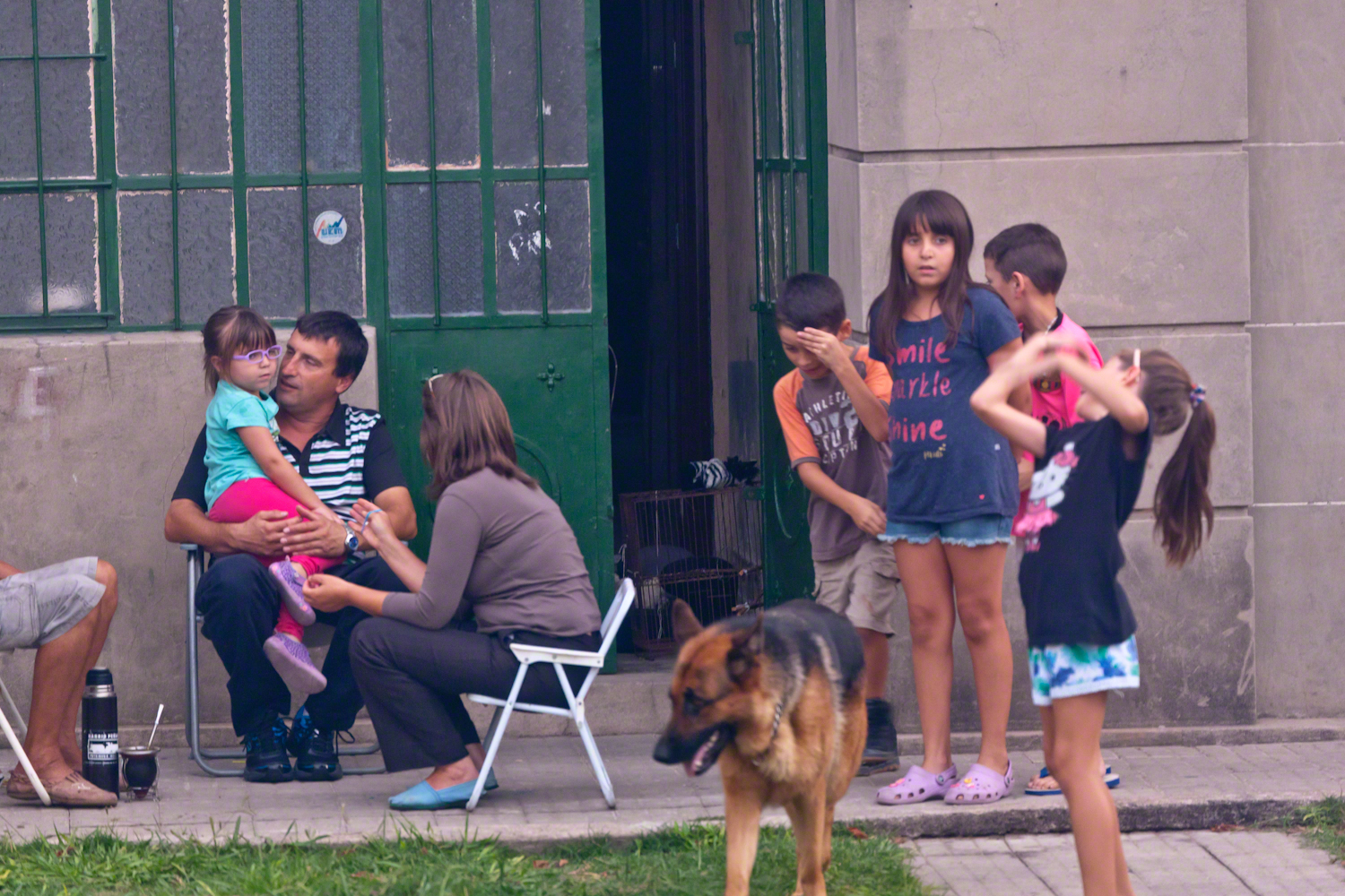
A family gathering in their yard on Avenue Gral Eugenio Garzon, enjoying a cool late summer evening.
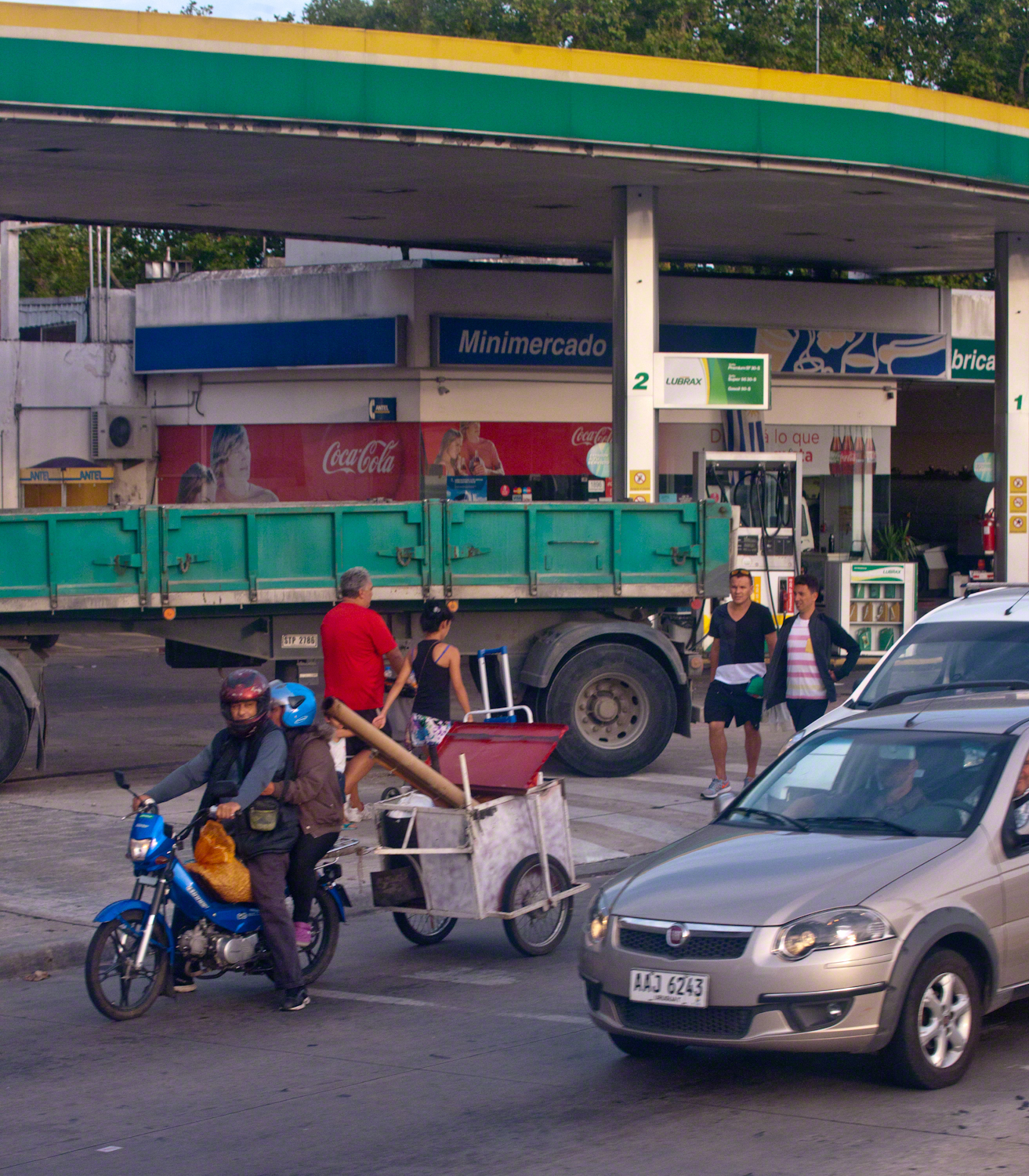
Traffic and a gas station. People were out and about, walking and conversing. There is a makeshift trailer attached to the motorcycle, behind is a large truck.
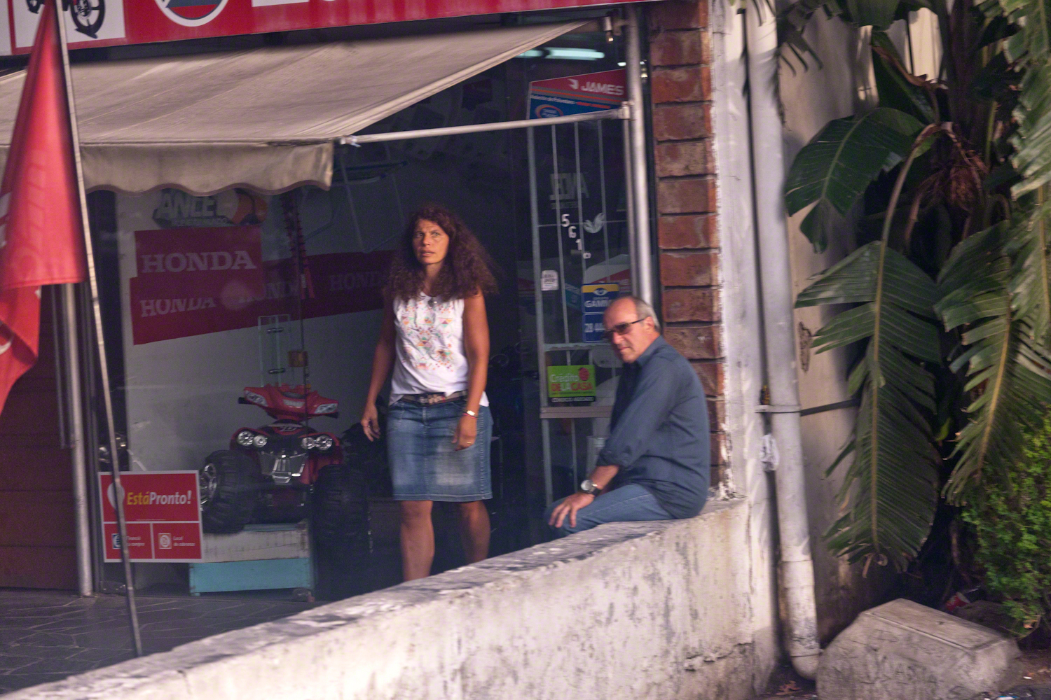
Storefront with customer and man loitering on wall. A mini-Honda all terrain vehicle is on display.
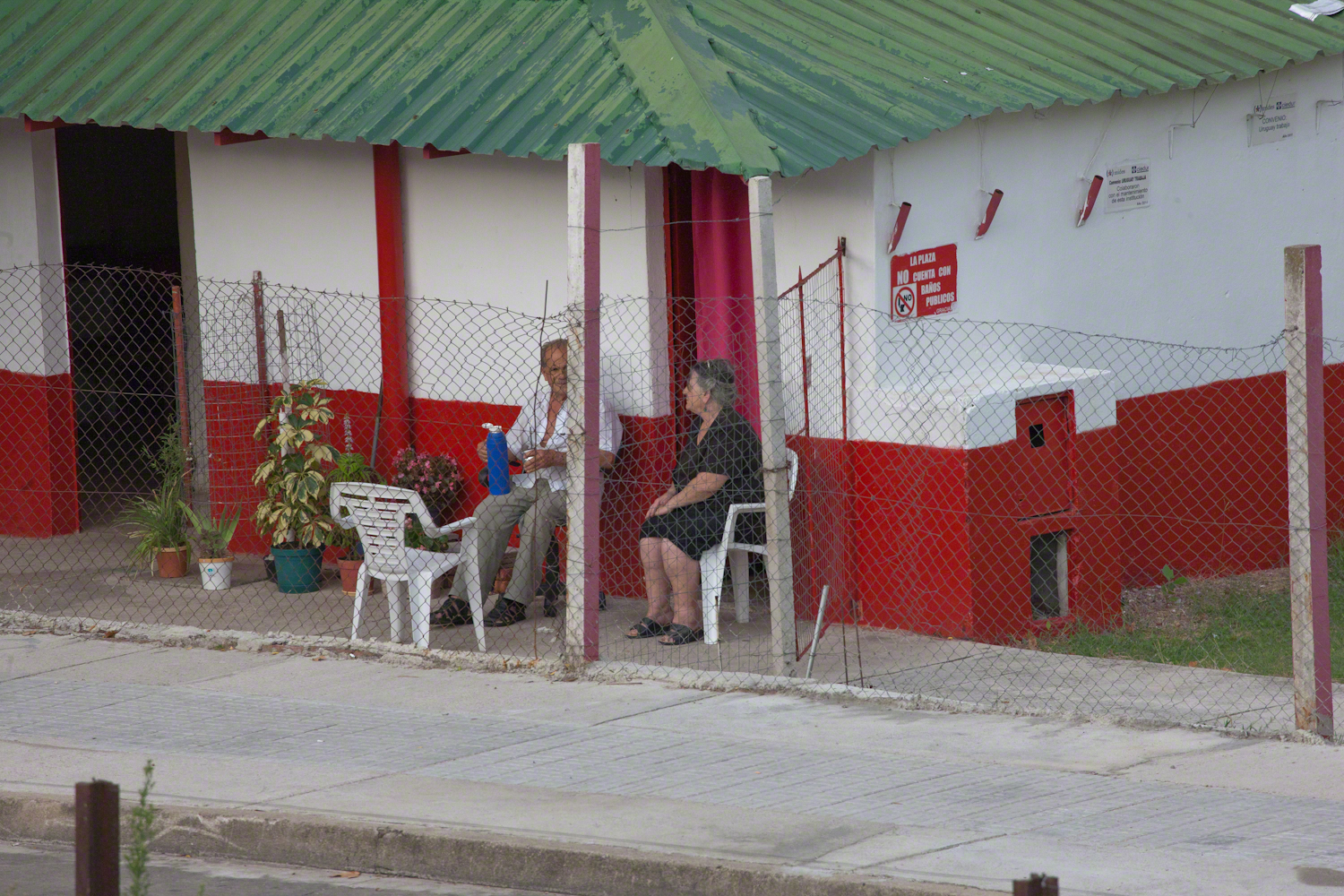
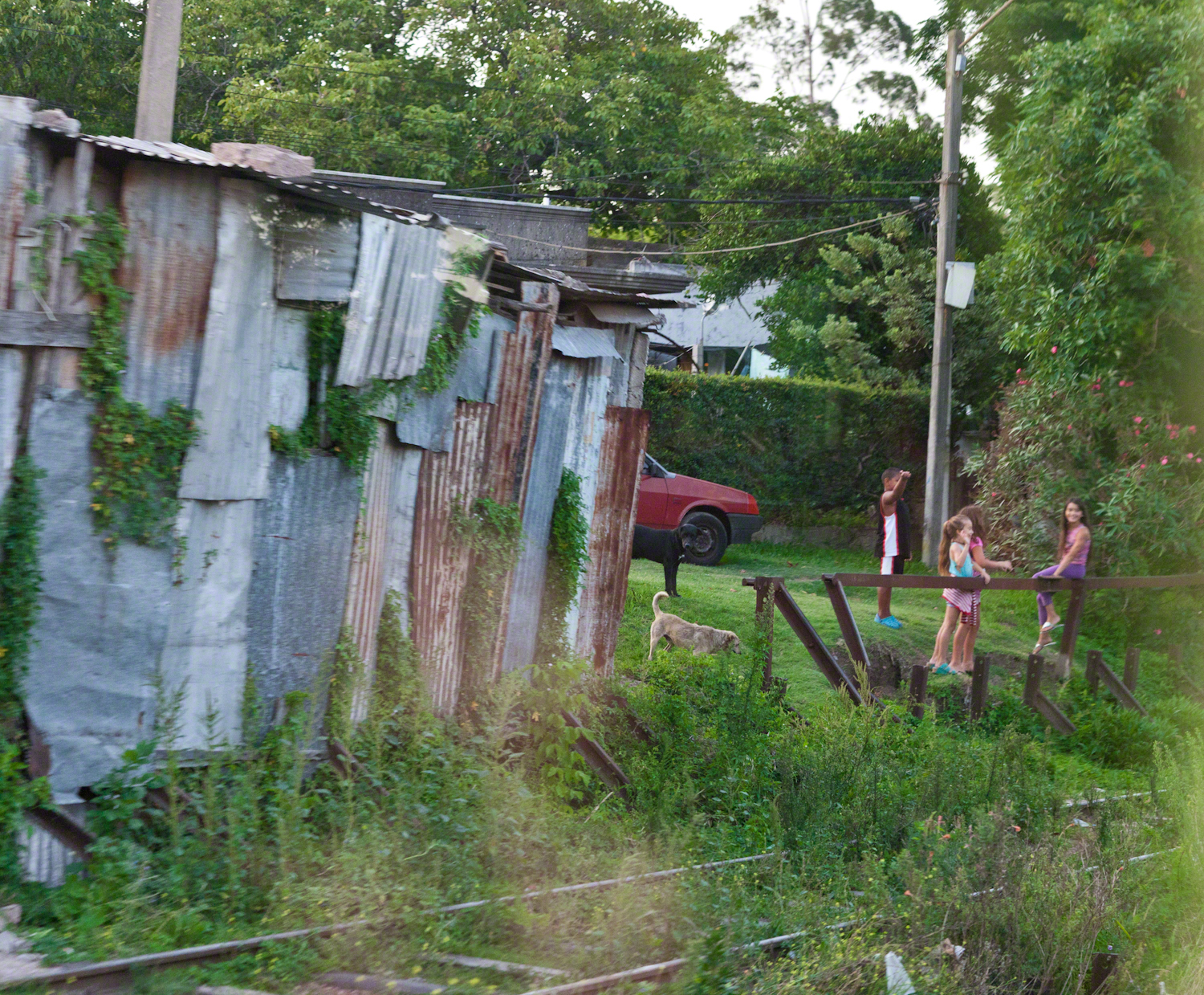
Mate is a beverage enjoyed throughout South America. Here companions enjoy a warm summer evening with a thermos of hot water and mate gourd behind a restaurant, their view across the train tracks and the Colon rail station is of a playground and playing fields.
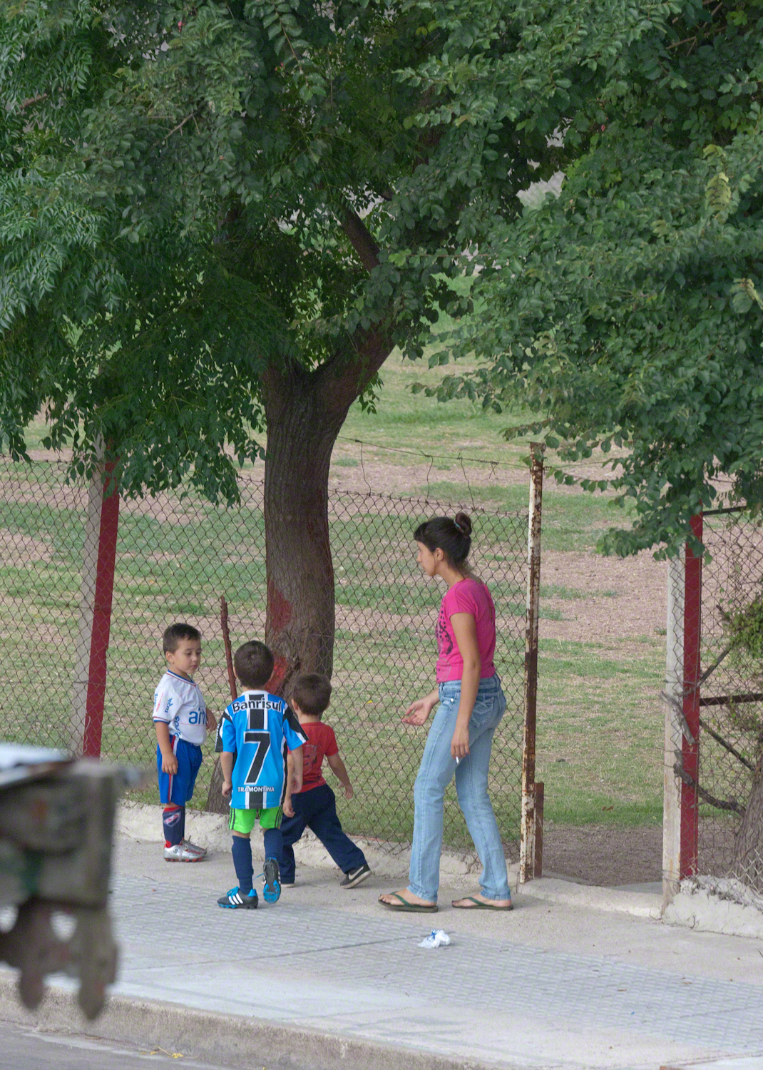
A family of very young soccer players coming from practice with teammates. The sponsors of lucky number 7 are the bank Banrisul and Tramontina, a kitchenware manufacturer.
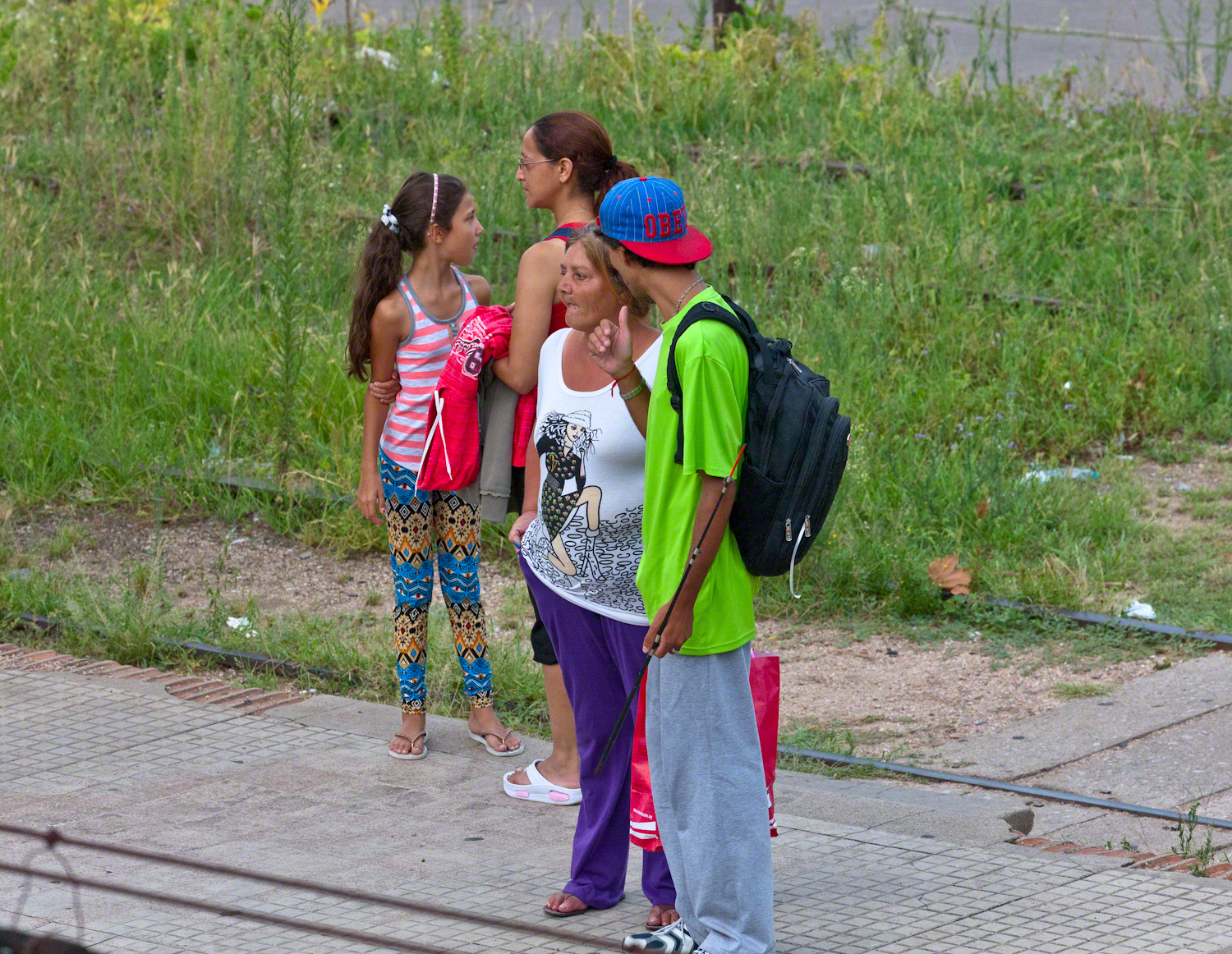
We waited to board an historic train and shared the station with Montevideans waiting for a passenger train. Here are two families: a mother and pre-teen daughter colorfully dressed, a grandmother and grandson. Behind them are the playing fields and playground.
A passenger train heading north passed while we waited for our ride to begin. Curiosity shines from this child’s eyes.
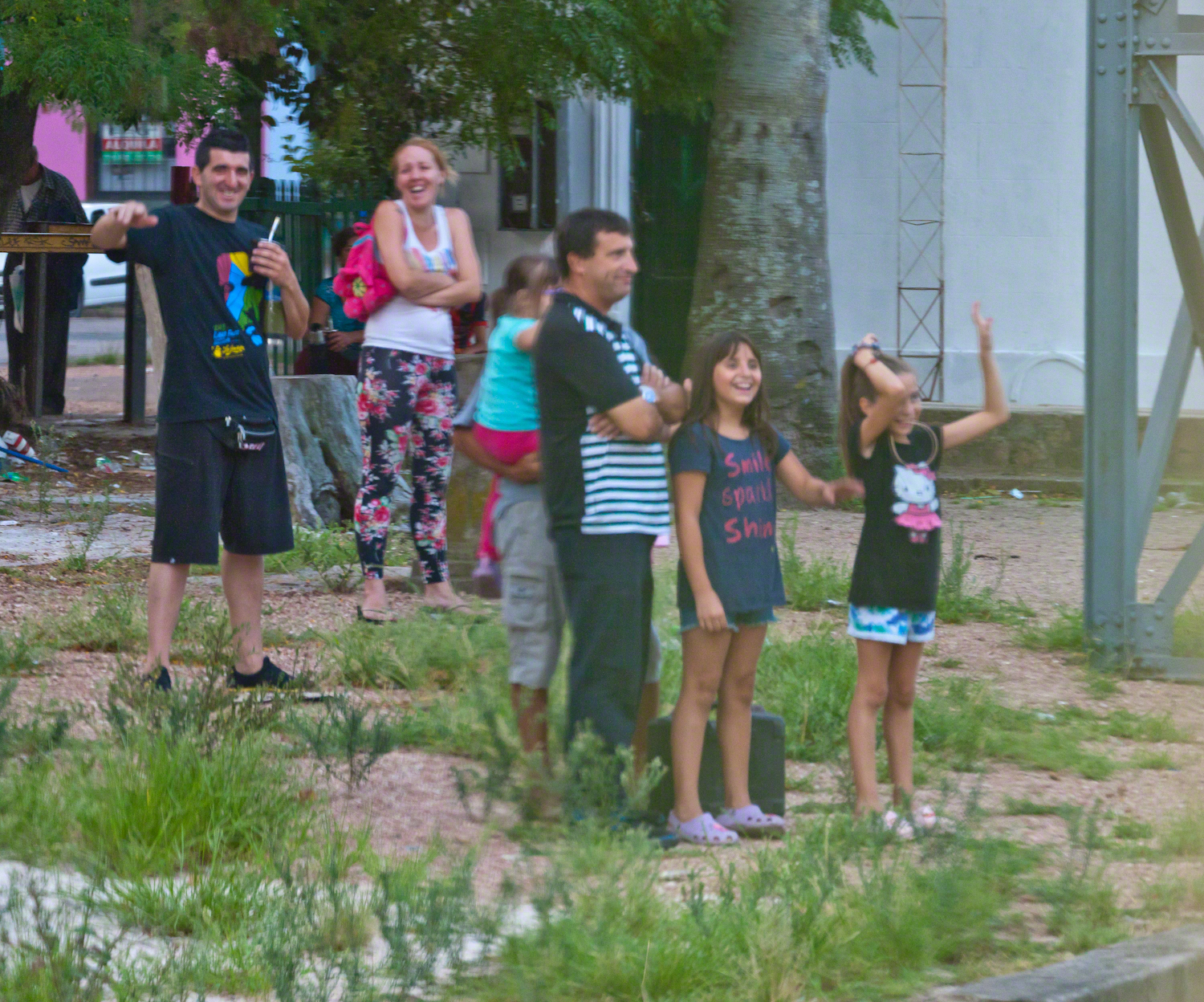
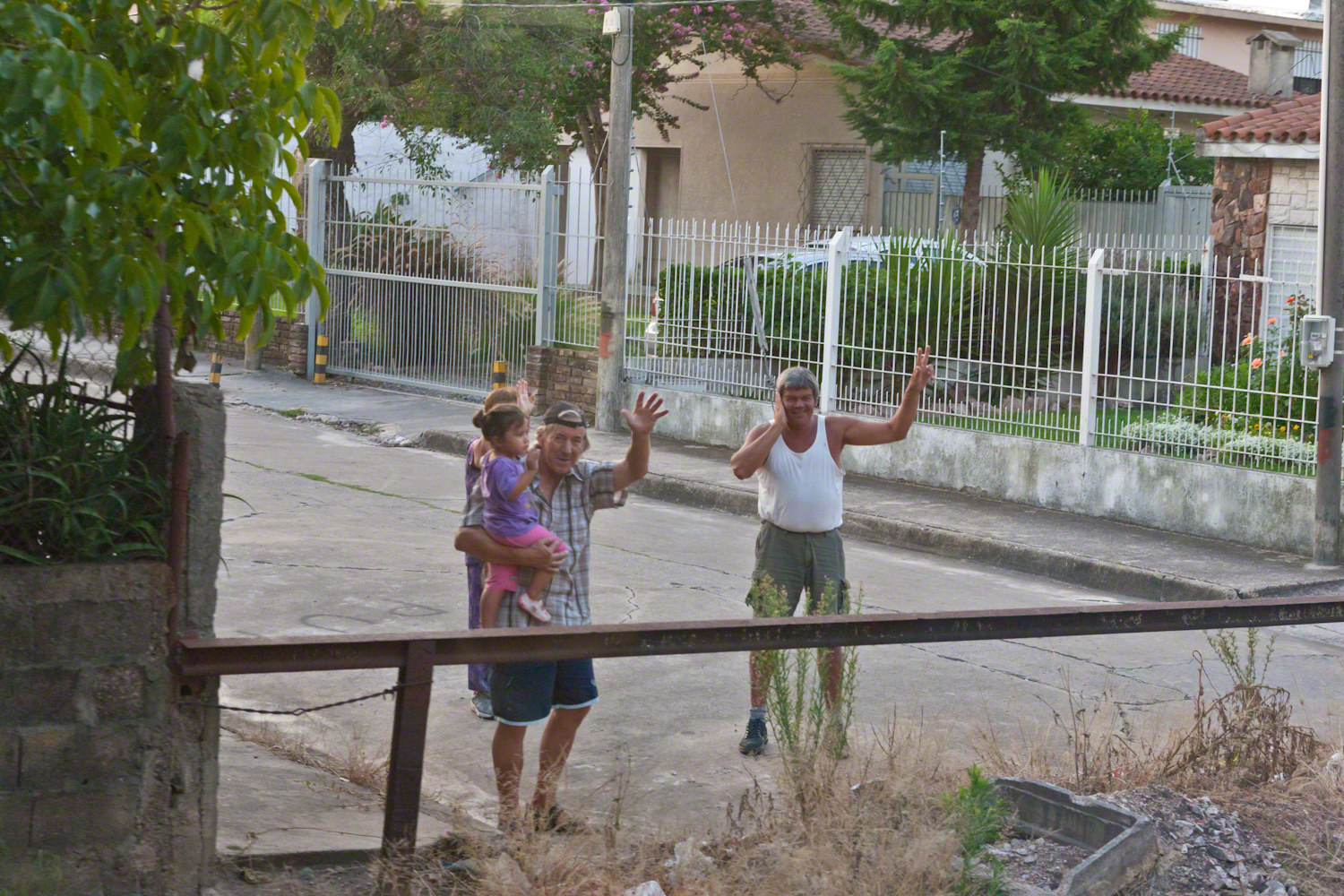
Happy families greeted us with waves and smiles during our trip to downtown Montevideo.
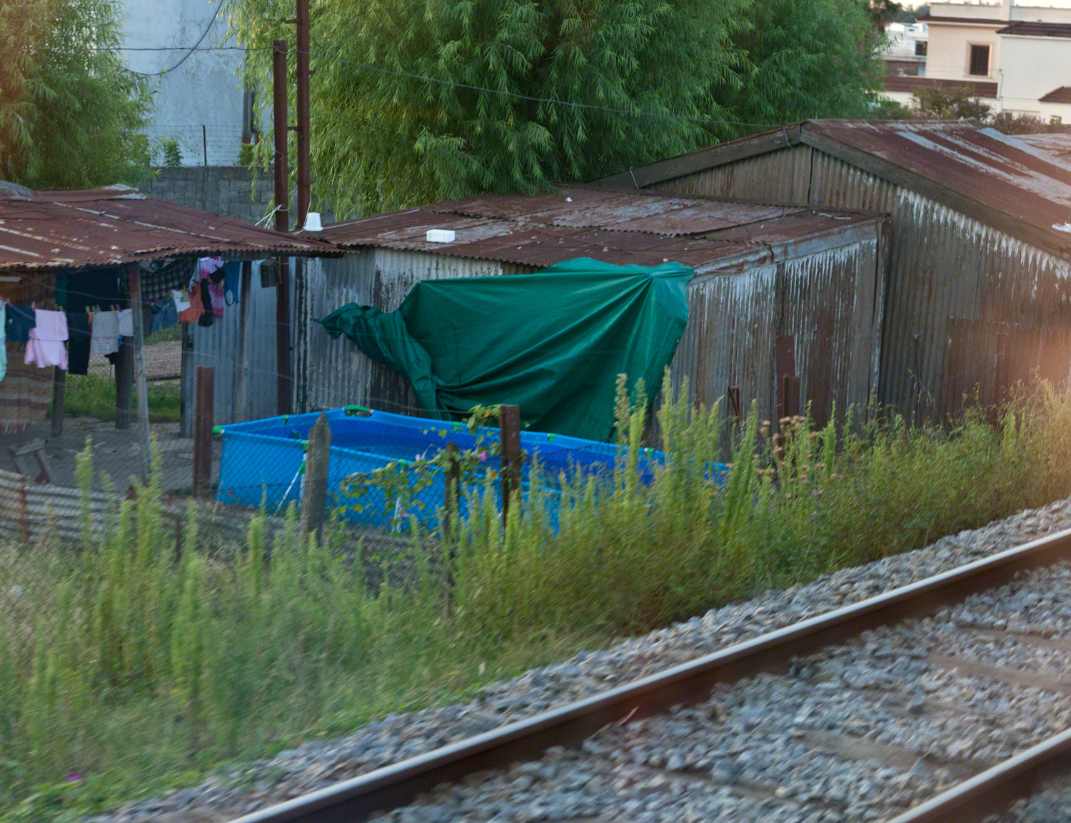
Some of the homes along the rail line. Pools such as that are popular in cities. We saw a great many on the streets in Lima, Peru.
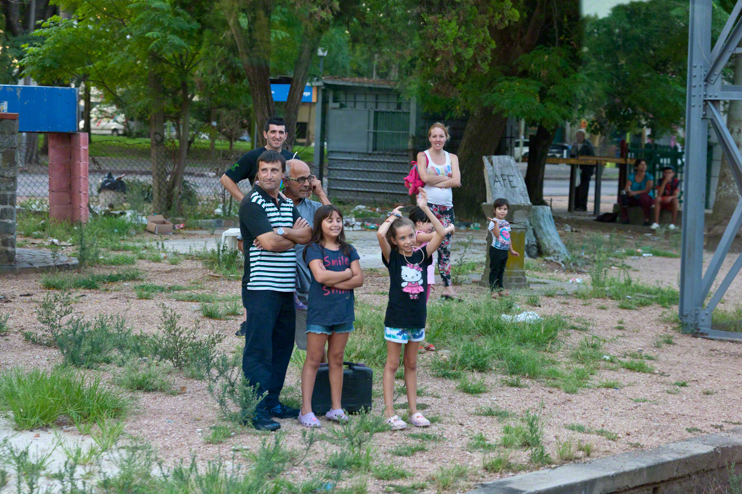
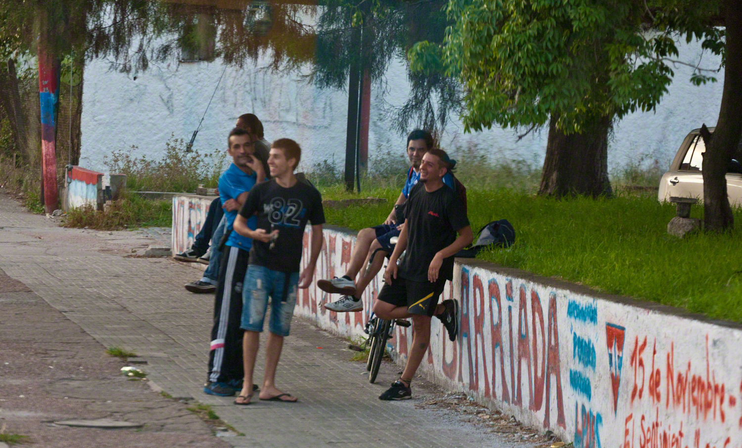
Reaction to the historic train from a group of young men.
Curious playmates gather at the end of the road.
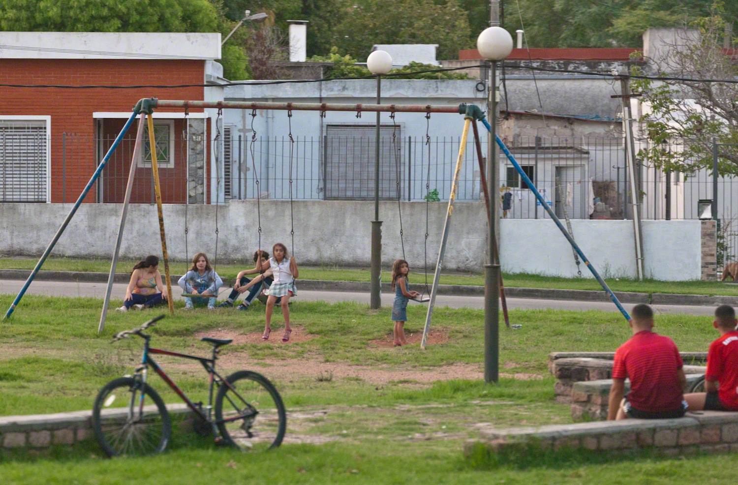
A well attended playground.
Copyright 2021 Michael Stephen Wills All Rights Reserved