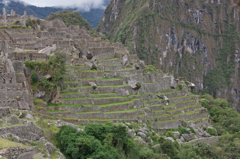
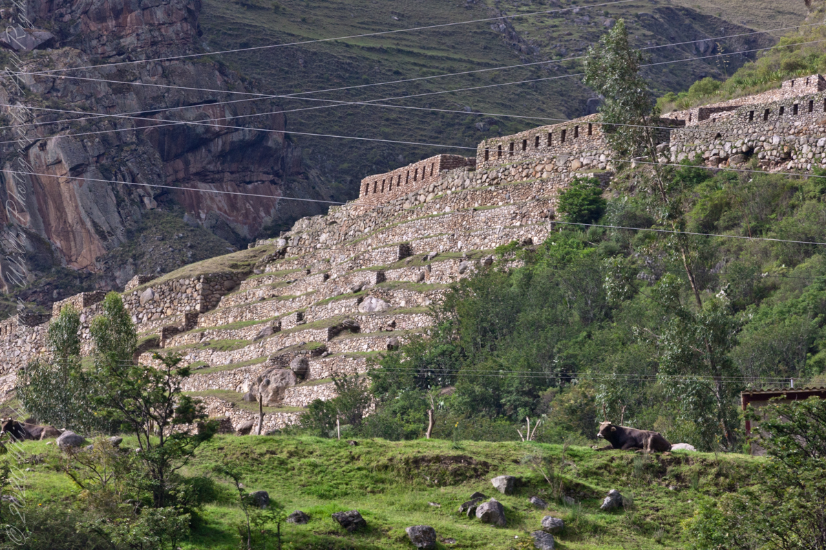
These agricultural terraces, built in the 15th century, were still in limited use by local farmers when Bingham arrived in the early 20th century.
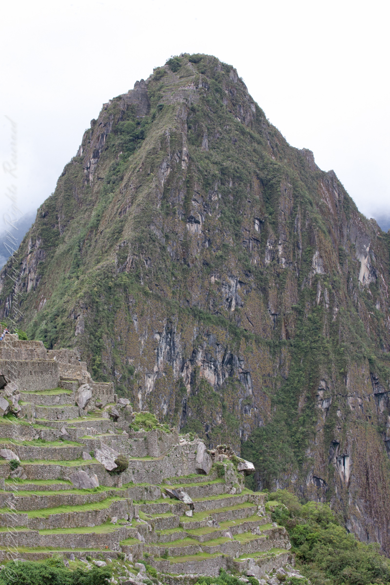
These terraces were a work of considerable engineering, built to ensure good drainage and soil fertility while also protecting the mountain itself from erosion and landslides. Modern soil studies reveal the major crops were corn and potatoes. These terraces are below the districts named “Industrial Zone” and “Factory Houses.” A cliff of Huayna Picchu is in the background.
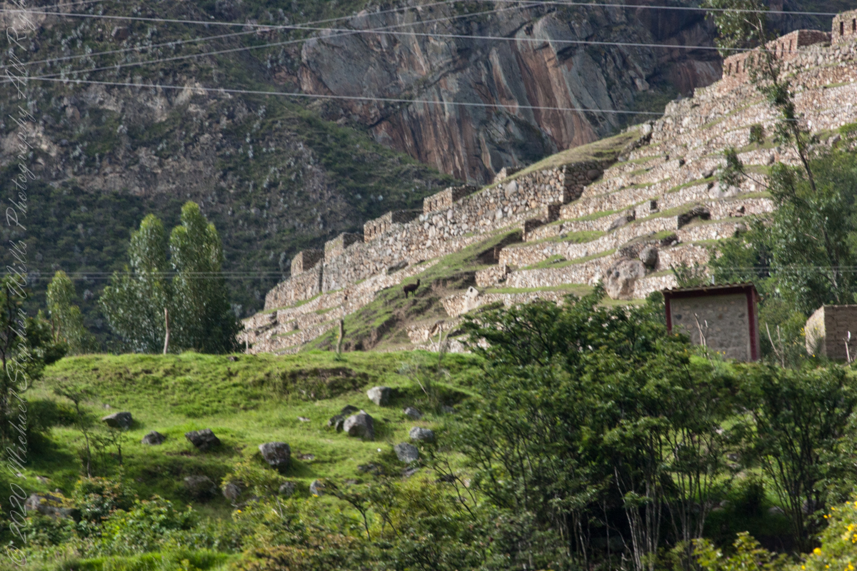
This photograph demonstrates either repair of or adaptation to landslides.
Copyright 2023 Michael Stephen Wills All Rights Reserved
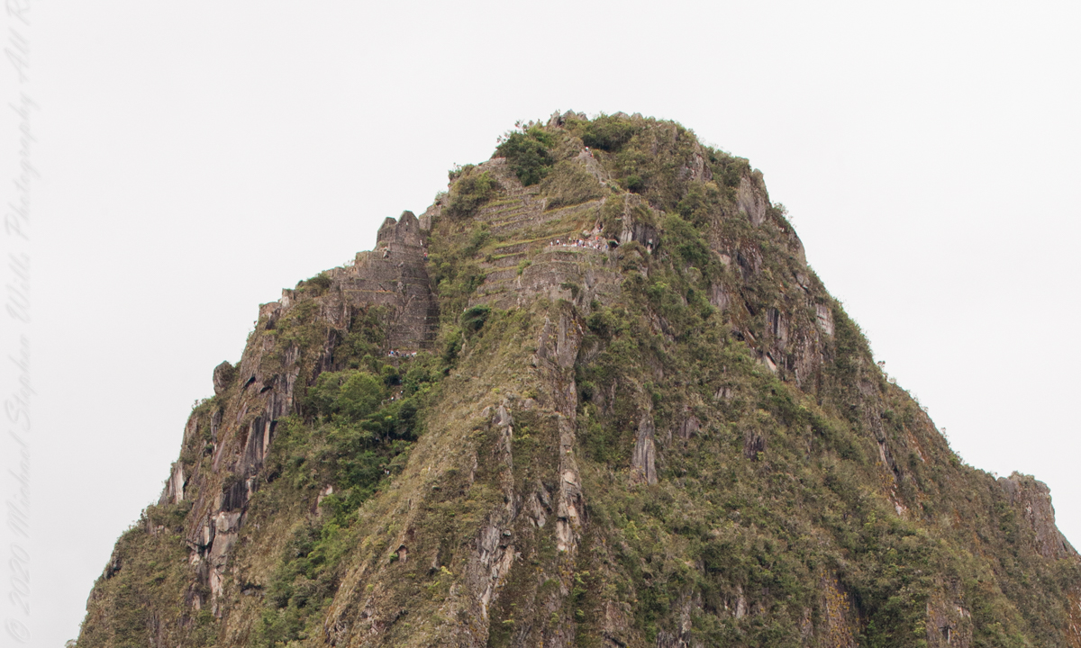
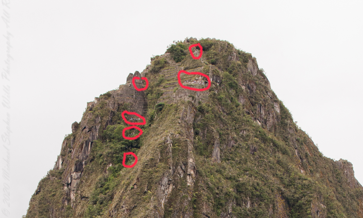
I set up a Manfrotto BeFree tripod with the Canon EOS 1DS Mark III mounted with the Canon EF 70-300 f/4-5.6 L IS USM lens. The lens is fast enough for the clear images from the train. Here, stabilized on a tripod, we can see tourists climbing and gathering on the peak as well as the terraces and ruins on top.
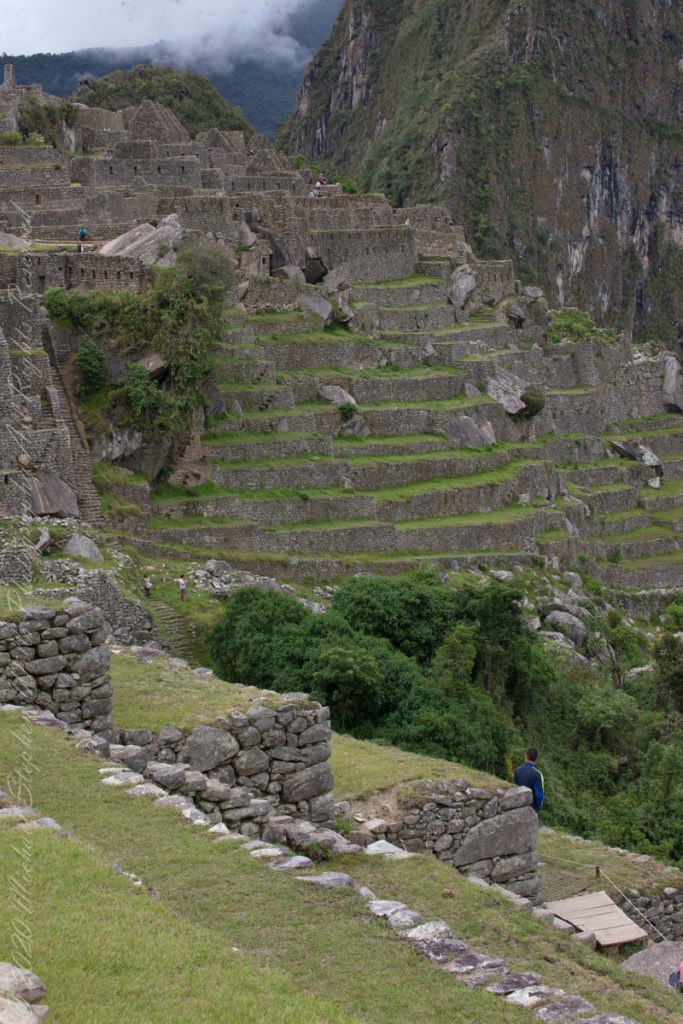
“Huayna Picchu, Quechua: Wayna Pikchu, is a mountain in Peru around which the Urubamba River bends. It is located in the Cusco Region, Urubamba Province, Machupicchu District. It rises over Machu Picchu, the so-called lost city of the Incas. The Incas built a trail up the side of the Huayna Picchu and built temples and terraces on its top. The peak of Huayna Picchu is 2,693 meters (8,835 ft) above sea level, or about 260 meters (850 ft) higher than Machu Picchu.”
“According to local guides, the top of the mountain was the residence for the high priest and the local virgins. Every morning before sunrise, the high priest with a small group would walk to Machu Picchu to signal the coming of the new day. The Temple of the Moon, one of the three major temples in the Machu Picchu area, is nestled on the side of the mountain and is situated at an elevation lower than Machu Picchu. Adjacent to the Temple of the Moon is the Great Cavern, another sacred temple with fine masonry. The other major local temples in Machu Picchu are the Temple of the Condor, Temple of Three Windows, Principal Temple, “Unfinished Temple”, and the Temple of the Sun, also called the Torreon.“
Terraces are salient, to left of peak is a roofless, gabled ruin. Look carefully to find climbing tourists and groups on terraces. Huayna Picchu
“Its name is Hispanicized, possibly from the Quechua, alternative spelling Wayna Pikchu; wayna young, young man, pikchu pyramid, mountain or prominence with a broad base which ends in sharp peaks, “young peak”. The current Quechua orthography used by the Ministerio de Cultura is Waynapicchu and Machupicchu.”
Terraces are salient, to left of peak is a roofless, gabled ruin. Look carefully to find climbing tourists and groups on terraces. Huayna Picchu.
Reference: Wikipedia “Huayna Picchu.”
Copyright 2023 Michael Stephen Wills All Rights Reserved
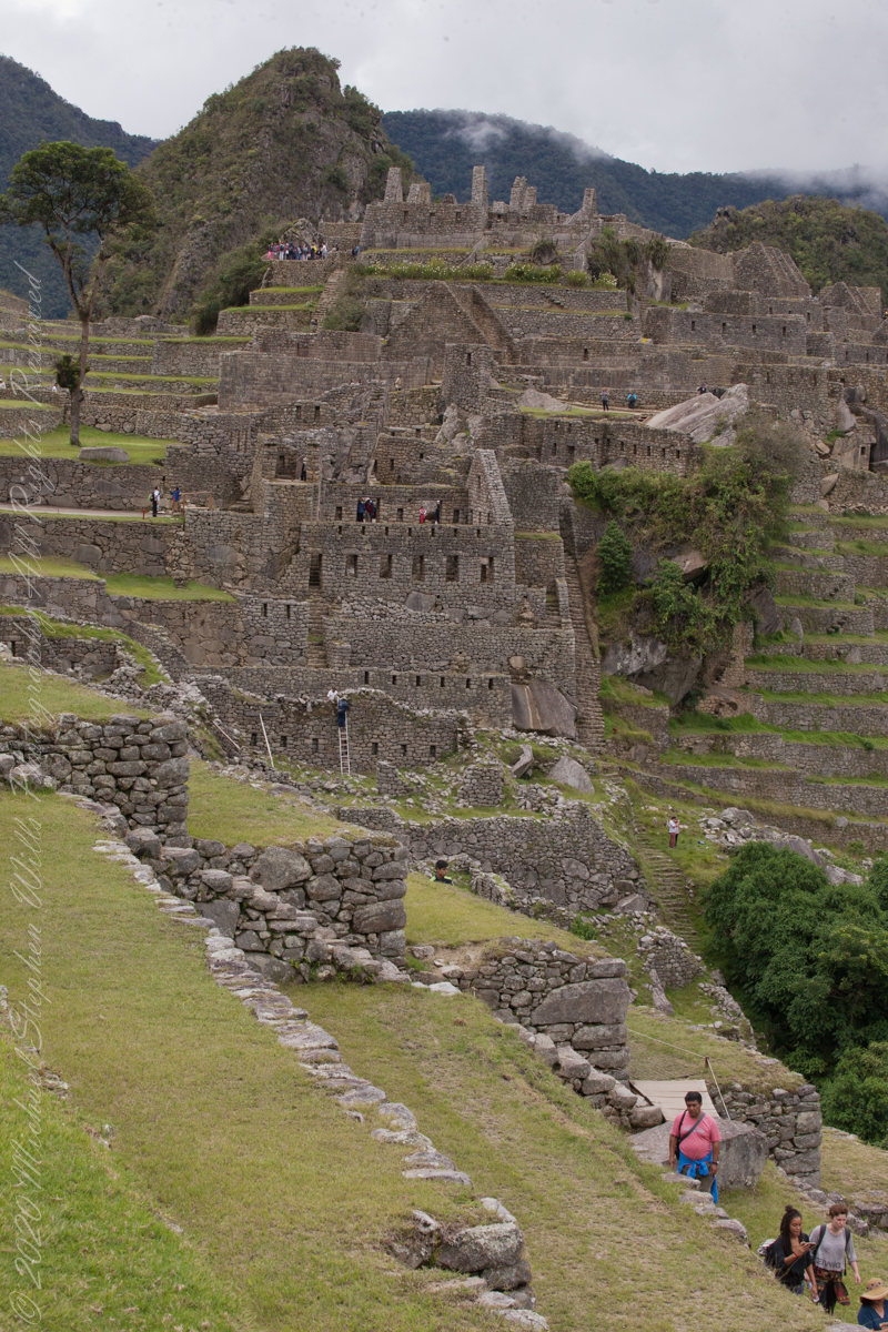
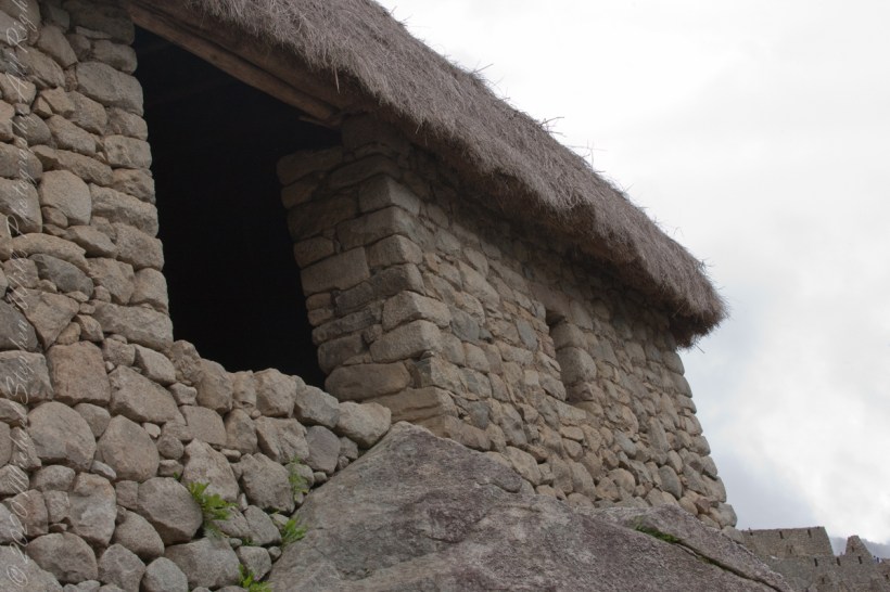
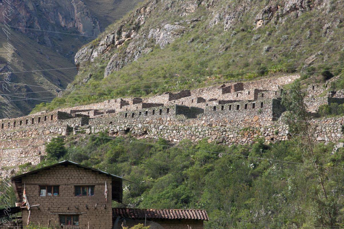
The wall with six rectangular windows is part of the “Prison Group”, a labyrinthine complex of cells, niches and passageways, positioned both under and above the ground. A portion of agricultural terraces is to the right and foreground. Look closely to see a group of tourists in the “Industrial Zone” district.
Copyright 2023 Michael Stephen Wills All Rights Reserved
These agricultural terraces, built in the 15th century, were still in limited use by local farmers when Bingham arrived in the early 20th century. These terraces were a work of considerable engineering, built to ensure good drainage and soil fertility while also protecting the mountain itself from erosion and landslides. Modern soil studies reveal the major crops were corn and potatoes. These terraces are below the districts named “Industrial Zone” and “Factory Houses.” A cliff of Huayna Picchu is in the background.
Copyright 2023 Michael Stephen Wills All Rights Reserved
On our way to the Urban Sector of Machu Picchu I capture the peak of Huayna Picchu above a rough stone wall. “Huayna Picchu, Quechua: Wayna Pikchu, is a mountain in Peru around which the Urubamba River bends. It is located in the Cusco Region, Urubamba Province, Machupicchu District. It rises over Machu Picchu, the so-called lost city of the Incas. The Incas built a trail up the side of the Huayna Picchu and built temples and terraces on its top. The peak of Huayna Picchu is 2,693 meters (8,835 ft) above sea level, or about 260 meters (850 ft) higher than Machu Picchu.”
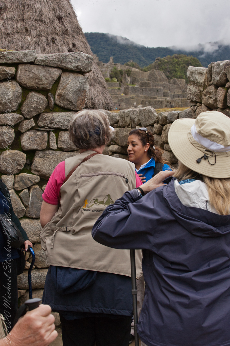
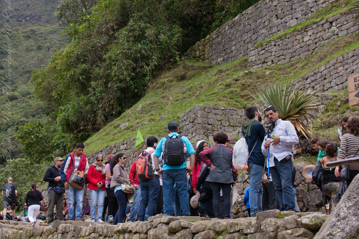
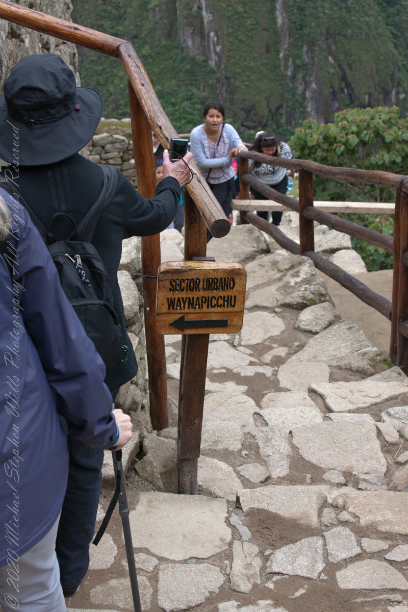
A fellow group of tourists wait for entry to the citadel
“According to local guides, the top of the mountain was the residence for the high priest and the local virgins. Every morning before sunrise, the high priest with a small group would walk to Machu Picchu to signal the coming of the new day. The Temple of the Moon, one of the three major temples in the Machu Picchu area, is nestled on the side of the mountain and is situated at an elevation lower than Machu Picchu. Adjacent to the Temple of the Moon is the Great Cavern, another sacred temple with fine masonry. The other major local temples in Machu Picchu are the Temple of the Condor, Temple of Three Windows, Principal Temple, “Unfinished Temple”, and the Temple of the Sun, also called the Torreon.“
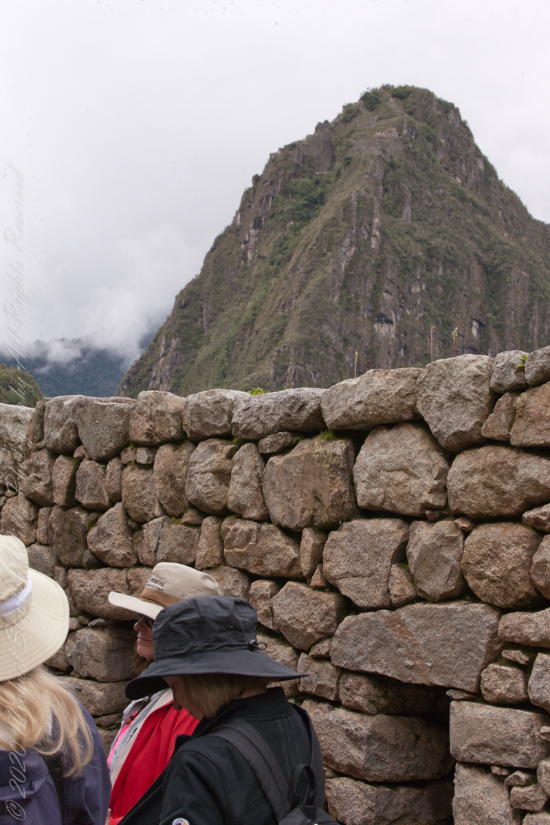
The end of a long climb
“Its name is Hispanicized, possibly from the Quechua, alternative spelling Wayna Pikchu; wayna young, young man, pikchu pyramid, mountain or prominence with a broad base which ends in sharp peaks, “young peak”. The current Quechua orthography used by the Ministerio de Cultura is Waynapicchu and Machupicchu.”
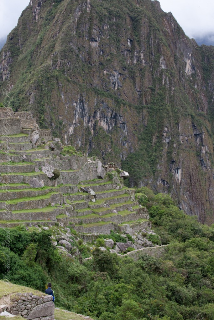
“Young Peak” rises above the “Lost City of the Incas.”
Reference: Wikipedia “Huayna Picchu.”
Copyright 2023 Michael Stephen Wills All Rights Reserved
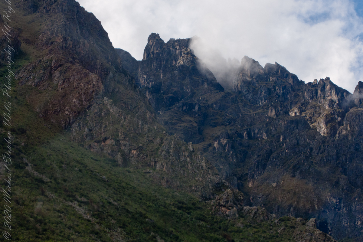
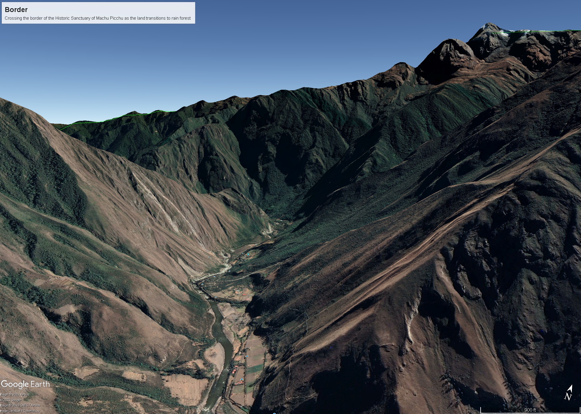
As we crossed the border of the Historic Sanctuary of Machu Picchu the valley walls rose steeply on either side, the land transitioning to rain forest.
Google Earth We approach the border of the Historic Sanctuary of Machu Picchu
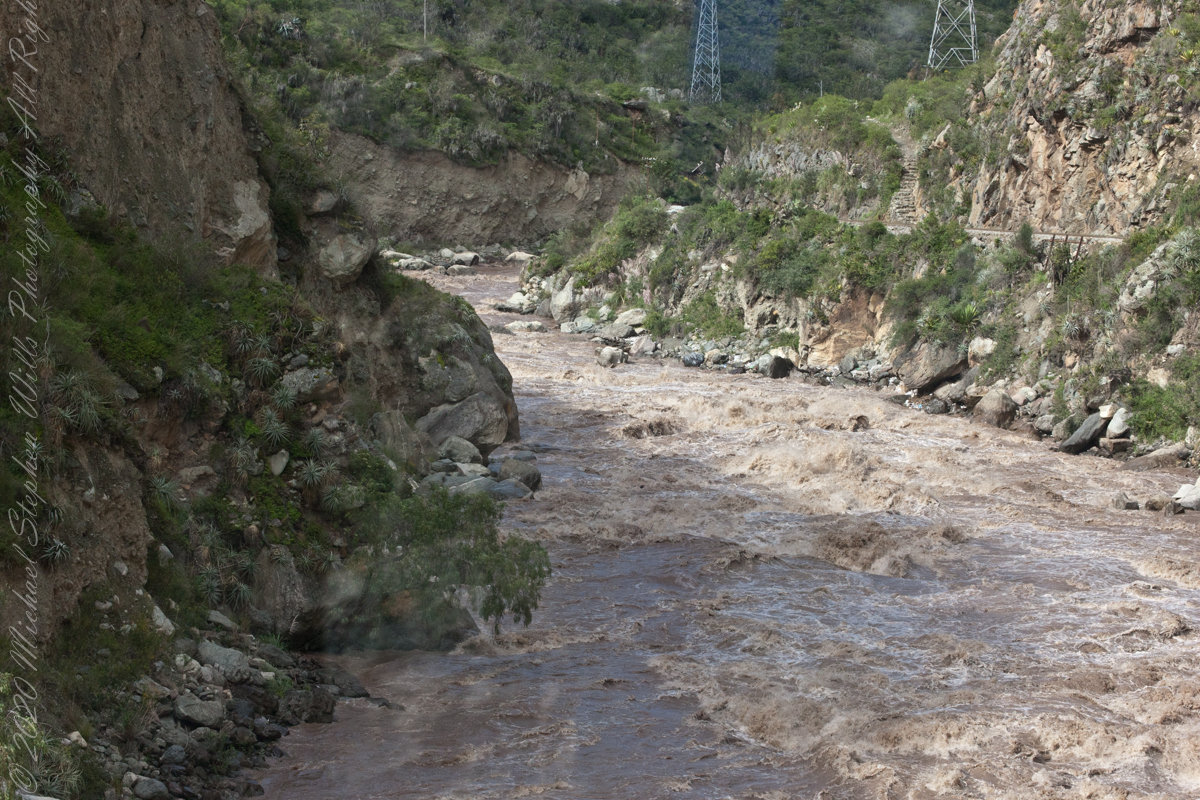
We entered a short tunnel through a mountain ridge, providing us this close view of the Urubamba River.
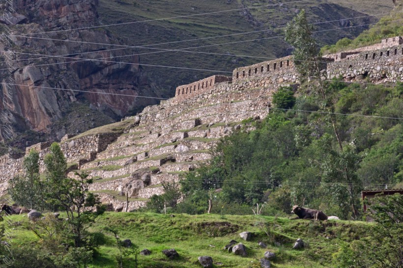
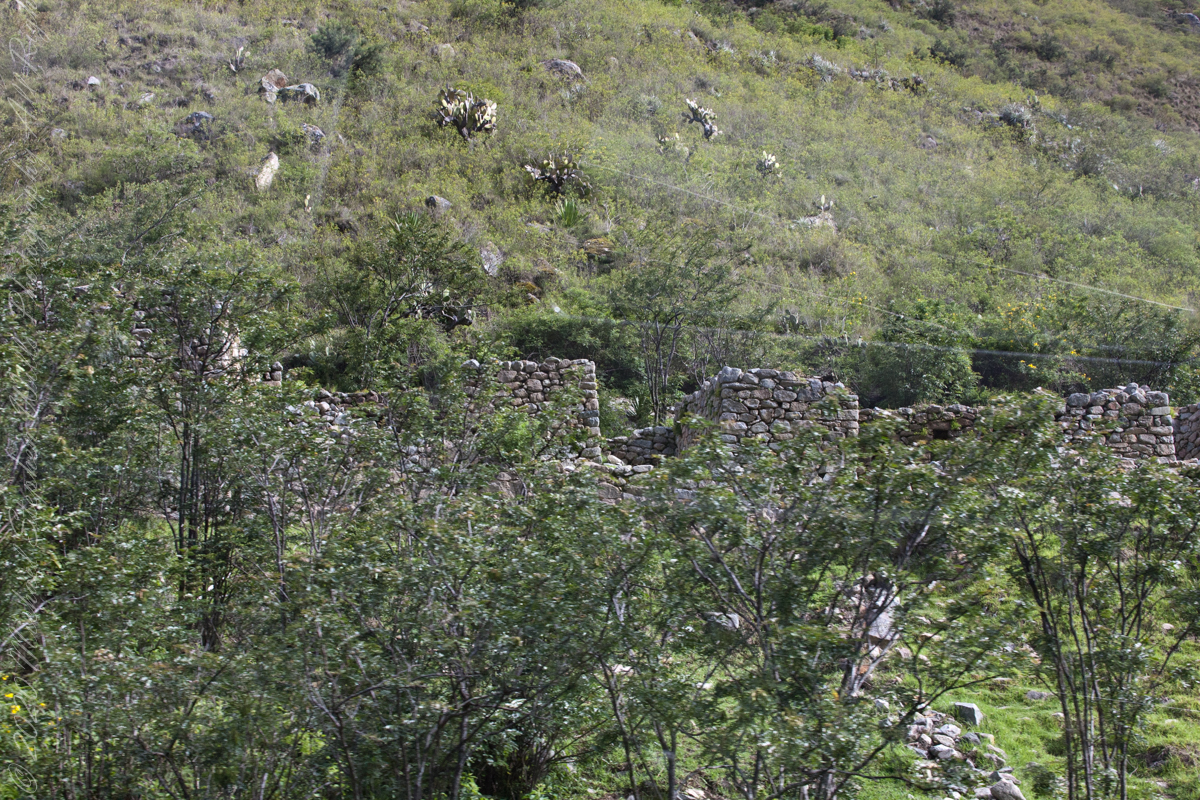
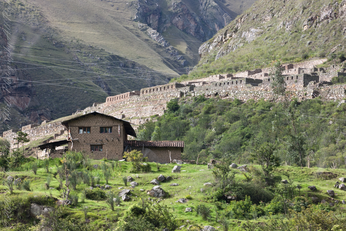
Next we came upon the Toronto Ruins.
The Toronto complex includes seven (7) archaeological groups and is in front of the Q’ente Complex, separated only by the Urubamba River, possibly they were independent chiefdoms with a strong economic bond.
The seven (7) archaeological groups are Torontoy: The local farmers call it Inkaperqa or Inca raqay, alluding to what they see. In this place we can find a main doorway, several groups of enclosures, patios or free areas separating the buildings, vestiges of a liturgical bath and a central enclosure with a lithic piece of more than 40 angles that joins other twenty-eight pieces with exact interlocking in the joints.
Salapunku: means hall door in the Inca language, because what is most obvious is a wide door that is on a platform that runs as a street in front of the wall. Behind the door we find cyclopean platforms and plains with remains of stairways, interior roads and remains of aqueducts. Qhanabamba translates to pampa where the grass “qhana” grows. It is at the height of Km. 85 of the railroad line. We can find a series of one-story buildings and a two-story building which is the largest. Wayrajpunku: meaning windy door (alluding to a windy place). In this group we find remains of buildings and a partially standing enclosure, there are vestiges of aqueducts, paths and overcrowding of canted stones that were part of constructions.
Pincha Unuyuj: Here were made the best hydraulic works of the zone, the crystalline waters that descend, appear channeled by wide lithic channels; also we find from the bank of the river a succession of parallel platforms, a road that leads to an adoratory carved in the rock insitu, ascending some houses and an observation tower. Qoriwayrachina It means gold winnowing. We can find the following: A huge staircase with more than one meter wide, semicircular ramparts, platforms as retaining walls and a vertical slope worked that is on the turbulent waters of the river.
Retamayuj, having a broom, in this group we can find long platforms with semi-cyclopean walls, tombs that are desecrated at the base of the mountain and others intact. In 2008 A team from Peru’s National Institute of Culture (INC) working on the ruins of Torontoy in the Historic Sanctuary of Machu Picchu, discovered the tomb of an Inca with full funerary regalia. The gender and age of the tomb’s owner has not yet been determined but found with the body were a number of decorated ceramics and two pins.
Copyright 2023 Michael Stephen Wills All Rights Reserved
Each of the 603 steps between the Skellig Michael dock and the monastery evoked contemplation, caution, wonder and gratitude.
Contemplation: how did the monks manage to survive while placing the steps? It can only be by a careful division of labor once a survival tripod was build. By tripod I mean the basics food, shelter, warmth.
Caution: as with any steps, for a 60+ person I have learned the hard way falls take a long time to recover from.
Gratitude: for the opportunity, growth and knowledge afforded by travel.
Wonder: every step offered a new vantage and discovery.
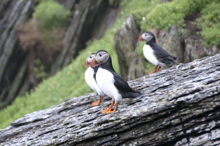
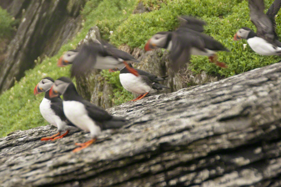
Puffins were on my mind for most of the lower steps being immediately at hand, almost underfoot, constantly. Underfoot, not in a obnoxious way. Underfoot in being right there, unabashed, going about the business of life. Pam and I were lucky, Puffin wise, for the weather. Sensible birds, when the visibility is low Puffins stay close to the burrow, making improvements and socialize with neighbors.
Click any photograph for my Online gallery.
Bad News: Atlantic Puffin populations are on a precipitous decline across Ireland and British Islands. There are talks of a population collapse. Researchers enlisted assistance from wildlife photography enthusiasts with outstanding results released in 2017. The photographs showed parents returning with less nutritious fish. The stress on Puffin populations follows the decline of fish stocks from over fishing. I listed two references at the end of this post.
The disturbing element to our experience was not one of the birds flew in with a catch. On second thought, this is not unexpected. Late May the eggs are laid and under incubation. The individuals in these photographs were feeding only themselves. If we returned mid-June there would be chicks to feed.
Click any photograph for my Online gallery.
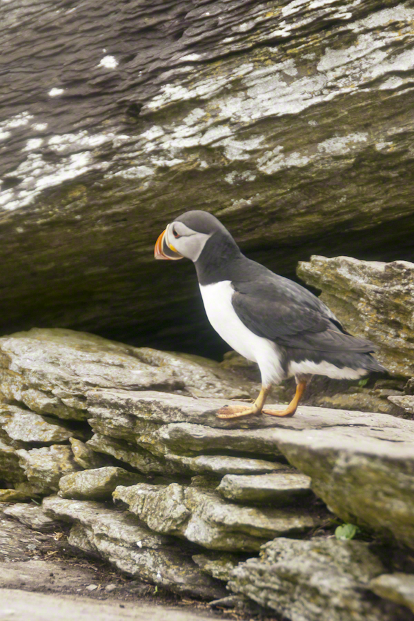
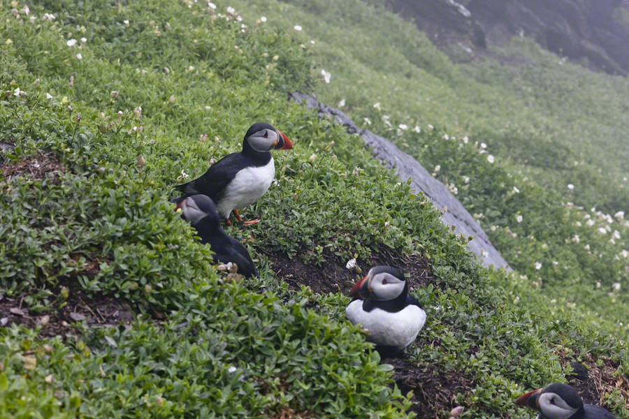
Puffin with an inquisitive attitude
Why do we love Puffins? We see reminders of ourselves. The expressive large eyes, over a striking beak and there is something expressive about the birds’ body movements. Don’t you almost know what’s on the mind of this fellow? “What’s going on, over there?”
Click any photograph for my Online gallery.
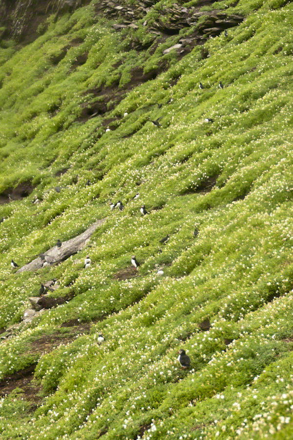
A colony of nesting puffins on a flowering cliff of green.
Puffins are small birds, the size of a human hand. This colony returned in late March or early April, each breeding pair claiming a nesting site. The coloring of the beak happens during breeding. The bird molts while at sea during the winter, the beak and other brightly colored facial characteristics are lost.
Michael Skellig puffins in social setting on cliff with burrows and flowers.
Puffin sexual differentiation is unique among birds. The coloring and markings are identical between males and females. Males are somewhat larger than females is all.
Click any photograph for my Online gallery.
Soft soil covering the flanks of Skellig Michael is the site of age old Puffin colonies.
Here is Puffin nesting behavior up close. I did some research on the flowering plants surrounding the burrows and am not sure. I believe the white flowers are a mixture of Sea Campion and Sea Mayweed.
As far as my photographic technique. There are two sets of Puffin shots from Skellig Michael. For the the walk to the top, the monastery site, I used the lighter Sony Alpha A700 dslr with a Sony variable lens, DT 18-200 mm F3.5 – 6.3. On top, I switched to the Canon EOS 1Ds Mark III and, for the descent, fitted a Canon EF 200mm f/2.8L USM lens.
The shot above and following are the Canon, taken on descent. Prior shots are the Sony, taken on ascent.
Click any photograph for my Online gallery.
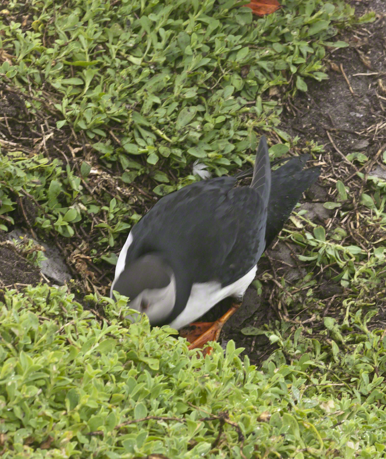
Puffin Entering Burrow
Puffins have striking black and white plumage and leg color some describe as “tangerine.” Tangerine? I guess. Here an individual ducks into the burrow.
Click any photograph for my Online gallery.
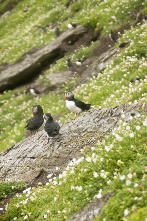
A grouping of Michael Skellig puffins, the foremost with an attitude of regard.
I did not spend a great deal of time in any one spot, being time limited and needing to get back to the boat. Don’t recall very much social interactions between individuals, other than this perching together on the rocks. The foreground Puffin seems to take the behavior of another bird to task.
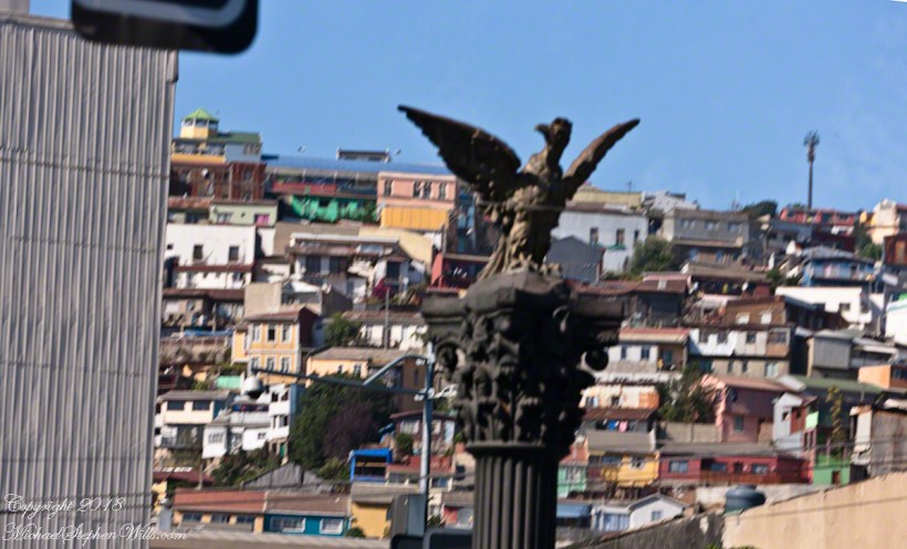
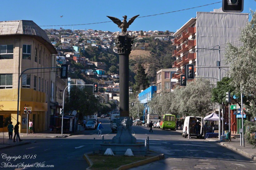
Trundled along within our bubble, the Mercedes tour bus proceeded up Avenue Montt when Ricardo pointed out this statue for ridicule. A depiction of the Chilean national bird, the Condor, porteños derisively call it “The Chicken,” and in truth the wingspan is undersized. From the vantage of the above photograph, the statue form does capture an impression of soaring among the hills of Valparaiso. Keep in mind, beyond those hills is Aconcagua, the highest mountain of the western hemisphere, home to Condors.
A reason for writing multiple Varparaiso “connection” posts is to better understand the jumbled impressions from that day. In a previous post I coined the term Varparasians for natives of the city. I found in researching this post the residents, as for Buenos Aires, call themselves porteños (people of the port). This cast iron statue speaks to the contributions of French immigrants to the city and nation.
Gift of the French Colony for the Centennial of Chile – Valparaíso, 1810 – 1910.
Here the view is south towards (what I believe is) Cerro Florida (Florida Hill). France Avenue continues, beyond the monument, following a steep and winding path up the hills, at the crest intersecting with German Avenue. Adjacent, on the right, is Park Italia where we’ll visit in part VI. Above a cast iron basin, at each corner of the commemorative column base is a female mask, above them a gold band inscribed (from the) “The French of Valparaiso” with 1810 – 1910 to denote the centennial. A condor with outspread wings surmounts the column.
The artist, Nicanor Plaza, born in Santiago, Chile was living in Florence, Italy at the time of this commission. He was a natural choice for the commission. Trained in Chile and Paris, Plaza taught for the Academy of Fine Arts of Santiago. It is of cast iron, produced by the French company Val Osne, an art foundry dating back to 1835. The owner, Jean Pierre Andre Victor, invented a cast iron ornamental technique originally used to produce street furniture.
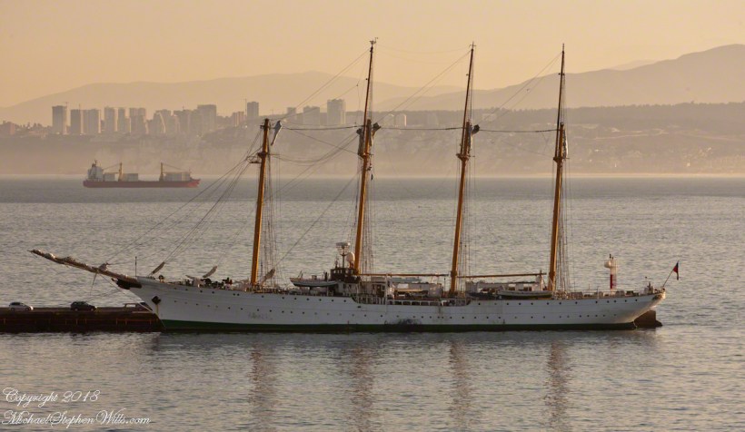
From 1854 to 1895 immigration from France burgeoned, from a country total of 1,654 to 8,266. This cohort is credited with developing the vineyards of the Central Valley, still famous today. The Chilean president Augusto Pinochet descended on his father’s side from an 18th-century French Breton immigrant from Lamballe and his mother was a descendant from 17th century immigrants, partially Basque. Pinochet’s legacy can only be attributed to himself and the ruling Junta. What is of concern is (1) Pinochet was protected against prosecution throughout his life. (2) The same people who protected him still hold power. A case in point is the Esmeralda, still in service.
The Naval Training Vessel Esmeralda
I took this photograph at dawn from our stateroom balcony, it is the Esmeralda, a four-masted top sail schooner, from Spain, christened May 12, 1953. From 1973 to 1980 it was a floating torture chamber where up to 100 persons were subjected to hideous treatment by the Pinochet regime. Protests erupt wherever it docks in a foreign port yet it remains in service. A relatively small part of the puzzle, yet it serves as an unacknowledged monument to the failure of Chile’s ruling elite to come to terms with the recent past.
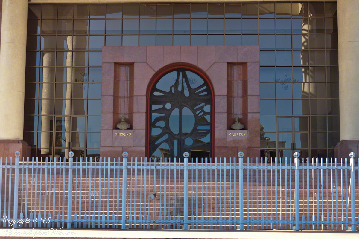
“Valparaiso Connections III” brought us to Pedro Montt Avenue and the building of this imposing façade, Congreso Nacional de Chile (National Congress of Chile). The very fact it is in Valparaiso is a recollection of the former National Congress, disbanded by the ruling Junta on September 13, 1973. During the final years the Pinochet dictatorship chose Valparaiso for the site of a new congress building. The former National Congress building still stands in Santiago, now housing the offices of both houses of congress.
I am fascinated the façade is shared by two founding fathers of Chile, Bernardo O’Higgins and José Miguel Carrera. O’Higgins father never married his mother (in other words, Bernardo was a bastard). Cared for by his mother’s privileged family, he used his mother’s family name until the death of his father. Carrera, was also born of privilege, the acknowledge son of his father who attended the best schools, well positioned to lead the movement for Chilean independence. Benefactors looked after O’Higgins, they sent the seventeen year old to Europe to finish his education.
Click either photograph to visit my Fine Art Gallery. Enjoy!!
In the chaos of war, in spite of ill-health and lack of military training, O’Higgins out performed Carrera as an officer through reckless bravery; surviving, he became an admired military leader through this example and ultimate victories. Carrera resented being overtaken (by a bastard), did not respect O’Higgins leadership and the two feuded. O’Higgins became the first head of the independent Chile while Carrera gathered a force. Exiled in Paraguay, Carrera marched across the intervening wastes battling indigenous forces. Eventually captured by those loyal to O’Higgins, Carrera suffered a mock trial and execution.
All five of Carrera’s legitimate offspring married and prospered, today his descendants number in the hundreds, being the majority of Chile’s ruling class. Today, the followers of Carrera (Carreristas) fight for his recognition against the O’Higginistas, who they despise. The balance is on display on the National Congress façade on Pedro Montt Avenue. The building is next to Plaza O’Higgins.
Measured by acreage, O’Higgins is far ahead of Carrera. The following photograph, from my posting “A Far Country VII: View of Tempanos Fjord” is from within Bernardo O’Higgins National Park, the largest protected land in Chile.
A large lake in Patagonia is named after General Carrera.
Copyright 2018 All Rights Reserved Michael Stephen Wills