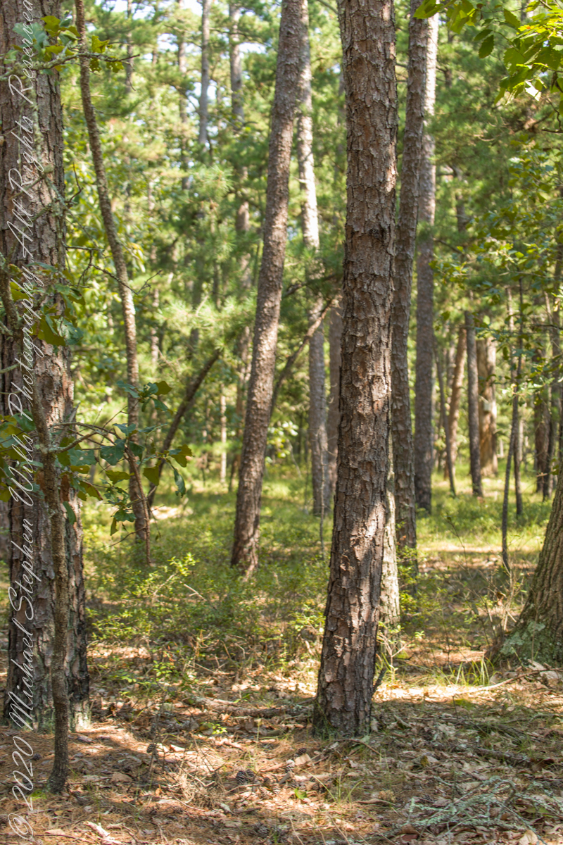
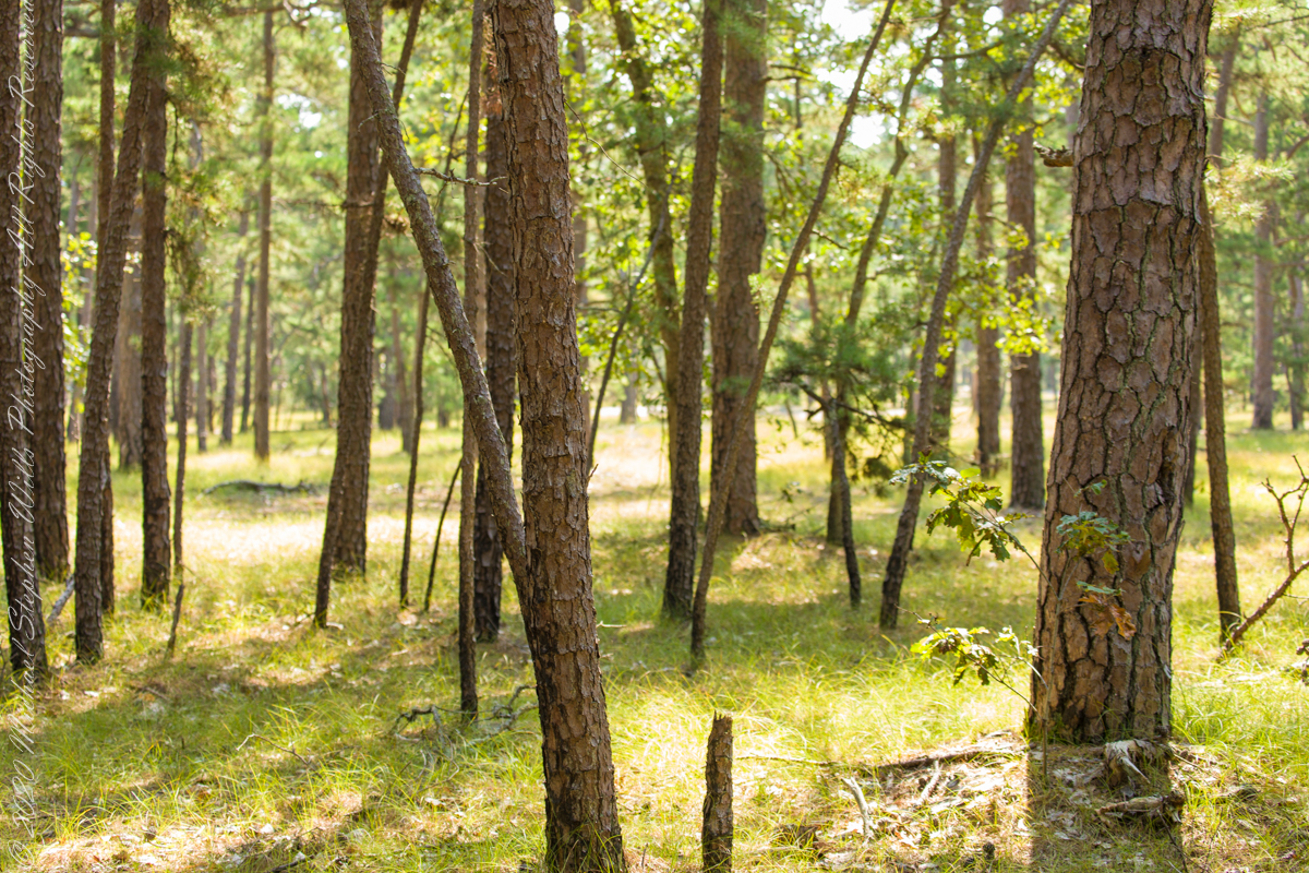
The 115,000 acres of Wharton State Forest are predomenantly Pitch Pine, scientific name Pinus Rigida, and AKA Black Pine and Hard Pine. Climb the fire tower of Apple Pie Hill, in all directions will be a sea of these trees interspersed here and there with occasional oaks. Cedars mark water courses. These photographs, unless otherwise identified, were taken deep in the forest, near where Quaker Bridge spans the Mullica River.
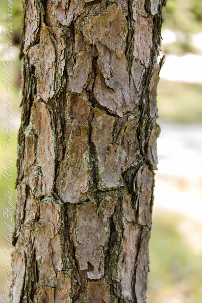
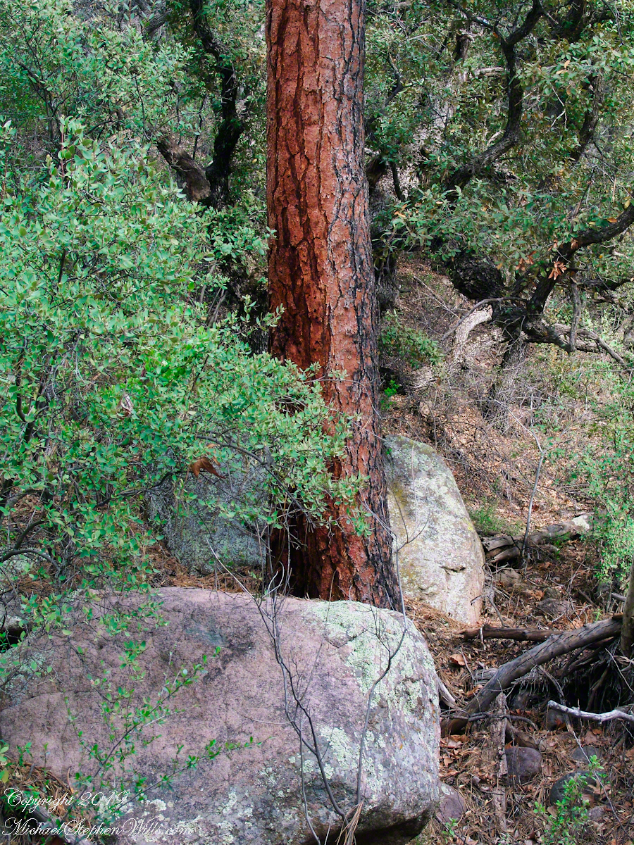
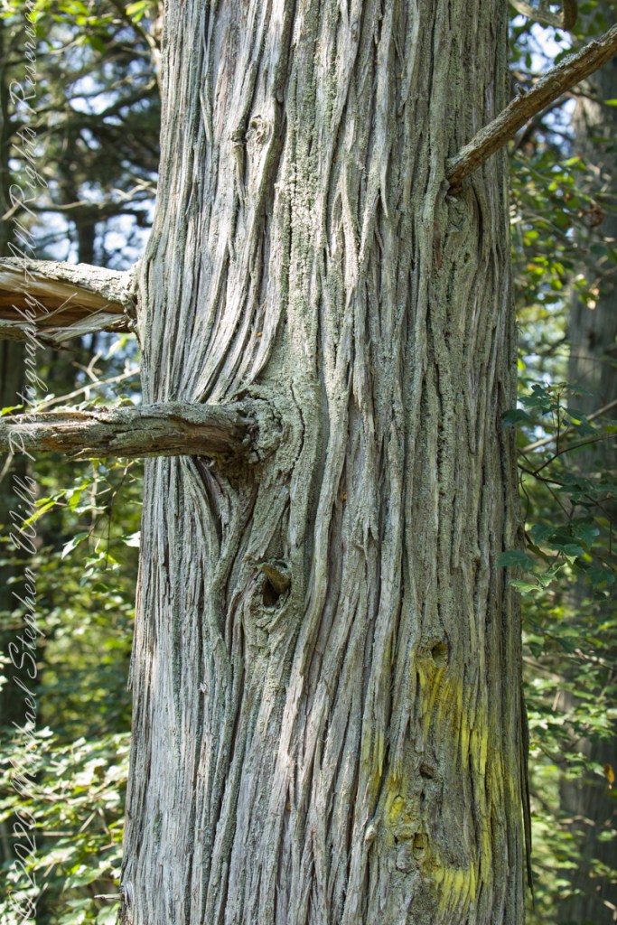
A mature Pitch Pine has bark of large, thick, irregular plates, adapted to survive forest first, similar to another member of the Pinus genera, the Ponderosa Pine.
Click pic for larger view in a new browser tab. If you are in WordPress Reader, open the post to use this feature.
Trunk of a mature pitch pine
Trunk of Ponderosa Pine, Superstition Wilderness
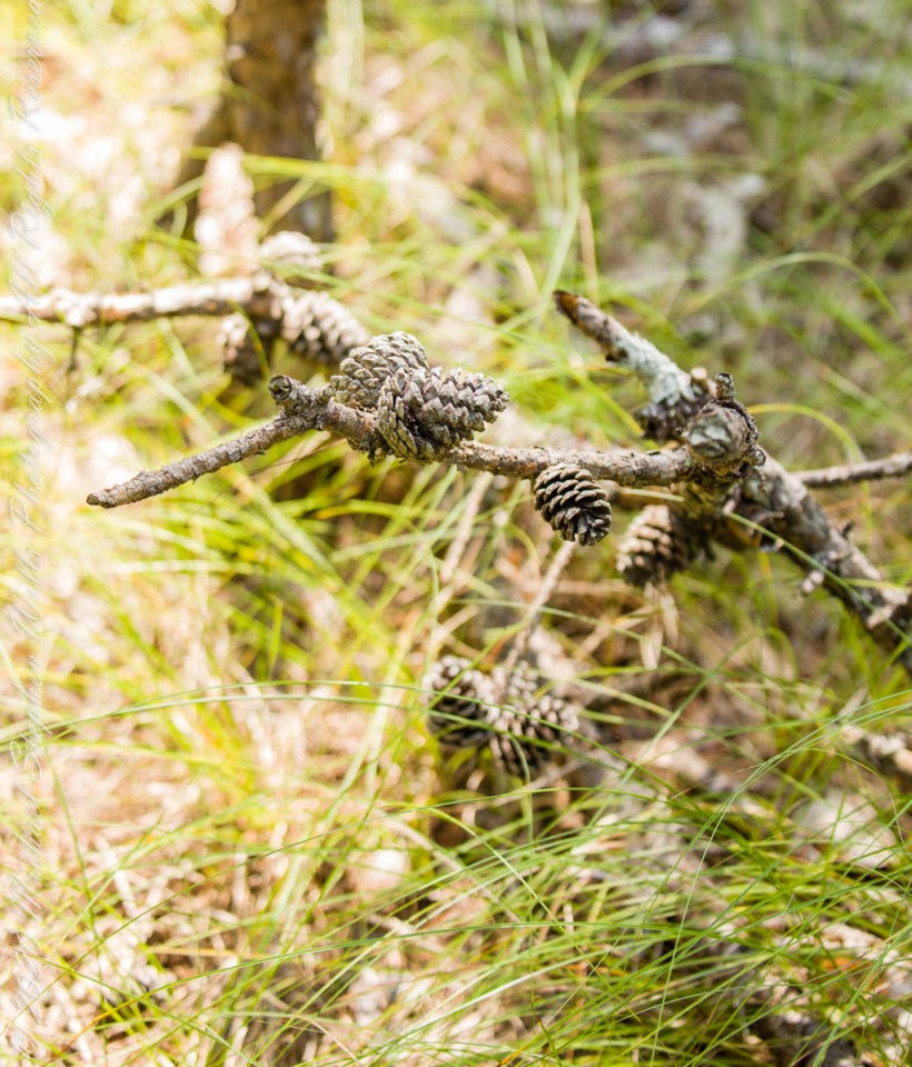
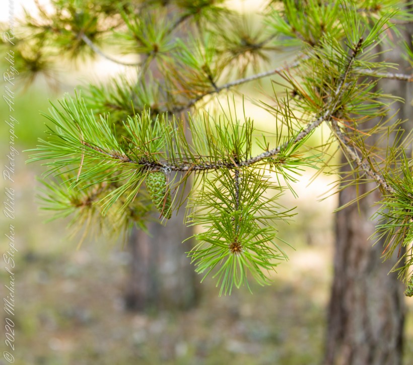
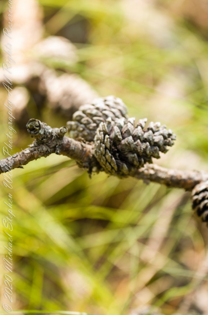
Open-growth trees begin bearing cones in as little as three years, with shade-inhabiting pines taking a few years longer. The cones are 4–7 cm (1+1⁄2–2+3⁄4 in) long and oval, with prickles on the scales. Cones take two years to mature. Seed dispersal occurs over the fall and winter.
Unlike the another member of genus Pinus, the Pinyon Pine, the seeds released by Pitch Pine cones are not sought out for human consumption.
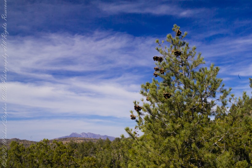
Large Pinyon Pine with mature cones on the slopes of Mound Mountain above Reavis Valley. Superstition Wilderness, Arizona. Four Peaks Wilderness is in the distance.
Copyright 2021 Michael Stephen Wills All Rights Reserved
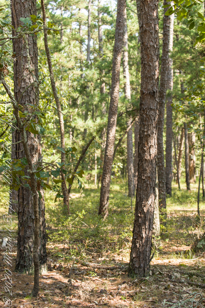
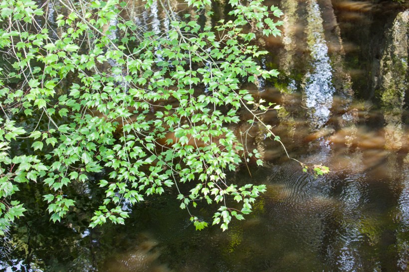
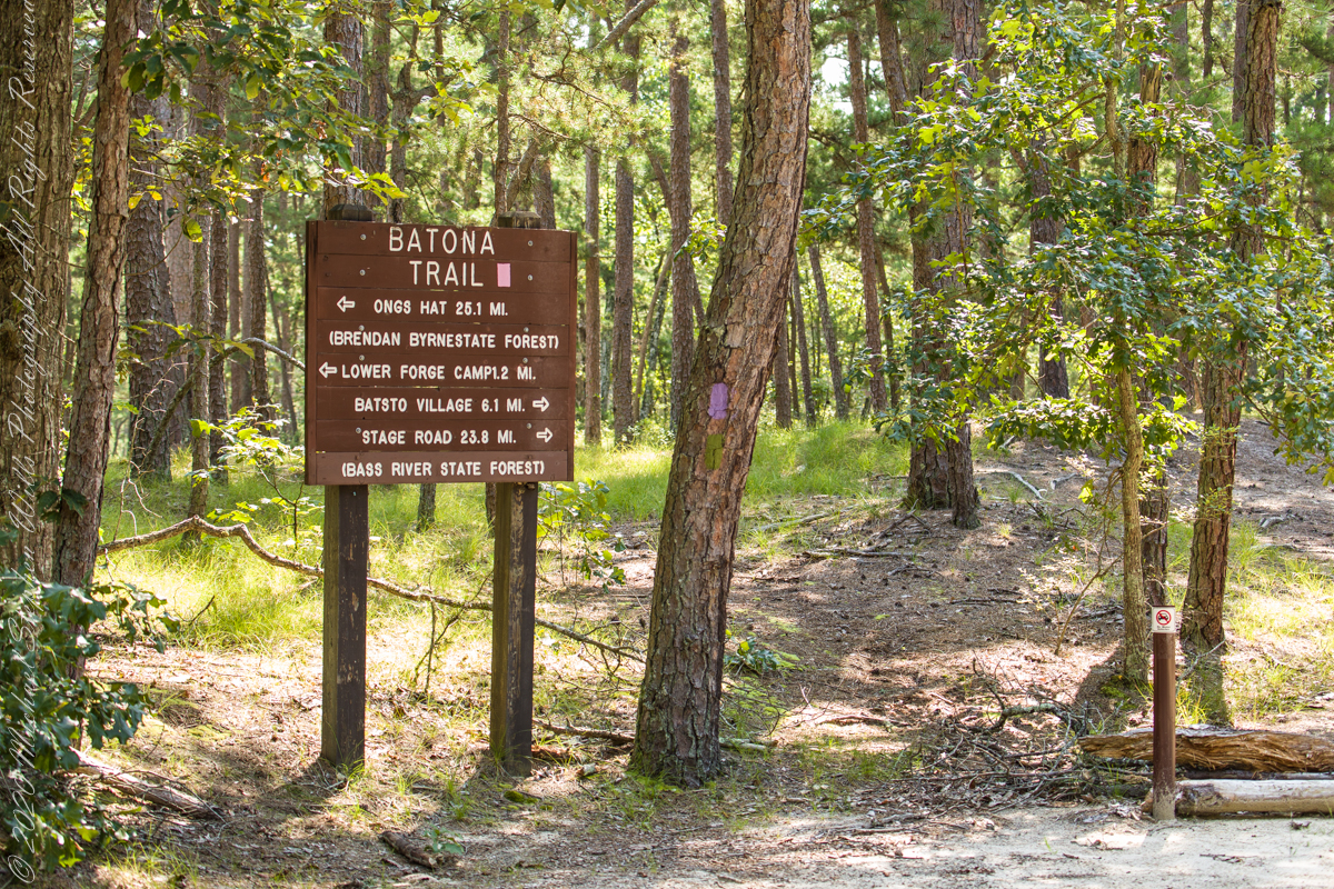
Multiple trails lead from where Quaker Bridge crosses the Mullica River. These are from a handheld Canon 5d Mark IV with the Canon EF 70 – 300 mm f/4.0-5.6 ISM lens.
Click pic for larger view in a new browser tab. If you are in WordPress Reader, open the post to use this feature.
70 mm, ISO 200 , 1/40 sec at f / 4.5
lll
Copyright 2021 Michael Stephen Wills All Rights Reserved
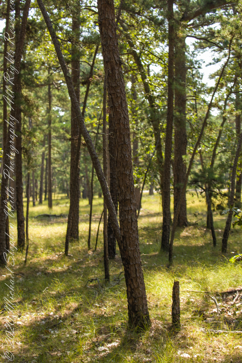
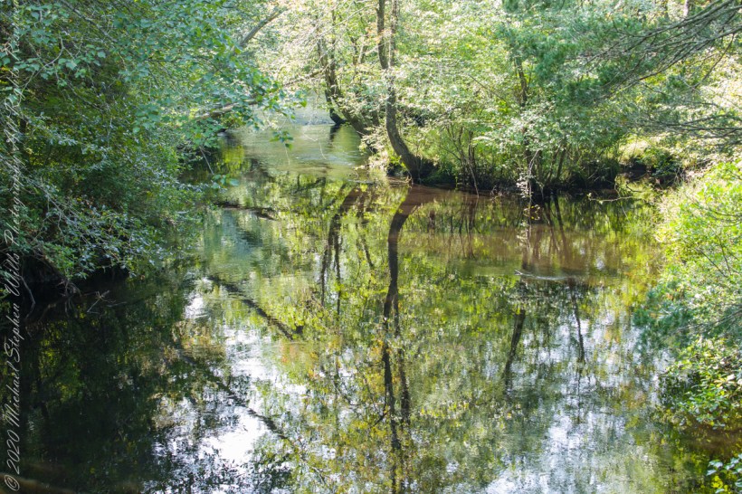
Multiple trails lead from where Quaker Bridge crosses the Mullica River. These are from a handheld Canon 5d Mark IV with the Canon EF 70 – 300 mm f/4.0-5.6 ISM lens.
Click pic for larger view in a new browser tab. If you are in WordPress Reader, open the post to use this feature.
70 mm, ISO 200 , 1/60 sec at f / 4.0
lll
70 mm, ISO 200 , 1/80 sec at f / 4.0
Copyright 2021 Michael Stephen Wills All Rights Reserved
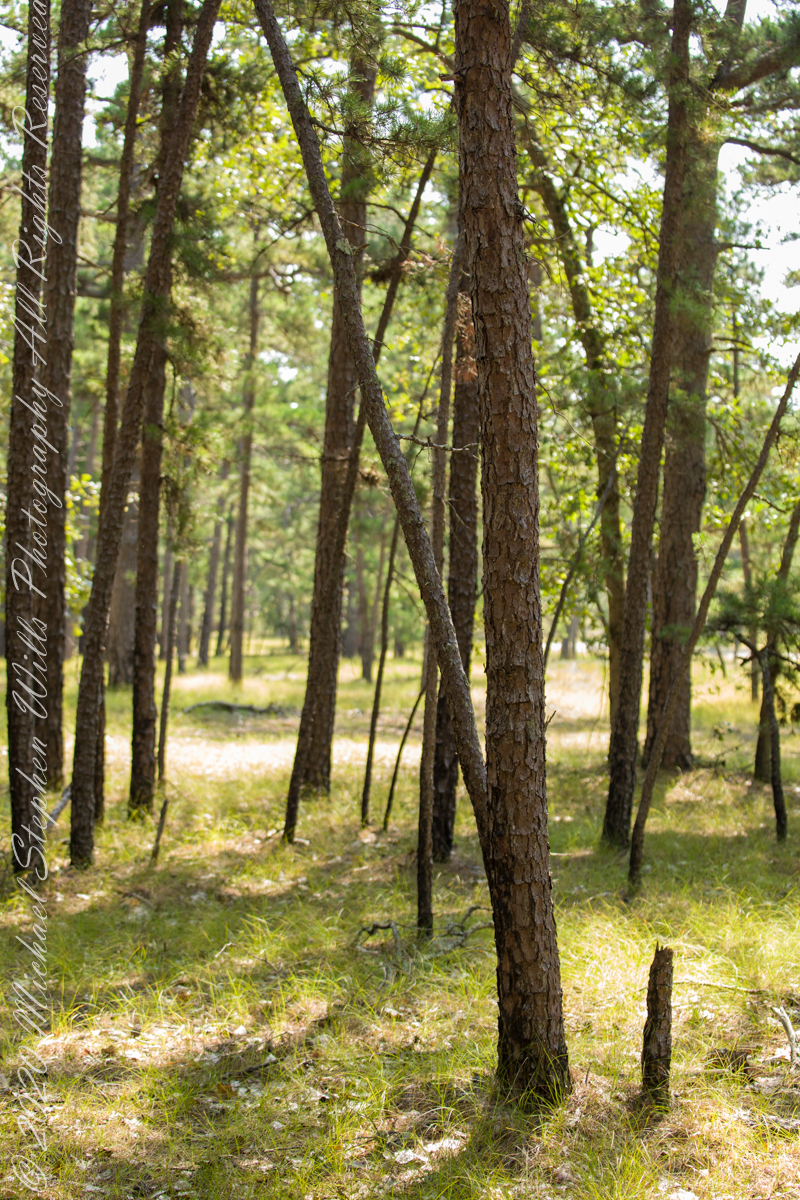
Multiple trails lead from where Quaker Bridge crosses the Mullica River. These are from a handheld Canon 5d Mark IV with the Canon EF 70 – 300 mm f/4.0-5.6 ISM lens.
Click pic for larger view in a new browser tab. If you are in WordPress Reader, open the post to use this feature.
70 mm, ISO 200 , 1/80 sec at f / 4.5
lll
70 mm, ISO 200 , 1/80 sec at f / 4.5
Copyright 2021 Michael Stephen Wills All Rights Reserved
In my last Pinelands post, “cedar water” was featured. This post is a exploration of the “cedar” in “cedar water.”
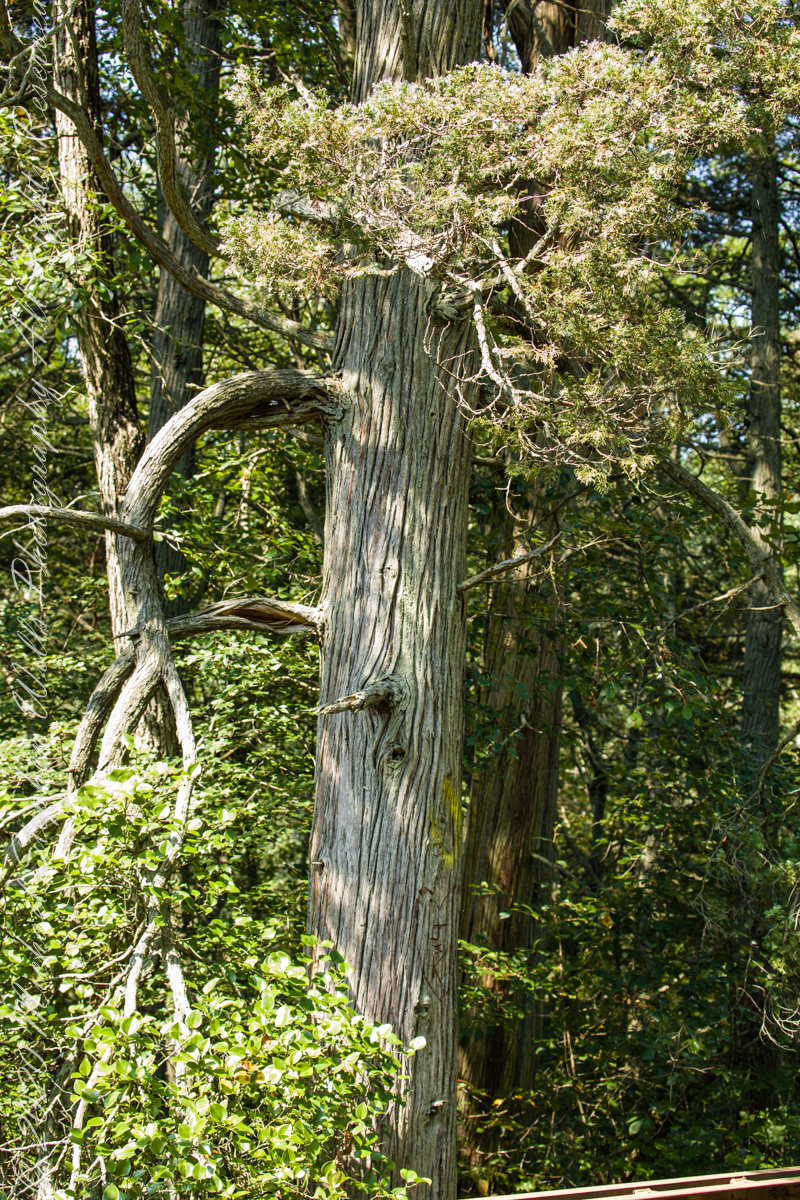
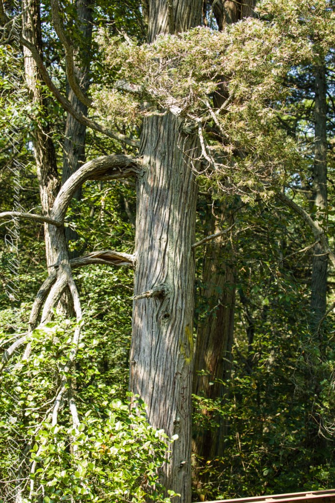
White Cedar, also known as Swamp Cedar, is a water loving tree seen here to the right of Quaker Brider, Wharton State Forest.
Click pic for larger view in a new browser tab. If you are in WordPress Reader, open the post to use this feature.
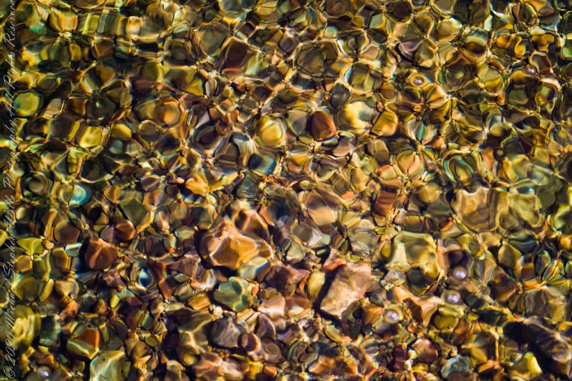
“Cedar water” is the dark, tea like, flow of Pinelands rivers colored by vegetable tannins.
White Cedar thrives along Pinelands waterways, lending color to the “cedar water.” 18th Century sea captains favored cedar water for long voyages, famours for staying fresh far longer than other waters. Also known as arborvite, “tree of life”, for the medicinal properties of the bark, well known throughout Native America.
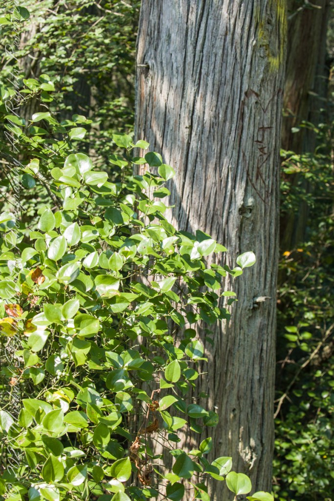
Known for flat sprays of scaley leaves
The Pinelands are under siege from attacks much worse than this defacement
These photographs were taken the last days of August 2021, the 26th and 27th, while exploring Burlington County, New Jersey, with my sister. I will be writing about our Thursday and Friday for awhile, starting with today’s installment.
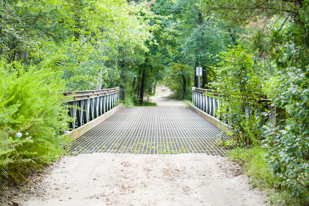
Quaker Bridge Road traverses the wilderness of Wharton State Forest with a beginning off Route 206, Atsion Mansion. Our planning included Jeep Wrangler rental, only high-clearance 4-wheel vehicles are appropriate, the road surface is humpy sand, water filled holes abound. Still, sitting there at the start, with Atsion Mansion house in view, I waited awhile until a high clearance tour bus packed with adventurers, kayaks passed into the pines and out of sight. We proceeded an uneventful ~4 miles to Quaker Bridge at a stately 5 miles per hour, invoking four-wheel drive low gear a mile or so in.
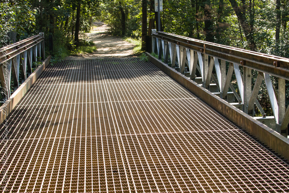
Here is Quaker Bridge over Mullica River today, facing East.
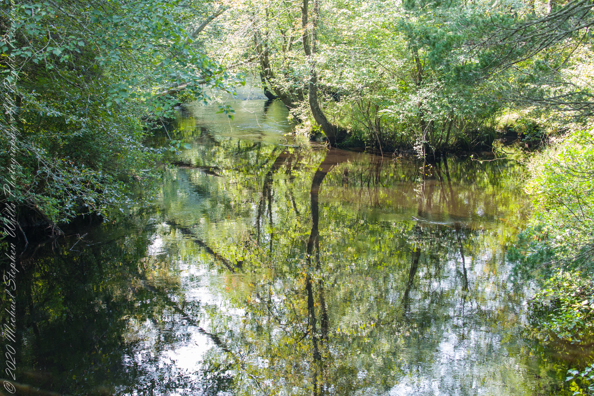
Mullica River from Quaker Bridge facing downstream
Quaker Bridge road was a well traveled main route through the Pines for almost a hundred years with an inconvenient crossing of The Mullica at this point. During the year 1774, some sa 1772, West Jersey Quakers travelling to the Little Egg Harbor Yearly Meeting, started “a day early”, built a bridge. From a c.1940 photograph it is clear in that “day” they felled large trees for pilings, smaller trees, pines and cedars, for the other bridge elements. Since then, the crossing has been called “Quaker Bridge.”
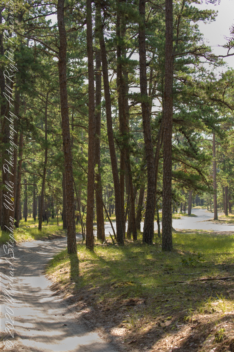
Over time, the east side became a resting place, with at least one Inn/Tavern. Here is the east side today.
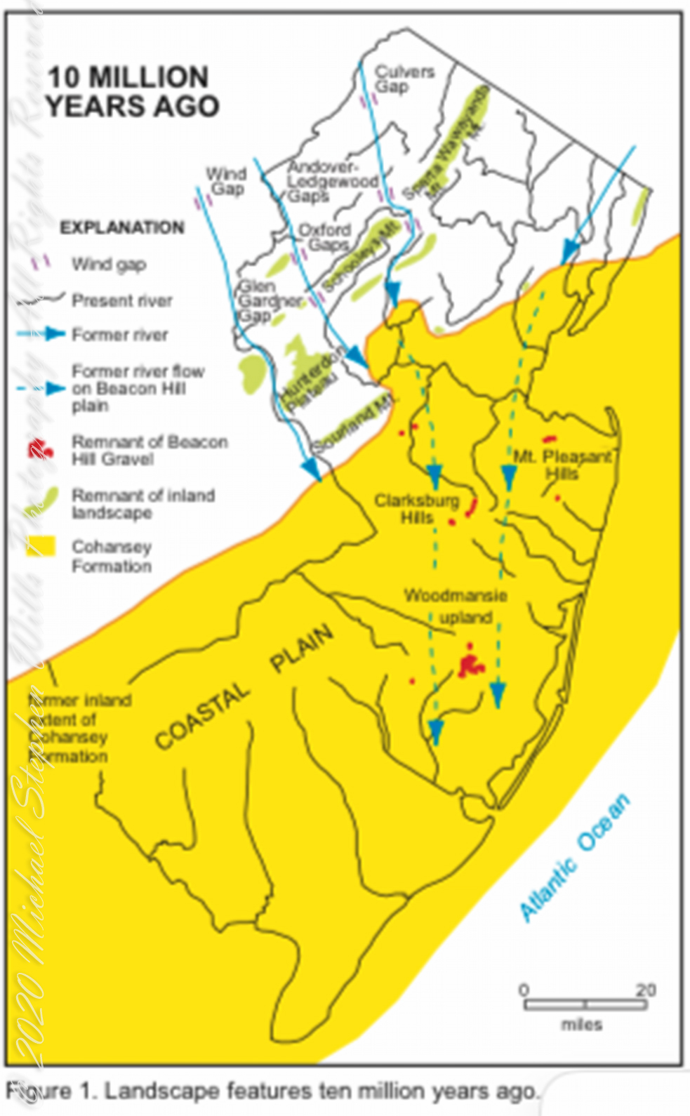
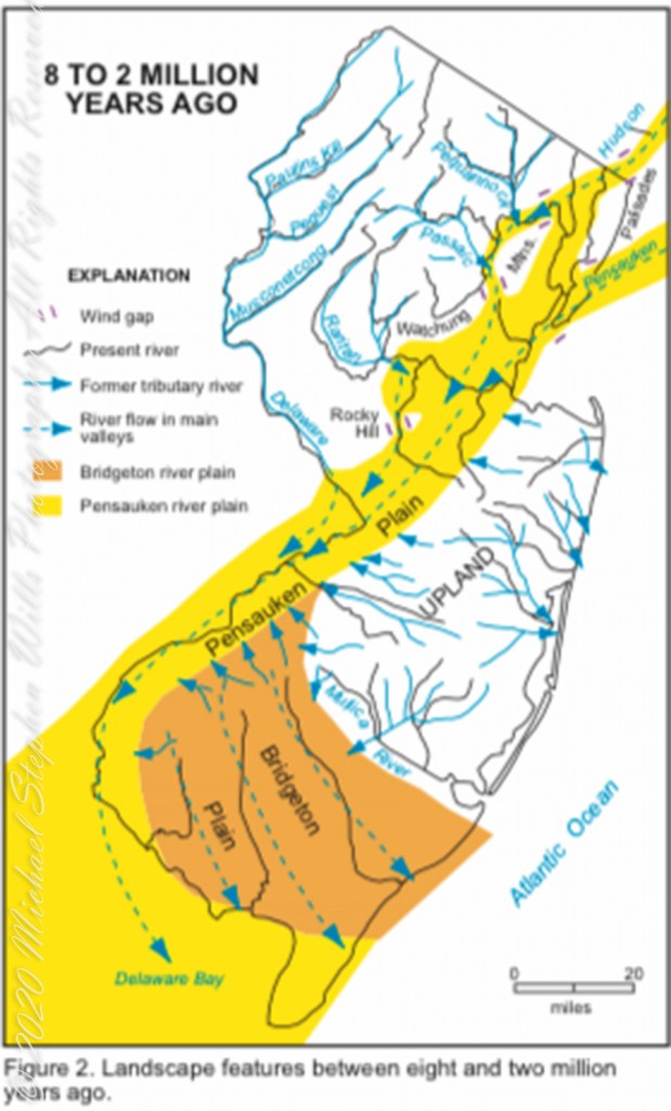
Even without hospitality and bustling humanity, after 4 miles of dreary road from Atsion this spot carries a sense of lightness, the well spaced straight pines over several acres conveying peace and rest. Over 35 miles from the ocean, the white sand presents as beach. There is a reason for this feeling, a 15 million year reason.
Visual presentation of Pinelands geologic origins, from New Jersey Geologic Survey, Scott Stanford author, 2005.
Between 15 and 10 million years ago the earth climate turned colder, so much water evaporated from the oceans to fall as snow and ice in the polar regions ocean levels fell 150 to 250 feet. As the ocean fell away, over eaons, mountains to the west were ground down, pulverized by the elements to flow, gather on the exposed plain. The white “beach” sand we see today, at Quaker Bridge and other Pinelands places, are surfaces of this “Cohansey” sands and clay ranging in thickness from 25 feet in the west to more than 300 feet at the Atlantic Ocean.
Over millions of years the land raised to become the drainage patterns we see today. The renewable resources of “bog iron” and water spring from this history.
Visual presentation of Pinelands geologic origins, from New Jersey Geologic Survey, Scott Stanford author, 2005.
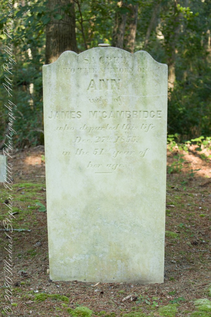
Standing there I imagined Great Great Grandmother Ann (Milley) McCambridge resting on the journey from the McCambridge home near Speedwell. I placed the pebble, collected from Long Island Sound, on Grandmother Ann’s headstone the evening of August 26th. Click this link for more about Ann McCambridge.
Sacred to the Memory of ANN wife of James McCambridge who departed this life December 27th 1855 in the 51st year of her age.
Reference
I found Quaker Bridge background in “Heart of the Pines, ghostly voices of the Pine Barrens” by John E. Pearce, pp 748 – 750, Batsto Citizens Committee, 4110 Nesco Road, Hammonton, N.J. 08037-3814.
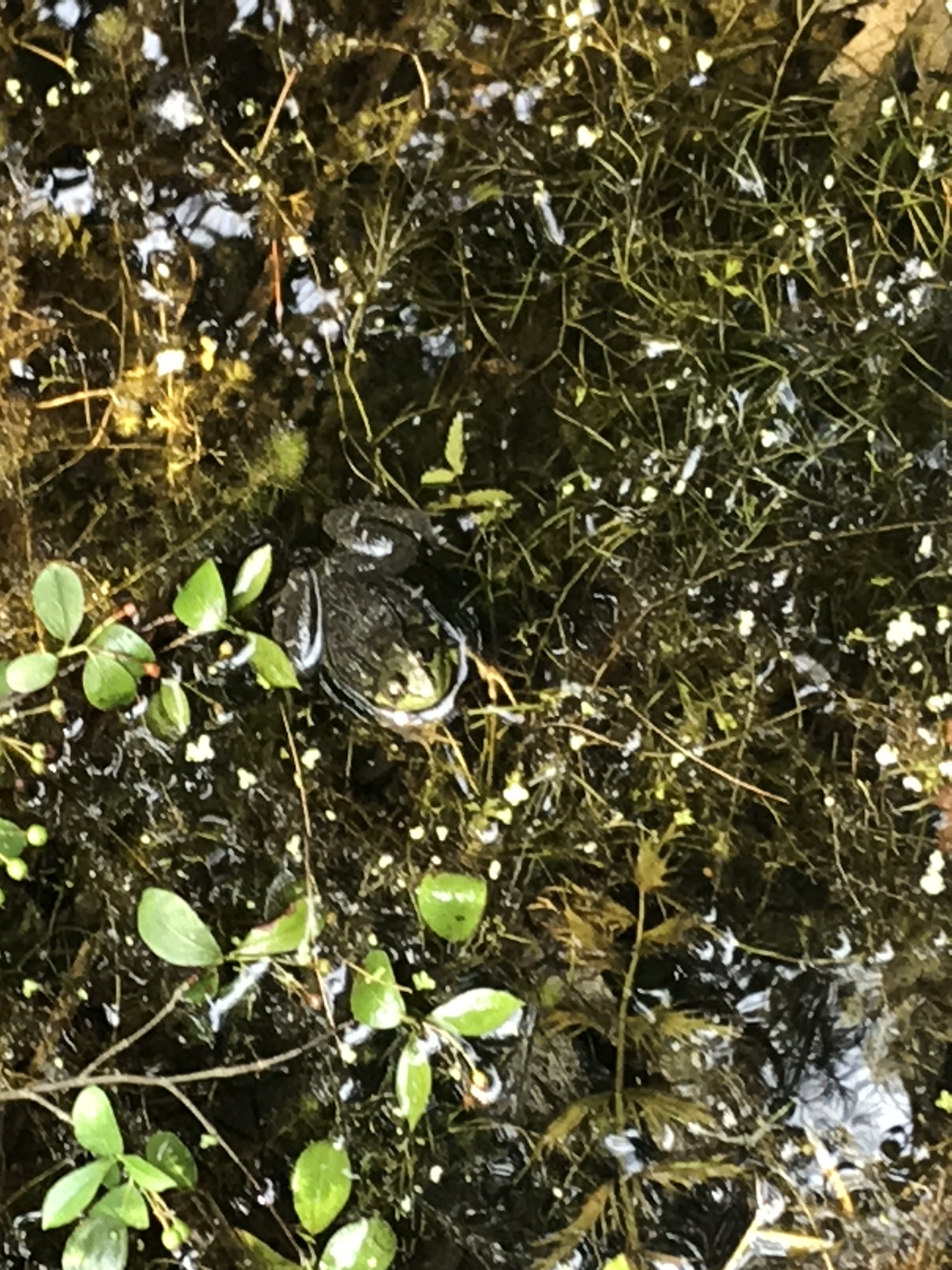
Wednesday last, grandson Sam, three years old at the time, and I wandered the landscape, catching the sights of summer. Eventually, we visited Sapsucker Woods, a Cornell University nature preserve. There, a boardwalk over the swamp is a proven venue for frog spotting and, this day, we had some success.
We found this cooperative golden-eyed beauty calmly squatting and croaking.
In this 30 second clip, reflected light off the water surface captures proto-croaks that did not quite escape from the source. There is a successful and full croak finale.
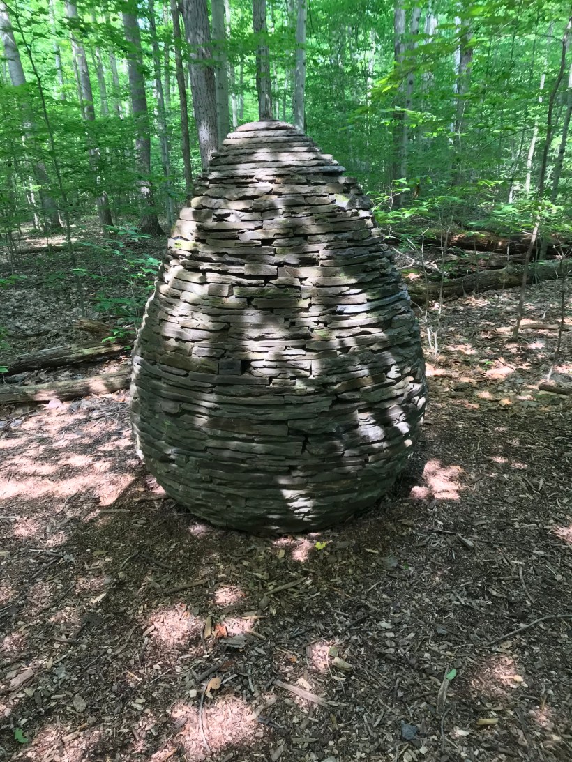
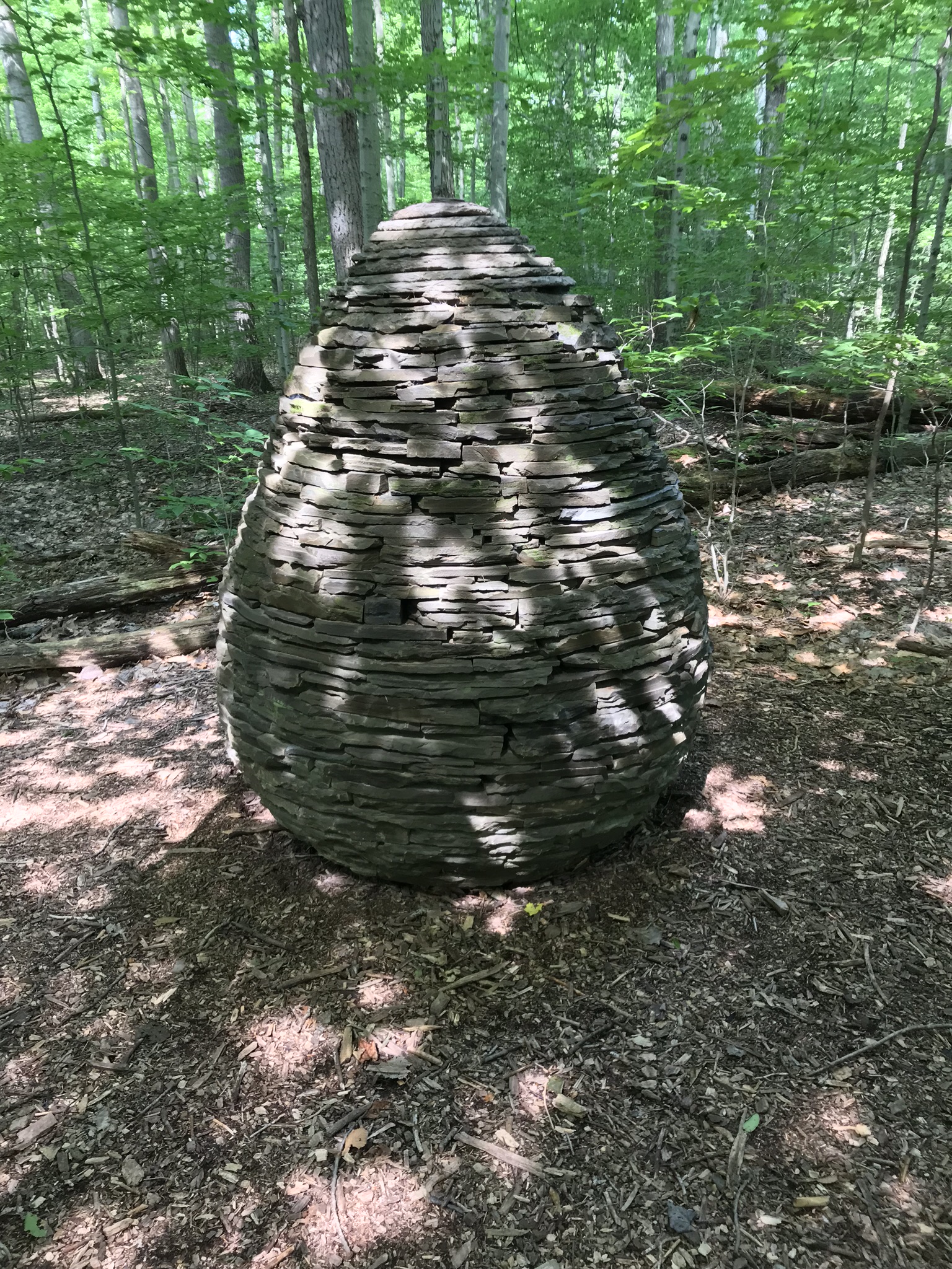
Off the boardwalk, we took a short detour to view an elaborate cairn built of local rock by a famous artist. The dappled sunlight across the surface is especially enjoyable.
The Sapsucker Cairn, Andrew Goldsworthy
At the furthest extent of the preserve is this pond where the residents were notably raucous in this 30 second clip.
About this time the mosquitoes descended for a determined attack on Sam’s legs. “Itchy,” he said. Myself, protected by deet, they left alone. Sam’s Mom prepared him for the trip with natural mosquito repellent that was not up to the task. Next time we visit, Sam will wear long pants and sleeves fortified with deet.
Just before picking Sam up for a quick retreat, I caught this turtle encrusted in duckweed sunning on a narrow branch. The head is retracted for the moment, can you imagine someone wading through that muck to place a rock? It is possible, but I witnessed the head, so am absolutely sure.
Special thanks to blogger shoreacres for the identification of duckweed. In my original posting I called it algae.
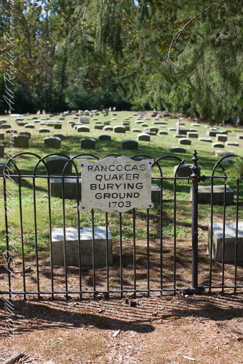
I am happy to share a breakthrough in my family research of our time in Western New Jersey, 225 years for my branch from the 1677 landing of the Kent on Rancocas Creek until my grandfather left for Asbury Park.
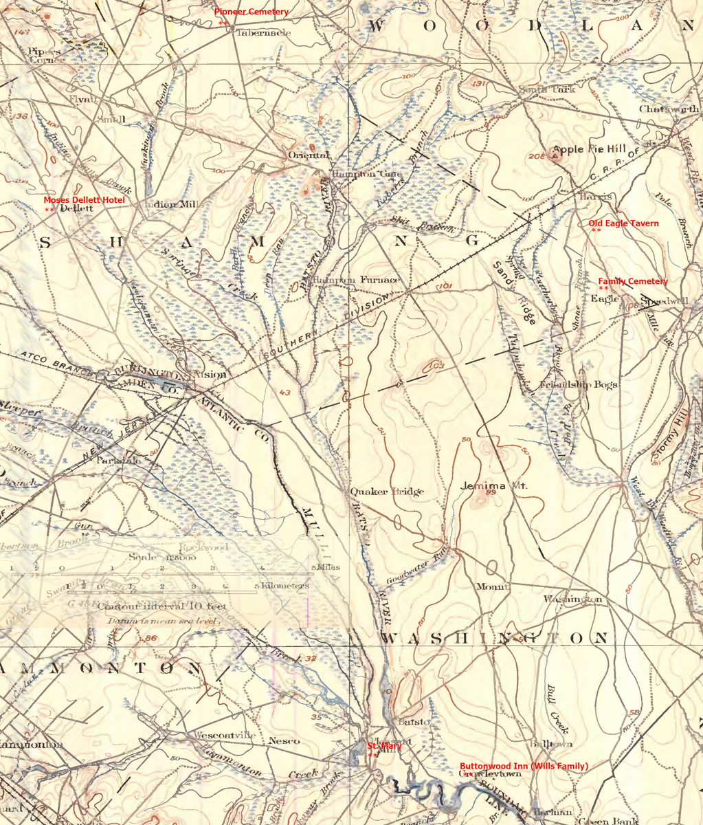
In this rectangle (10 miles by 15 miles) taken from the 1900 US Geological Survey, Rancocas Quadrangle, New Jersey topographic map is shown, upper right hand corner, Apple Pie Hill the starting point of this history where the author John McFee climbed the fire watchtower there, a view encompassing endless acres of pines. I learned an ancestor, third great-grandfather James McCambridge and his wife Mary owned the Old Eagle Tavern less than two miles south of there. The site is marked in red.
The Eagle Tavern existed for 28 years under various owners and names when James and Mary took over in 1926 serving a clientele, workers and visitors, from the struggling Speedwell Ironworks. Samuel Richards was a brother of Jessie Richards who owned the Batsto Ironworks and who provided the land for St. Mary of the Assumption (see my post Pineland Connections V). St. Mary’s is marked in red, bottom center. Samuel purchased Speedwell December 23, 1833 from Ann Randolph, made improvements and started operations without success before closing for good.
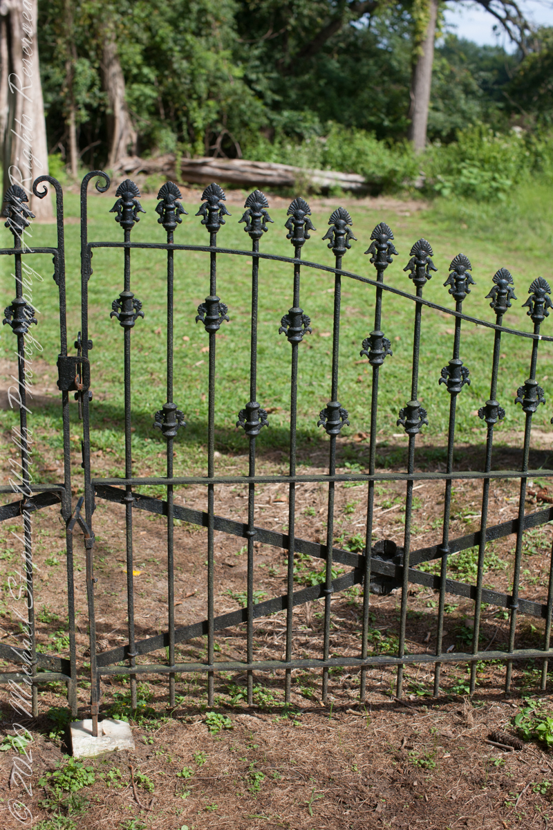
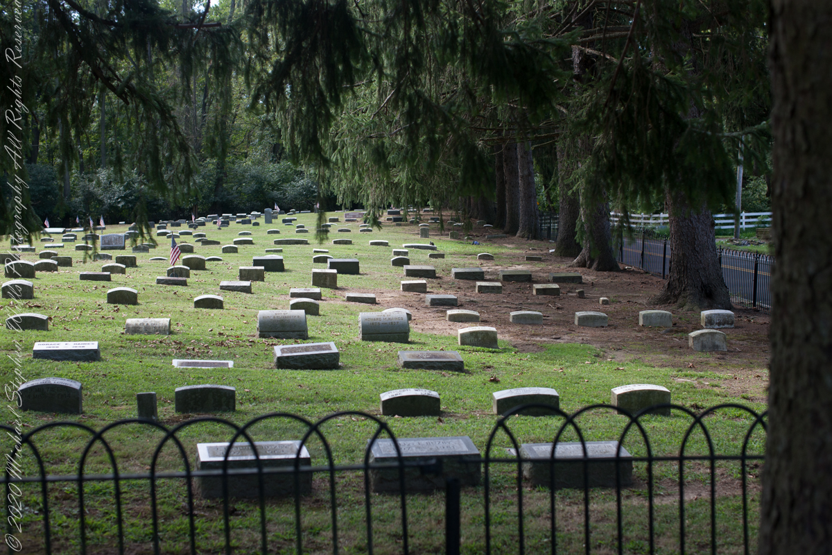
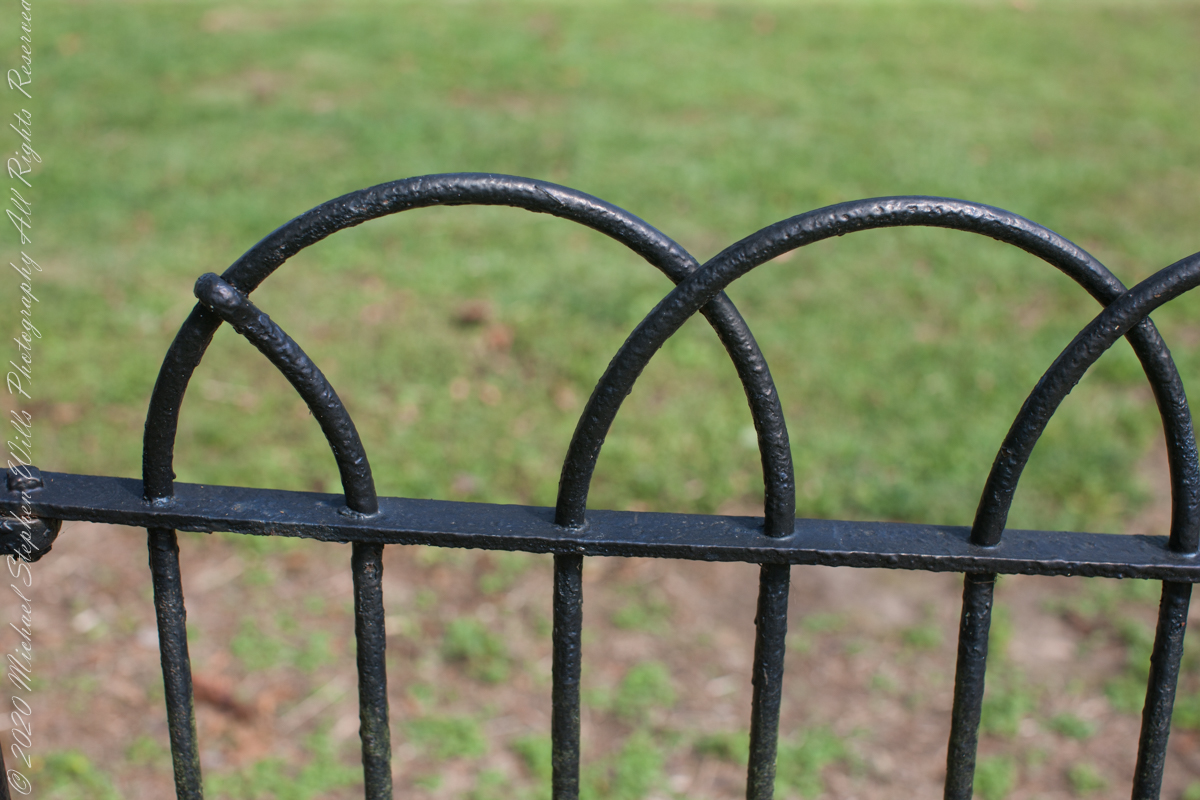
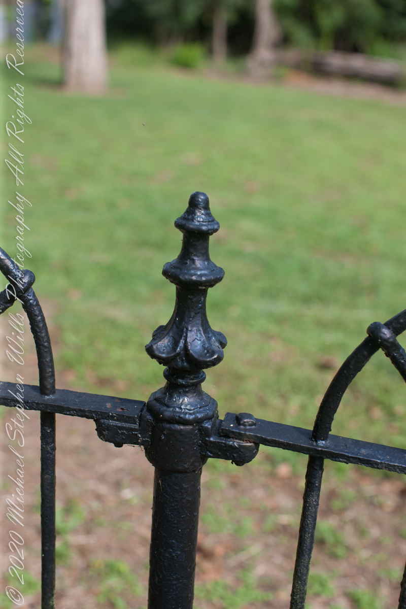
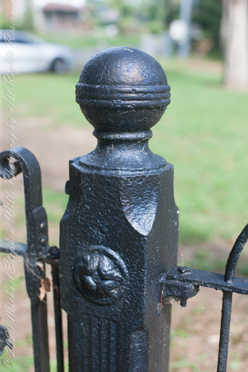
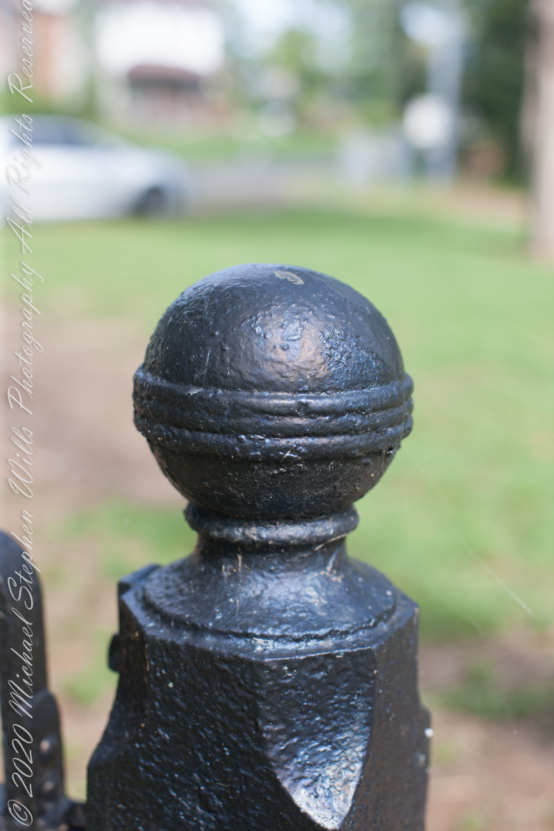
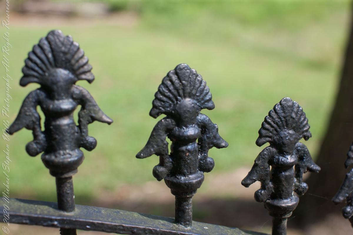
Entrance sign and overviewIron GateFence and burialsfilialIron fence postFilial of Iron Fence PostFilialThe Rancocas Quaker Burial Ground is surrounded by an iron fence, almost certainly of local origins. Here are my photographs of this exceptional ironwork.
On June 30, 1850, James McCambridge purchased Speedwell from the estate, eight years after Samuel’s passing, for $1,750. At this time he had accumulated over 2,000 acres. In this same year his son, James and wife Ann (Milley) (see my post Pineland connections VI) are listed on the US Census. The family lived either in the Eagle Hotel or close by raising nine (9) children: John (20), Mary Ann (16), James (15), Sarah Jane (14), my great grandmother Margaret (11), William (8), George (6), Edward (5) and Catherine (3). The younger James is employment was making charcoal for the ironworks, most likely for Atsion where Ann was employed. By the 1860 US Census Ann had passed away at the age of 50 and James (97) was living with the younger James and family.
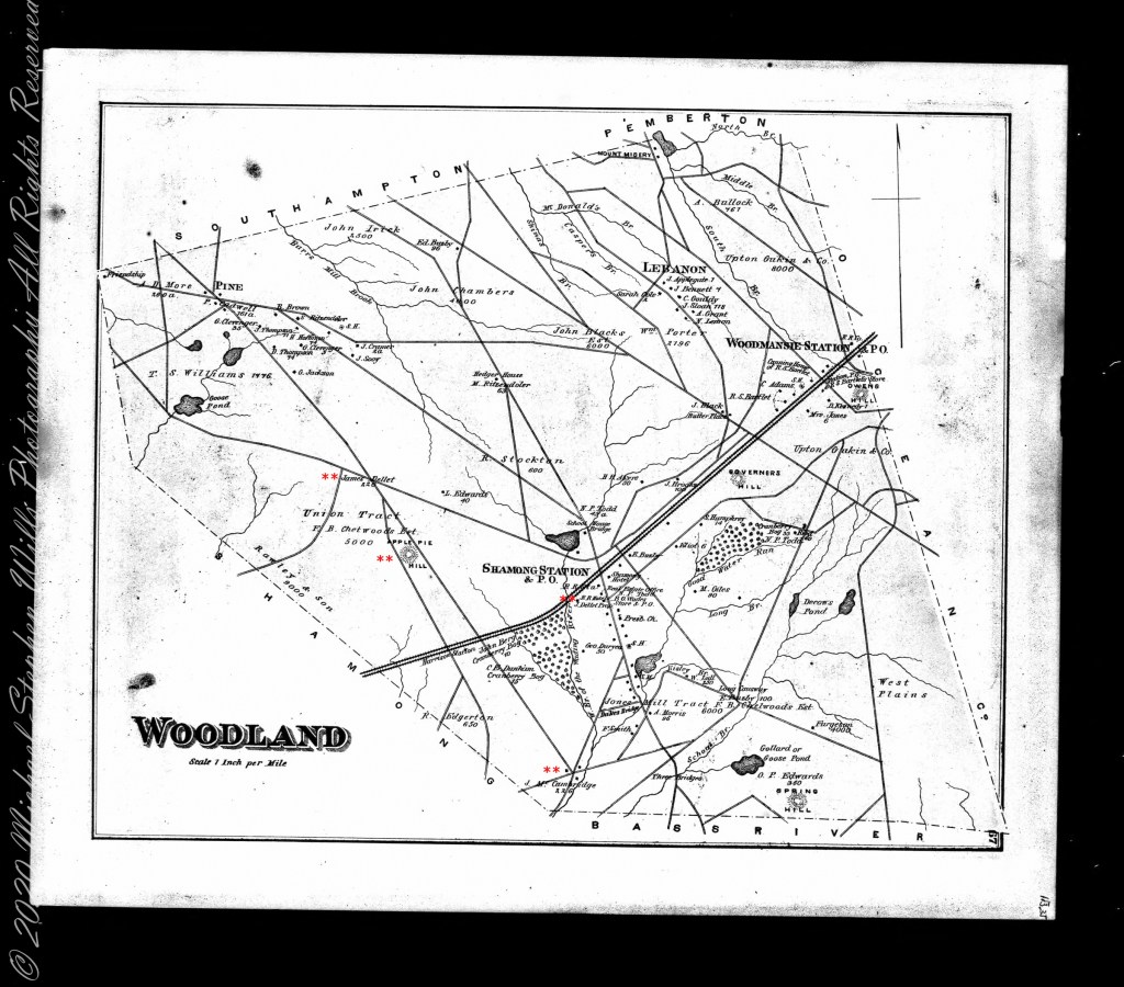
Here is a land ownership map from 1876 on which I marked with red asterisks James McCambridge, Apple Pie Hill, and the Delletts, the family of the second greatgrandmother, Mary Dellett. Dellett landownership is also indicated on the rectangle topographic map.
Around the 1850 US census George and Mary Wills lost their two month old son, Charles (See my post Pineland Connections III) who is buried in a family cemetery, land owned by James McCambridge marked in red on the rectangle topographic map. Charles was my greatUncle.
George and Mary Wills, second greatgrandparents
Another breakthrough was identification of the Buttonwood Hill Tavern, Crowleytown as the hotel run by George Wills on the 1850 census. Marked in red on the rectangle topographic map. There was not yet a family union between McCambridge and Wills. That would come with great grandparents George Wills and Margaret McCambridge. The family connection at this time was their shared Roman Catholic faith and Saint Mary of the Assumption church.
I found this information in the book “Heart of the Pines, ghostly voices of the Pine Barrens” by John E. Pearce, Batsto Citizens Committee, 4110 Nesco Road, Hammonton, N.J. 08037-3814.
Copyright 2021 Michael Stephen Wills All Rights Reserved