Newgrange VII

Approaching Newgrange for the first time

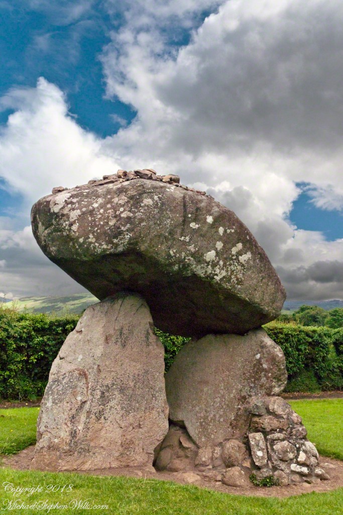
Michael Joseph “Brian” O’Kelly was selected to undertake the direction of the excavation of Newgrange during a 1961 meeting of “those who had a professional interest in the monument” organized by PJ Hartnett, the archaeological officer with Bord Fáilte Eireann (Irish Tourist Board) and a former pupil of Professor O’Kelly’s. Excavation commenced in 1962 and continued every summer for a four-month season up to and including 1975.

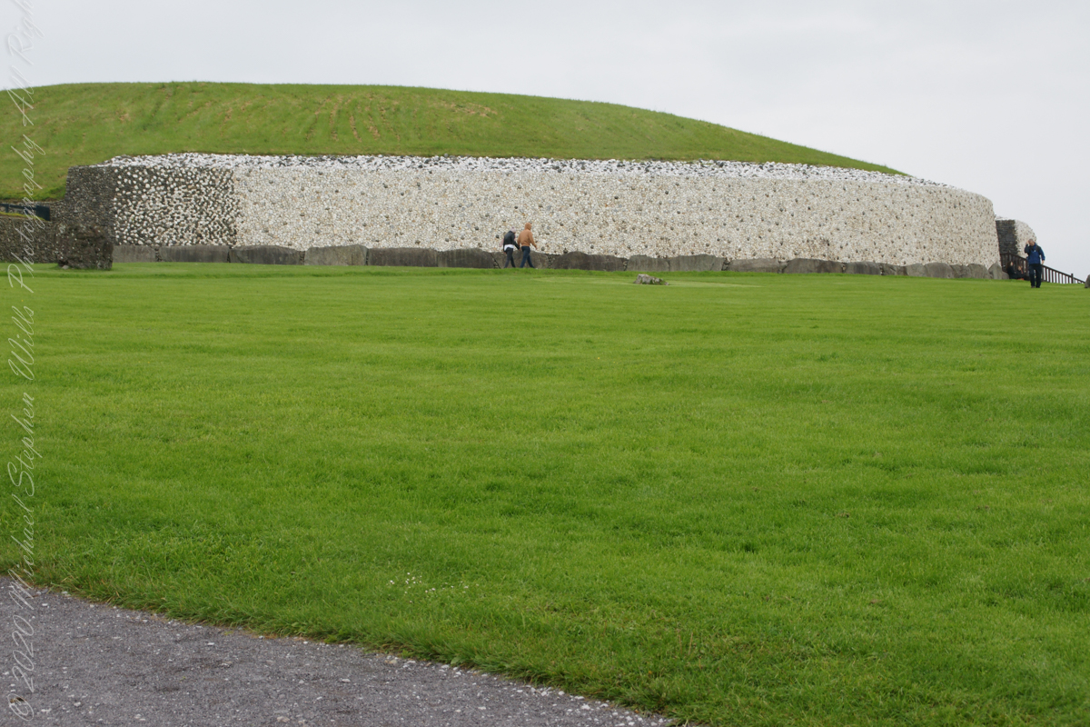
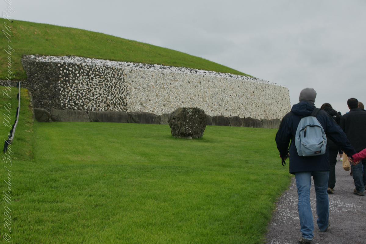
The aim of the excavation was to discover as much as possible about the archaeological and historical context of Newgrange and the people who built it and to discover what its original finished appearance was so as to direct a reconstruction, conservation and restoration of the structure to its former condition and appearance.

The last year of excavation was 1975, Michael J. wrote “We determined in 1975 that that should be our last season of excavation at Newgrange. We had investigated approximately one third of the structure and we had discovered much about it that was new, both in its structure and in its ornament, while radiocarbon had pushed its date back by 1,000 years……”

“…We felt that the other two thirds should be left for a future excavator, who, working with new knowledge and perhaps with better methods and new scientific approaches, should have large areas untouched by us in which to test, check and re-evaluate our findings.” From The Restoration of Newgrange by Michael J.O’Kelly. Antiquity LIII, 1979.

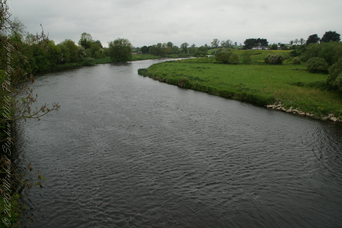
“Between the bright sky and the long glittering silver ribbon of the Boyne the land looks black and featureless. Great flocks of starlings are flying across the sky from their nighttime roosts to their daytime feeding places. The effect is very dramatic as the direct light of the sun brightens and casts a glow of light all over the chamber. I can even see parts of the roof and a reflected light shines right back into the back of the end chamber.” The recorded words of Prof O’Kelly spoken in the tomb of Newgrange on the 21st December 1969.

Click Me for the first post of this series.

Copyright 2023 Michael Stephen Wills All Rights Reserved

Newgrange VI

Newgrange and Knowth mounds were built and stabilized by structural experts.

At the same time as the passage and chamber were being built, work on the mound was going ahead.

At Newgrange, and the main mound at Knowth, an area around the tomb was left clear for a platform of stones to encase and stabilize the chamber roofs.

Once the passage roof was complete, structural experts returned to the kerb and continued to set the slabs in place — either in sockets or on prop stones, so as to achieve an even top-line all-round the mound.

Click Me for the first post of this series.

Copyright 2023 Michael Stephen Wills All Rights Reserved

Newgrange V

Newgrange construction involved meticulous planning, stone architecture, artistry, and astronomical understanding.

The initial task for the builders of Newgrange involved recording the annual alignment of the rising sun over several years, which was likely achieved using timber posts as markers. Subsequently, the dimensions of the passage and chamber were determined, and the groundwork was prepared by digging sockets for the structural stones. This excavation process was carried out using antler picks and shovels crafted from cattle shoulder blades.

After the structural stones were carefully positioned and levered into their sockets, lintel stones for the passage could be lifted into place. The corbelled roofs of the cross-shaped tombs were built with great skill and finally capped by one slab. Sturdy timber scaffolding and bracing must have been used. As the stones were set in place, carvers and artists decorated the stones.

The whole process must have been overseen by social or religious leaders; the building of the tombs shows great skill in working and building with stone and knowledge of architecture, megalithic art and astronomy.

Click Me for the first post of this series.

Copyright 2023 Michael Stephen Wills All Rights Reserved

Newgrange IV

How we sheltered at the time of Newgrange construction

The Brú na Bóinne Visitor Center includes this tableau of the shelter of the ancient farmers who constructed Newgrange: the monument is in the background.

Notice the wicker fence in tableau foreground.

Click Me for the first post of this series.

Copyright 2023 Michael Stephen Wills All Rights Reserved

Newgrange III

How the builders of Brú na Bóinne clothed themselves

quiver, arrows

Flax and Nettle Fiber

Woven Dog Hair

Click Me for the first post of this series.

Copyright 2023 Michael Stephen Wills All Rights Reserved

Newgrange II

Early Irish farmers introduced crops and domesticated animals, aided by milder climate.

The people who built the passage tombs at Brú na Bóinne and elsewhere in Ireland were farmers, a way of life which by this time had become well established in Ireland.  All the mainstays of early farming life — cereals such as wheat and barley, and domesticated animals such as cattle, pigs, sheep and goats — were introduced to Ireland by early farmers.  T

he climate was warmer and drier than it is today which meant that the growing season was longer and winter was shorter and milder.  The main crops grown appear to have been emmer wheat and naked barley.  Flint knives and blades were used for cutting meat.  Simple wooden ploughs with stone tips were probably used. 

The cattle were Bos taurus longifrans, large animals with forward facing horns which were kept primarily for farm work and meat.  Cattle may also have been important in a ceremonial sense; cattle bones were sometimes placed in a very deliberate way in the ground.  Sheep were probably like Soay sheep today, without a woolly fleece and probably used mainly for their meat.  Dog and pig bones have also been found.

Copyright 2023 Michael Stephen Wills All Rights Reserved

Newgrange I

For my 365th consecutive post: approaching an ancient passage tomb older than the Egyptian pyramids.

Thirty minutes headed up the M1 from Dublin Airport Pam and I arrived at Brú na Bóinne Visitor Center, gateway to Newgrange. Archaeologists classified Newgrange as a passage tomb, however Newgrange is now recognized to be much more than a passage tomb. Ancient Temple is a more fitting classification, a place of astrological, spiritual, religious and ceremonial importance, much as present day cathedrals are places of prestige and worship where dignitaries may be laid to rest.

Walking on the south bank of River Boyne we first glimpsed Newgrange on the hill above.

Bounded on the south by a bend in the River Boyne, the prehistoric site of Brú na Bóinne is dominated by the three great burial mounds of Knowth, Newgrange and Dowth. Surrounded by about forty satellite passage graves, they constitute a funerary landscape recognized as having great ritual significance, subsequently attracting later monuments of the Iron Age, early Christian and medieval periods.

Newgrange was built by Stone Age farmers, the mound is 85m (279ft) in diameter and 13m (43ft) high, an area of about 1 acre. Newgrange was constructed about 5,200 years ago (3,200 B.C.) which makes it older than Stonehenge and the Great Pyramids of Giza.

A overlook in Brú na Bóinne Visitor Center provides a view of River Boyne from the south bank. Here we are looking west.

Footbridge over River Boyne

We are on the south bank.

Queen Ann’s Lace on the south bank of River Boyne

Oh my gosh!! A wattle fence, an ancient technique.

Wattle is made by weaving flexible branches around upright stakes to form a woven lattice. The wattle may be made into an individual panel, commonly called a hurdle, or it may be formed into a continuous fence. Wattles also form the basic structure for wattle and daub wall construction, where wattling is daubed with a plaster-like substance to make a weather-resistant wall.

Copyright 2023 Michael Stephen Wills All Rights Reserved

Creeping up on 1200 Readers….

….and a photographic gallery.

As of April 5th 1181 is the count of subscribers to this blog, an interesting number. The individual numerals sum to a prime number, 11. I appreciate each and every “1” added together, you readers. Thank You.

Coincidentally, yesterday 1,200 of my blogs are published….Here is a selection of images from these posts.

Click Me for my Shutterstock Gallery

Copyright 2023 All Rights Reserved Michael Stephen Wills

Our Sally II

Thrifty

We continued down the half mile “Sallyport” footpath, marked in red on the Google Earth view provided at the end of this post, along shoreline cliffs to find these croppings of Sea Pink on jagged rocks.

Oddly, the jags being perfect places for Sea Pink to perch. Scientific name, Armeria maritima, and also known by Thrift or Sea Thrift, a reason these evergreen perennials are found on the obverse of the British Three Pence coin issued 1937 – 1952. Thrifty can mean to buy a lot for a little money — three pence is very little money.

Click any pic for a larger view, in a new tab, or a slide show. When using WordPress Reader, you need to open the post first.

Another sign informing hikers of the view.

Reference

Armeria maritima” – wikipedia

Copyright 2023 Michael Stephen Wills All Rights Reserved

Our Sally I

Views of Celtic Sea

A half mile footpath, marked in red on the following Google Earth view, leads from the Charles fort sallyport, along the shoreline cliffs, surmounted by working farmland and looks toward the Celtic Sea.

To “sally” is to suddenly charge out from a besieged place against the enemy. The word is also used as a noun. It can also be used to describe our walk, as a sally to an unusual place.

Here is a view of the Celtic Sea from the Sallyport

From Wikipedia: “The Celtic Sea receives its name from the Celtic heritage of the bounding lands to the north and east. The name was first proposed by E. W. L. Holt at a 1921 meeting in Dublin of fisheries experts from Great Britain, France, and Ireland. The northern portion of this sea was considered as part of Saint George’s Channel and the southern portion as an undifferentiated part of the “Southwest Approaches” to Great Britain. The desire for a common name came to be felt because of the common marine biology, geology and hydrology of the area. It was adopted in France before being common in the English-speaking countries; in 1957 Édouard Le Danois wrote, “the name Celtic Sea is hardly known even to oceanographers.”[3] It was adopted by marine biologists and oceanographers, and later by petroleum exploration firms. It is named in a 1963 British atlas.. A 1972 article states ‘what British maps call the Western Approaches, and what the oil industry calls the Celtic Sea […] certainly the residents on the western coast [of Great Britain] don’t refer to it as such.'”

Views of the wall from previous photograph. The vines were separated from roots to preserve the walls, leaving interesting patterns.

The distant land to the right, beyond the walls, is the Old Head of Kinsale.

Informational placards along the walk give background to the views enjoyed by hikers.

Here is the above view.

Pam, at start of our walk. Poking above the walls is the Charles Fort Lighthouse. “This lighthouse is a directional light marking the way to safe anchorage close to Kinsale. In 1665 King Charles II granted letters patent to Sir Robert Reading to erect six lighthouses on the coast of Ireland, including one at Barry Oge’s castle, near Kinsale later to become Charles Fort. The original structure would have had a coal fire on its roof. In 1810 powers given to the Commissioners for Barracks and others between 1767 and 1806 were all vested in the Corporation for Preserving and Improving the Port of Dublin or the Ballast Board. This board took over the general lighting and marking of the coast when fourteen lighthouses were transferred to it including that at Charles Fort. This lighthouse, built in 1929, is one of the more recent to be found along the coast, with most dating to the nineteenth century. A new mains powered light at Charles Fort Lighthouse was put into operation on the 14 April 2004 marking the end of a long era of gas and oil powered lights in Ireland.” Quote is from the link provided in references.

References

“Celtic Sea” – wikipedia

“Charles Fort Lighthouse” — Charles Fort Lighthouse, FORTHILL, CORK – Buildings of Ireland

Copyright 2022 All Rights Reserved Michael Stephen Wills