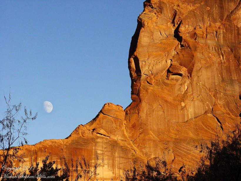
Moon Fin
Gibbous Moon and Red Rock
Gibbous Moon and Red Rock
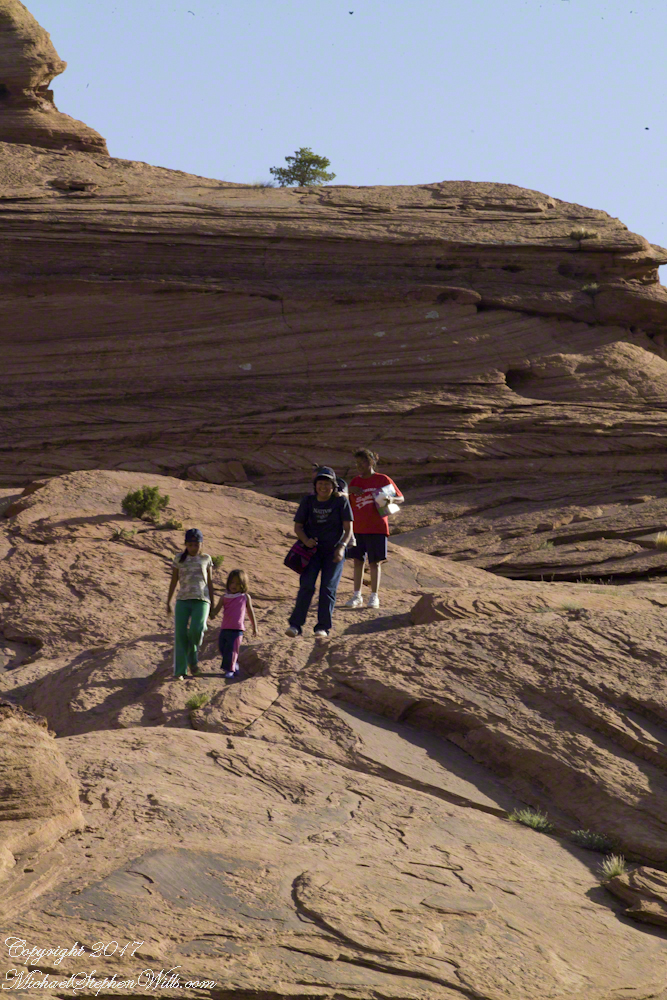
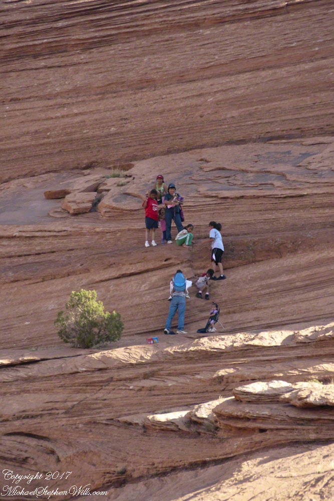
Step into our visual journey across Canyon de Chelly’s ancient grandeur, where photographs capture Navajo families weaving through the immense narrative of sandstone and sky.

In 2003 and 2008, the author visited and photographed White House Ruin in Canyon de Chelly, observing changes in landscape.
In November 2003, my son Sean and I journeyed up Route 191 from Petrified Forest National Park, arriving in Chinle on a crisp autumn afternoon. My photography equipment at the time was modest: a Sony Point and Shoot 5 MP camera with filters, a purse-like over-the-shoulder bag, and a basic tripod from Kmart.
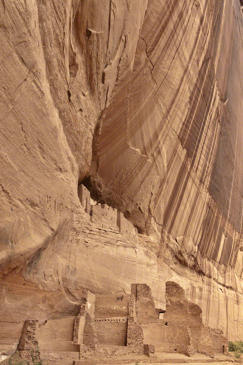
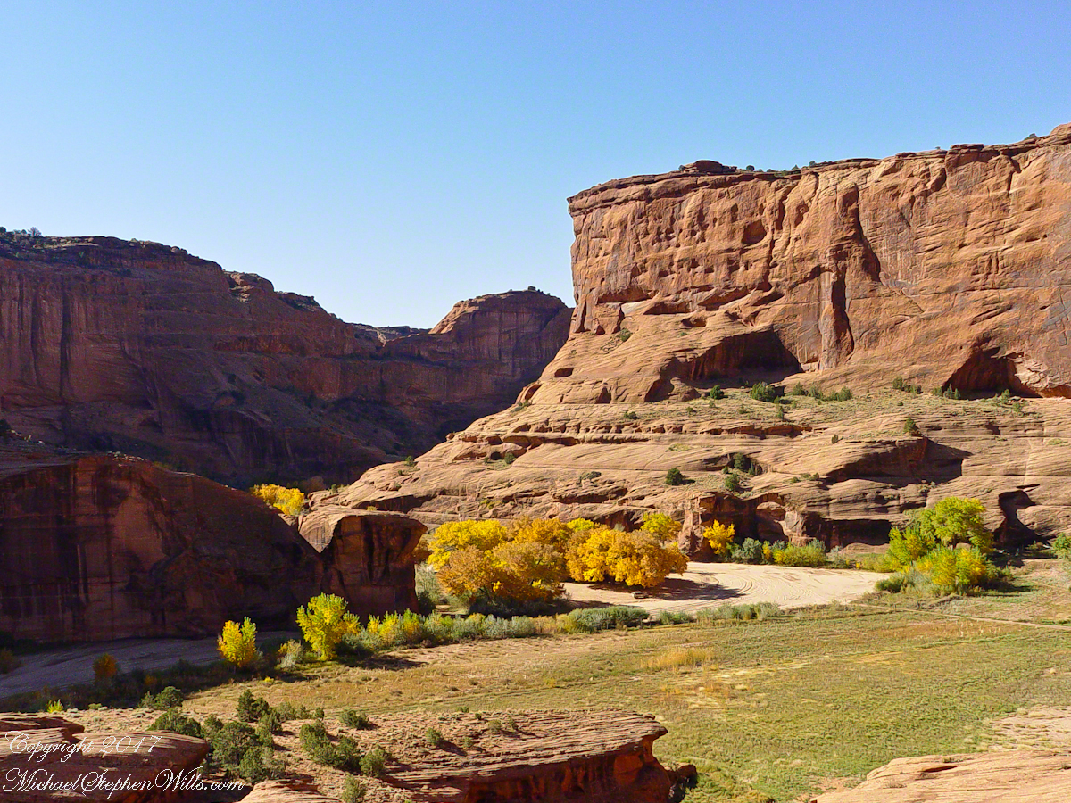
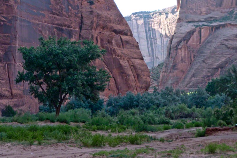
We reached the White House trailhead in Canyon de Chelly and began our hike. The trail was quiet, and as the sun set at 5:20 pm, we found ourselves virtually alone. A dense growth of Russian Olive trees dominated the wash at that time. In the dimming light, I captured a distant shot of the White House Ruin, whitewashed, set against the backdrop of autumn-hued Russian Olive foliage. Nearby, a grove of Cottonwoods, still green, stood near the canyon wall.

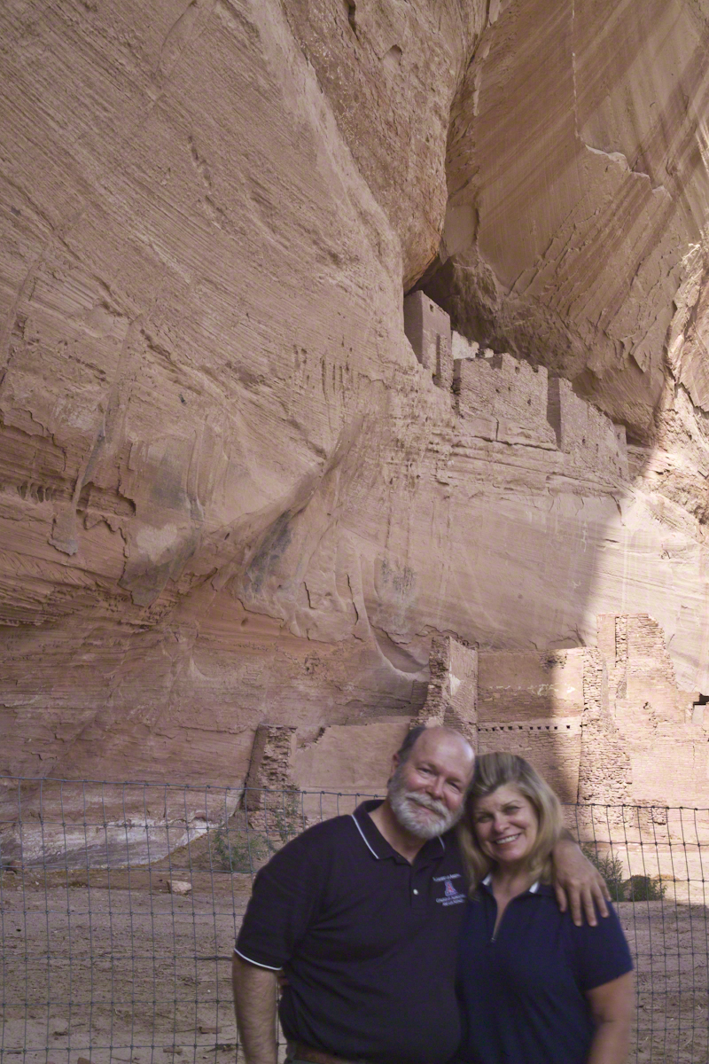
By the time Pam and I returned in July 2008, four years and nine months later, the landscape had changed. The invasive Russian Olives had been removed, and the White House Ruin was no longer painted white.
The same Route 191 that Sean and I had taken in 2003 led us through the Four Corners region of Northern Arizona. Pam and I had traveled from Colorado, arriving in the late afternoon. This time, the Navajo Reservation’s adherence to daylight savings time meant the sun wouldn’t set until 8:33 pm. My aim was to photograph the White House Ruin that I had missed years earlier.
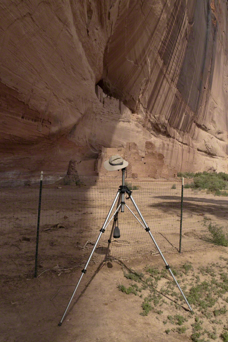
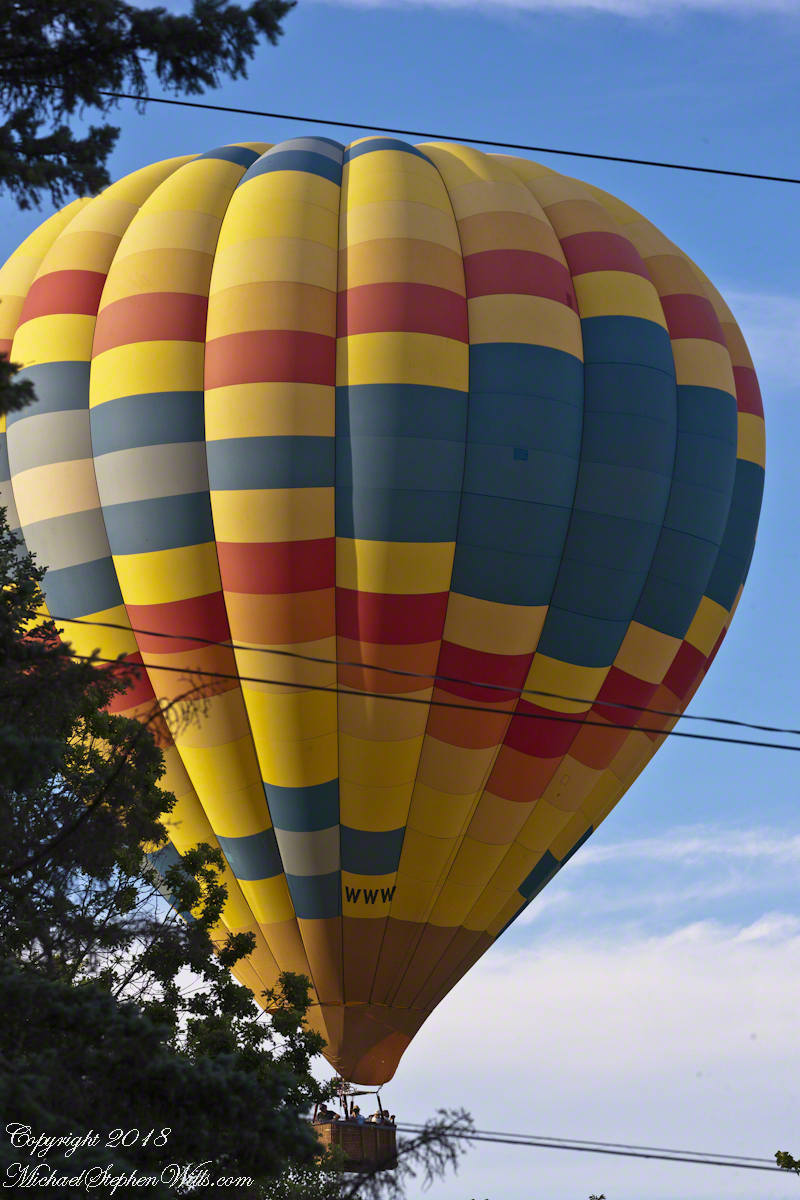
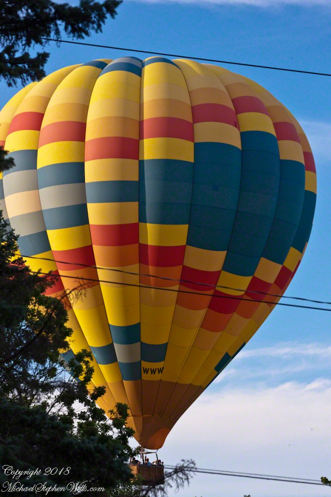
That July day the sun set 8:33 pm as the Navajo Reservation observes daylight savings time. My goal was to photograph the White House Ruin I missed in 2003. We arrived at the trail head. My photography kit was expanded from 2003, now included a Kodak DSC Pro slr/C, the “C” meaning “Canon” lens mounting, a Sony 700 alpha slr (I only use a variable lens), Manfrotto tripod with hydrostatic ball head, and the backpack style Lowe camera case. With the tripod it is over 25 pounds.
With this on my back I was prepared to boogie down the trail. At the height of tourist season there were many more people at the trailhead. Pam, being a friendly person, started a conversation while I ploughed ahead along the flat canyon rim. It is solid red sandstone, beautiful, generally level with enough unevenness to require attention. When Pam saw how far ahead I was she tried to catch up, tripped, fell hard.
I backtracked to Pam and we decided what to do. She thought, maybe, the fall broke a rib. We decided to proceed and descended, slowly, together. Here we are in front of the ruin. The sun, low in the sky, is moving below the south canyon wall. This is a perfect time, and I used both cameras.
The sweep of cliff and desert varnish was my intent to capture. Here it is through the Canon 50 mm lens.
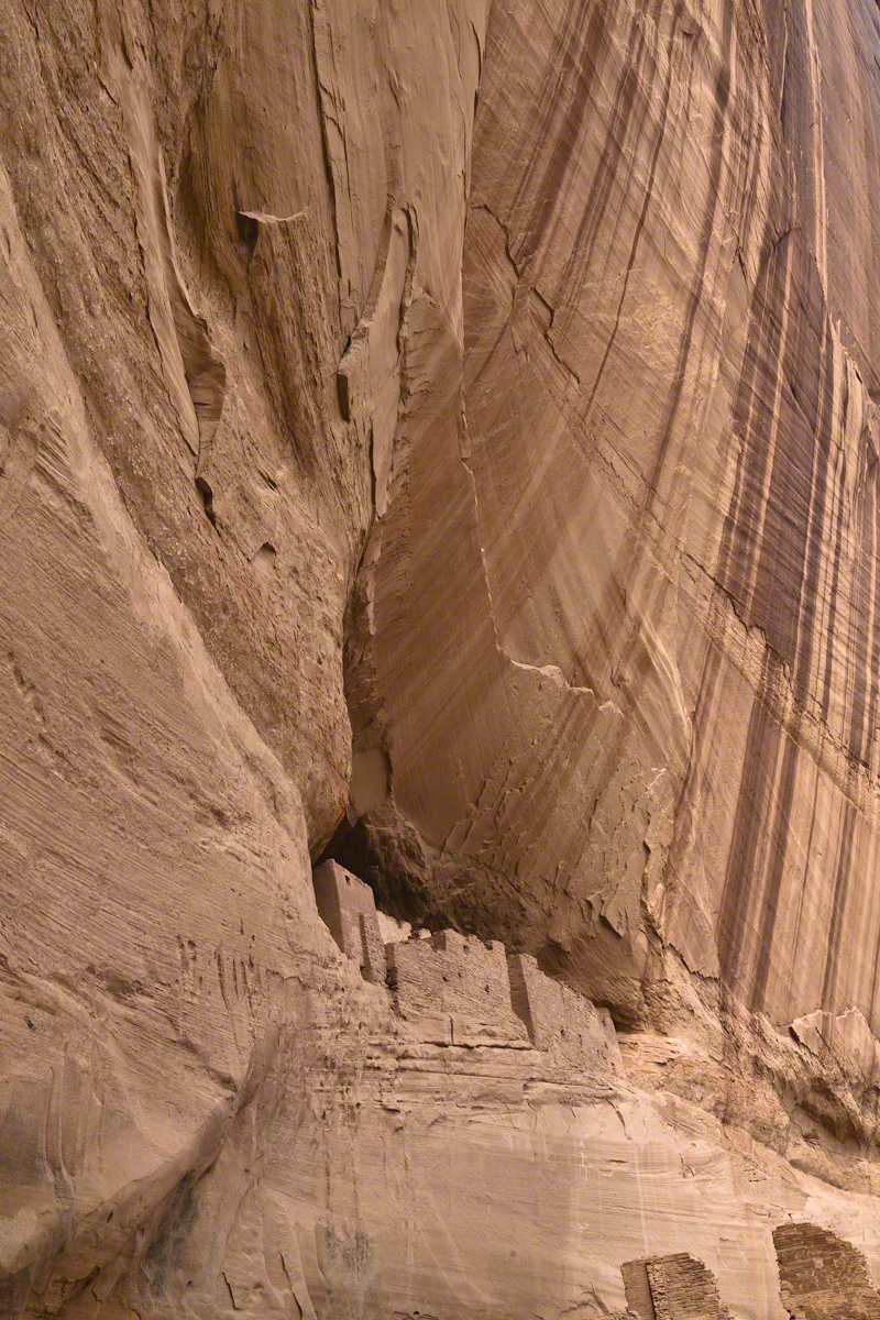
I captured this version with the Sony Alpha 700 slr, the variable lens set to widest angle.
Here the camera setup waits out the sun…..
crack of dawn
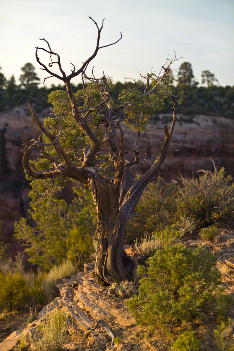
In this post we start the day of my posting “Family Trek“, July 19, 2008, when, well before the sun rose at 6:23 am Mountain Daylight Time (the Navajo Reservation observes daylight savings, the rest of Arizona does not), Pam and I were at the Spider Rock Overlook.
Most visitors to the canyon make use of a system of roads and parking lots next to strategic views. There is the White House Overlook we visited our first day, July 18, to hike from the trailhead into the canyon. There are also, on the south side of the canyon:
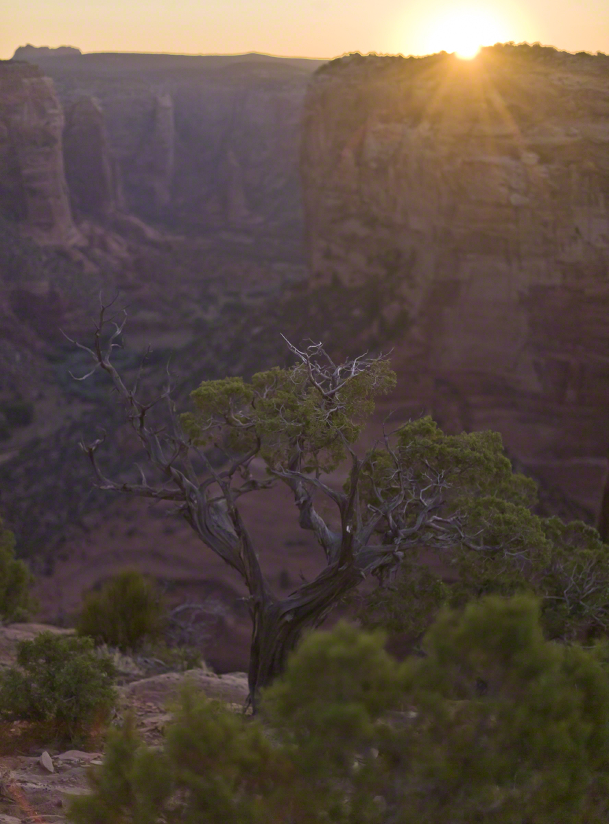
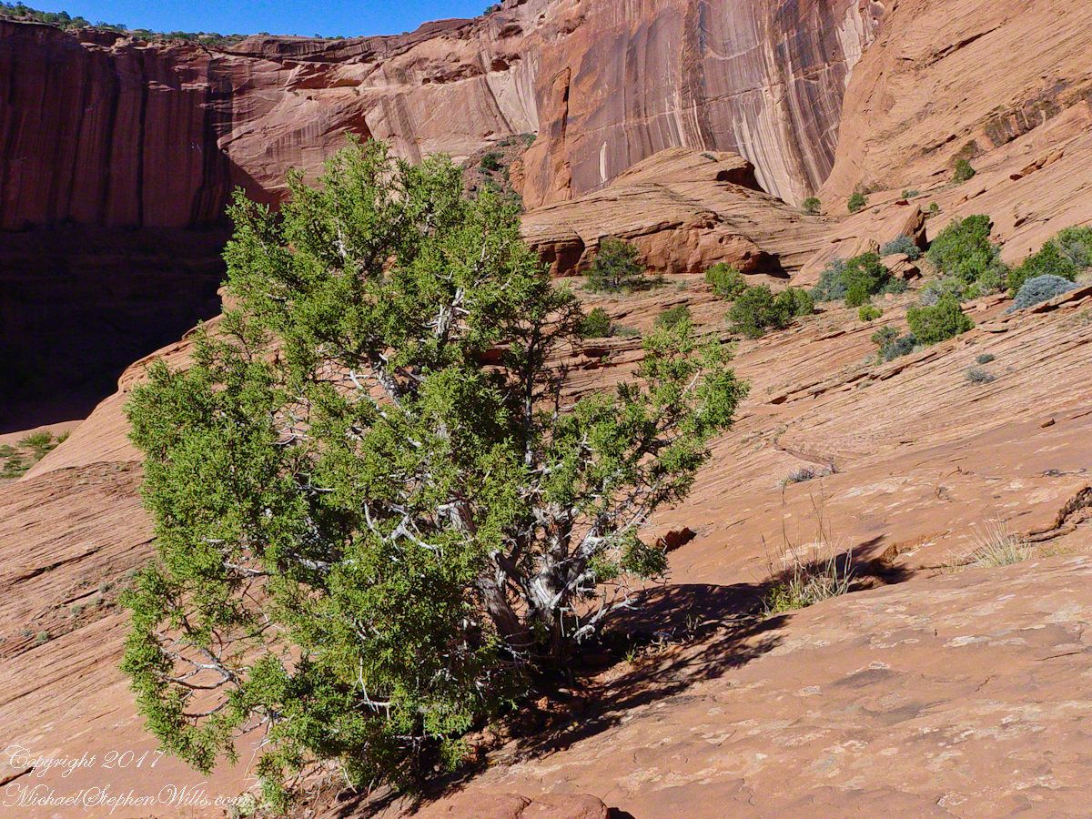
While getting ready I scoped out the location for interesting visual tropes. Utah Junipers are exceptionally hardy shrubs, stressed individual plants grow into compelling forms shaped by hardship. As the sun rose, this specimen emerged from the gloom and caught the first sun rays.

Enjoy!!
….and a photographic gallery.
As of April 5th 1181 is the count of subscribers to this blog, an interesting number. The individual numerals sum to a prime number, 11. I appreciate each and every “1” added together, you readers. Thank You.
Coincidentally, yesterday 1,200 of my blogs are published….Here is a selection of images from these posts.


In November 2004, a visit to Canyon de Chelly with guide Hadley Tsosie revealed ancient petroglyphs and ruins, highlighting Navajo culture and the canyon’s unique beauty.
On November 3, 2004 my son, Sean, and I made our way to Chinle, Arizona on the Navajo Reservation at the mouth of Canyon de Chelly.
The next day, driving a rented 4 wheel drive, we arrived at the visitor center, at dawn, and there met Hadley Tsosie who worked as a guide. This is how you do it, if learning about the Canyon is your goal. It is possible to walk, unaccompanied, into the canyon to view the “White House” and this I highly recommend. Tourists can also drive around the rim to various overlooks. This is what most people do.
The canyon is still farmed and the tribe only allows visitors when accompanied by a guide. Only Diné (Navajo) are certified as guides. They know the rights of way and the preferences of the landowners.
We negotiated with Hadley to take us for half a day for our interest in petroglyphs and ruins. It is important to start early when the sun is low in the sky, when directly overhead the details of ruins and petroglyphs are washed out by the light. Catching the late afternoon/evening sun is also an approach that requires detailed knowledge of the route, taking into account the time of year.
Hadley was an excellent choice, though he was our only option on that day. He was fluent in Navajo beliefs, the lore of the canyon and generous in sharing what he knew.
Here is Hadley, approximately 6.2 miles into the canyon with the “Ledge Ruin” behind. We arrived at the junction just in time, before the sun was high enough to wash out the ruin. It is slow going into the canyon what with the deep sand and water that must be negotiated. Hadley did the driving and was expert. We passed other parties bogged down in the wet sand. I do not believe it was luck that kept us moving . We stopped many times to talk and admire the petroglyphs and pictographs.

Petroglyphs are symbols incised, or cut, into the surface (the name means petro, “rock”, glyph, “symbol”). In the desert climate of the southwestern USA a thin, dark pigment forms on rock surfaces of overhanging cliffs. The pigment forms from infrequent precipitation, in the form of water, flowing downward over the surface or even dew. The high heat of the desert drives a chemical reaction between water, clays, iron and manganese oxide to form a coating on the rock surface. The dark coating, called “desert varnish”, contrasts with the underlying rock. When it is scraped away a line forms. Many of the petroglyphs were of this form. Others were carved into the rock itself, more time consuming and durable. No one knows when the petroglyphs were made, they were always there are respected. People have inhabited Canyon de Chelly for over a thousand years.
The word pictograph has a different meaning when used to describe prehistoric art. The earliest writing were symbols incised in wet clay, then allowed to harden. The pictographs we viewed was prehistoric art, mostly white pigment on the red rock, outlines of hands. There were also kokopelli, the outline of a flute player and jagged lines, symbolizing, Peter told us, lightening.
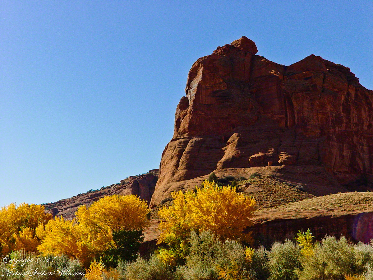
In November the cottonwoods were in fall foliage, a brilliant yellow under a cloudless sky. The sun is lower in the south and rises later. The Navajo Reservation follows daylight savings time, unlike Arizona. This November morning the sun rose around 7:45 am, so if you are not an early riser this time of year is an excellent choice for a Canyon de Chelly tour.


there if you want to see it
The village of Chinle is a “census designate place”, in other words it only exists because people live there, it was not formally recorded in “official” records. On the Navajo reservation, people lived here beyond recorded time. It is called in their language “flowing out”, where live giving water flows out from the canyons.
There is a fine Best Western in Chinle, better than most of that brand and the only choice for mile and miles and miles.
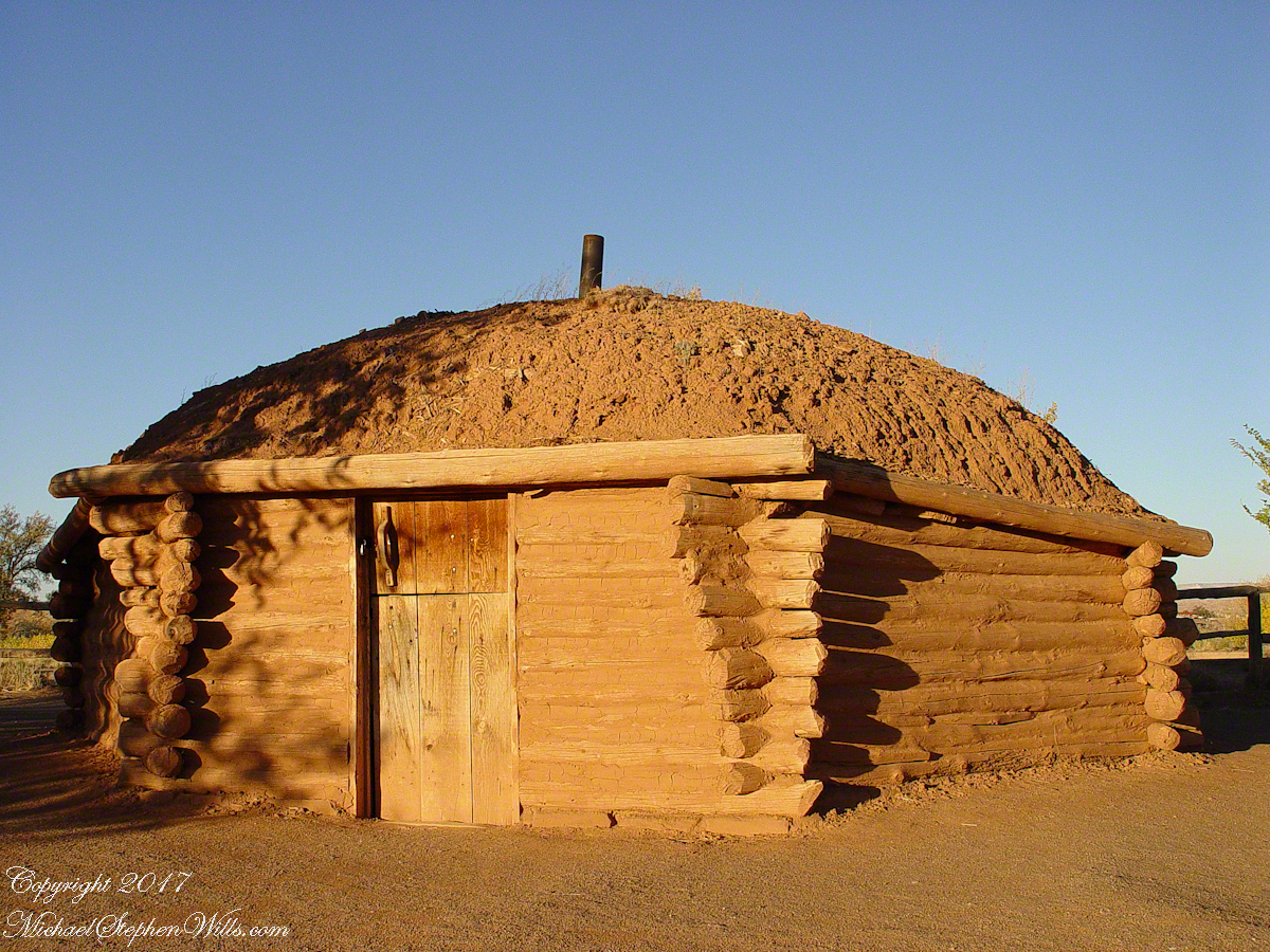
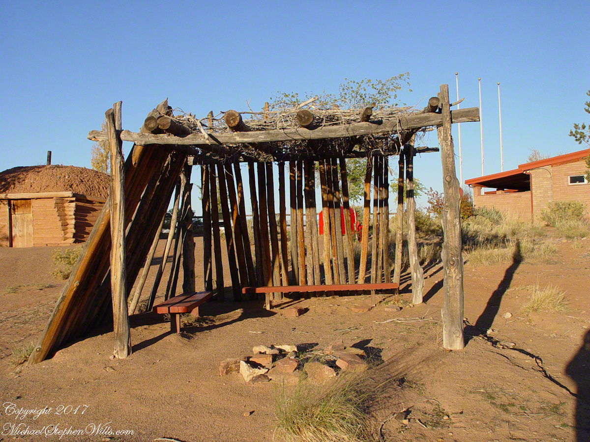
In Junction Ruin Musings, the previous post, a ruin from the Anasazi people was contemplated. Above is a traditional Navajo dwelling from a later, more secure, time.
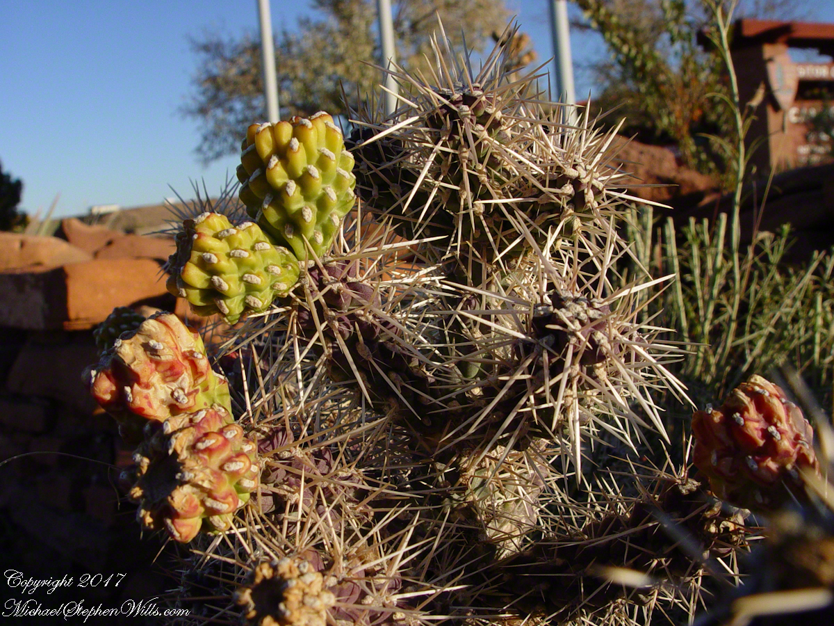
Ouch!! Everywhere in the southwest, watch where you tread.
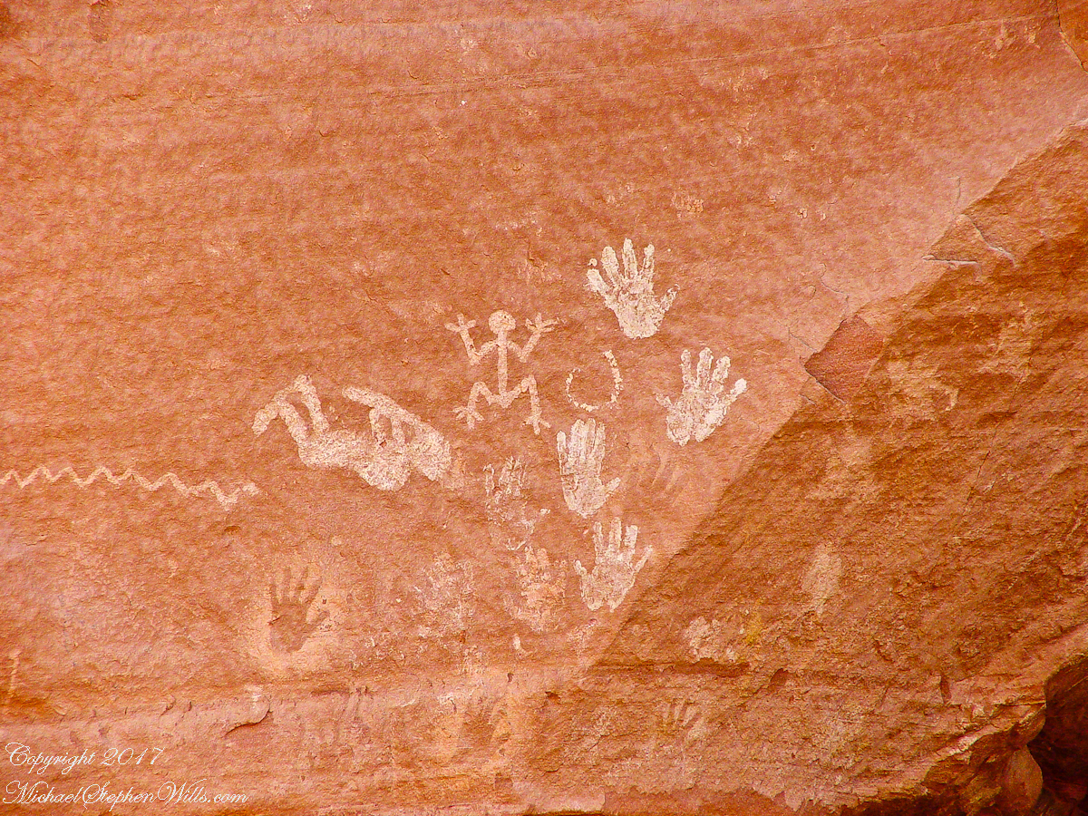
A Native American, seeing the flute playing Kokopelli, hears in the mind the sonorous melodies of their native flutes carried in as if on the wind. The hands waving in rhythm, “Here we are.”
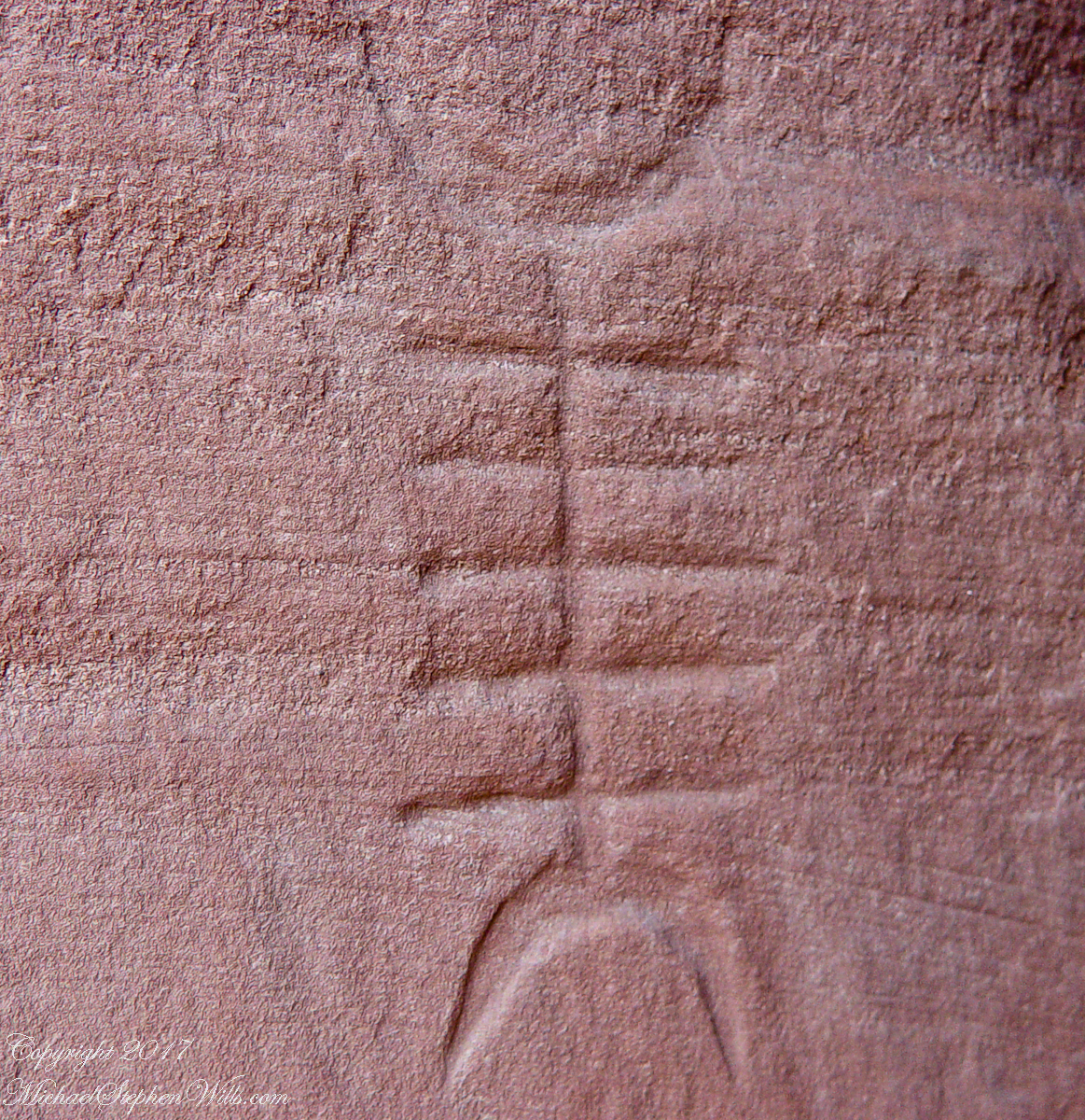
I recall our guide, Peter, describes this as a scorpion.
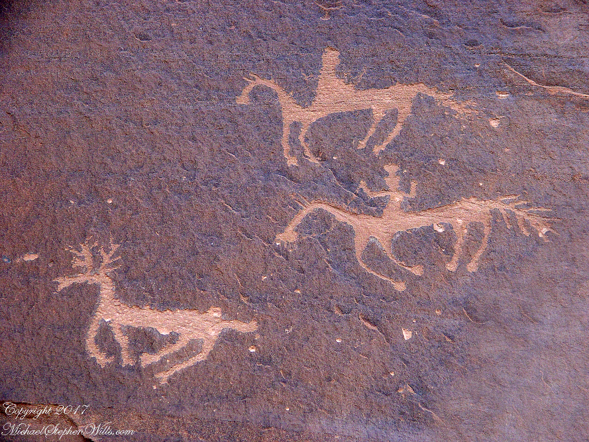
The feeling of movement and the story invoked viewing this drawing etched carefully on the rock demonstrates we are in the presence of an accomplished artist. The story of the times for us to learn from.
A Navajo woman, fleeing Apache captors, flew over this cliff, or seemed to. Survival depended on knowing how to run over slickrock without stumbling and to know where and how to disappear into the rocks.
Click for my OnLine Gallery of Arizona photography
Click for the next posting in this series, “Moon Fin”
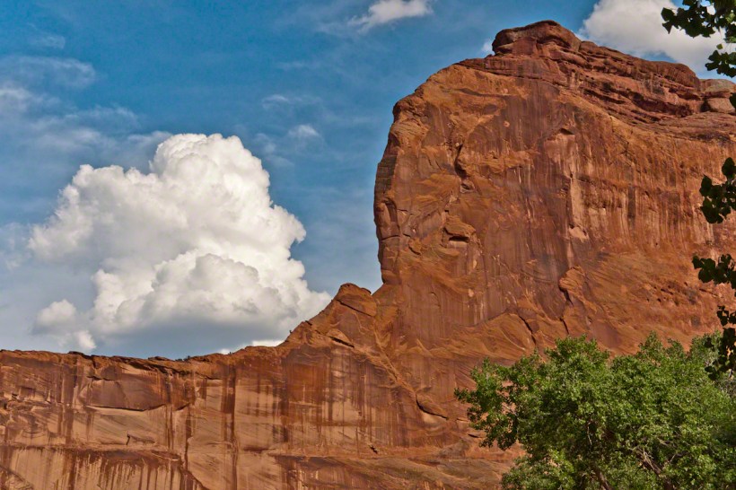
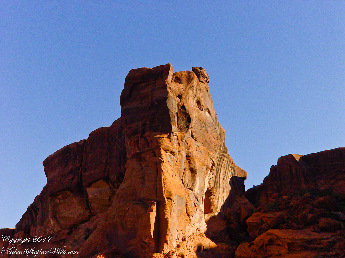
Thunderhead and Red Rock

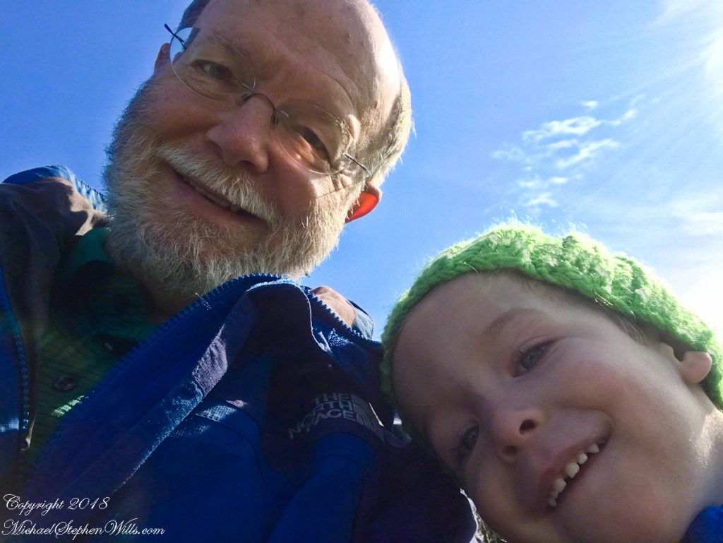
The landscapes I capture, like the face of a missing friend, fade gently from memory. My piece “Moon Fin Canyon de Chelly” became a mysterious vision. I remembered the context, the canyon topology was lost until I constructed the panorama, above, from three shots taken one evening, July 2008, from a cliff near the White House Overlook. Five years after my visit with Sean Wills, Pam and I returned to Canyon de Chelly to walk the same path.
At that time, a 50 mm lens was my widest angle, so I would take multiple images in sequence and use Photoshop later to construct a panorama. This past Sunday afternoon I spent stitching together my work from 2008. In doing so I see “my fin”, in the center, bordered by the canyon road, is attached to the White House Ruin cliff via a thin ridge.
During that session a photogenic thunderhead, lit by the evening, hovered behind the fin as the gibbous moon did that long ago evening.
Click to visit Rock Fin with Thunderhead in my OnLine Gallery

a window in time
Canyon de Chelly, on the map, is shaped like a Y or a chromosome. A chromosome as the walls of the canyon carry the heritage of the people who made this place their home over millennia. A Y as in the letter ship, a foot and two arms.
6.2 miles from the canyon mouth, where the road ends at Chinle, above the branch, on the north cliff, is this photogenic ruin, called the Ledge Ruin. In my previous posting, this ruin forms the backdrop of Peter Tsosie’s portrait. Peter is the header image of this posting.
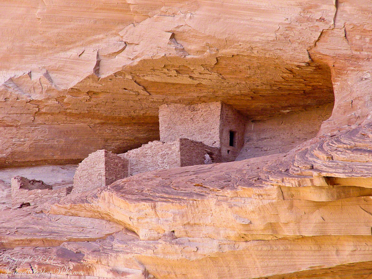
Difficult to believe, seeing it for the first time.
Difficult to see, a tiny nook in an enormous cliff, the structures formed from the same rock as though what remained after the cliff fell away.
Difficult to comprehend life there, what drove them to this effort? Fear, certainly, concern for their safety and security.
We know it by our name. Their name included the word “home.”
watch out for quicksand
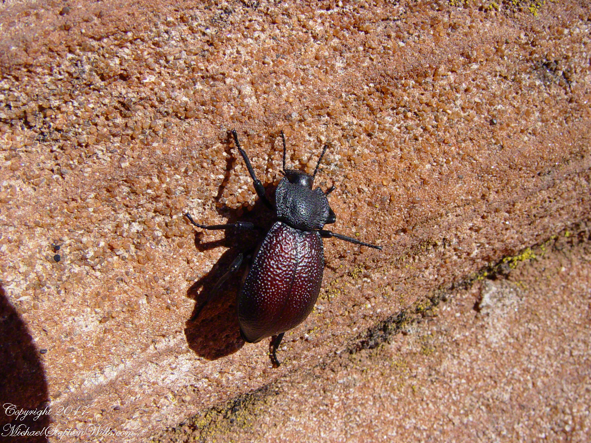
In my post Canyon of Music, Wind, Light I shared a different photograph of this beetle crawling on sandstone, naming it as a “dung beetle”. I had assumed it was one from once having seen a beetle in an Arizona desert pushing a ball of dung around. This morning, to confirm my assumption, I searched for images of “Arizona Dung Beetle” and was dismayed to find this beetle shares no characteristics with the photographs. Absent smoking gun evidence, sadly lacking in this photograph, I have to admit my “dung beetle” attribution is in error.
Supporting the beetle, the luminous surface of the red sandstone named “de Chelly,” sunlight reflects from durable remnants of the ancestral Rocky Mountains wore to these bits of rock, piled to mountainous dunes by the winds of tens of thousands years, polished to smoothness each against the others.

The above photograph is a detail from the brightly lit cliff of the following photograph. The desert varnish and underlying rock was weathered over thousands of years, the sand grains falling to the canyon floor.

The soil of the canyon is composed of these bits of the ancestral Rocky Mountains. What appears to be a white road in the above photograph is not man-made, it is the dried bed of a stream. When a waterway is dry like this, only flowing with rains, it is called a wash. When water fills the wash of the Canyon Del Muerto, the polished sand granules become a dangerous morass, sucking down horses, people, anything unlucky enough to step into it. Every movement, struggling for freedom, pulls the victim deeper down until the wet sand closes over the head and suffocation and death ensues.

The waters Canyon De Chelly National Monument naturally form a vast Y into the Defiance Plateau, naturally because two major streams merge into one canyon a few miles above Chinle. On both our guided trips, heading east from Chinle there is a branch. On the right De Chelly canyon continues. On the left is Canyon Del Muerto. The photos in this post are all from “The Canyon of the Dead”, what the name means translated into English.
No, it is not named this because of the quicksand. Conditions for quicksand are present throughout canyons of the southwest. It is history of human occupation for which this canyon was named. I will cover it in a future posting. For now, I will say the above views are from the spot featured in “Family Trek.”
My first visit, in 2003, while my son Sean climbed the rocks with our guide, I was left to document the wondrous surroundings. The above shallow cave is reached by that stairway carved into the precipitous ledge. The access to the cave is via those naturally occurring ridges of the cross bedded sandstone. It is another example of De Chelly sandstone formed from the windblown edge of a monstrous ancient sand dune.

Here is another example of rock formed from the solid body of the sand dune, that unbroken and un-striated cliff. Below is the cross-bedded, windblown sand.

As we proceeded generally east from the climbing spot of “Family Trek”, driving by the golden cottonwood foliage I asked the guide to stop for these photographs.

Soon the cliffs hid the sun.

Notice the modern water distribution system (pipe) at the foot of cliff on right. These vast tracks of shadow adjacent to bright sunlight are a fact of life for canyon dwellers, a source of joy and wonder.

The canyon here is rather like the Narrows of Zion, without the water.

Enjoy!!
