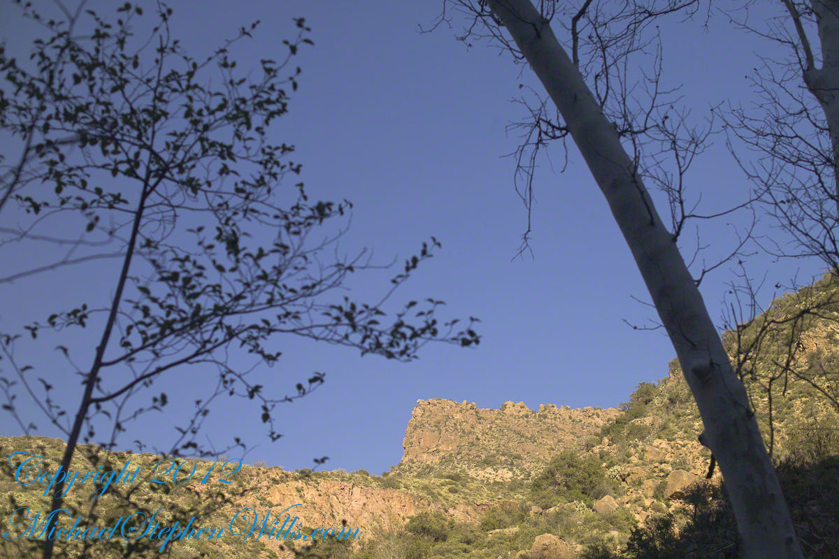
In this post we start the day of my posting “Family Trek“, July 19, 2008, when, well before the sun rose at 6:23 am Mountain Daylight Time (the Navajo Reservation observes daylight savings, the rest of Arizona does not), Pam and I were at the Spider Rock Overlook.
Most visitors to the canyon make use of a system of roads and parking lots next to strategic views. There is the White House Overlook we visited our first day, July 18, to hike from the trailhead into the canyon. There are also, on the south side of the canyon:
Tsegi Overlook, taken from a Navajo word that translates directly to “between the rocks” and usually refers to a deep canyon with steep cliffs.
Junction Overlook above the point where Canyon Del Muerto (see my posting “Sun and Shade, Canyon Del Muerto”, and Canyon De Chelly intersect. There is an Anasazi ruin in the south-facing cliff across the canyon.
Sliding House Overlook, another Anasazi run across the canyon.
Face Rock Overlook, to view the eponymous formation.
Spider Rock Overlook, the most stunning rock formation.
Click any photograph for my Online gallery.
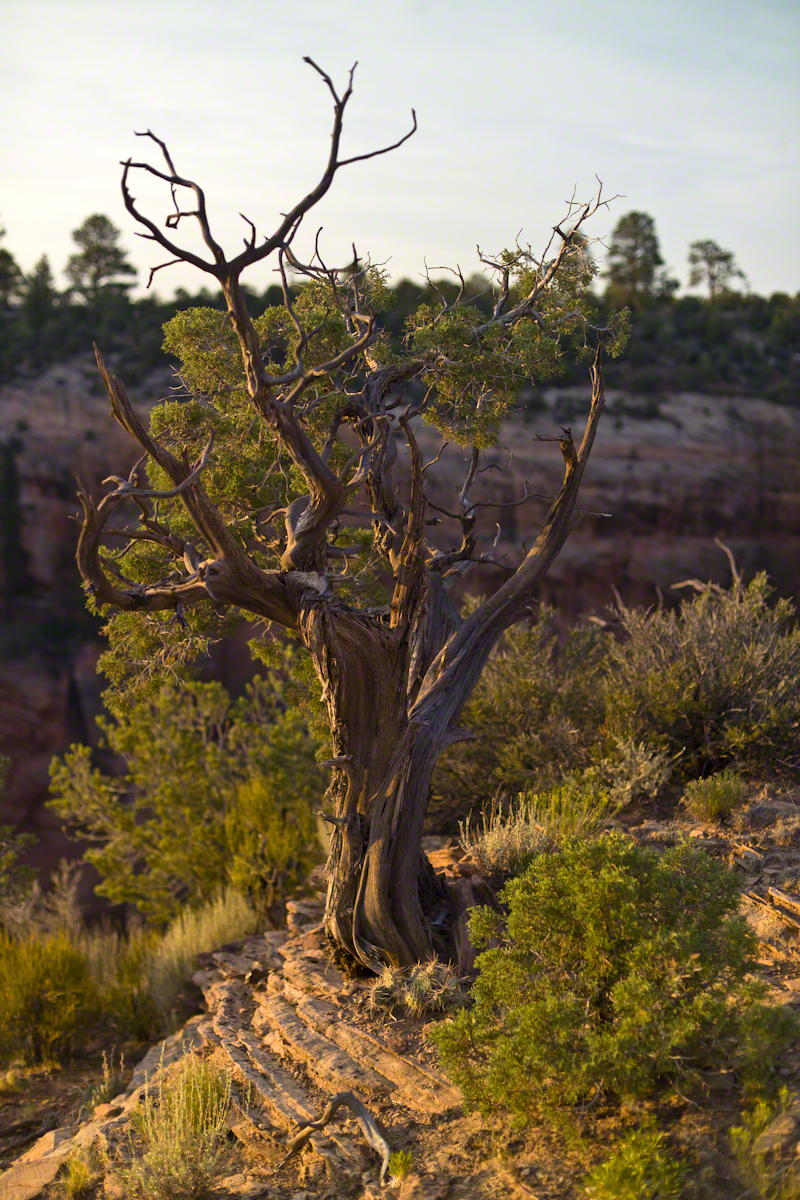
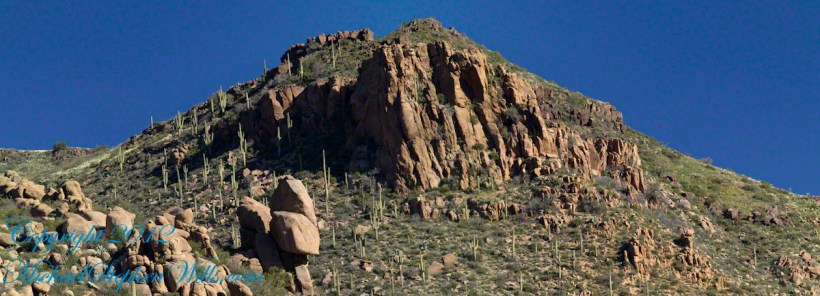
Looking east from the Spider Rock overlook, Canyon De Chelly.
While getting ready I scoped out the location for interesting visual tropes. Utah Junipers are exceptionally hardy shrubs, stressed individual plants grow into compelling forms shaped by hardship. As the sun rose, this specimen emerged from the gloom and caught the first sun rays.
Click any photograph for my Online gallery.
A distressed Utah Juniper on the edge of Canyon De Chelly overlooking Needle Rock a few moments after sunrise.
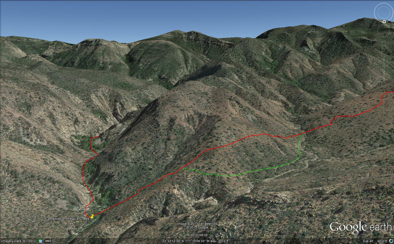
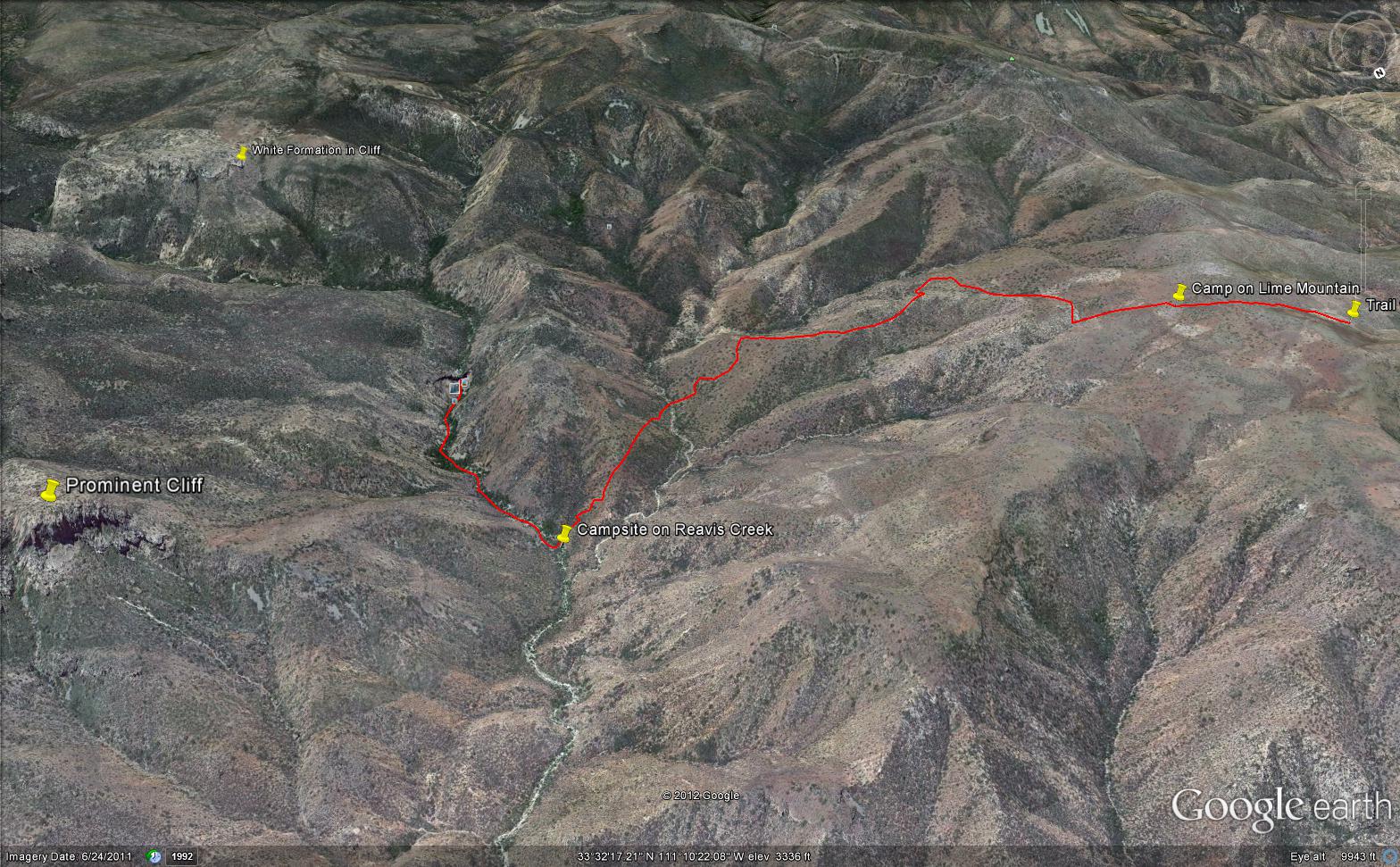
Here is an overview of my route through Cedar Basin on the way to Reavis Falls. There are two paths in the following image from Google Earth. The red path brings you into Cedar Basin and straight up a ridge and down to the campsite. The red path is incorrect in the approach to the ridge and, rather than repaint the path, I created the green path as the gradual and accurate description of how I climbed to the ridge point where I captured the photographs Hoodoos on the Descent to Reavis Falls.
No Path to Reavis Falls
You need to understand there is NO path through this terrain. It is necessary to follow a faint trail marked out by the footsteps of those before you and an occasional rock cairn placed at the most difficult points. The following image is misleading in that what looks like a road next to my green path is actually a creek bed from the Lime Mountain spring.
Huge Boulders
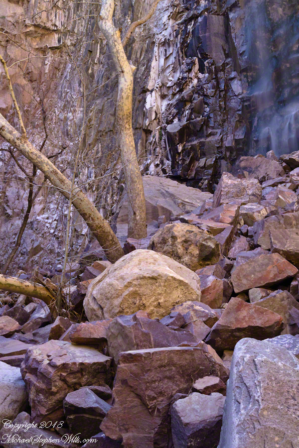
What looks like a road is the resting place of huge boulders fallen from the surrounding mountains. Since there is water, thick brush and trees grow everywhere in cracks and spaces between the boulders and rocks. Getting through the creek bed with an 80 pound pack and not getting lost is close to impossible. The solution is to hug the ridge slope, following the contours and navigate around boulders.
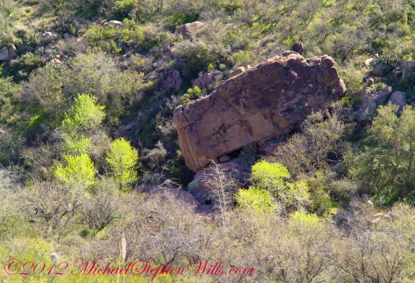
Reavis Canyon below the falls is filled with boulders of this size held in place by friction.
View of Reavis Canyon and Campsite
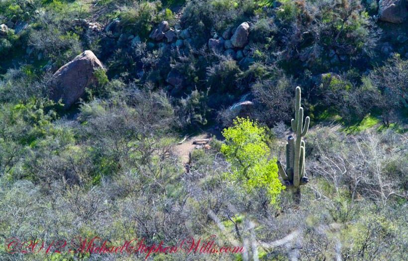
From the ridge small portions of Reavis Canyon were visible. I even spotted a campsite.
The mouth of Reavis Canyon below the falls opens into a sandy bottom. This camp, surronded by house-size boulders fallen from the slopes above, has a patch of grass bright green and fresh.
This camp, 1,636 feet below Lime Mountain peak, surrounded by house-size boulders fallen from the slopes above, has a patch of grass bright green and fresh to the right. In the center of the photograph is a tree trunk on rocks to serve as a bench next to a fireplace. With an 80 pound pack on my back, I was still an hour or so away from this spot. It was March, so sunset was around 6 pm, enough time to find a way down before darkness to overtook me.
Looking down from a ridge above the canyon that holds Reavis Creek and the falls.
This is an overview of my progress, with the Lime Mountain and Reavis Canyon campsites marked. Landforms are marked on the left: the Prominent Cliff , in the background it says “White Formation on Cliff.”
Copyright 2023 Michael Stephen Wills All Rights Reserved
My previous post, “Dry Juniper Descent” had me above the ridge of the featured photograph.
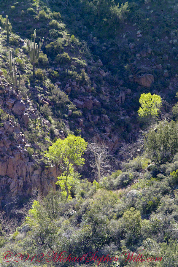
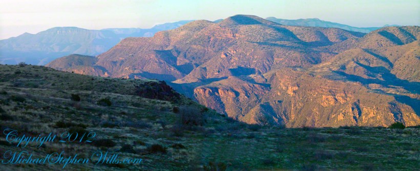
I interrupted my descent to Reavis Falls to stop on a ridge overlooking Reavis Creek, the same ridge that forms the western wall of the canyon. By this time it was late afternoon on a March Day with the angle of the sun being perfect for capturing rock formations. Notice the effect of the light on the distant mountains.
This is the North / Northeast view of the opposite ridge above a flow from multiple springs on Lime Mountain.
This photograph was created from multiple images using tripod-mounted Kodak DCS ProSlr/c with a 50mm, 1.4 Canon lens.
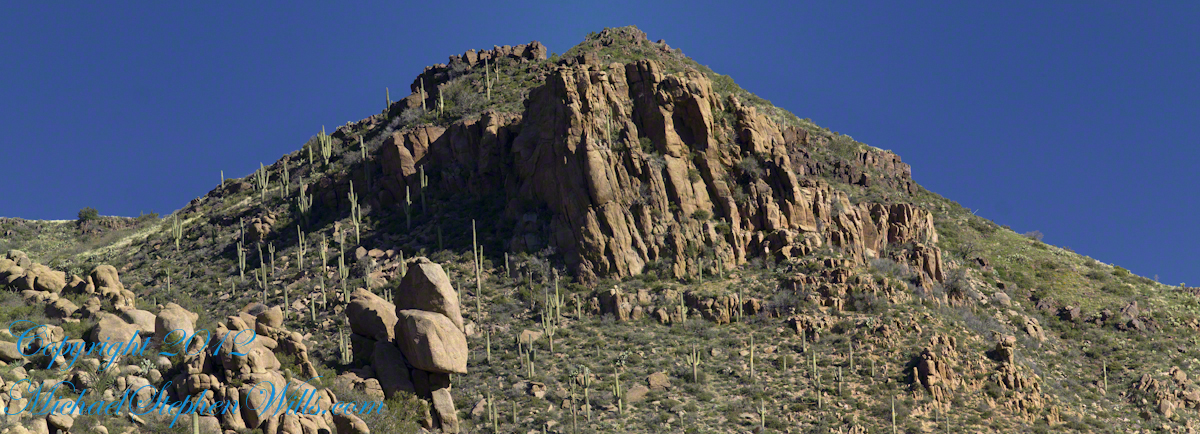
Cedar Basin hoodoos on the slopes of Lime Mountain
The ridge and slopes are covered with a rock formation named Hoodoos for the fantastic shapes taken on by layers of stone weathered over eons by water, wind, sun and cold. These hoodoos are enormous, some precisely balanced and carved into elaborate shapes. The word “Hoodoo” derives from the name of the practice of sorcery or folk magic. You can image the effect on ancient people of coming upon these formations and believing them created by malevolent beings (djinns, goblins, demons) in their leisure time, when not causing problems, and worse, for humans. These beings are especially active in desert places, such as this, which has the comforting name of Cedar Basin.
The hoodoos cast a spell on me. I had never heard of Cedar Basin, but knew, as the sun was low in the west, I needed to unload my 70 pound pack, set up the tripod and camera to spend over an hour of precious time to capture the images of this blog.
Ancient Village
Cedar Basin forms on one side from the ridge of this photograph. On the other side of the ridge, the mountain slope levels out to a site settled by ancient people we call Sin Agua. There is nothing but a few stones left of their village and way of life.
Cedar Basin
Looking to the left of the Hoodoo Panorama photograph and into Cedar Basin, you see more of that same rock type that formed the hoodoos to the right on this same ridge. This is also the lower slopes of Lime Mountain, as you can see from the color of the upper ridge.
The Slopes of Cedar Basin
This and the following photographs were created using a tripod-mounted Kodak DCS ProSlr/c with a 200mm, 1.4 Canon L type lens.
Another side of the basin is formed by the ridge I am on. This side is across from the canyon of Reavis Creek and Falls. The trail leads down switchbacks from the Dry Juniper of my previous post to a dry draw. You can see the way I came in the following two photographs. I captured Castle Dome, then panned to the right for the rest of the ridge. You can see the trail to Reavis Ranch carved into the slopes of Castle Dome.
Castle Dome Ridge and Reavis Ranch Trail
Cedar Basin and Castle Dome
I then panned one more time to the right to capture the ridge above Cedar Basin and the start of the hoodoos. It was an army spread across the entire ridge!!
Cedar Basin and Castle Dome
My next posting will feature close-up of the most interesting hoodoos from the panorama, using a 200 mm telephoto lens.
Copyright 2023 Michael Stephen Wills All Rights Reserved
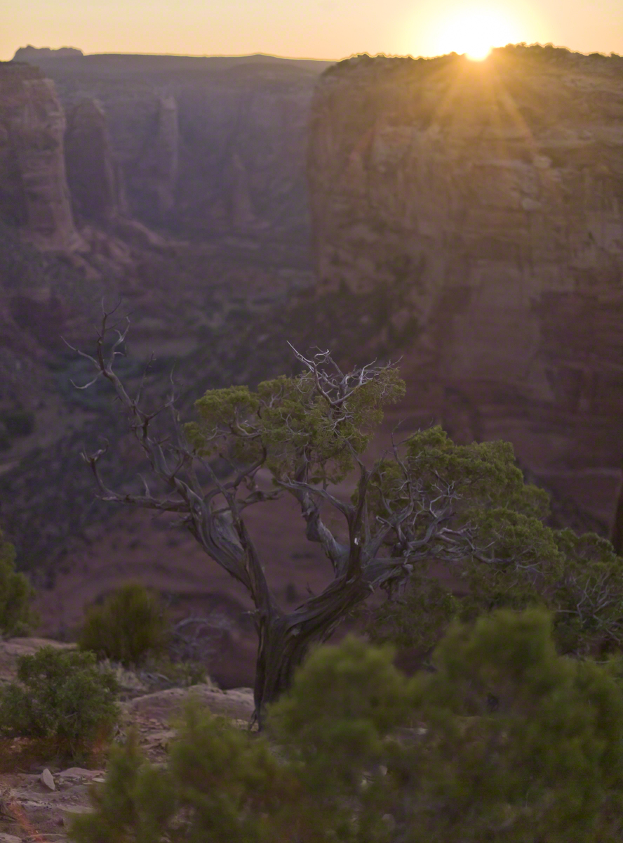
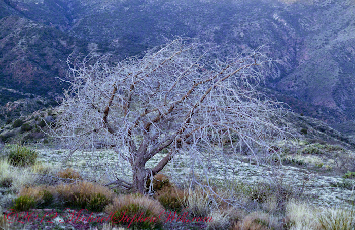
On my fourth morning, after I awoke to am immense silence, my first photography subject was the lone dry juniper you see below.
Then the dawn lit up the far mountains. You can view a larger image these mountains at dawn in my previous blog, “Superstition Wilderness Dawn.”
A Lone Dry Juniper
This is a photograph of that juniper tree, dryer than most, being dead. I take it to be a One-seed Juniper from the thick growth of branches and the strong rounded aspect of the crown. I captured this photograph from a tripod mount using a Kodak DCS slr/c with a Canon EF 50mm f/1.4 USM lens.
Looking into Reavis Creek Canyon from Lime Mountain
I used the tripod to bracket this shot on the left and right for the following panorama.
The Reavis Creek Canyon from Lime Mountain while still in shadow, morning
The Spirit of Elisha Reavis
From this vantage you can see my route into Reavis Creek Canyon and Reavis Falls taken on the first afternoon of the expedition. That first morning I loaded up 65 pounds of food, supplies and photography equipment and headed out from the Reavis Trailhead on the Reavis Ranch Trail. This was one of the trailed used by Elisha Reavis to ride a favorite burro and a string of 8 to 15 burros loaded with vegetables he sold to various communities throughout central Arizona. See my blogs “A Ride to Reavis Ranch” and “Apple Orchard in the Wilderness“for views of the paradise (as of the early 21st century) where Elisha Reavis, lived and prospered in the latter part of the 19th century where he lived his 70’s.
This his mountain valley, using a perennial creek, Reavis cultivated and irrigated about fifteen acres of land by himself with chickens, turkeys, hogs, burros, two horses and several dogs. The horses, teamed together, pulled a shear plow, disc and leveler. On April 9, 1896 Reavis was preparing of another trip to Mesa, to buy seed potatoes, and was found by a friend a month later on what is now the Reavis Ranch trail, to the south and west of his valley, near what is now called Grave Canyon were friends buried him.
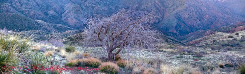
Past the Dry Juniper and Down
102 years later, I headed up the Reavis Ranch Trail, over the ridge of Lime Mountain and past this dry juniper in the same spirit as Elisha Reavis if for a different purpose.
Pre-dawn on the fourth morning of my solo expedition to Reavis Falls, before the last posting “Among the Desert Wildflowers“, on the slopes of Lime Mountain, as the eastern sky became slightly less dark, I woke to an unusual sensation: total silence. The air was absolutely still, no insects trilled, the birds were still asleep. Lying very still, the ringing of my ears announced the silence.
In that silence I set up for this panorama taken from a tripod-mounted Kodak DCS ProSLR/c mounted with a Canon EF 200mm f/2.8L II USM telephoto lens. It is 5 image files combined. The source file is about 300 MB.
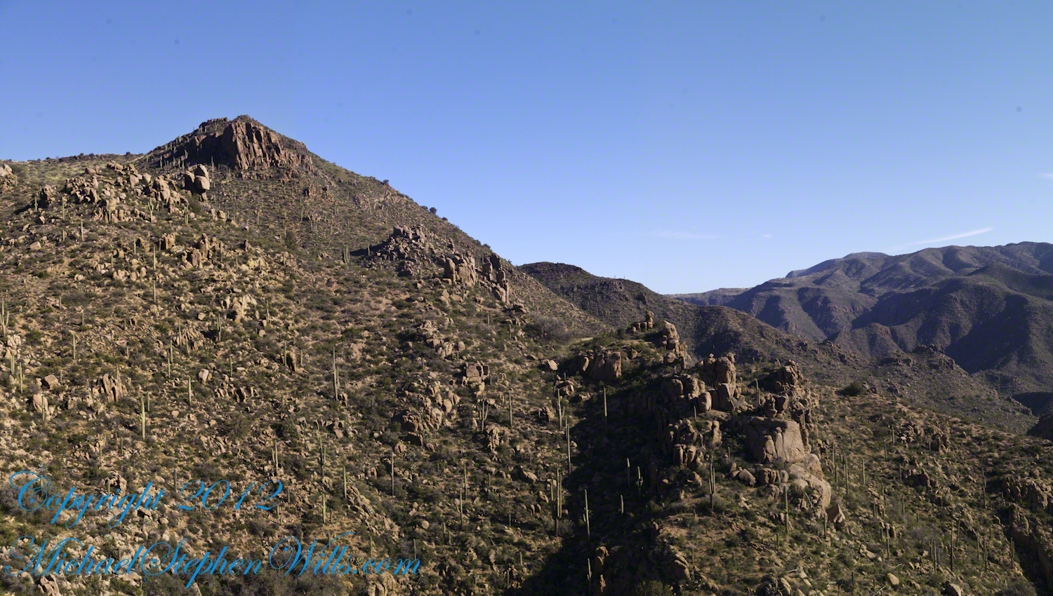
That is Pinyon Mountain in the center distance. The Arizona Trail traverses that terrain, though it is not visible from this distance (it is about 3 miles away).
Lime Mountain is truly a light green, as you can see from the foreground ledge. From there, a cliff runs round where on a south-facing site there are cliff dwelling ruins. The trail to Reavis Falls runs to the right, along a ridge broken by a narrow canyon with access to Cedar Basin, also at the foot of these cliffs.
Copyright 2023 Michael Stephen Wills All Rights Reserved
Another blog from my four day solo expedition to Reavis Falls in the remote eastern Superstition Wilderness. Here we will descend briefly to the canyon of Reavis Creek, below the Reavis Falls.
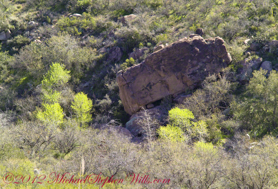
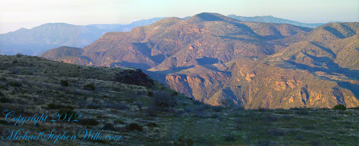
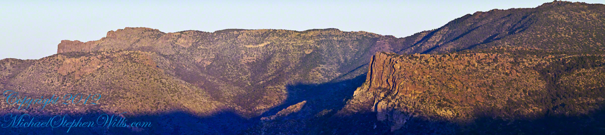
Shadows rising on the canyon walls are from Lime Mountain and Castle Dome. In the far canyon, below Two Bar Mountain, is a shadow from the notable cliff and prominence to the right, that rises above Reavis Falls, fall below and out of sight in the canyon.
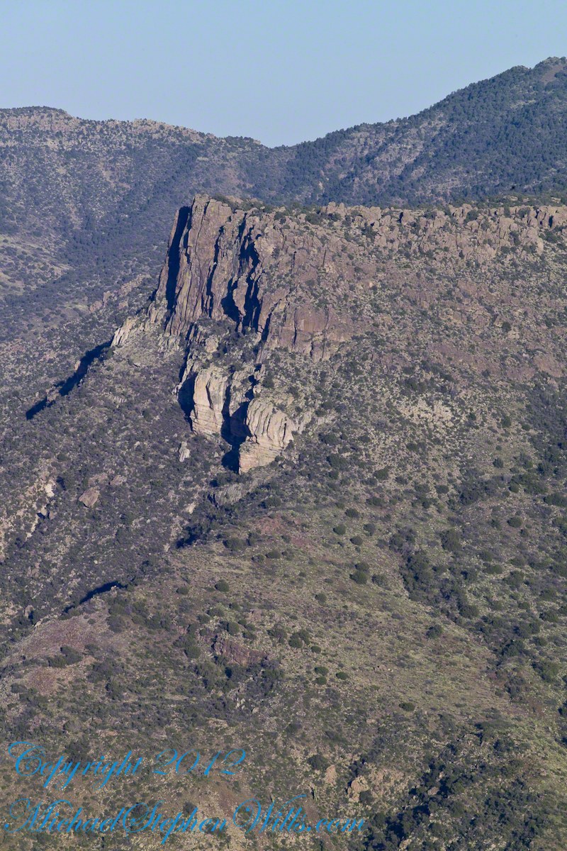
Here is that prominence from that same day, late afternoon when the sun is just starting to be low enough to throw the cliff into relief. This is a single shot with a canon 200 mm lens. This day I had climbed out of Reavis Creek, up to to this point on the slopes of Lime Mountain. Here I enjoyed an afternoon, evening, night and early morning of the following day.
The second day of the solo expedition, I hiked into the canyon of Reavis Falls from a camp at the canyon mouth. Looking up from the creek this same cliff was prominant against the sky.
Copyright 2023 Michael Stephen Wills All Rights Reserved
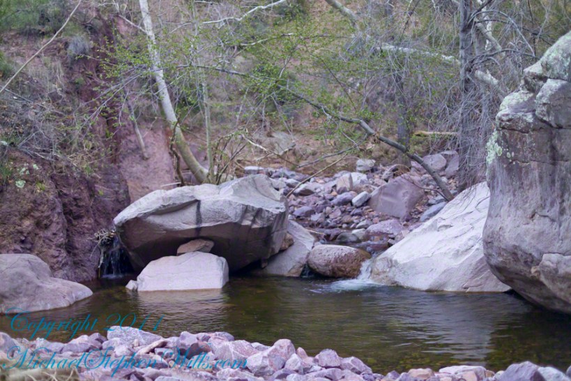
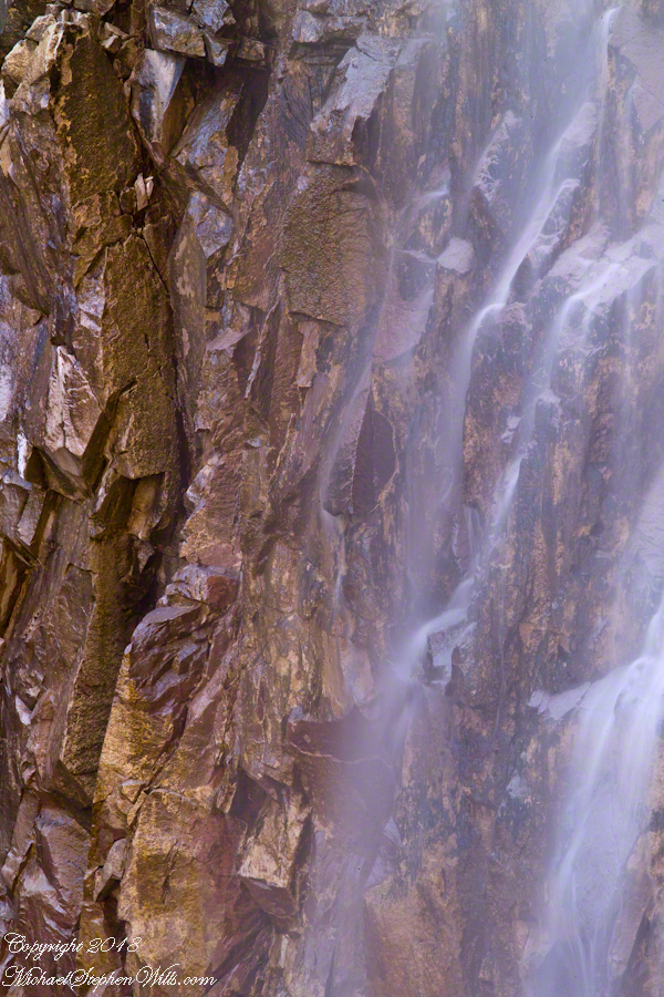
Two Nature Abstracts, macros of Reavis Creek below the falls
The light of a early spring desert afternoon on a broad rock shelves along the creek.
I spent a day hiking in, two days hiking out and a day of canyoneering to the foot of Reavis Falls. The featured (i.e. “header”) photograph is a view of the inner canyon, the raw material for these abstracts.
I received notice of IStock acceptance of select photographs from my last posting, “Wilderness Textures”, was accepted. Click to view my IStock Portfolio, including photographs from today’s posting included in the acceptance notice.
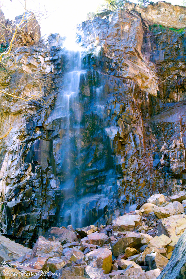
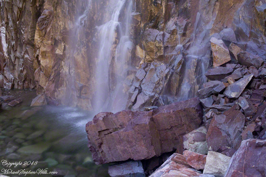
In this post I move up the Reavis Creek canyon from where the last posting, “Wilderness Textures”, was sited to the foot of Reavis Falls. With the first photograph you look up at the falls from the head of the canyon carved by the creek over eons. The rock wall, the canyon “head”, is thick with microorganisms, fungi, mosses.
Click Any Photograph for my Fine Art Gallery
In the foreground is a jumble of boulders, some washed down at flood time, spread wide at the bottom of the falls, piled to a jumbled height of 15 feet.
Talus is the geological term for this formation. Derived from the Latin word for slope (talutum) the definition, from the Oxford English Dictionary, is “A sloping mass of detritus lying at the base of a cliff or the like consisting of material fallen from its face.”
Click Any Photograph for my Fine Art Gallery
The ankle bone is also called talus, from the French word for heel, I bring it up because climbing this chaotic, unstable jumble is a way to break your ankle. The route to Reavis Falls, a climb up one side of Lime Mountain then down the other on a non-existent (lightly marked) trail, is rated difficult and impossible with a broken leg or ankle. I was alone and very careful to check each rock for stability before putting my weight on it.
A climb of the talus pile was necessary to view the pool at the waterfall base, for this photograph.
Click Any Photograph for my Fine Art Gallery
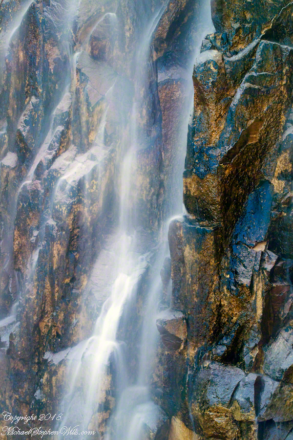
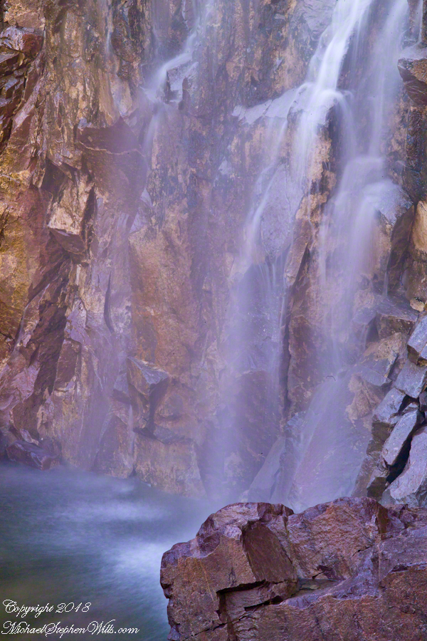
A more artistic vertical format version, below, captured with the Canon EF 100mm “macro” lens. All shots are using the Kodak DCS pro SLR-c (the “c” designated Canon lens compatibility) and a Manfrotto studio tripod with a hydrostatic ball head. The horizontal format shot was captured with a Canon EF 50mm f/1.4 USM lens. I prefer the vertical version, artistically, because the talus jumble is all but cropped out while the upper corner of the angular basalt boulder is left as an interesting focal point. The boulder, not being in the spray, is in focus to contrast with the basalt wall behind the water.
Click Any Photograph for my Fine Art Gallery
I captured a series of shots from this precarious vantage point, working up from the pool to the brim of the waterfall.
Click Any Photograph for my Fine Art Gallery
My goals was a composite photo of the falls. I have yet to succeed with this project. Maybe I will give it one more shot in spite of having learned the hard lesson the best photographs are a single moment captured in a single frame.
Click Any Photograph for my Fine Art Gallery
I find in this series the vertical aspect is more artistic. The water volume, of the falls, at this time of year offers only the finest of sprays with most of the basalt rock wall only moist. The 100mm “macro” lens allowed me to include only the falling water with a bit of the moist wall for contrast.
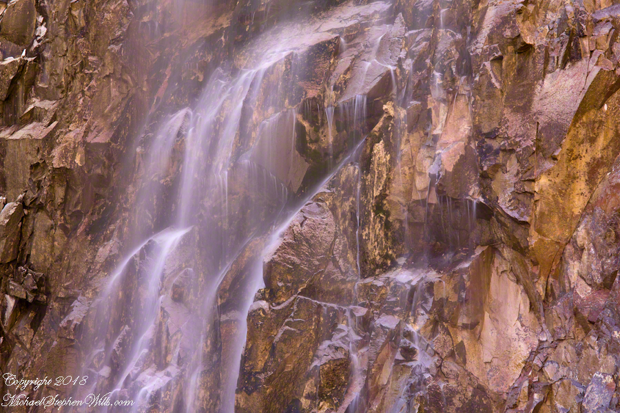
In the following version I experimented with color, moving from the narrow range of hues, to more contrast.
These abstracts are some of my photographic output from four days and nights spent alone in the remote eastern Superstition Wilderness. For the first three days I met not a soul, all these images were captured on a single afternoon spent in the canyon below Reavis Falls, a jumble of landslides, flood debris and boulders. There is no trail. The few people who enter the canyon must negotiate around boulders, crossing Reavis Creek many times.
Click Any Photograph for my Fine Art Gallery
My backpack kit included a full sized Manfrotto studio tripod with hydrostatic ball head. The benefits more than outweighed the effort (I was a lot younger in 2008) when the Canon EF 100mm (macro) lens is mounted on a Kodak dSLR body, allowing me to take crisp shots. The tripod legs can be adjusted to precise positions for stability.
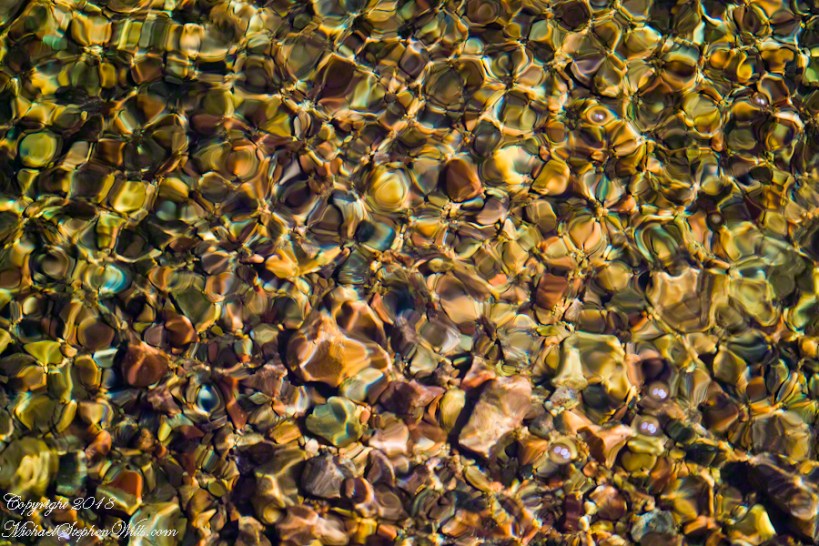
I can feel the bright afternoon desert spring sunshine in this photos. It was after the spring floods, the flow of Reavis Creek and ample still but slow. Gathering in pools over the rough stones of the creek bed, the water absolutely clear.
I held the shot over many minutes, capturing ever changing diffraction patterns.
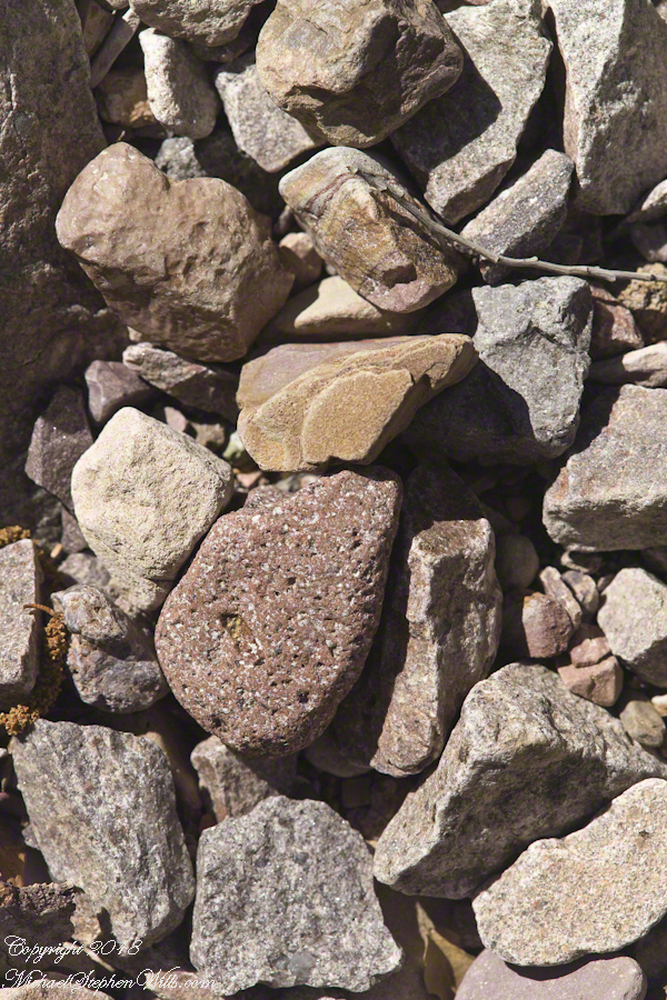
We see in all these photos, not a homogenous blend of stones from a shared geology. Reavis Creek washes over diverse geologies: volcanic, ancient igneous extrusions, sedimentary and metamorphic are jumbled together.
Click Any Photograph for my Fine Art Gallery
This is a series of photographs of smooth, white igneous boulders with shadows of still leafless sycamore and cottonwood trees.
Graceful shadows
Strong, demonstrative shadows.
Click Any Photograph for my Fine Art Gallery
A leaning cairn, not a trail marker….
A 15 foot high jumble of stones piled at the bottom of Reavis Falls, carried over by the floods.
In my post Canyon of Music, Wind, Light I shared a different photograph of this beetle crawling on sandstone, naming it as a “dung beetle”. I had assumed it was one from once having seen a beetle in an Arizona desert pushing a ball of dung around. This morning, to confirm my assumption, I searched for images of “Arizona Dung Beetle” and was dismayed to find this beetle shares no characteristics with the photographs. Absent smoking gun evidence, sadly lacking in this photograph, I have to admit my “dung beetle” attribution is in error.
Supporting the beetle, the luminous surface of the red sandstone named “de Chelly,” sunlight reflects from durable remnants of the ancestral Rocky Mountains wore to these bits of rock, piled to mountainous dunes by the winds of tens of thousands years, polished to smoothness each against the others.
Mysterious abrasion and grooves in a de Chelly sandstone cliff, Canyon de Chelly.
The above photograph is a detail from the brightly lit cliff of the following photograph. The desert varnish and underlying rock was weathered over thousands of years, the sand grains falling to the canyon floor.
The soil of the canyon is composed of these bits of the ancestral Rocky Mountains. What appears to be a white road in the above photograph is not man-made, it is the dried bed of a stream. When a waterway is dry like this, only flowing with rains, it is called a wash. When water fills the wash of the Canyon Del Muerto, the polished sand granules become a dangerous morass, sucking down horses, people, anything unlucky enough to step into it. Every movement, struggling for freedom, pulls the victim deeper down until the wet sand closes over the head and suffocation and death ensues.
Stairs cut into the sandstone cliff of Canyon de Chelly
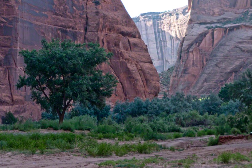
The waters Canyon De Chelly National Monument naturally form a vast Y into the Defiance Plateau, naturally because two major streams merge into one canyon a few miles above Chinle. On both our guided trips, heading east from Chinle there is a branch. On the right De Chelly canyon continues. On the left is Canyon Del Muerto. The photos in this post are all from “The Canyon of the Dead”, what the name means translated into English.
No, it is not named this because of the quicksand. Conditions for quicksand are present throughout canyons of the southwest. It is history of human occupation for which this canyon was named. I will cover it in a future posting. For now, I will say the above views are from the spot featured in “Family Trek.”
My first visit, in 2003, while my son Sean climbed the rocks with our guide, I was left to document the wondrous surroundings. The above shallow cave is reached by that stairway carved into the precipitous ledge. The access to the cave is via those naturally occurring ridges of the cross bedded sandstone. It is another example of De Chelly sandstone formed from the windblown edge of a monstrous ancient sand dune.
A solid block of De Chelly sandstone formed from the central bulk of a sand dune.
Here is another example of rock formed from the solid body of the sand dune, that unbroken and un-striated cliff. Below is the cross-bedded, windblown sand.
Autumn lights up the floor of Canyon De Chelly, the foliage rivals the cliffs for wonder at this time.
As we proceeded generally east from the climbing spot of “Family Trek”, driving by the golden cottonwood foliage I asked the guide to stop for these photographs.
Canyon walls
Soon the cliffs hid the sun.
Notice the modern water distribution system (pipe) at the foot of cliff on right. These vast tracks of shadow adjacent to bright sunlight are a fact of life for canyon dwellers, a source of joy and wonder.
The canyon here is rather like the Narrows of Zion, without the water.