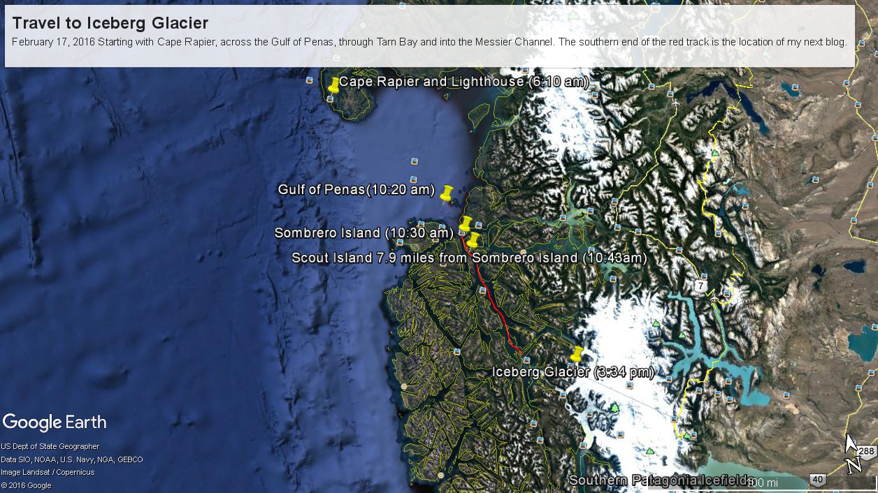
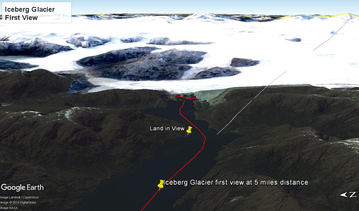
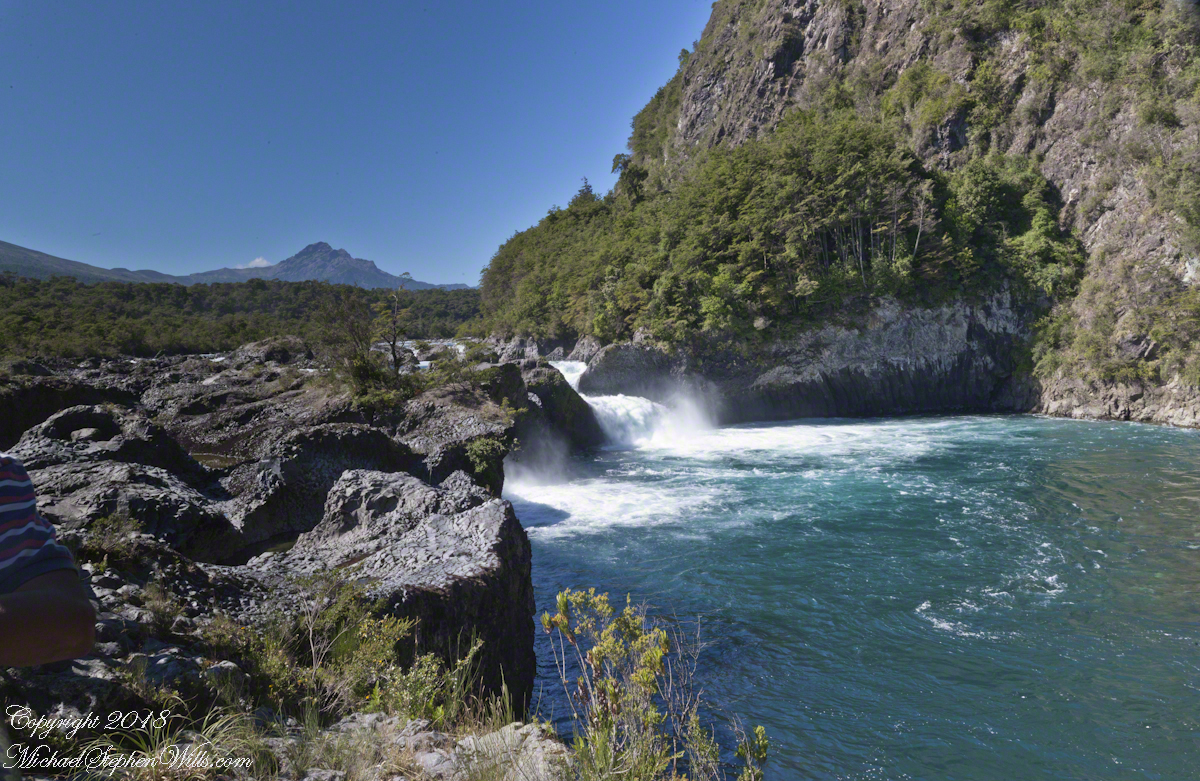
This is a view of the fjord countryside from the Oceania Regatta position about 4.75 miles from Iceberg Glacier . As the Regatta proceeded at the slow rate of 4.6 knots, I captured this high valley and waterfall from the position marked with the central pushpin in the following GoogleEarth image from 14,000 feet altitude.
Click any pic to visit my OnLine Gallery.
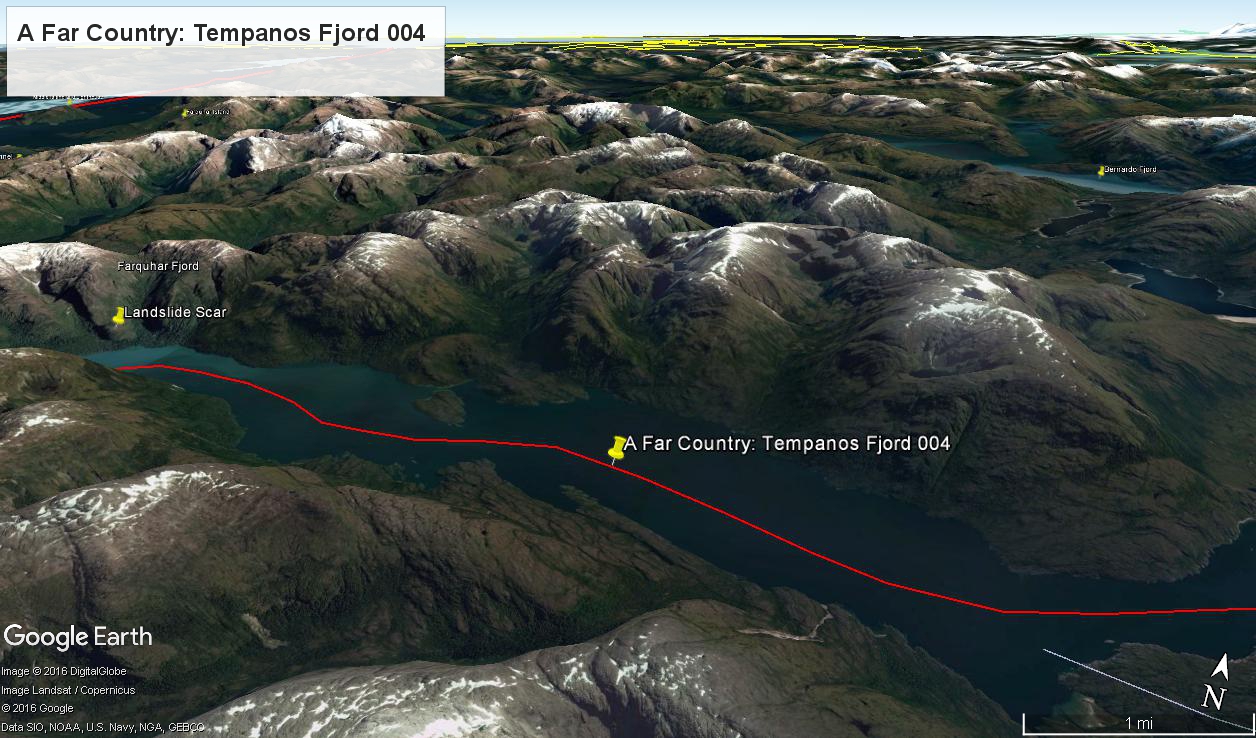
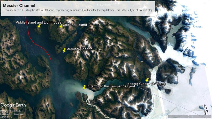
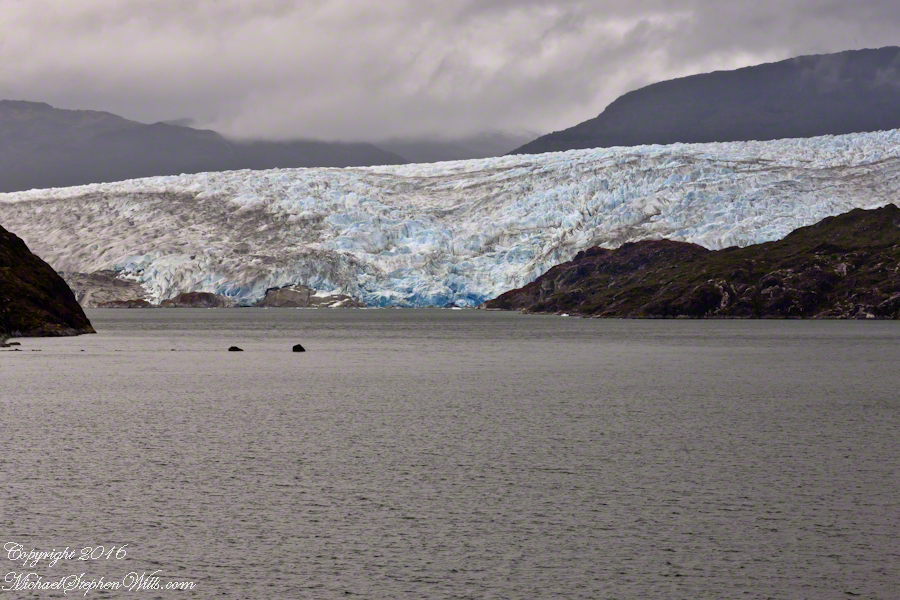
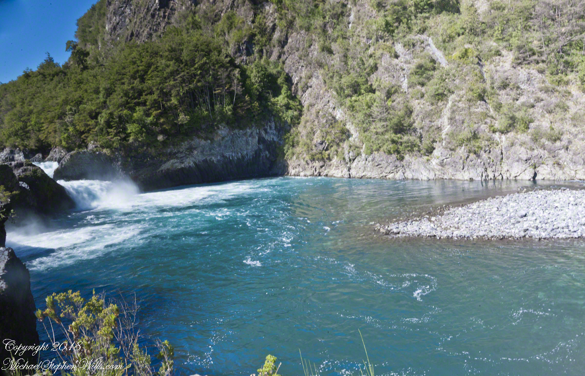
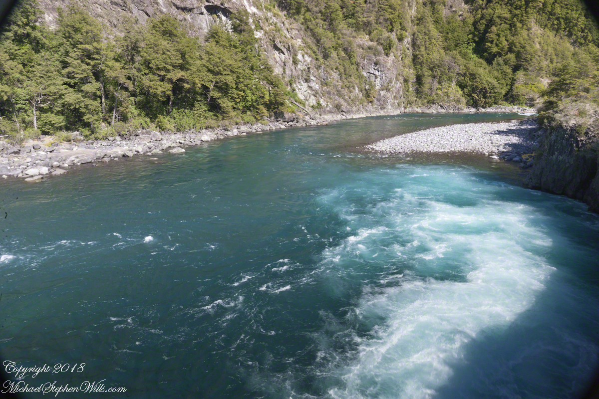
The following photograph is the view North. The far waterfalls are fed by two mountain top lakes, waters that feed into Tempanos Fjord. We are in the Chilean Aisen (also spelled Aysen) Region (XI) looking into a valley between Tempanos, Farquhar and Bernardo fjords. This island and valley has NO name, as far as I can tell. The region is uninhabited, part of the Bernardo O’Higgins National Park.
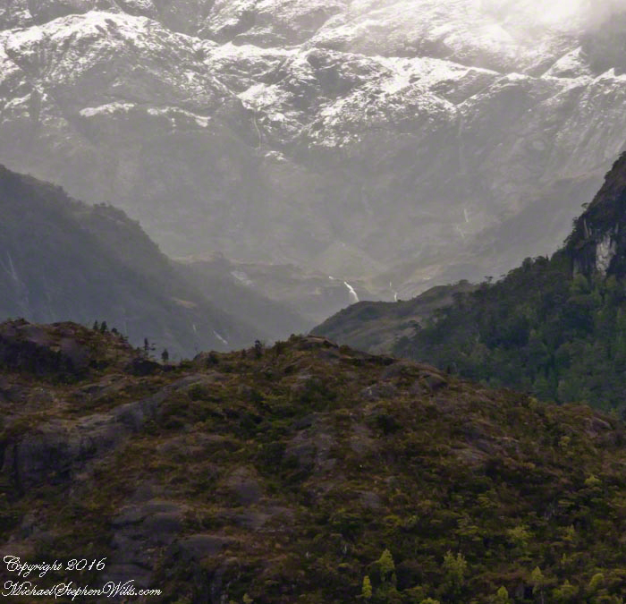
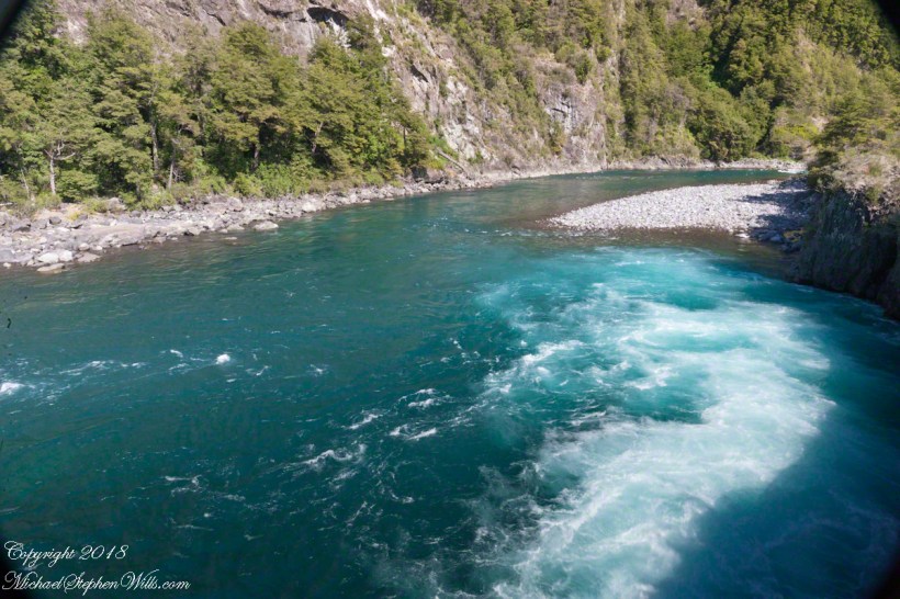
This was taken with a handheld Sony DSLR-A700, the variable lens at 200mm, 1/800 sec at f/13.
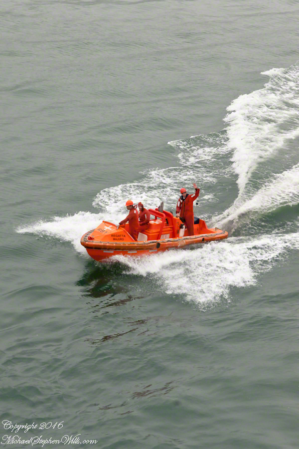
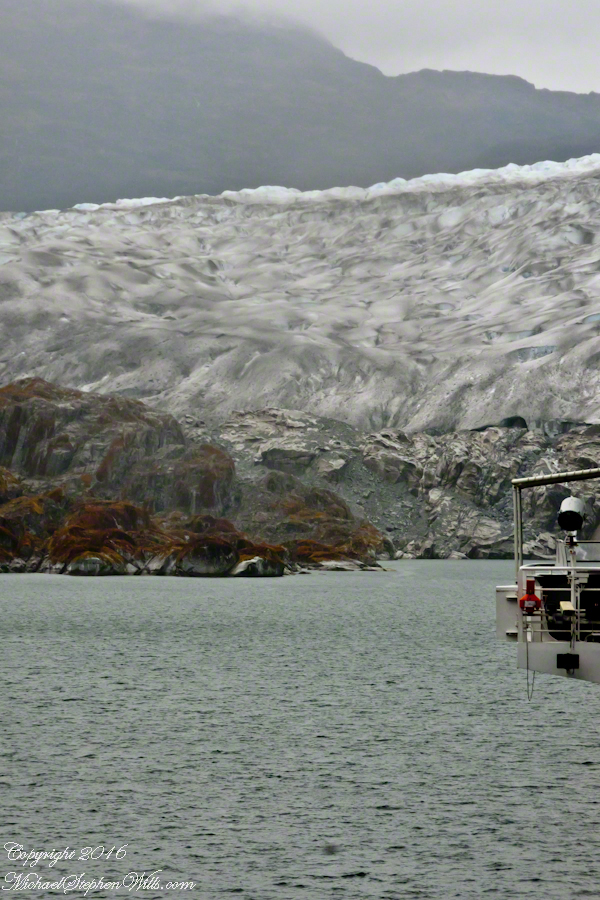
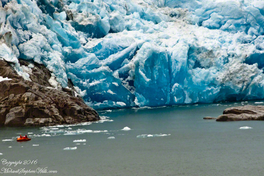
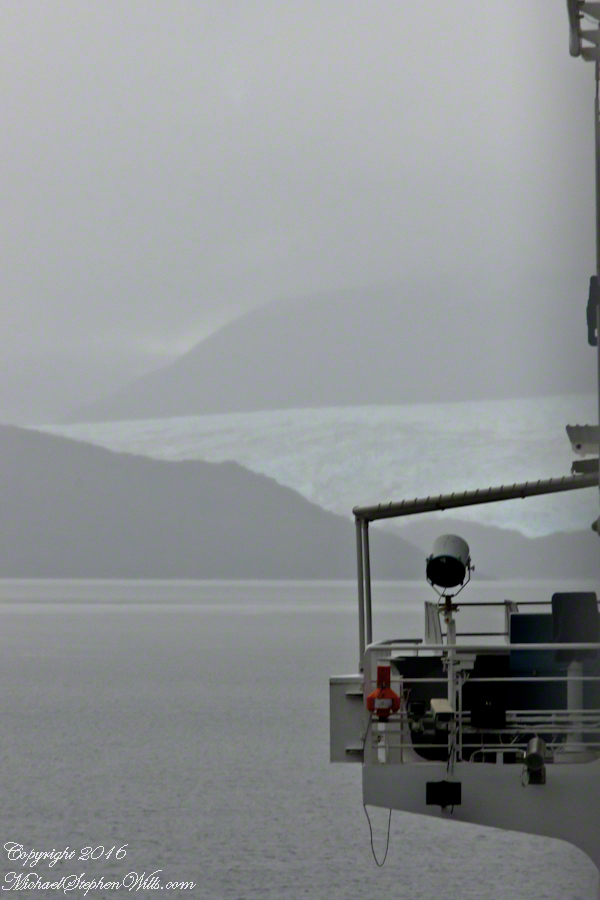
 A glacier is more than ice; not alive, it crawls; not feeling, it groans, cackles, shouts; passive, it is dangerous to approach closely backed as it is by the southern ice field, over a mile high. The ship nudged as close as a half mile from the massed ice, navigating using the bow thrusters to face first port, then starboard and back to port. I was lucky enough to be on the 11th deck, pictured above, when we caught sigh of the fast ship’s launch, manned by ship’s crew.