Evening and Morning

Boulder Canyon Camp

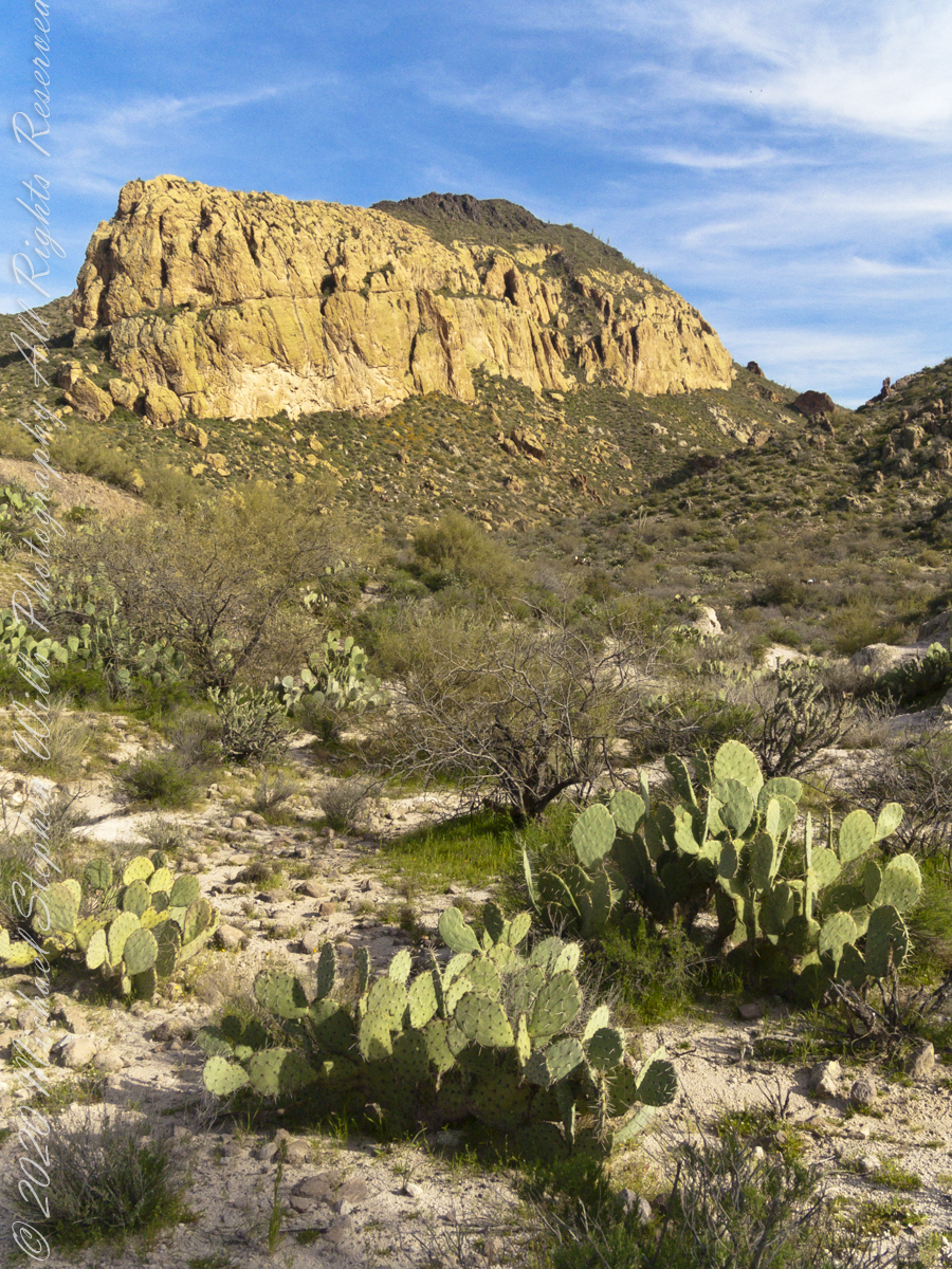
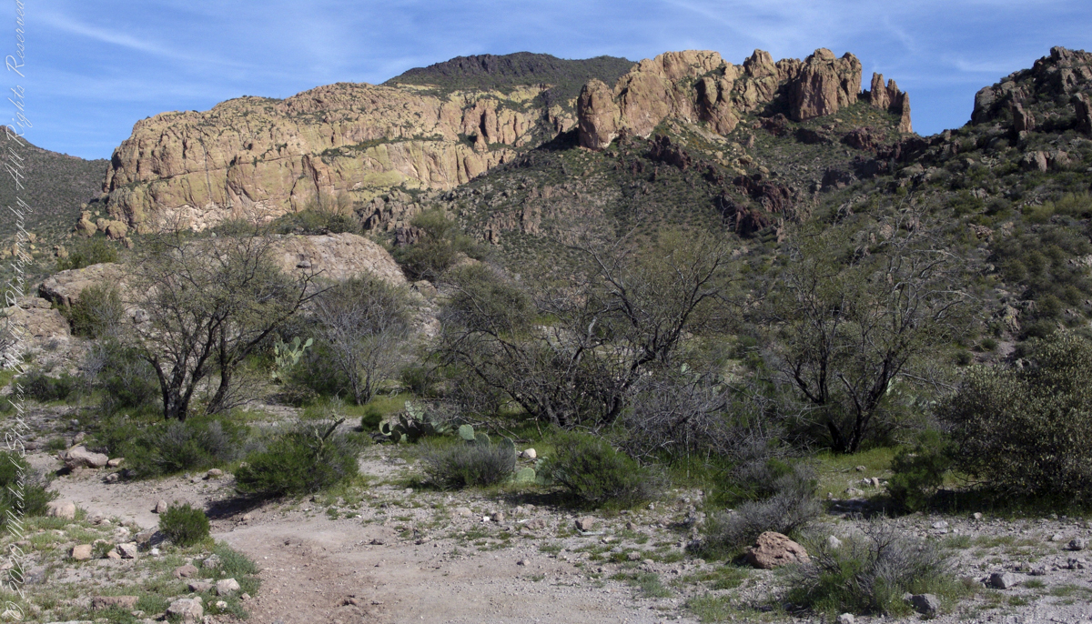
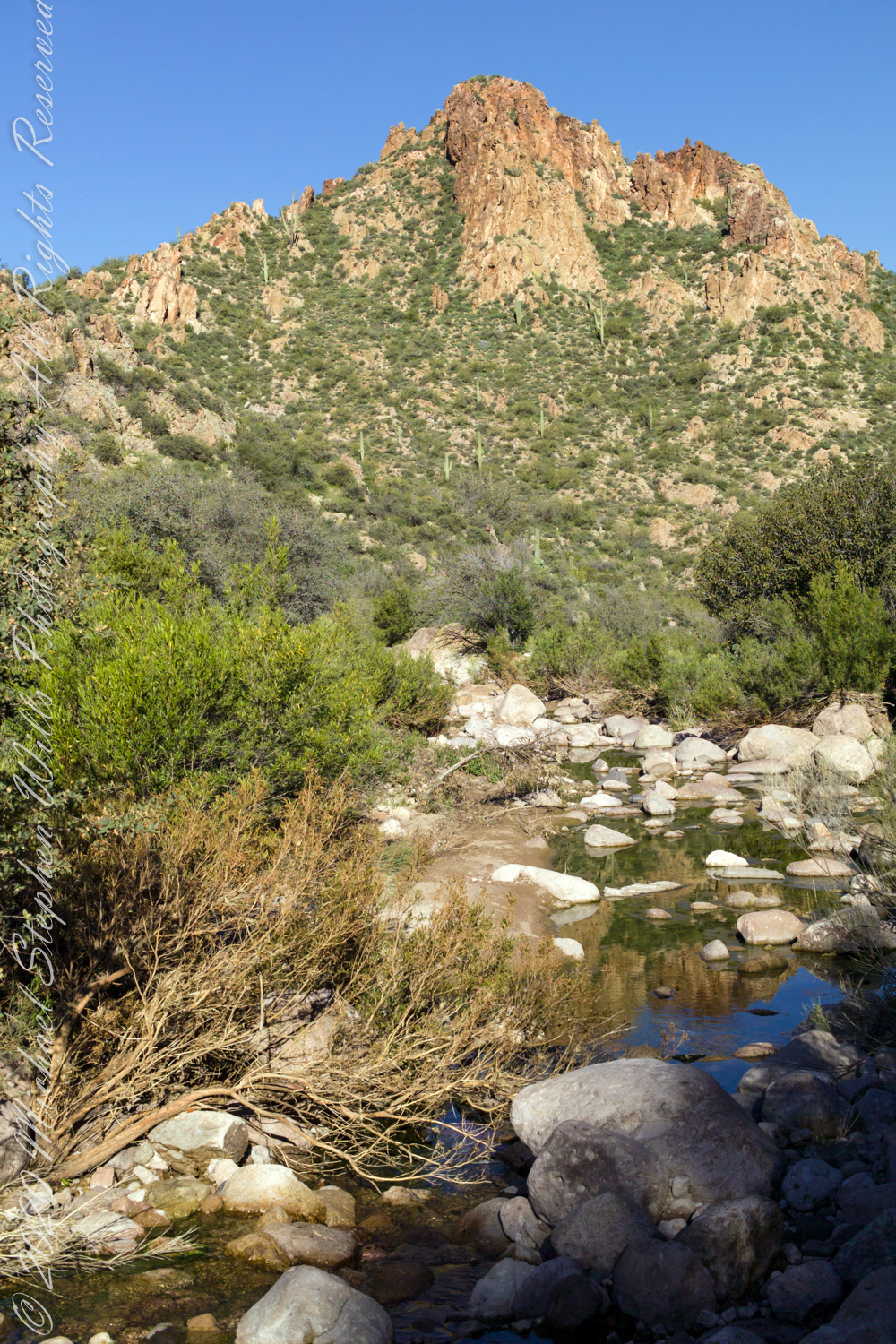
Our camp for the first night was East Boulder Canyon, between Black Top Mesa and Palamino mountain. On the topographic map, below. the bright orange line is Dutchman Trail. We are at the lower center, at the foot of the “Z” in trail, a switchback over Black Top Mesa pass we’ll traverse the next day.

Click Me for my Online Gallery

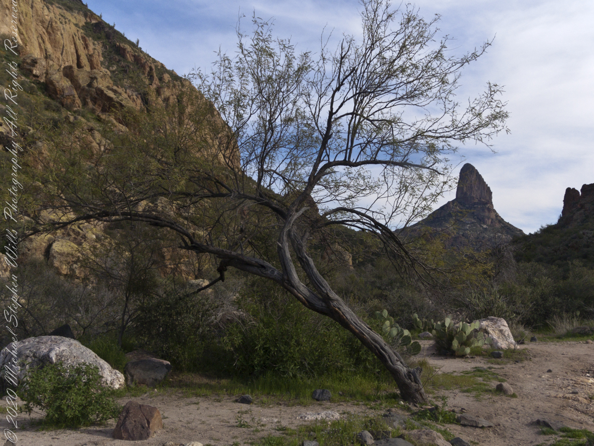
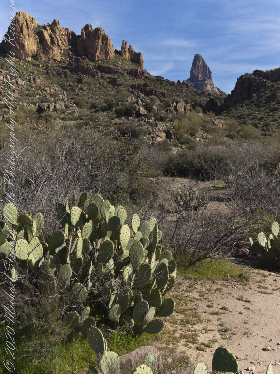
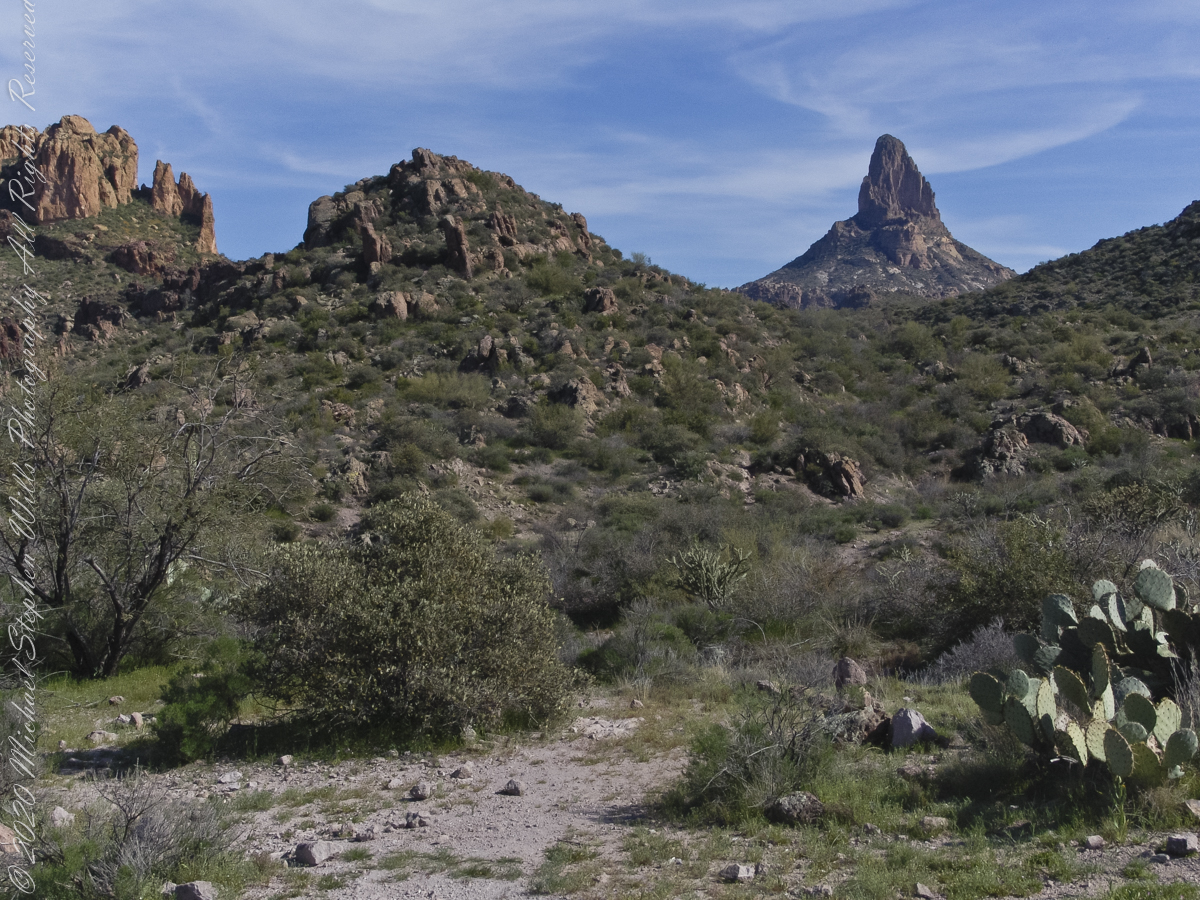
The map locates Yellow Peak, where the four Utah treasure hunters lost their lives Summer 2010, at the upper center next to Black Mesa Trail. The peak is framed by Black Top Mesa and Palamino Mountain in views to the northwest from Boulder Canyon, as you will see in a later posting.

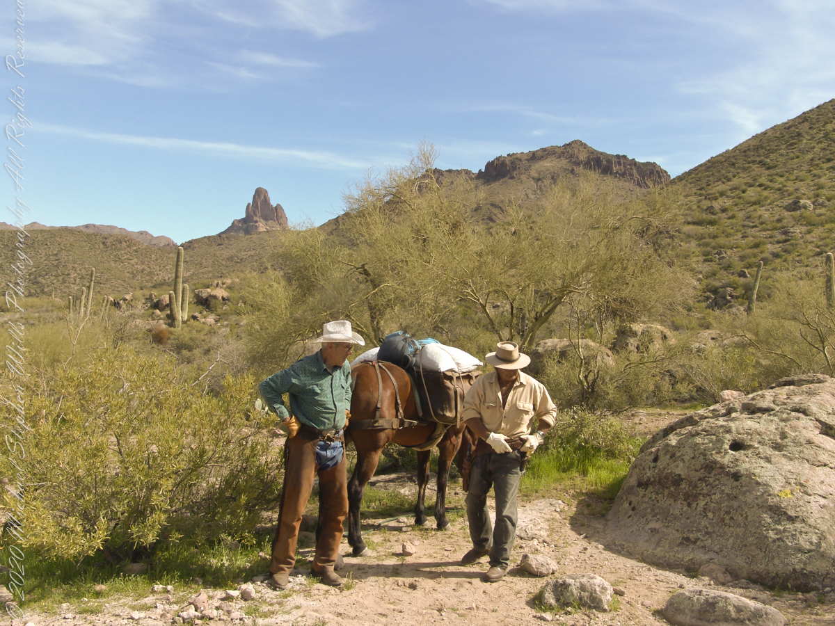
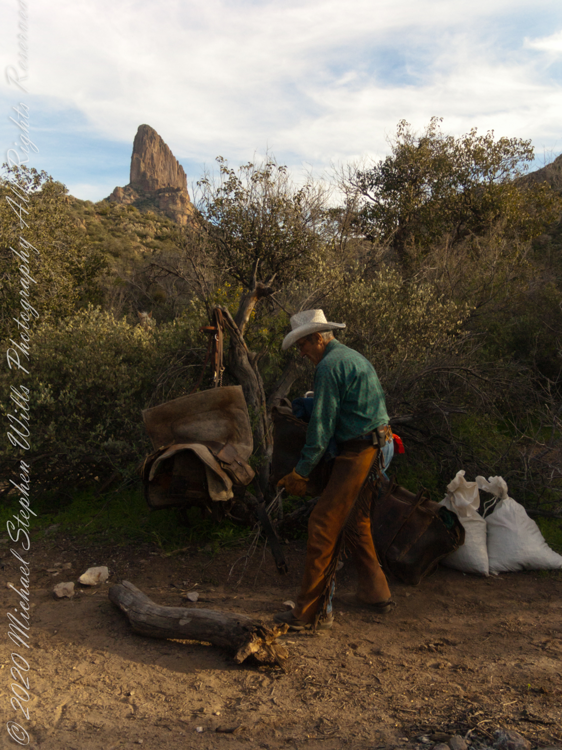
Our evening was a quiet one of camp chores, an enjoyable meal with homemade beef jerky, coffee and plenty of water to rehydrate. The horses chomped on grain from feed bags. They packed in the grain as grazing is not allowed in the wilderness. I gave each a treat of carrot and apple.

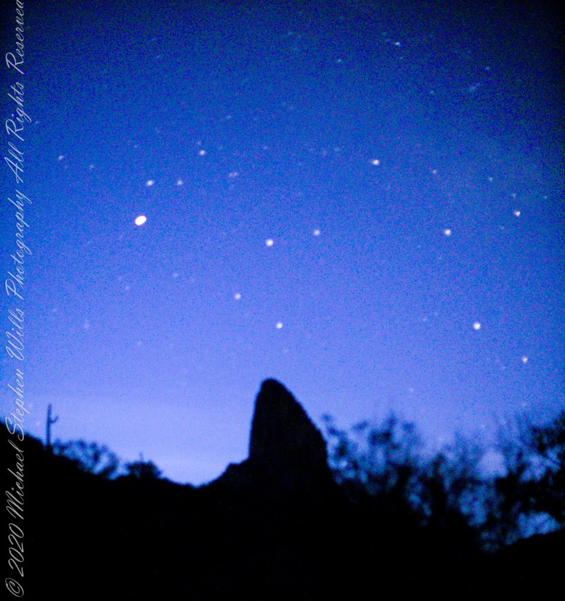
I was up well before dawn to capture the morning constellations over Weavers Needle: from the left, I believe I recognize Lyra with Vega accompanied by Epsilon Lyra, next the keystone of Hercules. The brightest object is Venus.

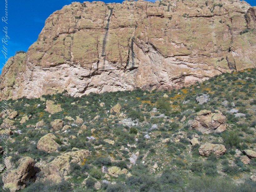
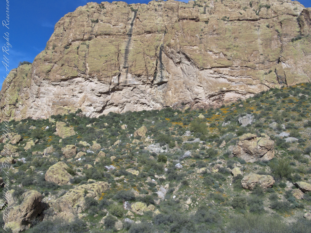
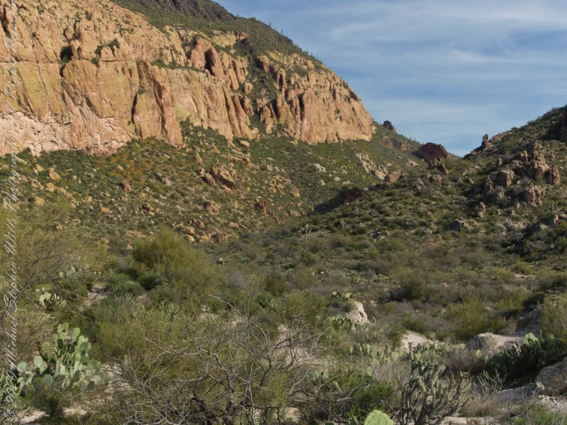
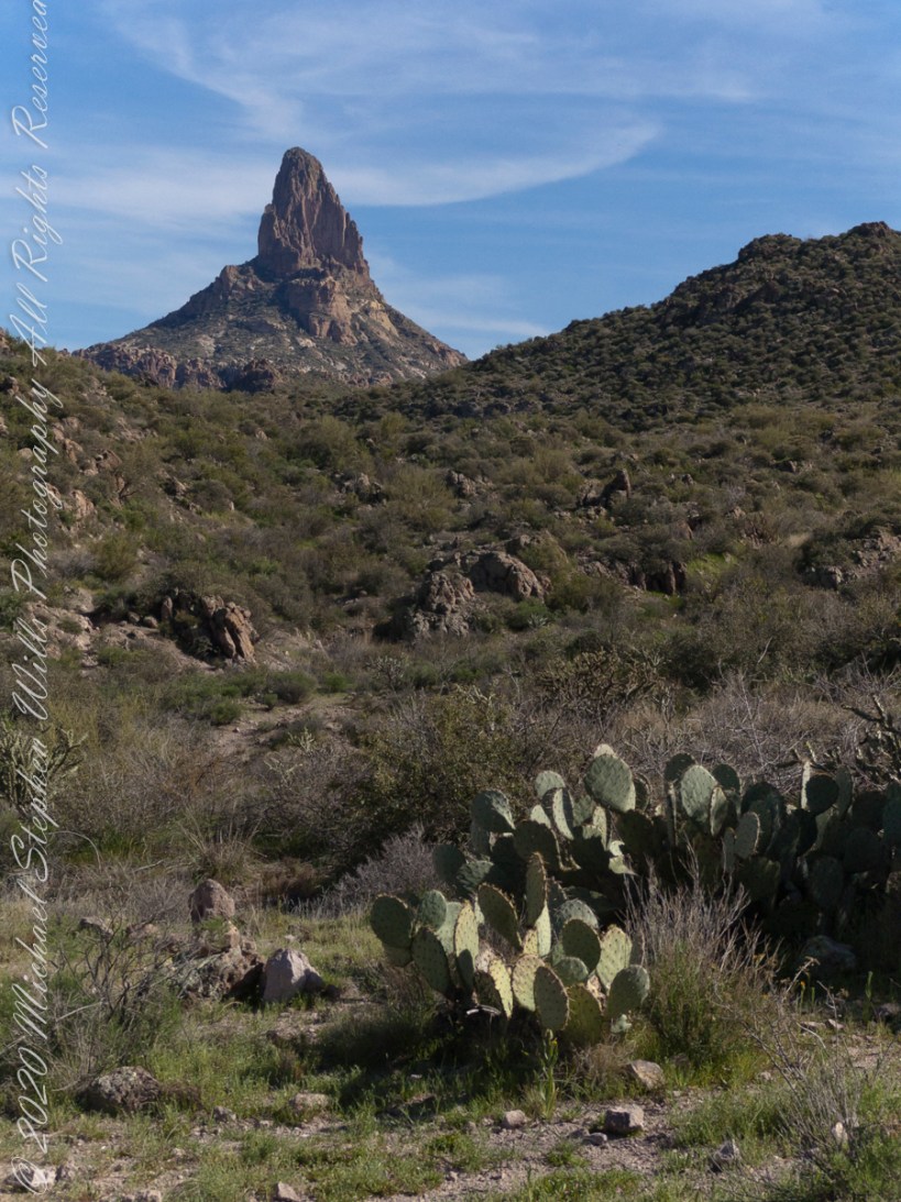
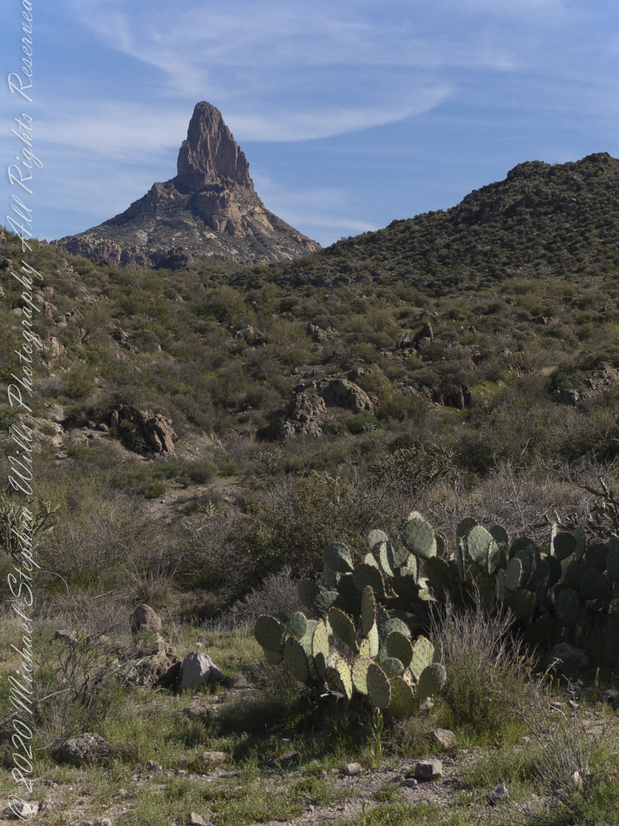
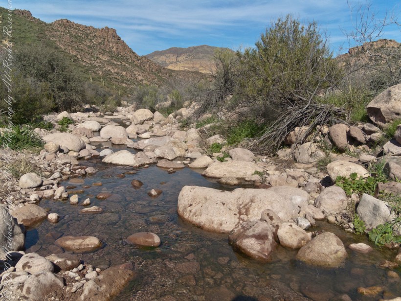
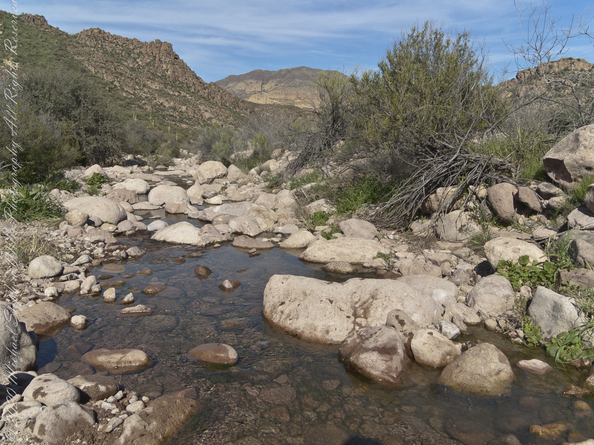
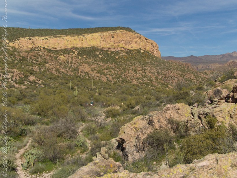
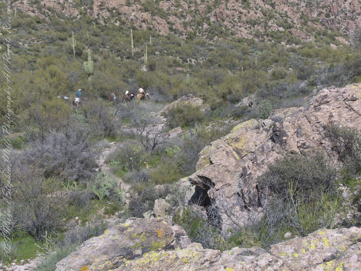
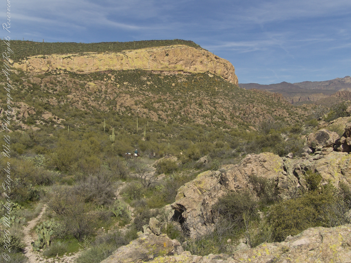
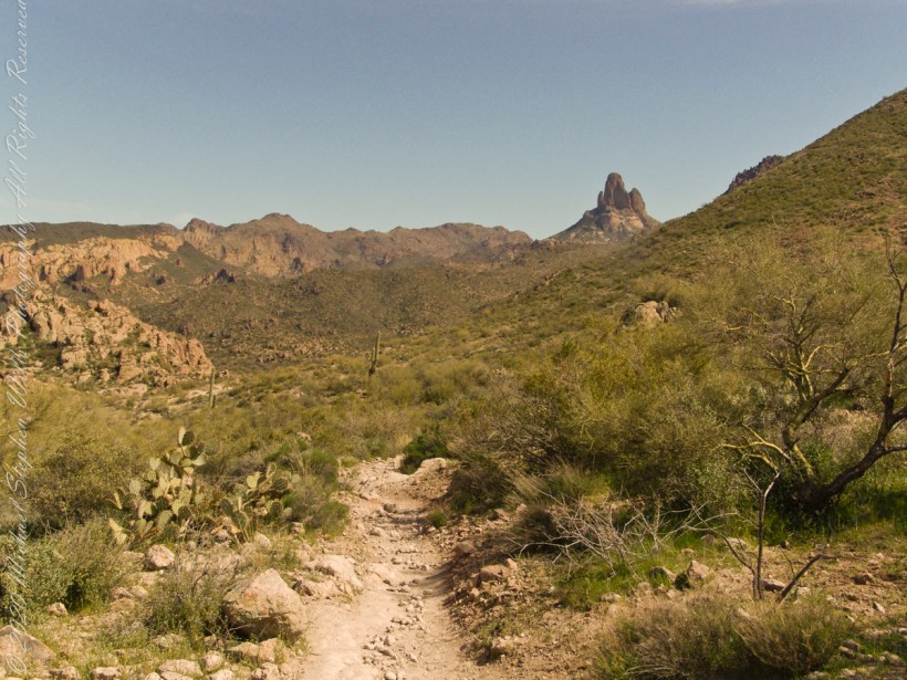
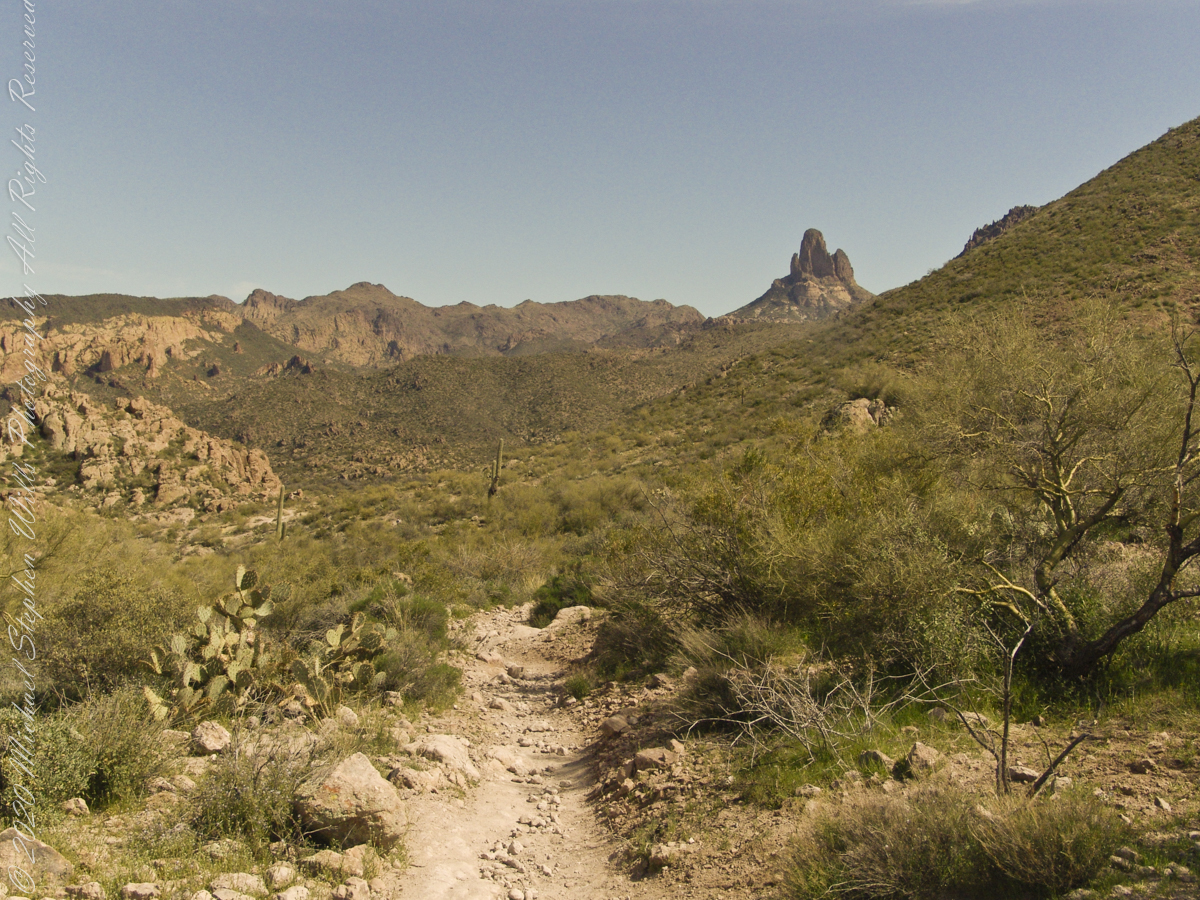
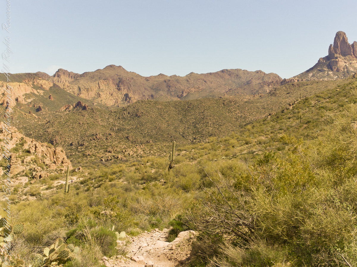
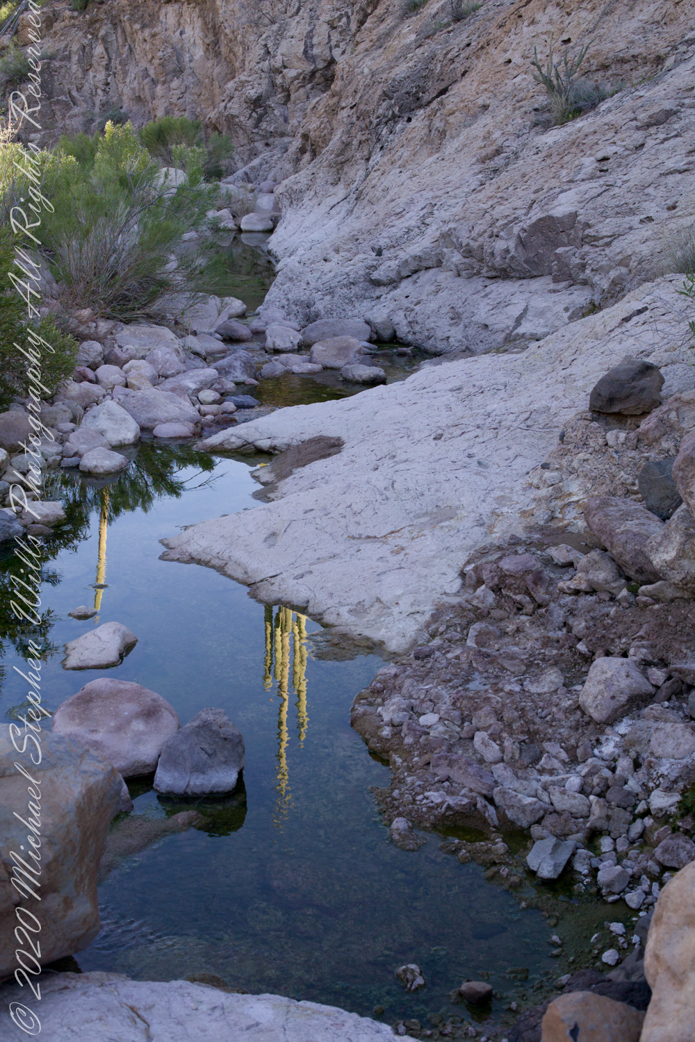
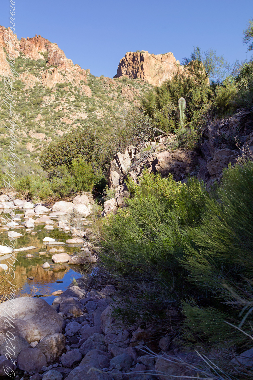
Taking a break from morning water gathering in East Boulder Canyon: saguaro cactuses reflected in a still pool, looking up to the northwest you can just about see the Peralta trail where it crosses a Palamino Mountain ridge. West/Northwest the Peralta trail crosses behind the same ridge.

References:

Click me for the source of topographic map.

Copyright 2022 Michael Stephen Wills All Rights Reserved

Gold Dust Found

Desert Riches

A few minutes after photographing the Stressed Mesquite I looked across the creek to the slope of volcanic rock fallen from the cliff of Black Top Mesa where clumps of dark yellow mark clusters of flowering Mexican Poppies.

Click Me for my Online Gallery

Plentiful winter rains trigged a profusion of Mexican Poppies throughout the Superstition Wilderness. Here is a photograph captured after our expedition.

Look carefully for a scattering of color, like gold dust, at the foot of the volcanic cliffs. That is spring blooms of Mexican Poppy (Eschscholtzia californica). This gold wonder is plentiful from the month of late February through April, varying with the rains.

Copyright 2022 Michael Stephen Wills All Rights Reserved

Black Top Mesa

Superstition Wilderness

The black basalt of the mesa, for which it is named, is just visible above the lighter colored alternating layers of ash and tuff all remnants of volcanic eruptions 15 to 29 million years ago. We are on the Dutchman trail with the slopes of Palamino Mountain on the right. Ahead, other members of the expedition are just visible.

Click Me for my Online Gallery

In this view the late afternoon shadow of Palamino Mountain reveals the defile to which we are headed. Poles of young Saguaro Cactus (Carnegiea gigantean), poke from the black basalt capping Black Top Mesa. Foreground left is Stag Horn Cholla (Cylindropuntia), on the right is Prickly Pear (Optuna).

.

Look carefully for a scattering of color, like gold dust, at the foot of the volcanic cliffs. That is spring blooms of Mexican Poppy (Eschscholtzia californica).

References:

Read more about Black Top Mesa

Copyright 2022 Michael Stephen Wills All Rights Reserved

Ridge

Superstition Wilderness

Starting from the First Water Trailhead, the Dutchman trail leads over Parker Pass into a large basin at which the branches, East and West and Little, of Boulder Canyon meet.

Click Me for my Online Gallery

This southeast view is from the widest portion of the basin. You are looking toward Palamino Mountain and the top of Weavers Needle. There’s a path in there up to that Palamino Mountain ridge, note the hoodoos on right.

References:

Learn More About Hoodoos

Read more about Palamino Mountain

Copyright 2022 Michael Stephen Wills All Rights Reserved

Named For A Horse

with Aylor’s Arch

Dutchman Trail turn left up ahead to proceed between Palamino Mountain and Black Top Mesa, both shown in this photograph. The ridge of the mountain reminds some of a horse and there is an arch, Aylor Arch, on the southern side: here was approach the north side. Aylor is the family name of gold prospectors who set up camp on that south side close to where we will spent the night below Weavers Needle.

Click Me for my Online Gallery

Black Top Mesa is named for a layer of black basalt. Look closely to see the crags on the mesa (the flat-topped mountain) are black. Gold prospectors who combed Black Top Mesa over the years found not one speck of gold.

References:

Explore Aylor’s Arch

Read more about the Aylors and Palamino Mountain

Copyright 2022 Michael Stephen Wills All Rights Reserved

Looming

a deadly quest

O’Grady Canyon widens at the meeting with Little Boulder Canyon.

Click Me for my Online Gallery

Prickly Pear cactus is in foreground. In season these produce magnificent flowers, see below.

East by Southeast a low ridge forms the west side of the canyons above which Weaver’s Needle looms. “Weavers Needle has played a significant role in the stories of the Lost Dutchman’s Gold Mine. The Needle’s shadow reportedly indicates the location of a rich vein of gold, and many treasure hunters have searched for it. The hunt for gold around Weavers Needle has been pursued by hundreds (possibly thousands) of people. Weavers Needle has a large split in the side that makes it look like it has two tops, not one. This can only be viewed from the side.” — wikipedia

To the far left is Palamino Mountain.

Reference: wikipedia “Weavers Needle”

Copyright 2022 Michael Stephen Wills All Rights Reserved

Signs

a deadly quest

The Dutchman trail curves around this rocky outcrop on the east side of O’Grady Canyon, on the left are two hoodoos, on the right side a vandal has defaced the rock. Prickly Pear Cactus in foreground. Malpais Mountain (Spanish “Bad Country”) in distance.

Click Me for my Online Gallery

Signs and wonders, such as this mysterious “S”, lure people into the Superstitions. Two years after our expedition, July 2010, three men set out from First Water trailhead on a quest for Superstition Gold, never to be seen again. Unprepared for the summer heat, the skeletons of two found January 2011 on the slopes of Yellow Peak, a straight-line mile from this location.


Click me for a story of three men lost in the Superstition Wilderness

Click me for the Final Word on Men Lost in Superstition Wilderness –CURTIS MERWORTH

Click me for the Final Word on Men Lost in Superstition Wilderness — ARDEAN CURTIS CHARLES

Click me for the Final Word on Men Lost in Superstition Wilderness — MALCOM MEEKS

Copyright 2022 Michael Stephen Wills All Rights Reserved

Blessing

blessed water

The blessing of desert water flows through a portion of West Boulder Canyon known as O’Grady Canyon, named after “Rattlesnake” Tim O’Grady who prospected the area mid-Twentieth Century.

Click Me for my Online Gallery

Even more so as this is an intermittent flow, dry boulders offer no solace in dry seasons. In the distance, beyond a Black Mesa ridge studded with Saguaro cactus, is Malpais Mountain (Spanish, “Bad Country”). Closer, on the right, is the ridge of Palamino Mountain.


Click me for another Superstition Wilderness Episode

Copyright 2022 Michael Stephen Wills All Rights Reserved

Into O’Grady Canyon

touching base and more looking around

Twenty-three minutes later I caught up with Dave and Al taking a break at a large loop in the trail, a half mile below Parker Pass.

Click Me for my Online Gallery

Fourteen years later, using GoogleEarth, I deduce the location to be 33°27’19.39″N , 111°24’38.58″W. After the horse party proceeded, I stayed behind to record them.

….as well as the surroundings. The geological formation is the escarpment of Black Mesa above O’Grady Canyon.

The name O’Grady Canyon piqued my interest, so I poked around the internet and found this posting from Tom Kollenborn, a well-known authority on the Superstitions.

“I was told Tim O’Grady prospected the area for about twenty-five years before moving to Washington. He was a well known character around Apache Junction from about 1945 – 1980. There are other interesting stories about Tim. I visited with him several times on the old First Water – Charlebois Trail in the late 1950’s and early 1960’s when I worked for the Barkley Cattle Company.

Tim’s Saddle was named after “Rattlesnake” Tim O’Grady a prospector who searched the Superstition for the Dutchman’s Lost Mine in the 1950’s and 1960’s. O’Grady Canyon is also named after him. The story goes something like this. A USGS map crew was working in the area around Parker Pass in the early 1950’s and came across this old white bearded prospector. They ask him about several landmarks in the area and their names. He pointed to a saddle and said that is Tim’s Saddle and the canyon on the right is O’Grady Canyon. They talked for a while about other landmarks and finally ask the old prospector for his name. He looked at them politely and said he was Tim O’Grady. The last I ever heard of “Rattlesnake” Tim O’Grady was he moved to Washington. He was 87 at the time.


Click me for another Superstition Wilderness Episode

Copyright 2022 Michael Stephen Wills All Rights Reserved

Respite

stopping for a look around

One hour and twenty minutes into Lost Dutchman Trail I stopped for a look around.

Click Me for my Online Gallery

My party is out of sight, Parker Pass seems no closer, Weaver’s Needle looms 3.1 miles away over several ridges.

A sole day hiker is on the trail ahead. I carried a gallon of water with a siphon pipe, so was taking sips every so often and becoming dehydrated anyway. Ahead is the ridge of Parker Pass, the pass is the green slant of land on right.

This is a capture from Google Earth of our route to Parker Pass, with a chart of the elevation changes. I am on that last hump with a few more up and down climbs before the pass.


Click me for another Superstition Wilderness Episode

Copyright 2022 Michael Stephen Wills All Rights Reserved