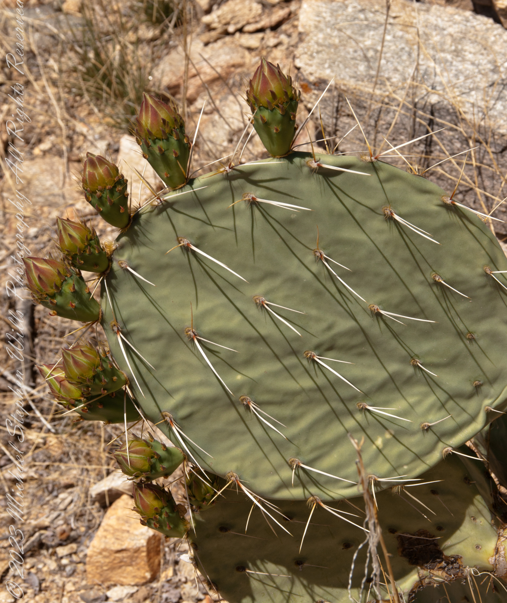
Here are 8 flower bud growing from one cladode (pad). There is a 9th bud on a second cladode. What is interesting about these pads are the needle shadows. Although thin, each provides some protection from the sun.
Cactus Closeup
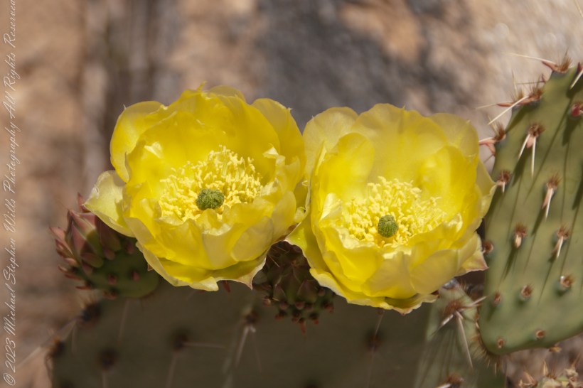
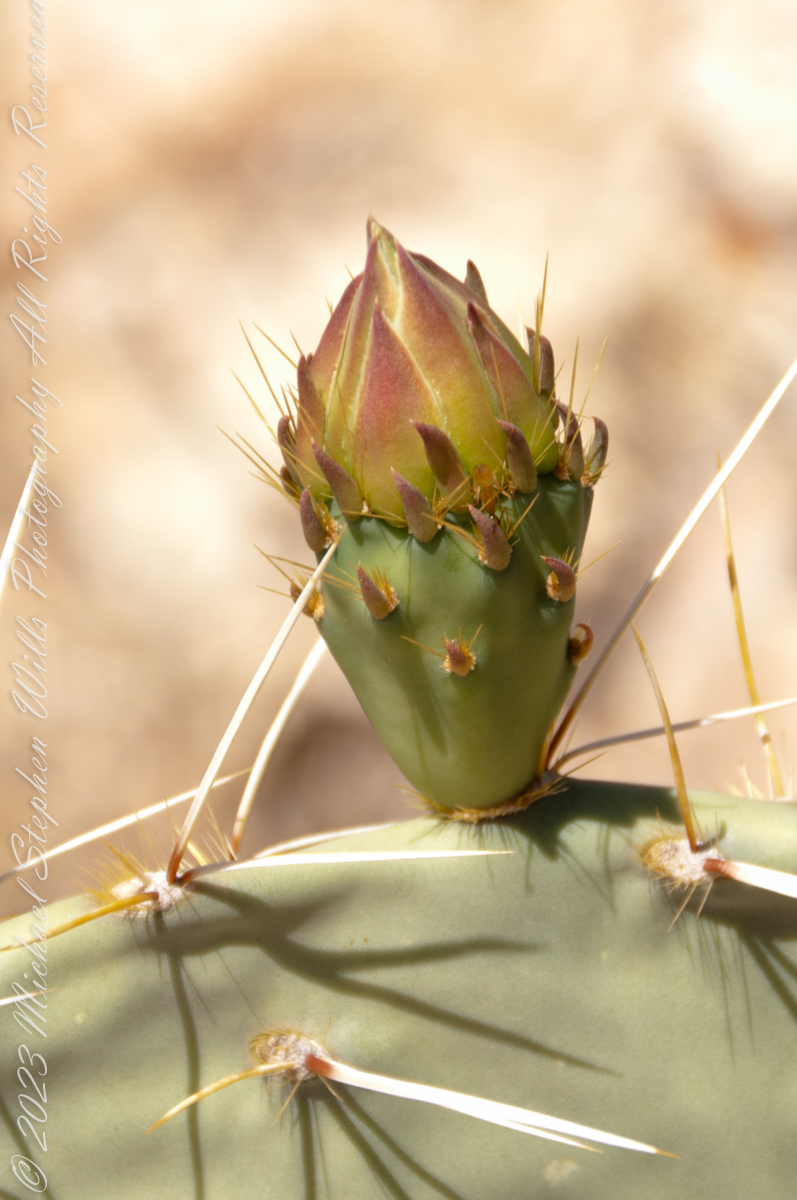
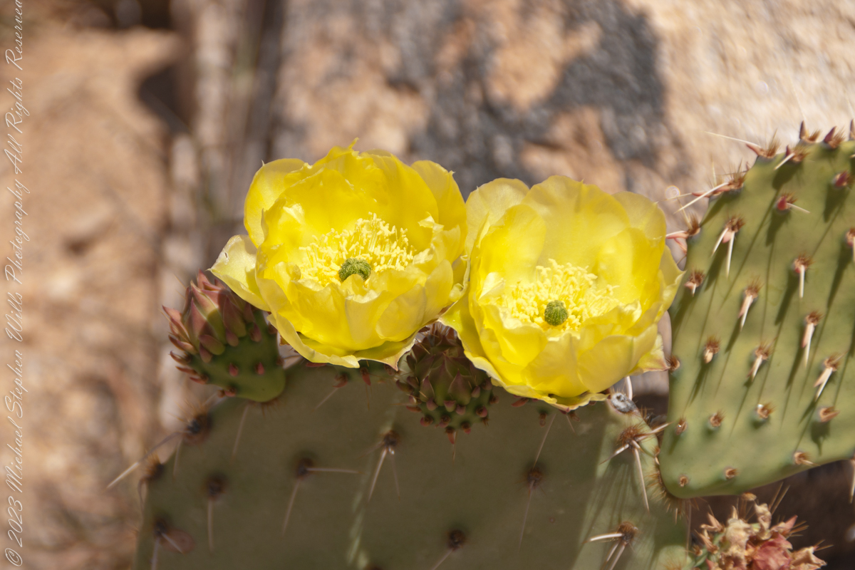
This delicate bud will develop into a flower and, then, into a cactus fruit (in spanish, tuna). The fruit retains those tiny spines, called glochids, which detach on the smallest contact. The pads are also covered with them.
Prickly pears are known for growing into thickets. The Cuban government created a “cactus curtain” of prickly pears around the Guantanamo naval base in the 1960’s, to prevent Cubans from escaping to refuge in the United States.
Cactus Flowers
Look closely at the anthers of these flowers. Each curls over when touched, depositing its pollen. The habit of prickly pears to grow together in thickets mean there are clusters of blossoms in springtime.
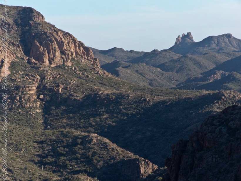
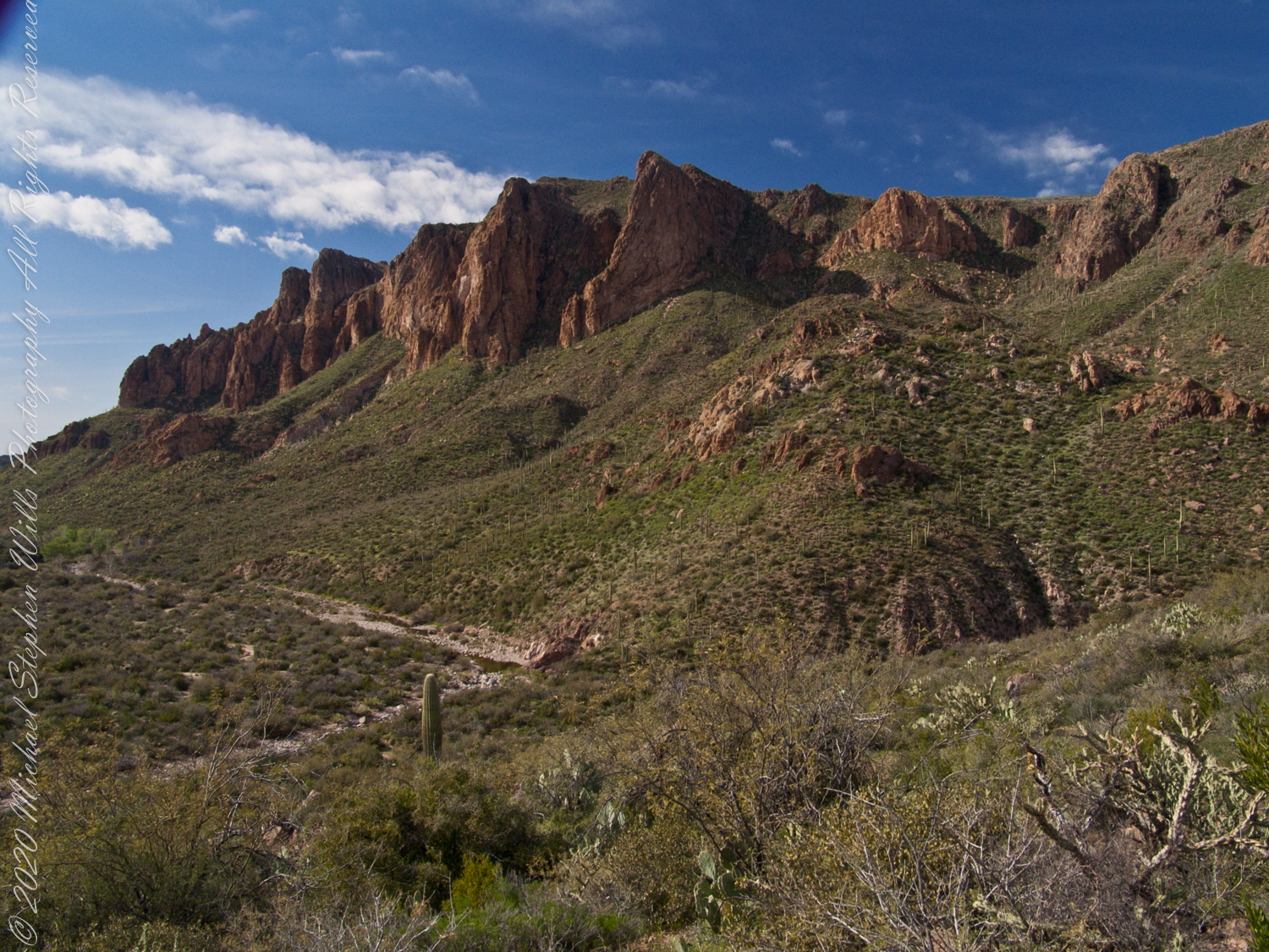
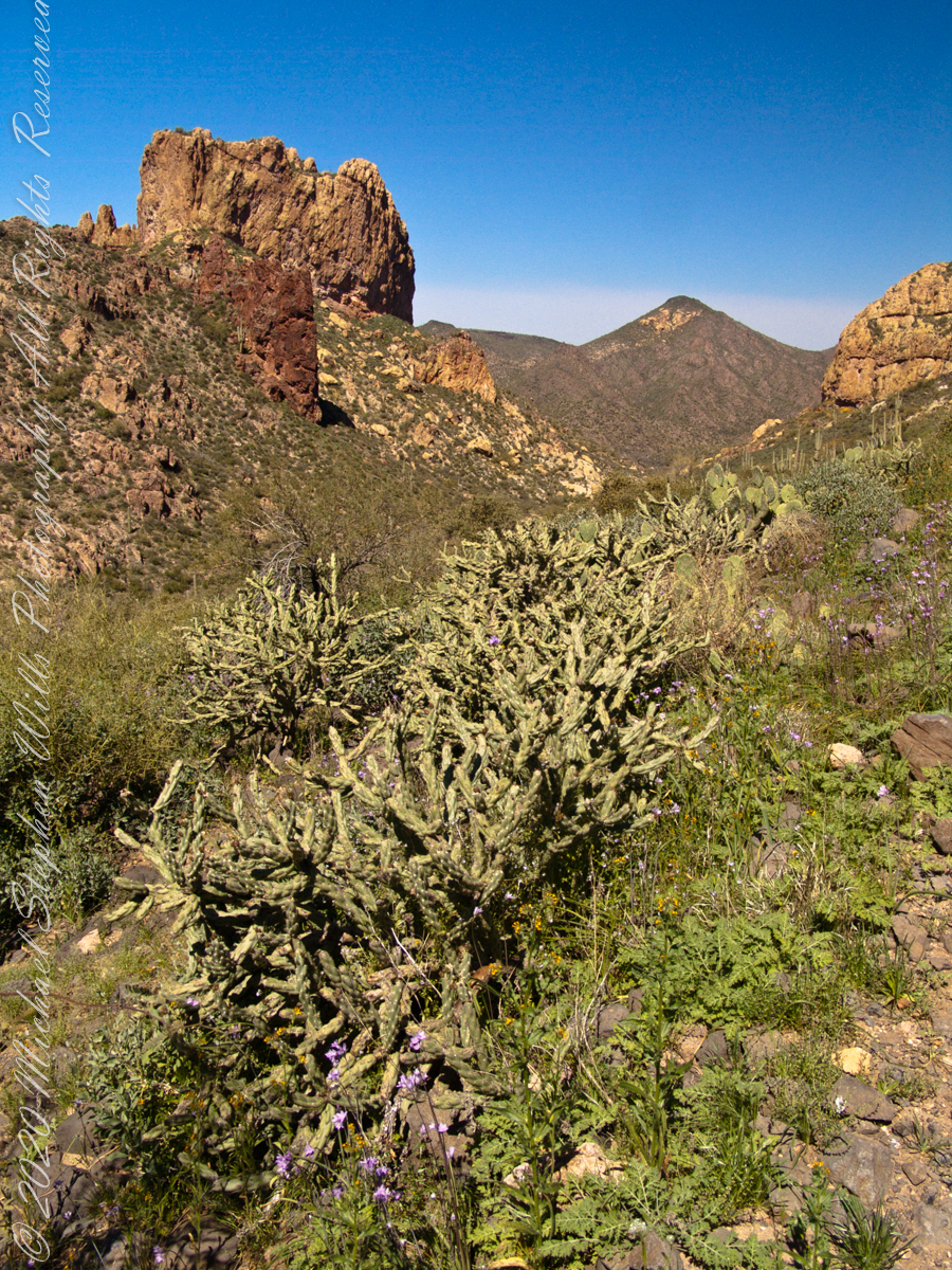
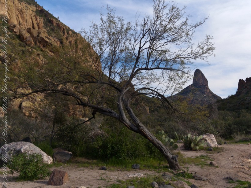
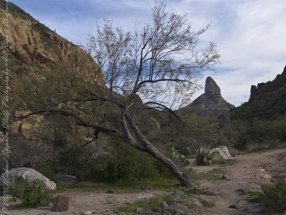
The eye of Miner’s Needle is clear in both these South / Southeast views from Peter’s Mesa looking across the Music Canyon.
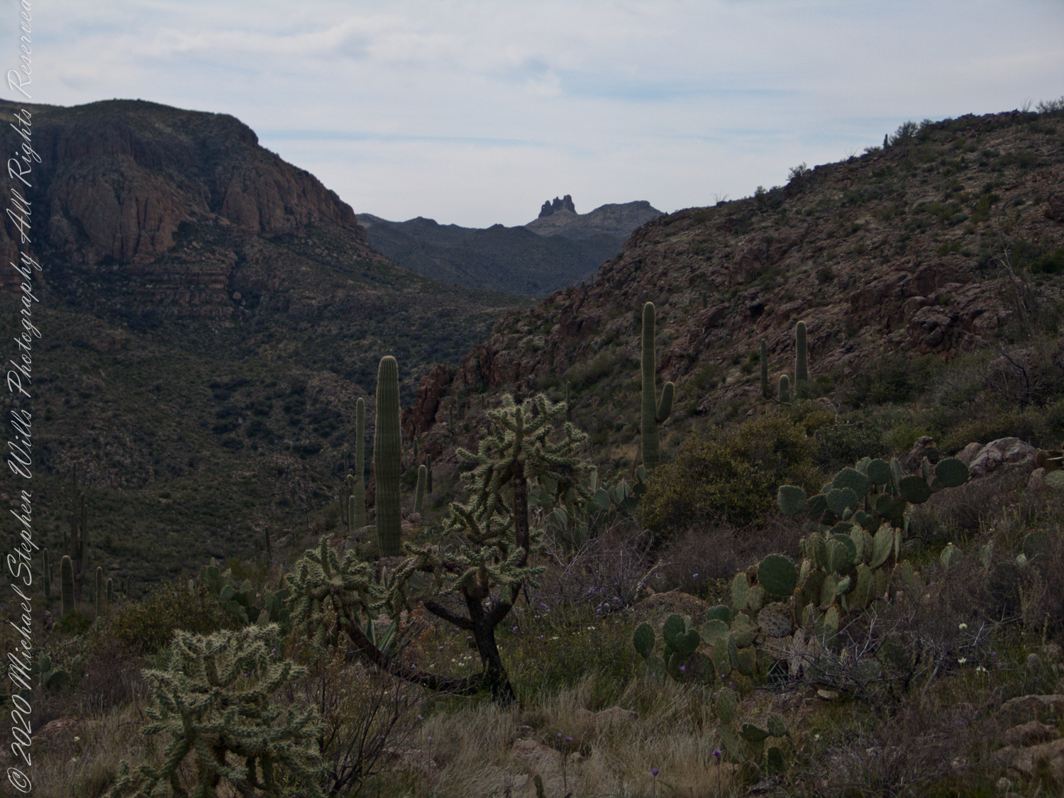
Morning
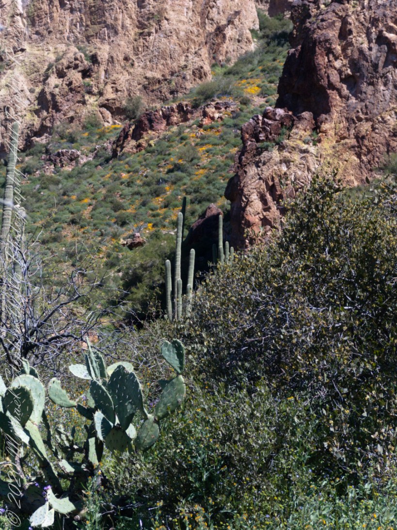
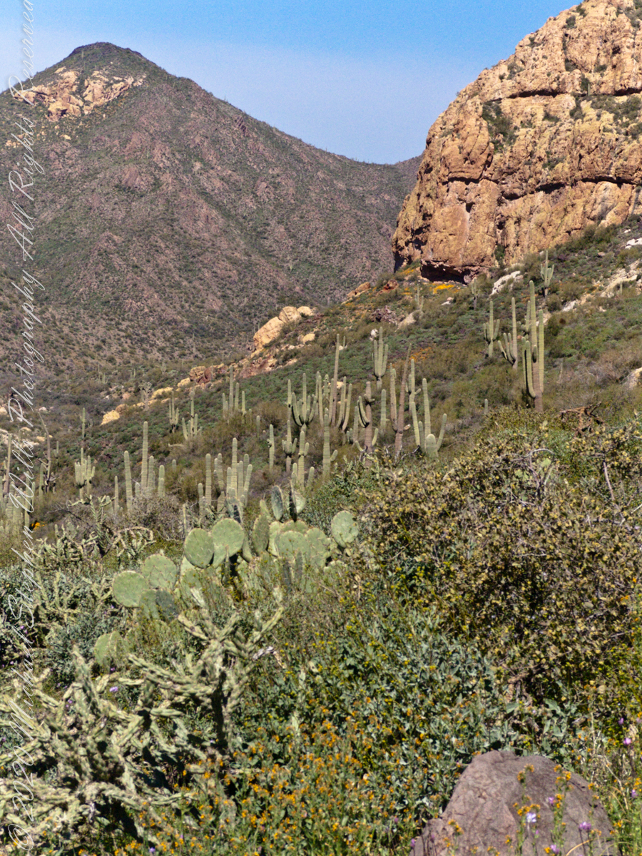
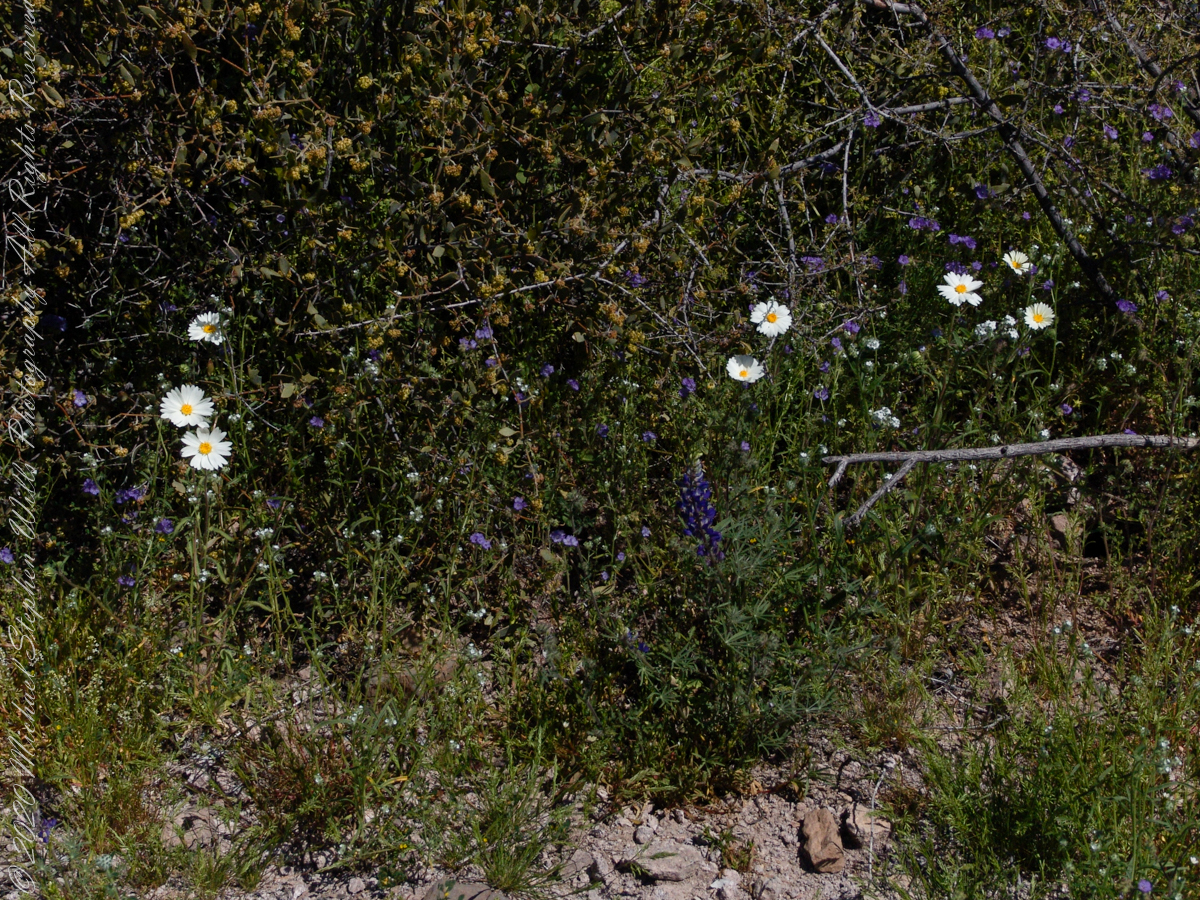
Many wildflowers, sprinkled like stars through the foreground of the morning photograph with Prickly Pear, Cholla and Saguaro cactus. Beware of “Jumping Cholla”, named for its seeming ability to attack passers-by. Another name, “Hanging Chain Cholla”, is more appropriate. Each chain with many hooked barbs is lightly attached to the branch, ready to snag a ride from unwary hikers.
Light rakes across the landscape in the evening photograph, taken from another vantage point on Peter’s Mesa. Miner’s Needle is four (4) miles away “as the crow flies,” i.e., line of sight distance.
View North / Northwest from Peter’s Trail looking back the way we came. Black Mountain on right, Bluff Spring Mountain left with LaBarge Canyon running to the Red Hills center. On a March afternoon 2008.
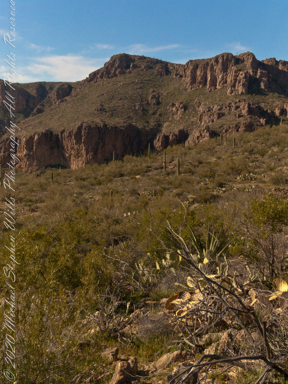
Here we are climbing Peters Trail to the eponymous mesa and facing East to Music Mountain. Scattered in the brush are desiccated and live Prickly Pear cactus. Poles of young saguaro cactus like randomly placed telephone poles poke up around the lower slopes.
The first published record of Music Mountain is by Ray C. Howland of Mesa Arizona who sent a letter to “Everybody’s Magazine” that appeared in a feature called “Everybody’s Meeting Place: Where writers, readers and the editor gather for informal discussion,” May 1928, Volume 58, Issue 5, page 173. I reproduce Howland’s letter here with minor editing:
“I am in the deserts and mountains of Arizona most of the time. I go into town once each month for mail and provisions. I meet many things as I ramble around, many strange things, things that are beyond my ability to comprehend. One particular was in my mind as I read your printed thought in the back of Everybody’s. Far in the Superstition Mountains of Arizona, in the deepest, most rugged canyon, there are three caves halfway up a great yellow bluff. In these caves are mud dwellings. There are not the cliff-dwelling as found in other parts of Arizona.
The mud walls of these dwellings were made by people with very small hands. The handprints of these ancient masons remain as though they were made yesterday. Just below these caves a beautiful pool of crystal-clear water lies between grassy banks. Tall ghostlike sycamores grow there in great numbers.
I have camped many times beneath those sycamores. It is a beautiful spot. Such a difference between there and the hot desert that lies fifteen miles to the south.! As one lies there, just at twilight, begins the most wonderful music one could imagine. I have never heard music that could compare to it, vague, elusive at times, then again of greater volume. It is my opinion that no living being could record it.
The music is, I believe, beyond description. It seems to take you out of your moral self and transport you back ages and ages, almost to the beginning of things. For the time being one feels as though he were in another world.
I have often tried to solve this little private mystery. I can’t explain it. I can’t even describe it intelligently.
You will probably say as you read this that is is the wind among the pinnacles, caves, trees, etc. that make this wonder phenomenon. It cannot be, for usually there is no breeze in the mountains at twilight. It is still as a tomb except for that music. Besides when the breeze is blowing at any other hours of the day there is no sound.”
Here is a copy of that issue for you to see for yourselves.
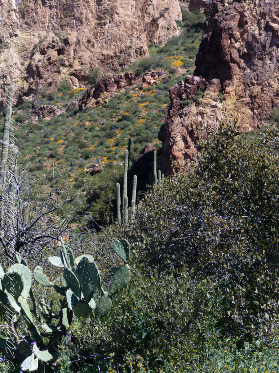
In my photographs the bluffs described by Howland are seen clearly in the distance. During our expedition we were never able to visit the caves, though Dave described the location, caves, and dwellings. On Peter’s Mesa are remains of pits where Apaches and Yavapais gathered hearts of agave to roast. We visited a small cave in the side of Peter’s Mesa showing signs of high heat and possibly used for roasting agave.
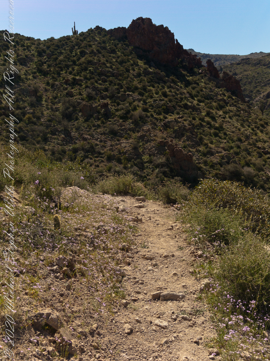
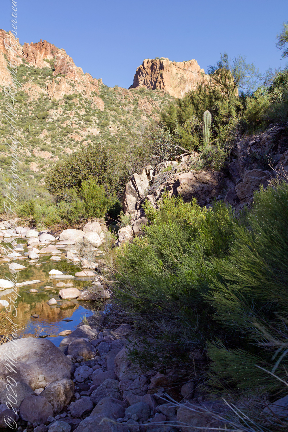
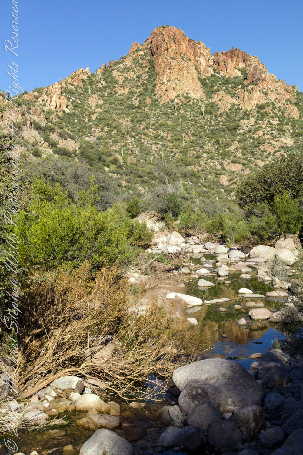
After a respite among the cool spring waters, we headed up Peters Trail for the top of Peter’s mesa where, for all we knew, there was no water.
In this photograph I face northwest, looking down on Dutchman Trail. The peak, upper center left, is Black Mountain. The cleft of Charlebois Canyon is lower middle right. Stag Horn Cholla cactus is lower right with Prickly Pear cactus scattered in the brush. Poles of young saguaro cactus are scattered around the lower slopes. Look carefully and you can make out the pooled water of our rest stop.
Copyright 2022 Michael Stephen Wills All Rights Reserved
Our second day began in East Boulder Canyon, in the following map it is at the foot of the “Z” of the orange line, the Dutchman Trail, lower left center. The shape is the signature of a switchback needed to negotiate a steep slope up to Upper Black Top Mesa pass. This day will see us traverse Dutchman Trail to the intersection with Peter’s Trail (yellow), another steep climb up Peter’s Mesa.
A topographic map including Yellow Peak with Dutchman Trail in orange. Upper Black Top Mesa Pass lower center.
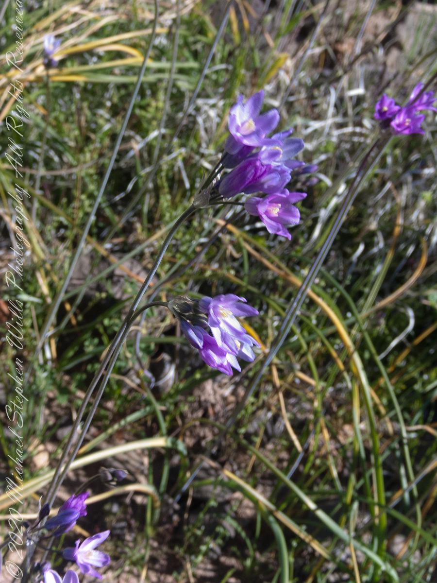
Today’s post features photographs of flourishing Sonoran Desert plants and landscape on the slopes of Black Top Mesa. Dipterostemon capitatus known by the common names blue dicks, purplehead and brodiaea is native to the Western United States (particularly Arizona, California, Oregon, Utah, New Mexico and northwest Mexico.
Dutchman Trail above East Boulder Canyon, Palamino Mountain left, Yellow Peak in distance. We are on the side of Black Top Mesa.
Here I used the “zoom” for a better view of distant Yellow Peak. In foreground is Brittlebush (Encelia farinosa) and Blue Dick. In the distance Saguaro Cactus. Below the cliff of Black Top Mesa, above East Boulder Canyon, is a patch of yellow, Mexican Poppy (Eschscholtzia californica).
Slope of Black Top Mesa above East Boulder Canyon with the distant Yellow Peak.
Here is camera, set to zoom, is swung toward the mesa cliffs. Prickly Pear and Brittlebush growing along the Upper Black Top Mesa Pass trail. I have not identified the shaggy shrub above the Brittlebush. In the distance Saguaro Cactus (Carnegiea gigantean) flourishes. Below the cliff are patches of “gold dust”, the Mexican Poppy.
PCliffs of Black Top Mesa
Heading southeast climbing out of East Boulder Canyon with a very young Saguaro Cactus (Carnegiea gigantean) just off trail on left, a large specimen silhouetted on ridge ahead. Windmill Pink (AKA Common Catchfly) (Silene gallica) foreground, lower left. Brittlebush (Encelia farinosa) on both sides.
Upper Black Top Mesa Pass
This post ends as it began, with wildflowers growing next to the trailon a March morning. Blue Dicks (AKA Purplehead) (Dipterostemon capitatus), Tidy Tips (Layia) — daisy like flower, Brittlebush flowers are yellow when not dried. The larger small white flowers are Desert Phlox (Phlox austromontana) — I have not identified the tiny white flowers sprinkled around.
Our camp for the first night was East Boulder Canyon, between Black Top Mesa and Palamino mountain. On the topographic map, below. the bright orange line is Dutchman Trail. We are at the lower center, at the foot of the “Z” in trail, a switchback over Black Top Mesa pass we’ll traverse the next day.
A topographic map including Yellow Peak with Dutchman Trail in orange. Upper Black Top Mesa Pass lower center.
The map locates Yellow Peak, where the four Utah treasure hunters lost their lives Summer 2010, at the upper center next to Black Mesa Trail. The peak is framed by Black Top Mesa and Palamino Mountain in views to the northwest from Boulder Canyon, as you will see in a later posting.
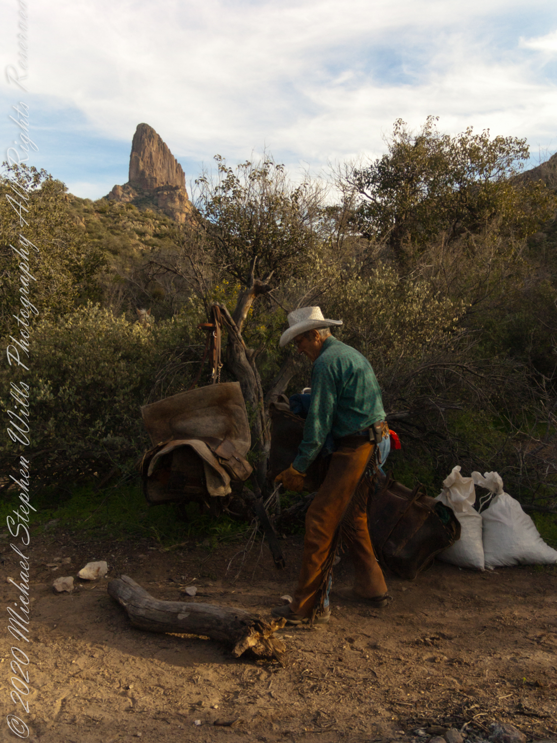
Our evening was a quiet one of camp chores, an enjoyable meal with homemade beef jerky, coffee and plenty of water to rehydrate. The horses chomped on grain from feed bags. They packed in the grain as grazing is not allowed in the wilderness. I gave each a treat of carrot and apple.
.
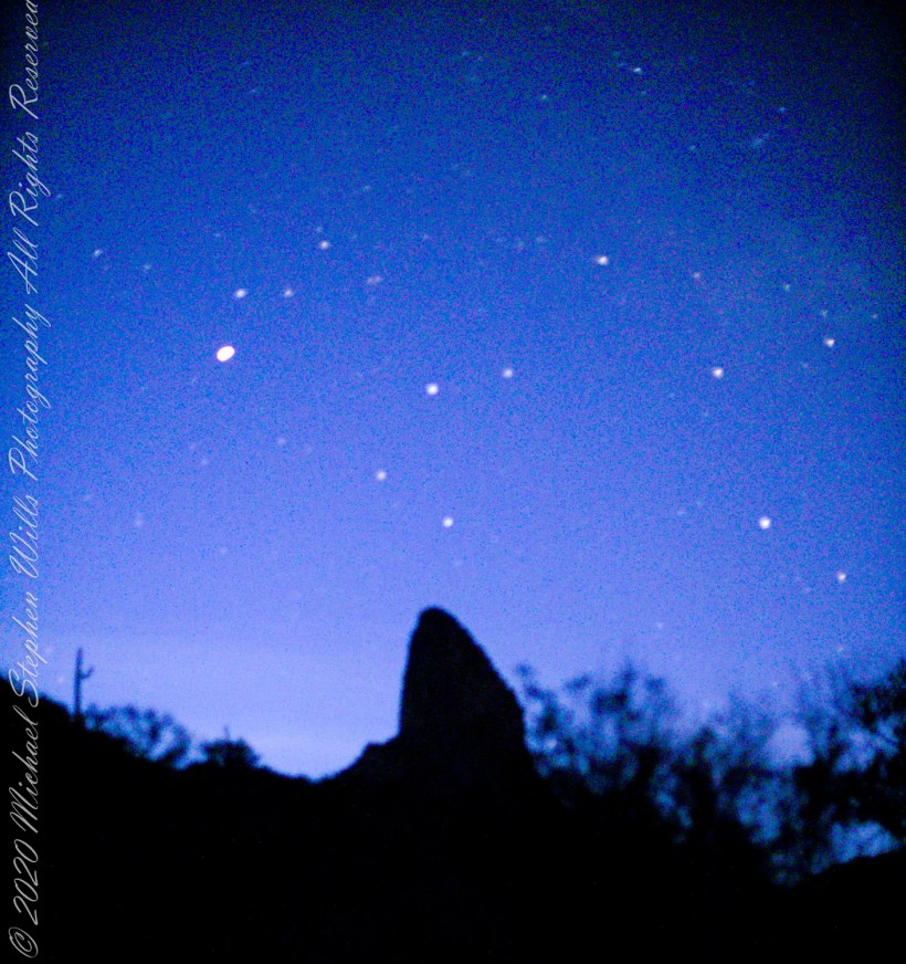
I was up well before dawn to capture the morning constellations over Weavers Needle: from the left, I believe I recognize Lyra with Vega accompanied by Epsilon Lyra, next the keystone of Hercules. The brightest object is Venus.
.
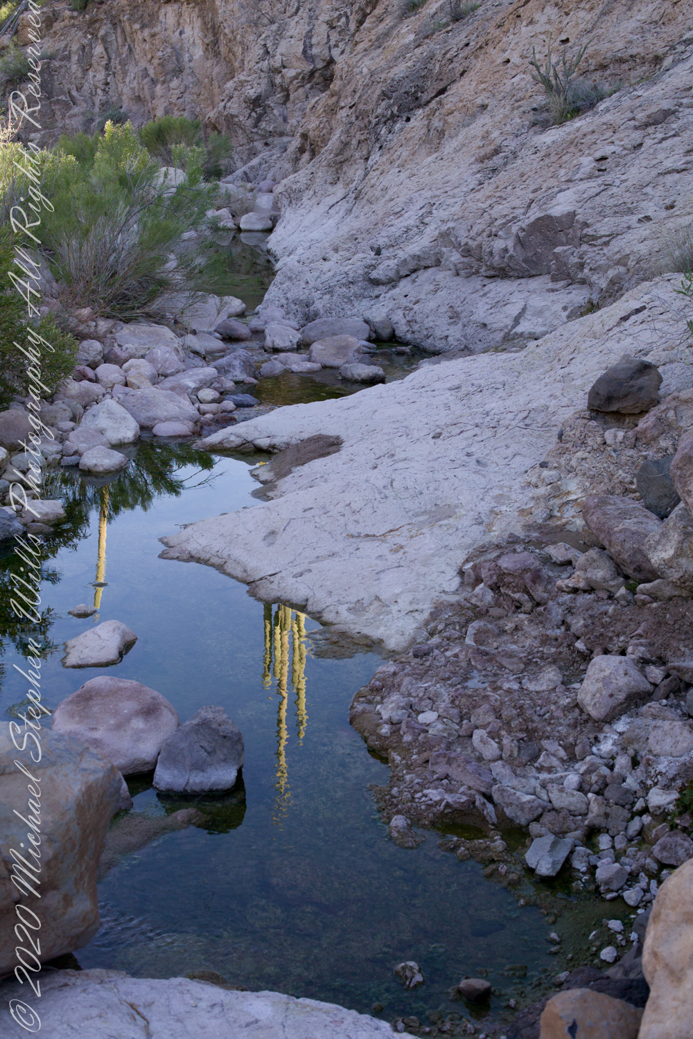
Taking a break from morning water gathering in East Boulder Canyon: saguaro cactuses reflected in a still pool, looking up to the northwest you can just about see the Peralta trail where it crosses a Palamino Mountain ridge. West/Northwest the Peralta trail crosses behind the same ridge.
Mesquite, of the genus Prosopis, is a widespread, successful desert shrub that sometimes grows into tree form, as you see here. A mesquite tap root can extend 190 feet down to draw on the water table.
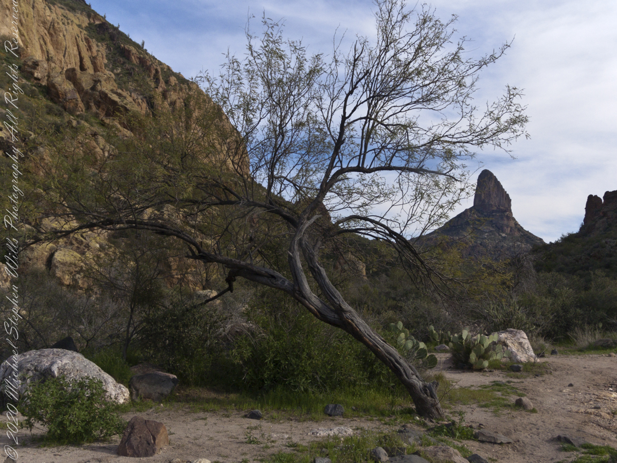
East Boulder Creek was flowing, in this season, a few feet away. Still, this mesquite is stressed, with a loss of over half of its bark. The ever-present Prickly Pear is in the middle distance. I prefer the image with the distant Weavers Needle, a neck of eroded volcanic rock, is brightened by the setting sun. To the left, the light-colored rock of Black Top Mesa is also of volcanic origin.
.
I am here on the Dutchman Trail between Black Top Mesa and Palamino Mountain, Superstition Wilderness, Tonto National Forest, Arizona.
Here is a gallery of post images, making comparison easier. All were taken with a handheld Sony F828. Walking without a pack make it possible for me to wear the camera.
Two Bar Mountain from trail 122 with corral made from mesquite trunks and barbed wire. Yucca and prickly pear in foreground.
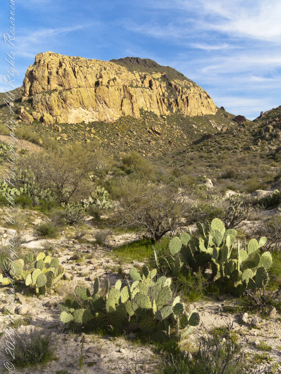
The black basalt of the mesa, for which it is named, is just visible above the lighter colored alternating layers of ash and tuff all remnants of volcanic eruptions 15 to 29 million years ago. We are on the Dutchman trail with the slopes of Palamino Mountain on the right. Ahead, other members of the expedition are just visible.
In this view the late afternoon shadow of Palamino Mountain reveals the defile to which we are headed. Poles of young Saguaro Cactus (Carnegiea gigantean), poke from the black basalt capping Black Top Mesa. Foreground left is Stag Horn Cholla (Cylindropuntia), on the right is Prickly Pear (Optuna).
.
Look carefully for a scattering of color, like gold dust, at the foot of the volcanic cliffs. That is spring blooms of Mexican Poppy (Eschscholtzia californica).