Grandfathering Around Tompkins County

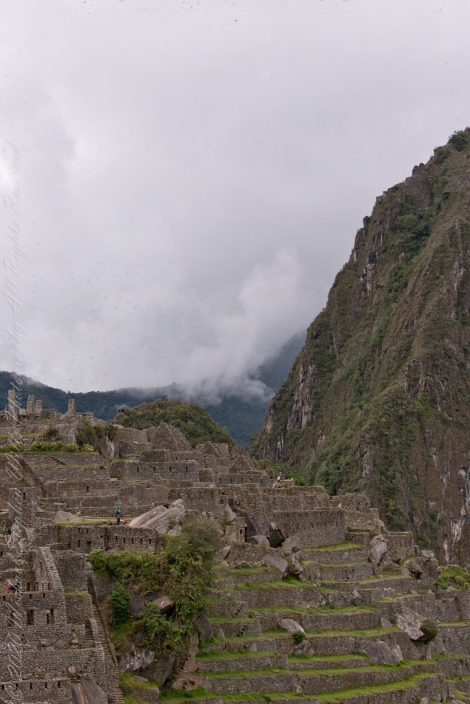
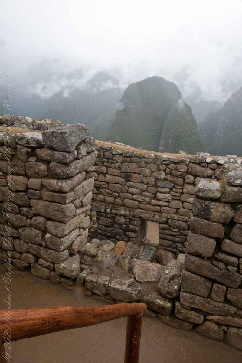
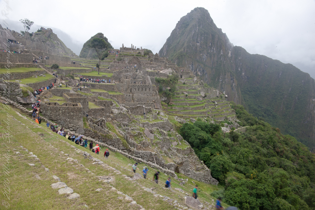
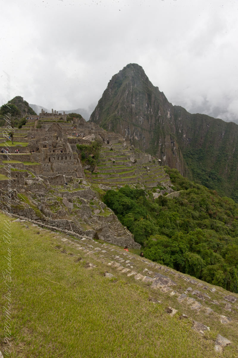
negotiating the Urban Sector of Machu Picchu
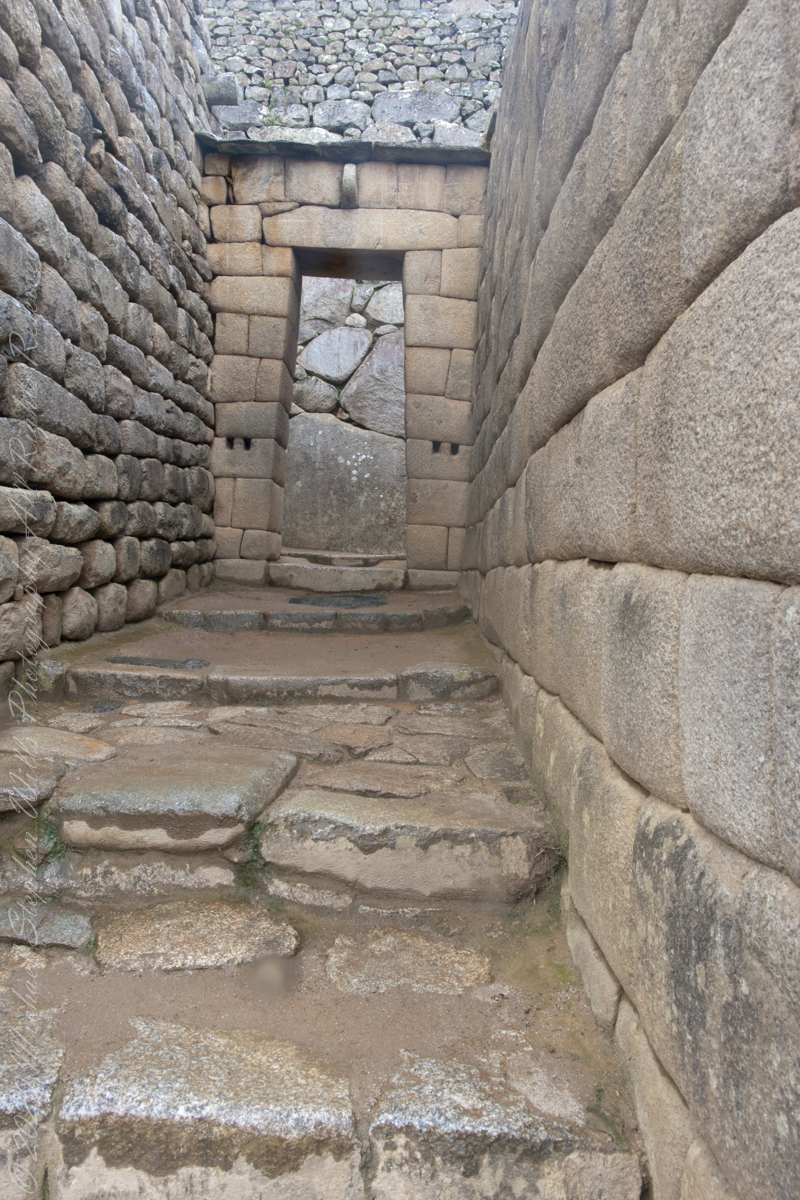
“The central buildings use the classical Inca architectural style of polished dry-stone walls of regular shape. The Incas were masters of this technique, called ashlar, in which blocks of stone are cut to fit together tightly without mortar.“
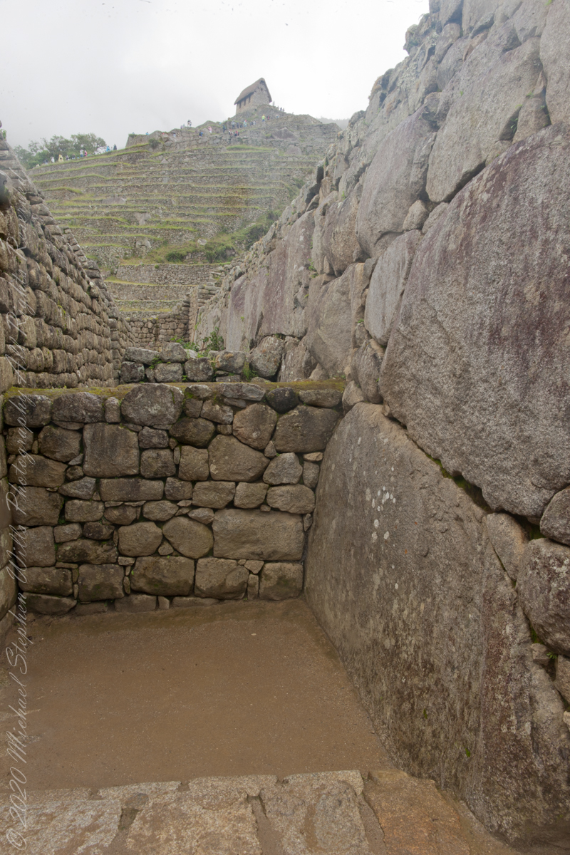
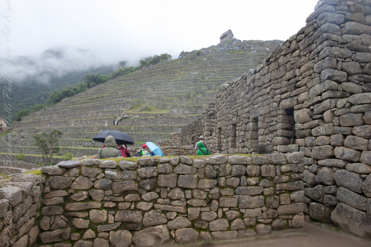
You can tell we are climbing from the angle of the guardhouse.
“The site itself may have been intentionally built on fault lines to afford better drainage and a ready supply of fractured stone. ‘Machu Picchu clearly shows us that the Incan civilization was an empire of fractured rocks‘”.

“The section of the mountain where Machu Picchu was built provided various challenges that the Incas solved with local materials. One issue was the seismic activity due to two fault lines. It made mortar and similar building methods nearly useless. Instead, the Inca mined stones from the quarry at the site, lined them up and shaped them to fit together perfectly, stabilizing the structures. Inca walls have many stabilizing features: doors and windows are trapezoidal, narrowing from bottom to top; corners usually are rounded; inside corners often incline slightly into the rooms, and outside corners were often tied together by “L”-shaped blocks; walls are offset slightly from row to row rather than rising straight from bottom to top.“
“Heavy rainfall required terraces and stone chips to drain rainwater and prevent mudslides, landslides, erosion, and flooding. Terraces were layered with stone chips, sand, dirt, and topsoil, to absorb water and prevent it from running down the mountain. Similar layering protected the large city center from flooding.[106] Multiple canals and reserves throughout the city provided water that could be supplied to the terraces for irrigation and to prevent erosion and flooding.”
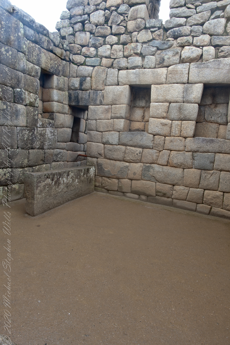
“The Incas never used wheels in a practical way, although their use in toys shows that they knew the principle. The use of wheels in engineering may have been limited due to the lack of strong draft animals, combined with steep terrain and dense vegetation. The approach to moving and placing the enormous stones remains uncertain, probably involving hundreds of men to push the stones up inclines. A few stones have knobs that could have been used to lever them into position; the knobs were generally sanded away, with a few overlooked.”

Feeding Apple Trees
A spring rite of ours is caring for three apple trees. We provide each, a Cortland, a McIntosh, a Delicious, with 15 fertilizer spikes ; 45 in all.

I am way past using a hammer to pound in each. The preferred method is to drive a space into the ground beneath the drip line (the other reach of the branches), lift the handle and drop the spike into the ground, remove the spade and tamp down the ground.

These helpers are now experts in the dropping and counting. Then, enough is enough, time for play.
And lunch….

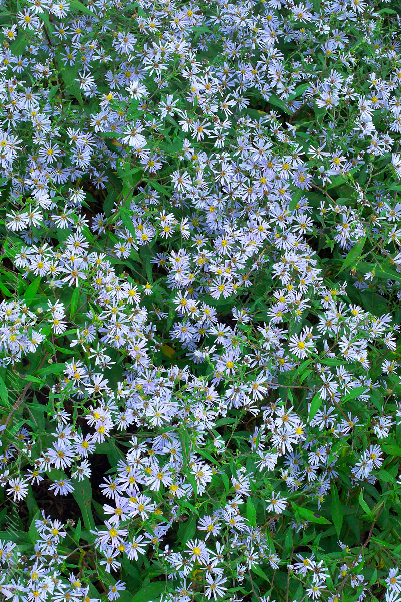
To The Stars
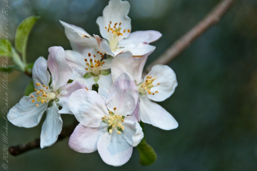
A mass of lavender asters produced for a painterly, restful esthetic. Over the years I have tended beds of these wildflowers. The sunlight of late August/early September here in the Finger Lakes is especially clear and this is when these asters bloom. This were caught on a clear September evening with the sun just behind a stand of large Ash trees.

“Symphyotrichum novi-belgii (formerly Aster novi-belgii), commonly called New York aster. Symphyotrichum, a genus in the family Asteraceae, whose species were once considered to be part of the genus Aster. Plants in both these genera are popularly known as Michaelmas daisy because they bloom around September 29, St. Michael’s Day. The Latin specific epithet novi-belgii (literally “New Belgium”) refers not to modern Belgium, but the 17th century Dutch colony New Netherland which was established on land currently occupied by New York state (as Belgica Foederata was the Latin term for the United Netherlands at the time).“
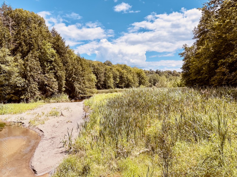
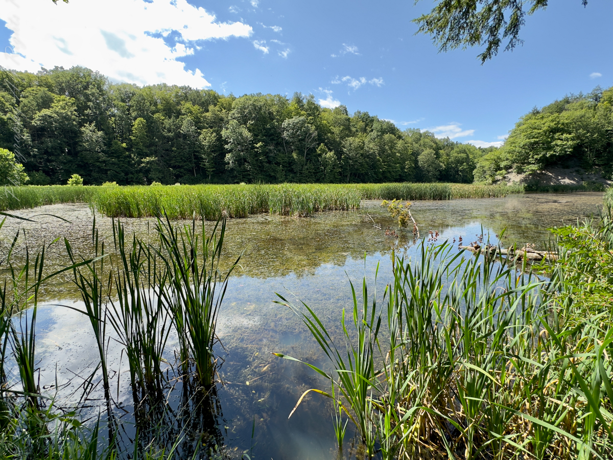
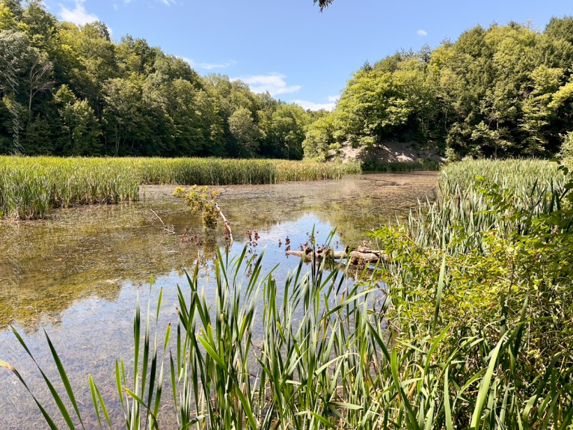
formed by a 1930’s Dam on Buttermilk Creek

Dam on Buttermilk creek that forms Lake Treman. Here is stunning Civilian Conservation Corp (1930’s) work in this 36-foot-high stone dam that is not only a spectacle to observe but also serves as part of the trail that encircles Lake Treman. The man-made lake’s wooded shores and placid waters are a stark comparison to the gorge’s rocky cliffs and surging water
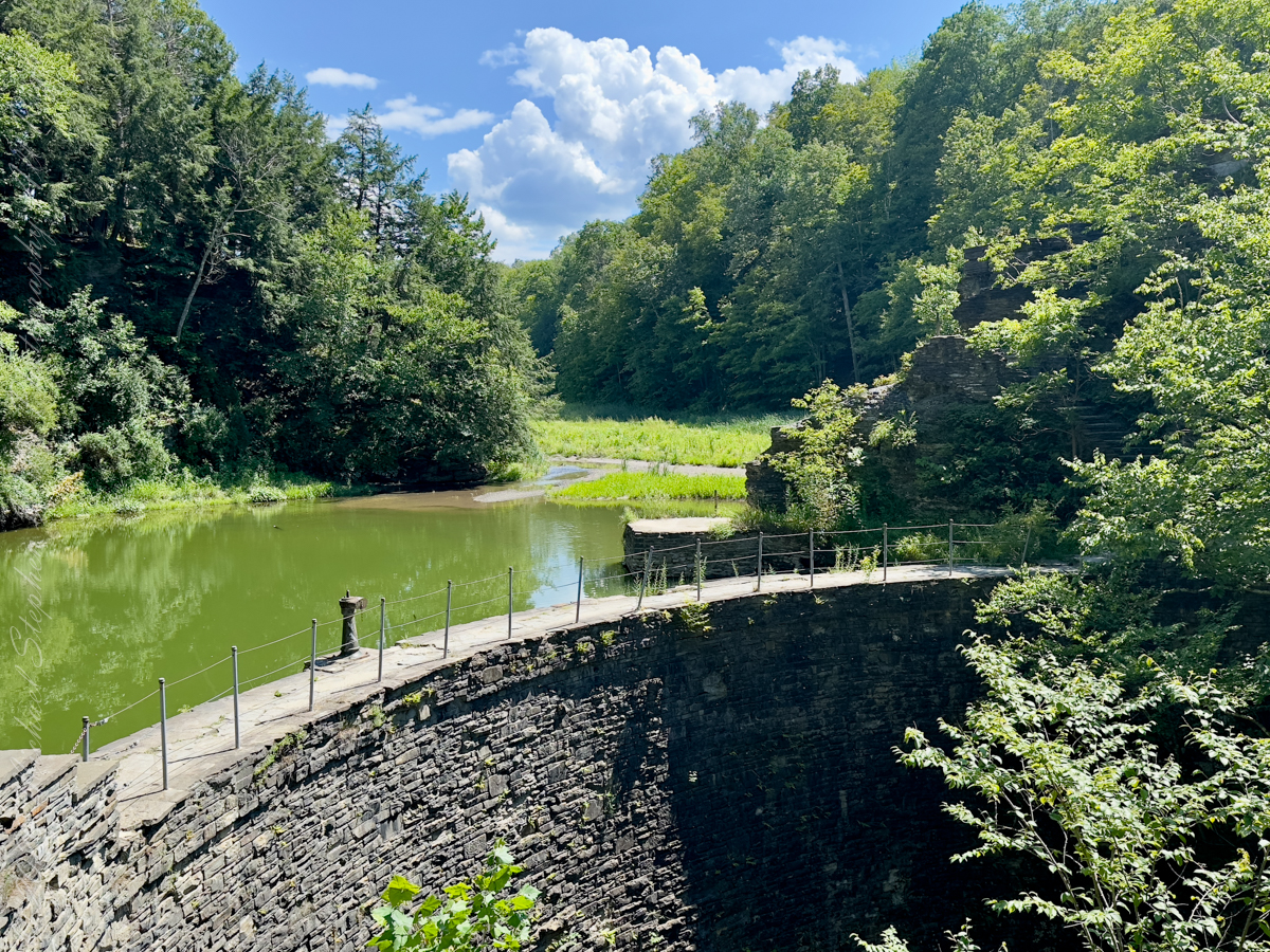
August 2023, Buttermilk Falls New York State Park, Ithaca, Tompkins County, New York.
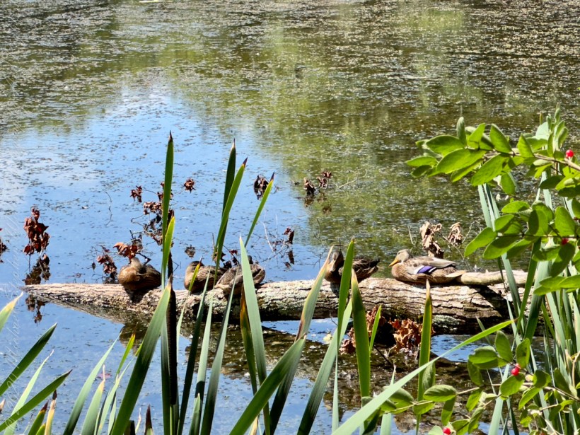
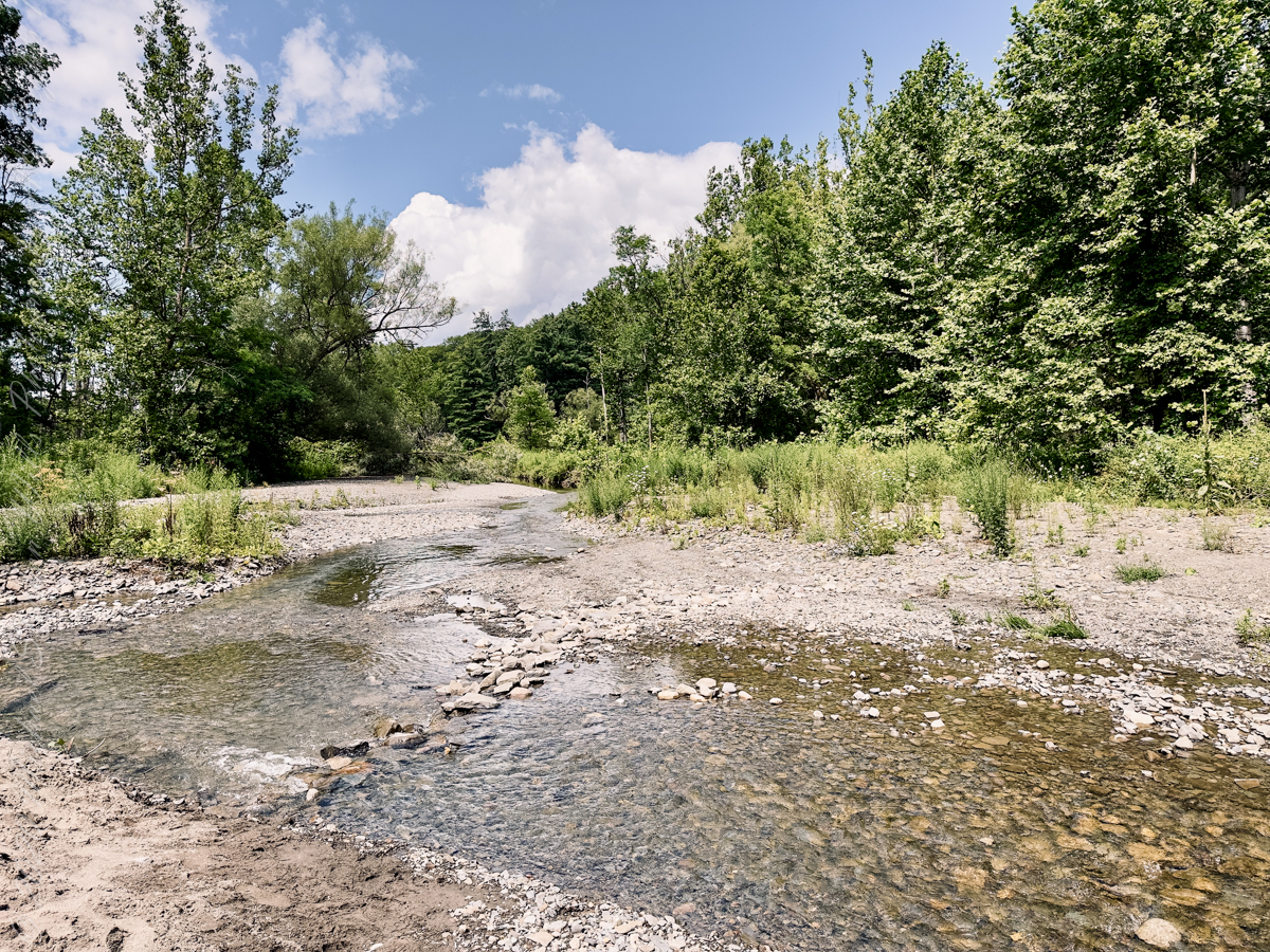
On Lake Treman.
Two species of wild ducks rest on a fallen tree trunk.
That is a female Wood Duck (Aix sponsa) on right.
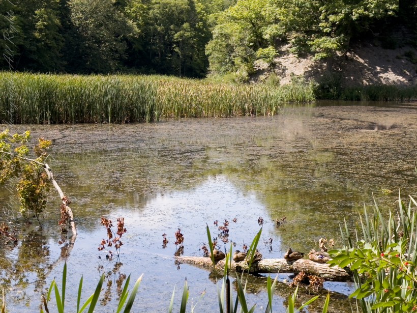
Wood Ducks mainly eat berries, acorns, and seeds, but also insects, making them omnivores. They are able to crush acorns after swallowing them within their gizzard.
August 2023, Buttermilk Falls New York State Park, Ithaca, Tompkins County, New York.
negotiating the Urban Sector of Machu Picchu
It was from reviewing this photograph, and others, I realized the photo of the woman being evacuated did not include the guardhouse. That is the guardhouse high above us.
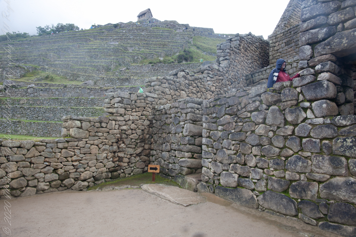
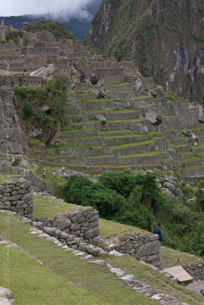
This photo taken from the rock wall foreground in previous photo.
“Embedded within a dramatic landscape at the meeting point between the Peruvian Andes and the Amazon Basin, the Historic Sanctuary of Machu Picchu is among the greatest artistic, architectural and land use achievements anywhere and the most significant tangible legacy of the Inca civilization. Recognized for outstanding cultural and natural values, the mixed World Heritage property covers 32,592 hectares of mountain slopes, peaks and valleys surrounding its heart, the spectacular archaeological monument of “La Ciudadela” (the Citadel) at more than 2,400 meters above sea level. Built in the fifteenth century Machu Picchu was abandoned when the Inca Empire was conquered by the Spaniards in the sixteenth century. It was not until 1911 that the archaeological complex was made known to the outside world.“
“The approximately 200 structures making up this outstanding religious, ceremonial, astronomical and agricultural center are set on a steep ridge, crisscrossed by stone terraces. Following a rigorous plan the city is divided into a lower and upper part, separating the farming from residential areas, with a large square between the two. To this day, many of Machu Picchu’s mysteries remain unresolved, including the exact role it may have played in the Incas’ sophisticated understanding of astronomy and domestication of wild plant species.“

“The massive yet refined architecture of Machu Picchu blends exceptionally well with the stunning natural environment, with which it is intricately linked. Numerous subsidiary centers, an extensive road and trail system, irrigation canals and agricultural terraces bear witness to longstanding, often on-going human use. The rugged topography making some areas difficult to access has resulted in a mosaic of used areas and diverse natural habitats. The Eastern slopes of the tropical Andes with its enormous gradient from high altitude “Puna” grasslands and Polylepis thickets to montane cloud forests all the way down towards the tropical lowland forests are known to harbour a rich biodiversity and high endemism of global significance. Despite its small size the property contributes to conserving a very rich habitat and species diversity with remarkable endemic and relict flora and fauna.“

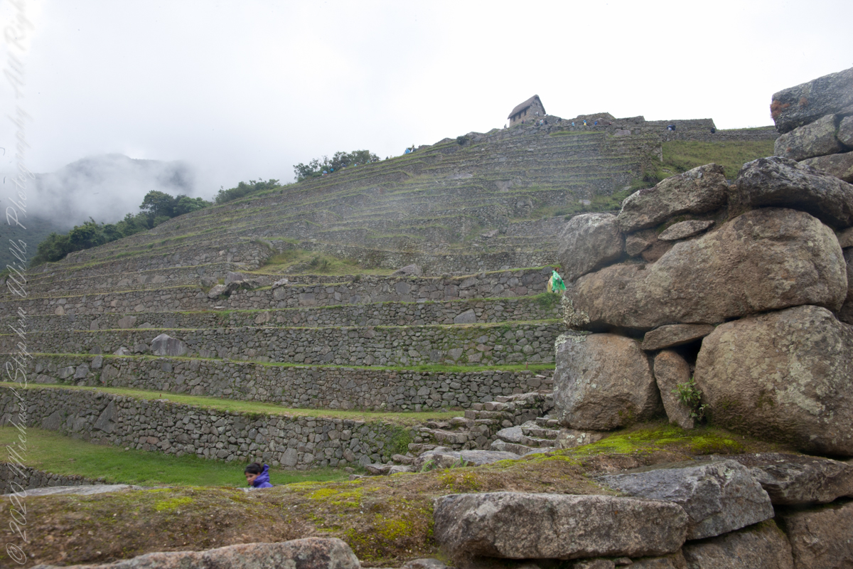
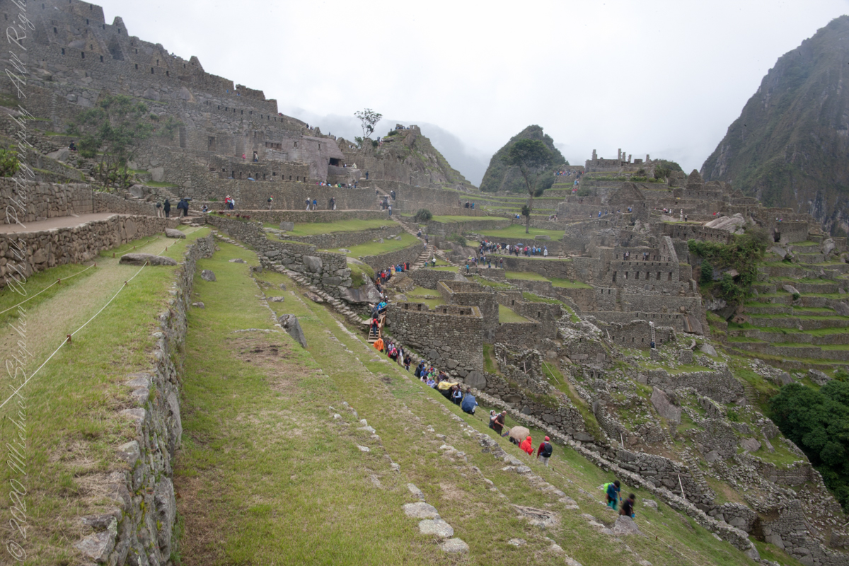
walking along Agricultural Terraces
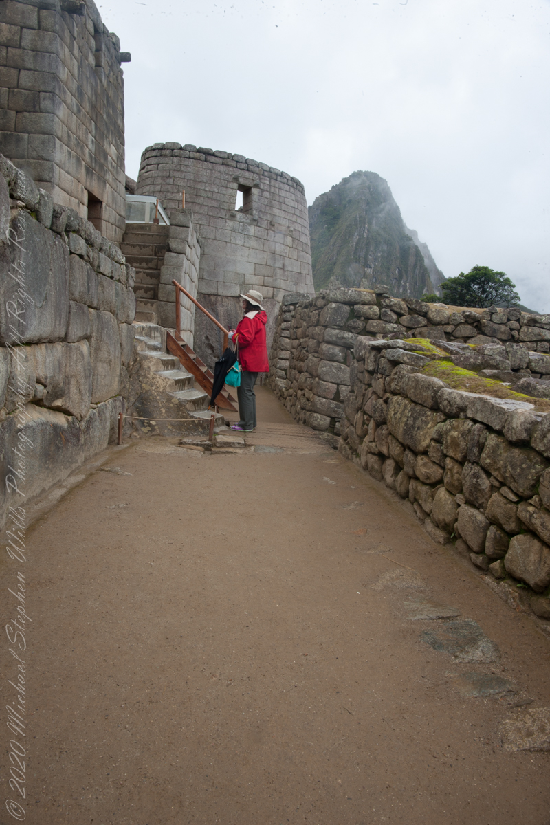
Pam and Mike pose at the overlook, February 2016. “We were there!!”

The plateau on which the city was built was also the place where the construction materials were extracted. The rock quarry – this can still be found in the city of Machu Picchu. So, the Incas had no major difficulties in constructing the stone blocks.


The majority of construction bricks, rocks are rather small, unlike in the case of Ollantaytambo and Sacsayhuamán.

About 5.000 people must have worked to build Machu Picchu – specialists say. But it could only accommodate 750 – 1.000 inhabitants. Strangely there were only about 200 – 250 skeletons found.

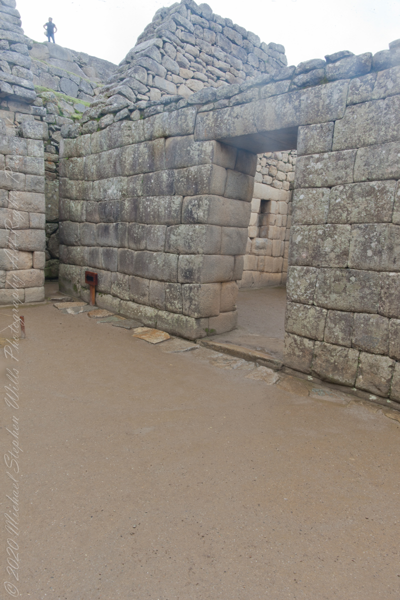
About 140 buildings were erected. Most of these are houses, some are temples. There also are depots and even a guard house at the edge of the city.
The Incas used dry stone technique to build the city. No mortar was used, the stone bricks were simply put together without any material to stick them together.
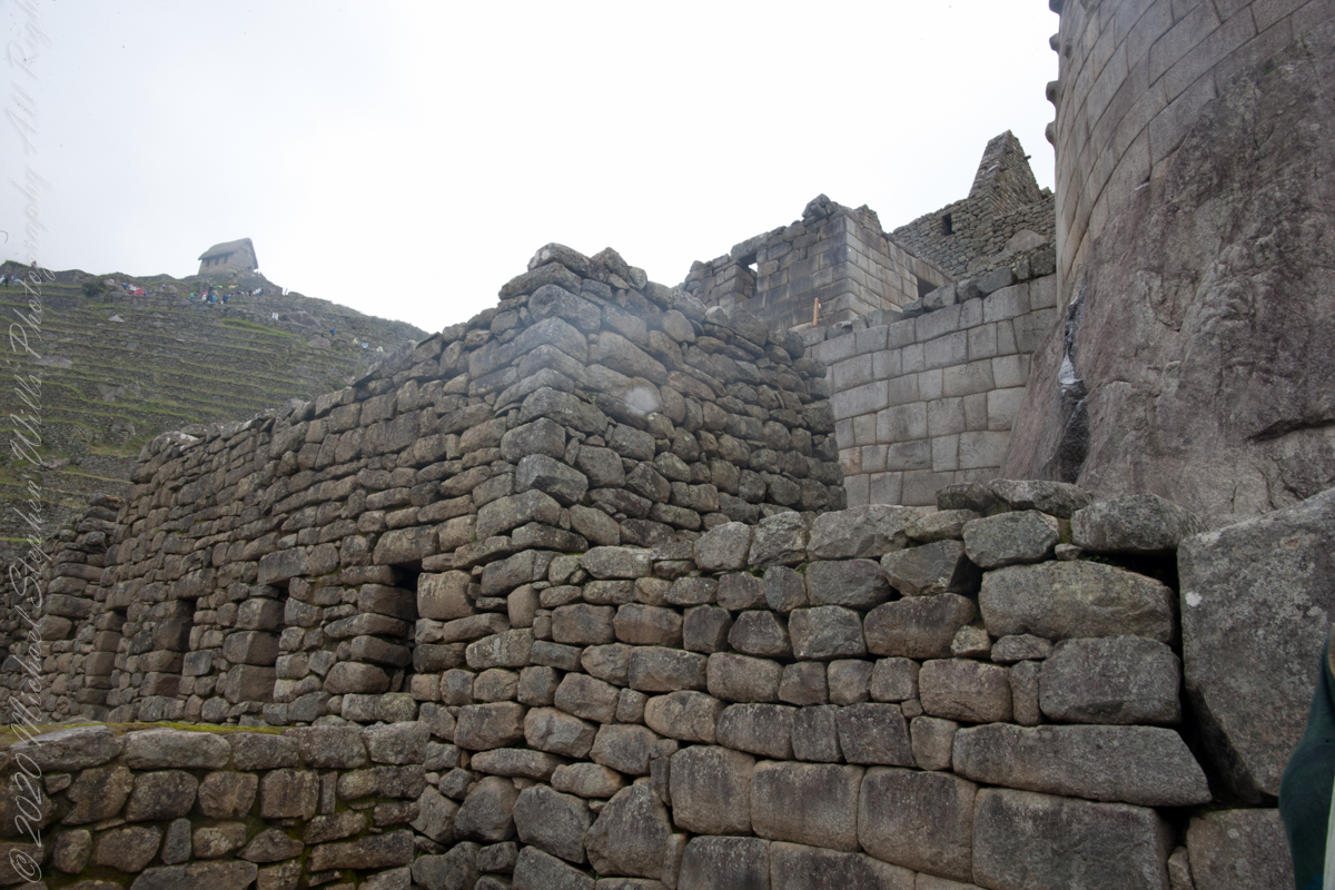
All rocks used were split perfectly and the bricks were put together like a huge puzzle. Some of the bricks are so tightly put together that one cannot even put a knife between them. The rocks were probably cut with the so-called wooden wedge technique: holes were drilled into the rocks and wet wooden wedges were inserted into them. After that the constructors waited until the wet wooden wedges froze.


Views while entering Machu Picchu
I set up a Manfrotto BeFree tripod with the Canon EOS 1DS Mark III mounted with the Canon EF 70-300 f/4-5.6 L IS USM lens to capture our experience while entering Machu Picchu.
Huayna Picchu and the eastern portion of Machu Picchu from the agricultural terraces along with tourists proceed to the ancient city.
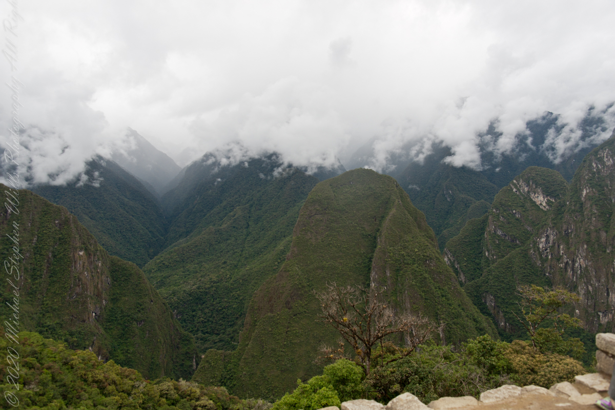
The eastern shoulder of Huayna Picchu is left and the Urubamba river curves around it. Leading the eye to the distance is an uninhabited andean valley covered in rain forest.

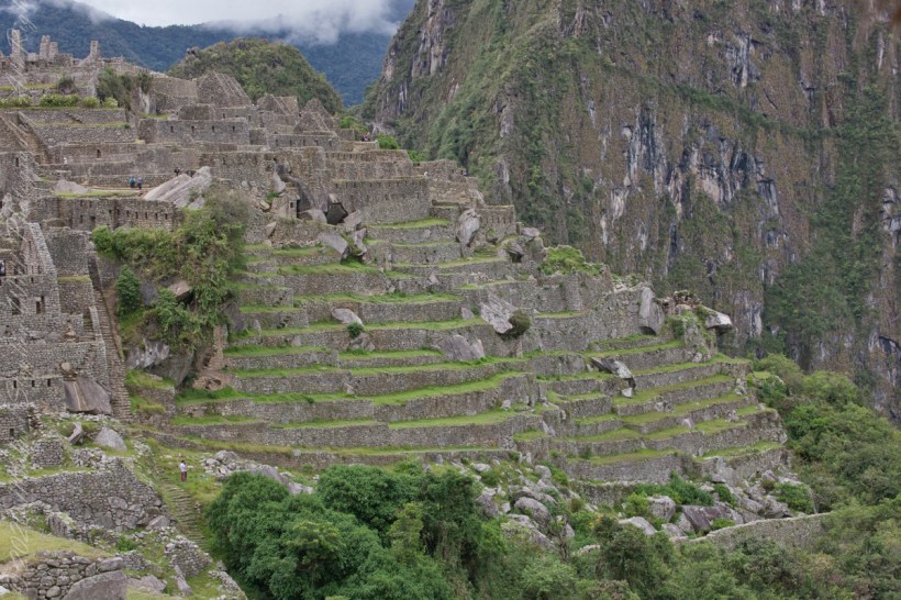
Agricultural terraces
These agricultural terraces, built in the 15th century, were still in limited use by local farmers when Bingham arrived in the early 20th century.
These terraces were a work of considerable engineering, built to ensure good drainage and soil fertility while also protecting the mountain itself from erosion and landslides. Modern soil studies reveal the major crops were corn and potatoes. These terraces are below the districts named “Industrial Zone” and “Factory Houses.” A cliff of Huayna Picchu is in the background.
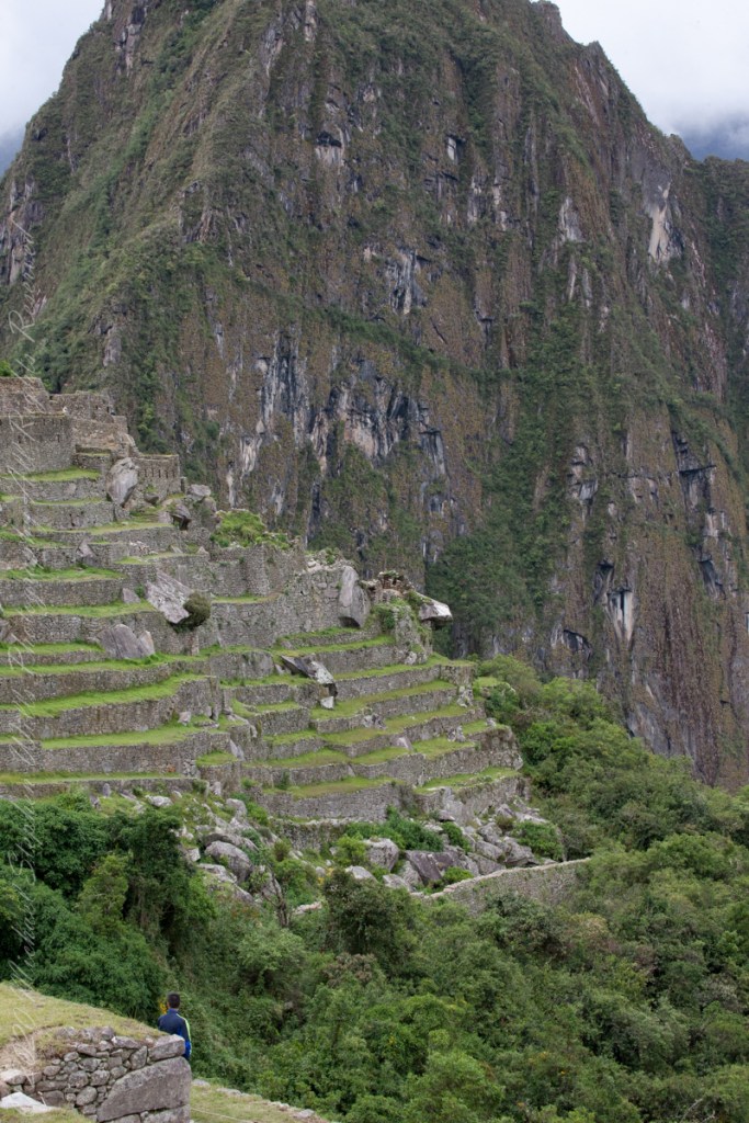
This photograph demonstrates either repair of or adaptation to landslides.