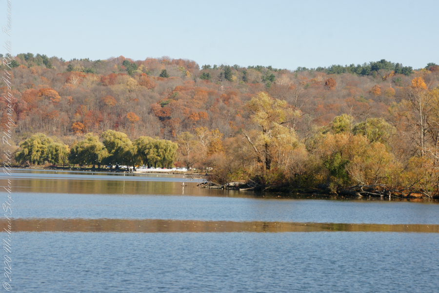
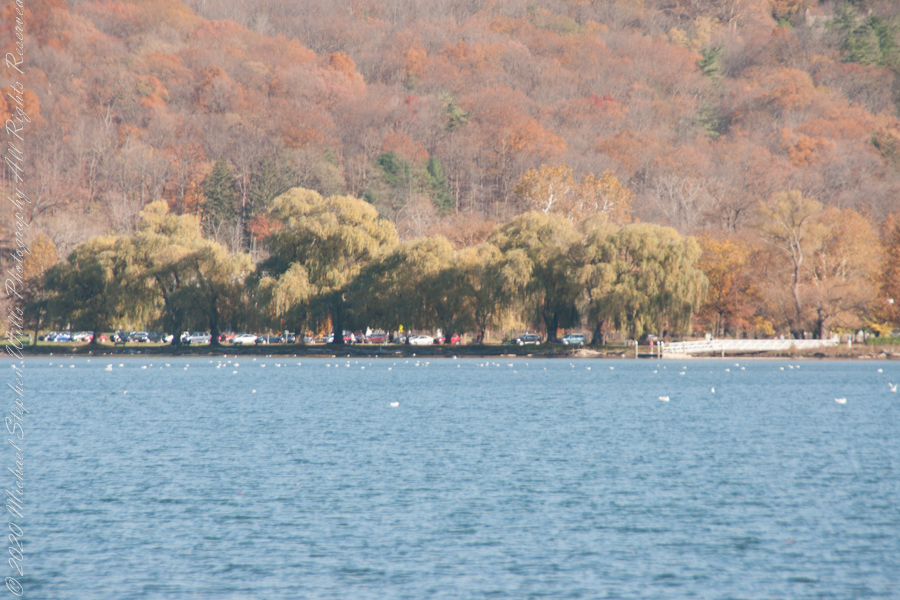
Here is the south end of Cayuga Lake on a bright November afternoon. Stewart Park is enjoyed by Ithacans year round.
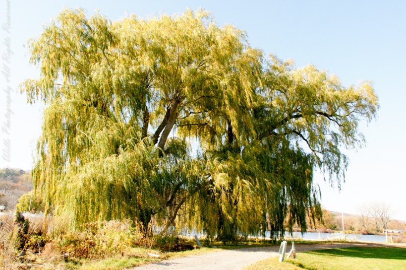
Everyone is a fan of the Willows framing the lake views.
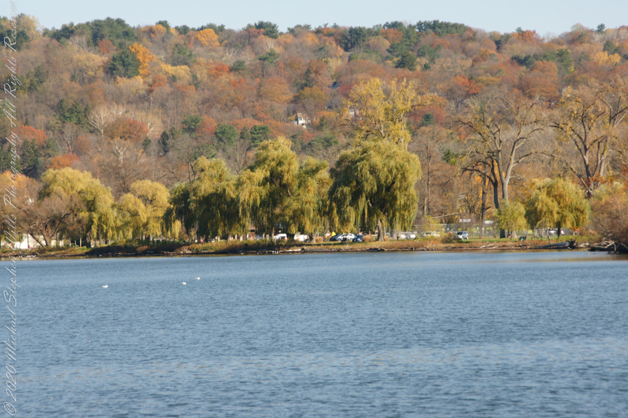
Can’t get enough of Stewart Park..
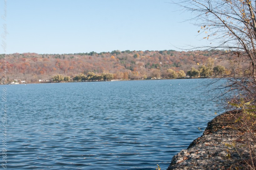
An unzoomed view, to give an idea of the distance across the water.
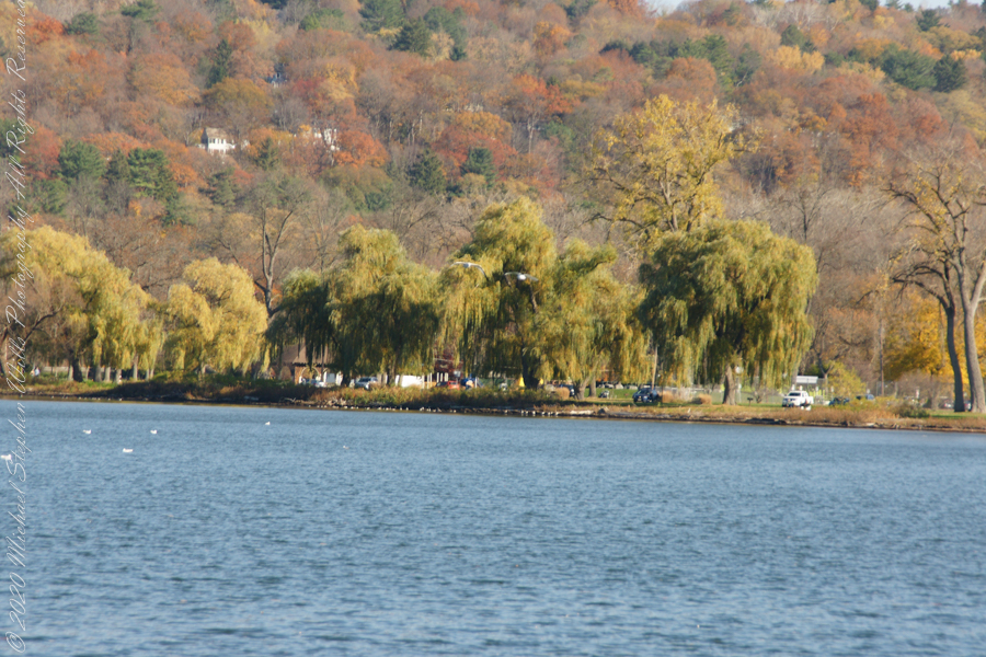
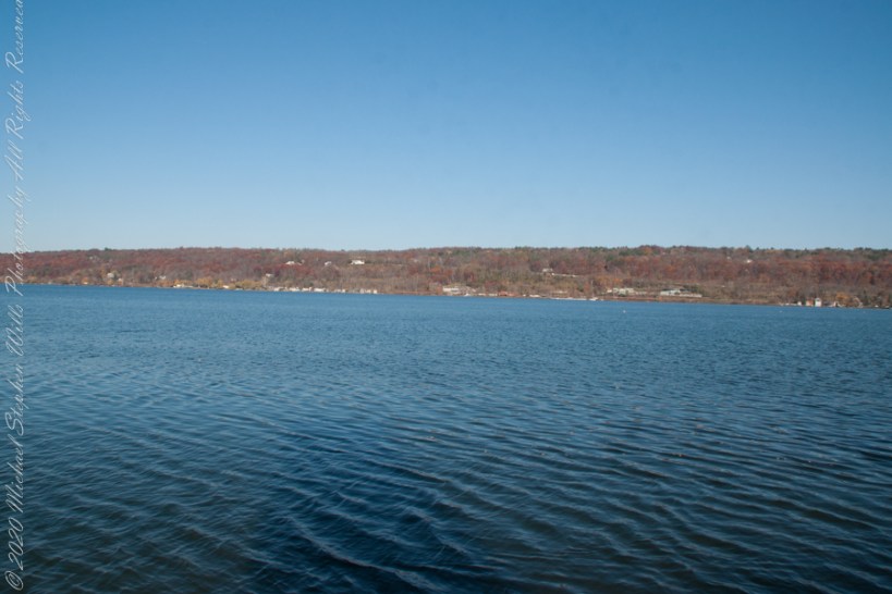
Pam and I have great memories of sailing this stretch from our years of membership in Cornell Family Sailing.
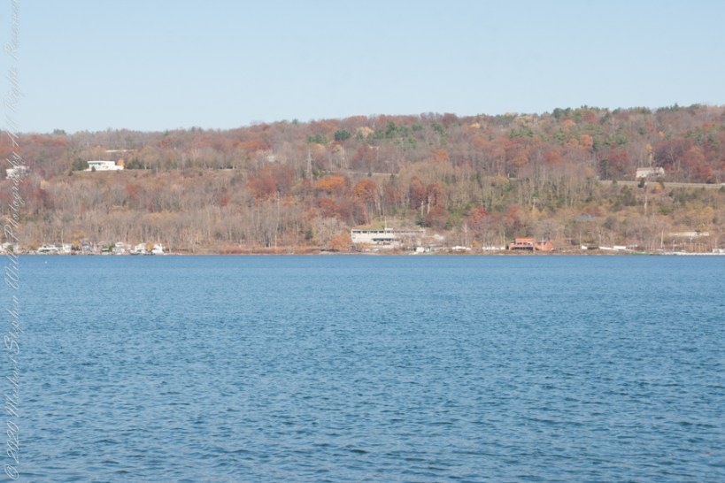
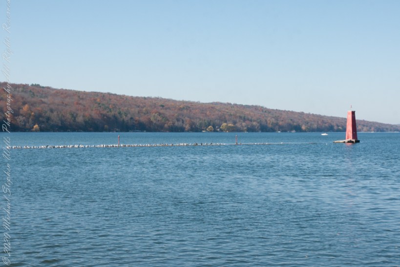
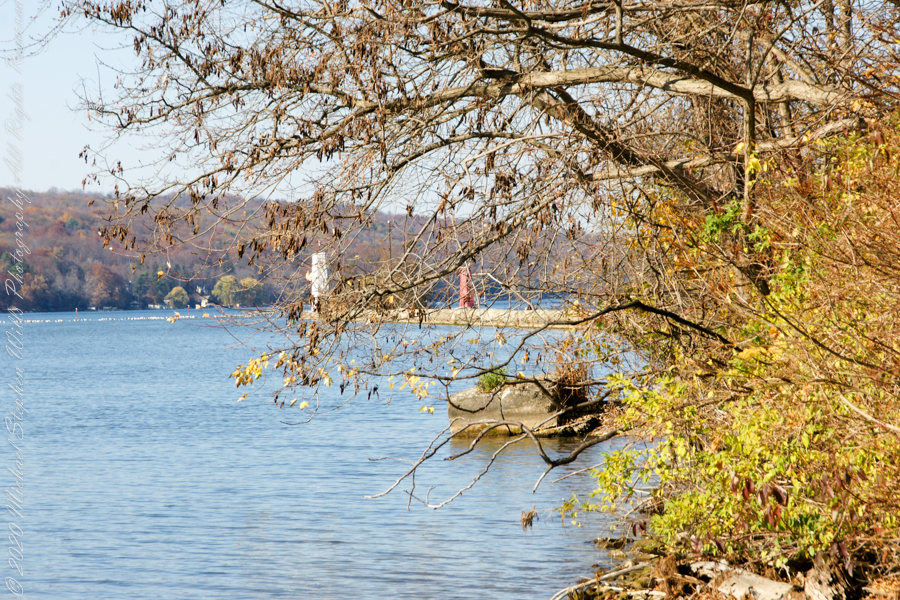
The east lake shore.
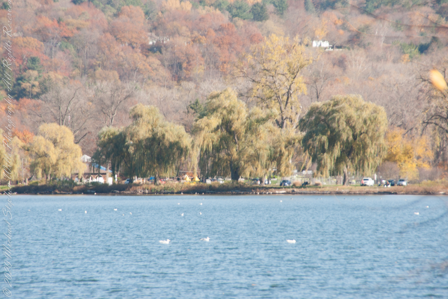
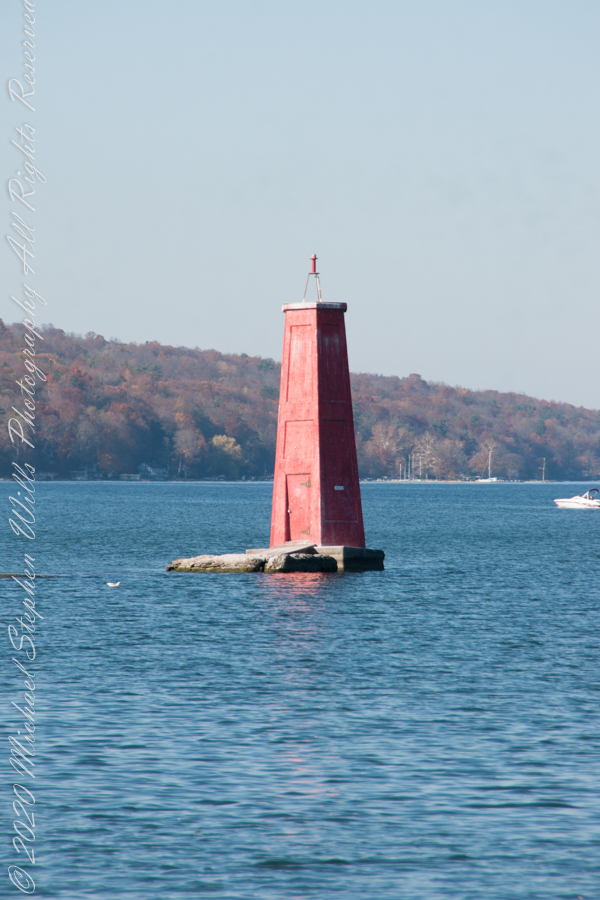
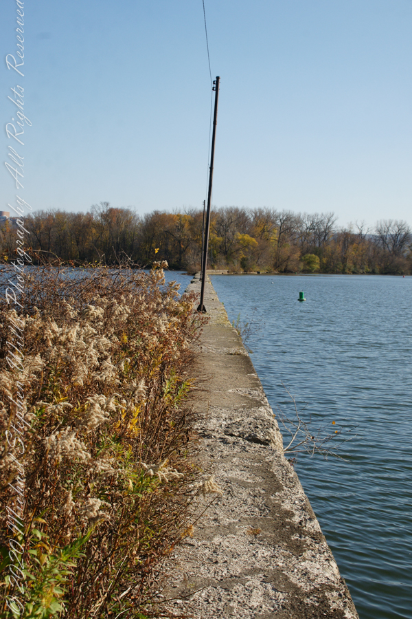
The West Lake Shore. This photograph captures the electric line that powers the Red Tower light. Seagulls enjoy that causeway…I’ve never seen humans walk it.
Copyright 2022 Michael Stephen Wills All Rights Reserved
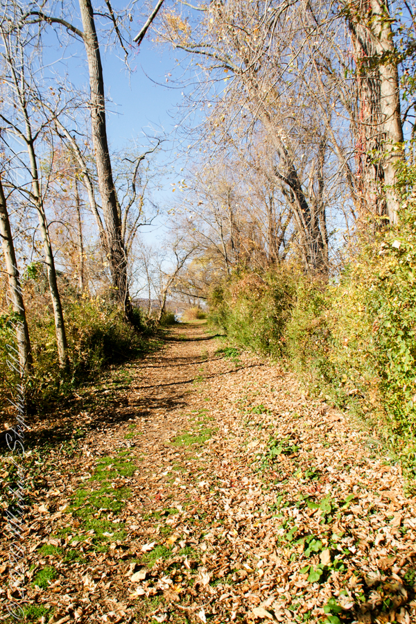
Post 1 of Lighthouse Point provided an impression of our hike along the golf course, from there we turned onto this wooded path on the shores of Cayuga Inlet.
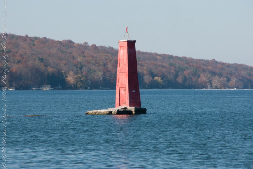
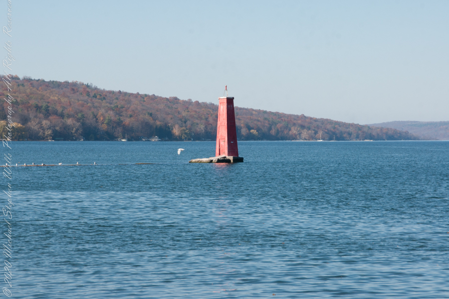
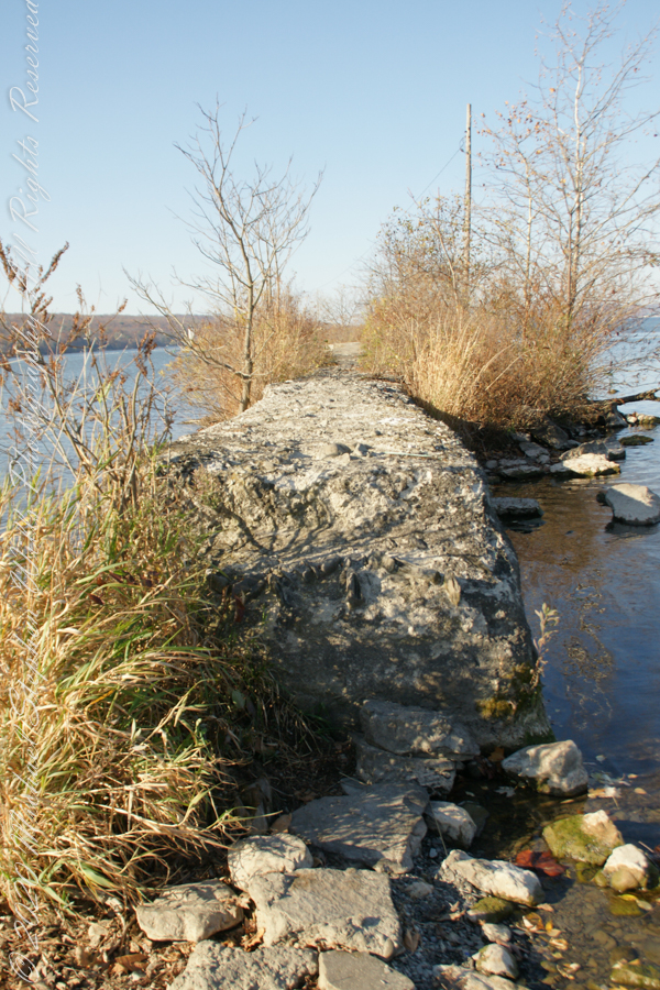
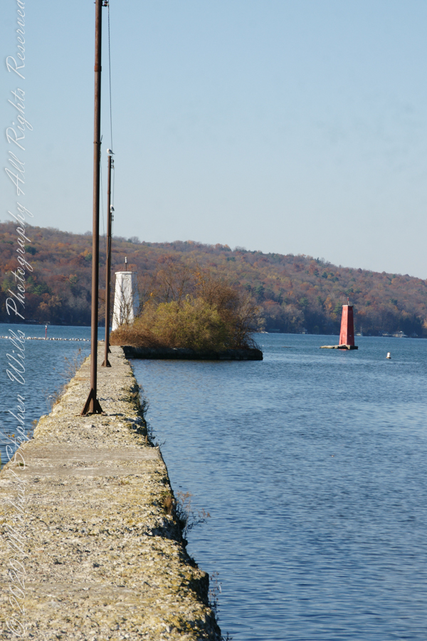
First view of the paired Lighthouses marking the Cayuga Inlet. The white tower is connected to shore by a causeway something less than a quarter mile in length. The red tower marks the other side. These navigation guides allow boats to safely enter the channel exiting the south end of Cayuga Lake. The Erie Canal connects to the north end, allowing access to the Great Lakes and, eventually, the Atlantic Ocean.
The 4-foot-high step up to the concrete causeway path is an insurmountable obstacle to some. I managed to clamber over.
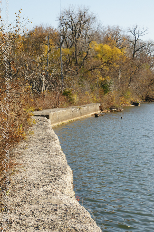
Looking back to shore….
Rusted iron poles support the electric line for the white tower. They remind me of ship masts.
The straight shot back to shore.
Copyright 2022 Michael Stephen Wills All Rights Reserved
November 3rd, 2022, Blessed Us with an azure sky, an Indian Summer Day. During our walks on Cass Park Shorts we’d look across to see hikers emerging from the gold course to walk the Lighthouse causeway. After decades of longing, these Ithaca residents took upon themselves the adventure of finding the path and walking it. This series of posts documents the walk and some treasures discovered on the way.
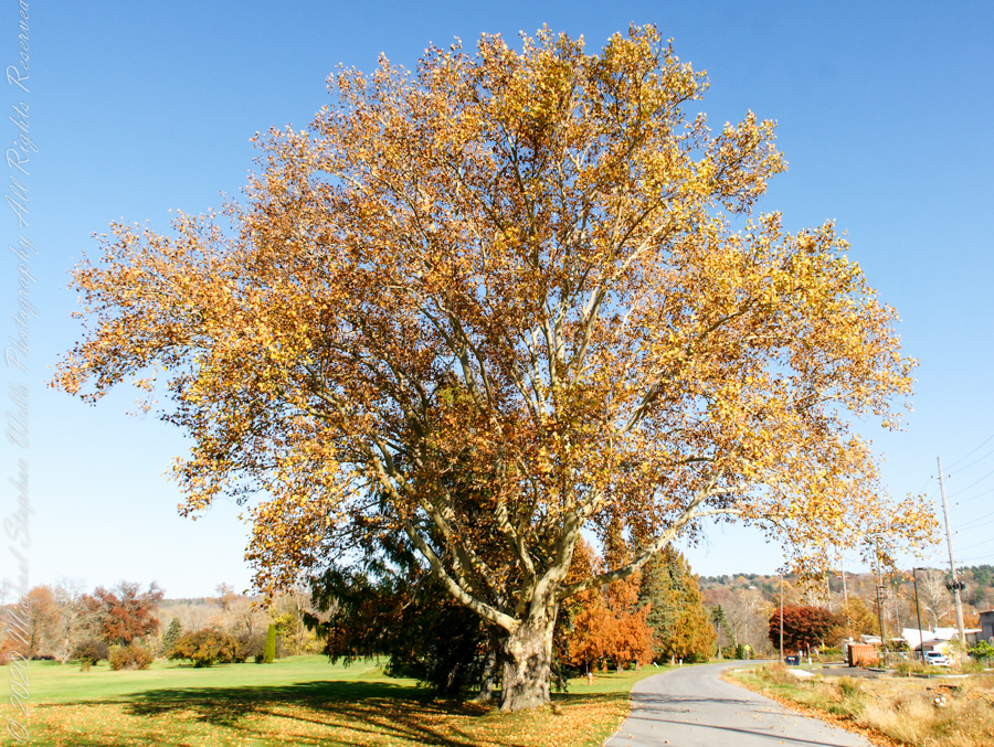
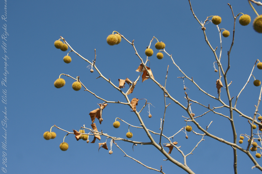
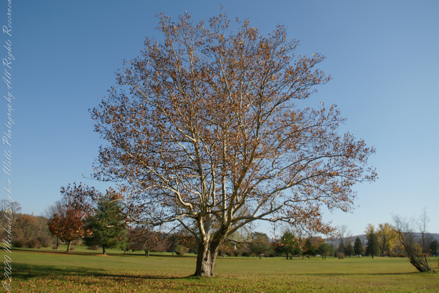
Sycamore, aka Plane Tree
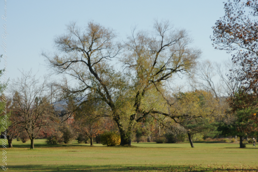
Willow on Cayuga Inlet and Newman Golf Course
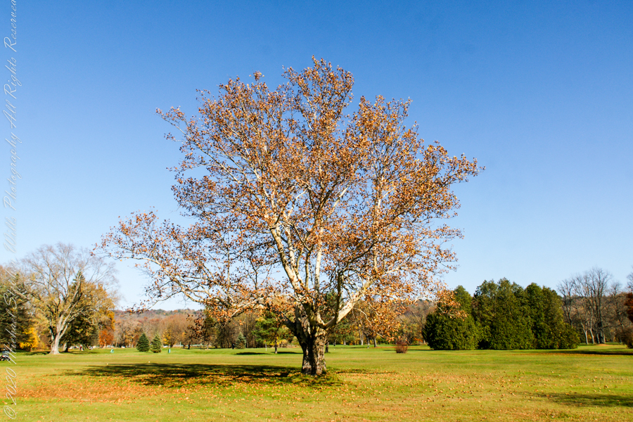
might be another Sycamore on the golf course
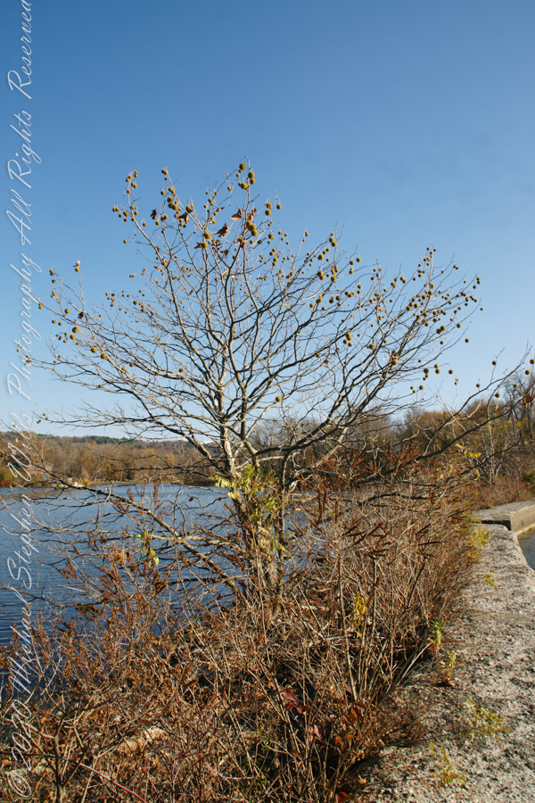
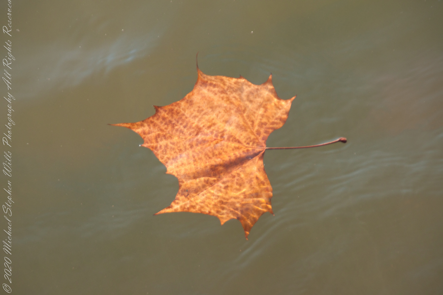
An uncultivated Sycamore sprouting from the causeway leading to the lighthouse “The reason Sycamores are also called “Buttonwood”. Children love to throw these seed heads at each other, sometimes “exploding”The reason Sycamores are also called “Buttonwood”. Children love to throw these seed heads at each other, sometimes “exploding” on impactSycamore leaf floating in Cayuga Inlet
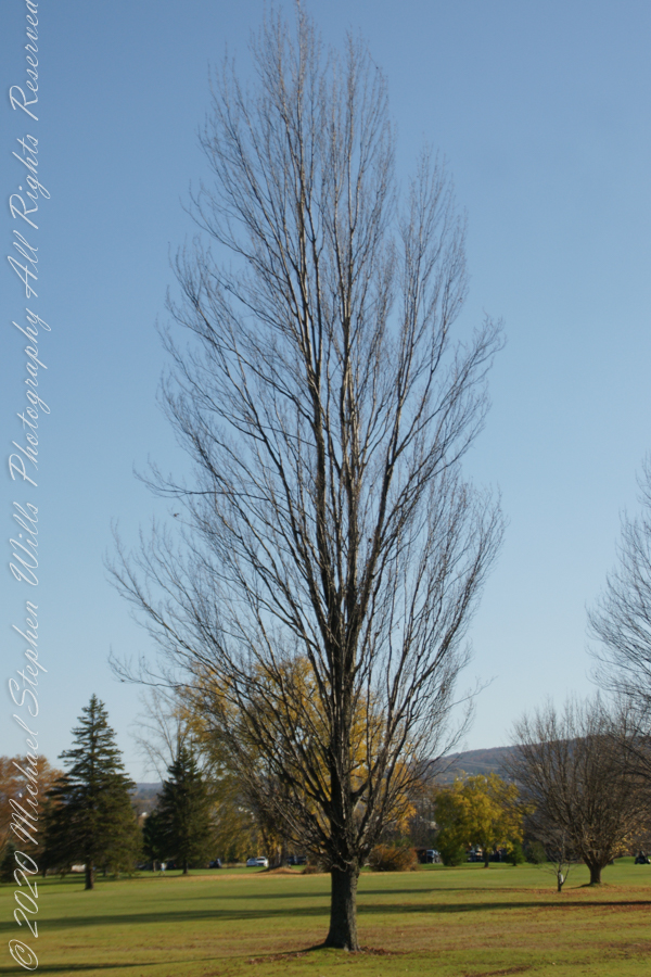
Unidentified tree on golf course
Unidentified tree on golf course
Unidentified tree on golf course
Copyright 2022 Michael Stephen Wills All Rights Reserved
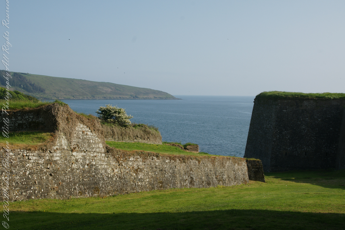
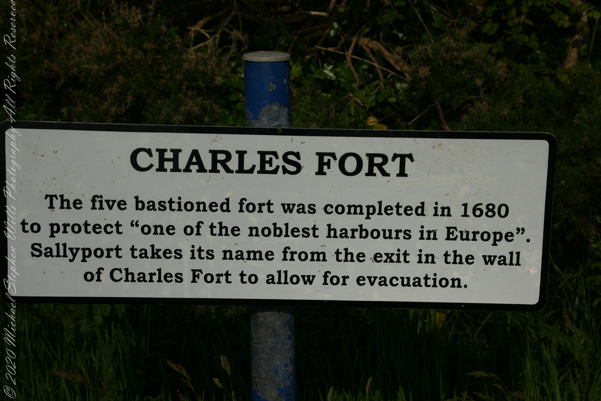
A half mile footpath, marked in red on the following Google Earth view, leads from the Charles fort sallyport, along the shoreline cliffs, surmounted by working farmland and looks toward the Celtic Sea.
To “sally” is to suddenly charge out from a besieged place against the enemy. The word is also used as a noun. It can also be used to describe our walk, as a sally to an unusual place.
The town above the walk is named Sallyport
Here is a view of the Celtic Sea from the Sallyport
From Wikipedia: “The Celtic Sea receives its name from the Celtic heritage of the bounding lands to the north and east. The name was first proposed by E. W. L. Holt at a 1921 meeting in Dublin of fisheries experts from Great Britain, France, and Ireland. The northern portion of this sea was considered as part of Saint George’s Channel and the southern portion as an undifferentiated part of the “Southwest Approaches” to Great Britain. The desire for a common name came to be felt because of the common marine biology, geology and hydrology of the area. It was adopted in France before being common in the English-speaking countries; in 1957 Édouard Le Danois wrote, “the name Celtic Sea is hardly known even to oceanographers.”[3] It was adopted by marine biologists and oceanographers, and later by petroleum exploration firms. It is named in a 1963 British atlas.. A 1972 article states ‘what British maps call the Western Approaches, and what the oil industry calls the Celtic Sea […] certainly the residents on the western coast [of Great Britain] don’t refer to it as such.'”
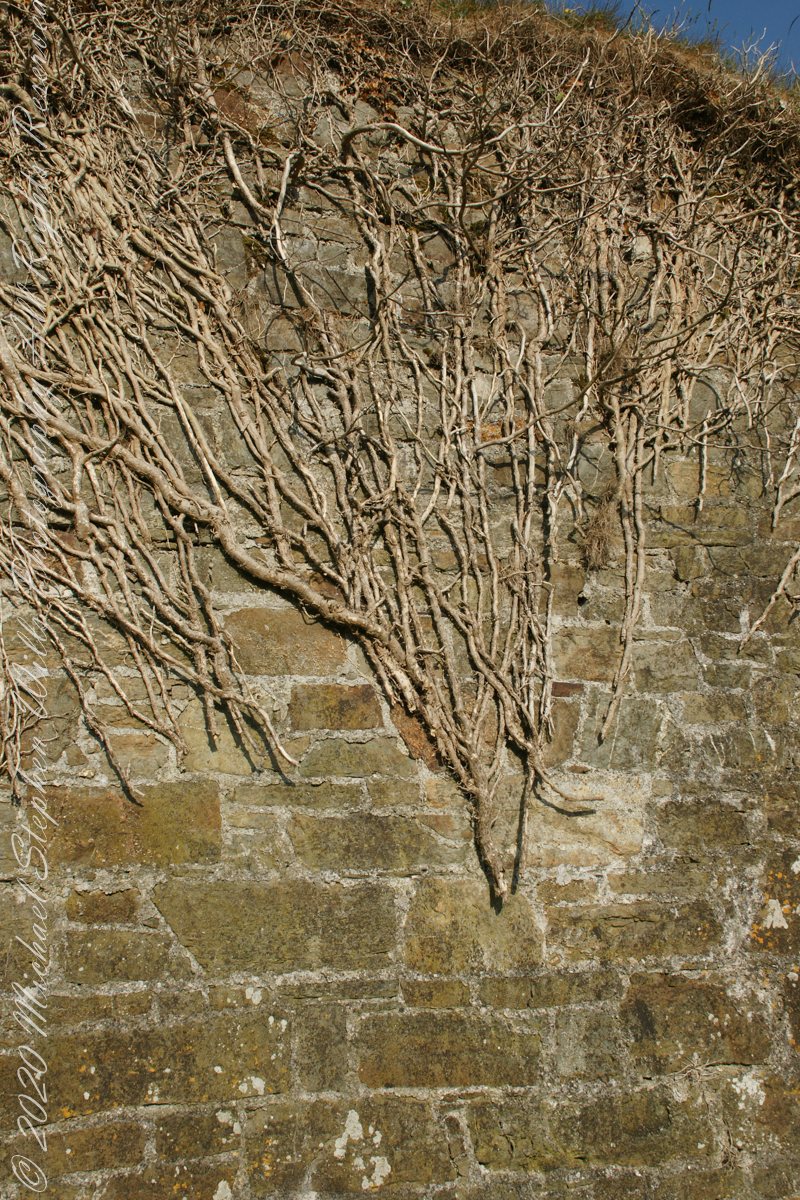
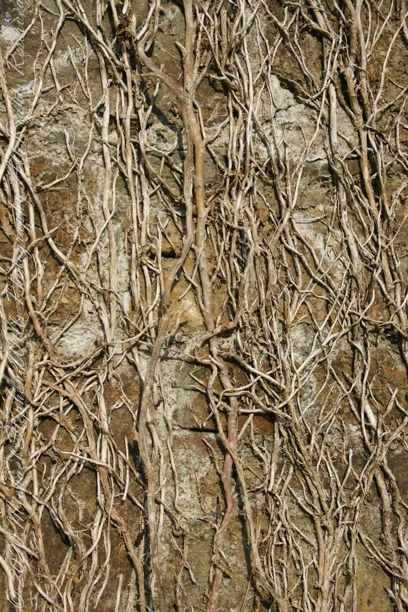
Views of the wall from previous photograph. The vines were separated from roots to preserve the walls, leaving interesting patterns.
The distant land to the right, beyond the walls, is the Old Head of Kinsale.
Informational placards along the walk give background to the views enjoyed by hikers.
Here is the above view.
SONY DSC
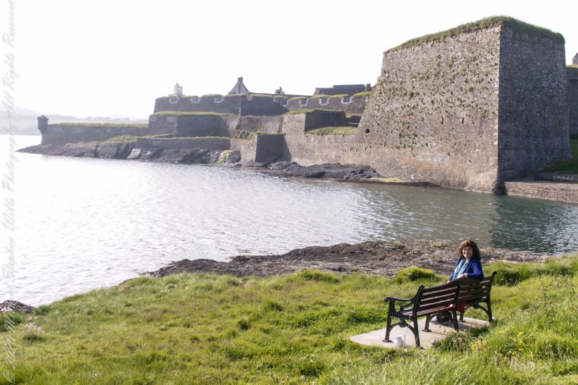
Pam, at start of our walk. Poking above the walls is the Charles Fort Lighthouse. “This lighthouse is a directional light marking the way to safe anchorage close to Kinsale. In 1665 King Charles II granted letters patent to Sir Robert Reading to erect six lighthouses on the coast of Ireland, including one at Barry Oge’s castle, near Kinsale later to become Charles Fort. The original structure would have had a coal fire on its roof. In 1810 powers given to the Commissioners for Barracks and others between 1767 and 1806 were all vested in the Corporation for Preserving and Improving the Port of Dublin or the Ballast Board. This board took over the general lighting and marking of the coast when fourteen lighthouses were transferred to it including that at Charles Fort. This lighthouse, built in 1929, is one of the more recent to be found along the coast, with most dating to the nineteenth century. A new mains powered light at Charles Fort Lighthouse was put into operation on the 14 April 2004 marking the end of a long era of gas and oil powered lights in Ireland.” Quote is from the link provided in references.
May 30, 2014 outside of Charles Fort, Kinsale, County Cork, Republic of Ireland
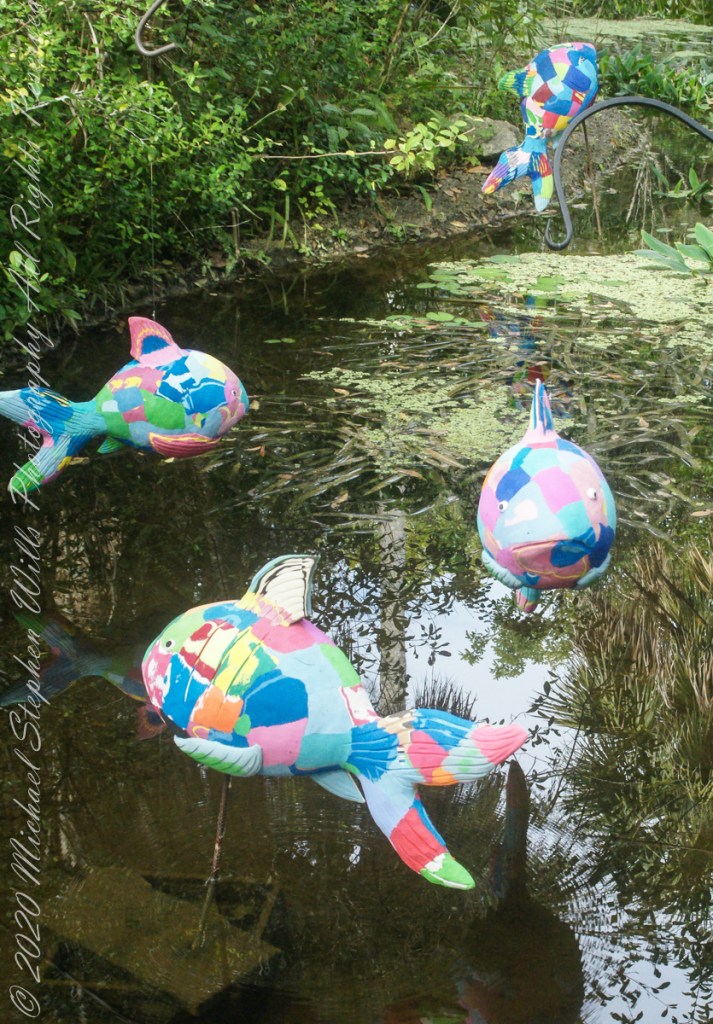
50 recycled flip flops were used by Ocean Sole Africa Project artists to create each Reef Fish sculpture from a 2019/2020 exhibit hosted by McKee Botanical Gardens, Vero Beach, Indian River County, Florida.
Coral reef fish live among or in close relation to coral reefs. Coral reefs form complex ecosystems with tremendous biodiversity. Among the myriad inhabitants, the fish stand out as colorful and interesting to watch. Hundreds of species can exist in a small area of a healthy reef, many of them hidden or well camouflaged.
Reef fish have developed many ingenious specializations adapted to survival on the reefs. Safe habitats, many different species of fish inhabit coral reefs where they are protected from predators and find food. In turn, reef fish eat algae, preventing overgrowth and smothering of the coral animals. Common fish in Caribbean reefs have interesting names: parrot, angel, puffer, surgeon and clown.
Coral reefs occupy less than 1% of the surface area of the world oceans but provide a home for 25% of all marine fish species. Reef habitats are a sharp contrast to the open water habitats that make up the other 99% of the world oceans. Loss and degradation of coral reef habitat, increasing pollution, and overfishing including the use of destructive fishing practices, are threatening the survival of the coral reefs and the associated reef fish.
Copyright 2022 Michael Stephen WillsAll Rights Reserved
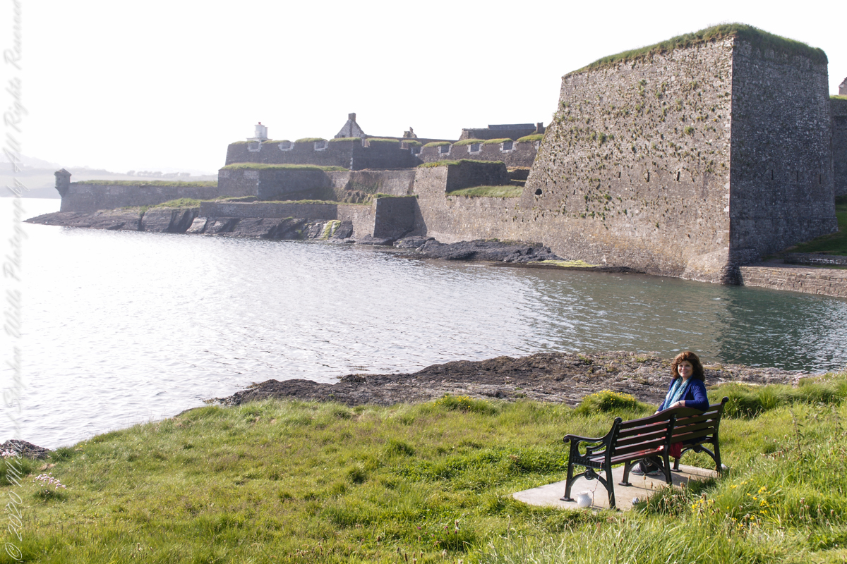
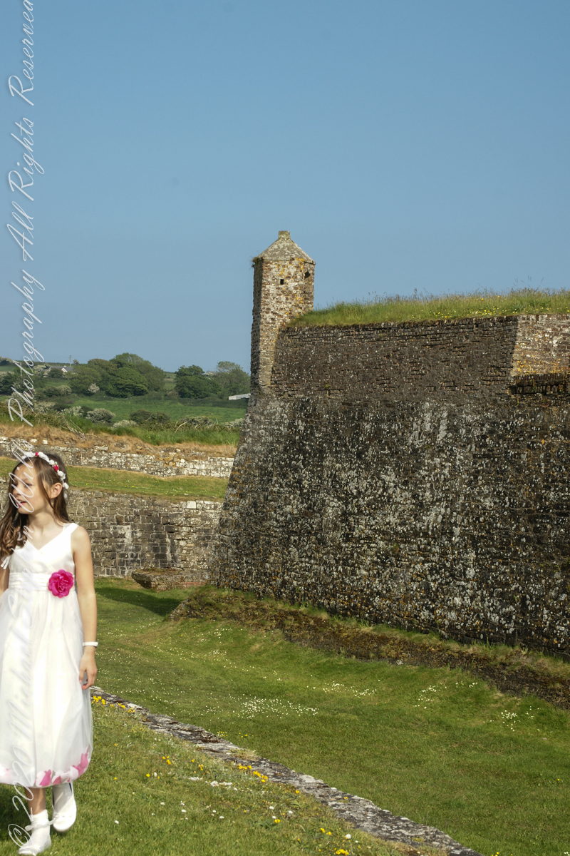
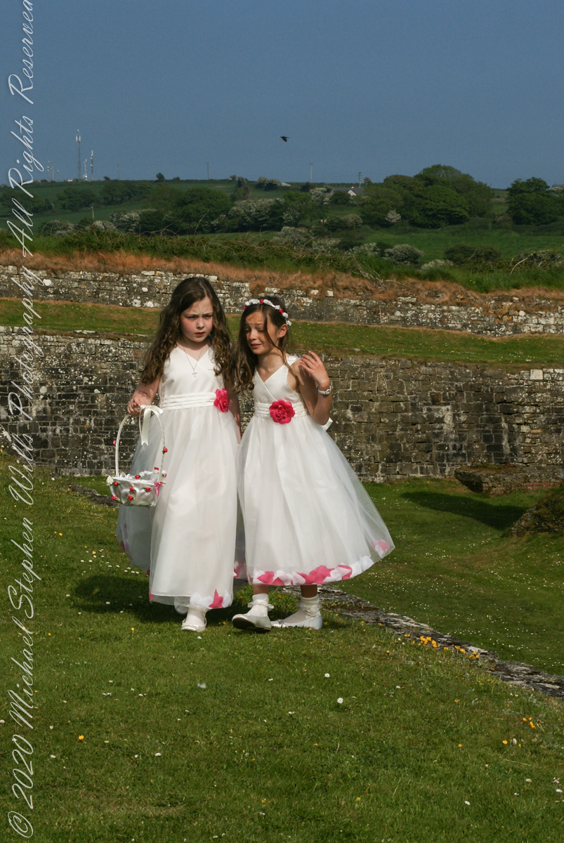
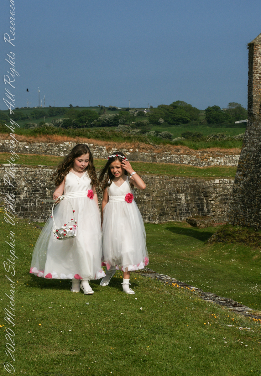
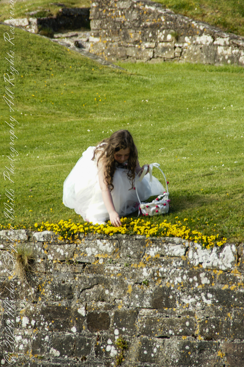
Arriving at Charles Fort, the “new” fort compared to the “old” James Fort across the cove, late in the day after our walking tour of Kinsale and lunch, the gate to the interior was closed. Pam and I made do with exploring the outer battlements where the citizens of Kinsale were enjoying themselves.
A shortcoming of Charles Fort was the high ground you can see behind the figures. The defenses are strong on the seaward side and open to attack from the land.
After exploring Kinsale town and lunch Pam and I drove two miles, along the east side of the cove, to the ruins of Charles Fort, one of a pair of fortifications protecting Kinsale from seaward attack. The “New Fort,” Charles, faces the “Old Fort”, James, across the cove.
Built in the 17th century on the site of an older fortification, Ringcurran Castle, it is named for Charles II, the English monarch of the time. The fort was burned during by retreating anti-treaty forces in 1922 during the Irish Civil war. It lay derelict until today’s 1971 until now restoration.
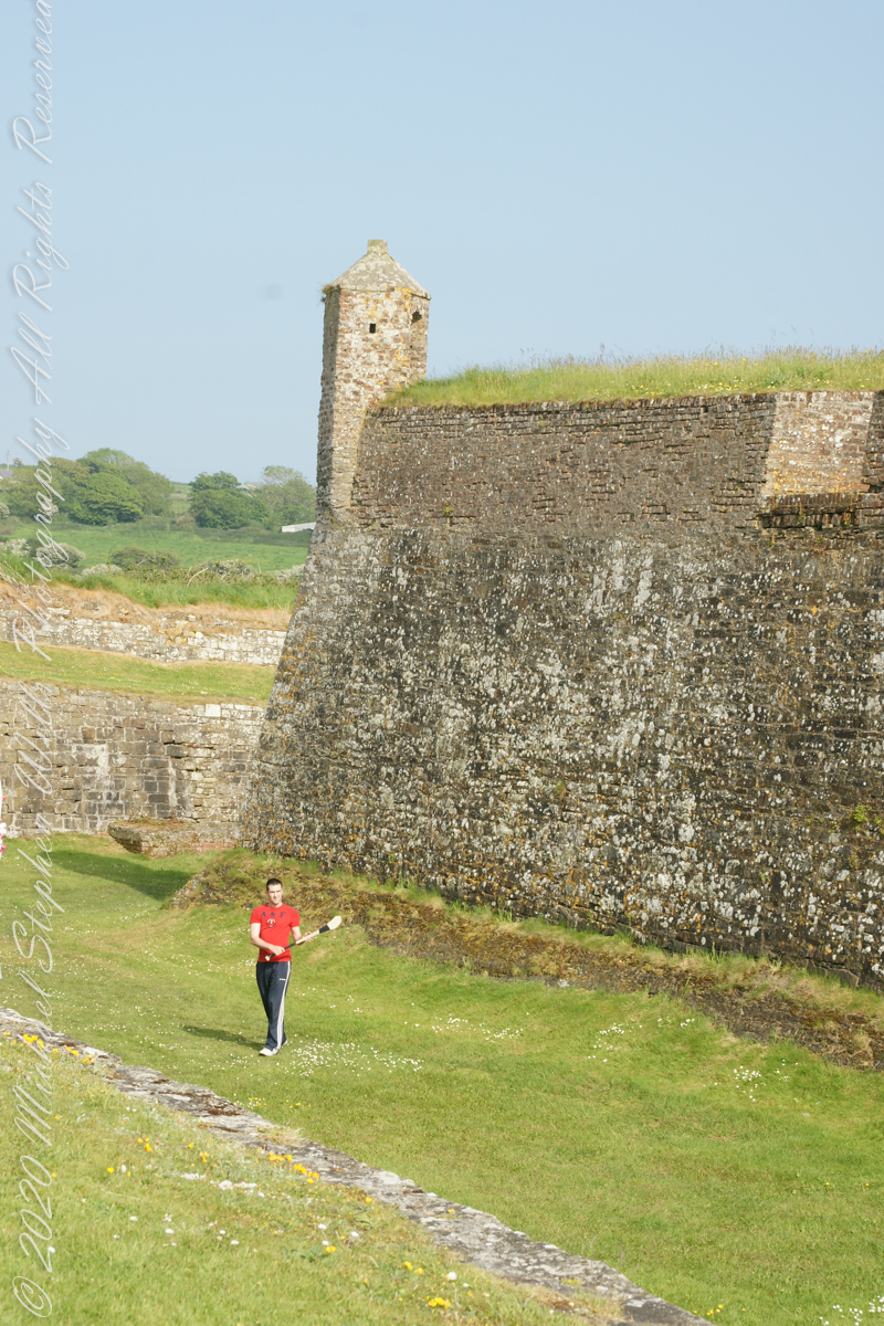
Upon our arrival this young man was handling a hurley and sliotar beneath the fort wall, an incarnation of Cúchulainn playing hurling at Emain Macha. From Wikipedia, “Hurling is older than the recorded history of Ireland. It is thought to predate Christianity, having come to Ireland with the Celts. The earliest written references to the sport in Brehon law date from the fifth century. Seamus King’s book A History of Hurling references oral history going back as far as 1200 BCE of the game being played in Tara, County Meath. The tale of the Táin Bó Cuailgne (drawing on earlier legends) describes the hero Cúchulainn playing hurling at Emain Macha.”
380 recycled flip flops were used by Ocean Sole Africa Project artists to create these seahorse sculptures from a 2020 exhibit hosted by McKee Botanical Gardens, Vero Beach, Indian River County, Florida.
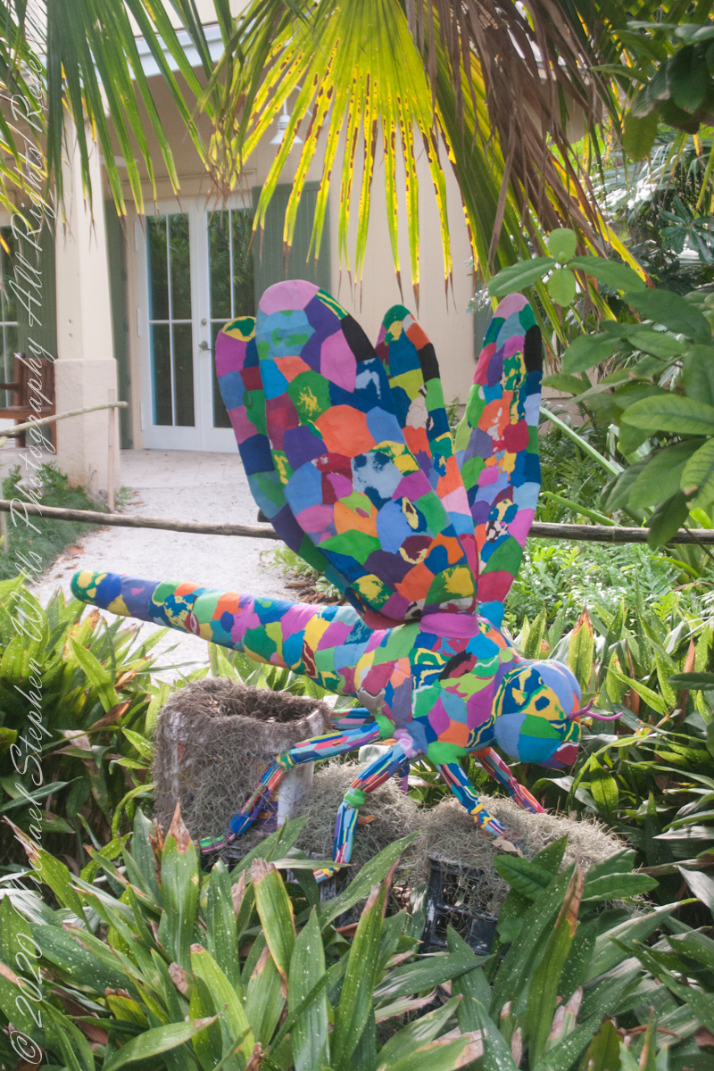
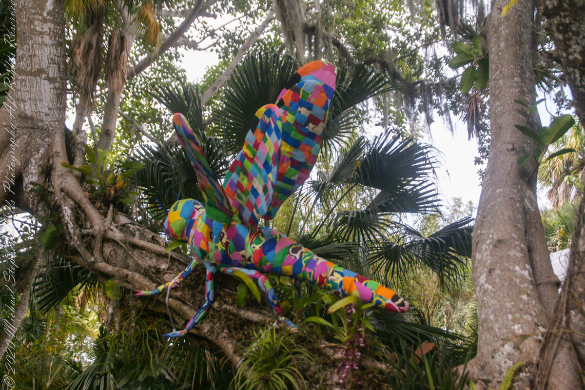
Adult dragonfly lifespan of a few days to 5 weeks contrasts with the wide distribution, variety with over 3,000 species and deep longevity of the infraorder, Anisoptera, especially compared to our genus, Homo: Hundreds of millions of years, compared to 2 million.
An insect, dragonflies live on every continent except Antarctica, from sea level up to the mountains.
I have experienced hundreds of dragonflies swooping and hovering around Peaked Mountain of the Adirondacks.
Copyright 2022 Michael Stephen WillsAll Rights Reserved
The tenth and final of a series of idiosyncratic posts from a walking tour of Kinsale by Dermot Ryan. My Sony Alpha 700 captured the events back in May 2014.
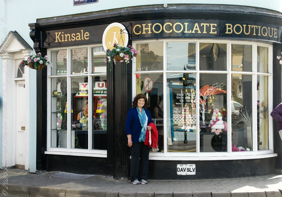
We are headed toward lunch along the River Bannon. The Kinsale Chocolate Boutique, Exchange Buildings, 6 Market Square, did not survive the pandemic. This iconic corner is now the First South Credit Union (sigh).
SONY DSC
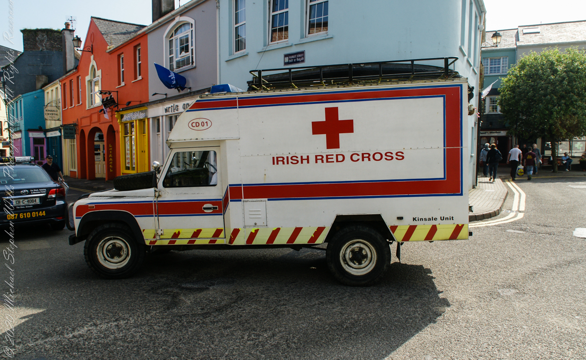
With headquarters in Dublin, the Irish Red Cross provides in Ireland (click the links to learn more):
Come out of the center town to walk along Pier Road, River Bannon on its way to the harbor, on one side, town parks on the other.
Taking a walk along the river Bannon and Pier Road, Kinsale Town, County Cork, Ireland
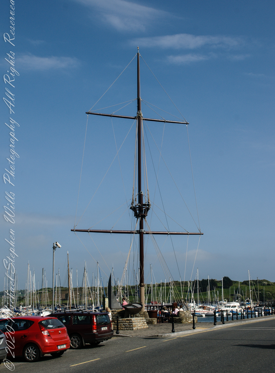
Across from Kinsale Town Park rises this Tall Ship mast and other memorabilia from Kinsale’s maritime heritage.
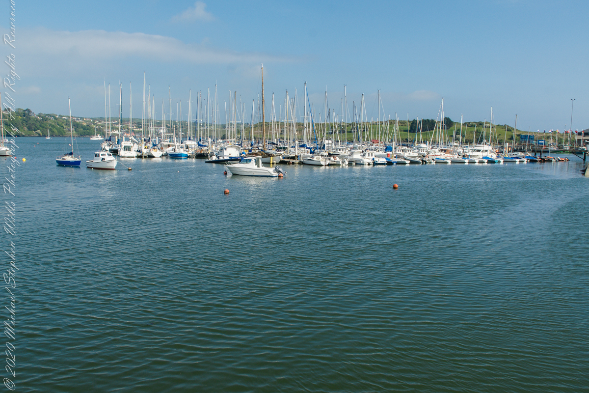
A few hundred feet away are moorings for the Kinsale Yacht club, ” located in Kinsale, County Cork lies just 120 nautical miles from Wales, 240 from North West France and only 500 from the Galician Coast of North Spain. Most significantly it is only 30 km by road from Cork, Ireland’s second city, and between the two lies one the region’s main assets – Cork International Airport – with its daily links to many European capitals. Keelboats and Dinghies. The club runs inshore and offshore races, has active cruising and powerboat sections and most significantly for any real club, a strong and dynamic junior training program. Kinsale Yacht Club and marina are only a few minutes walk from every shop, hotel, pub and restaurant in Ireland’s gourmet capital.” — from the Yacht Club web site.
Moorings for pleasure craft on the River Bannon, off Pier Road (R100), the town of Kinsale, County Cork, Republic of Ireland